Lynn Amber - Travel & Photography
sharing my thoughts through words and images
Photo of the Day 4.13.20

Shifting gears a bit this evening and posting a photograph I took while visiting the Marin Headlands north of San Francisco in February. There were a few flowers in bloom on the headlands as we hiked along part of the coastal trail as well as some marine life! More to come on that day trip in my next blog posting. 🙂
Photo of the Day 4.12.20
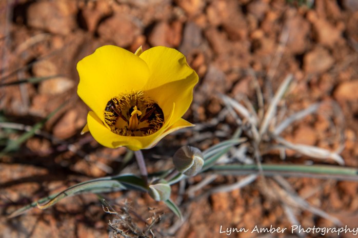
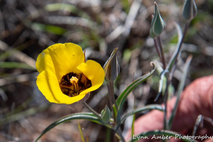
How special that I found some Desert Mariposa Lilies blooming on Easter day in the grassland!! Jim and I decided to take an afternoon bike ride on a new dirt road we discovered here in the NCA. We detoured onto an unmarked road, curious how far it traveled and, if it was the same path that climbed the plateau we could see in the distance.
We parked the bikes at the bottom of the plateau and hiked to the top. It’s a high spot in the grassland and the view was amazing! As I was walking back down the hill, I noticed the yellow flowers of a Mariposa lily. They were so unassuming and sparse that they were hard to spot and I had not even noticed them on the hike up. I have not seen them blooming anywhere else but in this isolated location. What a treat!! 🙂
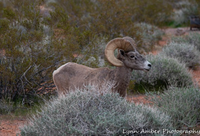
On our way back to the campsite, we stopped off at Cottonwood Pond. I had taken an early morning walk down to the pond and had once again watched “my” two red-tailed hawks soaring high above the land. One did eventually land in the Cottonwood tree across from the pond. I also enjoyed the antics of several birds while I sipped my coffee and ate my stroopie.
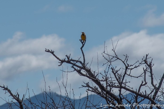
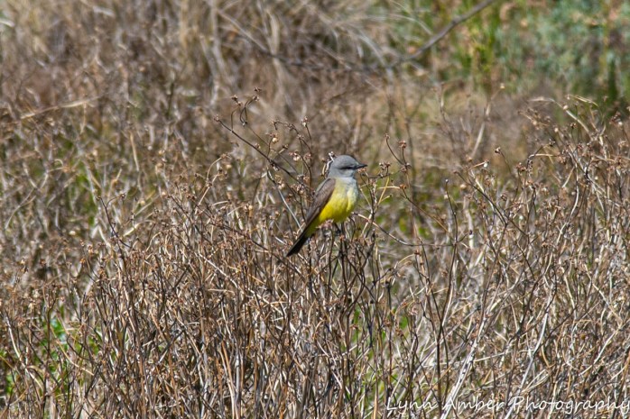
Sharing a perching spot with the Kingbirds this morning was a very vocal Red-winged Blackbird.
And, of course, the swallows were abundant. And I have a confession to make regarding the swallows! Jim was still not stirring when I embarked on my walk this morning. He mumbled a good-bye and said maybe he would meet me down there later. I spent a considerable amount of time at the pond observing the birds and watching the hawks. Jim never showed up so I headed back. We must have missed each other – as I walked back on the road and he had bushwhacked through the wash to get to the pond. When he returned, he told me he had seen a woman at the pond and struck up a conversation with her. He mentioned to her our fascination with the tree swallows. She quickly corrected him – noting that they were, in fact, Northern Rough-winged Swallows. He explained to her our indecision over what type of swallow they were and thanked her for the identification. So, being the very novice birdwatcher that I am – I am grateful that he happened upon this more experienced birder!! I am happy to admit my error!!
I will be correcting my blog posts where I mention tree swallows!! If you know me like my family does, you know that I do not like to be inaccurate! But, having said that, I still think I could have identified tree swallows initially here at the pond. It’s hard to miss their iridescence. I suspect they were migrating through but the Northern Rough-winged swallows are the more frequent residents. So, this afternoon, when we stopped at the pond I examined the swallows more closely with binoculars – waiting patiently for one to land so that I could get a good view. I wanted to verify the identification for my own satisfaction. And, sure enough, it was obviously the Northern Rough-winged Swallow! Thank goodness we now know for sure that we have identified them correctly!! 🙂
Photo of the Day 4.11.20
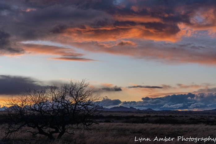
I know. Another sunset photograph. How boring, right? One thing is sure. After I leave this place, a lasting memory will definitely be the endless, magnificent sunsets that occur here each night.
Today was a busy day. We had to venture to town for grocery shopping which has become our least favorite chore. It means being exposed to the public and potentially to the deadly virus. We take precautions, of course, but it still feels weird to be walking around the market trying to avoid close encounters and wearing bandannas and latex gloves. We have chosen to shop at the Safeway since they have been very progressive about minimizing exposure for both customers and employees. Since our last visit, they have staff outside wiping down the carts for customers, have installed plastic shields at the check-out, have ALL staff wearing masks and gloves, and have many floor labels designating safe distances and one-way aisles.
So, due to our excursion today, my first opportunity to photograph was after we returned, put groceries away and prepared dinner. Today, the forecast was for 80% rain and thunderstorms which was why we chose to shop. We got back to our campsite and it had not rained one drop! The mountains all around us were cloaked in clouds and experiencing some type of precipitation. Just before sunset, clouds started to disperse and the sky was very dramatic. Hence, my photo op!! Enjoy!
Photo of the Day 4.10.20

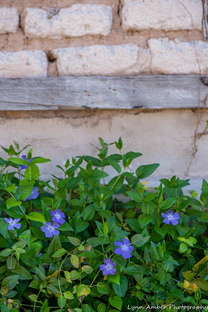
On an early evening walk down to the pond, I noticed these Blue Dicks blooming off the side of the road. There’s not much in bloom in this high-desert grassland right now – so any color catches my eye!! The lavender flowers contrast nicely with the orange-red, sandy soil in the background.
We lingered at the pond watching the tree swallows dipping and swooping above the water. They were particularly active tonight and I managed to catch several picking up insects off the surface of the water. The photos are not professional-grade but still pretty cool!! They are soooooo entertaining!
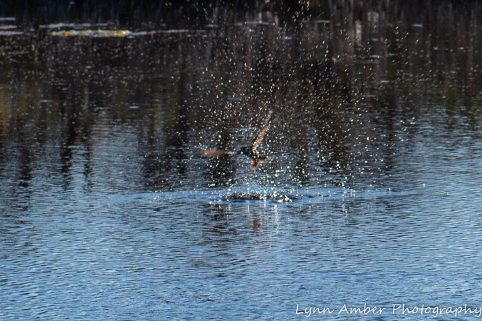


Photo of the Day 4.9.20
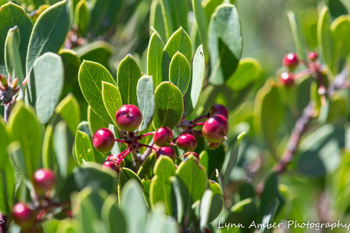
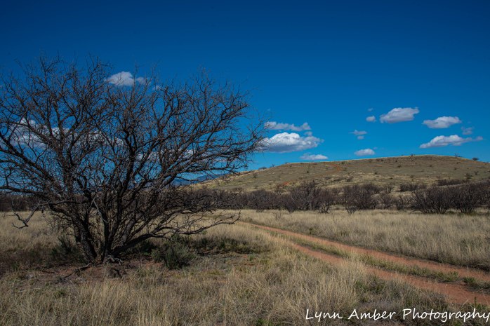
We took a ride over to the Coronado National Forest – Mt. Wrightson Wilderness area to hike part of the Arizona National Scenic Trail. The Arizona Trail encompasses 800 miles of non-motorized pathways stretching from the Mexico border north to Utah. Since we have a great view of the Mt. Wrightson Wilderness area mountain peaks from our camping spot, it was fun to hike along a trail that crisscrosses through that landscape.
The terrain is so much different than the high-desert grassland. We walked within the foothills of the mountain peaks through oak-pinyon-juniper forests interspersed with Mexican Manzanita – a beauty of a plant! The reddish-brown bark of the branches against the bright green leaves and red berries is a sight to behold. I love this plant. It was refreshing to immerse ourselves in a completely different ecosystem for a day – and so close to us!
Photo of the Day 4.8.20

Evening on the Cienegas
As the moon rises
The wind sings through the Mesquite
And coyotes howl.
– Lynn Amber
As I predicted, the cloud cover impacted the initial rise of the moon last night. I still like the effect of the sunset coloring the clouds with the moon peeking through to tease me. It was a beautiful evening. I am always awestruck while watching the full moon rise over the horizon.
This morning as I lay in bed, that little haiku appeared in my mind begging to be put to print. It’s windy here and we hear coyotes singing on the grassland every evening. Last night as I went out to the tripod to start taking pictures, the coyote cries greeted me. I’ve noticed on our many walks the wind whistling through the mesquite bosques – such a unique sound that I’ve grown accustomed to here on the ranch 🙂
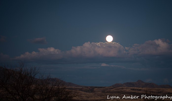

Photo of the Day 4.7.20

It was “chore” day today. The wind and sunshine were perfect drying conditions!! Truth be told, I am also trying out my new remote shutter release cable hoping to get a full moon shot tonight – and the clothes drying on the line are my only interesting subject!
I bought a shutter release cable before we headed out in January but had yet to take it out of its package. It was time!! I had to search through my camera manual and do some research online both to figure out which external socket on my camera was the correct one. It was not obvious to me! After I shot some “wash” photos, I set the tripod up angled towards the moonrise location, set the focus manually and took a couple of shots for practice. The cable works perfectly. Now I just need for some of these dang clouds to disperse! They could provide some nice contrast or they could also cover up the moon as it rises over the horizon. We shall see!
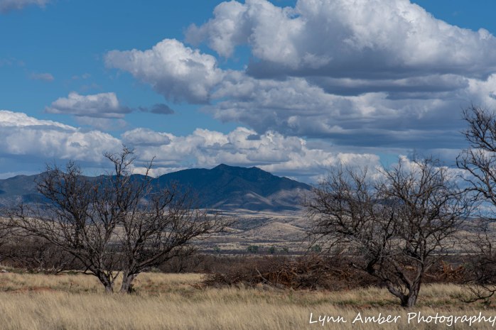
Photo of the Day 4.6.20

The sunsets have been incredible here in the Las Cienegas NCA. As I post this one taken last night, I am looking out the window at an even more incredible color display!! The above photo is looking toward the eastern sky and the colors are more pastel. The photo below is taken toward the western sky. Both in the same evening minutes apart!
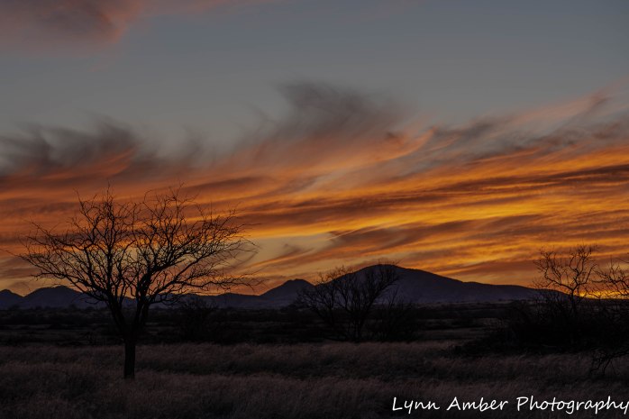
Photo of the Day 4.5.20

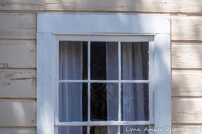
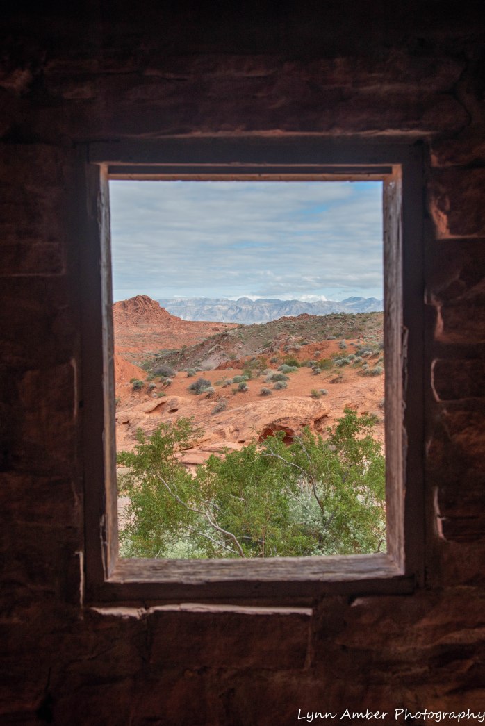
We had to go fill up our 6-gallon water container today so we could add some water to our fresh water tank in the trailer. At the Empire Ranch Historic Site, there is a potable water source that we can access. While Jim was filling up the container, I walked around the historic site and in the ranch house taking “architectural” photographs. I was struck by these gingham curtains at the window in one of the rooms. The pretty, old-fashioned curtains contrasted against the cracking, peeling plaster walls just begged to be photographed.
As I walk around the old ranch, it almost feels too familiar to me. Maybe it’s just that it’s so reminiscent of all those western TV shows I watched as a kid. Or, perhaps in some other life, I was raised and lived on an Arizona cattle ranch – who knows!! 🙂
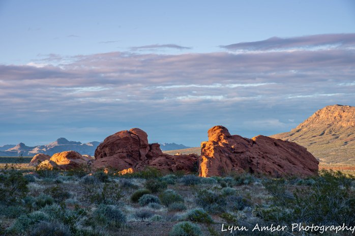
Valley of Fire State Park
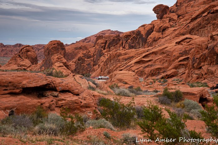
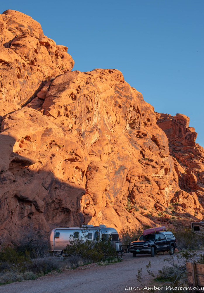
Based on a conversation with some fellow Vermonters who were camped near us at Hole in the Wall campground in the Mojave Preserve, we decided to make Valley of Fire State Park our next destination on our southwest tour. We have been past this park before but never at a time when we felt inclined to venture in and camp.

There are two campgrounds within the park that are first-come, first-serve. The Atlatl Campground has a few sites with electric and water hookups while the Arch Rock Campground is dry-camping only. Of course, in our usual style, we arrived late afternoon since it was a trek from the Mojave Preserve. The ranger at the entrance station did not know if there were any sites available in the campgrounds but wanted to charge us the $10 entrance fee anyway. We talked him out of it indicating that if the campgrounds were full then we would not be staying. His comment at first was “That’s what everyone says.” Not the right answer for this here customer service oriented person and park ranger! I can safely say I grimaced visibly! We insisted on not paying him since I knew that if we did find a campsite we could pay the entrance fee as part of our site price. He let us in 🙂
We reached the turn off for the campgrounds and there was a FULL sign posted out on the main road. We never believe FULL signs and ventured on into the camping area. The first campground to appear on our left was Atlatl CG. There was an additional sign there indicating it was full so we kept on driving to the Arch Rock CG a mile or so down the road. We did not see a FULL sign at the entrance so we pulled right on in and scoped out the situation. Right away, a camp host came riding up in his little buggy and, offering us a wide, toothless grin, said, “I think I may have just one site left, stay right there and I’ll go check it out.” He came back minutes later and directed us to follow him. We had indeed secured the very last site that was unoccupied. The site was on the outside of the loop and backed right up to a red sandstone cliff. It was perfect! We knew that if the campgrounds were full we had our choice of several BLM lands surrounding the park at which to boondock but it sure was nice to be able to be right in the park!
A very, very brief history…..information taken from the Valley of Fire SP website:
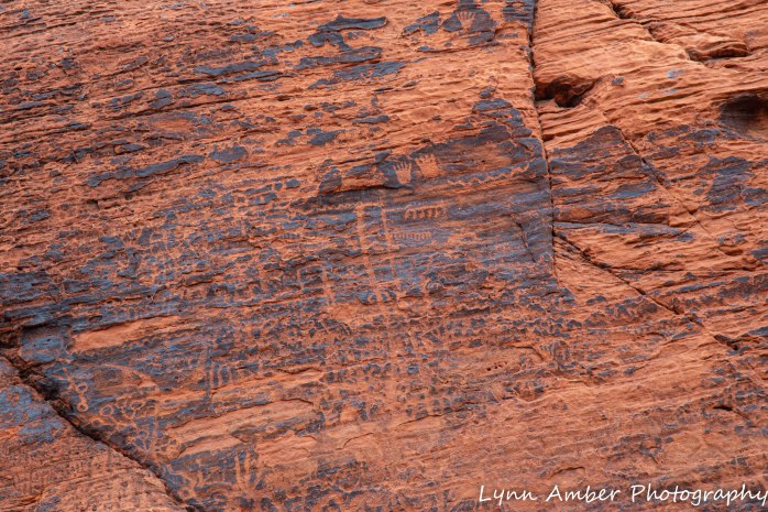
Valley of Fire was established as a state park in 1935. Prior to this, the land had a rich history of Native American occupation as evidenced by the numerous preserved petroglyphs carved into the sandstone rock by the Basketmakers some 2,500 years ago. More recently, the Paiute tribe lived here and, soon after, they were followed by white settlers including the Mormons.
A road was constructed through the area in the early 1900’s that connected Los Angeles to Salt Lake City and it was then that the geologic richness, historical significance and recreational potential of the “Valley of Fire” was recognized. The federal government owned much of the land and donated it to the state of Nevada for preservation and maintenance.
It was the Civilian Conservation Corps who built the initial buildings and campgrounds.


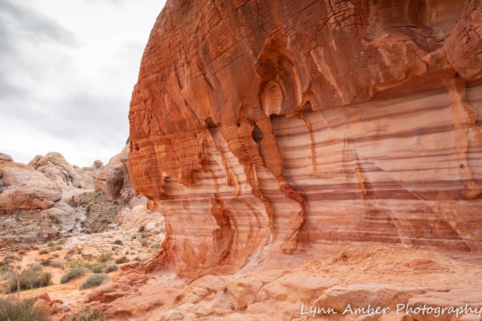
The geology of the area consists of Aztec sandstone outcroppings (the red stone) interspersed with limestone (the gray rock). Forces of nature over the years has produced the effect we see today. Earthquakes and volcanic action caused the older limestone rock that formed the floor of a giant ocean to be thrust up and exposed. The red sandstone was created during a period of drought when great sand dunes appeared. Over time, the dunes became compacted and, through iron oxide and various other minerals interacting with water, the rich colors of the resulting sandstone emerged. Wind and water continue to erode the delicate sandstone creating an ever-changing land of wonder!

Our visit…..
In and around the campground
While we stayed in the campground, we often took walks in the evening around the loop. There are some really nice private sites along the one-way road leading out of the campground. Although most sites, including ours, were nicely spaced apart.
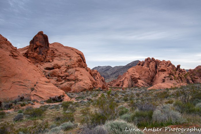

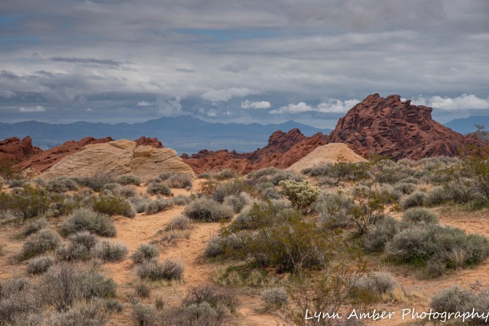
During our visit here, we traveled the White Domes Road through the main area of the park. We stopped at each trail head and overlook! Most of the hikes along this route were short and passed through some unique rock formations.
Mouse Tank Trail
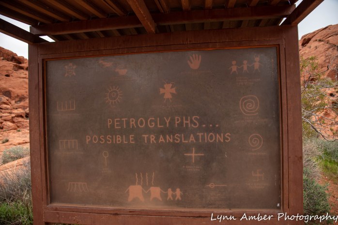
Along the Mouse Tank Trail exists some of the best example of petroglyphs that I have ever seen. The Native American Anasazi lived and farmed in the area between 300 BC and 1150 AD. They carved into the black patina “desert varnish” on the red sandstone leaving behind symbols that give us a glimpse back in time. This rock art is remarkably preserved here!


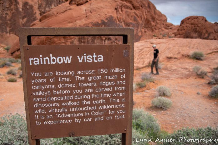
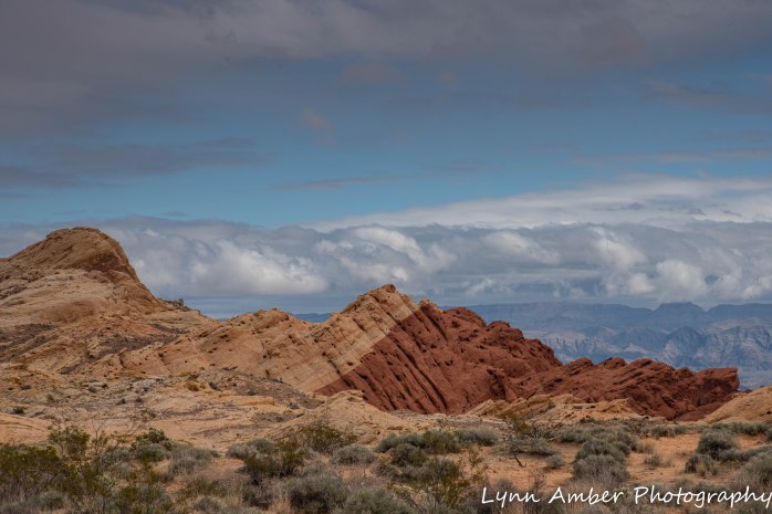
Rainbow Vista
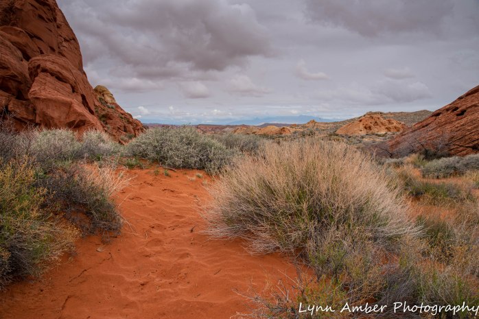
A Rainbow Vista was a short loop trail that showed examples of the colorful sandstone rock formations. Half-way around the loop, there is a side trail that ends at an overlook for Fire Canyon. Please forgive all the photographs! Around every corner was an amazing view!!

Love the contrast of the Teddy Bear Cholla against the landscape!!


The side trail to the Fire Canyon overlook…..


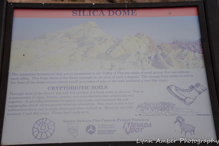
Silica Dome
We rode out to the Silica Dome – a white-colored dome rock formation. There were some incredible vistas along the way. Oddly enough, it was at the end of this road where I could actually get cell phone service! Otherwise, we were completely tuned out for the several days we were here.

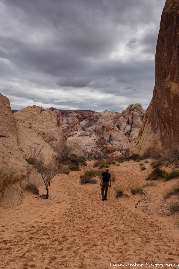
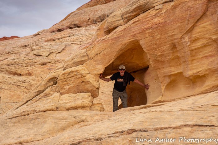
White Domes
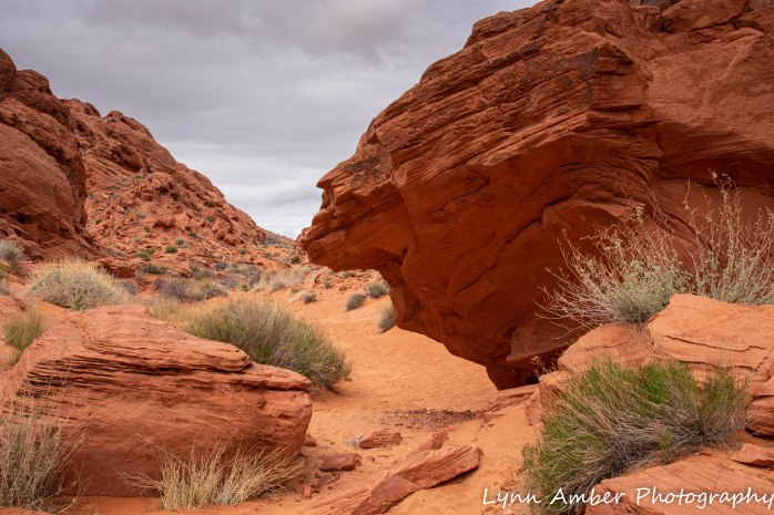
The White Domes Road ends at area called White Domes where there are amazing rock formations and slot canyons. The trail is a 1+ mile loop and includes some ruins from a movie set. Given the beauty of the area and history, it’s no surprise that the film industry shot on location here!
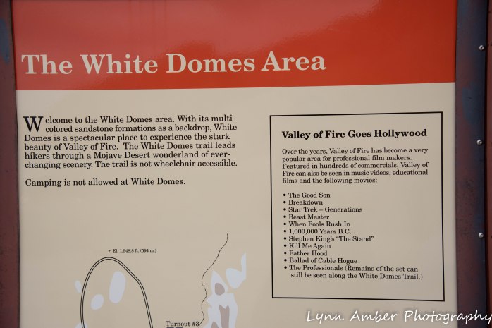

Lights, Camera, Action!!


Going through one of the slot canyons….


And Jim, just being – well, Jim! 🙂
Hope you enjoyed the journey through Valley of Fire!!