Lynn Amber - Travel & Photography
sharing my thoughts through words and images
Photo of the Day 3.28.20
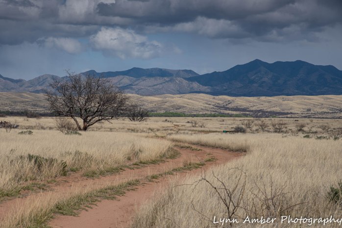
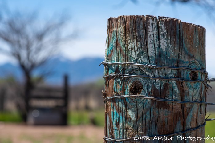
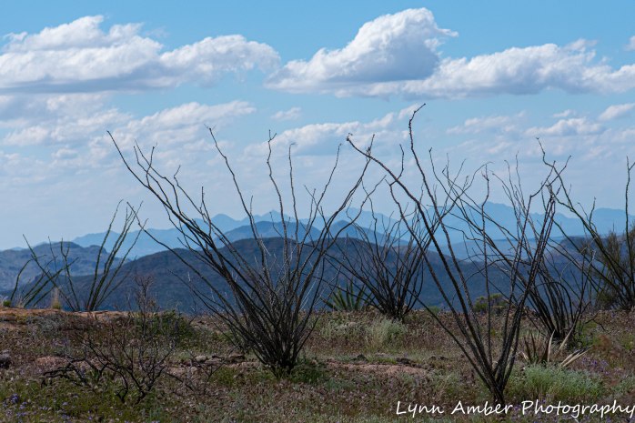
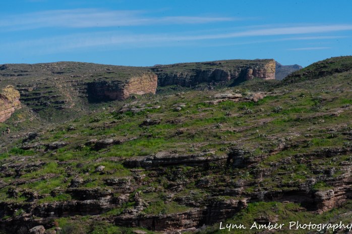
Late yesterday afternoon I needed to get out of the trailer and get some fresh air. A cold front moved in here and there were storm clouds all around us interspersed with blue skies. Very dramatic skyline! Jim was not feeling up for a walk so I bundled up in my winter gear and headed out on my own. I walked and walked along this dirt road heading out into the grassland and never did come to the end of the road. This photograph is very representative of the topography here!
I was reminded of Robert Frost’s iconic poem “The Road Not Taken” as I walked. Many interpretations of this poem exist. I’ve always interpreted the poem to be a narrative about the choices we make in life. More specifically, taking the unconventional approach – the road less traveled -can lead to a more fulfilling outcome. The poem has certainly been wildly analysed over the years. I read where Frost actually wrote this poem as a joke for his friend and fellow poet Edward Thomas. Thomas apparently often would complain on their many walks together that perhaps they should have taken a different path when disappointed by the outcome of the path they chose. Frost was supposedly mocking Thomas’ indecisive nature in the poem. He mentions to Thomas that he was disappointed that the poem was being “taken pretty seriously” when he really just meant it as a joke.
As I read over the poem again, I’m now torn. The title – The Road Not Taken – suggests really two separate thoughts. Which road is the title referring to? Should the reader have taken the more traveled road – the road he did not walk? Or is the title referring to the less traveled road? Is the poem really just a conversation about indecision and not meant as an encouragement towards nonconformity? It could be that it refers to either road being okay – just make the choice and don’t turn back or regret it! What do you think?
This line suggests both roads are equally the same –
This is what happens when you are on the road, hanging out in dispersed camping spots and waiting on word about your job!! I journey from just posting a Photo of the Day to an interpretation discussion on The Road Not Taken! Well – that’s what the photo brought to mind!
While I’m enjoying hiking, biking and being out in nature – I am ready to get back to the work I love!


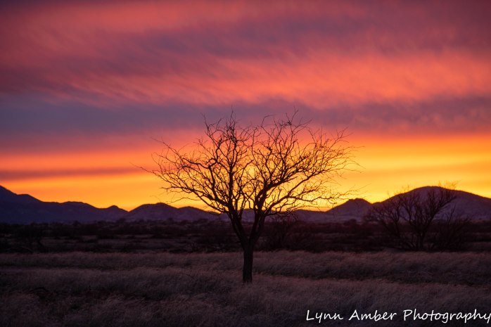
Photo of the Day 3.27.20
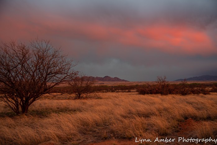
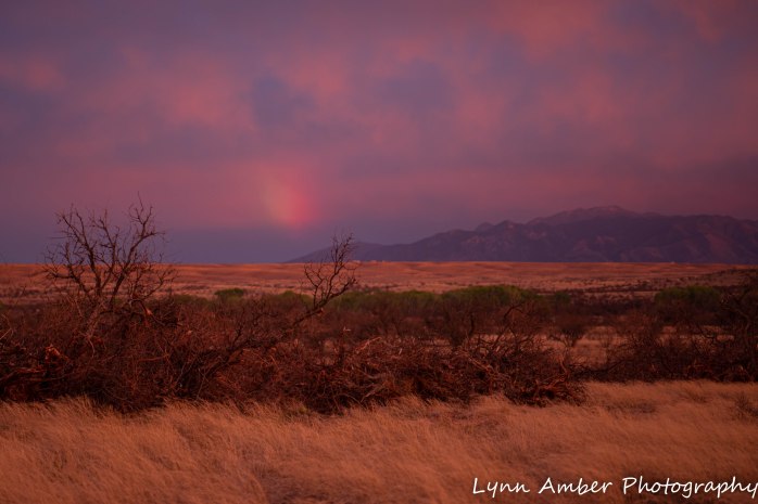
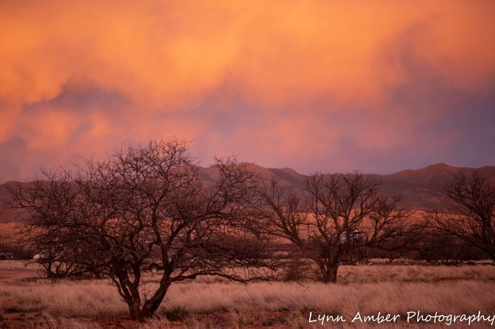
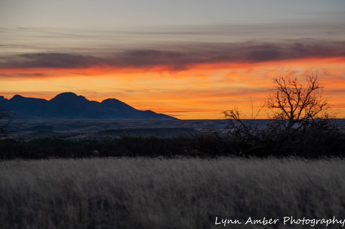
Last night around sunset, I was deep into listening to a detective murder mystery audio book when I noticed what was happening outside the trailer. The sky was ablaze!! No time to get my tripod out so I just grabbed my camera and shot these hand-held – so not the clearest photos – but you get the idea. I think the one above was my favorite. I included several others as the scene unfolded and the sky changed.
Point Lobos State Natural Reserve
Between late February and early March, we were mooch-docking at my son Luke’s house in Menlo Park, CA. We took advantage of being near the California coast to do some exploring. During a conversation with a neighbor’s parents, the Point Lobos State Natural Reserve was mentioned. They live in Stockton but spend time with their grandson next door weekly and they suggested we make time for a visit to Point Lobos. They touted it as one of their favorite places. We always make it a point to get travel tips from locals! So, I added it to my to-do list and checked the forecast for that area daily. Finally, a perfect weather day presented itself.
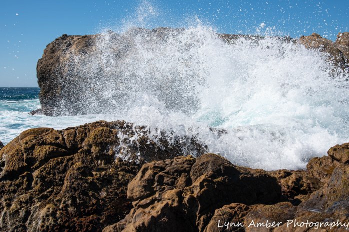
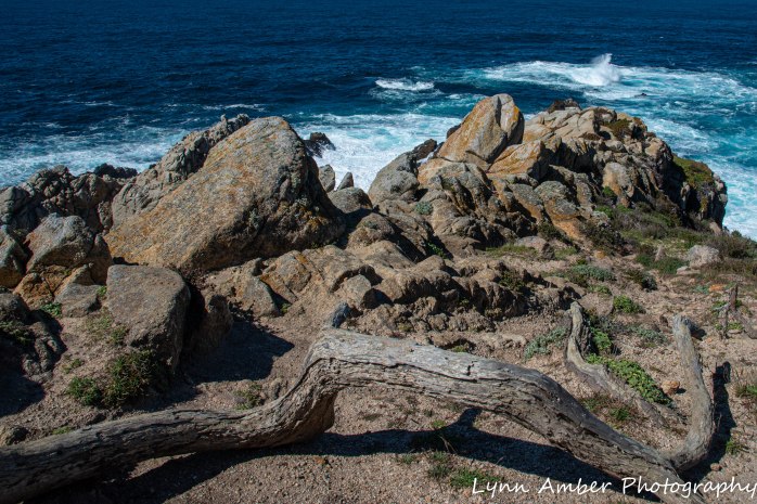
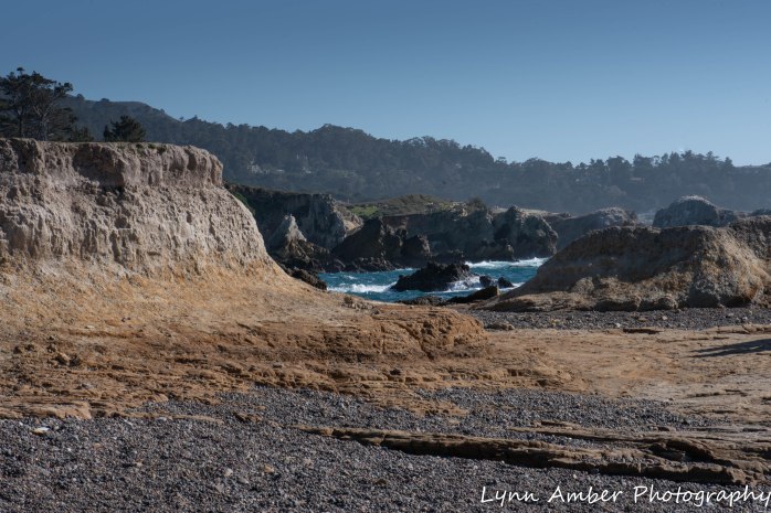
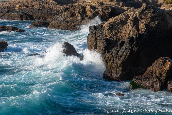
On March 2, we left Menlo Park and made our way to Point Lobos SNR. It sits off Highway 1 just south of Carmel-by-the-Sea and the drive along Rt. 17 and California 1 was scenic and uneventful – taking us about 1 ½ hour driving time. The park charges an entrance fee of $10.00 with a dollar off that price for seniors. They also limit the number of visitors who can enter the park by vehicle so that there is minimal impact on the area. It was off-season during our visit so the park was not full and we had no problem finding a parking space in a lot near the coast. It was an absolutely gorgeous day along the coast – warm and sunny. I marveled at how blue the ocean appeared here.
A little history….
The area where Point Lobos sits has been used by various inhabitants since ancient times. The first to use the lands abundant resources were Native Americans who lived here seasonally when fresh water was available. With the European influx in the mid-1700’s, Point Lobos served many purposes. Settlers grazed livestock, operated a whaling station, built fisheries and canneries, quarried for granite and developed a shipping port.
A local inhabitant, A.M. Allan started purchasing large tracts of land here in the late 1800’s with the ultimate goal of preserving this unique coastline ecosystem. With encouragement and support from local conservation groups, the area was incorporated into the state park system in 1933. Eventually, an additional 775 acres of submerged acres were added that established the nation’s first underwater reserve.
Minimal intervention is done to the land – leaving it to absorb the natural processes of weather, time and environment – and keeping it as close as possible to its natural state. We chose to hike some of the headlands trails and the coastal trail while here. We walked the short Cypress Grove Loop which includes the Allan Memorial Grove – a Cypress grove honoring A.M. Allan and his wife for their foresight in preserving Point Lobos.
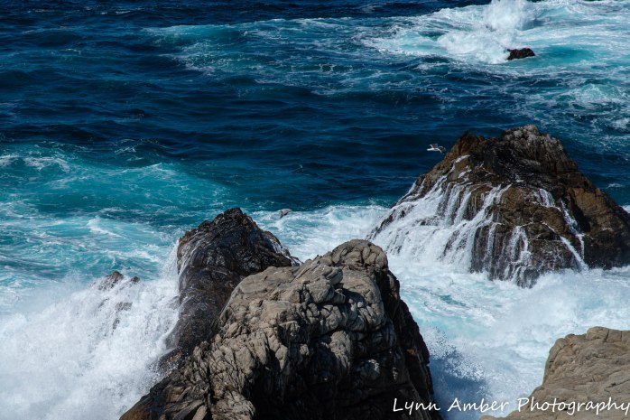
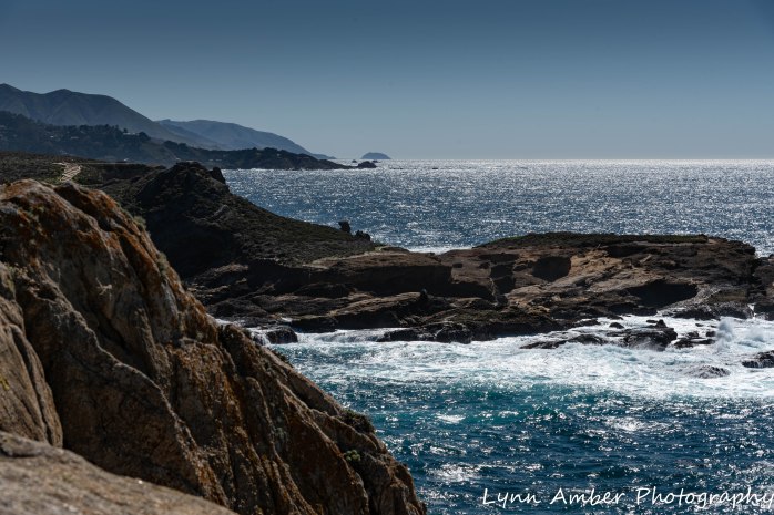
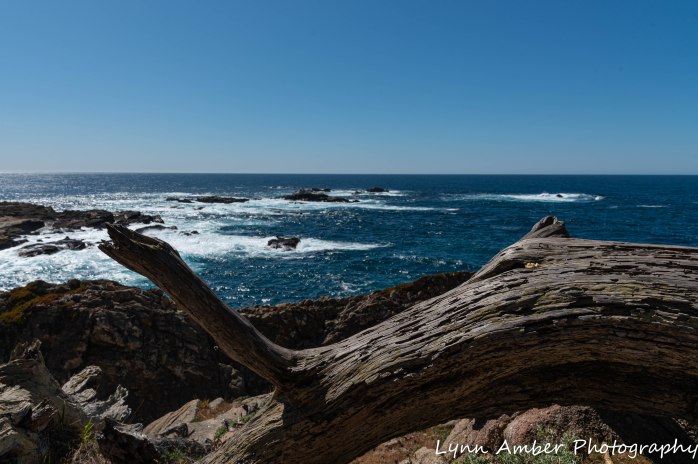
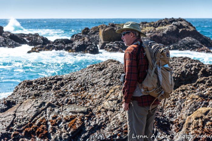
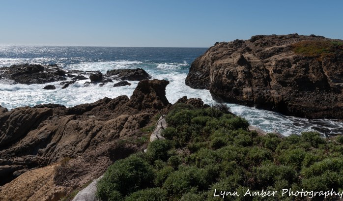
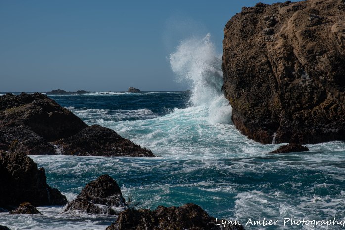
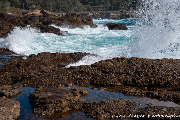
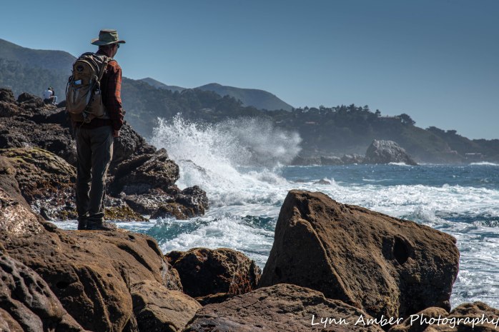
We then hiked along the coastal trail – South Shore Trail – with short diversions onto the Sea Lion Point Trail and the Sand Hill Trail. I have to say the rocky coastline reminded me of Acadia in Maine – the cliffs and coves and waves!

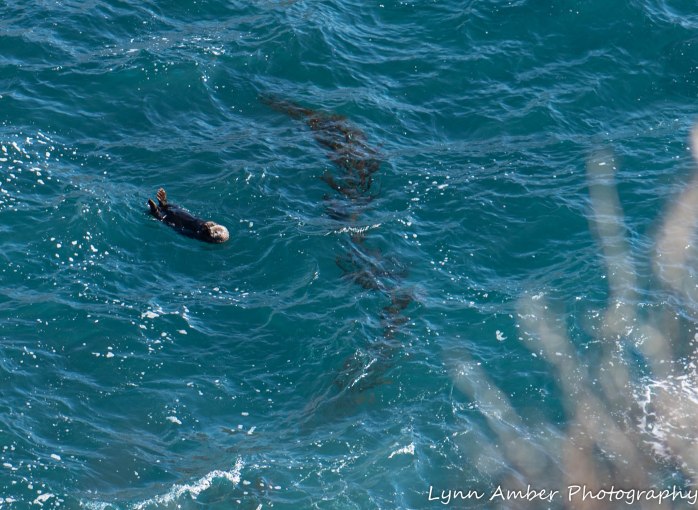
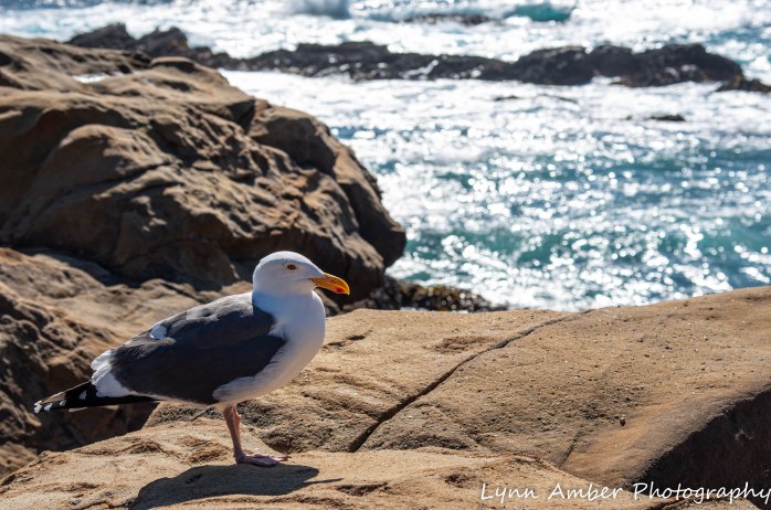
The abundance of aquatic wildlife was amazing!! We watched a sea otter playing among the kelp fields from the cliffs on the Sand Hill Trail.
With binoculars, we could observe the sea lion colony occupying the rocky outcroppings off shore. I should note that Point Lobos was named by the Spanish settlers – a shortened version of “Punta de los Lobos Marinos” – or Point of the Sea Wolves.
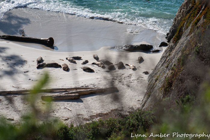
We were treated to a tranquil scene at Hidden Beach. This beach is inaccessible to the public and, viewing it from above on the South Shore Trail, we noticed a group of Harbor Seals sunbathing on the sand! Jim counted 23 seals in all! Apparently they are year-round residents here and, in April and May, pups are born on rock ledges and beaches.
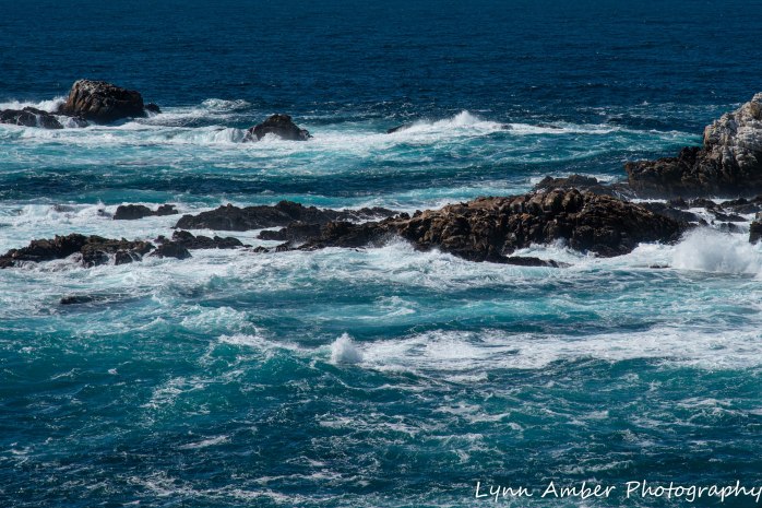
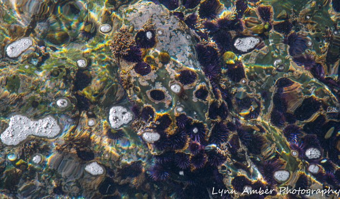
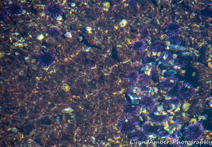
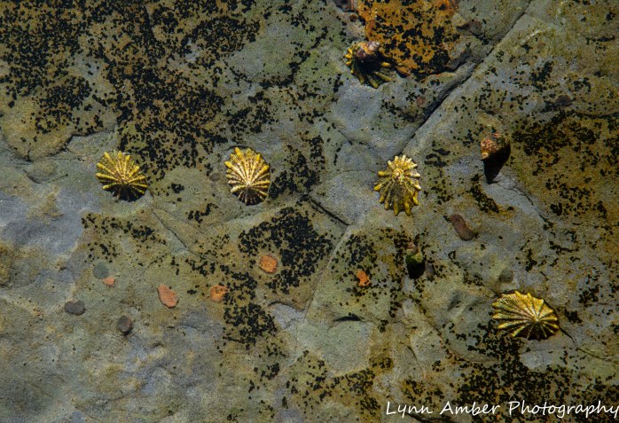
Much of the time, we wandered on the shoreline rocks watching the waves and exploring the tide pools. At Weston Beach, the tide pools were rich with aquatic life. In several places, there were masses of purple sea urchins! Their color inundated the water and gave it a lavender glow. One pool had colonies of Rough Limpets. Periwinkles and other limpet species were also abundant. I was most enthralled with the purple sea urchins though!!
Towards the end of the day, we drove down to the southern most parking lot to access the Bird Island Trail. This trail leads to an overlook where you can observe colonies of Brandt’s Cormorants nesting on Bird Island. It was along this trail that Jim thought he spied an Orca whale off the coast. He saw a distinctive “blow” and then a black fin break the surface of the water. We weren’t sure what type of whale it was until we ran into a park staff employee and asked about it. She said it was quite possibly an Orca. How thrilling!! We kept vigilantly scanning the ocean for another glimpse but did not see him again.

Around every bend in the trail was another mesmerizing scene!
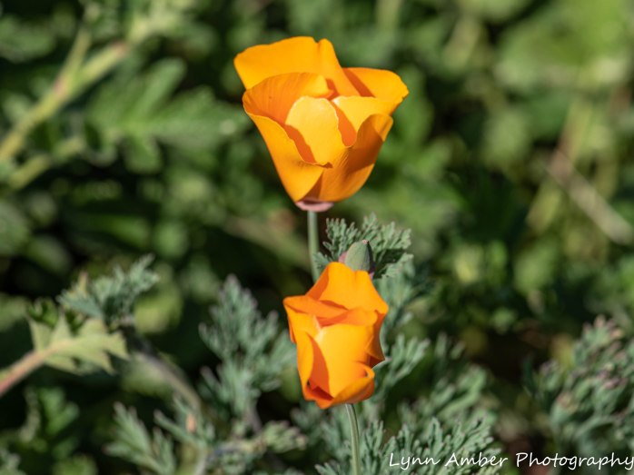
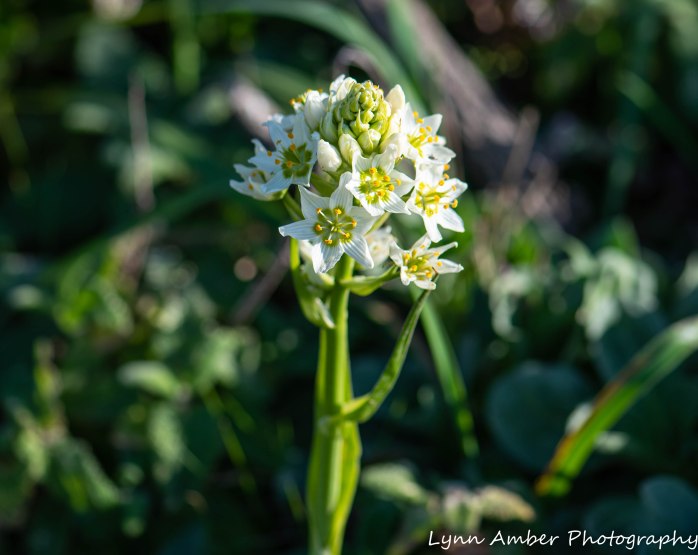
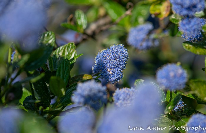
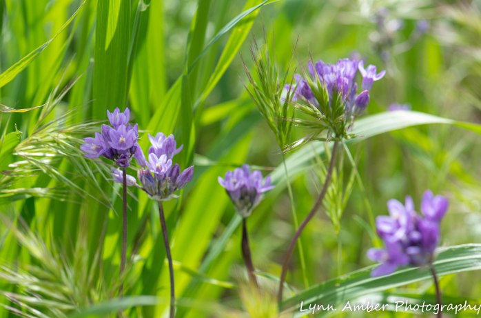
There were masses of wildflowers blooming along the trails and shoreline….


The Point Lobos website has some great informative information on its flora and fauna complete with pictures – worth checking out!
I fell in love with this beautiful, serene place – highly recommend a visit for anyone traveling along the California coast!
I hope you enjoyed this journey through Point Lobos! What was your favorite photo??
Photo of the Day 3.26.20
It was a cool, windy and cloudy day in the Arizona desert so I spent some time processing photographs. I have a backlog of pictures to edit since beginning our winter journey throughout the Southwest and California. And, today seemed like a perfect time to put my feet up on the sofa and work in Lightroom! I chose to upload and edit the photographs I captured at Point Lobos State Natural Reserve. The setting could not be more different than where we are currently camped! It was fun to review these seaside snapshots and reminisce about our beautiful day there walking along the high cliffs overlooking the Pacific Ocean.
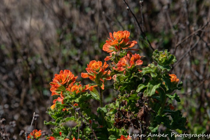
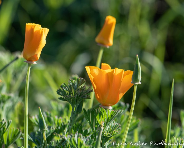
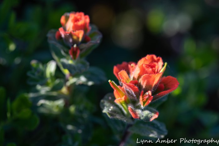
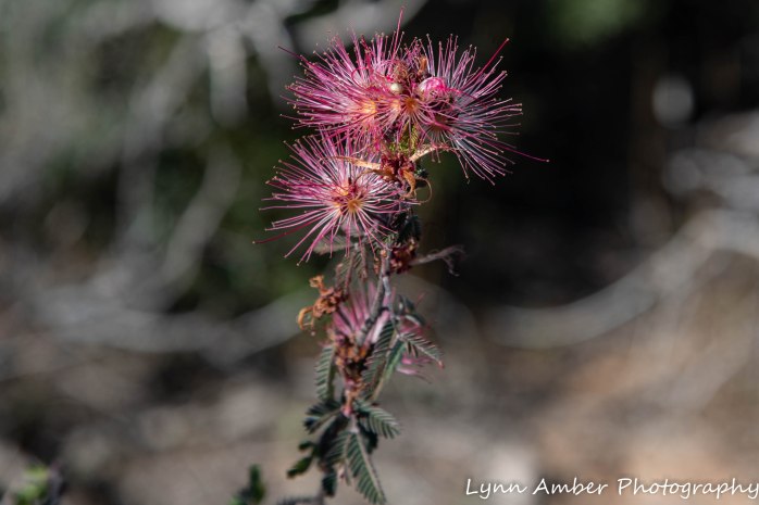
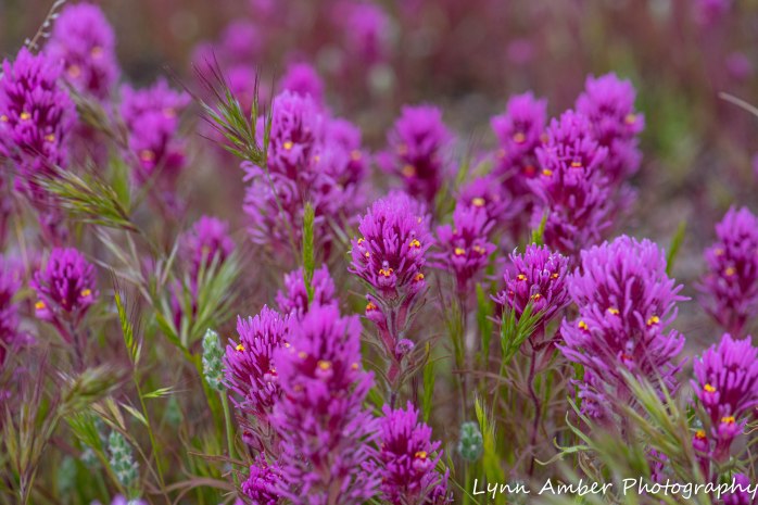
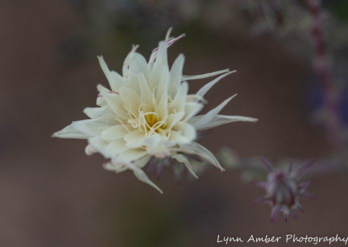
There were many flowers blooming at Point Lobos. My next blog posting will explore our day trip there on March 2, 2020. But for now, enjoy this precious little wildflower nodding towards the sun on the cliffs high above the roaring ocean. The Seaside Painted Cup apparently grows along the California coast between Point Reyes and Big Sur. It is found right on the coast often growing in sand dunes and coastal shrub communities. When I first noticed it blooming, the flower reminded me of Indian Paintbrush. In fact, it is indeed a species of this plant. Another common name for the plant is Monterey Indian Paintbrush.
Photo of the Day 3.25.20
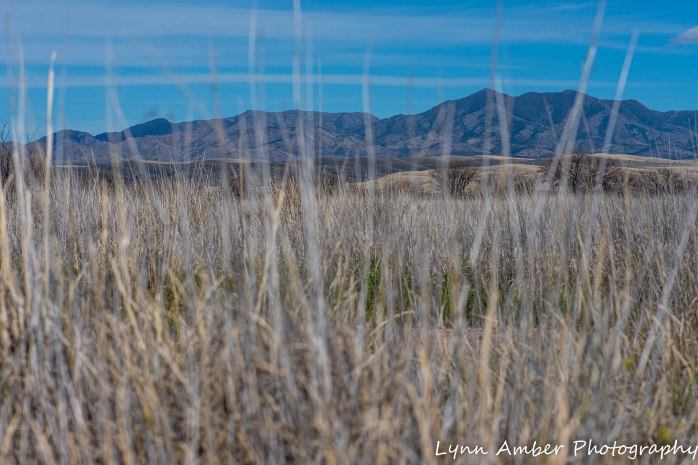
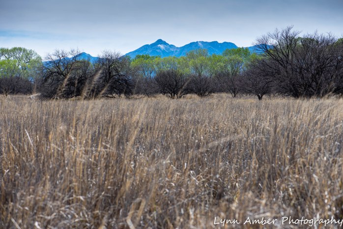
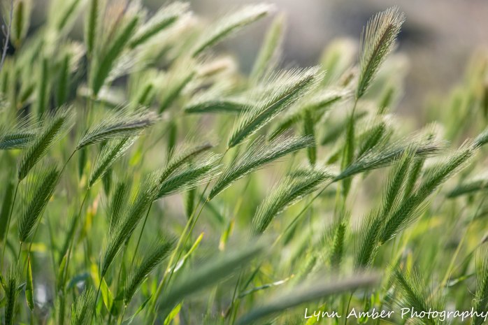
On our bike ride today, we came upon an area with taller grass than what we have seen near our campsite. An interpretive sign indicated we were in the Sacaton Flats. The giant sacaton grass (Sporobolus wrightii) is an important native species in the area that helps this harsh ecosystem in several ways – it provides an absorption mechanism during flood flows, aids in erosion control and traps and holds soils in place. Without this grass, wind and water erosion cause soil depletion, dust and increased silt in area streams. The grass also contributes food and habitat for both native and introduced wildlife. Efforts have been underway here in Las Cienegas NCA to replant sacaton grass in places where it has been lost or is threatened. Who would have thought that this native grass could be so important for the local environment? I love finding out about these obscure, yet vital pieces of our natural world.
The environment here at Las Cienegas NCA is so very different from the mountainous canyon lands to the north of Phoenix. While there was so much in bloom along the Apache Trail, here at 5000′ in the southern high plains the land is still relatively dormant. I’m enjoying the contrast but, at the same time, feel challenged with finding good photographic subjects!! Some other interesting photos of the day:
A fellow blogger and Vermonter shared with me the following quote after my last post. I am familiar with this verse and have fond memories of time spent at the Laurance S. Rockefeller Preserve in the Tetons. Thanks, Stewart, for reminding me of this quote – it is so very true and I’m sharing it here:
“In the midst of the complexities of modern life, with all its pressures, the spirit of man needs to refresh itself by communion with unspoiled nature. In such surroundings- occasional as our visits may be- we can achieve that kind of physical and spiritual renewal that comes alone from the wonder of the natural world.”
― Laurance S. Rockefeller
In search of Dripping Springs….
I‘m back to sharing the adventures we launched from our dispersed camping site at La Posa South BLM in Quartzsite, AZ! On February 12, we decided to go on a road trip to visit the Dripping Springs site located high up in the hills to the east of us. I read about this area in the 2020 Quartzsite Visitor Guide. The description indicated there were hundreds of petroglyphs to be seen at Dripping Springs and that was all I needed to spark my curiosity!
Dripping Springs gets its name from a spring that originates in a cave here providing a year-round water source – and apparently if you enter the cave you can hear the water “dripping.” Remnants of an old stone cabin and arrastra can also be observed here. I was not familiar with the term “arrastra” so I looked it up! It’s a “primitive mill for grinding and pulverizing gold or silver ore.” Well, that certainly fits with the mining history of the area.
Most people access this area riding an ATV utilizing the various BLM dirt roads that criss-cross this vast land. I started asking around for information on the best way to approach the area via a 4-wheel drive truck. I received various responses ranging from “you cannot get there with a pick-up truck as the wheel base is not short enough” to “you can get within a mile on the dirt roads off Gold Nugget Mine Road.”
One thing was clear. We needed a map. I purchased a La Posa Travel Management Map published by the BLM that covered the area in question. It listed all the primitive roads by number and would serve as a guide for us. I also stopped in to the local Chamber of Commerce and verified the information we had received. Whether we could get to within a mile of Dripping Springs by vehicle was still questionable, but the woman at the Chamber of Commerce was very nice and printed off some maps from the Quartzsite Off-Road Atlas to supplement our BLM map.
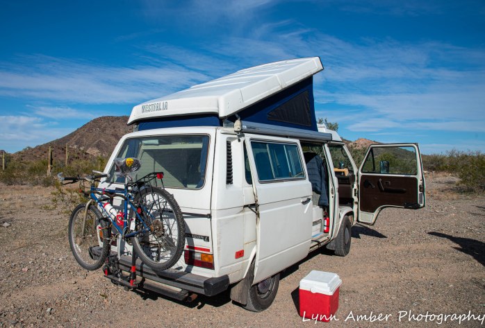
Armed with our navigation aids, we set about to access Dripping Springs from the north. We traveled east on I-10, exited at Gold Nugget Mine Road and followed the directions to the primitive road # 0065 that we needed to start our ascent into Dripping Springs. We promptly got lost since the iron road signs were very confusing. We dead-ended at a working mine and had to backtrack to our starting point. It was at this time that we met the Quebecois who was traveling in his old Westfalia and had pulled over along the dirt road to camp for the night. We chatted with him for awhile since he is basically our “neighbor” to the north and then went on to find our route.
We found road #0065 again and drove a short distance only to realize that it was going to be a little sketchy whether we could actually continue given the road conditions. We parked the truck and decided to hike into the spring estimating that it might not be that far.

As we started our hike, we heard a voice yelling to us. It was the Quebecois who we had met earlier. He ran up to us and asked if we minded if he joined us on the hike. He was alone and wanted to explore but was hesitant to do so without a map or a companion. We enthusiastically said “Yes!” and we enjoyed a nice walk and great conversation with our new friend. His English was excellent and he was impressed by my knowledge of the local plant material – so he was okay with me! He had just retired, experienced a recent health scare and decided to travel before it was too late. Driving straight through from Quebec to Arizona – his only goal was to see the desert. His wife was to be joining him in a few days and he was going to rendezvous with her in Las Vegas.


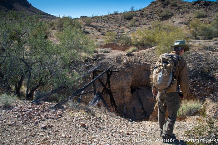
We never made it to Dripping Springs although we did make it to what I think was the Dos Picachos Mine just a mile before the steep ascent to the spring.
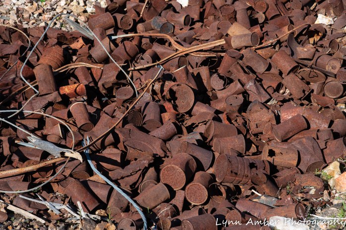
SOME OF THE MINE SHAFTS WE SAW


DESERT ART


It was getting late in the day and we needed to turn around. We parted company with our French friend once we reached our truck and wished him well.
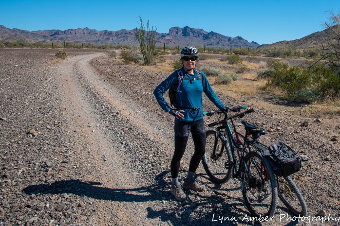
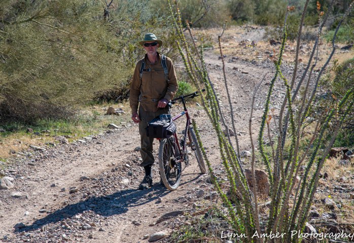
Our second attempt to reach Dripping Springs was the very next day, February 13. Reviewing the maps, it appeared that we could ride our bikes directly from La Posa South along several primitive roads to reach the spring. If we took road #0059 from the end of the dispersed camping area and then followed #0058 and 0058B, we would be within hiking distance again. I would not be robbed of my chance to see these petroglyphs!!
PLANTS ARE STARTING TO BLOOM IN THE DESERT


It was a great bike ride for me, however, since Jim’s old mountain bike has no front shocks , he was not comfortable. We managed to make it onto road #0058B before turning around and heading back. We rarely saw or heard any ATV’s during our jaunt and the scenery was beautiful. I was disappointed that we never made it to Dripping Springs but the bike ride was awesome.
As Ralph Waldo Emerson said, “Its the not the Destination, It’s the Journey!”
Photo a Day 3.24.20

I’ve been on an emotional roller coaster the last couple of days – as I’m sure many people have whose jobs are up in the air as we work through these interesting times. After an entire evening of sulking and feeling sorry for myself, I woke up the next morning and, with camera, coffee and a stroopie in hand, I walked and walked – and walked some more. I came across this little pond and watched this Great Egret preening itself perched in this tree. Nothing like a good walk and a little nature to set things back on a more positive track. I’m not totally there yet – but at least I’m on my way.
I’ve decided to just focus on photography for while – it always brings me joy – and see what unfolds in the days and weeks ahead . I’ll be posting a photo a day until the crisis subsides…..
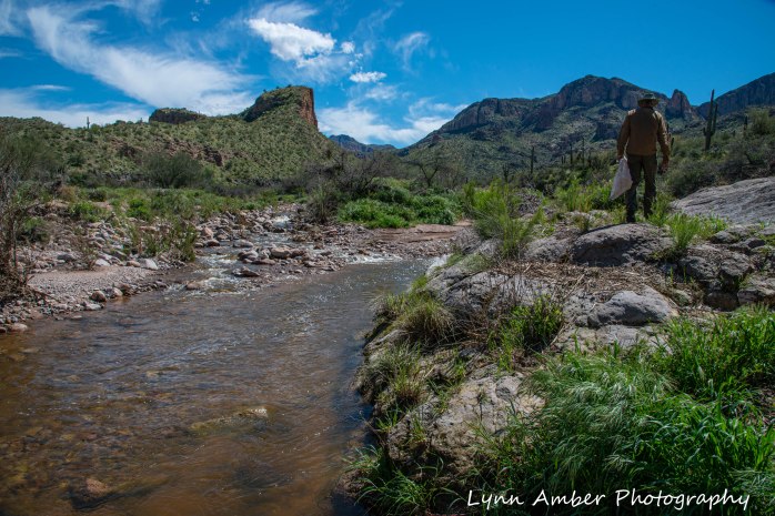
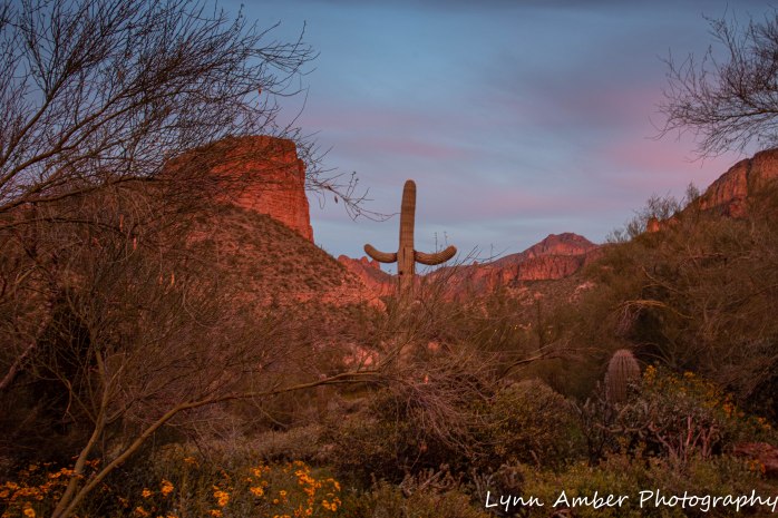
The Apache Trail

Since I’m so far behind on my blog posts, I decided to alter my plan and post some more recent adventures interspersed with the earlier travels this winter. I’m so excited about the area we are exploring right now that I cannot wait to write about it and share my photos. Between my computer crashing and our days camped without service, it’s been a challenge to keep current!
At the moment, we are located along the historic Apache Trail in Arizona. We found a comfortable spot in a national forest service campground that is quiet and beautiful! We are in Tortilla Campground in Tortilla Flats, Arizona. The campground is operated by several volunteer hosts and each site has water and sewer hook-ups along with a fire pit and picnic table. The sites are very generously sized and beautifully maintained by the friendly hosts. With a senior discount, we are paying the large sum of $10 per night.


As the name suggests, the Apache Trail originated as a migratory route for Native Americans from their winter camps in the low lying desert to their summer homes in the higher elevations of the central mountains of Arizona. Original inhabitants were the Salado, a name given to this Native American group by archaeologists. The name is adapted from the Spanish name Rio Salado – or Salt River – which is the river flowing through the Tonto Basin. The Salado were cliff dwellers and some of their dwellings are now preserved at the Tonto National Monument along the Apache Trail. They occupied the area somewhere between 700 C.E. and 1450 C.E. and were farmers, hunters and gatherers. Their migration from the area is thought to have happened due to changing climate conditions making life along the once lush basin more difficult as droughts became more common. It remains a mystery what happened to them after they left the area. I learned the above information from the national monument website. Please take a look at their page – interesting reading. I was hoping to travel to the monument after we leave the western part of the Apache Trail however I just read that they have closed the facility until further notice due to the coronavirus.
According to the historical account on the website of the Apache Junction Public Library, when the white man settled the area and established Fort McDowell, things began to change. Of course! Local native American tribes such as the Apache and Yavapais conflicted with the U.S. military occupation and, eventually, lost the battle for the area when Geronimo surrendered in 1886. With the increasing settler population, the Tonto Basin and Salt River became an area of interest for construction of a dam that would serve as a water supply and flood control for the communities of Mesa and surrounding area. In the early 1900’s, construction commenced on the Roosevelt dam which included a more accessible road from the valley to reach the dam. It was called the Tonto Wagon Road and, after the dam was complete, the road became a popular tourist attraction. Called the Apache Trail today, the route extends along Rt. 88 from Apache Junction through the Tonto Basin to east of Miami, Arizona. That concludes my very shortened version of the history of the road!
It is reported to be one of the most scenic routes in Arizona and is popular with motorcycle enthusiasts and automobile day-trippers. The road is steep and winding with drop-offs not protected with guardrails. Driving the Airstream up the 15 miles of road to the campground was slow-going but fairly safe. The road is paved for 9 miles past the Tortilla National Forest campground. I’m not sure I would want to navigate the road with a much bigger rig, however!
At the moment, due to flood damage, the section of the road from Fish Creek Hill through Fish Creek Canyon is closed. So, it is not possible to travel the entire distance until the road is repaired.
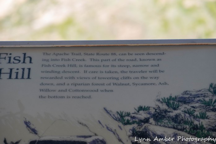
We have explored the road from Apache Junction to the Fish Creek Hill rest area and I can personally attest to beauty of the scenery along the trail. It is one of the most scenic roads I’ve traveled. According to the National Park Service website:
“The Tonto Basin is a large inter-mountain basin rich in natural resources. The broad valley floor and steep mountains contain several different micro-environments, producing a wide range of resources within a small geographic area. Thick stands of mesquite, walnut, and sycamore grow near water. Saguaro, cholla, prickly pear, jojoba, and other species that produce edible buds and fruits grow on the slopes and mesas. At higher elevations, the pinyon-juniper belt is rich in game and edible fruits and nuts.”
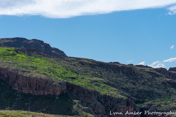
The diversity of this area will blow your mind away. During our explorations, I have seen a wide range of plant material and wildlife and witnessed the unique and varied geology of the area – from valley floors to steep canyon walls. The Sonoran desert here is greening up with recent rains and plants are starting to bloom.
In the few days that we have camped along the trail, we have done some hiking and canoeing. We have also just chilled out around the campfire and enjoyed a great visit with Mike and Amy – some old boy-scout parent friends from Vermont – who were traveling through the area.
I hope you enjoy the following inspirational photo journey through the Tonto National Forest and the Superstition Wilderness!!
ON LAND
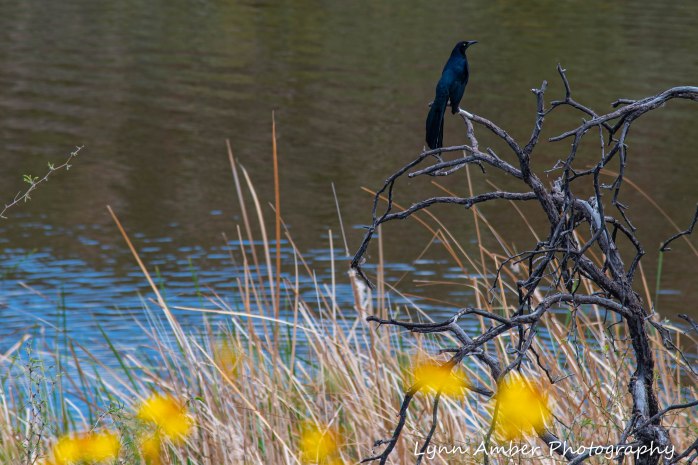
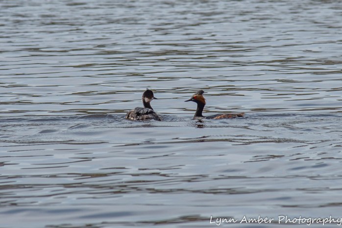
Our first full day in the national forest, we thought we might canoe on Canyon Lake. It is just 2 miles down the road from the campground and we have not had the canoe off the truck since we left Vermont! We went down to the lake to scope things out but were quickly discouraged by the crowds. It was Sunday and the lake was teeming with boats and people. As we drove around to the different boat launch areas looking for a spot to put the canoe in, we decided that we did not want to canoe in a crowd! Before we headed back to the campground to re-assess our day, I was able to capture some birds enjoying the day in and around Canyon Lake.

After abandoning the canoe idea, we went back to the campground and decided to go in search of firewood so we could have a campfire that night. We asked the camp hosts and found out that you are allowed to scavenge for dead wood along the wash below the campground.
After getting some wood for the night’s campfire, we decided to drive up the road and find a place to take a short hike and get some exercise.
Our first hike in the area was on what is called the Mesquite Flat and it was a short walk on an old, unimproved dirt road. The route took us into a canyon and dead-ended at a washed out bridge that spanned the canyon. Perhaps this was an old mining road or an access road to a long-ago ranch?? It was a 3-mile round-trip hike and there were many interesting plants along the way.


At the end of the day, our Vermont friends, Mike and Amy, arrived and set up their tent on our site. We enjoyed a great campfire and some good conversation and, while cooking dinner, we were treated to a magnificent sunset.

ON WATER
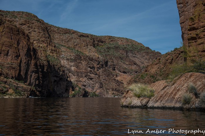
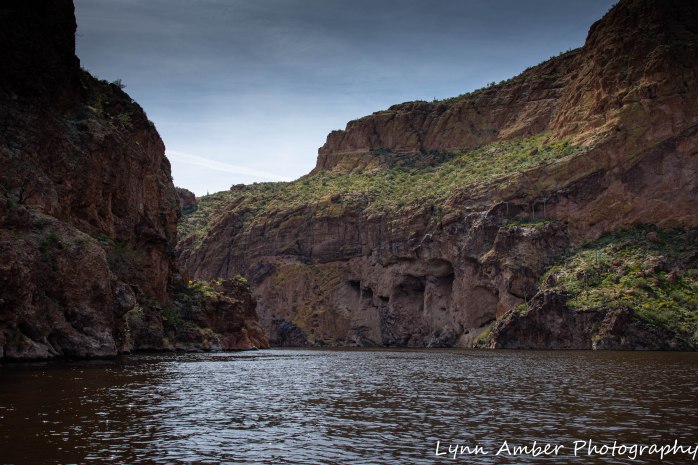
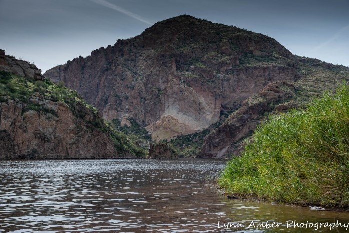
The next day, we headed off to canoe Canyon Lake. It was Monday and we thought things would have cleared out on the lake. We were wrong. Due to the coronavirus, Phoenix areas schools are closed and so there were still many families enjoying the outdoors and day off. We decided to put the boat in anyway and deal with it! We launched at the Acacia Recreation Area and headed straight across the lake for the finger of water that headed upstream into the canyon.

As we headed into the narrow section of the lake, the scenery was breathtaking with the sheer canyon walls and steep, sloping areas covered in thick vegetation. We even saw some Big Horn Sheep up looking up into one of the narrow canyons.

There is a substantial commercial operation at Canyon Lake that includes a restaurant, campground, gift store and, of course, boat tours!! The Dolly is a replica paddle-wheel boat that takes people up into the lake. I’m not sure it is an authentic paddle-wheel but I did just hear today that it may be suspending operation due to the coronavirus.

We found a nice spot to pull over and eat some lunch before heading back to the launch site.


While we were canoeing, Amy and Mike embraced my recommendation to take the drive past the campground to the Fish Creek Hill rest area and do some short hikes along the way. They said it was awesome and that there were many flowers blooming along the Tortilla Trail. They left the following morning to rendezvous with relatives in Tucson, so Jim and I decided to follow in their footsteps and hike the Tortilla Trail since they gave it such rave reviews.
BACK ON LAND
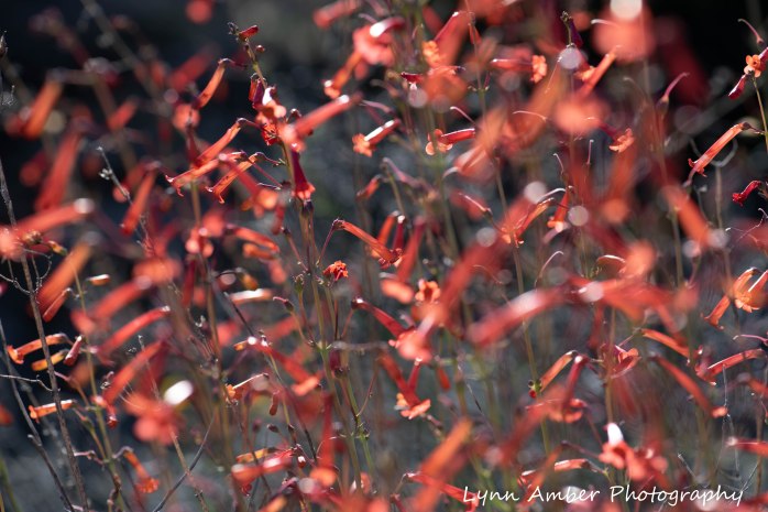
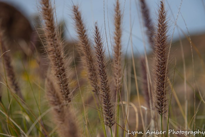
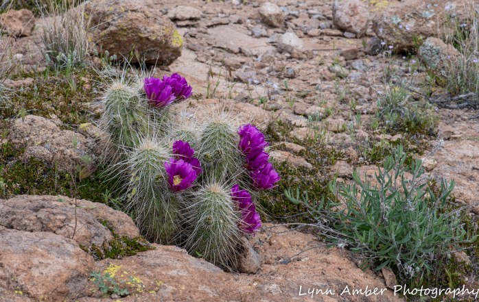
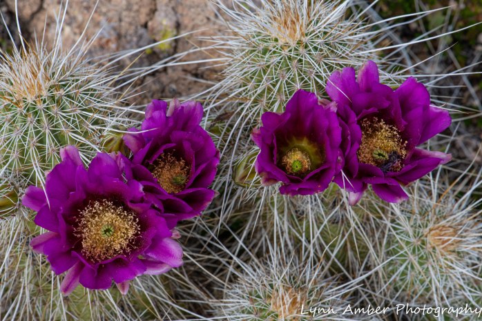
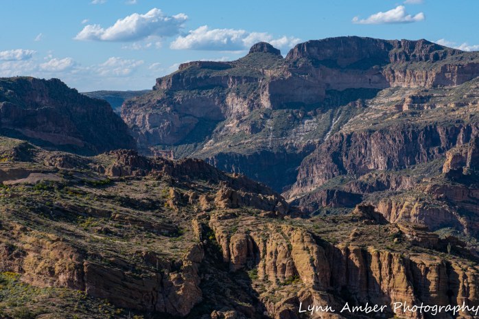
The Tortilla Trailhead starts just a mile from where the road ends on this side of the Apache Trail. There is an alternate starting point on the other side of the basin. It is about 3.2 miles to hike to the other trailhead from where we started – making it a 6.5-mile roundtrip hike. We only went about 2 miles and turned around given the time of day and the fact that we also wanted to continue to the Fish Creek Hill rest area after the hike and see that canyon. The Tortilla Trail traverses an old road that is supposedly open to 4WD vehicles. It is very rough – and seems more like a very wide hiking trail. We certainly did not see any 4WD vehicles – or any other people for that matter!! I’ve seen some pretty amazing territory over the years and the scenery along here was mind-boggling!! My focus on this hike was photographing flowers so I had my macro-lens on – but I still got some landscape shots with it as well.


I tried to capture some of the amazing scenery along the trail with my 105mm lens – here goes!

More plants along the way…..


We left the Tortilla Trail and followed the dirt road up to the Fish Creek Hill rest area – the end of the line for this section of the Apache Trail. There is a paved, accessible walkway here with a dirt trail extension that overlooks the canyon.


A relaxing, beautiful sunny day in the Tonto National Forest ended with a perfect campfire and another gorgeous sunset. Jim is known for his talent with a campfire. He never disappoints!!


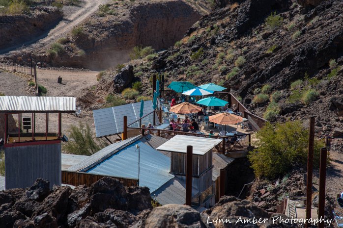
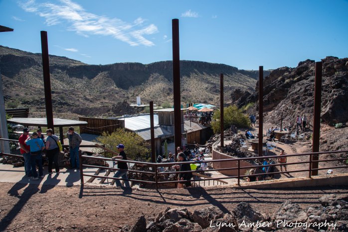
The “Nellie E. Saloon” Desert Bar

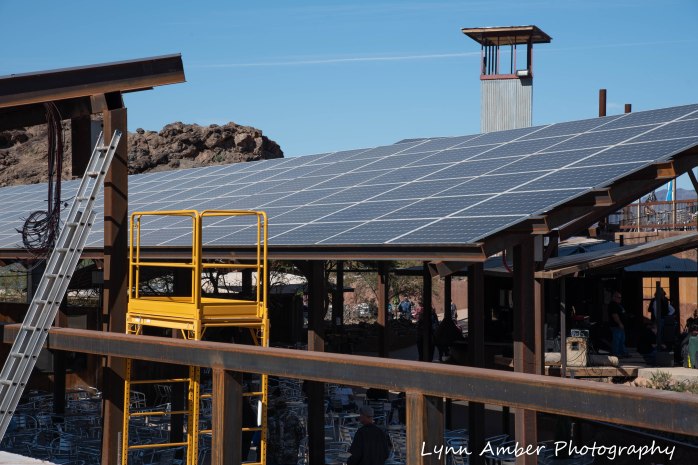
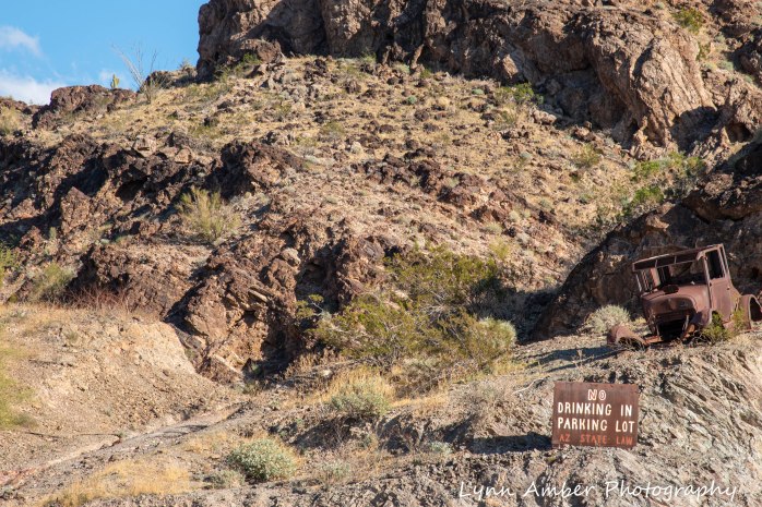
The “Nellie E Saloon” Desert Bar is certainly one of the most unique places to hold a music venue! Located outside of Parker, AZ, the bar is accessed via Cienega Springs Road – a 5-mile drive on a very unimproved, narrow dirt and gravel road with some precarious drop-offs! On Sunday February 9th, we decided to take a ride from Quartzsite and listen to some good, live music. My brother-in-law drove us there in his Chevy truck with dual wheels and it was slow going. On a previous visit, he experienced a flat tire when he veered to far off the side of the road. Knowing this, and the trepidation of my sister, I am grateful to them for offering to drive us there to experience this one-of-a-kind place. We were joined by friends of theirs from Canada who were also camped at La Posa South – Steve and Dianne, and Dave and Leslie.
According to their website, the Desert Bar sits on ground where an old copper mine operated. The owner, “Ken”, purchased the land in 1975 and the idea of a “bar in the desert” was born. He officially opened for business in 1983 in a small, original structure and over the years has expanded to what you see now.
The whole place operates via solar energy with panels on all the roofs and a bank of batteries for storage. According to the website, improvements are made each year and his latest brainstorm is to create a small town on site! That’s enticing enough to draw people back next year to see the progress made and/or latest project completed.
Walking down to the venue, you get a bird’s eye view of the solar array – quite impressive!!
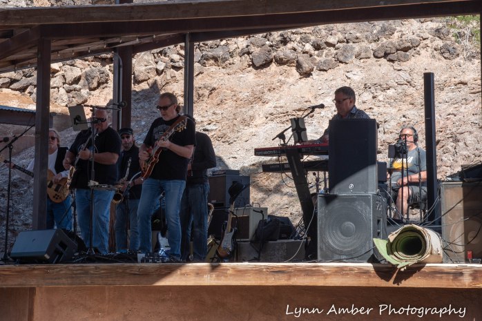
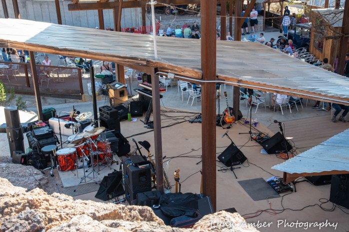
The band, Ripple Effect, was already playing when we arrived. Their music was definitely geared to the older generation – with songs from the rock n’ roll era of the sixties and seventies. Their repertoire included tunes from the Eagles, Bob Seger, Eric Clapton, John Denver, Johnny Cash, Led Zeppelin and on and on…….it was a treat to hear these old familiar songs!!
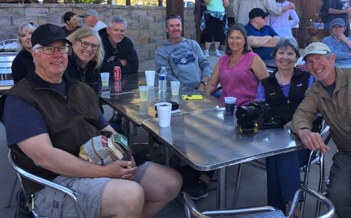
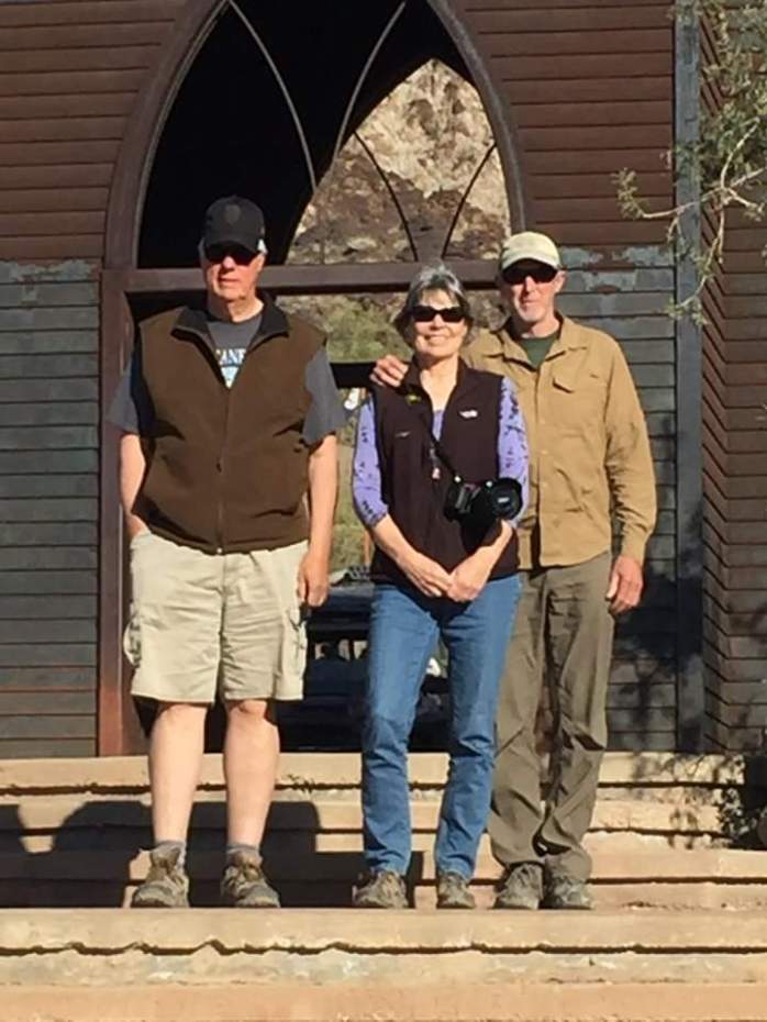
 Steve and Diane and Dave and Leslie arrived ahead of us and grabbed a good table – arriving early is advisable!! The venue operates on Saturday and Sundays from 12noon – 6pm. Our crew – from left to right, counterclockwise – Harry, Vicki, Dianne, Steve, Dave, Leslie, Lynn and Jim
There’s food for sale as well as beverages ranging from Coca Cola to beer and wine and mixed drinks. All cash transactions – so be prepared! The prices were reasonable which I did not expect!
The atmosphere is very relaxed and, after a while sitting at the table, Jim and I decided to get up and walk around. There’s a trail behind the venue that leads up to a knoll above the compound. It was fun to get that perspective!


Vicki and Harry joined us on the hike up to the top of the mountain


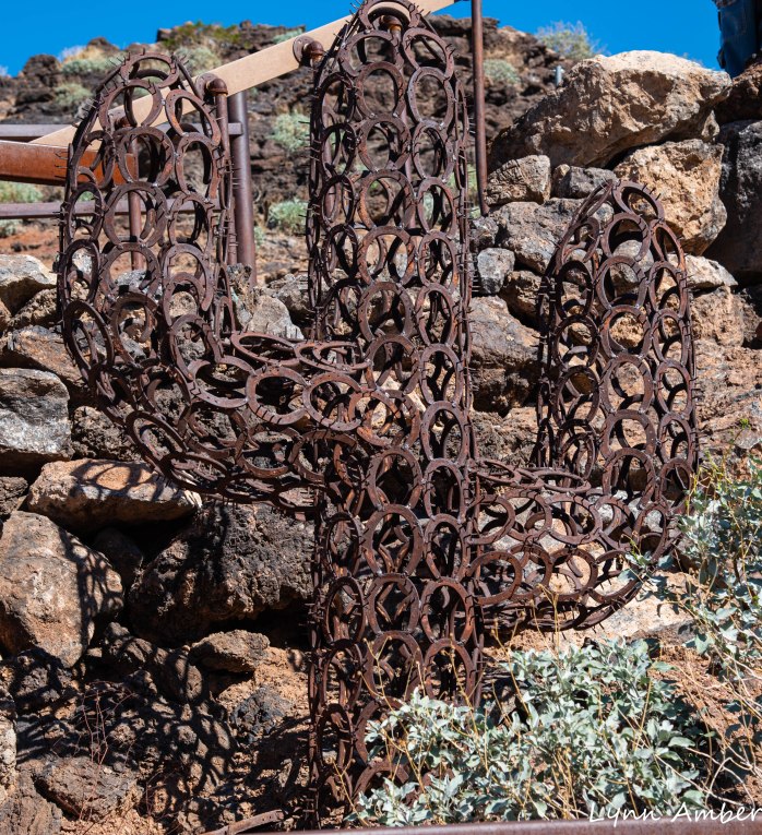
I loved the “art” that was interspersed around the property 🙂

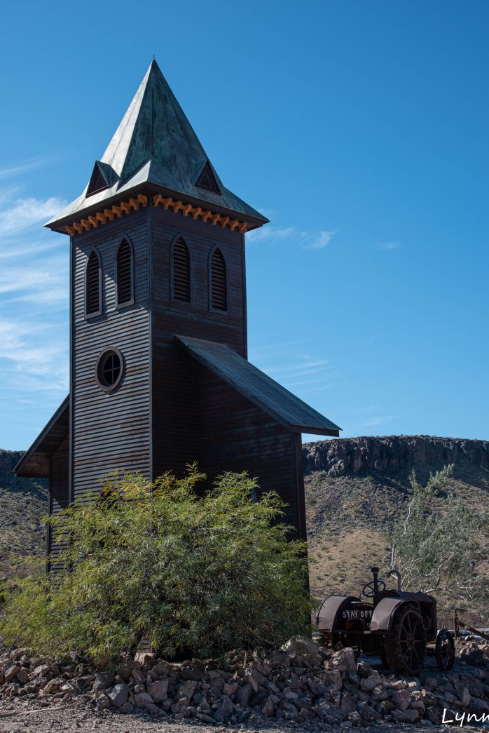
One curiosity was the church on the property – it’s not an original structure but was built in 1996 as one of Ken’s projects. A great photo-op place!!
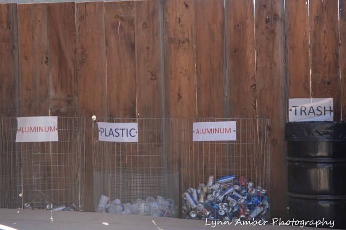
One of the most impressive parts of the venue was the effort made to encourage recycling! What a novel idea to make the recycling bins transparent so that it makes it really easy to see what should be deposited there!! Good job, Ken!!!! 🙂
More images and scenery!!


This was an absolutely beautiful, warm and sunny day and could not have been a more perfect choice for a Sunday afternoon. If you are ever in the Parker, AZ area during the winter months – take the time to experience the Desert Bar. You will not be disappointed.
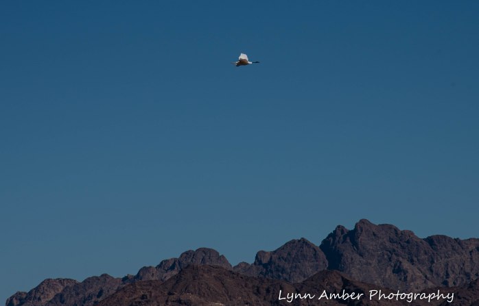
Cibola National Wildlife Refuge
On February 8th, my sister and brother-in-law suggested a field trip to the Cibola National Wildlife Refuge and I enthusiastically accepted! There are nine different wildlife refuges in Arizona and we were close to several of those while in the Quartzsite area.
Cibola NWR includes an area of 8,444 acres surrounding the floodplain region of the lower Colorado River. It was established in 1964 in order to repair and recreate habitat from damage done to the marshes and backwaters of the area due to flood prevention measures. The refuge seeks to simulate the original habitat and has reestablished wintering grounds for many migratory waterfowl and other wildlife.
I’m always interested in the origin of names. The name Cibola was given to the area by Spanish explorers to the region and rumor has it that the name originated from the legend of the Seven Golden Cities of Cibola. Early explorers believed that these legendary cities existed somewhere in the Southwest. Cibola was also the ancestral home of some of the Native American tribes of the region including the Mohave and Quechan. They farmed in the rich floodplain soil during the dry season and migrated to the desert uplands to hunt and gather during flood season.
The town of Cibola has a history as a farming community since the late 1800’s and there is a historical marker in the area with the following inscription:
“Gold and silver strikes in the 1860’s created growth in the area. It is said Wyatt Earp served as sheriff of Cibola for one year in the 1890’s. The town of Cibola formed in 1898 and construction began on a 16 mile canal to bring water from the river to the town. A post office operated here from 1903 to 1933, serving the farms, but the irrigation project failed. Floods were a yearly event until dams were built on the Colorado River. All the remnants of Cibola are now located on nearby private property.”
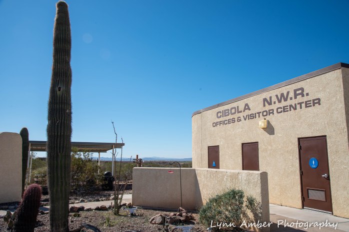
The Cibola NWR visitor center is open during the winter season daily from November through the middle of March. Visitors can stop in and view the small exhibit area and get information on activities within the refuge. There are several short trails for hiking and an auto tour road around the refuge. The refuge is also open to hunting and fishing opportunities. Volunteers staff the visitor center and live on site in employee RV sites. There are opportunities in many NWR’s to do this type of volunteer work. I would love to be in a position some day to volunteer at one of our nation’s many refuges. For more information on these opportunities, visit the Fish and Wildlife Service website. The woman who we chatted with in the visitor center was volunteering at Cibola for the first time. She spends her summer’s working in the Grand Canyon. I also found out she was from a town in Colorado close to where I will be working this summer at Great Sand Dunes National Park. She gave me some good tips on places to visit and, most importantly, which grocery store was best in Alamosa!
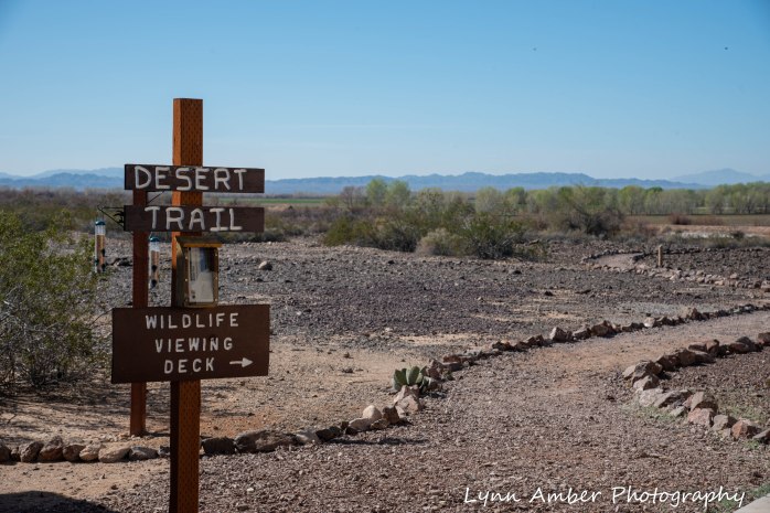
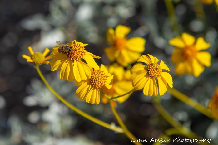
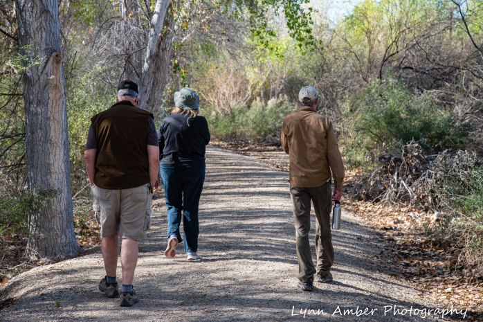
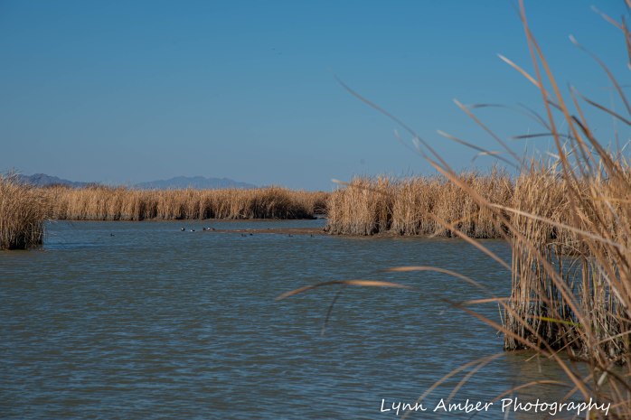
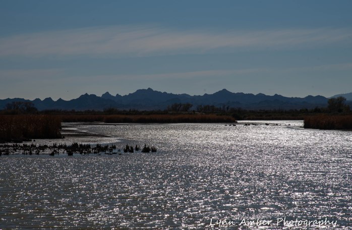
We opted to walk two of the short interpretive trails – the Desert Trail and the Nature Trail. We also rode the short 3-mile auto loop road near the visitor center and then explored the southern part of the refuge by vehicle. This involved following some improved dirt roads along levees and through marshes and wetlands. We traveled through the Hart Mine Marsh Unit and along some of the levees.
THE DESERT TRAIL
The Desert Trail is adjacent to the visitor center and was constructed in 1996 by the Youth Conservation Corps. There are numbered posts throughout the walk that match information in an interpretive brochure that can be picked up at the visitor center.

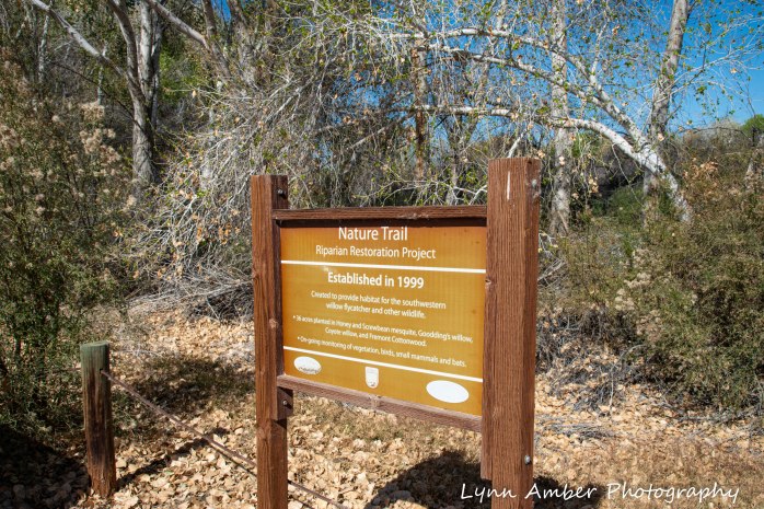
THE NATURE TRAIL
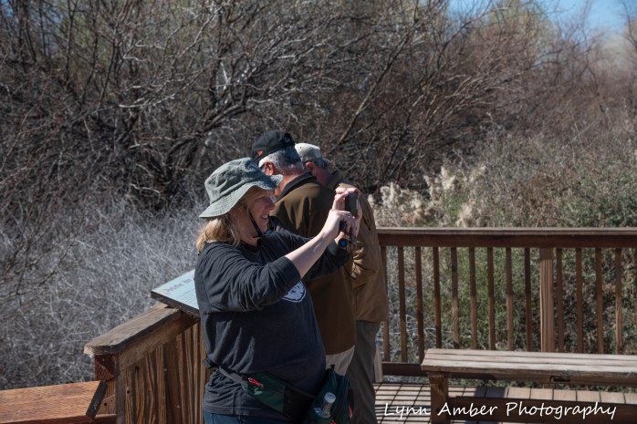
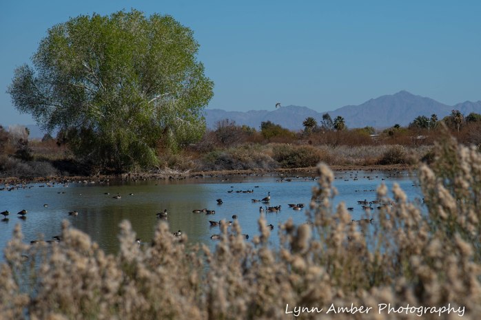
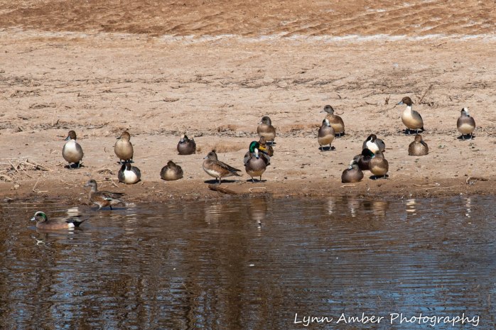
The Nature Trail starts at a small parking lot along the Goose Loop Auto Tour. It’s a short 1-mile walk through a “restored riparian forest and mesquite bosque.” (from the Goose Loop brochure) This habitat of mesquite, cottonwood and willow supports many wildlife species including bobcat, mule deer, coyote and the rare Colorado River cotton rat. I learned that the mesquite tree cannot germinate and therefore spread unless the seed is eaten. Coyotes play an important role in this process – eating the seeds and spreading it around after digestion and elimination. Fascinating!! There is a wildlife viewing deck half-way through the hike that overlooks a pond teeming with overwintering waterfowl.
THE GOOSE LOOP AUTO TOUR
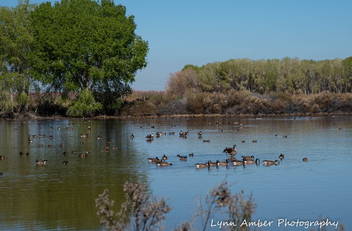
This auto tour is a 3-mile loop that takes you through part of the refuge. It is advised to remain in your vehicle so that the wildlife is not disturbed – with the exception of the Nature Trail walk. The loop traverses some cultivated corn and alfalfa fields and along Long Pond.
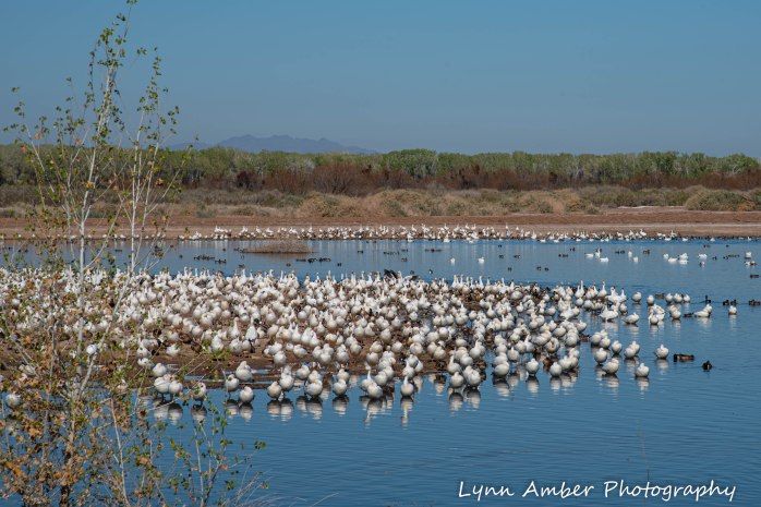

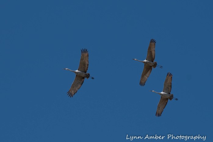
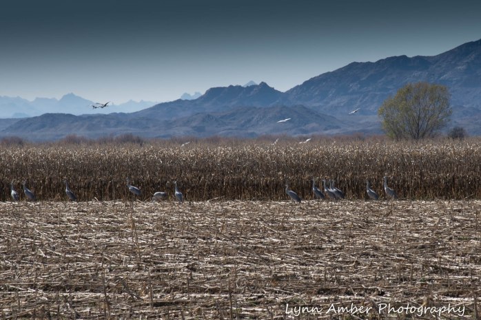
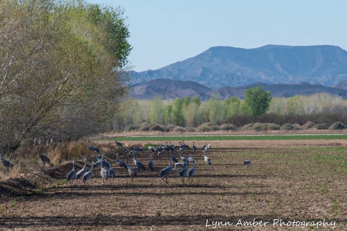
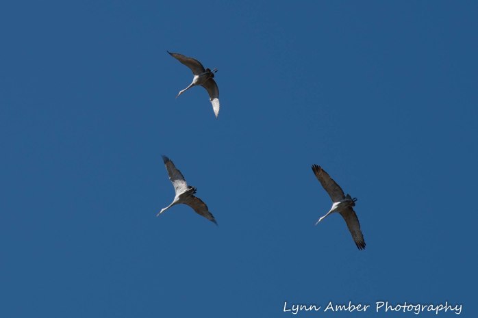
Along the drive, Farm Unit 1 includes cultivated crops that provide foraging opportunities for overwintering wildlife. We were able to view masses of Sandhill Cranes in the cornfields and saw a coyote hunting in the alfalfa fields!
HART MINE ROAD UNIT AREA
Leaving the Goose Loop Auto Tour, we proceeded south deeper into the refuge and traveled some of the dirt roads through the Hart Mine Unit area. This route took us along some of the levees and also along the Colorado River. We passed by some small marshes and ponds along the way as well.


Many thanks to my sister for recommending this day trip. We have not seen each other very much over the past few years – sometimes going more than a year without being in the same neck of the woods – and I learn something new about her every time we visit. I learned that she shares my enthusiasm for learning about wildlife and nature – such fun!!
