Lynn Amber - Travel & Photography
sharing my thoughts through words and images
Le Puy Camino – via Podiensis: La Romieu to Condom
May 1, 2023
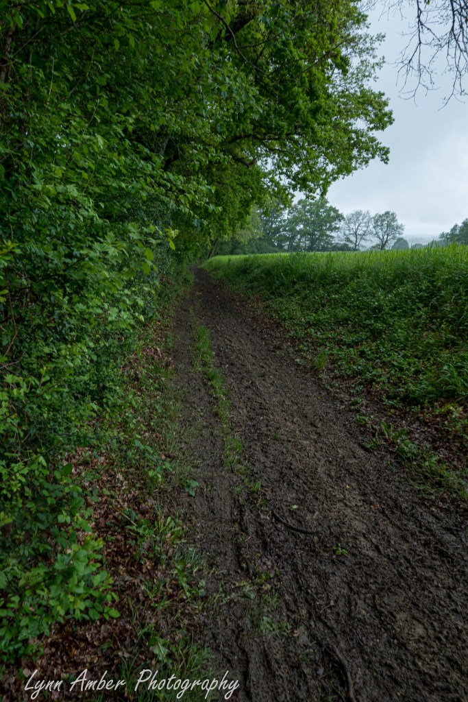
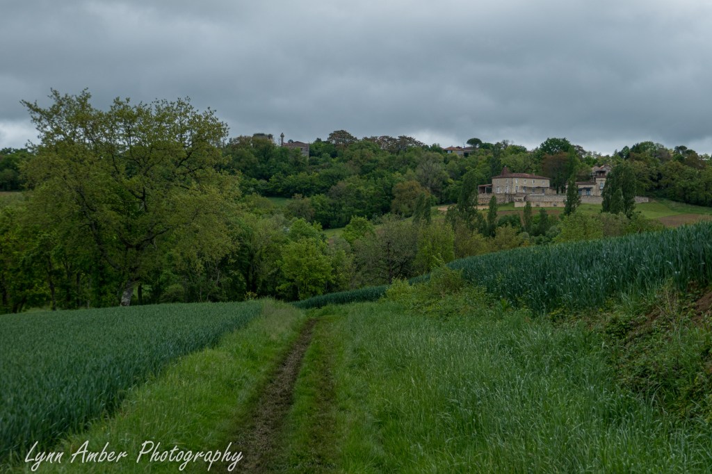
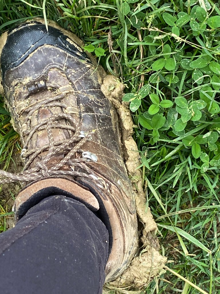
Today’s walk to Condom would take me 14.5 kilometers through yet another muddy trail day! It was an easy route except for the delays when I had to scrap mud from my boots!
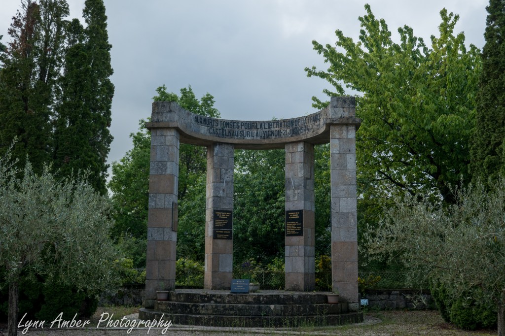
There were a couple of highlights along the Way today worth mentioning. In Castelnau-sur-l’Auvignon, I passed by a unique war memorial with some interesting albeit sad history. On June 21, 1944, a battle took place here between multi-national resistance fighters and troops of the German occupation of France. The out-numbered resistance fighters were forced to evacuate and suffered the loss of 19 heroic freedom fighters. This memorial commemorates their bravery in the face of insurmountable odds.
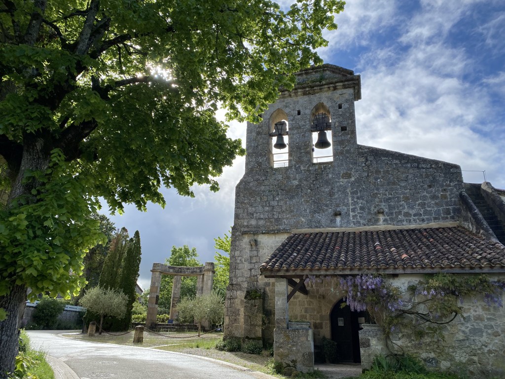
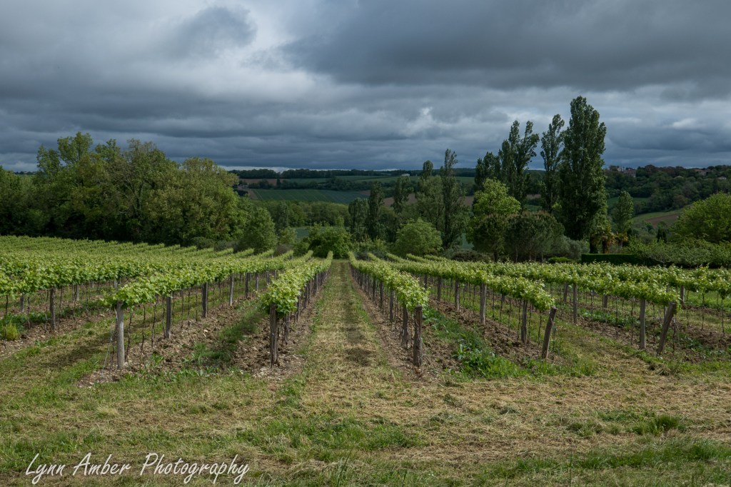
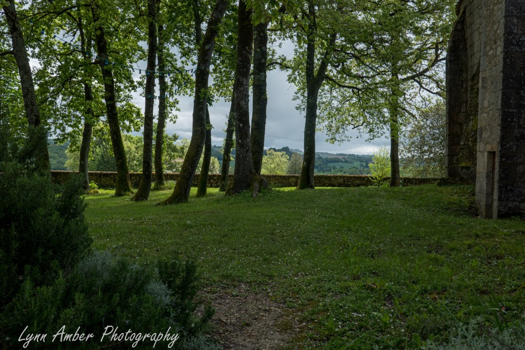
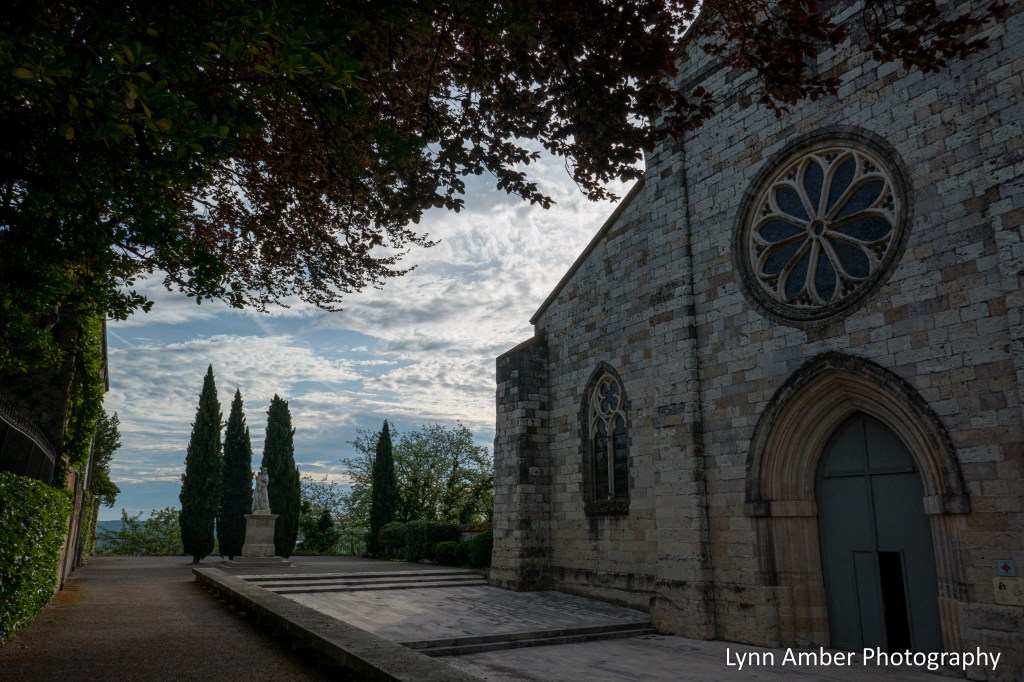
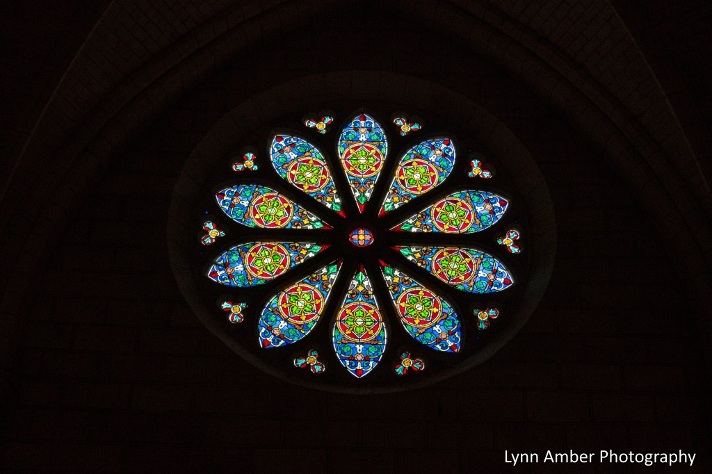
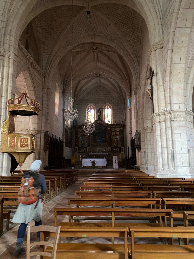
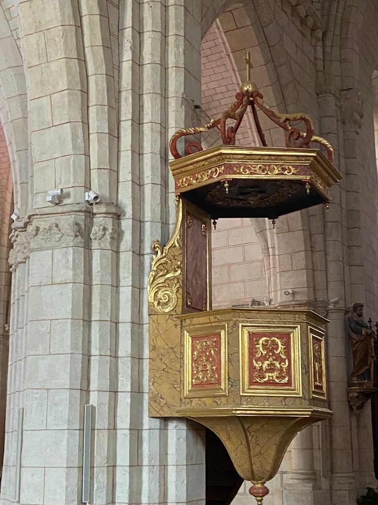
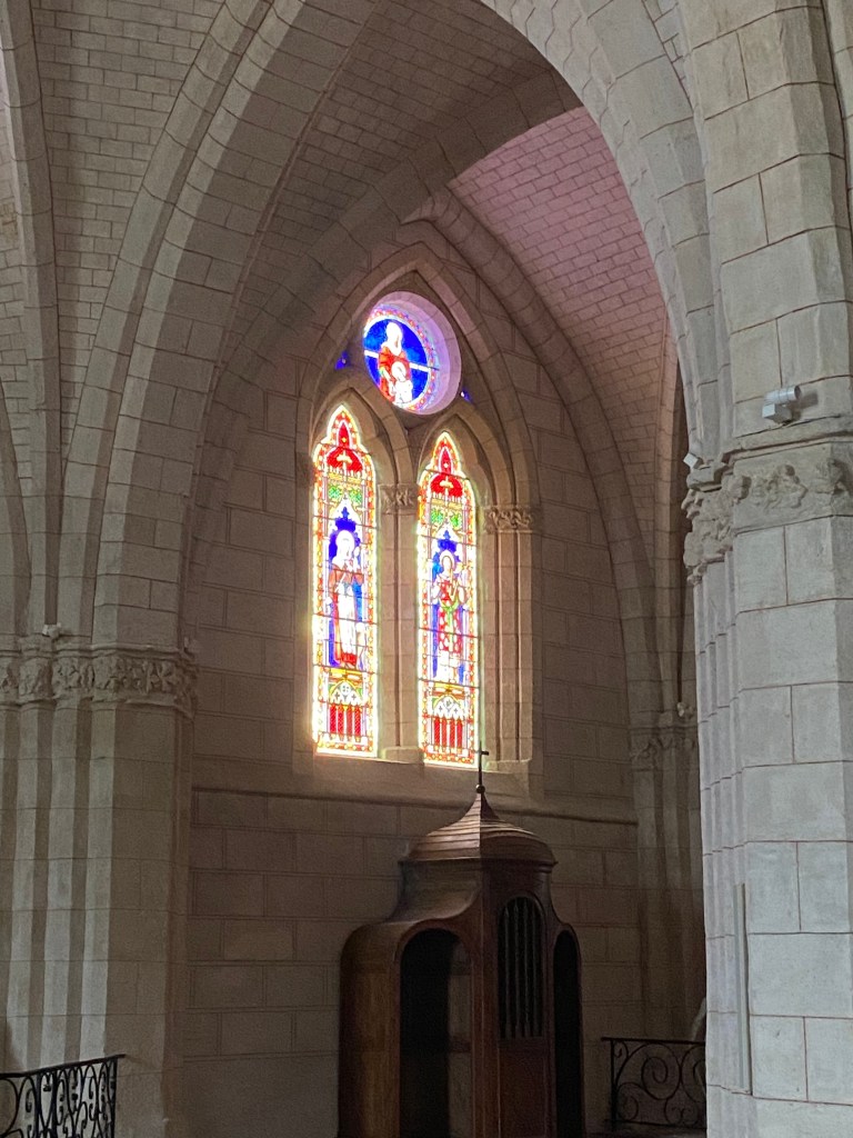
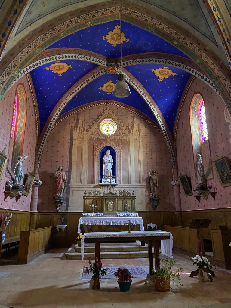
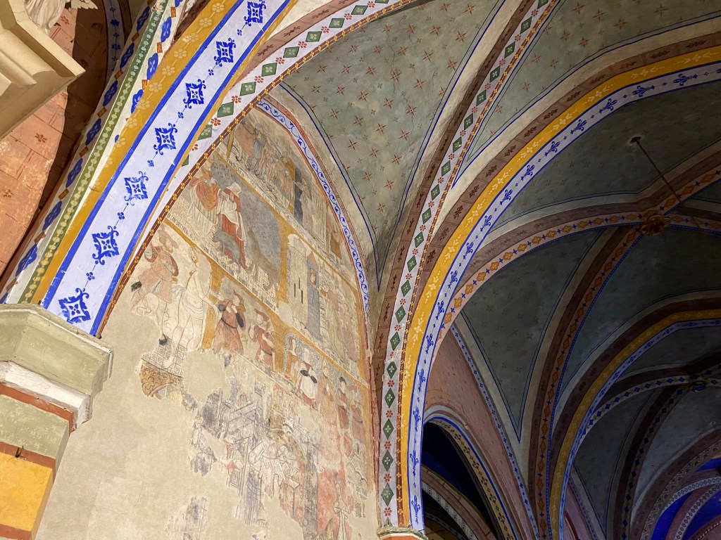
A short walk from Castelnau-sur-l”Auvignon, through a countryside filled with vineyards, I came upon the Chapelle Sainte-Germaine de Baradieu. This lovely 12 century Romanesque chapel is all that remains of an ancient monastery. I took a break here and walked around the grounds and inside the church.
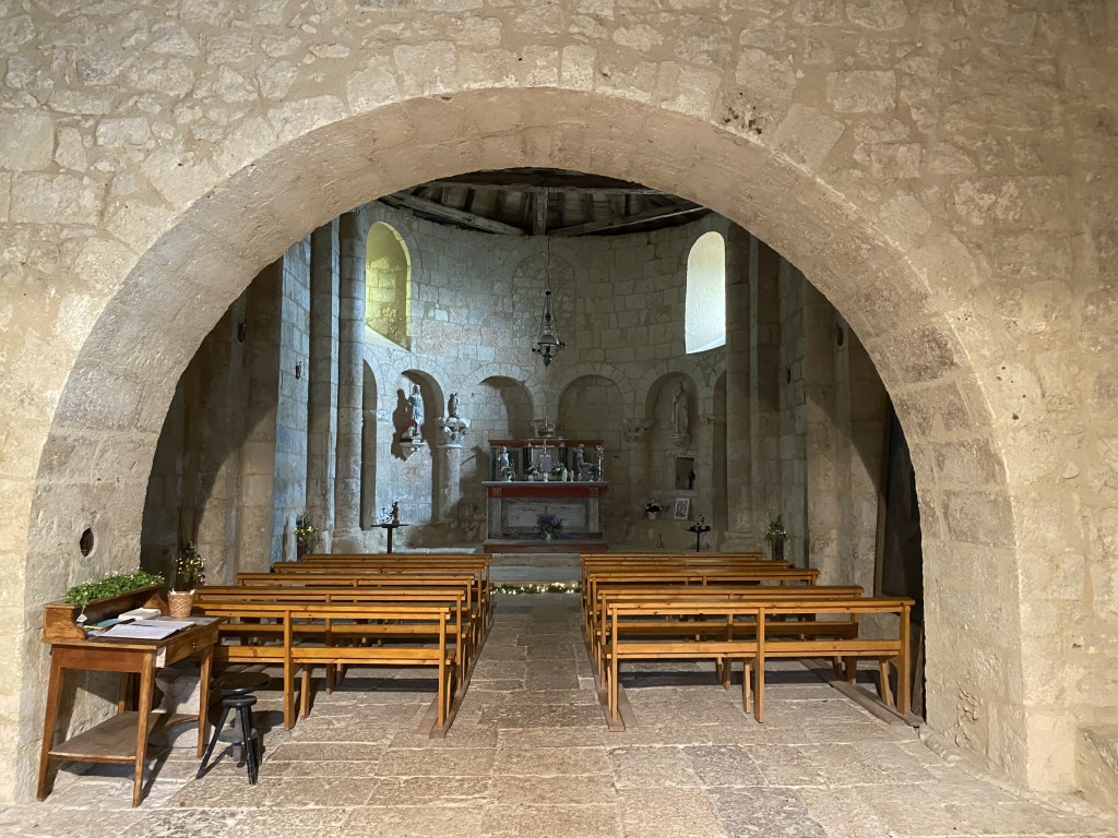
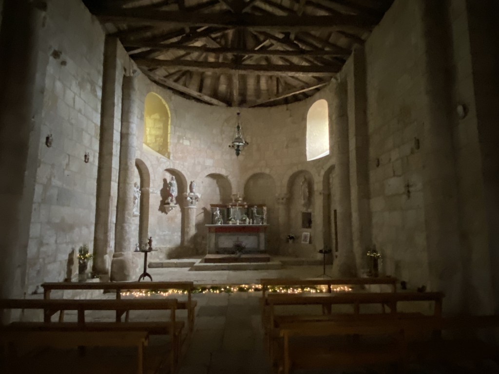
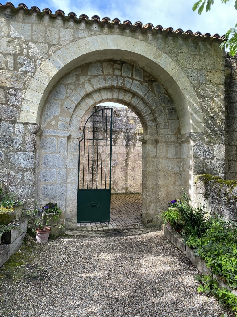
Above – inside the church and the entrance courtyard…
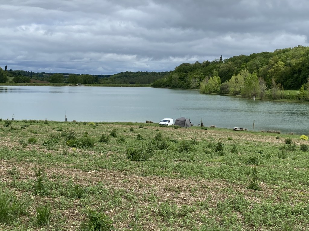
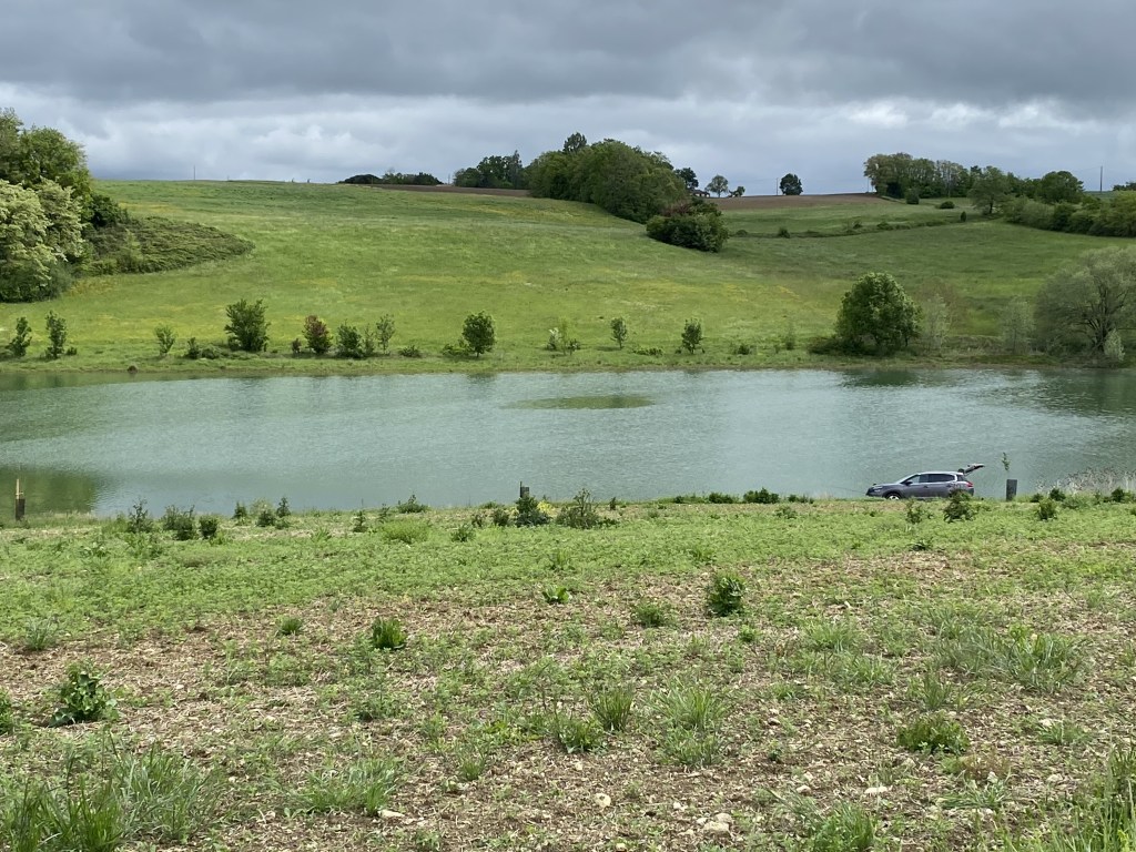
After leaving the church, the GR65 runs alongside the Lac de Bousquetara for a short distance. I noticed some “boondocking” campers on the shoreline.
I enjoyed the company of a couple of gentleman pilgrims for part of my walk today. They were from Paris and one of them had studied at New York University and spoke very good English. They informed me that during the trail tomorrow there is a section that should be avoided due to very steep, muddy terrain and provided me with a detail of an alternate route. I very much appreciated this!!
When I arrived in Condom, I found a nice spot to have a cold beer and rest before finding my gîte – Gîte d’étape Le Réconfort. The gîte was okay. My only complaint is that there wasn’t a real good system in place to wash and clean boots! I ended up having to take a dishpan with water to the back alley and scrub them with a brush. I admit to being in a very ugly mood for a bit that night!! My boots needed to get dry and stuffing them with newspaper did not help matters. It would prove to be an issue in subsequent days.

I spent some time in the evening trying to plan out the rest of the trip’s accommodations. With the Victory Day holiday coming up, some gîtes were closed. As with much on the Way, it all works out in the end!
Coastal Maine Botanical Garden 6.8.26
When I decide to stay in Maine on my day’s off, I watch the weather and pick a good day to wander around the Coastal Maine Botanical Garden. I need to see what has come into bloom since my last visit!!
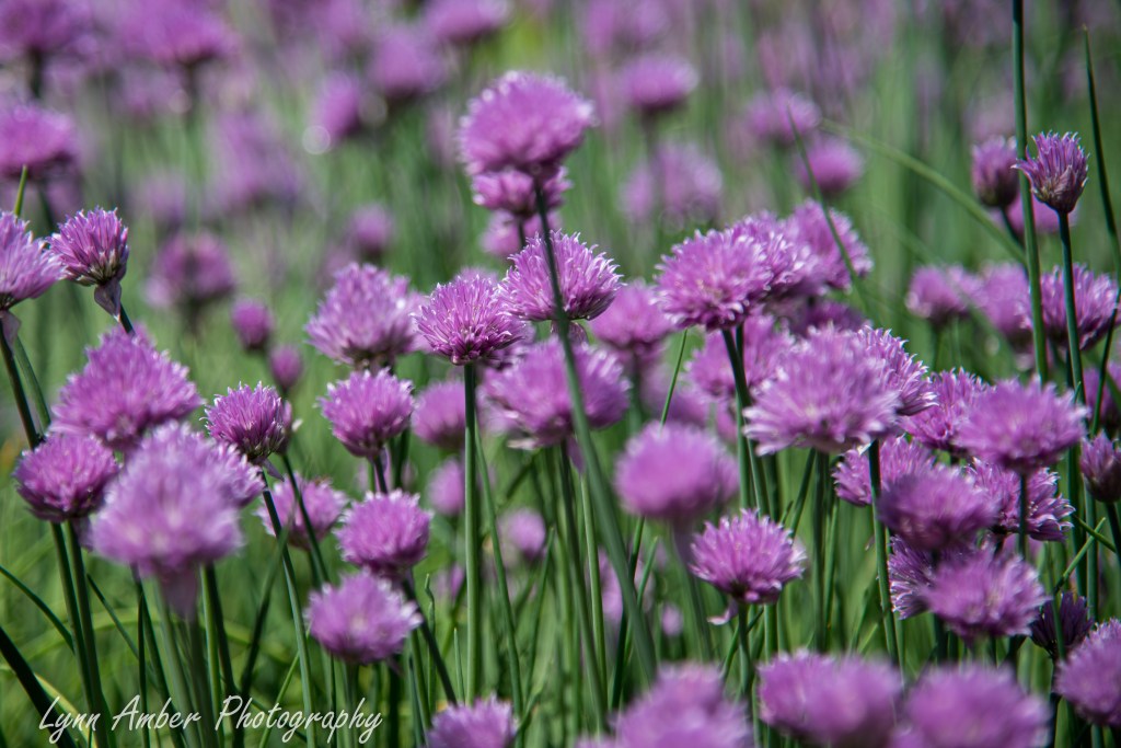
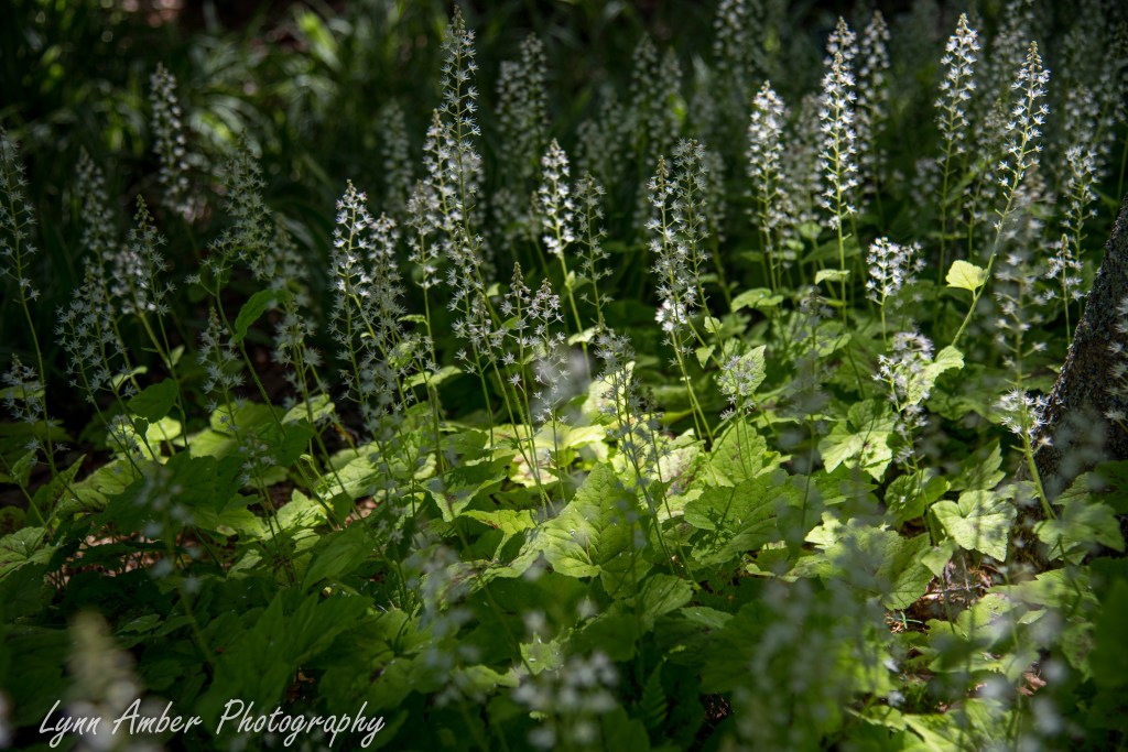
I headed right for the forest walk via the Haney Hillside Garden and found a beautiful clump of Tiarella in full bloom.
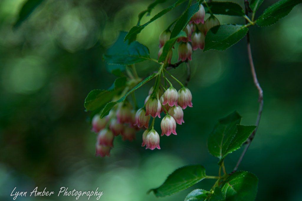
Further down the hillside in the Meditation Garden I noticed the delicate little flowers of Redvein Enkianthus brushing against my cheek!
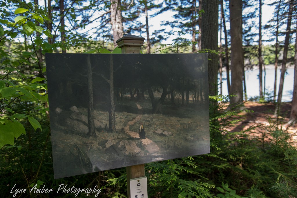
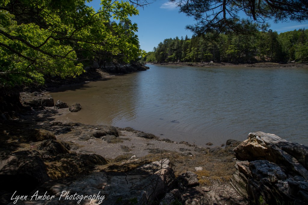
At the bottom of the hillside, I took a left and walked along the Huckleberry Cove trail. I had not walked in this direction before and was surprised to see the paintings displayed intermittently along the trail. There was a sign with a QR code so you could access more information about the display but my cell service was too light to bring up the website.
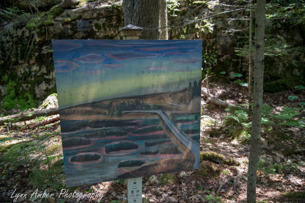
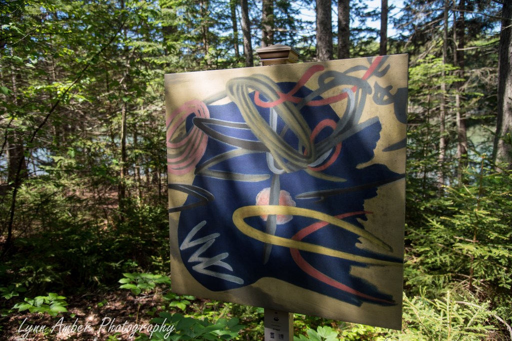
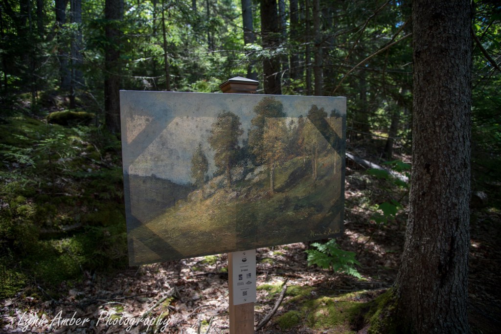
I walked as far as Huckleberry Cove and turned around.
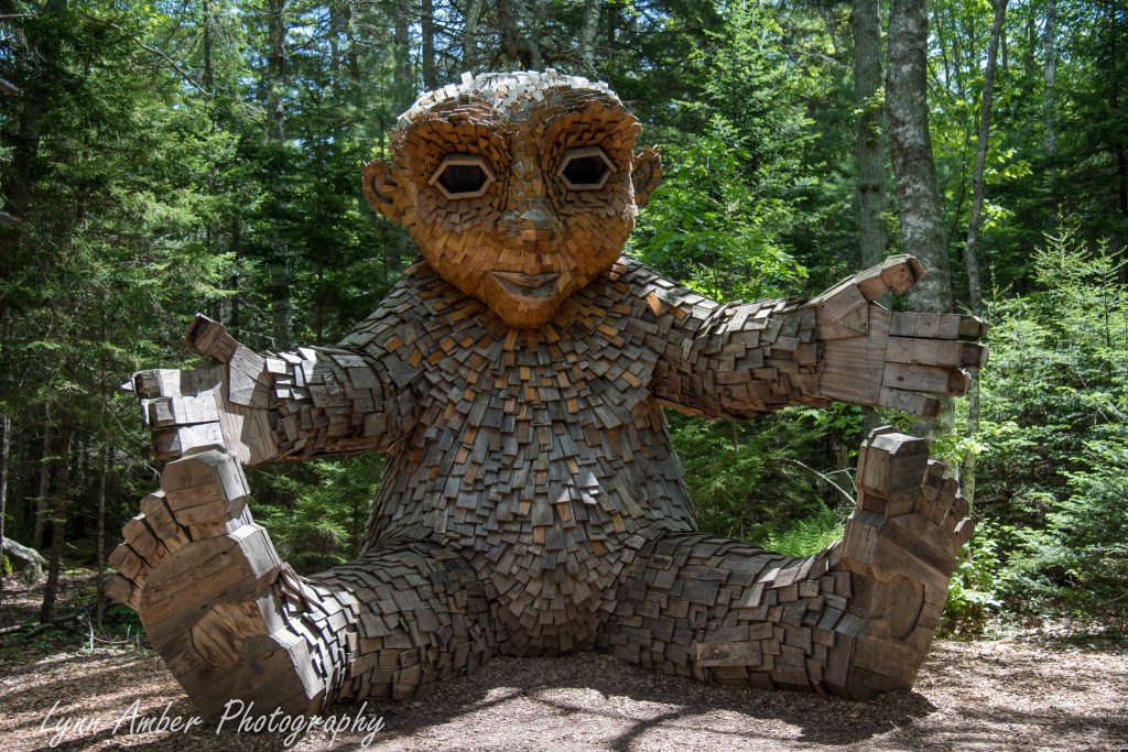
I walked back up to the more manicured garden area via the Backwoods Trail. This brought me by one of the trolls I had not yet discovered – Lilja, who holds the scent of the Fowers of the tree.
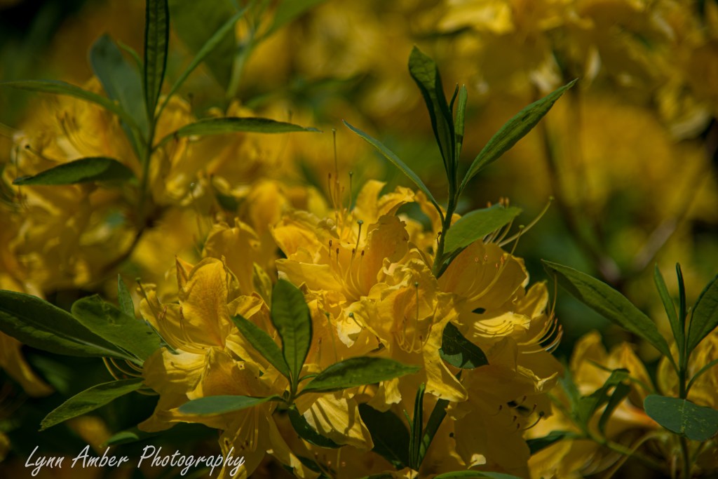
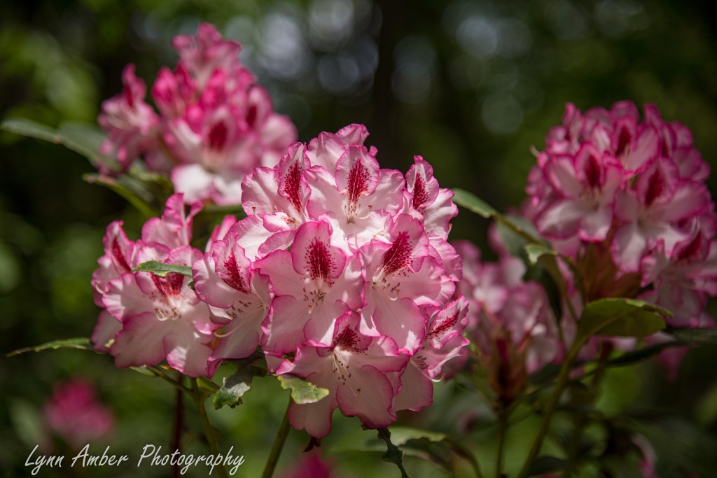
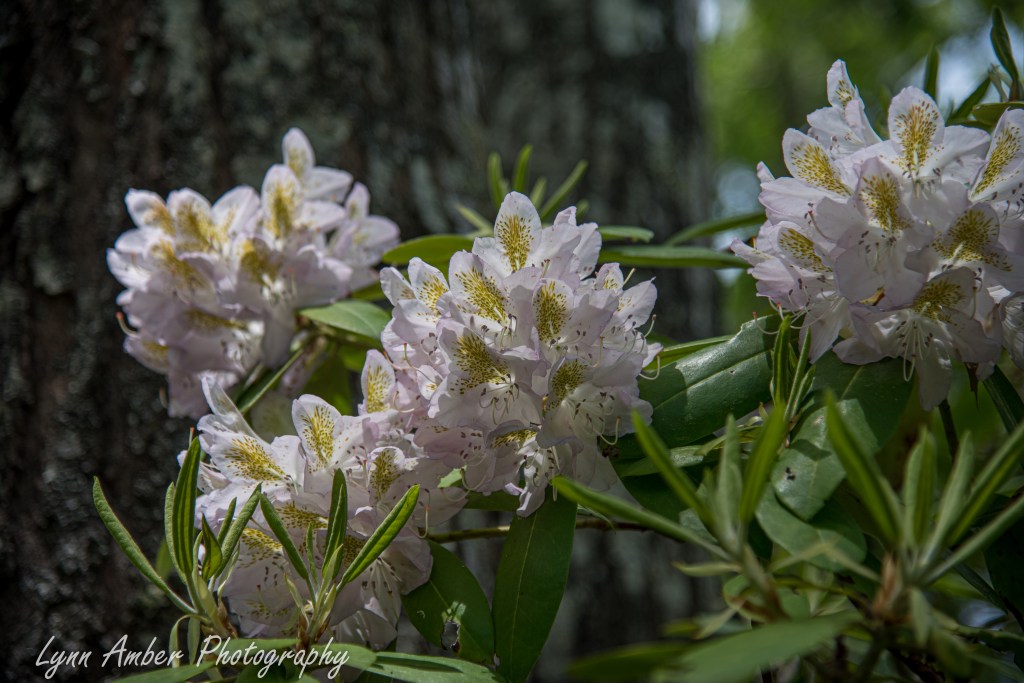
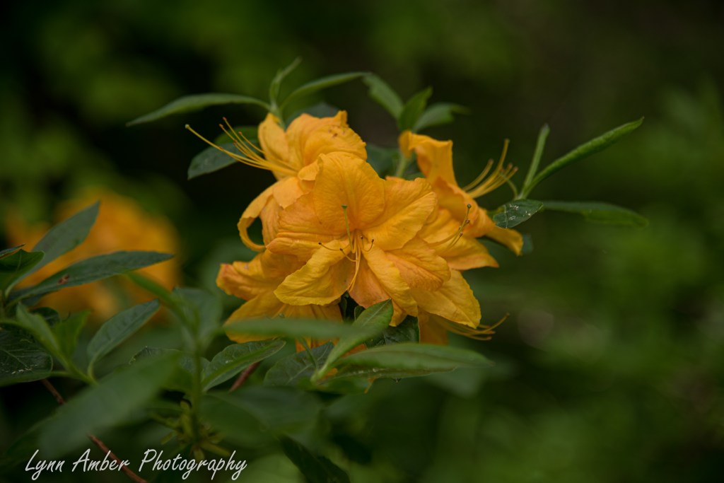
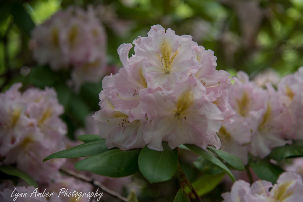
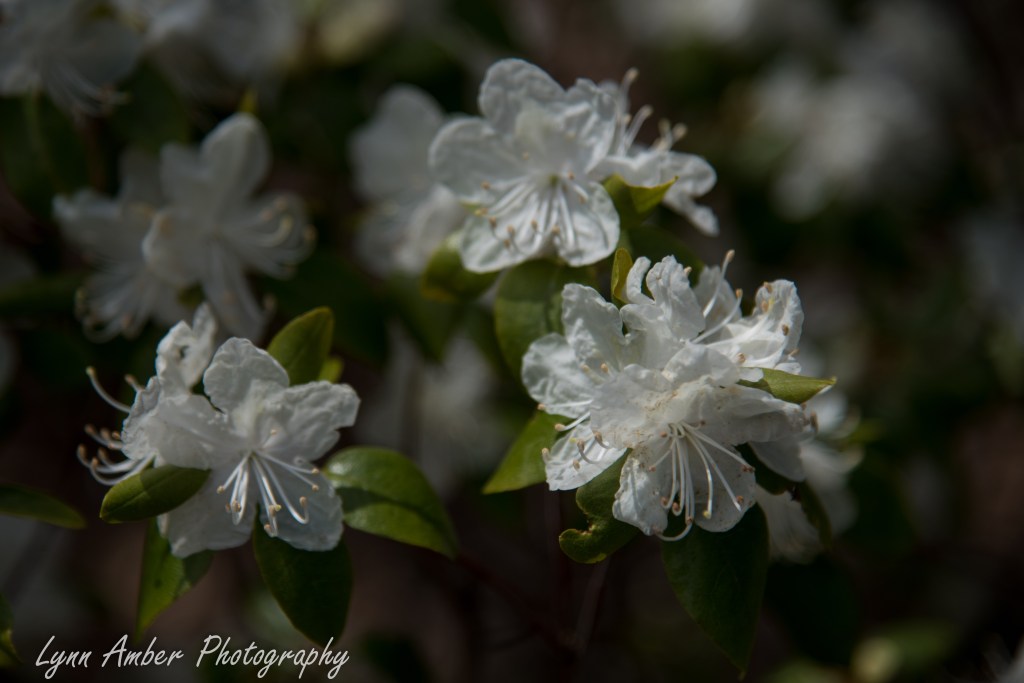
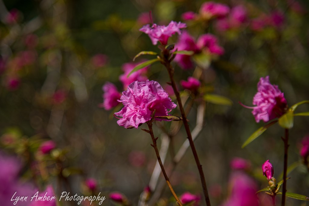
I kept going to the Rhododendron Garden to see what was putting on a display right now. Some very exotic-looking rhodendrons along side some good ole stand-bys.
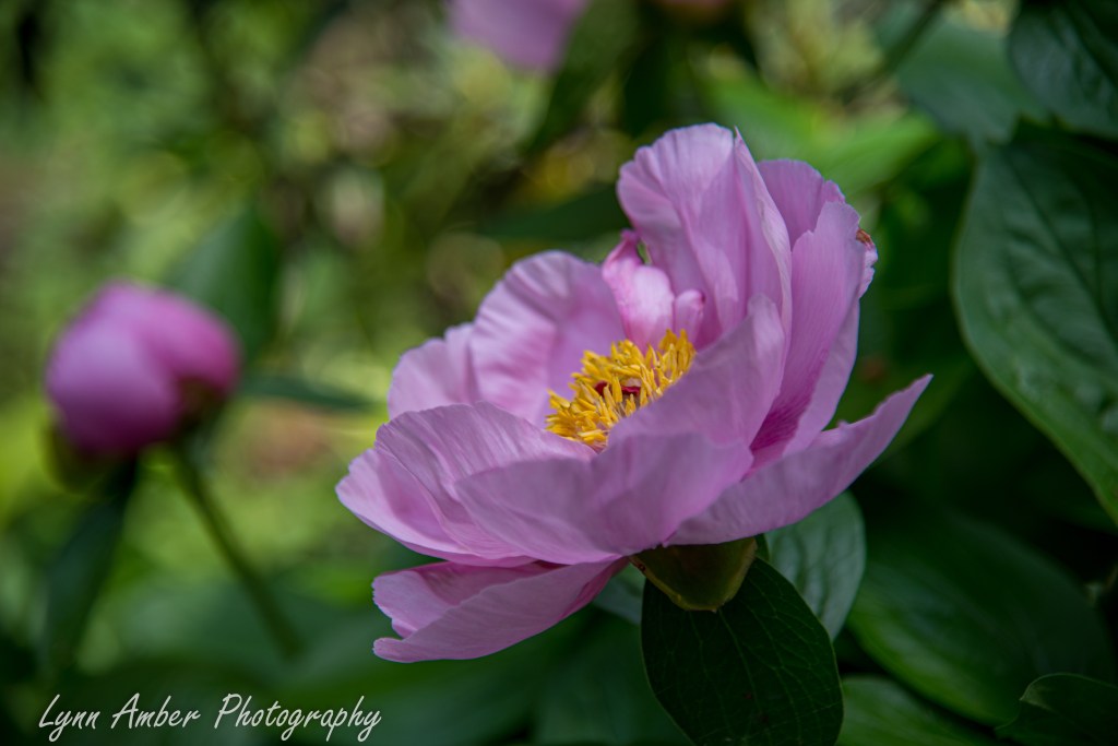
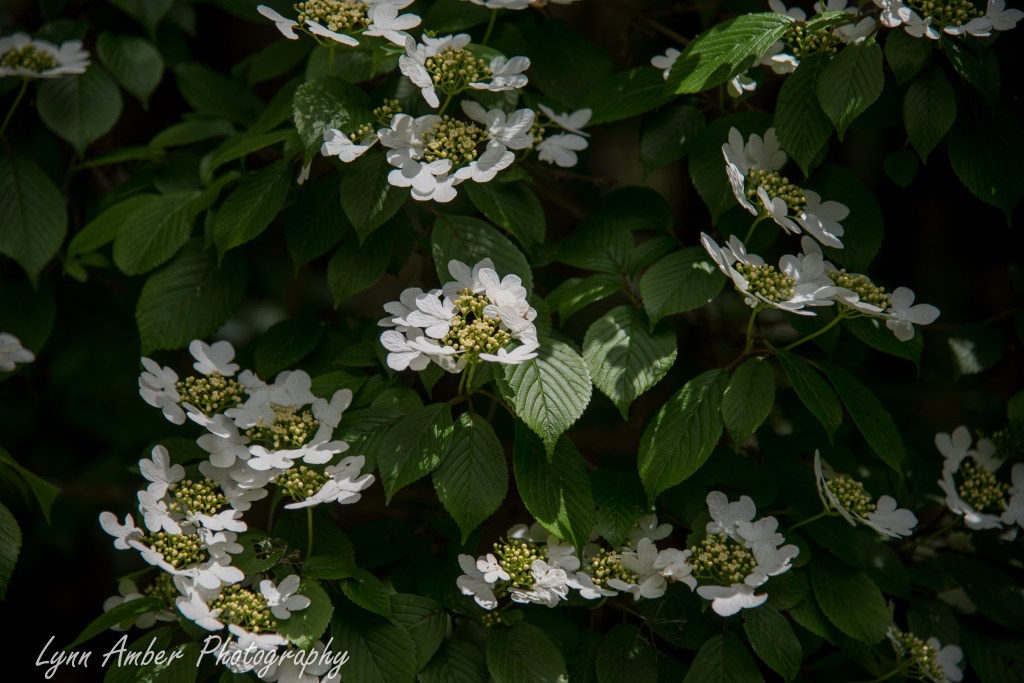
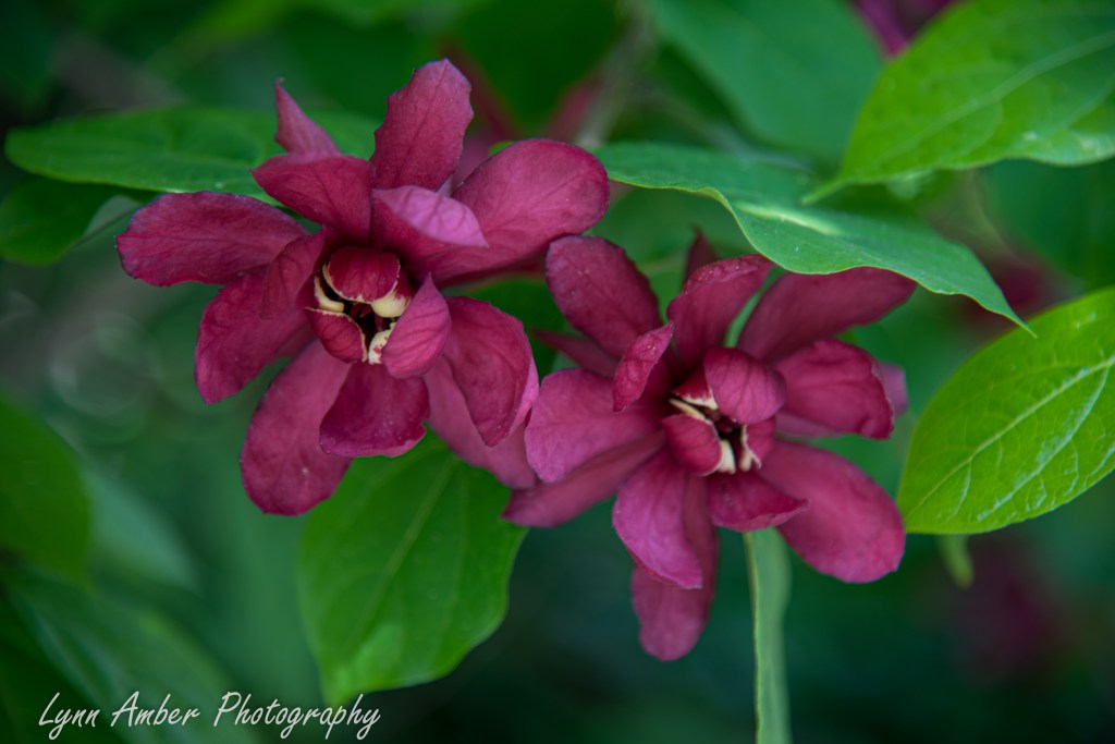
On my way back to the entrance to the garden, I came across this beautiful peony, a lovely Viburnum plicatum tomentosum and a magnificent Calycanthus “Harlage Wine.”
Coastal Maine Botanical Garden 5.26.26
I was back at the Maine Coastal Botanical Garden just after Memoral Day to see how things have changed since my visit earlier in the month. Lots of trees now out in leaf and new spring blooms to appreciate!!
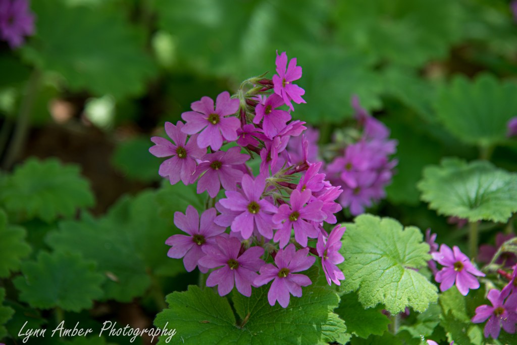
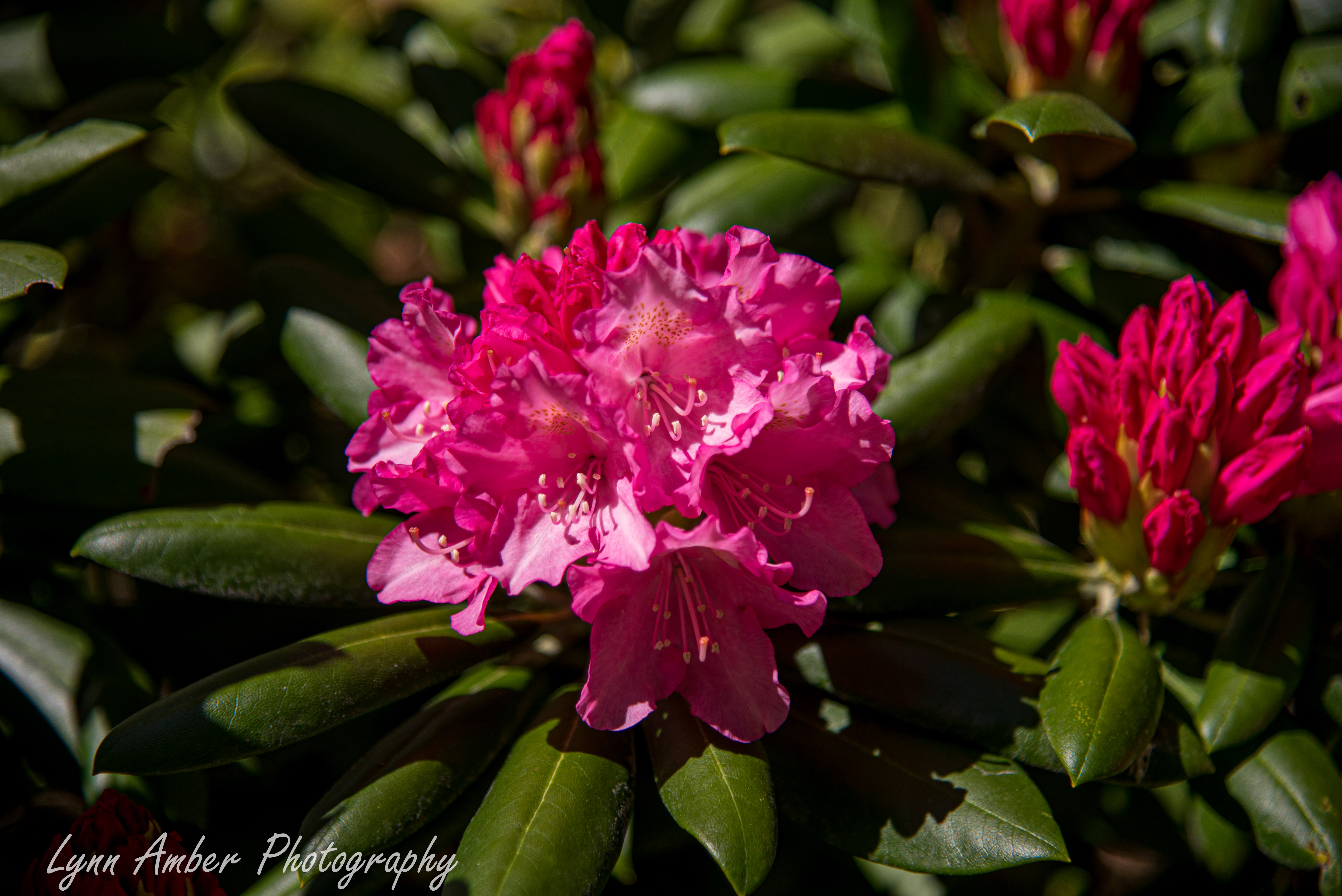
Rhodendrons in bloom above in the Rhododendron garden
My one complaint about the Maine Coastal Botanical Garden is that many plants are simply not labeled – which is very frustrating to me when I come upon a plant that I’m not familiar with. But, I really do love the garden and the grounds – especially the woodland trails.
Coastal Maine Botanical Garden 5.4.26
I spent three seasons workamping at Acadia National Park on Mount Desert Island. At the time, I wanted so badly to take a trip to the Coastal Maine Botanical Garden but it was just too far for a day trip from that location. I am workamping this season on the coast in Southern Maine and find myself less than a hour drive from this special place. Yesterday, the weather was looking promising and I traveled the short distance to check it out.
I ended up purchasing an annual membership since I was sure I would be returning multiple times during the summer and fall season. And, as a bonus, my membership allows me access to many more public gardens across the country who participate in a reciprocal agreement. It was not a hard decision for me!!
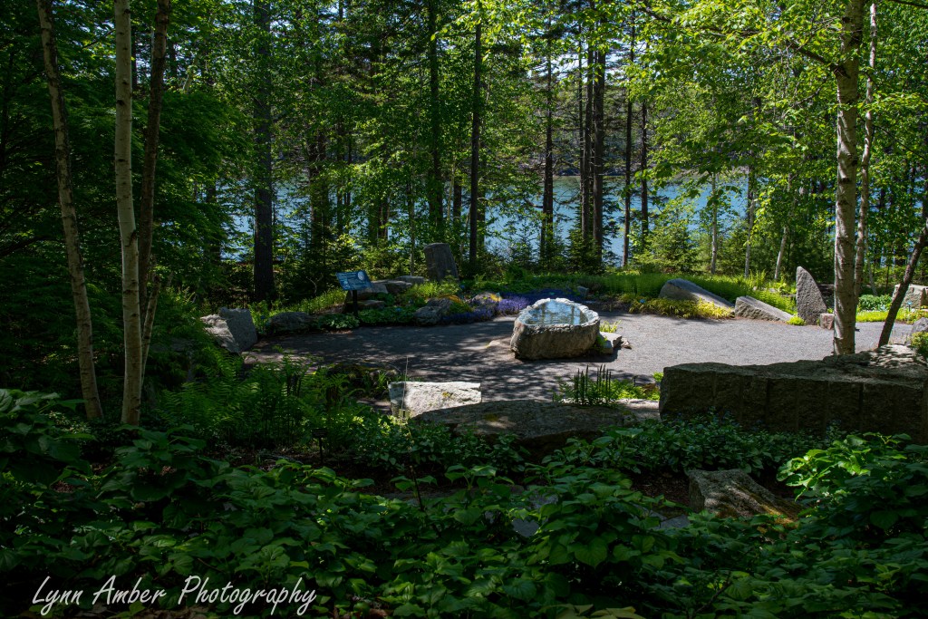
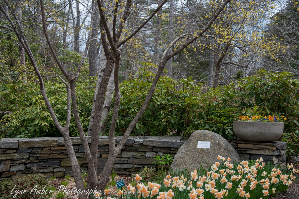
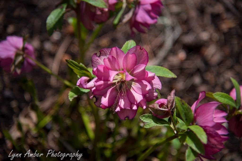
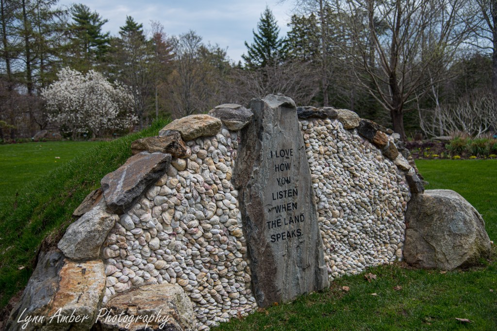
The gardens are an interesting mix of natural and more formal spaces with an extensive ‘forested’ trail system around the perimeter. Spring flowers were putting on a spectacular display.
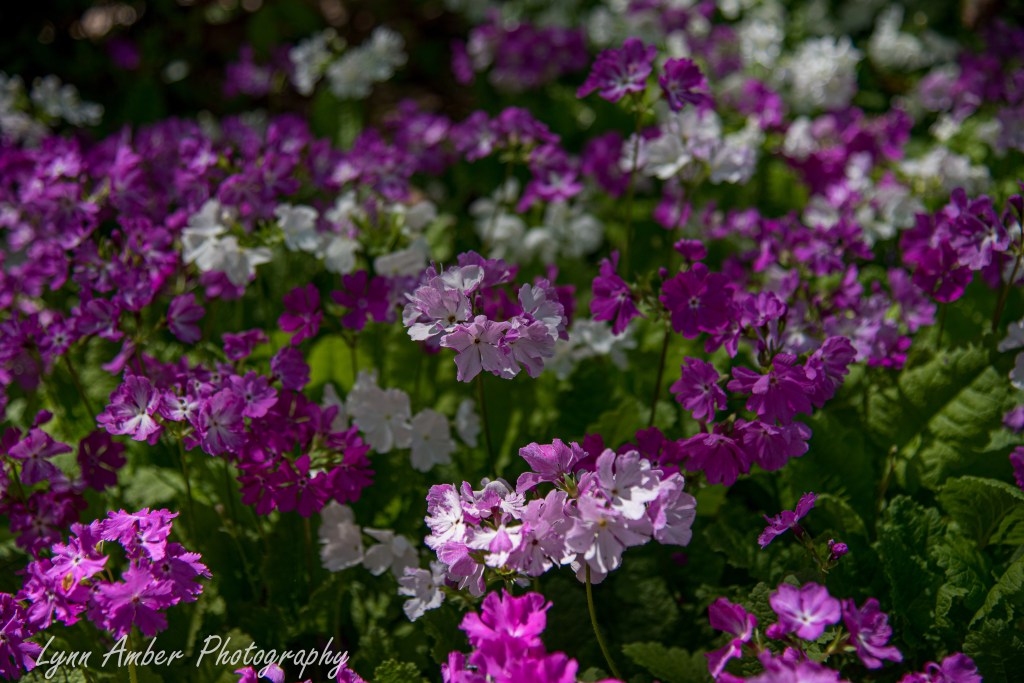
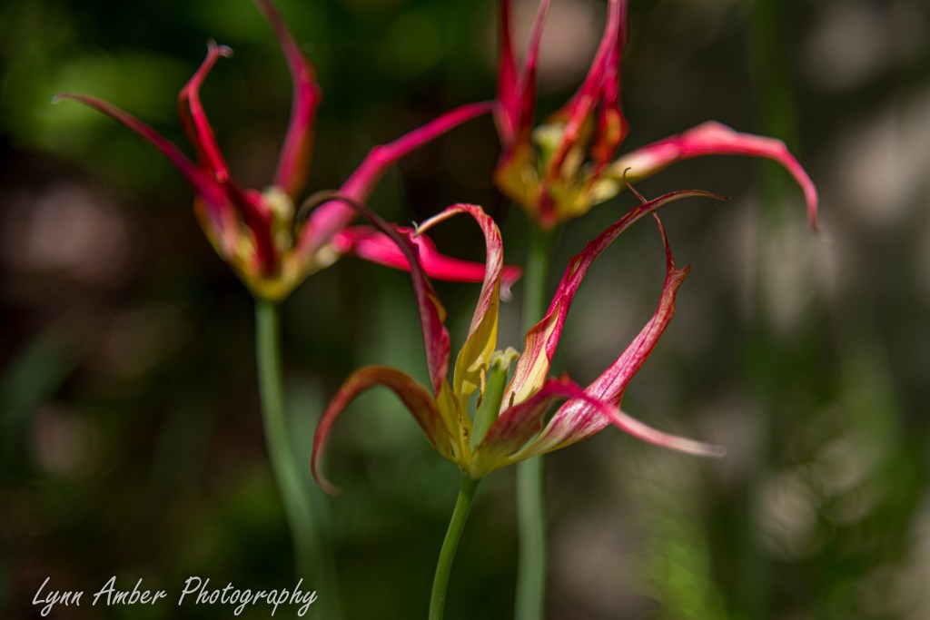
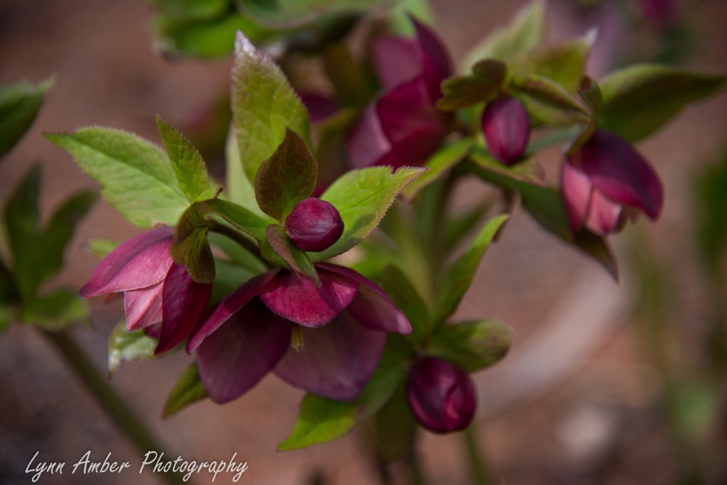
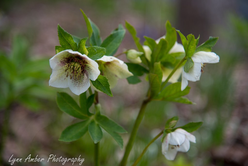
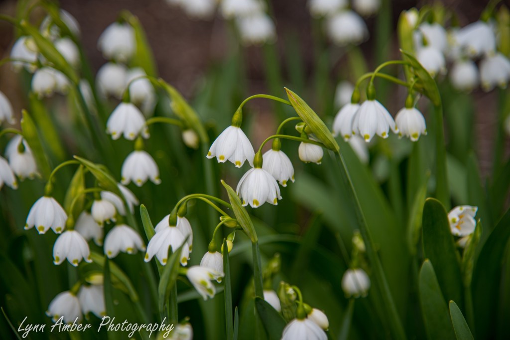
There was an extensive collection of Hellebores – which are one of my favorite spring perennials!
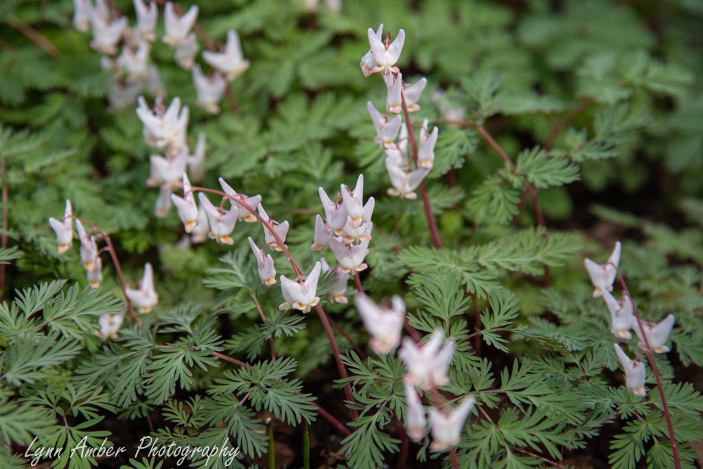
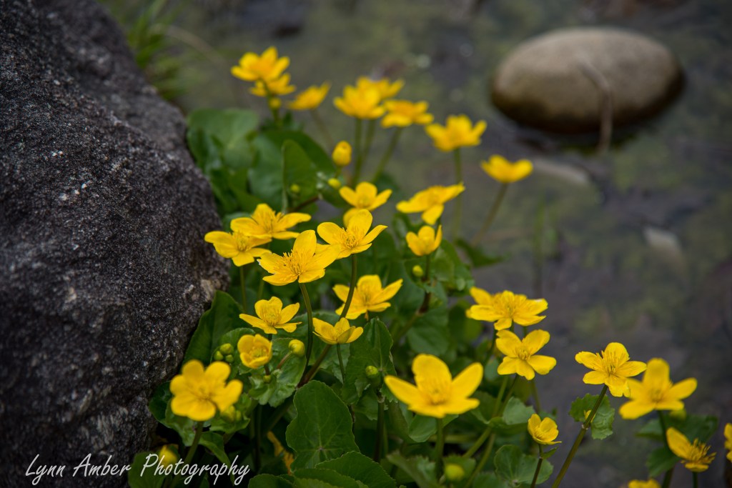
Native bleeding heart, marsh marigold and snowdrops…
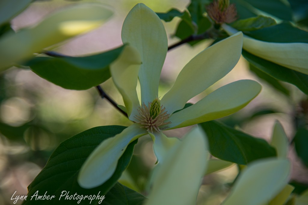
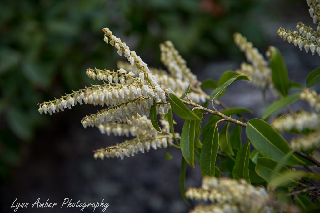
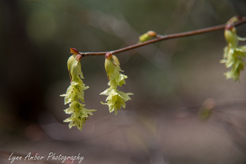
Pieris japonica (Japanese Andromeda) and Corylopsis gotoana (Fragrant Winter Hazel)
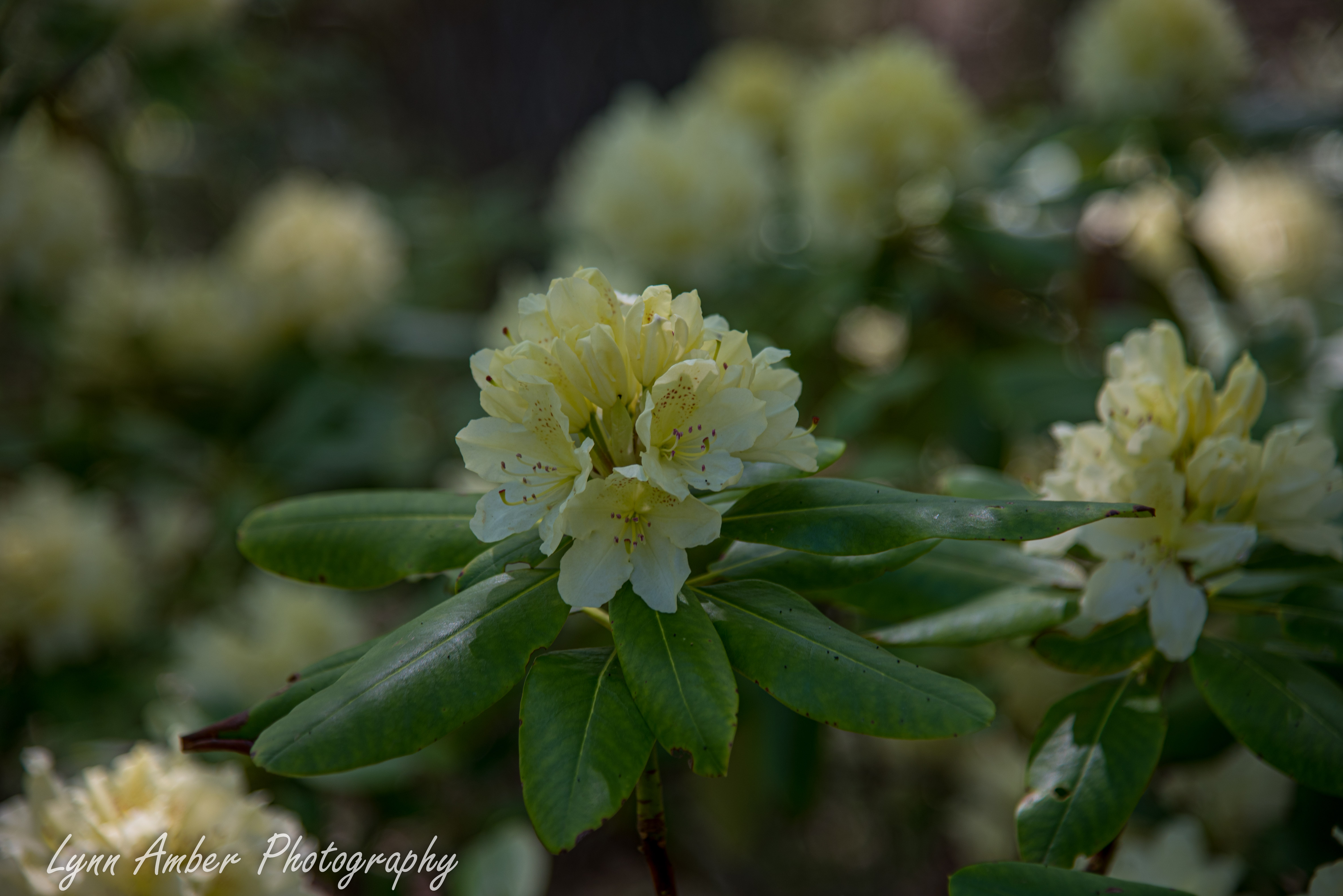
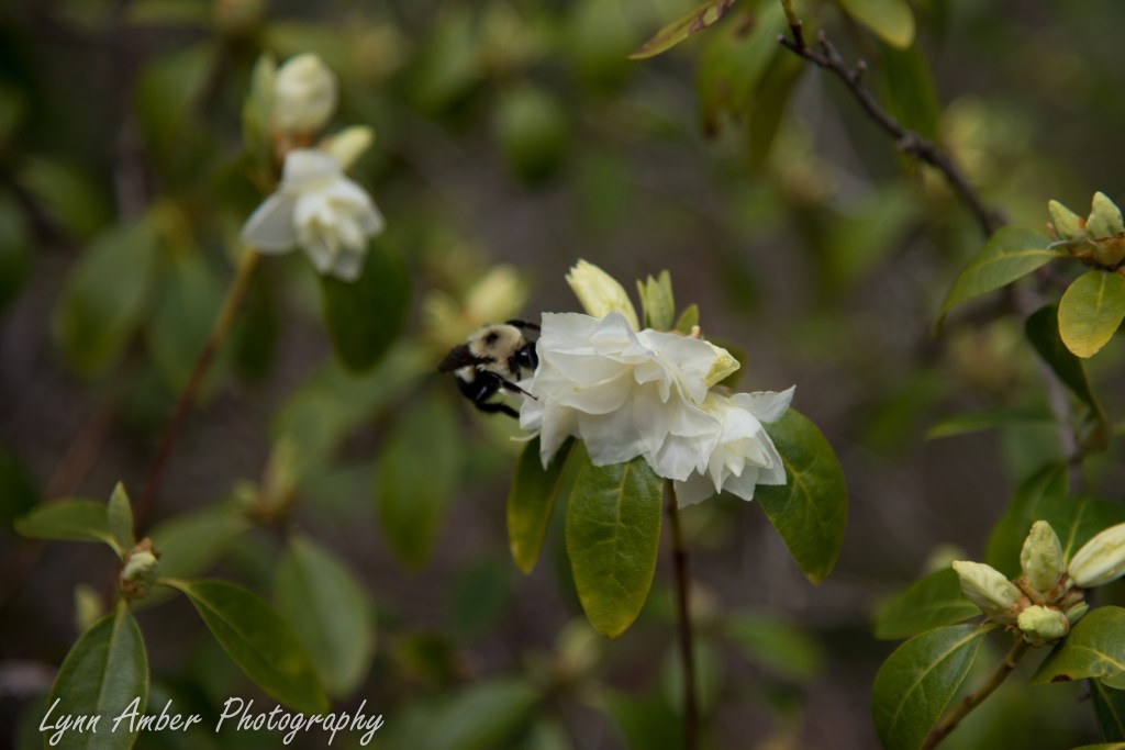
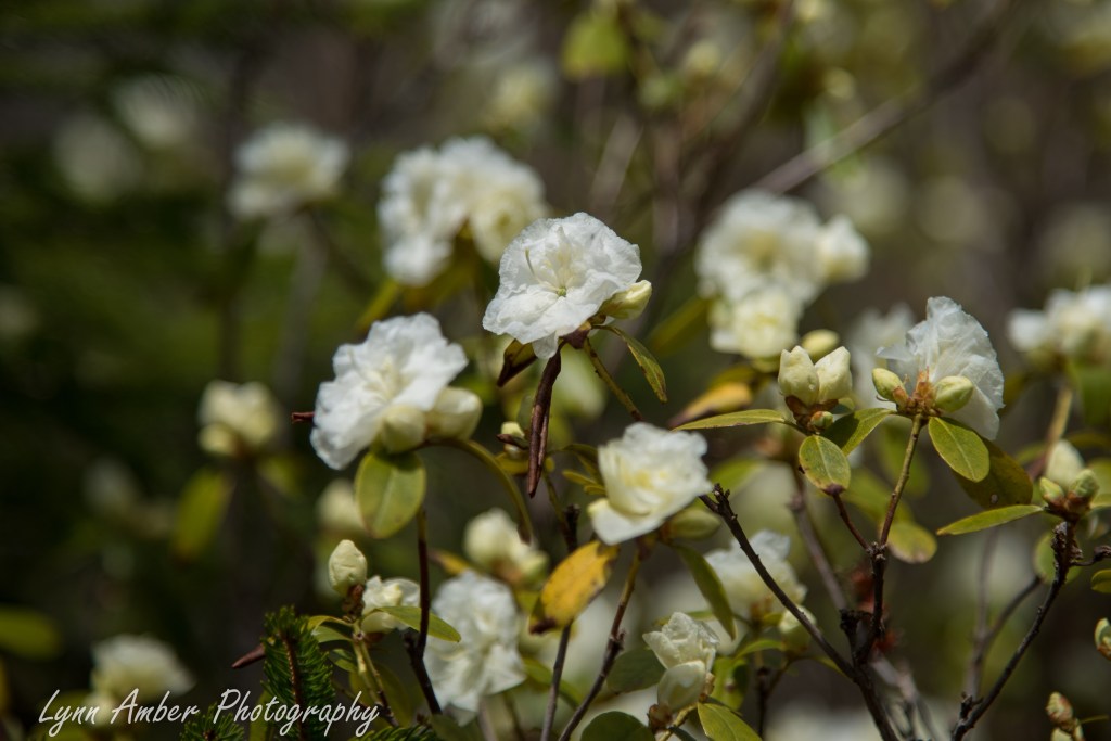
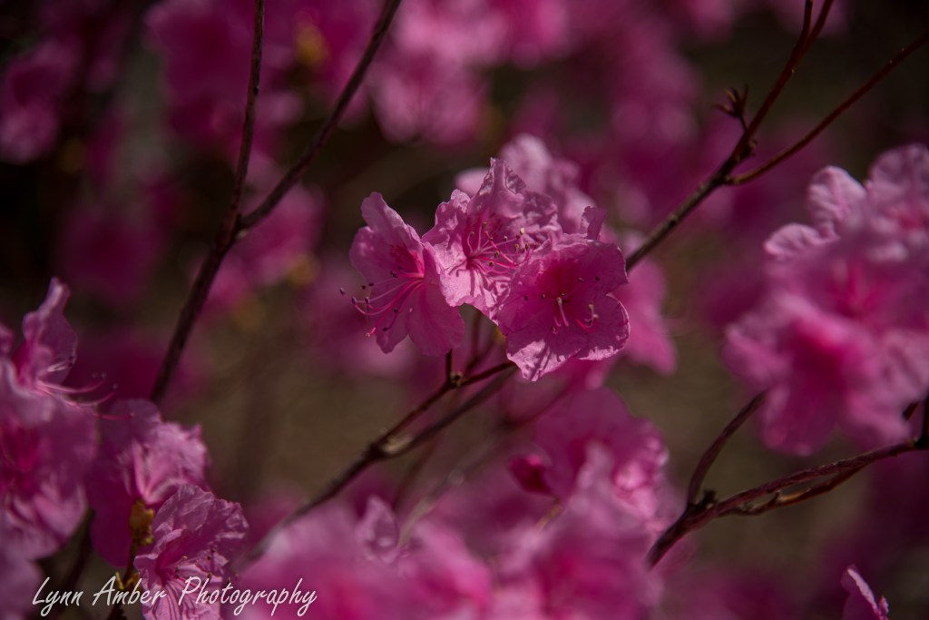
There were some early rhodendrons and azaleas blooming in the Rhodendron Garden. In order:
Rhodendron “April Snow” – Rhodendron dauricum “Album” – Rhodendron “April Gem”
Rhododendron “Rosebud” – Rhododendron “Cornell Pink”
The most whimsical part of the garden are the extraordinary bigger-than-life giant trolls that are located in various locations throughout the property. Created by Danish artist Thomas Dambo, the structures are collectively called the Guardians of the Seeds and are intended to celebrate the Maine woods. Made from recycled wood, each troll has an important mission that is shared on interpretive displays.
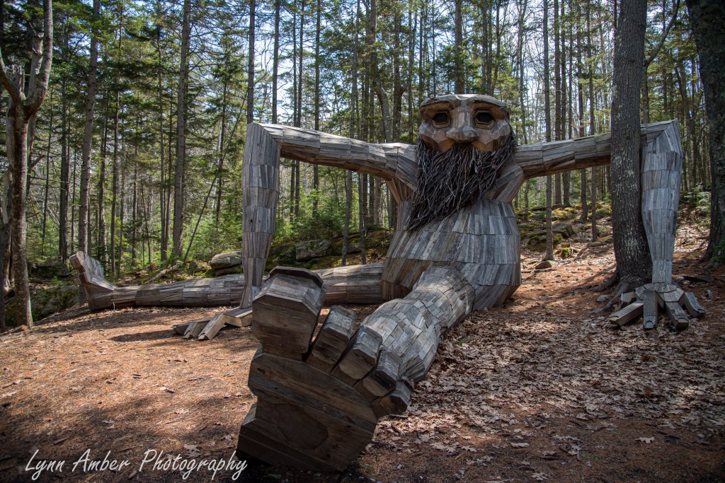
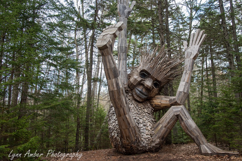
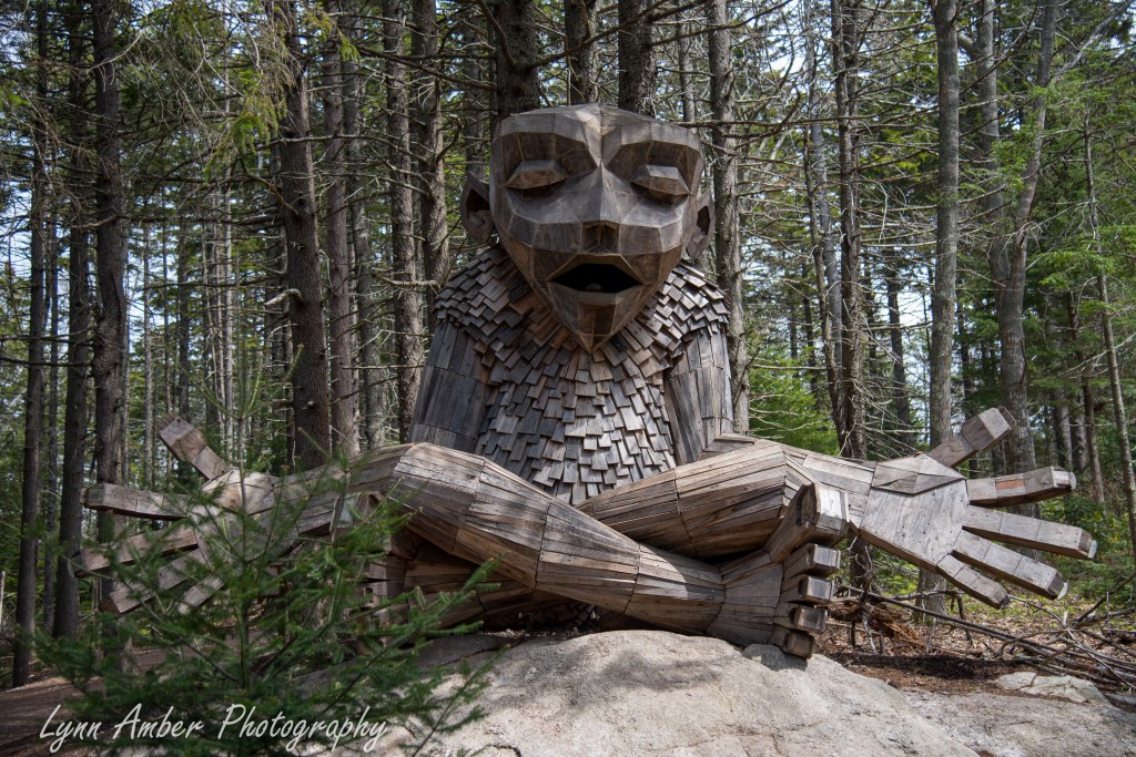
There are two more trolls that I did not pass by during my travels through the garden, so I will need to go back!!
Looking forward to many more trips to the Coastal Maine Botanical Garden during the season as plants continue to leaf out and flower. There is also a very cool children’s garden and I will save that for another post. 🙂
Le Puy Camino – via Podiensis: Lectoure to La Romieu
April 30, 2023
After a continental self-serve breakfast, Susan and I headed out. I was starting my walk towards La Romieu and Susan was hoping to stop by the Chapelle des Carmélites de Lectoure in time for the morning mass before leaving Lectoure. We would meet up in La Romieu at the end of the day.
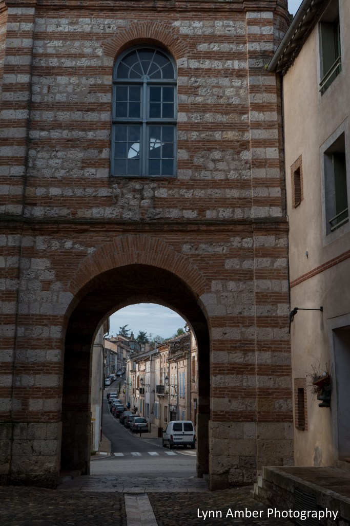
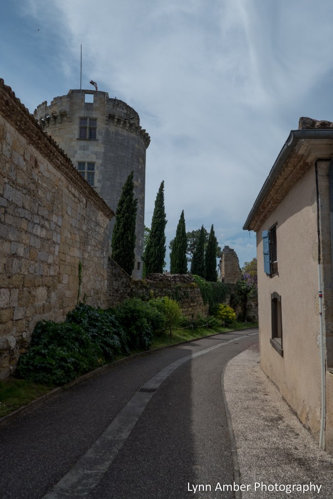
The descent out of Lectoure snaked through the ancient wall that used to surround the city.
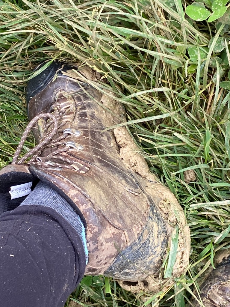
It was another misty, cloudy day and with all the rain that had fallen the previous day I was soon to discover a trail ladden with significant mud. This mud is like nothing I’ve ever experienced. It must have a high clay content because it is very sticky. Much of the day was spent stopping to scrap built up mud from my boots!!
I did not take any photographs after leaving Lectoure until I reached the village of Marsolan. In the middle of the traffic circle in town, there was an iron cross. I loved the chicken that sat upon the top of the cross!
Between Marsolan and La Romieu, I encountered much of the muddy trail. It was quite a slog to get through. Little did I know there would be more to come (and much worse!) in the days ahead.
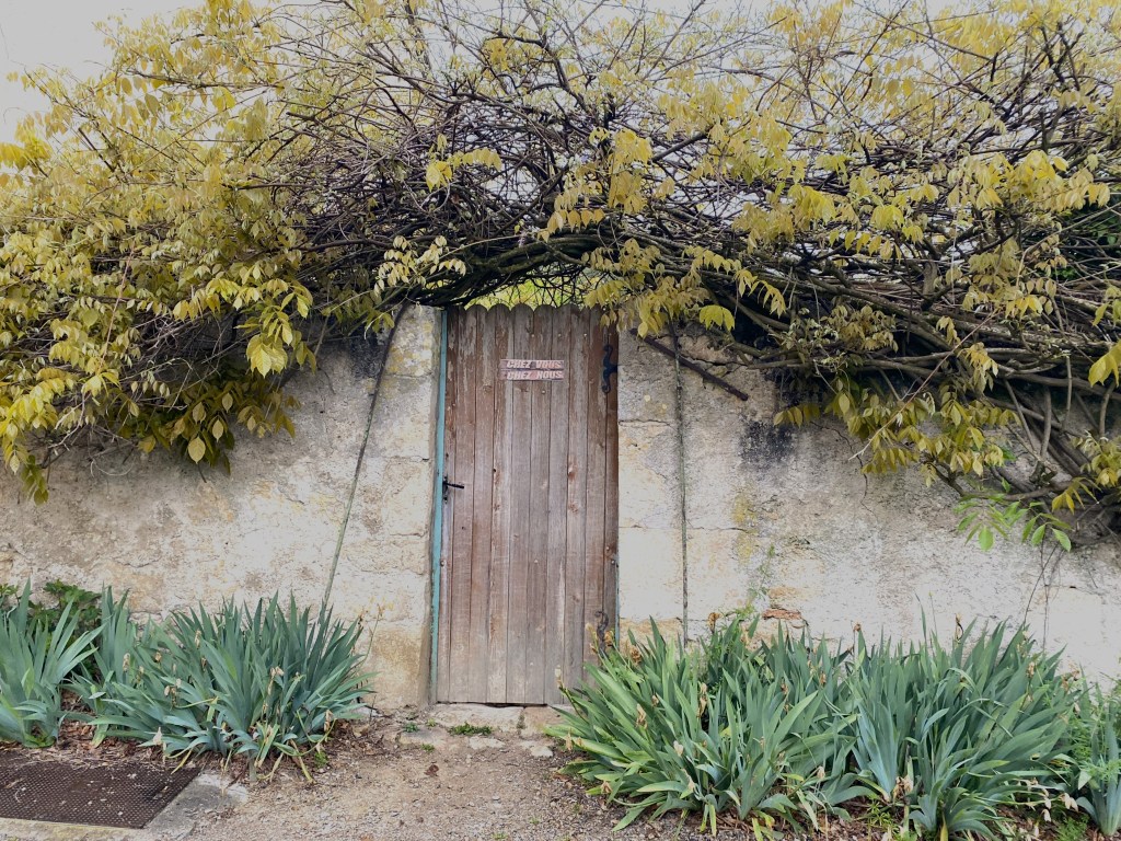
Today was a very light day for photographs as I was concentrating mostly on getting through the mud. I remember walking down a very secondary road not far from La Romieu when I saw a sign that intrigued me.
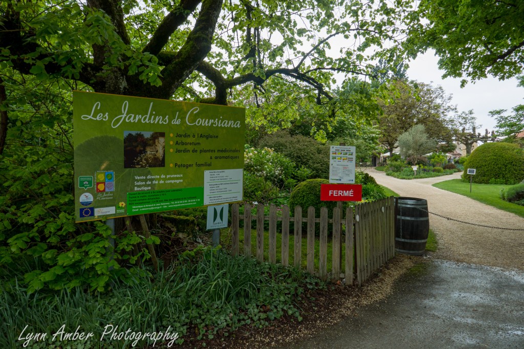
What luck to stumble upon a botanical garden!! I was in heaven until I realised that the garden was closed the day I was walking through this area. So disappointing! The garden has an interesting history. It was developed on land owned by the renowned French botanist Gilbert Cours-Darne. The collection of plants that are nourished on this land in Gascony were collected by Cours-Darne from all corners of the world. He bequeathed his land in 1992 to Véronique and Arnaud Delannoy. Cours-Darne felt this couple had a love of the land and a desire to continue his project to maintain the garden and open it to the public. Véronique and Arnaud Delannoy and members of their family still operate the garden to this day Here’s a link to the full story of how the garden came to be.
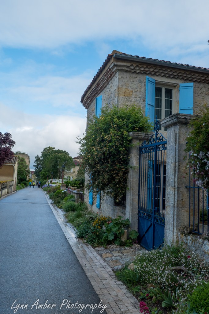
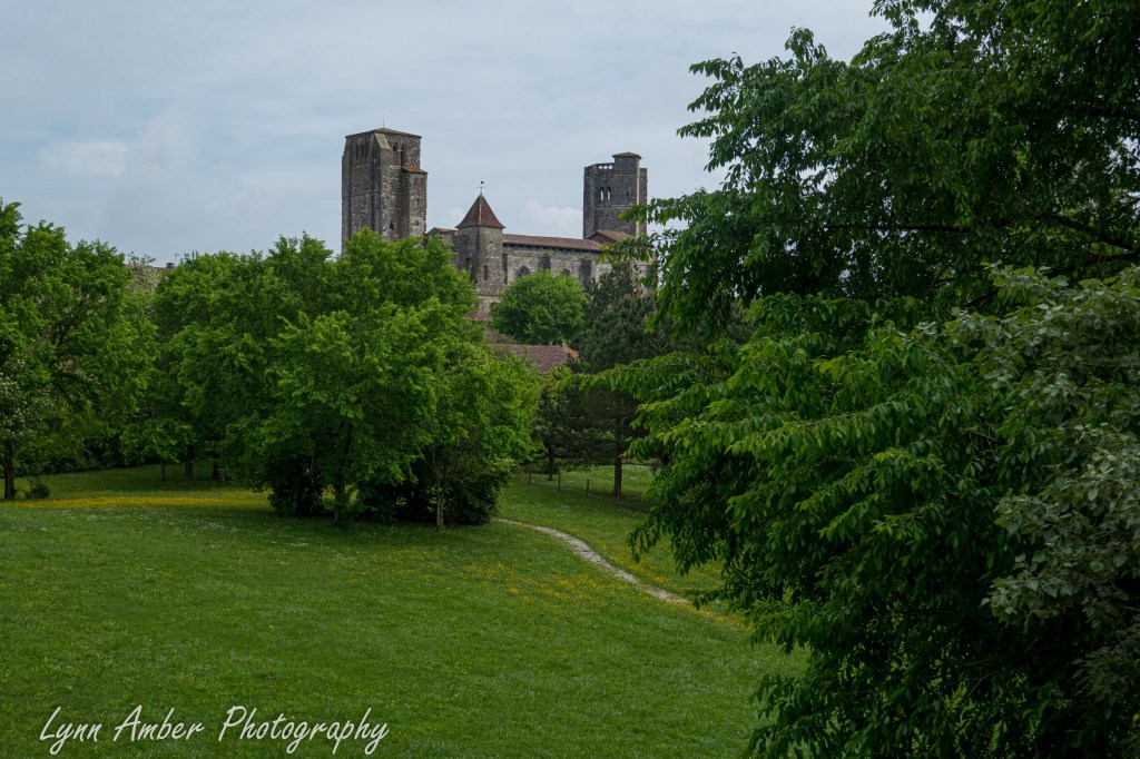
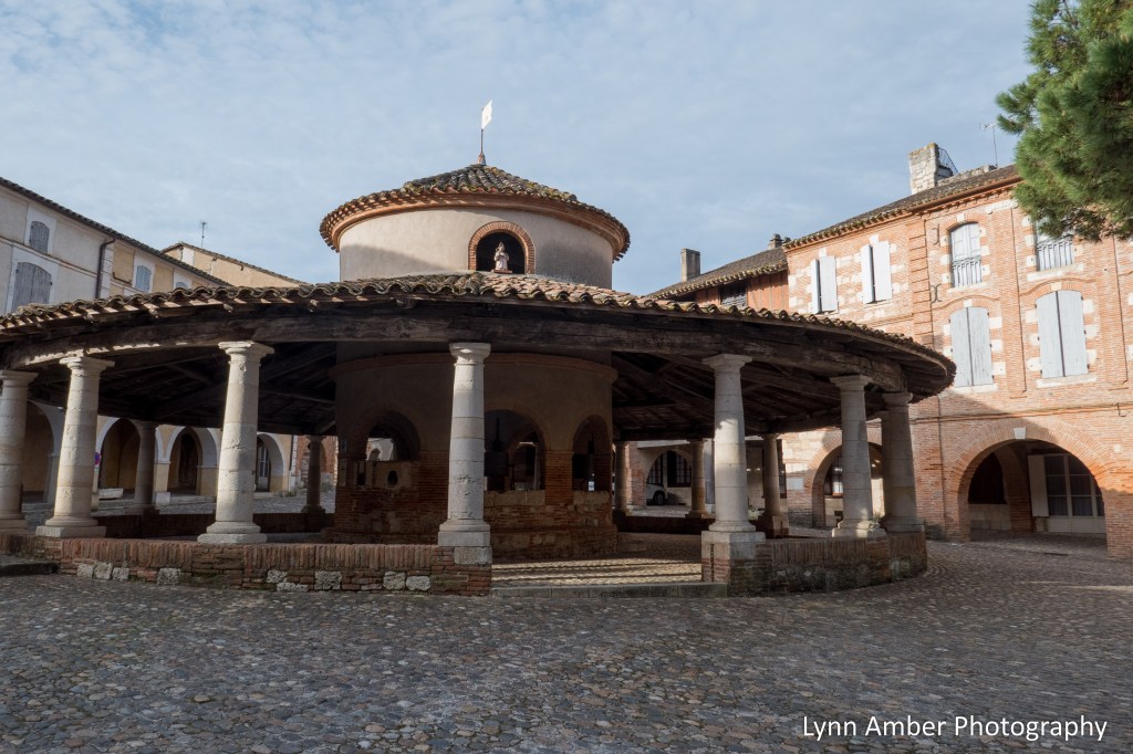
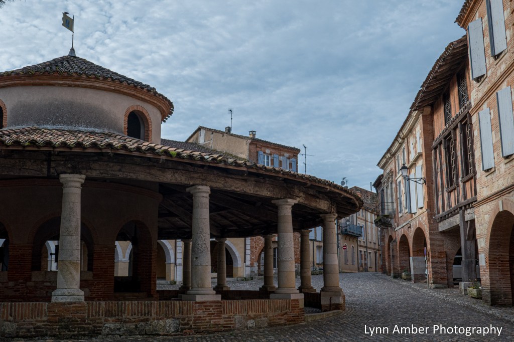
Shortly after leaving the garden, I arrived in La Romieu. The GR65 enters the village via the Parc de l’Olivier à La Romieu. It’s a nice green space with play areas for children and a commanding view of the Collégiale de La Romieu – a 14th century historical monument and UNESCO site. The village was originally founded by two monks who had just returned from a pilgrimage and the name La Romieu means “pilgrim” in the Occitan dialect of Gascony. That’s really cool!!
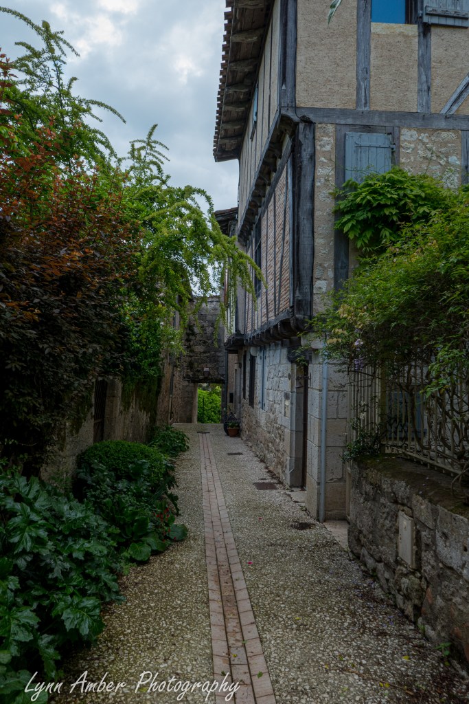
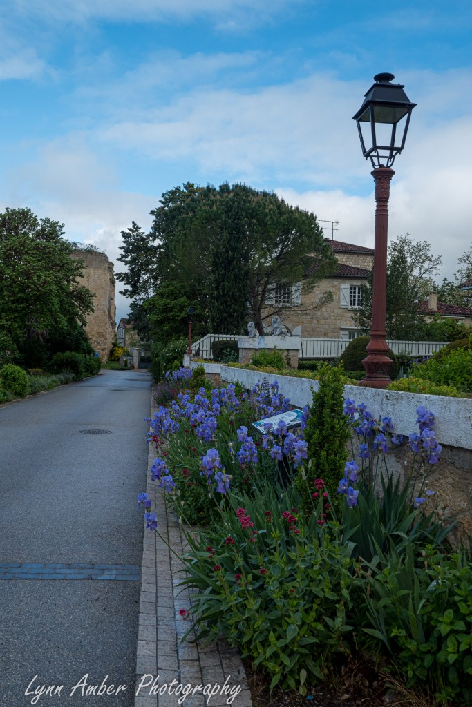
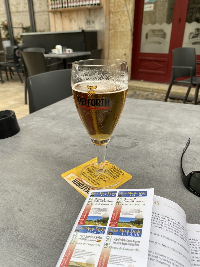
La Romieu is a pretty little village and as I entered the center of the village I quickly spotted a cafe and decided to rest and enjoy a beer before looking for my lodging for the night.
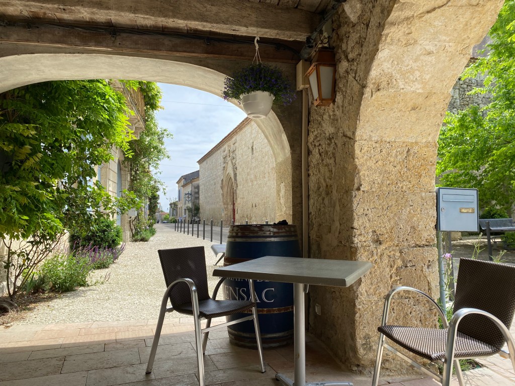
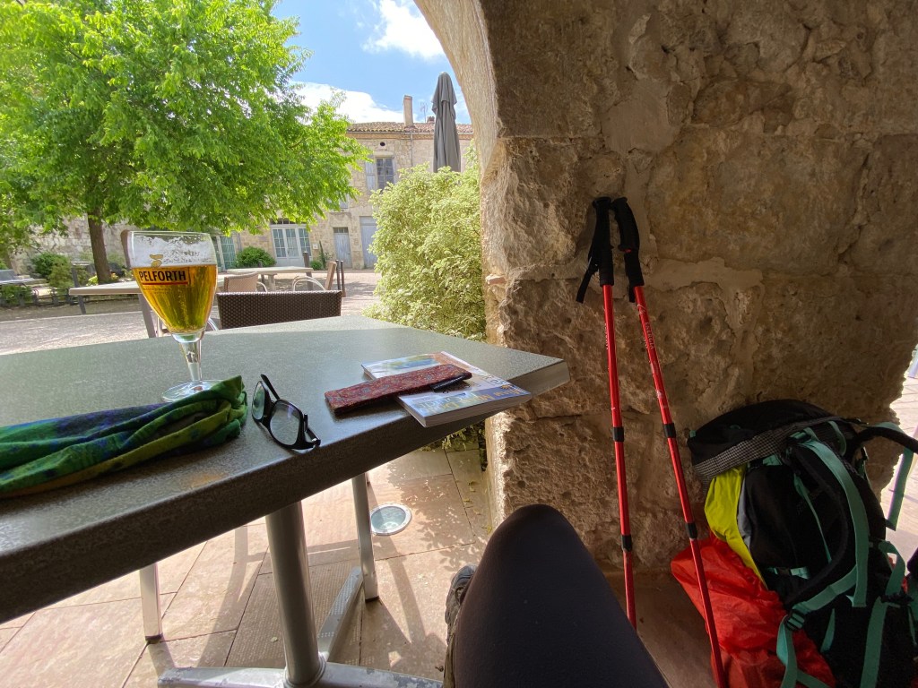
I settled at an outside table and enjoyed the blue sky that finally appeared!! The establishment where I grabbed my refreshment is L’Etape d’Angeline. It is a cafe, bar and restaurant that also has pilgrim accommodations. I had hoped to stay here but they were full when I was booking my reservations a few days in advance.
There is a fun legend associated with this town and I wish I had known about it when I was there. The village has a curious nickname – “the village of the cats.” And apparently throughout the town there are stone sculptures of cats that were created by a local artist. Had I known, I suspect I would have wandered around the village in search of these stone cats!
The legend goes like this: During medieval times, a peasant girl named Angeline (hence the name of the restaurant!) lived in the village and had a love of cats. When a famine hit the area and food was scarce, it became necessary to survive by eating what was available and sadly the “cat” population in town started to decline. Angeline secretly made an effort to protect as many cats as she could. When the famine ended, and there was an abundance of food, the villagers realized they had a major problem. No cats meant an increasing rat population which caused problems of its own! Angeline let it be known that she had rescued some cats and they were set loose in the town to control the rats. The cats did their job and, to this day, cats are revered in the town!
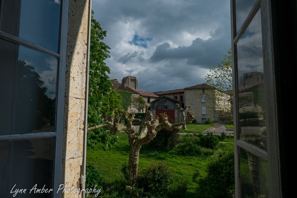
When it was time to check in to our lodging, I went in search of the building. We stayed in the Chambres d’hôtes Boisson which is operated by a local artist, Christine Boisson. Her paintings filled the walls of the house and it was a nice cozy place to stay for the night. The price included breakfast but not dinner. We knew this in advance and, before leaving Lectoure, we had purchased food for dinner – noodles, veggies and some good bread and cheese. Our accommodation had a small kitchen in which we could prepare our meal and it was perfect!
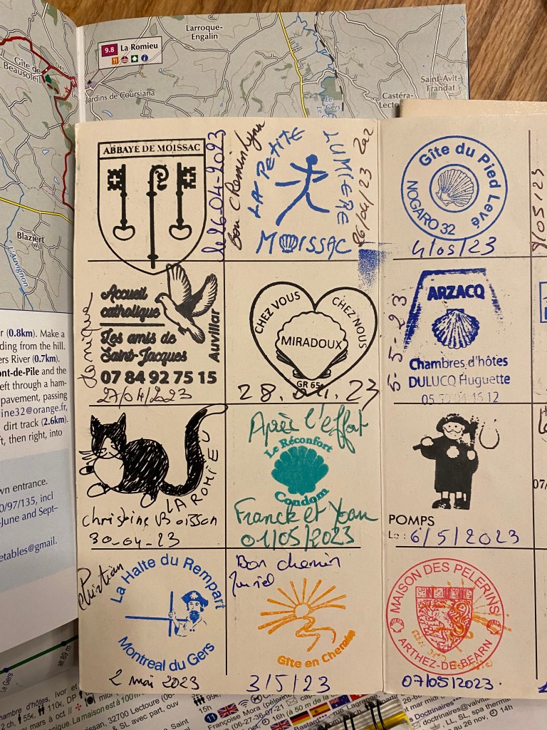
When our host, Christine, stamped our pilgrim passport books I was surprised that she did not actually have a “stamp” as most accommodations did. Instead, she drew a picture in our pass book and dated it by hand. I thought the picture that she drew curious and wondered why she chose that particular item to draw. Having read now about the legend of the cats – it has suddenly become perfectly clear!! Ha!! Can you spot the “stamp” from Chambres d’hôtes Boisson??
Le Puy Camino – via Podiensis: Miradoux to Lectoure

April 29, 2023
After a good night’s sleep and breakfast at Chez Vous Chez Nous, I started off towards Lectoure – a 16 kilometer walk today. Before leaving Miradoux, I stopped in a patisserie to grab a sandwich and a piece of fruit that would serve as my lunch later on in the day. It was a misty day for much of the walk, but still a pleasant easy walk on relatively benign, rolling-hills terrain.
A short distance outside of Miradoux, I noticed some ruins off in the distance. The Château de Gachepouy was built in the 14th century and served as a watchtower. The word “gachar” means – to watch, to guard or to spy on – in the dialect Gascon from the Gascony region of France. And “pouy” means hill, mound or height. I love how the name of the castle fits its purpose!


The cloudy, misty day put forth an ambiance that was relaxing and peaceful. The gray mist allowed the beauty of the spring colors to dominate the landscape. This day was one of my favorite walks – filled with solitude and stillness. While much of the day I walked on my own without many passing pilgrims, I was delighted to see some familiar faces at one point along the trail.
As I was walking along enjoying the silence of the day, I heard some distant singing. It was coming from behind me and growing nearer. Shortly, I was overcome by the French family of five that we had met at an earlier gîte. They were trekking along and singing as a group. I was delighted to witness such family cohesion. I remembered that Lectoure would be their stopping point after a two-week vacation walk along the GR65. Such fun to see them again.

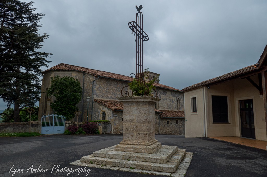
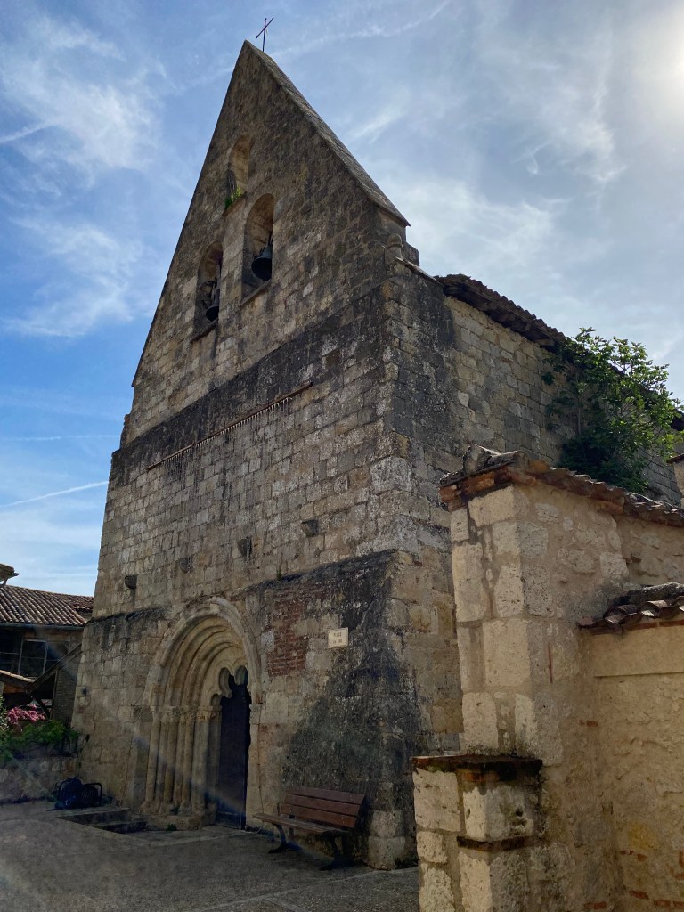
In the small village of Castet-Arrouy, I stopped and peeked inside the Église Sainte-Blandine. I’m always amazed at the ornateness of the interior of some of these churches given the often very simple exterior architecture. Unlike many churches, the pews are replaced with chairs.

More of the countryside alone the way and some things in bloom!


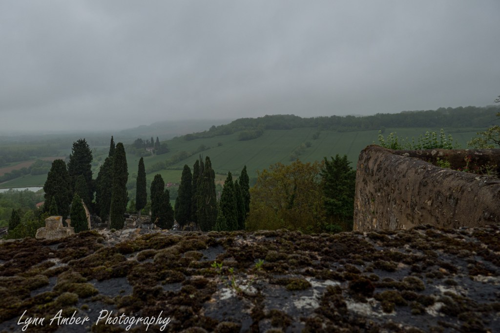
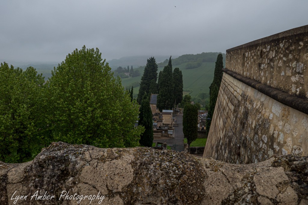
Just on the outskirts of Lectoure, I came upon this cemetery – possibly the Cimetière Saint Gervais. I took a short break from walking and wandered around here for a spell.


Leaving the cemetery, I started to enter the outskirts of Lectoure. Before coming to the old town section of the city, I passed by a round-about and was greeted by a very rustic interpretation of a pilgrim.

Since it was too early to check in for our accommidation for the night, I decided to try and locate my belle-soeur Susan. I texted her to see where she might be, and then sat down on a bench right outside the Cathédrale Saint-Gervais and Saint-Protais and ate my lunch. Eventually, Susan responded and I found her enjoying a hot cup in a small restuarant a short distance away. She had taken a day off from walking due to a sore knee and grabbed a taxi to Lectoure – spending much of the day there. I learned from her that it actually rained hard all day in Lectoure! I treated myself to a warming glass of wine and a Crème Brûlée for my lunchtime dessert! 🙂 Unfortunately, our accommodations for the night would not let her check in early but she was able to drop her bag there. I was disappointed to hear this since I knew her knee was bothering her and she did not feel well. I already had a not-so-good feeling about the place.


We had reservations in a renovated 18th century royal tannery built in 1754 that is now an historical monument and operated as a bed and breakfast and meeting space. The Gîte d’étape La Manufacture Royale de Lectoure was one of the most unique places that we stayed. We headed there after our snack in the cafe to check-in. The atmosphere was an interesting mix of fancy yet simple decor. The accommodation had been open only one year. Our host greeted us and while very nice, she exuded an elegance beyond what I expected in a pilgrim accommodation. Although it is advertised as welcoming to pilgrims, I got the impression that they were really catering to a different clientale. Upon further research, I discovered that the owners do have more upscale accommodations in the lodging as well as special events.
The “Pilgrim Cottage” is a separate area where those of us walking the camino are housed. I’m not sure we even had access to the rest of the lodging. It is much simpler in design and sparse in furnishings but still very comfortable. It appeared they were having a special upscale function in another part of the building and we were given a quick tour, shown to our rooms and left by ourselves. It is one of the few places where I took some interior pictures of the fixtures, etc.
The Pilgrim Cottage


We settled in and took showers and walked around the town for a spell – landing on a small cafe for dinner. I had a delicious salmon burger with fries that was more than adequate for my appetite. When we returned to the lodging, we discovered the only other pilgrim that was staying here had arrived – a young woman who was traveling solo and was just starting her camino from Lectoure.
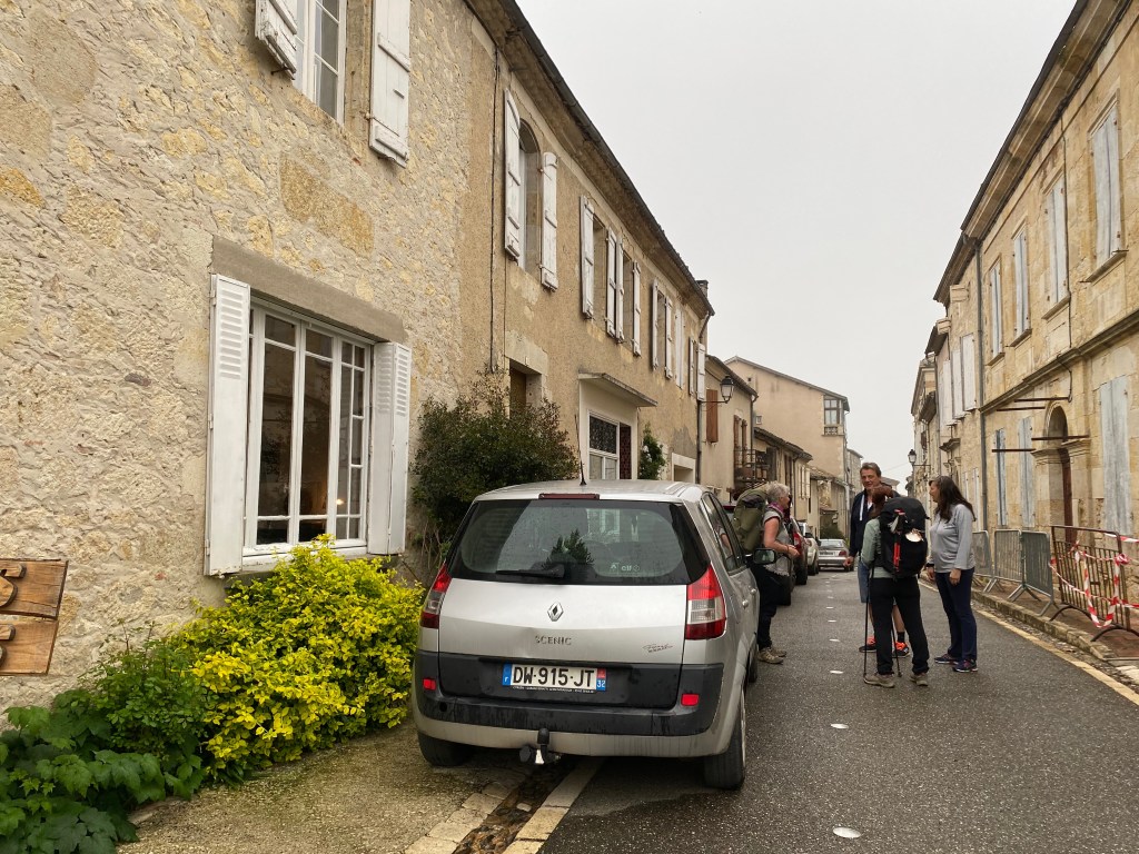
Scenes from Lectoure:


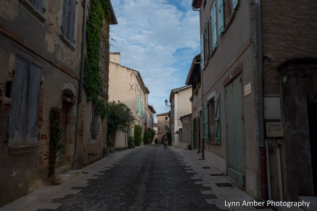
The town was very busy with tourists from around France as it was during one of their many school vacation times. It has the designation of the “town of art and history.” Lectoure traces its origin from an Iron Age settlement to medieval times and was at one time a walled city. It was considered an “oppidum” – a fortified town that existed between the 2nd and 1st centuries BC during the Iron Age. Wow – that’s old!! It is in the Gascony region of France and I got the impression Lectoure is a bit of a tourist town.
The next day was going to be close to a 19 kilometer walk so we retired early. While the beds were comfortable, I had a hard time getting warm. The stone construction and basement feel to the place did not “warm” up during the night. Despite that, I slept and woke up refreshed and ready for the next day’s walk.
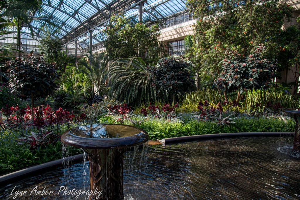
Longwood Gardens Conservatories
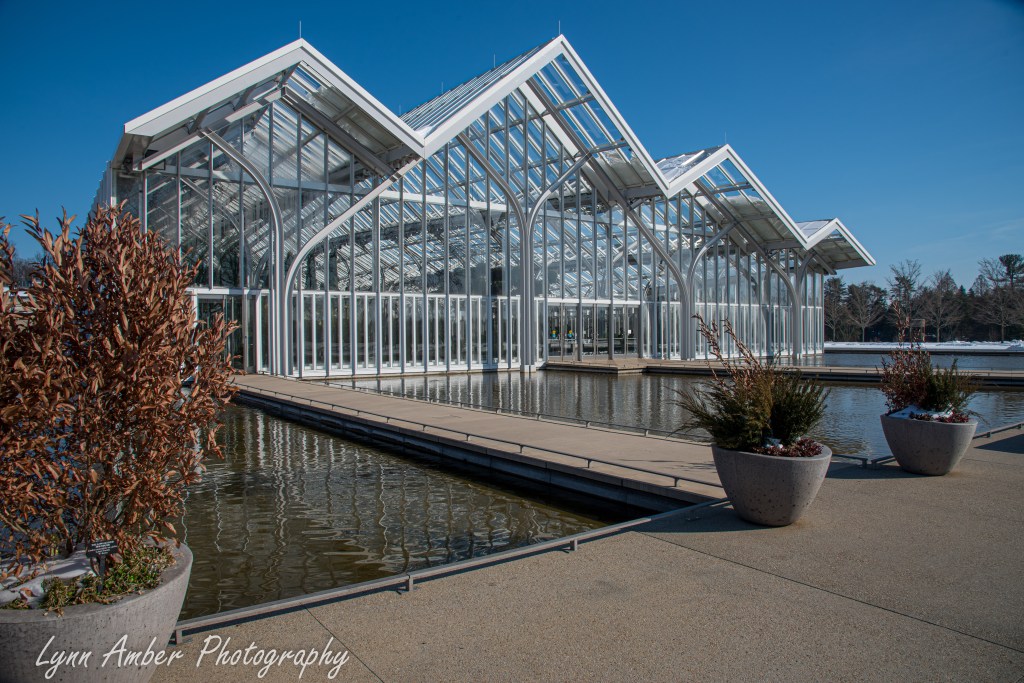
Given the long, snowy, bitter cold winter we have been experiencing in Vermont, a recent visit to our native state of Pennsylvania required a stop at Longwood Gardens. I grew up on the grounds of this reknowned public garden and there’s nothing quite like walking into the moist, warm atmosphere of a conservatory in the dead of winter. In November 2024, a years long project that was part of the “Longwood Reimagined: A New Garden Experience” renovation transformed about 17 acres of the land on the grounds. One major aspect of this project was the construction of the new West Conservatory. I had not been to Pennsylvania to see the new conservatory since its opening and I could not wait to explore it.
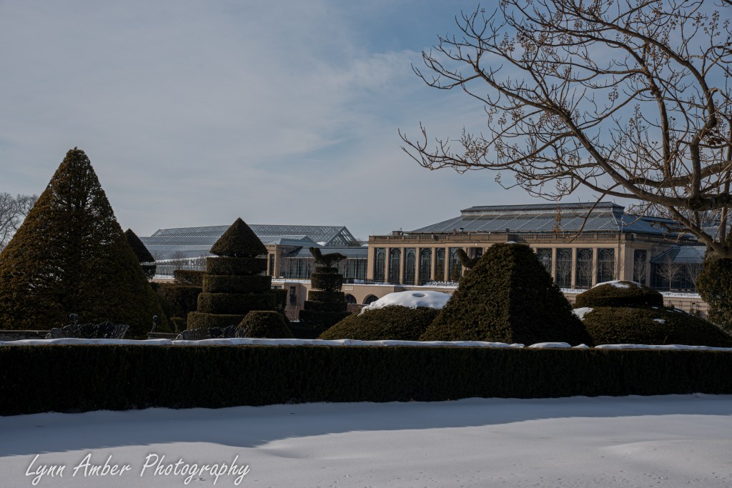
It’s rare these days to see Longwood blanketed by snow but we visited a week after a major snow storm dumped several inches of the white stuff on the ground. Cold temperatures prevailed that prevented the snow from disappearing before our arrival.
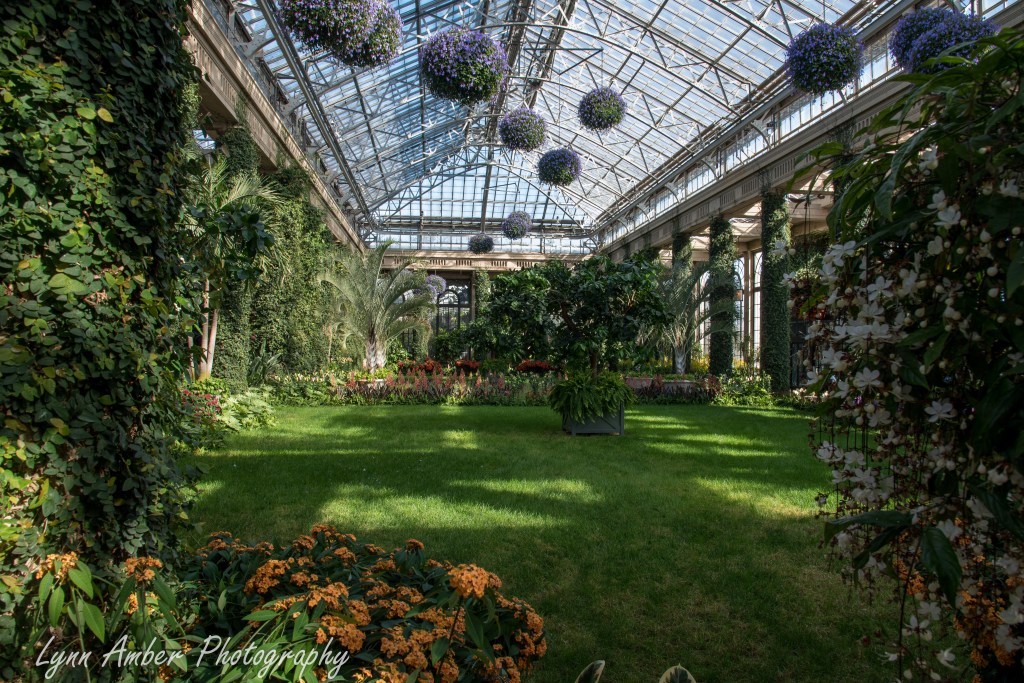
We started our visit in the East Conservatory and worked our way through to the end of the old conservatory. It’s such a special place for me. I have such incredibly fond memories of growing up here, living in employee housing and exploring the whole grounds as my backyard.
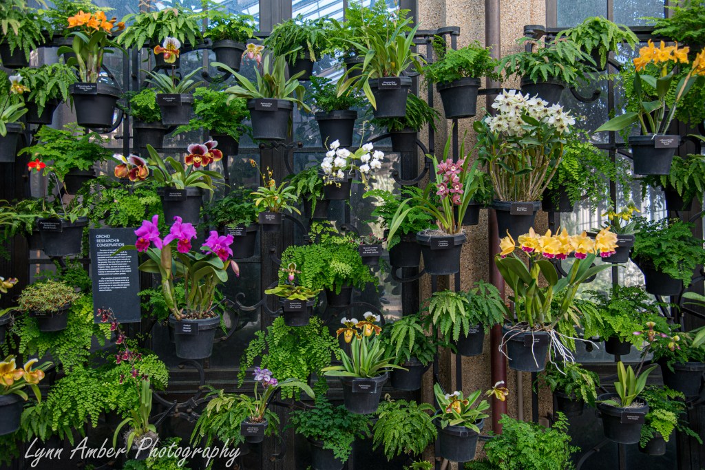
The Orchid House was completely redone as part of the most recent construction project. An architect who used to be one of our landscape customers was part of the design team. That was pretty cool!! Every effort was made to keep it within the same look and feel of the old conservatory.
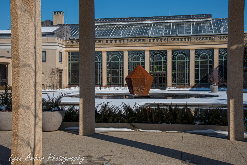
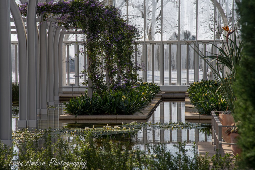
Exiting the old conservatory at its western side, there is an outdoor courtyard that leads to the West Conservatory. Looking back towards the windows that frame the Exhibition Hall, the renovated water lily garden fills the space between the two conservatories. I’ll have to come back in the summer to appreciate that feature!
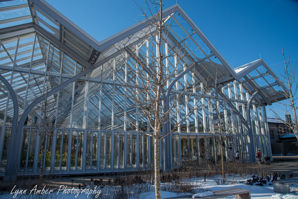
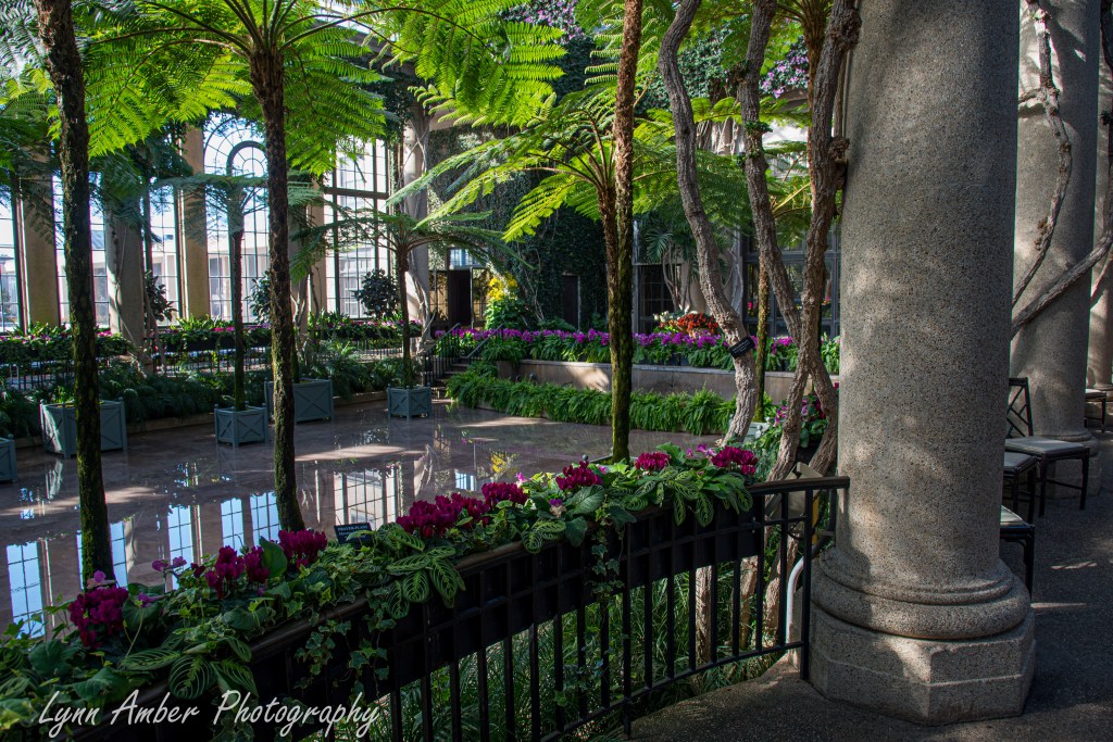
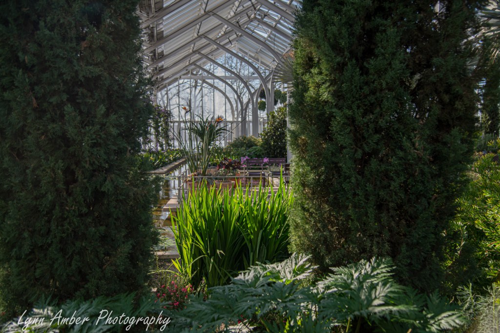
Stepping inside the new conservatory, I was immediately taken with the open, airy feel complete with canals and ponds surrounded by a Mediterraean inspired landscape.
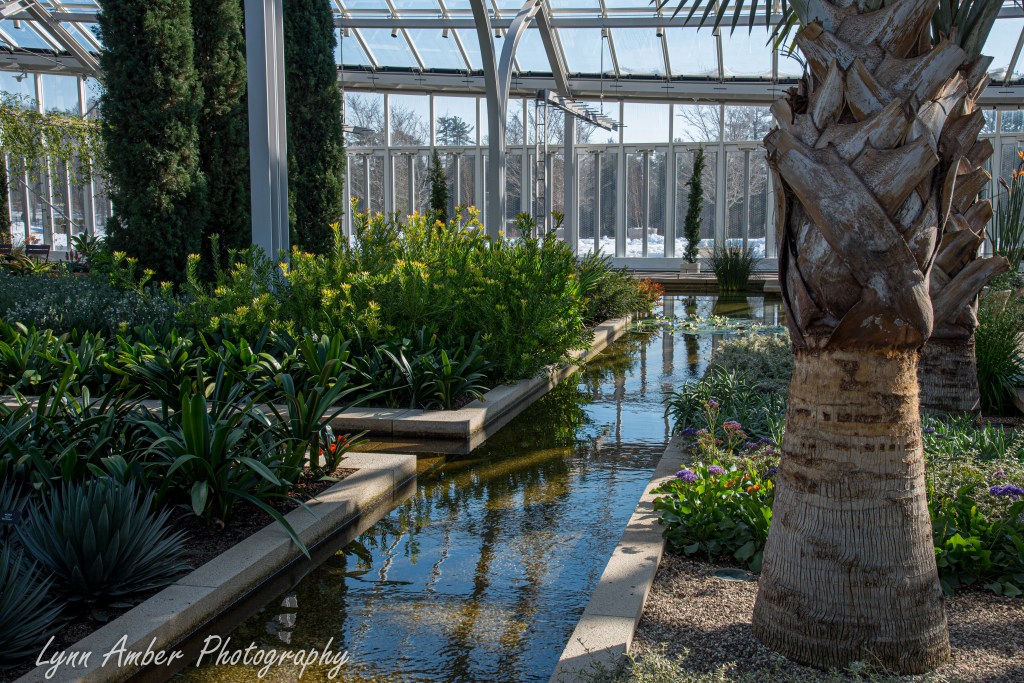
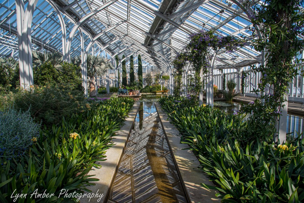
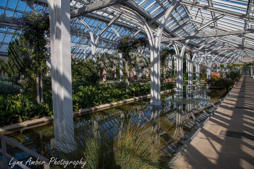
There are numerous small alcoves throughout where one can sit and reflect on the surroundings.
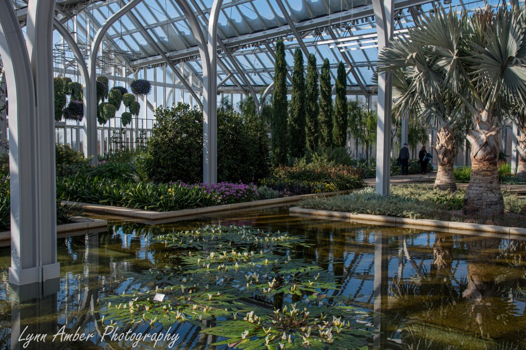
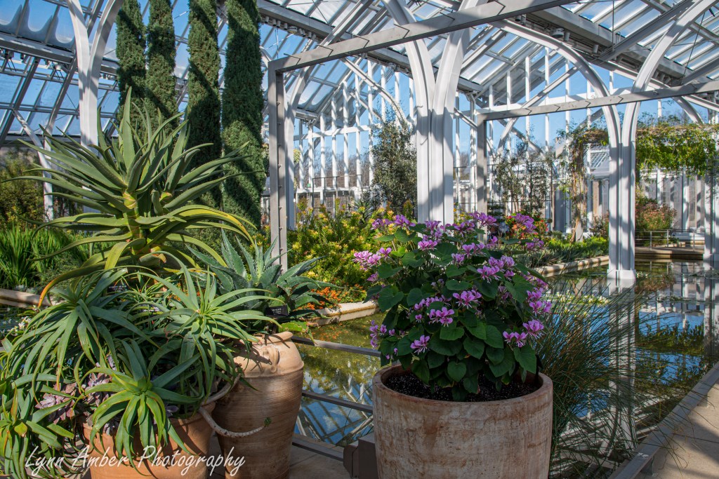
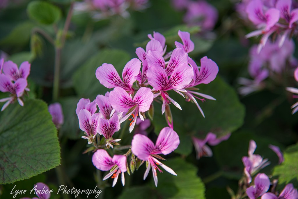
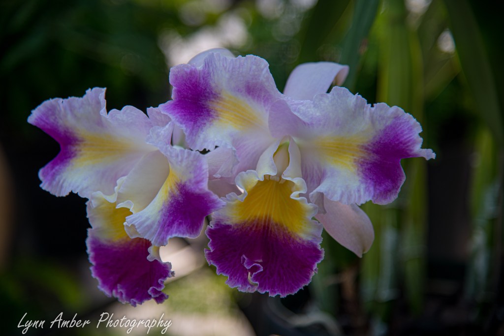
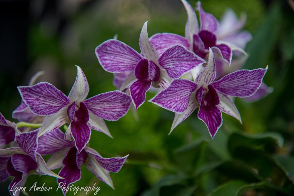
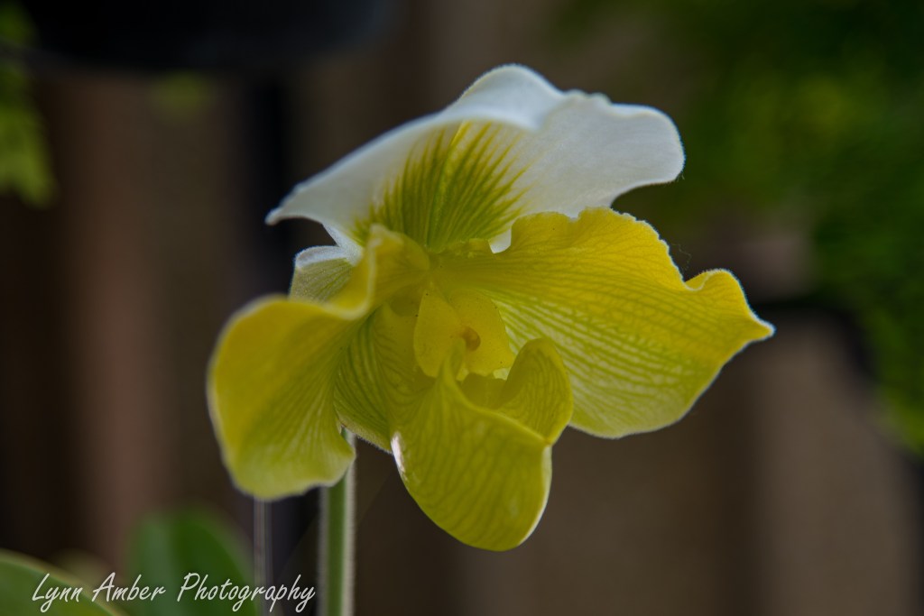
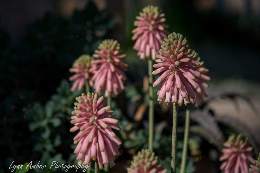
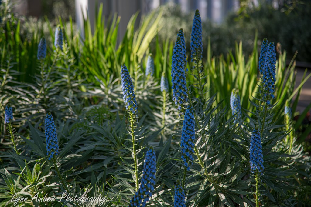
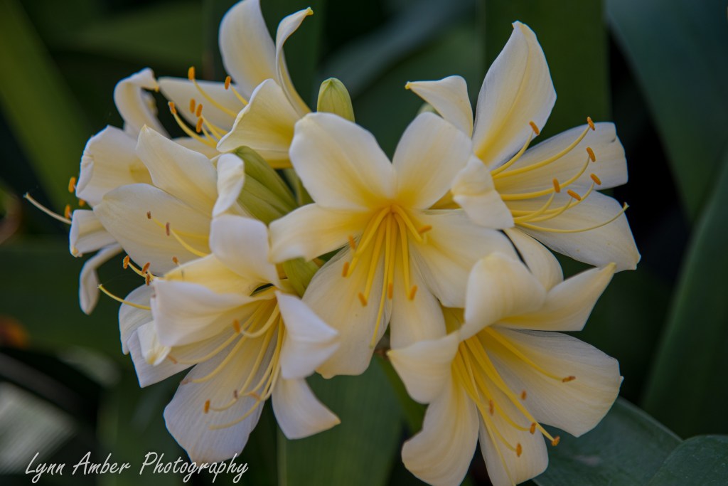
Some of the flowers blooming in the West Conservatory:
It was a perfect day with very few people – a great time to avoid the crowds!! I think we counted more employees than visitors during our romp around the grounds.
Le Puy Camino – via Podiensis: Auvillar to Miradoux
I have been feeling guilty for the length of time is has taken me to finish recording both of my Camino walks to the blog. But, as I return now to those walks, I realize that it’s okay. I am having such fun reading over my old notes and recalling the small little details of the walks through my photography. It is a bright spot in what seems like an endless, dreary, cold winter! My focus will be on my first camino in the Spring of 2023. I am starting where I left off!
April 28, 2023
Before leaving Auvillar, we did a brief walking tour of the town. I love the beautiful brick and limestone architecture that gives this town its charm.
On our way to the walled town center, we passed by the Eglise Saint-Pierre. Originally built in the 12th century, the church has undergone many renovations overe the years.
We left the church and wandered into the town center to see some of the sites. As is typical of these medieval villages, the streets are narrow and cobbled.
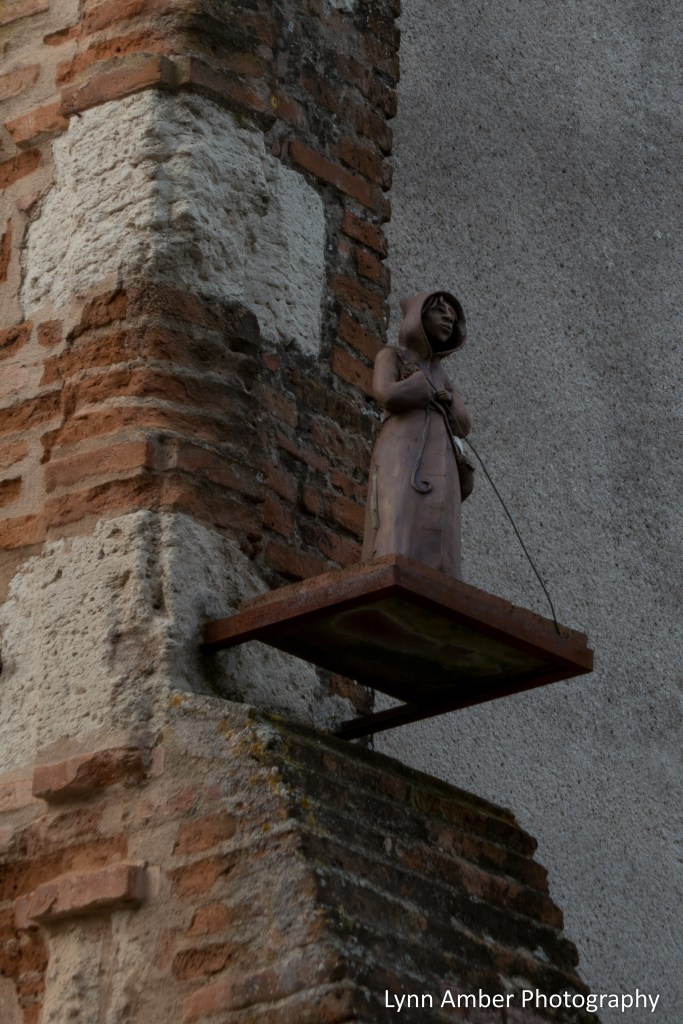
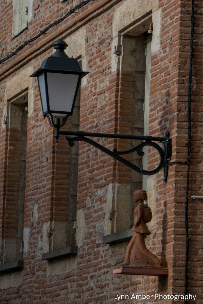
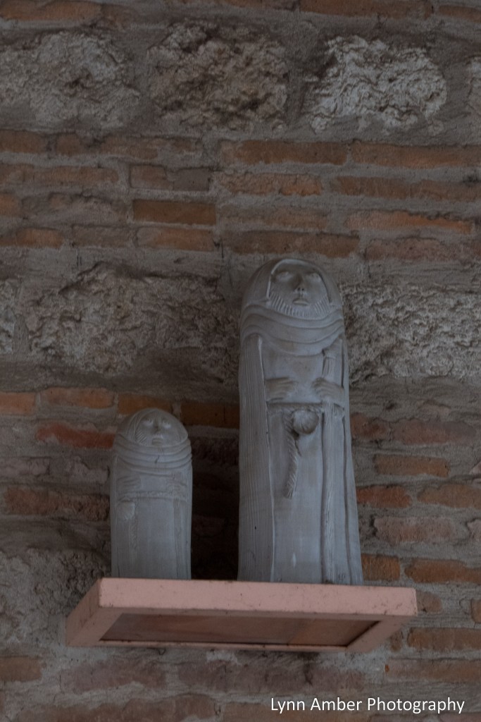
Auvillar was built high on a rock outcropping and was the site of many invasions over the years and changed hands several times. In 1589, it became part of France permanently and due to its fortress-style architecture was subjected to conflicts such as the Hundred Years War and the French Wars of Religion. From the 17th to the 19th centuries, the town was known for its pottery and also its production of writing “pens” from goose feathers. One of the unique features of the town are the ceramic pilgrim figures that are perched on many of the buildings in town. They are very fanciful and fun to discover! Be sure to look up when walking through town!

Our next stop was in the Place de la Halle for a look at the “Halle aux grains” building – an old market place built in the early 1800’s.
I saw signs along the way for a scenic overlook and had to go investigate. The view from the overlook on top of the massive fortress walls was spectacular.
To get back on the GR65 and head out for our walk today, we had to pass through the Tour de l’Horloge d’Auvillar. The clock tower is an historical monument and was built in the later part of the 17th century. It was a very cool piece of architecture!
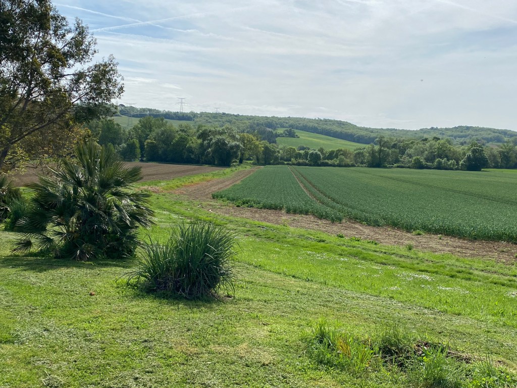
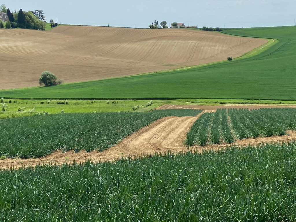
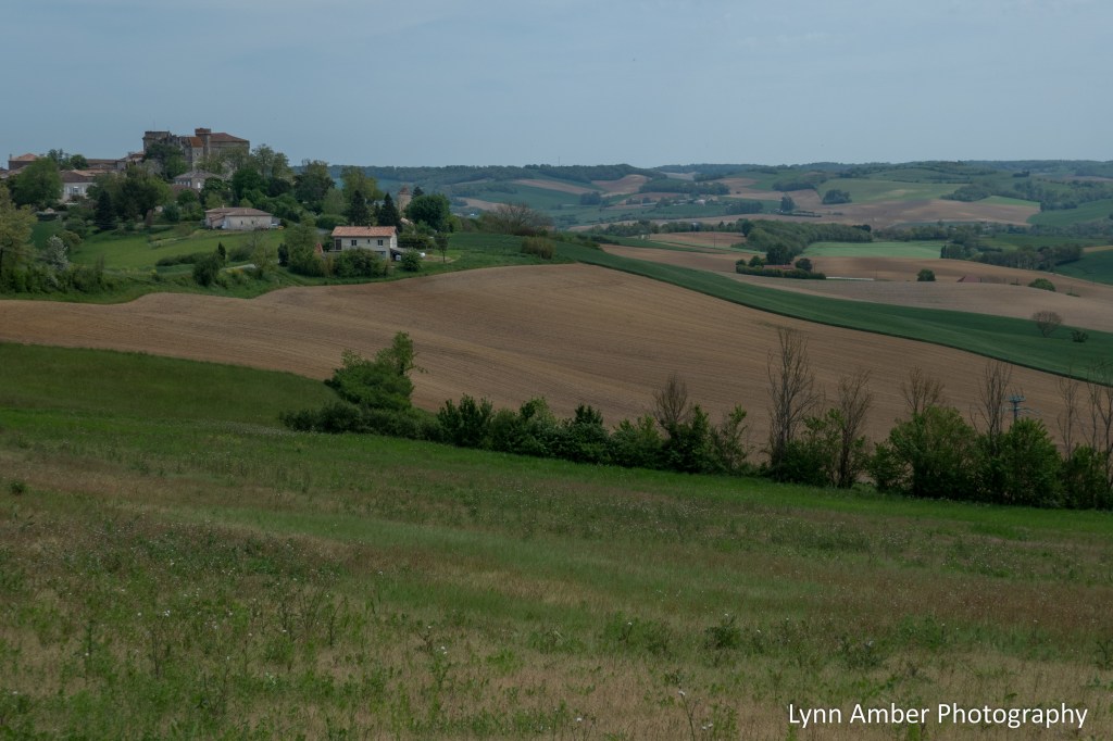
Much of the walk today was fairly tame with “levelish” ground. The hot and humid weather carried over from yesterday so I was happy there were no major elevation gains! The walking terrain was a mixture of pavement, dirt tracks and small footpaths. The overall distance I had to cover today was a about 17 kilometers! Some guidebooks treat the walk between Auvillar and Lectoure as one stage for a distance of over 32 kilometers. Breaking this into two stages was a much better idea!
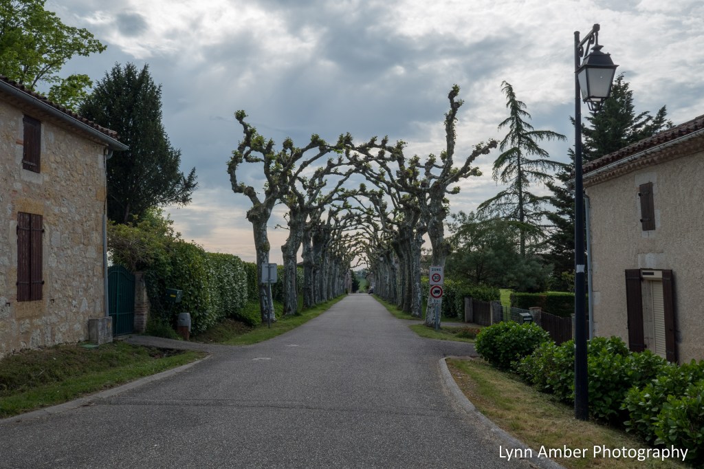
Pollarding was a common practice since medieval times in Europe. In ancient times, the trees were pollarded to produce fodder for animals and to produce wood. These days, it is done for ornamental reasons and to keep trees small in urban areas.
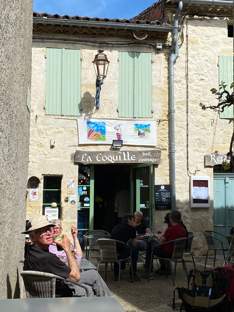
Around lunchtime, we started to come upon the village of Saint-Antoine-de-Pont-d’Arratz that advertised a great restaurant called La Coquille de Saint-Antoine. It was obviously a popular pilgrim stopover as we came upon many others who were looking for a rest and some refreshment.
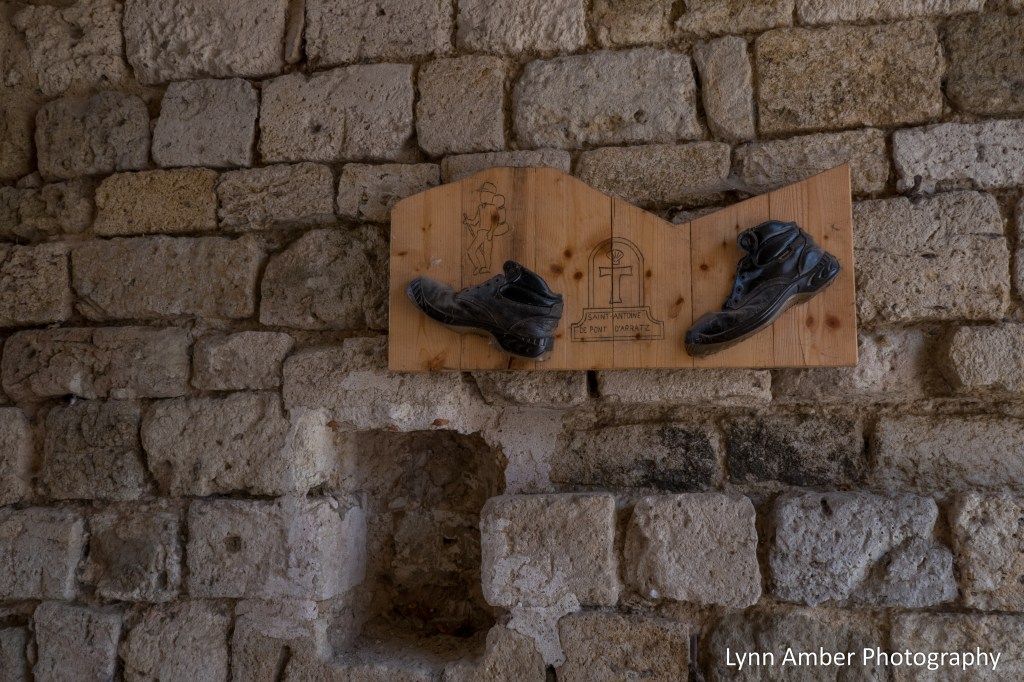
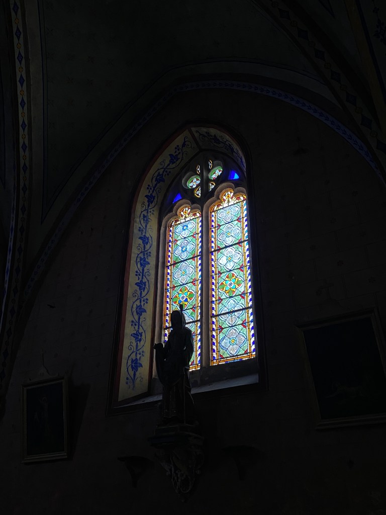
Before heading to the restaurant, we popped into the Eglise de St Antoine – a unique Romanesque style chapel. The plain exterior did not prepare me for the more elaborate interior design.
The restaurant was busy and had a rather festive atmosphere. With outdoor seating, we grabbed a table and ordered some food. Really nice place!
After leaving Saint-Antoine-de-Pont-d’Arratz, the scenery returned to the rolling hills landscape of this morning. It was such a nice pleasant day!
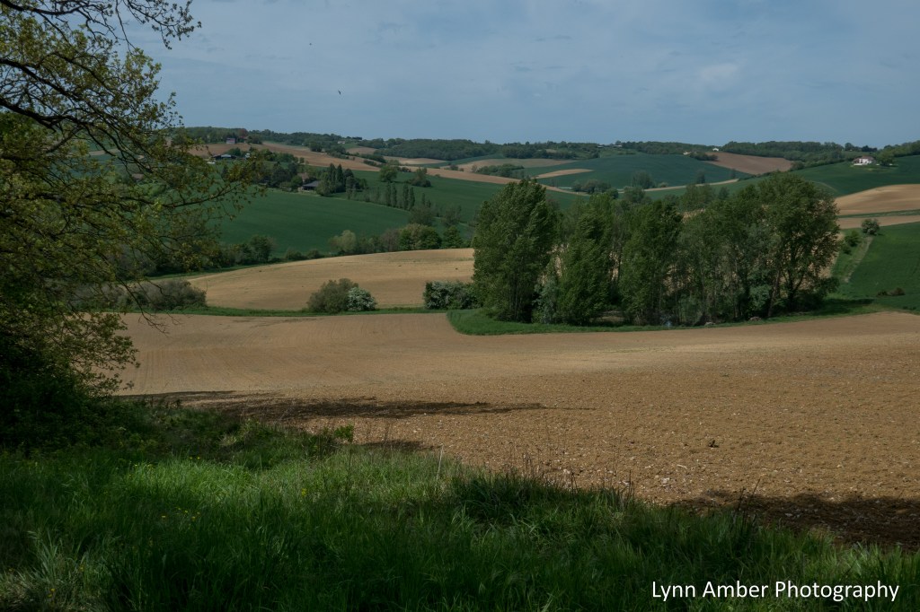
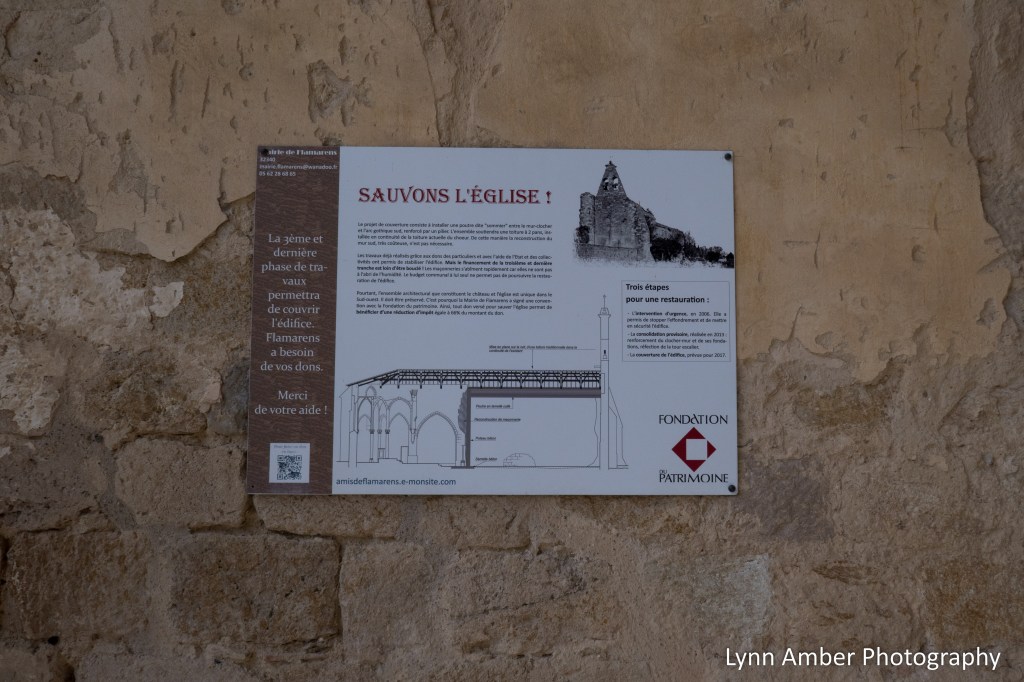
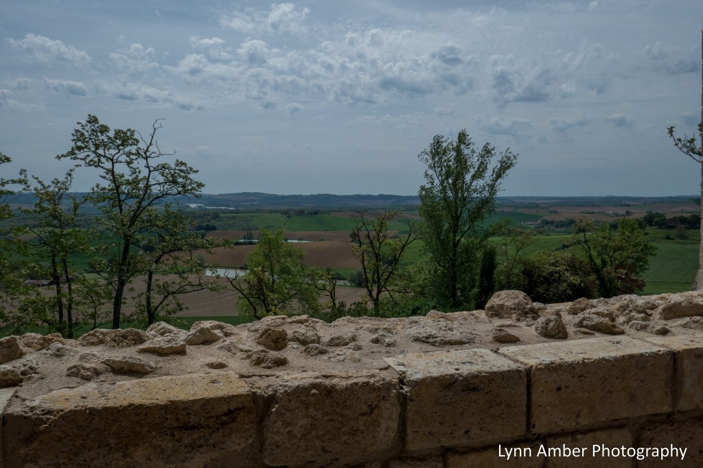
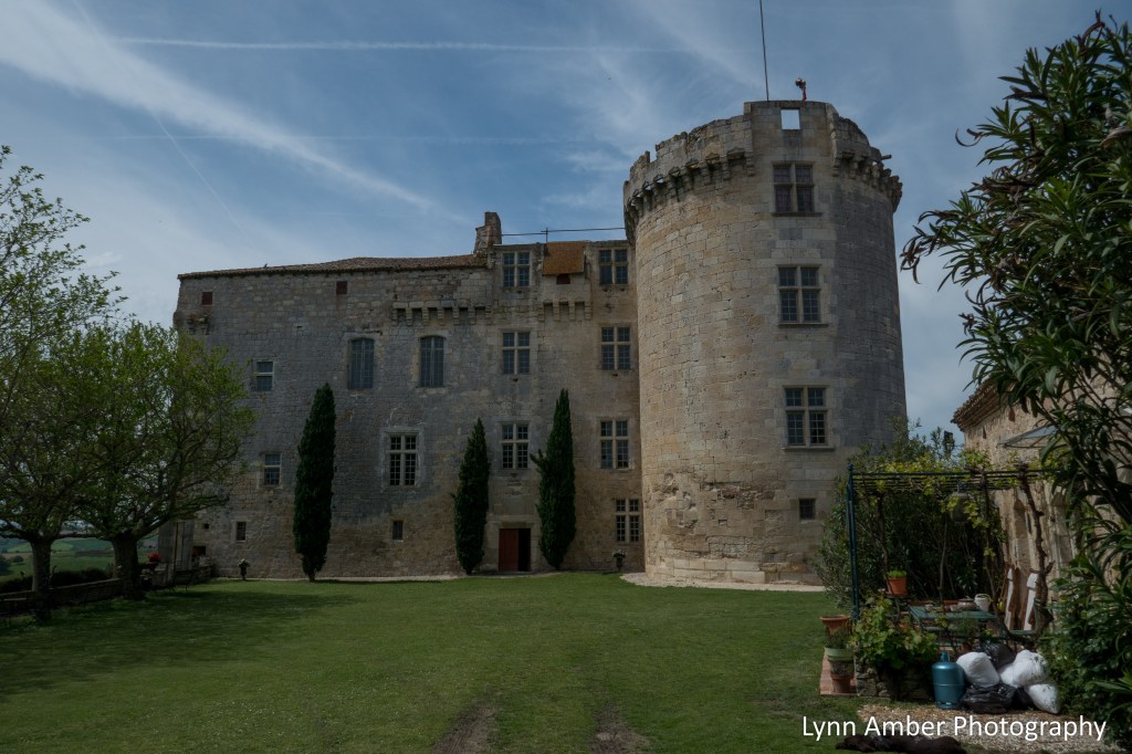
Right about the time I was ready for a water and snack break, I came upon the small hamlet of Flamarens. There was not much here – sort of a one-road village but two structures caught my attention. The Eglise Saint-Saturnin is an old structure in partial ruin. It is believed to have been constructed in the 14th century near to the Château de Flamarens. Together the two structures served as defense positions for the villagers. The Château de Flamarens dates to the late 1200’s and today serves as a lodging for pilgrims.
There was a really nice picnic area just opposite the church where pilgrims could take a break and relax. I was not alone as this was another perfectly placed rest stop!
The rest of the day was uneventful and I arrived in Miradoux early and before my accommodations opened for the afternoon. Chez Vous Chez Nous is a lodging that occupies an old renovated building and has an enclosed garden on the opposite side of the road. They allowed me access to the garden while I waited for the gîte to open. When I was able to check in, our host indicated that the place was full! We had a room with 3 beds and found out we would be sharing our room with Gerald – a pilgrim we have met before from Germany. .As I was checking in, there was also another American couple from Nevada. It was unusual to come across Americans on this journey so it was a nice encounter!
We paid for a demi-pension which gave us both dinner and breakfast for an unbelievable price of 37 euros. Dinner was served outdoors in the walled garden and included an aperitif prior to a multi-course meal. Our roommate Gerald showed us some of his talents when he played the guitar and led us all in a rendition of the Pilgrim Song. There are many different pilgrim songs. I don’t remember the exact one that Gerald sang but I’ve grabbed the pilgrim song lyrics from the movie “The Way”. I just like it.
This is the first step to a new part of my life
a small step for mankind but a giant leap for my mind.
I’ve got so many questions, so many things to solve
looking for the answers all along the walk.
On the highest mountains, in the middle of the plains,
somewhere between valleys, under the sun or in the rain,
I try to find myself, I try to find who I am.
Buen camino peregrino
hope to see you on my way
we got 500 miles to go on the road to Santiago
This is the first time that I’m really feeling free
delivered from all the burdens granted by society.
Crossing that many people who are thinking just like me
makes me feel like I am a part of a great big family.
I came to find some peace and what I found is love.
Buen camino peregrino
hope to see you on my way
we got 500 miles to go on the road to Santiago
Whatever you came for
Whatever is the goal
Lighten your backpack
and take it step by step
And I walk and I walk and I walk and I walk and I walk
And I walk and I walk and I walk and I walk and I walk
And I walk and I walk and I walk and I walk and I walk
And I walk and I walk and I walk and I walk and I walk
Buen camino peregrino
nice to meet you on my way
we got 500 miles to go
on our road to Santiago
Morning sun
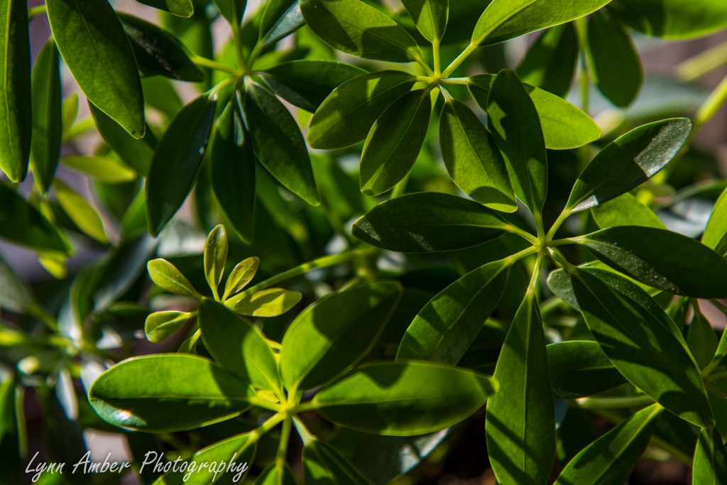
I have a few of my houseplants lined up on the the window sill of my south-facing picture window. Even though we have a porch roof that shades this window part of the year, the low winter sun peeks through now for much of the day. One of my morning rituals is to stand by the window soaking up the morning sun while my coffee brews. I love the way the sunlight dances off the leaves and flowers in the morning light.
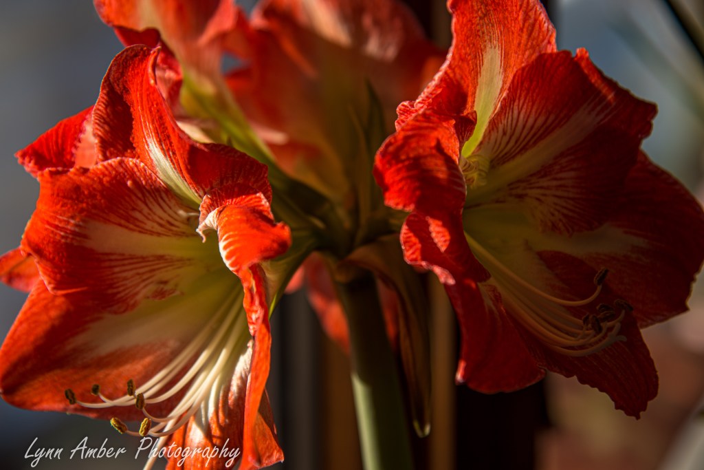
Winter Bulbs – Amaryllis Take Two
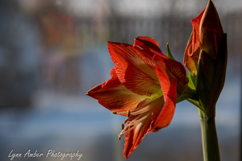
My second amaryllis is finally starting to open up! It is a red variety and, at first, struggled to get going. I potted it at the same time as my pink variety that bloomed long ago but is now sending up a second flower stalk!
