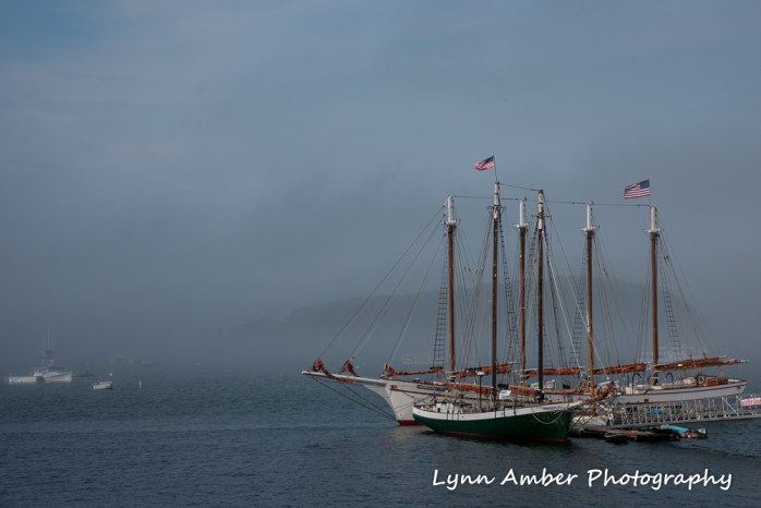
Lynn Amber - Travel & Photography
sharing my thoughts through words and images
On the Move Again….
Some road ramblings…………😊
After spending the last 2 years on the east coast traveling between my home in Vermont and my seasonal park service work in Maine, I needed a “long road trip” fix and longed to gaze upon the deserts of the southwest once more. So, here we are – traveling west on Interstate 40 heading towards Nashville and ticking off the miles. As Jim says whenever anyone asks where we are headed: “Lynn has chosen to go about as far away from Vermont as you can get to the southwest and still be in the USA!” We both felt a bit rusty as road-trekkers during the first two days, but we are getting into the groove now! I’ve got John Prine loaded in the CD player belting out his poetic country-folk tunes for Jim’s amusement while I write.
It was a rocky road to get to this point in our trip. We had been delayed making our exodus from the frigid, snowy far Northeast for several reasons – some by choice, some by necessity. By choice, we wrestled with how best to “winterize” the house and decided to spend the time to install a hardwired generator plug so that our caretaker (AKA our wonderful, responsible nephew) could easily keep the house above freezing if the power were to go out. As do-it-yourselfers, this process involved countless hours on the phone to both our sons seeking advice on how best to wire it up. Our electrician neighbor also gave us some of his time-worn wisdom. We also exhaustively researched generators – brand, size, volts, wattage and amperage – were all considerations in narrowing down our choices. Decisions had to be made on just what we wanted to power in the event of an outage and then calculations done for wattage and amperage requirements. I learned a bit along the way as did Jim who had to actually do all the work. In the end, we settled on the reliability and quality of a Honda generator. Jim got the whole thing wired and up and running successfully! 😊


By necessity, we had some repairs that needed attention on the truck before we could depart. Again, Jim gave it his best effort to do these repairs himself. Rusted steel fuel lines had contributed to a small leak in the line and Jim attempted the repair himself after seeking professional guidance from two of our local diesel mechanics. He tried to replace the rusted sections with rubber fuel lines. Unfortunately, it did not work and we had to make an appointment with a Chevrolet dealer near us. Turns out it was a good thing that Jim’s fix did not work. While replacing the fuel lines, the dealer’s service department noticed that the brake lines had also degraded over time. As a result, we are embarking on this western adventure with new fuel and brake lines which is certainly reassuring.
Eventually, we deemed that it was time to go – the house was all set, the truck repaired and we had grown weary of the snow/ice/rain weather that has been the norm in the Northeast. Off we traveled to our son’s house in New Hampshire to retrieve the Airstream and head south. Our first stop had to be south-eastern Pennsylvania for a brief visit with Mom. We were thankful to her retirement community for closing off a section of one parking lot so that we could “moochdock” here for two nights. There are no campgrounds open this time of year!
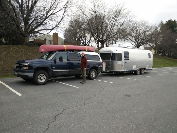
Before leaving Vermont, I had created a spreadsheet detailing our trip with potential mileage each day and possible places to stop over along the way. Our first day out of Pennsylvania and that spreadsheet was obsolete!! We made really good time the first day through Virginia and traveled over 100 miles further than anticipated. I scrambled to find an alternate “free” stopover, and found a Bass Pro Shop in Bristol, TN that was reviewed on Campedium. A reviewer who I’m familiar with had given it positive marks and I trust their judgement. It was the perfect place to pull in and spend the night. With the exception of a tractor trailer who pulled in briefly near us, we were alone and it was quiet.

Most important, there was a choice of a Starbucks or a McDonald’s for early morning coffee on our way out! We opted for McDonald’s because it was easier to get in and out of their parking lot with our rig. While I never frequent this food chain while stationary, their coffee is good and cheap when traveling! 😊
Leaving McDonald’s – a typical travel conversation ensued:
Me, speaking with authority: You should have turned right out of the parking lot.
Jim, answering with authority: That’s not the way we came in
Me, saying pointedly: Not the way we came in from the Pro Shop, but it is the way we came in off the highway last night
Jim, countering with exasperation: (while sitting in the middle lane of the shopping area with cars going on either side of us) Which way do you want me to go?
Me, reiterating: Back through McDonald’s and make a right.
Jim, responding touchily: I don’t think that’s the way we came in.
Me, reconsidering: Yes, it is but – hold on while I check the map – oh, actually we came in that way, but we can’t go out that way. You’re fine to keep going and make a left at the traffic light.
(We are just trying to get out of this mega-shopping center at this point!)
We have fun while traveling by keeping a virtual “tally” as we drive – who’s right/wrong on a given decision. I had to admit to being wrong on this one! It’s one to one right now – as I won the bet regarding payment accepted for a toll in New York – which was cash only as I indicated.
As we drive and stop at various places for fuel or just to take a rest, we always meet people and engage them in conversation. We’ve already had some nice interactions at this early stage of the trip. The early morning staff at McDonald’s was very accommodating and put up with me asking for half decaf/half regular in my own coffee mug. Some McDonald’s will not do this. They also took it in stride when Jim requested that they not put everything into a separate bag. We have become minimalists with regard to packaging, etc and have made it a point to ask for less wherever we travel. 😊
Fuel stops are always interesting. You hope that access is easy and the place is relatively clean. One stop this morning turned sour and I could sense Jim tensing up beside me as we made the approach. We had to make a U-turn on a busy 4-lane highway to get over to the station. In order to do that, we had to go over on the shoulder and stop – then re-merge back into traffic to turn into the station. A pick-up truck went by us and pulled into the station, then stopped and waved to us. Once we pulled into the station, he came running over. I was initially thinking the worst – that he noticed an issue with the trailer as he went by us. Turns out, he noticed our Vermont tags and wanted to talk and assist us with directions if we needed them. He moved to Knoxville from Vermont – in one of the town’s adjacent to ours. He chatted with us for a bit, wished us a good trip and went on his way. So, what started out as a bad choice for a fuel stop immediately turned positive! It only takes one smiling, friendly face!!
More ramblings to come as we head west!
Isle au Haut Family Time

Spending quality time with family is the thing most precious to me. It sustains me in a way that is indescribable. Currently, my two grown children live about as far apart as you can get and still be in the lower forty-eight. One son is in the Northeast just a short driving distance from the Atlantic Ocean, while my other son lives south of San Francisco in close proximity to the Pacific coast. It is rare to have them both in the same place at one time. I believe Christmas 2018 was the last occasion we were all together as a family.
In July 2019 while stationed in Acadia National Park, I had no expectation that I would see them until my tour of duty was over. With our post-Acadia plans uncertain, even the 2019 holiday season was up in the air. Then, a miracle occurred in the middle of my stint in Acadia.
One of my bucket list items for my second season here was to arrange a trip to Isle au Haut. I knew the chance of actually securing a campsite at Duck Harbor was probably unlikely but I thought perhaps I’d arrange a day trip to the island via the ferry out of Stonington. Duck Harbor Campground sites are reservable online and so popular that the entire season sells out soon after reservations open in the spring. Mid-summer, I had started searching the online reservation system for cancellations along with some of my colleagues with the hope that a couple of nights might open up. One of my fellow duty station comrades noticed a cancellation in August that did not work with her schedule and she alerted me to the cancellation. The available dates aligned perfectly with my days off. Serendipity has once again been good to me! I quickly decided to reserve the open campsite for two nights with the idea that I’d work out the details later.
I alerted my husband to bookmark the August dates for the campsite reservations so he could plan on coming east to Acadia to join me for the trip. I then started researching the rules and regulations for camping at Duck Harbor and planning my supply list. Since the rules allow for up to 6 persons to share a site, I decided to invite both my sons and their partners. Why not? It was a long shot that both would accept the invitation given their limited vacation time and distance but I thought it was worth a try. I embellished my invitation with the valid point that this was a “once in a lifetime” opportunity given the popularity of camping on this remote island. My sales pitch apparently worked. I was completely surprised when they both indicated their intention to come to Acadia and experience Isle au Haut with me!
What’s so special about Isle au Haut? It’s an island off the coast of Maine with a small year-round population of just over 50 residents. During the summer months, this number increases five-fold. About half the island acreage was donated to Acadia National Park in 1943 and the park land is managed with a goal towards minimizing impact to the natural environment. There are about 18 miles of hiking trails – all very primitively maintained – and about 12 miles of paved and unpaved roadways. The island is home to several diverse ecosystems including forested uplands, bogs and marshes, remote rocky coastal beaches and cliffs and one very long pond. During one hike, it is possible to traipse through each of these unique habitats.
The town of Isle au Haut sits on the north end of the island and is a tiny community that supports a general store, post office, school and ferry landing. I encourage you to check out the town website for additional information on this unique community including the solar project that is being undertaken by the Isle au Haut Electric Power Company that will culminate with 90% of the island’s power coming from solar energy. (A side note – a friend of ours in Vermont who owns a solar design company was involved in this project.)
On the south side of the island within the park, Duck Harbor Campground is the destination for primitive camping. There are 5 lean-to sites here reservable for a maximum of 3 nights stay limited to once per calendar year per person. The campground has several composting toilets near the lean-tos and a drinking water source located about a ¼ mile hike from the campsites. Each site contains a fire ring, a picnic table and a food storage box. All food must be stored in the box. As it states on Acadia’s website, this is definitely not car camping! Preparation for camping here is similar to planning a wilderness backpacking trip. Access to the island is via the mailboat out of Stonington, ME. You must be prepared to carry all your provisions with you onto the boat and to your site. There is a ferry landing at Duck Harbor where you pick up a short path that leads to the lean-tos.
Please visit the links I’ve provided above for detailed information about visiting the island and camping there. We spent 2 nights/3 days on Isle au Haut and it was a memorable experience. The weather was finicky – one good day and one overcast/rainy day – so we enjoyed the island at its best and worst! Actually, the storm blew in late on our second day and interrupted dinner preparations a bit but we still managed to eat and enjoy a campfire!
Thanks to my family – Leif, Jeannie, Luke, Sharon and Jim – for sharing this special place and time with me!! 😊
Our Photographic Journey on Isle au Haut
DAY 1

We started our journey in Stonington, Maine at the town dock. While we waited for the mailboat to start loading, we finished up our take-out breakfast from the local cafe in town.

The mailboat had some very nice carts that we could use to load our gear onto and that helped tremendously in getting the camping stuff down the ramp and stowed on the boat. There were a couple of other campers on the boat with us as well as a few day-trippers.


The mailboat dropped us off at the Duck Harbor landing and we unloaded our gear and headed up the ramp towards the campground.
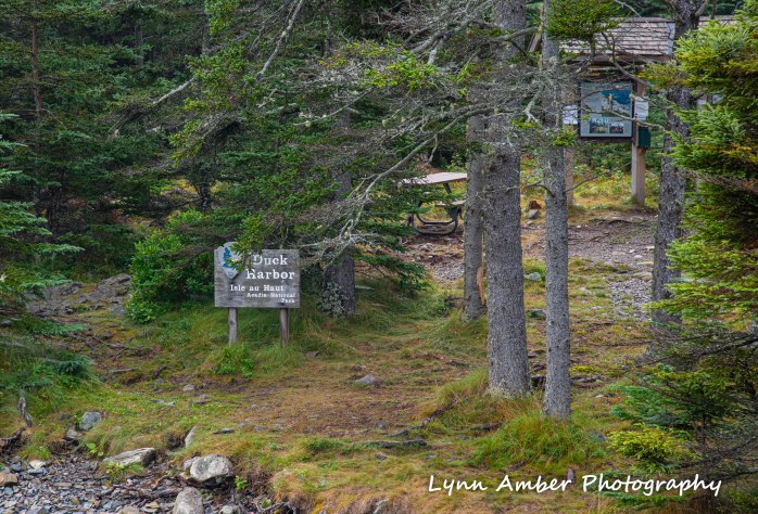

We followed the signs to Lean-to #2 and started to set up camp. According to the regulations, all tents must be set up inside the lean-to so that there is minimal impact on the surrounding terrain. I had researched the size of the lean-tos (8′ x 8′ x 12.5′ wide) and talked with one of the on-site rangers before arriving to be sure we could fit three 2-person tents within the structure. He assured me that it should not be a problem. That was our first miscalculation! I did not account for the width of the 3 double-wide air mattresses that we all brought with us!! We managed to squeeze all three tents into the lean-to with some ingenious maneuvering. It took some acrobatics to get into our tents and we were a little “cozy” but comfortable.

We had a robust conversation about how we would do things differently if we ever came out here to camp again. We decided some mosquito netting to enclose the lean-to would keep those pesky insects at bay. Then, we could forgo the tents and just have sleeping pads and bags. As it turned out, on our second night out, there was a no-show for one of the other lean-tos due to weather I suspect. Leif and Jeannie decided to move down there for the night allowing us to spread out the two remaining tents at #2. 🙂

After we got settled in, one of the rangers arrived at our site to give us a brief introduction to the area, go over some rules and give us a chance to ask any questions. We took that opportunity to let them know that we had left one of our coolers on the mailboat! In that cooler was our dinner for one night!! They said they would try to intercept it at the town landing and bring it to us the next morning. I am happy to report that they did find it at the town landing and even put it in the ranger station refrigerator overnight when they realized there was perishable food in the cooler. The next morning it was delivered right to our site! What service!! Moral of that story is to double-check when you leave the boat that you have all your gear!!
The rangers informed us that there was a really nice little “town” beach on Long Pond and gave us walking directions from the campground. Most of the route ended up being along one of the unpaved roads and was about 3 miles one-way from our campsite. Everyone agreed it would be a perfect thing to do after getting set up and we would make it back to camp in plenty of time to start dinner before dark.

After returning to camp, we decided we wanted to find a spot along the coast to cook and eat dinner. We found a trail from the campground that led to an idyllic cobblestone beach with a “bench” that proved a perfect spot for our camp stove.
It was a beautiful evening and the breeze kept the mosquitoes away while we ate and enjoyed the sunset.


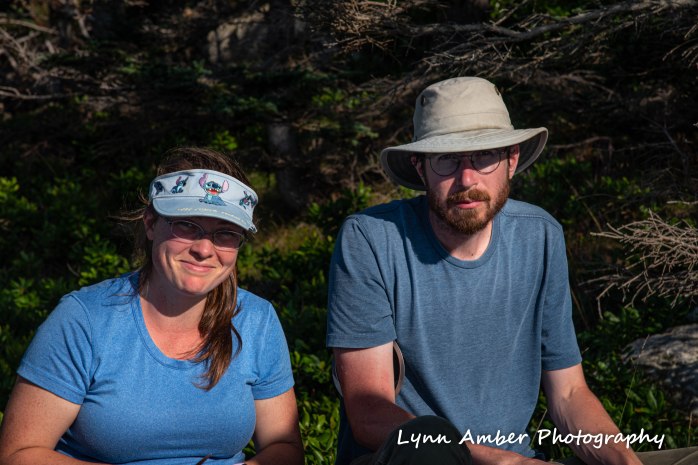
After eating, we stayed on the beach relaxing and watching the sunset. It was low tide and there was a sand bar that allowed access to a small rock “island”. It was just begging to be explored! Jeannie was the first one to cross and scale the rock – followed shortly by Leif, Luke and Sharon.


We climbed around on the rocks here and watched an osprey who was perched in a tree on the opposite shoreline. He was hunting for fish and dove in the water multiple times as we looked on. We were thoroughly entertained!!
After we got back to the lean-to and cleaned up our dinner dishes, we walked down to the landing to watch the sun set. It was magical.

We noticed that Duck Harbor serves as a safe haven for sail-boaters who are passing through the area. They anchor for the night and take advantage of the water source here – rowing onto shore and walking to the water pump to fill up jugs with drinking water for their voyage onward the next day.
DAY 2
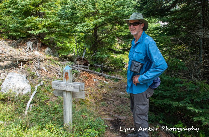
We decided to hike around the island on some of the trails and chose a route that would take us near Long Pond so that the crew could enjoy another swim. We hiked the Western Head Road to the Goat Trail and followed this trail along parts of the southeastern coast line. The Goat Trail passes by several cobblestone beach coves. The rangers mentioned that there is a preserve that abuts the park land with trails that would take us towards the road leading to Long Pond.
We decided to be adventurous at this junction and follow the trail leading into the preserve. The Head Harbor Preserve encompasses 72 acres and is part of a network of preserves operated by the Maine Coast Heritage Trust. The trail through the preserve follows the coastline around Merchant Cove and continues along Head Harbor ultimately connecting to Main Road leading to Long Pond and the town center.
It was overcast most of the day with the threat of rain imminent. Luck was with us though and it never did rain until we were back at camp later in the day.
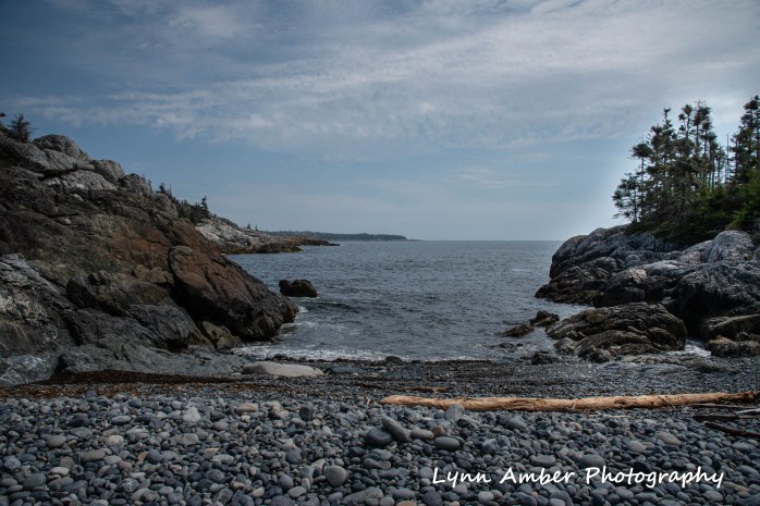


We walked for a while longer and started looking for a spot to stop for lunch when it was obvious the troops were getting hungry! Luke and Sharon spotted a rocky outcropping on a peninsula around the corner from Merchant Cove and we made our way out there.


Shortly after lunch, we made the decision to leave park land and enter the preserve. The trail took us through some marshy land and along the coast. Beautiful views!!


We eventually came to the end of the trail at the Main Road and the hiking party took another swim in Long Pond before heading back to the campsite. Cooking dinner that night was a challenge when the storm blew in. We did manage to keep a campfire going to cook some food and we had to huddle under the lean-to to keep the stew pot going. But, it was a good meal and the storm abated before it was time for bed.
DAY 3
The next morning we focused on packing up since we had to be down at the dock to catch the morning mailboat run. We decided not to cook breakfast and settled on granola bars to give us sustenance until we hit the mainland.

We arrived at the dock early. There was a heavy fog along the coast which made for some interesting photo ops.
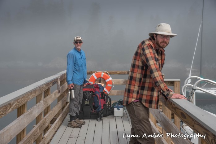

We took the time to get some group photos with all our gear – Luke and Sharon grabbed the camera and got some “rare” shots of me. I’m usually the one behind the camera!

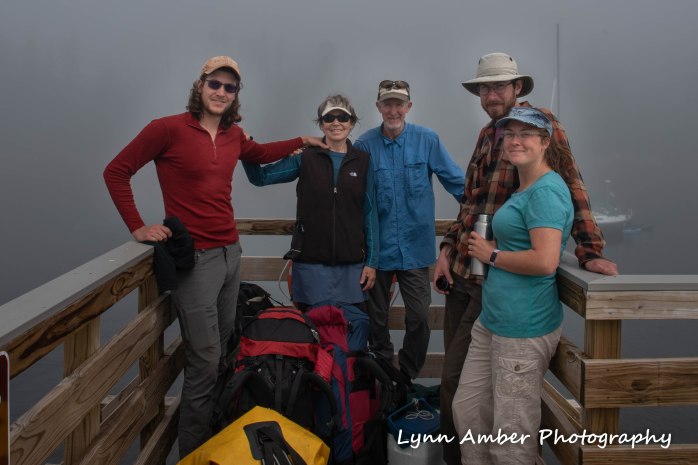


After we loaded our gear on the mailboat, we enjoyed a ride around the island to the town dock. The fog was starting to lift along the way.
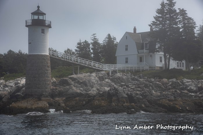

We had a 45 minute lay over at the town dock so we were able to disembark and walk around the town for a bit.

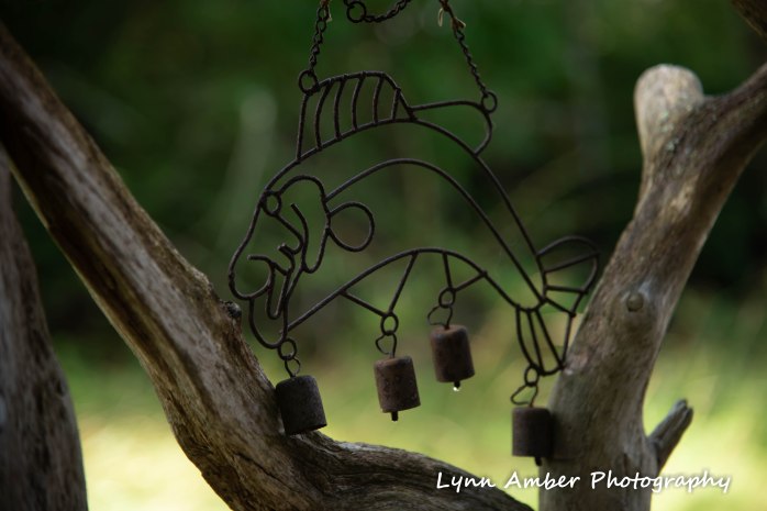

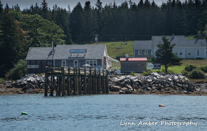
Back on the boat, we motored past the General Store and enjoyed the views of some small uninhabited islands on the way back to Stonington.

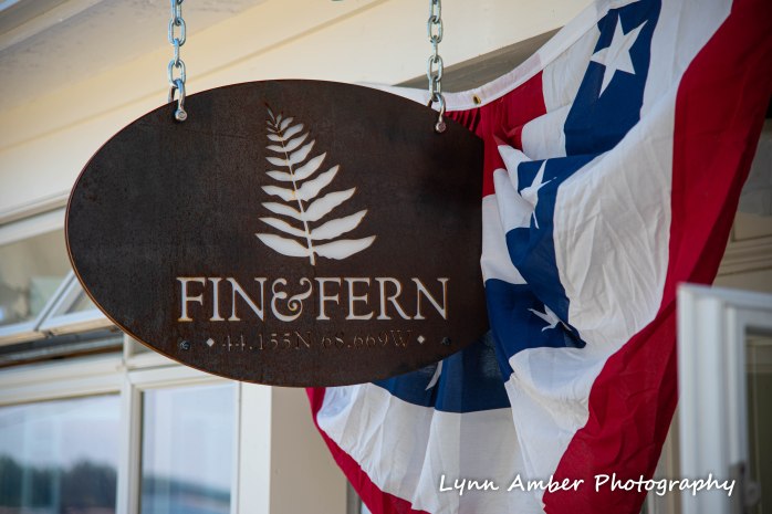
By the time we arrived back at the Stonington dock, our early morning granola bars had worn off and we were all starved. Upon the advice on one of the ferry guys, we decided to give the Fin and Fern restaurant a try. It did not disappoint. We sat out on the deck and I do believe I had the best quiche I’ve ever tasted.
Thanks to my family for taking the time and expense to travel to the coast of Maine and spend some time with me!! You cannot imagine how very much it meant to me!!
Highlights for me:
- dinner on the cobblestone beach our first night out
- watching everyone enjoy a swim in Long Pond
- Hiking, always hiking!
- lunch on the rocky peninsula and trying to figure out what the heck was out there in the water!!
- the ever present mosquitoes
- listening to my family converse about everything under the sun

Life after Acadia

I’ve been back in Vermont since the end of October – enjoying the space and comfort of my home. I find that it always takes me awhile to “adjust” to life back home and settle into a routine. This year, that adjustment was complicated by the fact that I traveled shortly after returning home to South Carolina.
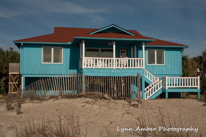
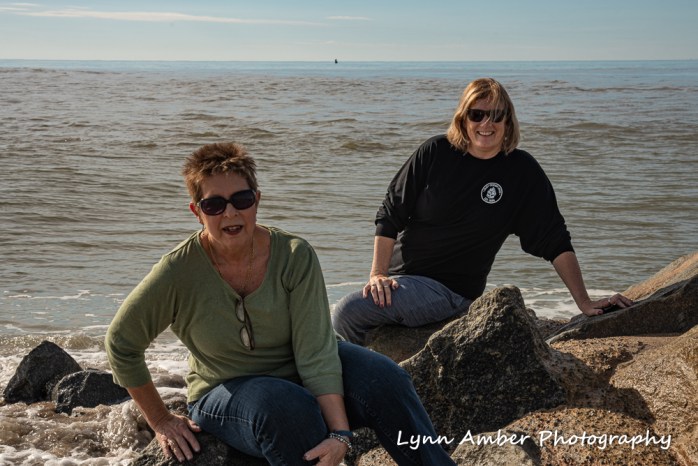
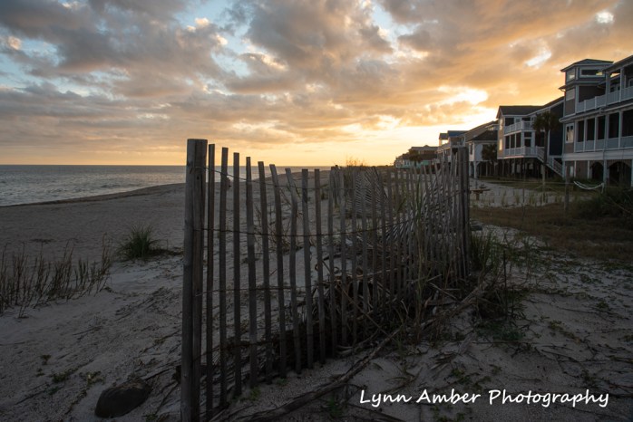
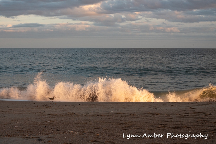
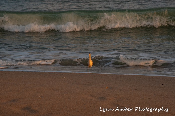
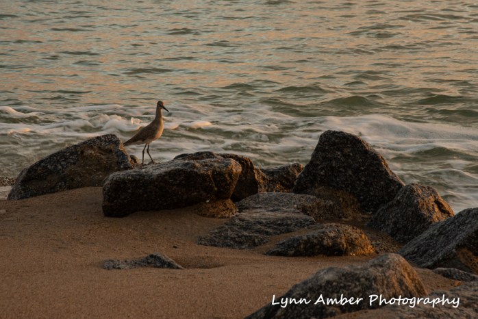
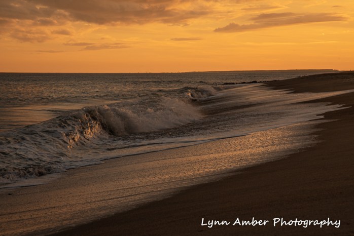
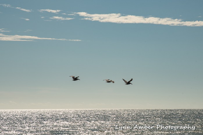
I drove to Pennsylvania and rendezvoused with my mother, sister and cousin. We traveled from there to Edisto Beach, South Carolina to enjoy a few days of rest and relaxation and visit with family and our newest member – my great-nephew. We rented a small cottage right on the beach. It was perfect. Temperatures were mild enough to enjoy early morning coffee on the deck and several long beach walks. A good time was had by all!
Morning Relaxation and Sunrise



Walks on the Beach!

Sunsets and Bird Life

Newest Edition to the Family


BACK IN VERMONT
Developing a routine was suspended until my return from SC. Many workamping RVer’s live full-time in their rig and, therefore, do not have to make the transition to “home” after their seasonal work is completed. While that presents its own challenges, returning to a bricks and mortar house is a different dynamic. When I returned this year, I put my camera aside and took a break from writing. I needed to focus on settling into life here and making plans for winter. I’m still immersed in that process!
While we contemplate how the winter will unfold and decide on our next adventure, there are many things that need attention. I’ve been busy making lists of necessary tasks to be completed. These tasks represent new projects to be tackled as well as completion of those left undone from last spring. There really is never any shortage of projects – the challenge is prioritizing!
One major project that we want to finish is our partially completed cedar strip canoe. We spent the better half of a day conducting online research and settled on the fiberglass and epoxy that we want to order. While Jim works on completing sanding the hull, I am going to attempt caning the seats that we will install in the canoe. After much research and deliberation, we decided on a pattern and size for the seats. Jim constructed the seats over the past two days and they are ready for me to start caning. Should be interesting! I’ve bookmarked some great YouTube videos to reference while I work and will start caning this weekend using leftover materials from the last seat caning project Luke completed many years ago. It pays to save all that stuff!!


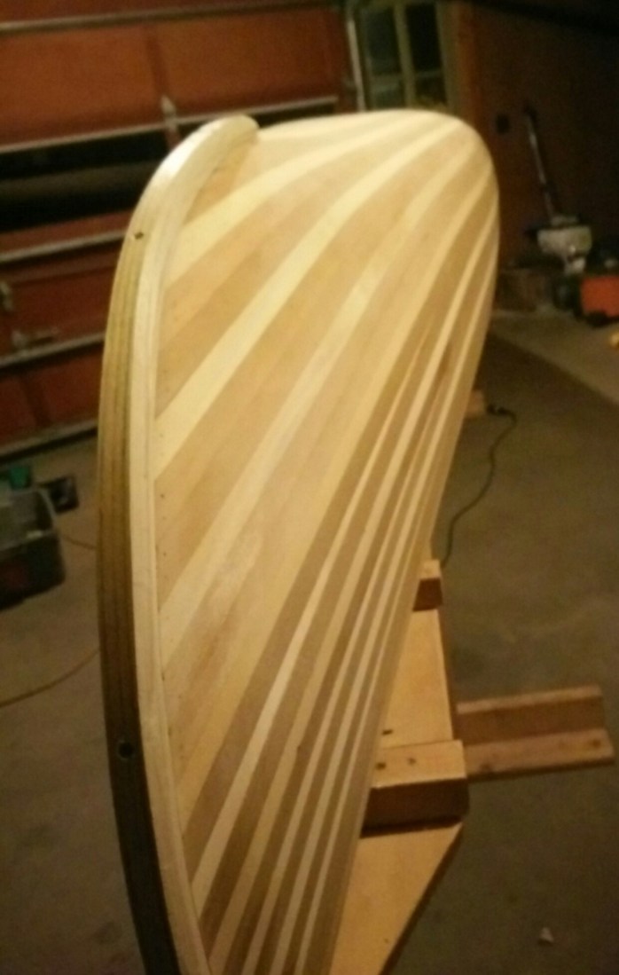
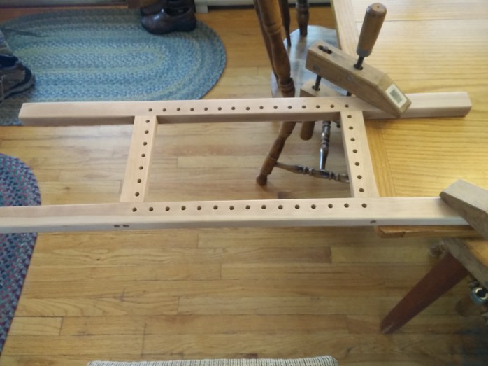
In addition to the canoe project, I’m busy deep cleaning the house, organizing files, sorting through and getting rid of “stuff”, editing all my summer photographs in Lightroom, taking daily walks, setting a routine for writing and photographing and planning the next adventure.
I still have some blog posts to share relating to my summer in Acadia. Stay tuned for those! Hoping to post more frequently now that I’m settled – topics to vary depending on what is happening in my life and where the spirit takes me.
Acadia’s Uniqueness

As I wind down my second season here on Mount Desert Island at Acadia National Park, I’ve been reflecting on what it is that makes Acadia unique among national parks. The origin of the early trail system in the park certainly meets that criteria. There are numerous publications that touch upon the historic nature of Acadia’s trails. These island trails were built over a period of many years – both before and after the establishment of the national park. Early trailblazers included Native Americans and, subsequently, European explorers turned island settlers. These settlers were farmers and fishermen who established the foundation of some of today’s current industries. Following the settlers, a new wave of tourists arrived in the mid-1800’s including artists and writers from the Hudson River School – called rusticators – whose work led to a new breed of island inhabitant. Following the Civil War, travel to Mount Desert Island picked up and the major towns of the island enjoyed an influx of affluent families who purchased land and built summer homes on Mount Desert Island.
Native Americans were the first to blaze paths throughout the island although little remains to suggest precisely where these trails where located. Their trails were most likely portage paths for traversing the island between lakes and ponds via canoe. Some evidence of potential carry paths is still in existence today in the form of current hiking trails. For example, the Jordon Pond Carry Path provides passage between Eagle Lake and Jordan Pond while the Jordan Stream Trail makes a connection between Jordan Pond, Little Long Pond and the sea. I’ve hiked both of these existing trails and can easily imagine this ancient use of these connector pathways.
With the increase in population following the influx of wealthy families to the area in the late 1800’s, the towns grew in size and the desire to maintain the natural beauty of the area led to the development of civic and village improvement societies. One of the earliest civic organizations was the Hancock County Trustees of Public Reservations. In addition, each community on the island created their own village improvement associations that specifically addressed their unique needs. It is because of these early preservation efforts that the island-wide trail system exists today. Early trail builders included George Dorr, Herbert Jaques and Walden Bates.
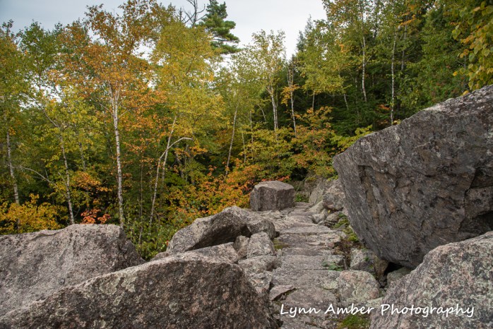
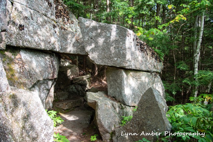
Many of today’s trail names pay homage to those who helped establish and maintain the aesthetic and natural beauty of Acadia. I’ve tried to hike most of these early historic trails – many of which are adorned with memorial plaques commemorating the person or persons who contributed land, money and time towards the preservation effort of Mount Desert Island’s unique surroundings. My July 25th post explored one of my favorite historic trails – the Beachcroft Path. Time to honor some of the other early trails that helped make Acadia what it is today. I hope you enjoy the photographs I’ve captured of some of these amazing trails. The pictures show not only their beauty but the incredible engineering work involved in their construction.
Emery Path
Built by George Dorr, the Emery Path was constructed from money donated by Mrs. John Anson, a member of the Bar Harbor Village Improvement Association. The path was named for her late husband, John S. Emery. The Emery Path is a tad over ½ mile long and is said to contain over 900 steps. While I did not count the steps as I climbed, I am not inclined to disagree with this assertion. 😊
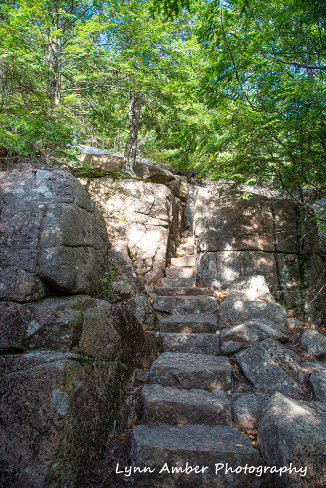


Homans Path
Located in the same area of Sieur de Monts as the above trail, Dorr built this trail as a memorial to Mrs. Charles Homans. She donated several very important tracts of land to the Hancock County Trustees of Public Reservations that would later be incorporated into Acadia National Park. The view looking down onto the Great Meadow from this trail is unrivaled!
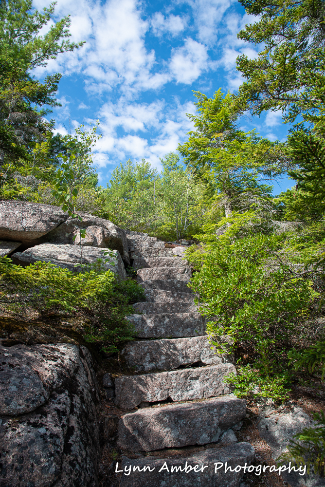


Jesup Path
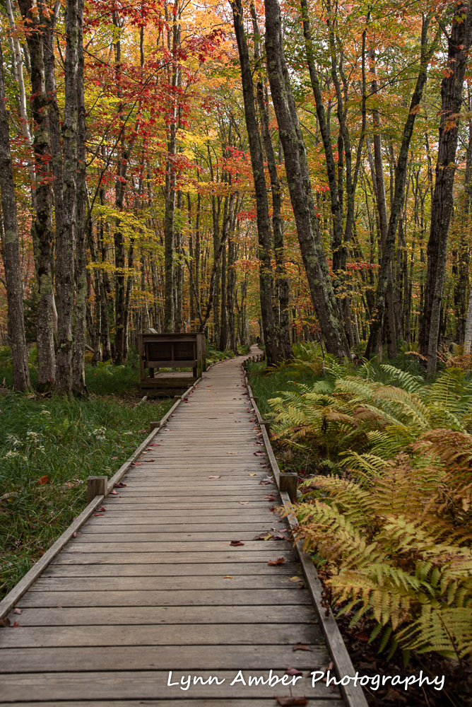
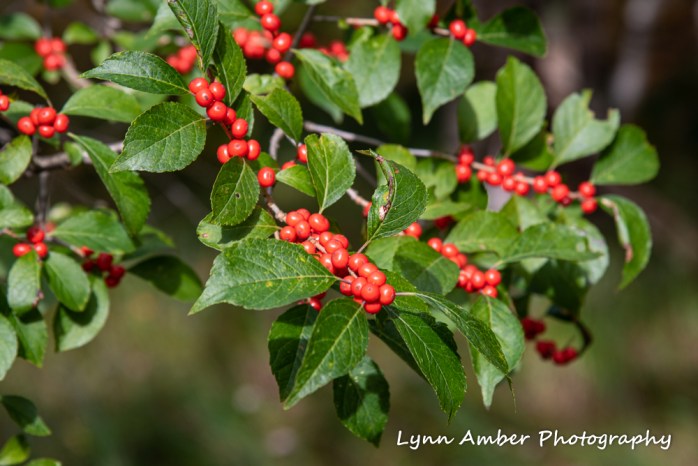
Considered to be an ancient Native American travel route between Bar Harbor and Otter Creek, the Jesup Path runs from Sieur de Monts, along the Great Meadow and eventually ends in the town of Bar Harbor. Part of the trail is now a boardwalk that protects the fragile ground through a swampy area. There are a pair of Barred Owls that hang out here – although they have eluded me this summer! I’ve heard but not seen them!


More Scavenger Hunt Photos

Our staff photo challenge scavenger hunt is over. It was fun for those of us who participated. Here are some of my other entries.
The above shot was #12 on our list and the task was to capture a butterfly shot. I had no doubt where I would choose to go to find the most butterflies. Thuya Gardens is all about Monarch butterflies right now. They are floating en masse in the sky above the border gardens and feeding on the Joe Pye Weed in particular. It was magical to watch them flutter in the air and gracefully descend onto a flower.
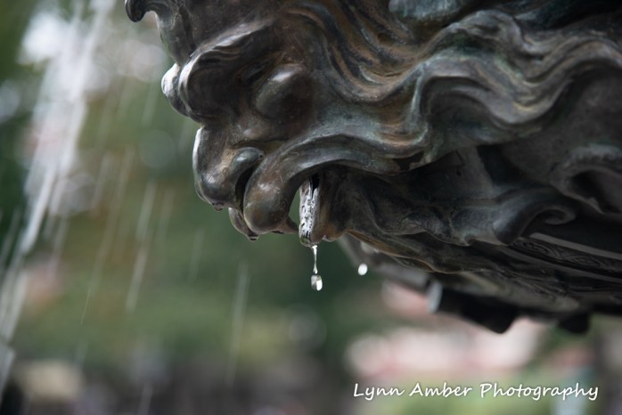
I guess I cheated here a tad on the rain drop photo! 🙂 A close-up shot of the fountain on the Village Green in Bar Harbor. It might have been raining as well 😉
I submitted a couple of real rain drop photos just to be fair!


In retrieving a full moon shot, I was forced to wait until I got off work. The nice part about that is I did not need a headlamp! Boy – was it bright out! I wasn’t able to make it down to the coast for the moon rise due to work schedule – but still captured a nice shot and reflection on the water with the spruce tree silhouettes in the foreground.
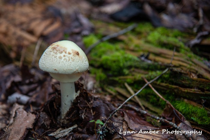
When you want to find a mushroom to shoot, all of a sudden they disappear!! I searched for mushrooms on several hikes before I found any worthy of a photograph. This gem was located just off the Quarry Trail near Blackwoods Campground – on a small unmarked side-trail. Love the bright green moss in the background – such rich, earthy colors!

I noticed these leaves floating in the fountain on the Village Green and I thought they made a nice mosaic of fall leaves floating on the water. Notice the coins sparkling in the background!
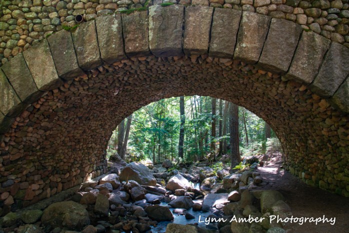
It was obvious that one of the Rockefeller bridges would be chosen for this challenge photo. I wanted something a little different than a wide-angle shot of the entire bridge. The Cobblestone Bridge is one of my favorites and I decided to focus on the arch spanning the Jordan Stream.
A fun workplace challenge!
Tuesday Treks: Photo Scavenger Hunt

Throughout the summer, our fee station staff have participated in several monthly “contests” just to make life interesting and to have some fun. For the month of September, we are engaging in a Photo Scavenger Hunt! As you can imagine, I jumped right on this and since our official start date of 9/8/19 I have been busy capturing some of the necessary subjects. Not everything I post here will make it to the “final” 16 – but I’ll share some of my efforts!
The first photo (Entry #1) on the list must include a favorite rock formation. Acadia boasts many such features including the infamous Bubble Rock. However, my all-time favorite is the above glacial erratic that is perched on the edge of the shoreline along a quiet part of the Park Loop Road. I have affectionately named this rock “Lynn’s Rock” since I have climbed down to this little beach many times and consider it my own private spot.

For my Tuesday Trek this week, I chose to walk around the Witch Hole Pond carriage road loop in search of some more scavenger hunt photographs. I almost missed these ducks entirely! They were so camouflaged that it was not until I turned to clamber back up the bank from this marshy area that I caught a flicker of movement and discovered these two ducks resting among the lily pads.
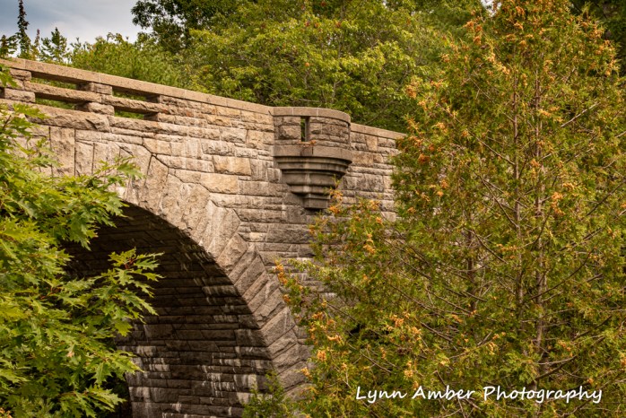
One of the prettiest bridges in the park spans the Duck Brook gorge and serves as the entrance to the Witch Hole Pond carriage road system. There are 17 total bridges in the park – 16 of which were built by John D. Rockfeller, Jr. The Duck Brook Bridge was completed in 1929. Visit the Acadia National Park web page to learn more about these historic bridges and the carriage road network.
Sunset in Acadia
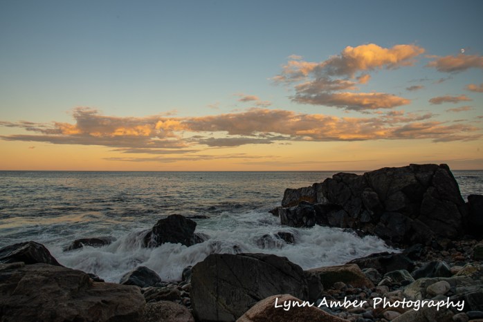
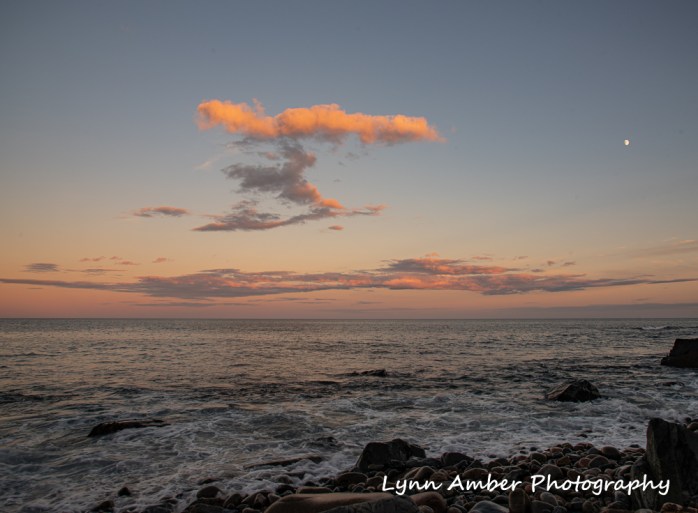
The sunrises and sunsets I’ve experienced along the coast of Acadia over the past two seasons will share a place among the fondest memories I will take away with me when I depart here in late October. Tonight I walked down to the rocks and played with my camera. The glow in the eastern sky from the setting sun was subdued yet still enchanting.
Wednesday Walkabout: Little Hunters Beach Take Two
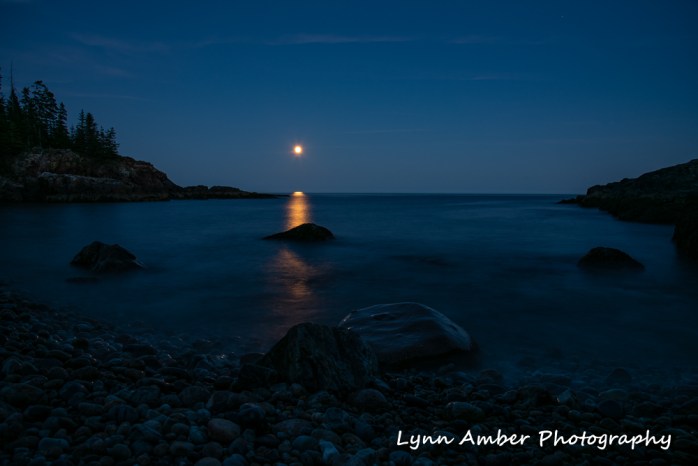
I got a second chance to shoot the moonrise at Little Hunters Beach tonight. Arriving just before moonrise, I calculated where the moon would appear using my compass cell phone application. I moved around the cove several times taking shots from different angles and I think this one was my best effort.
I would have preferred that the tide was coming in a bit stronger since it would have given me some nice slow shutter speed water effects in the foreground. But, alas, it was not to be. The effect is somewhat “dreamy” and I’m satisfied. 🙂
Tuesday Treks: Little Hunters Beach
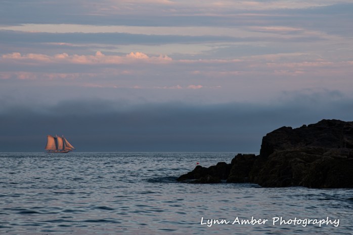
Sometimes the best laid plans are foiled. I intended to walk to Little Hunter’s Beach to capture some moonscape photographs on Tuesday evening. When I got to the cobblestone beach, I discovered a dense fog on the horizon that obscured the rising of the moon. At first I was disappointed, but then thought I could at least secure some sunset pictures.
Imagine my surprise when this sailboat suddenly appeared crossing the horizon while I was waiting for sunset! With the fog as a backdrop, and the sails lit by the setting sun, I snared an unexpected and pretty cool photograph! 🙂
It’s supposed to be a little clearer on Wednesday night, so I’ll try my luck again with the “almost” full moon rise.
Wednesday Walkabouts: Around Mount Desert Island

Wednesday was a busy day for me. I had several goals to accomplish – visit Thuya Gardens to see what was blooming and visit with the Monarch butterfly caterpillars, walk the loop around Witch Hole Pond in search of pitcher plants, and pick up a package in Bar Harbor (a new air mattress for my upcoming Isle au Haut camping trip).
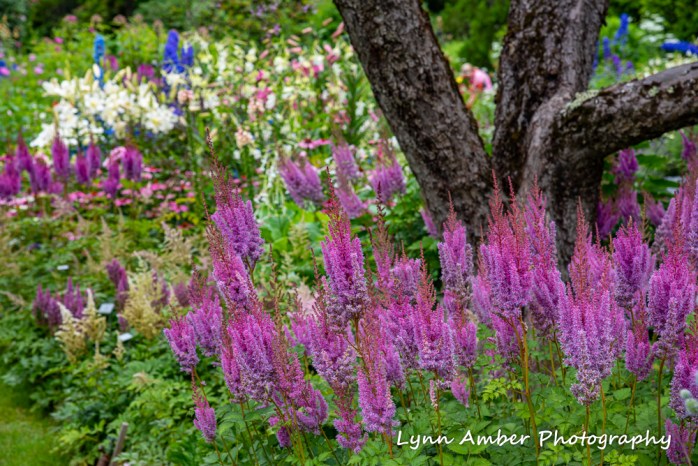
I started with Thuya Gardens. It was the perfect day for photographing flowers. There was a light cloud cover with no threat of rain. The last time I had visited Thuya Gardens in early July, irises and peonies were the flavor of the day along with a smattering of foxgloves. The season got off to a slow start due to the cool, wet spring. Today, I was anxious to see how the garden had progressed over the last month. It was a riot of color! Dominating the scene were lilies, foxglove, delphinium, astilbe and phlox. The lilies, in particular, were at their peak and absolutely stunning.
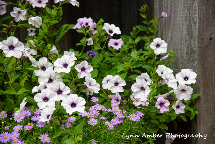
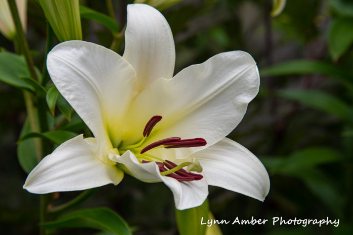

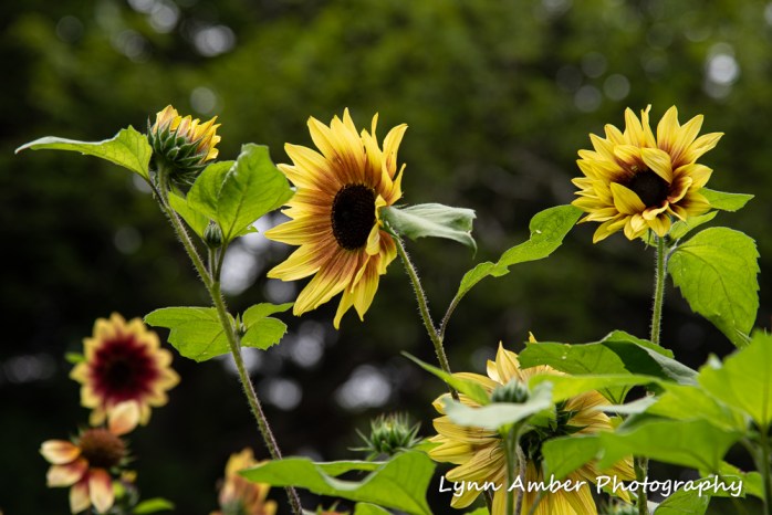
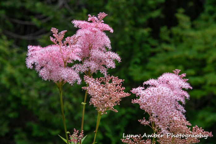
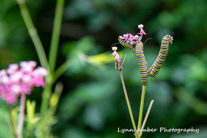
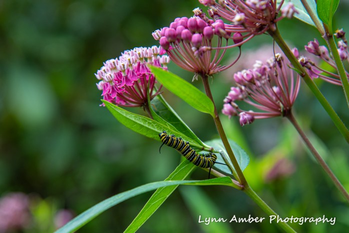
I managed to visit the Monarch caterpillars in their hidden spot in the garden among the milkweed plants at just the right time so as to be all alone with them. Given that I have never seen the garden so overrun with visitors, I can only say that my solitude was serendipity. I had at least ten minutes to observe the caterpillars in action and shoot photographs before anyone else located this little land of enchantment.
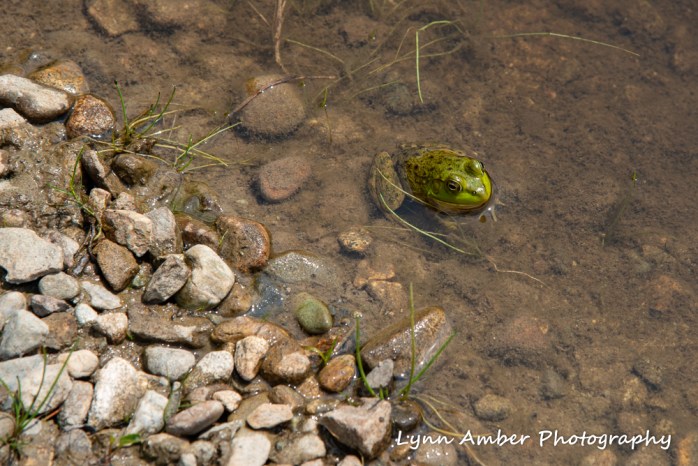
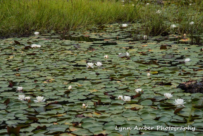
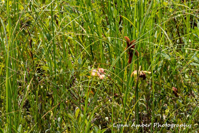
After my Monarch caterpillar fix, I drove over to the end of Duck Brook Road to hike the Witch Hole Pond carriage road loop. I knew that the pitcher plants were blooming and wanted to seek them out. Along the way, I scared this little creature at pond’s edge.
After my Witch Hole Pond excursion, I drove back home and hopped on the shuttle into Bar Harbor to pick up my package. I am convinced that the first two weeks of August are the most popular vacation times for the majority of folks worldwide. As I pushed my way through the throng of tourists, I was struck by the absolute calm of the harbor compared to the streets of Bar Harbor.