Lynn Amber - Travel & Photography
sharing my thoughts through words and images
Photography Tales 4 – Amateur Photography Primer 2

“Buying a Nikon does not make you a photographer. It makes you a Nikon owner.” – Anonymous
I love it! I couldn’t resist this quote! I’ve seen it written many times that it’s not the camera that makes a good photographer. That seems like common sense, right? A great picture can be taken with any piece of equipment – including a cell phone. I truly do believe this. But, as with any tool – understanding how it works and learning how to use it efficiently and effectively – is definitely to your advantage.
I’ve been without my Nikon for over 3 weeks now. It’s getting repairs to the shooting mode dial locking mechanism at a Nikon Service Center. I had noticed last Fall that the dial was no longer locking in place and it caused me to inadvertently shift the dial to a different shooting mode without realizing it. I had several wildly overexposed photos in the Badlands before I noticed the shift! Luckily, I had only taken several photos before I realized! I decided to just live with it until the thin piece of metal that has the shooting mode selections on it happened to fall off my camera several weeks ago. Luckily, this happened indoors and I heard it hit the floor. With that critical part now separated from the camera, I decided I needed to just send it away and get both items fixed.
In the meantime, my Canon Rebel T3i has gotten some use. The only lens I have for this camera at the moment is a 55mm to 250mm telephoto. My other wider-angle lens for the camera is stored with the trailer in New Hampshire. I’ve taken to using this telephoto lens for close-up photography, so I’ve been “focusing” on that and playing with my tripod while I wait for my Nikon to be returned.

Let’s continue with the “check-list” of settings that you should become familiar with and assess each time you pick up your camera.
ii. Mode Dial
After going through the Absolute Basics from my previous post, the next critical decision that you need to make is what shooting mode to select. The mode you choose will determine what choices you can make with regard to shutter speed, aperture and ISO – the main components that make up your exposure settings.
Look for the dial on the top of the camera that has settings such as Av, Tv, P, M along with an auto setting (looks like a green rectangle with an “A” in the middle on many cameras).


In addition, there are usually picture icons on this dial for some special shooting situations (or in the case of my Nikon, it has two options – scene or effects – which you select and then a number of special choices appear to choose from).
For many folks, this step is as simple as choosing the “auto” setting. But, the idea here is to expand your horizons, right? And move into the modes that give you more flexibility to alter exposure, control depth of field or capture moving targets?
When I first bought my Canon DLSR a few years ago, in addition to using the “auto” mode, I would use the Program mode, and often took advantage of the “special” settings. Canon’s graphics are fairly intuitive. The flower for close-up photography, the face for Portraits, etc. Let me emphasize that these settings do work, and you can take great pictures using the more automatic settings. It’s okay…if you are out taking pictures, and loving it – whatever works for you is the best thing to do!
In short, the Av, Tv, P, and M modes give you more manual control over your picture and exposure settings. If you are trying for a specific effect, such as freezing motion or blurring backgrounds for give your subject more focus, then you will want to learn and master these modes.

For me personally, I’ve made it a point to work mostly in the Av mode – as my default. This means that I choose the aperture setting on my camera, and the shutter speed is automatically set using the cameras internal light metering system. I can also choose the ISO setting in this mode. For me, with the types of photos I’m taking, controlling depth of field is usually most critical for me. I can quickly assess what it is I want to be in focus in a picture.
I’m starting to branch out now and spend more time experimenting with the M mode – or totally manual mode. I set the aperture, shutter speed and ISO. The Tv mode allows you to set shutter speed manually with the camera selecting the appropriate aperture for a proper exposure. In P, the Program mode, the camera sets both shutter speed and aperture while you still have control over the ISO. ISO can also still be altered by you when in any of the more manual settings – such as Av or Tv. The Program mode (P) can be helpful if you are uncertain of your subject – and want to be ready to quickly get a shot off in different types of situations.
When you are in the manual modes, you will see in the viewfinder an exposure meter. It looks like a ruler with marks – 0 (zero) in the center and then on either side – negative numbers and positive numbers. It depends on your camera brand how these are oriented. Notice in the manual (M) mode that when you alter shutter speed or aperture, it will affect the exposure meter. The object is to have the arrow/pointer at “0” or in the middle of the meter. What I’m liking best about the M – Manual mode is actually very useful. I like that I can quickly under-or-over-expose my picture depending on light.
With the Auto mode, the camera makes all the decisions and does not give you the flexibility to alter any other settings, such as ISO. You usually have the option also to use Auto with flash disabled. The programmed specialty modes are also designed to automatically set your exposure with no flexibility to alter just one component.
Play around with the mode dial settings to see how each setting works, and learn what you can control with each option!
iii. Adjusting aperture/shutter speed – in order to experiment with the mode dial settings, you need to know how your camera allows you to adjust the aperture and shutter speed. In most cases, there is a “main dial” that allows you to adjust aperture or shutter speed. On my Canon, there is just one main dial, with a button that allow you to toggle between exposure settings. On my Nikon, there is a main command dial and a sub-command dial. One adjusts the shutter, the other one adjusts aperture. That means I have to remember which dial adjusts which exposure setting! Again, it’s all about practice! Locate these dials on your camera and learn how to use them.


iv. Auto-focus setting – When you depress the shutter-release button on your camera half-way, the camera will initiate auto-focus. Continuing to depress the button releases the shutter and snaps the picture. There is usually a manual focus (MF) option that allows you to switch off the auto-focus and manually adjust focus. You will find the switch to toggle between AF and MF on the camera body, on the camera lens you are using, or sometimes both places. Some camera lenses that have auto-focus and manual selection settings also offer an additional option. My Nikon 24mm-120mm lens allows me to manually refine focus in the auto-focus mode. The setting is indicated by an M/A.


Make sure you know how your camera lenses operate. On my Canon Rebel T3i, there is no auto-focus setting on the camera body, just the lens. The lens I have does not have a manual override in the AF mode. Which means, I can damage the auto-focus mechanism if I try to manually adjust focus without switching to MF.
v. Auto-focus Mode and Focal Area Mode – there are a couple more decisions you need to make regarding how your camera reacts while focusing. Different camera brands will name these options in a slightly different way.
My Nikon, for instance, calls the three main focus modes – Auto-servo AF, Single-servo AF or Continuous Serve-AF. It is recommended that you stick to the Single-servo AF when shooting generally stationary subjects, and move to the Continuous-servo AF for moving subjects. When choosing which focus mode to use, you will also refine these settings even further by selecting the AF Area Mode. This determines where the main focus point will be established and you can see this in the viewfinder. You can set your focal point to a single spot, so that you can control the point where you want the sharpest focus, or set it to include a wider dynamic range – allowing the focus to shift for moving objects or subjects traveling across your scene.
Canon refers to these auto-focus mode settings as One-shot AF (single), Al Servo AF (continuous) and Al focus AF (auto). The focus area points are then adjustable in the more manual shooting modes – P, Av, Tv, or M – to refine the scope of your focal area.
I am finding that I take advantage of these refined settings more and more – and so I continuously adjust where my camera is set up once I assess my shooting situation.

We’ve covered a few of the steps in getting your camera set up for a photography outing – let’s review the parts we’ve covered on the outline so far:
Step 1: There’s a setting for that!
i. The Absolute Basics
a. Batteries charged and ready to go
b. File format chosen
c. ISO setting selected
ii. Shooting Mode Dial – select desired mode based on conditions and situation
iii. Know where to quickly adjust aperture and shutter speed for manual shooting modes
iv. Set auto-focus option
v. Select focal mode and focal area points – depending on your subject/situation
True to my word, I’ve already slightly altered the original outline – ha! I told you I would! I separated out the focal modes from the metering options – which I will continue with on the next post!
In honor of Chinese New Year – huí tóu jiàn!

Photography Tales 3 – Amateur Photography Primer

“I think this is the most exciting time in the history of photography. Technology is expanding what photographers can do, like the microscope and the telescope expanded what scientists could do.” – Richard Misrach
I was looking for a quote that would help launch the first part of my discussion on this topic, which is all about the “technology” of the digital camera. I’ve often heard people say that it’s the photographer who crafts a good picture, regardless of the camera they are using. And, to some extent, I believe that is true. But, I also believe that understanding the technological capabilities of your camera and using them to your advantage can play a huge part in producing a great photo.
Being stationary for a winter, and having some spare time, is allowing me an opportunity to delve a bit deeper into my photography obsession. I’ve spent the last two years experimenting with my new Nikon D750 totally on my own – (while traveling and working from our Airstream travel trailer) – learning the settings through trial and error, and consulting the manual when necessary. And, let me tell you, the manual is very dog-eared at this point! I endearingly call this “experiential learning.” 😊

While I’m feeling quite comfortable with the camera now, I’m definitely at a crossroads where I’m craving more knowledge – in one direction, I’m seeking a return to the fundamentals and yet, in the other direction, I’m yearning for an advancement of my skills and techniques. This seems contradictory, right? Return to the basics, but also advance? Sometimes, however, I do believe the road to improvement is rooted in a return to the basics. Over the past two years with my Nikon, I’ve been predominantly using the Aperture-Priority mode as my default setting, and while I feel good about my abilities in this realm, I’ve reached a point where it’s apparent to me that I’m not really using my camera to its fullest potential, or my own creative abilities. I feel like I’m stuck in one of those bottomless, Vermont mud-season ruts and spinning my wheels – holding my own but not advancing.
The turning point for me was my decision to sign up for some online photography courses while I waited out cataract surgery this winter. I thought I had developed a pretty good working knowledge of my camera functionality until I signed up for these two classes – one focusing on just the settings for my specific camera, and the other, titled The Fundamentals of Photography. I was very quickly humbled to learn how much I didn’t know about my own camera’s capabilities. Furthermore, while I do have a reasonable grasp of basic photographic fundamentals, I recognized the need to ramp up my game and start setting new goals to advance my skills.
My goal with this series of blog posts is to outline my journey this winter toward improving my photography. This written dialogue is really more for me personally than anyone else. I wanted a place to chart my course, and record my progress. But, I hope whoever is reading takes something away from what I have to say! 😉 Getting back to basics is enlightening, inspiring and energizing.
This will be a series of posts – each one going a bit further than the last towards expanding upon photographic principles – from basic concepts to more advanced methods. I’m writing the content based on the classes I participated in, online blogs I’ve stumble upon, and my own trial-and-error experiences. I find I learn best by reviewing, condensing and reorganizing my notes in written format, and then, transferring these written notes to the field as practical exercises. It is an incredible experience to revert back to the basics and start fresh – I’ve already gained traction and feel myself lifting out of those darn ruts in the road!
I highly recommend taking the time to get help from the experts – whether it’s taking an online class, buying a hard-copy photography primer or surfing the internet for expert photography blogs that offer advice and tutorials. I am most definitely not one of those experts, but I’m hoping to close in on them! 😉
In an effort to stay focused and organized, here’s a basic outline of the topics I will touch upon over the next few blog posts – with a caveat that this is a dynamic outline, and subject change at any time! This is my journey – I hope you enjoy the ride.
An Amateur’s Photographic Journey
- There’s a setting for that! – get to know your camera inside and out
- Master the basic photography principles
- Ramp up your photo skills with some advanced techniques
- It’s all in the composition
- Photo processing options
- Practice! Practice! Practice!
- There’s a gadget for that
Here goes! I hope in my effort to record my learning process that I also inspire others to take the next step toward improving their own photography skills. Most important, of course, is to have fun with the process!
An Amateur’s Photographic Journey
Step 1. There’s a setting for that!
Up until I purchased my Nikon D750, I had been using Canon cameras all my life – from the old 35mm film models up to my last Canon – the EOS Rebel T3i. It was a real learning curve when I switched to Nikon. All the dials and settings are physically placed in different places on the camera body, and sometimes, the nomenclature is different as well. I still own and use my Rebel T3i, so it’s a real challenge when I opt to switch for a day and use the Canon after perhaps months of using my Nikon. It’s critical to develop an almost blind-folded ability to alter settings and make adjustments when out shooting pictures, especially if you are using different brands of cameras!
I found this to be particularly apparent when I attempted to get some shots of the moon rising over Mono Lake in the Eastern Sierras two summers ago. I was using my Nikon D750 with a 24mm-120mm lens. (I had owned the camera less than 6 months, and was still in the infancy stage of acclimating myself to the settings.) I positioned myself along the shore, in a spot that I thought was ideal, and was getting ready to adjust my camera settings. Amateur that I was (and still am), I realized too late that it probably would have been smart to bring my tripod, and also a headlamp. It was dark enough that I could not see the settings on my camera very well and only getting darker! The tripod was back at the campsite and the headlamp was in the truck, parked too far away to retrieve. These oversights forced me to use settings that would allow me to hand hold the camera with minimal blur-inducing movement. And thus, limit my options.
In addition, I wanted to try adjusting the white balance manually, as I had read that sometimes this is helpful for producing better results. Since I had not practiced doing this before (I’d always had the camera set to Auto White Balance), I was struggling to remember just how to manually alter this setting on the spot. I spent some valuable time figuring out how to do it (in the dark, without being able to see very well!), and that resulted in less time to take pictures of the moon as it was rising. James Joyce said it best — “Mistakes are the portals of discovery.” My results on that expedition:


The next four shots, I experimented with slight shutter speed adjustments, and altered the white balance on the last one for some subtle, but noticeable results. I should add that technically, I was using way to slow a shutter speed for hand-held photography, but like I said before – live and learn.


The moral of this story is – know the settings specific to your camera and how to quickly adjust them. The only real way to do this is to practice, practice and practice some more. The following is a list of the most critical settings to master, in a prioritized order from the most basic to the more advanced functionality. I’ll take each one and go a tad deeper, starting with The Absolute Basics First, which will wrap up this post.
i. The Absolute Basics First
ii. Mode dial
iii. Adjusting aperture/shutter speed
iv. Auto-focus options
v. Adjusting focal points and metering
vi. Using single shot vs. continuous shooting
vii. How to use the timer
viii. Flash usage
ix. Live view and advantages to using this
This is my humble opinion on how to approach this – others may disagree. With your camera manual in hand, start with “i” and work your way down the list – experimenting along the way. If you are a real newbie to photography, while learning each dial and button – put together a glossary of terms that you are unfamiliar with along with their definitions. Don’t worry about what they mean just yet – that will come later – after you are able to navigate around your camera!
i. The Absolute Basics First
a. Learn how and where to load batteries and memory cards – this is pretty essential wouldn’t you say? Probably goes without saying, but…..😊 I will offer some sound advice. Purchase two extra batteries for each camera – and always have the extras charged and ready to go. There’s nothing worse than having your camera battery die just at the moment you need it most. Countless customers came into the Jenny Lake store last summer wanting to know if we had an outlet where they could charge their camera battery! And, my final point on this, always have extra memory cards as well – and make it a habit to ALWAYS check your camera card slot before heading out on a trail, etc. to make sure you actually have one in there! Why do I include this sage piece of advice – it’s happened to yours truly more than once, and I hope it never happens again.
b. Decide on the file format – JPEG vs. RAW. Most non-professionals will use a JPEG file format since it is immediately available for use and widely recognized. RAW images are larger in file size, and require editing and conversion to JPEG for use. Think of a RAW image as the digital equivalent of a “negative.” RAW files capture more detail and dynamic range and are typically preferred by professionals who want more flexibility with post-photo processing. I recommend starting out with a format such as JPEG – fine or JPEG – high quality. You’ll need to determine how your camera brand labels this. Look for Image Quality settings in your manual for the options available to you and where to set these in your menu listings. Personally, I am starting to experiment more with RAW files now that I have access to Lightroom software. Part of my plan to “up my game”!
c. Choose the ISO setting – using some basic guidelines. It’s important to use the lowest ISO setting possible for conditions. ISO measures the sensitivity of your camera’s image sensor to light. A lower ISO number will produce a photo with finer grain and increased sharpness. Often, this is referred to as “noise” in a photo. If you look at a photo taken at ISO 100 compared to a photo captured at ISO 3200, you will see a “grainy” appearance on the later. That is “noise.” ISO 100 is often used as the benchmark that you should try to achieve for clear, sharp photos. However, depending on conditions, it is not always possible. The following photos show a close-up of one of my orchids – one with the ISO set to 100, and the bottom one with ISO 3200.


A good rule-of-thumb is to start with your camera at ISO 100, and then start making adjustments depending on what you are trying to achieve. For now, just learn where and how to set this. In a later discussion in Step 2, I’ll go into more depth on ISO.
I think that about wraps it up for this post. I’ll continue with Step 1 of my outline – examining the camera settings and feeling comfortable with them – in my future installment. Up next, the all important Mode Dial and more!
Ciao!
And So It Goes….

A very musically talented friend of mine recently posted a beautiful choral rendition of Billy Joel’s “And so it goes” tune on her Facebook page. The song is a tribute to unrequited love, and an affirmation to try again. While this blog post has little to do with this heartbreaking theme, I thought the title of the song was appropriate for my current blog post. And, upon reflection, perhaps I do see some parallels to my current situation embedded in the lyrics of this song! My love affair with a self-imposed nomadic life-style has temporarily come to a halt, albeit with the promise of a new beginning in the spring! If you’ve never heard The King’s Singers version of this melody, here’s a link. Enjoy!
Since the End of September
We’ve been back in the east since the last week in September. If you’ve been following me, you know my last post ended with our arrival in New Hampshire. Our first priority was getting the Airstream settled into its winter home at my son, Leif’s, house in southern New Hampshire. While there, we spent some time helping him and his wife with some remodeling projects. It was so much fun to be with them once again, and lending a helping hand.
One of the highlights of the visit was assisting my daughter-in-law, Jeannie, with a dinner party she was hosting for some of her co-workers. The dinner guests were almost all immigrants to our country representing several different parts of the world – from Belarus to Syria to Sri Lanka. We enjoyed visiting with this very culturally diverse and intelligent group. Chatting with these folks was both refreshing and eye-opening. What if we all developed a more universal mindset – one that preserves the uniqueness of our individual nations, but also recognizes that we are all citizens of the Earth and, as such, dependent on one another. I consider everyone on Earth to have dual citizenship – to your native country and to the global community. If only we could all feel this way, and not lapse into self-indulgence and isolationism. What a world we could envision! Okay – enough philosophizing for now…..
Back in Vermont
Inevitably, we had to break ourselves away from southern New Hampshire and come home to Vermont. Why in the world did we choose to return to Vermont for the winter, you ask? I’m still trying to answer this very same question!


Truthfully, “re-entering” into a sedentary life, and facing the decision-making process we ultimately must focus on, was a bit unsettling for me. I did not adjust well! We came east and decided to hunker down for the winter at home for two main reasons – 1.) take care of some medical concerns, and 2.) make some potentially life-altering, but necessary decisions. The medical reason is by far the easiest to deal with – although that has been fraught with its own stress-inducing moments!
Those darn medical appointments!
I have experienced deteriorating vision for a couple of years now due to premature cataracts. While the diagnosis came just before we were heading off on our nomadic adventure, I was assured that it would probably be 20 years or more before I would actually need surgery. Well, it turns out that I’m one of the few who experience a more rapid decline of eyesight – and so it goes! Never in my wildest dreams did I think I would be facing cataract surgery in my early 60’s. Due to a few setbacks, my surgery is not scheduled until March, assuming all goes well with testing over the next month. The positive spin on all of this – I will be glasses free, at least for distance, for the first time since the 3rd grade, and everything should be completed in time for our next summer adventure.
Decisions, decisions!
Our other major challenge this winter is to make some critical decisions regarding our property here in Vermont. For some full-time RVer’s, there was no question they would sell everything before hitting the road, and their RV is their full-time home. For others, that path is not so cut and dry. In essence, they become part-time RVer’s with a physical home base. We know folks who are in both worlds – some who live full-time in their RV, some who will always have a sticks and brick abode, and others who postpone the decision to liquidate their property in order to be sure that the nomadic lifestyle suits them. We fit into the later group. We decided to hit the road, knowing we would have to return at some point and face the music – and so it goes!
Rver’s who decide to keep a home base have varied personal reasons for choosing this route. There are plenty of articles out there on this subject. Two main arguments include:
- Keeping a place close to family and maintaining the security of having a place to fall back on, a place for storing stuff and working on hobbies, crafts, etc.
- Using the property as a source of income
For us, we were not ready to make a decision to sell or rent, initially. We knew that if we waited until all the projects were done, and the time was right to sell – that the time would never be right. That’s just how we operate. (or at least how one-half of the duo operates, which impacts both of us!) It’s expensive to keep a home that you are rarely using – insurance, maintenance, utilities and taxes – all add up over the course of a year. Even though we work while traveling, it’s difficult to produce enough income to cover the cost of a property we are not living in full-time. Especially if that property is in a cold, northern climate, which has its own unique challenges. Add to that the stress of worrying about everything while you are away – and well, you get my point.
If one is retired and has a sufficient pension or retirement income that allows for travel and maintaining a property, then the decision is a little easier. If you don’t fit into that category, then keeping a home base becomes more problematic. Since we have not retired from pension-generating jobs, and are not ready to dip into our retirement savings, we have some soul-searching to do and some decisions to make moving forward.
In order to prepare ourselves for whatever decision we ultimately reach, there are some projects to complete, some minor remodeling/face-lifting that needs finished, and, here’s the scary part, some major cleaning up and out of all the STUFF we’ve accumulated over the past 18 years. So, that brings us to our other main reason for coming back to Vermont this winter.


Some fall photos of garden and indoor plants!
House Renovation and Projects
The weather was good when we first returned in early October so we prioritized outdoor projects and got to work. Some of the outdoor work includes:
- Finishing the cedar shingle roof on our garden shed and grading the soil around the perimeter
- Painting the walls and ceiling on our back porch and installing two new porch lights. I did this completely on my own, and am proud of my electrical wiring accomplishment 😊
- Weeding the front perennial garden, transplanting and removing plants as needed
- Continuing with completing the detached garage/workshop siding – working on the north side now. I pre-stained boards and Jim did most of the rest of this work, including installing a window on the second floor. He has started to work his way up the wall with siding, but then winter reared its ugly head (and I DO mean ugly!). It’s been the coldest winter we’ve ever experienced in Vermont. This put a halt to siding work until better weather.
- Completing an actual set of stairs to the second floor of the garage instead of using a ladder 😊 Way to go Jim – how did we live without these!
- Fixing some minor issues with the chimney (with some challenging weather issues that made for a very slippery roof!)
")

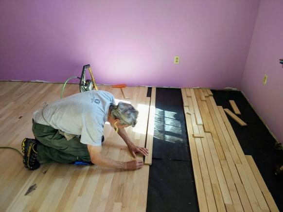
Eventually, we had to move completely indoors. We’ve been tackling some minor remodeling and painting projects. These include:
- Scraping off the awful “popcorn” ceiling we inherited with the house in the living room, dining room and kitchen. We have completed the largest room, the living room, as of this writing.
- Painting over the “fake” paneling that we also inherited with the house, in the living room. Along with this, we needed to improve some of the existing trim.
- Cleaning out and painting the pantry closet in the laundry room.
- Sorting out all our STUFF and reducing/eliminating the clutter that has accumulated over the years. This is by far the most time-consuming and difficult task.
What else?
It may seem like the above-mentioned task list is keeping us in constant motion. And, for the most part, that is true. We have actually found some time for other endeavors. As is usually the case, I have added more to my list than Jim. I have always been the one with more outside interests – so to speak. These time-consuming additional activities include:
- Working a full-time, seasonal job during the months of Nov/Dec in New Hampshire (for a major outdoor clothing and gear retailer). That significantly cut into my time for home projects until January. It did however pay some bills!
- Writing a couple of articles, one that was published so far, in a popular RVer’s magazine.
- Participating in two online photography classes – one that is on demand, and the other that is an intensive, live streaming class.
- Applying for potential jobs for the summer season. I’m happy to report that we had multiple options (and still more pouring in), and I have accepted a much-sought-after position that will keep us on the East coast this summer. Nice to have a plan mapped out so I can concentrate on other things.
- Researching other potential streams of income – you cannot imagine all the creative ideas I’ve entertained! Some may just come to fruition at some point in the near future….
- Listing items that need attention regarding the Airstream before our next trip
- Taking endless walks along my back country roads
Jim has been steadily getting many of the projects completed, but has also found time to enjoy some other fun activities.
- Starting a new cedar strip canoe. He generally putters about with this project in the evenings.
- Playing pick-up ice hockey at the community rink in town 2 -3 nights/days per week.


We’ve both enjoyed the time we’ve had this winter to visit with family and friends – some of whom are experiencing their own transitions and changes – in different ways from us, but changes nonetheless. Can’t wait to see what the future holds!
And So It Goes…….


")
Hockey day with family and friends over holidays!

Road Trip Journal – 9.14.17 to 9.26.17
I thought it would be fun to chronicle one of our road trips in a diary format to illustrate how we travel. Our current trip across country from Wyoming to Vermont is typical of the way we travel when we have a destination in mind, and somewhat of a timeline to follow. I say “typical”, but our road trips are definitely more atypical in nature!
When the time draws near to pull up stakes and move on, I start perusing the map a couple of weeks ahead of our departure date to get a rough idea of our route. I might even set up a spreadsheet with destinations each day, that includes mileage and potential camping spots if I’m feeling particularly energetic and organized.
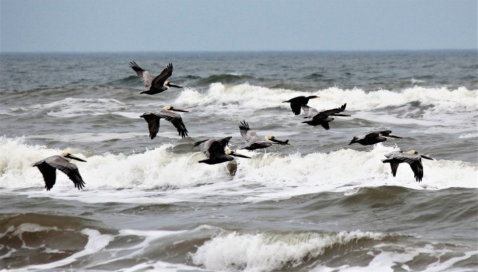
Our route is often determined by the points of interest I want to visit along the way. This is precisely how the start of this trip east evolved. I wanted to be sure to stop off at the Badlands National Park on our way, and in addition, hit some lesser known parks and monuments. I noticed there are several national parks/monuments in the Black Hills on the way to the Badlands, including Mount Rushmore. So, I planned on hanging out in the Black Hills for a couple of days in order to check these parks off my bucket list, and secure passport book stamps!
For this trip, I planned as far ahead as the Badlands, or about 5 days into our trip, which is probably pretty characteristic for us. We never make reservations, and we always remain flexible, altering our route along the way. Our route can change due to weather, traffic, camping options, points of interest – and, on this trip, I think we employed all of these reasons for changing course.
Throughout the narrative, I’ll highlight in orange text what I am labeling “Travel Tips”. I hope you enjoy these tidbits of information! 🙂 There are no great revelations here – just common sense observations about life on the road for us.
September 14, 2017
We left Colter Bay in the Grand Teton National Park , and headed east on Route 26 over the Togwotee Pass through the Bridger-Teton National Forest. We were headed for Route 25 and our first night’s destination of Douglas, WY.
The drive through the Bridger-Teton National Forest was breathtaking, and as we entered the Wind River Indian Reservation, we were flanked to our right by the Wind River Range. I chose the town of Douglas as our first stop for several reasons – it was a manageable 300 miles from Colter Bay, they have a “free” city park camping area, and it’s only a half day’s drive to the Black Hills from there. That would give us a mid-day arrival in the Black Hills, allowing for plenty of time to secure a camping spot the next day.
The Riverside City Park in Douglas is a great place to pull over and dry camp for a night if you are heading east from the Tetons to the Black Hills. I was amazed to learn that they even provide flush toilets, showers for campers and a free dump station. The park sits right on the North Platte River, and it was completely adequate for an overnight stop.


Although the park sits adjacent to a busy road, the traffic quieted down at night. To the left side of the park, there was a township garage and municipal complex which was reassuring. The park advertised regular security patrols, and we felt completely safe here.
September 15, 2017
We left Douglas first thing in the morning so that we could reach our next camping location early in the day, with time to get set up and still have daylight to explore. I stayed in a national forest campground the last time I traveled through the Black Hills, and with Jim’s senior park pass, we prefer to use these campgrounds if “free” options are not available. The Oreville National Forest CG was fairly central to all the attractions we wanted to see, and had pretty good reviews on Campendium, so that was my choice.
Travel Tip #1: I mention Campendium on my resources page. It is one of several websites/apps that I use frequently to find overnight accommodations. My other top choices are Ulitmate Campgrounds Public Campgrounds and FreeCampites.net. I’ve heard good things about AllStays – but it costs money, and I’m too cheap to pay for an app. When the free apps no longer work for me, maybe I’ll try it! I rely heavily on the reviews posted on these sites and this past year, I started contributing reviews as well.
With Jim’s senior pass, our camping fee was $9.00 per night – dry camping only – and that’s within my parameters for a night’s fee. Oreville was a beautiful, small campground. We had daylight overhead so that we could get sun on our solar panels but unfortunately, the sun did not shine too much while we were here! We ended up pulling out the generator each night to be sure our batteries stayed charged since night time temps dipped below freezing.
After getting all settled in, we drove to Mount Rushmore. This campground is only 10 miles from the monument. The Black Hills are known for extreme weather, and unbelievably, when we arrived at the monument we found it completely socked in with fog. I’ve seen the monument on two other occasions so we decided to just visit the Lincoln Borghum Museum here (which is awesome) before heading back to the campground.


September 16, 2017
My plan for our first full day in the Black Hills was to visit both Jewel Cave National Monument and Wind Cave National Park. We planned a loop that would take us first to Jewel Cave, and then to Wind Cave – returning to the campground via the Needles Highway. I had traveled the Needles Highway several years ago, but Jim has never taken this scenic route.
It was interesting to learn about the extensive underground limestone caves in this region, and while both parks offered guided tours only, we were willing to pay for just one tour. We decided to do the cave tour at Jewel Cave, which is reputed to be the third longest known cave in the world. It was a 1 ½ hour tour along a metal walkway that winds up and down through a very small section of the huge cave network. We were as much as 400′ below the ground, and negotiated over 720 stairs on this route. Well worth it! I’m constantly amazed by the natural beauty that surrounds us. Thanks goodness for the visionaries who took measures to preserve these national treasures.


Wind Cave National Park includes not only the underground caves, but a large tract of grassland and forest. Wind Cave is a drier cave, and claims to have over 95% of the world’s known boxwork formations. Boxwork is created before the cave and is revealed when the cave forms – and is classified as a speleogen. Most cave formations develop after the cave due to water flow and are called speleothems – such as stalactites, stalagmites, draperies, etc. Interesting stuff!!!! We enjoyed wandering around the visitor center here, and were planning to do a short hike – but most of the hiking trails were closed due to a recent wildfire. Bummer!


So, we settled for a driving tour and took Route 87 north through the park and then headed up into Custer State Park and towards the Needles Highway.
As we approached the Needles Highway, the darn persistent fog was still evident so we decided it was not worth traveling this narrow, winding road with little visibility! We headed back to the campground for an early dinner, and hoped for some clearing skies so we could once again try to see Mount Rushmore.
Early evening brought clearing skies at the campground, so I called the visitor center at Mount Rushmore to check on weather conditions. I was informed that the fog was lifting up there, and we decided to take our chances and attend the evening lighting ceremony at the monument. I had never seen the monument lit up at night, and I determined that fate had intervened on my behalf to force a nighttime viewing! The stars aligned perfectly, and just minutes before the light switch was turned on, the fog cleared.


It was a very moving experience and one I will remember with reverence. In these troubling times, with such a volatile political climate, to gaze upon these sculptures and what they represent gives me pause to reflect on the future direction of our country. These four great men were intelligent visionaries who cared about equality, conservation, and the principles of our constitution that guide us in our governance. This monument has become “a symbol of freedom and hope for people from all cultures and backgrounds.” It strikes me just how much at odds our current “leader” is with these great men. And, how insanely inferior he is to our past presidents. My hope is that the citizens of this country will look deep into their hearts and recognize that our current administration’s agenda is dangerous, self-serving and contrary to what our founding fathers envisioned. We need true representation in our Senate and House (instead of wealthy, self-serving congressman and senators who push forth an agenda bought and paid for by the wealthy) – and bipartisan cooperation to affect change in policy that brings us closer to the principles for which this country was founded. I have hope that we will once again move in the right direction before too much damage is done. Okay – that’s enough politics for now – just had to say my piece!
September 17, 2017
We planned on two nights in the Black Hills, and stuck to that plan. The Badlands are a short 90-mile drive from the Black Hills, giving us plenty of time to arrive at the dispersed camping spot I was anxious to try in the Buffalo Gap National Grassland. On the way, we needed to find a dump station, and fill up our fresh water tank. Here’s where that Cabela’s Club membership came in handy once again! Right off I90 in Rapid City, there is a Cabela’s store that offers an RV Dump station and potable water fill station. With a club membership, these services are free. Just present your club card at one of the cashiers, and they give you the code for the dump station. Perfect! It sure beats using the dirty, loud and busy Flying J facilities!
Travel Tip # 2: I use a couple of apps for locating dump stations throughout the USA that will allow you to pull in and empty gray and black water tanks – for free or fee. I use rvdumpsites.net and an app called RV Dump Stations Locator. I prefer the former as it seems more comprehensive. There are a few other options including Sanidumps and RVDumps, but I have not used these sites regularly.
We took care of business, then started east on I90 for Wall, SD. I had a pretty good idea how to find the dispersed camping location outside of the Badlands due to some great reviews and directions on Campendium but when we reached Wall, I noticed a sign for the Buffalo Gap National Grassland Visitor Center. It was early in the day, so we detoured over to this visitor center. First, I wanted to ask about the dispersed camping and, second, I wanted to get my passport book stamped!
It turned out to be a very worthwhile stop. I learned about a map app that I had not yet come across in any other blogs, or research. It’s called Avenza Maps, and it includes maps for all our national lands. I was able to download the app right there on my phone, and pull up the map for the Buffalo Gap National Grassland. You can download the map for use offline, and it has a locator so you can use the phone’s GPS to know exactly where you are on the map – helping to make sure that you are camping on public lands, and also that you are on the correct road. I used it to navigate to our dispersed camping spot. Worked beautifully! I love it when I find something so useful!!

In addition to some great help with this new app, the visitor center had a nice exhibit on grassland flora and fauna, and I learned that it is the only visitor center that deals specifically with our national grasslands. I was very impressed with the staff, and highly recommend stopping here and talking with them. I give them 5 stars!!!


Using my new digital map, I located the dirt road we needed to access off of Rt. 240 seamlessly, and we drove around until we found a fairly level spot perched high on the cliff overlooking the Badlands. I could not ask for a better view or location. While this is a popular spot due to its accessibility, we were a decent distance from other campers and everyone respected each other’s’ privacy. We did learn at the visitor center that you can literally camp anywhere in the grassland provided you can get your rig there. When we have more time, we decided we would be more adventurous and scope out some other more gently used areas. The grassland is immense and completely surrounds the Badlands.
We settled in to our spot and then took a long walk along the cliffs. Returning to camp, we proceeded to set up our chairs right on the edge of the cliff and enjoy the sunset with a glass of wine. Perfect evening! I did remark to Jim that perhaps he should not wander out in the middle of the night to water the grass — with the edge of the cliff just feet from our door! 🙂


September 18, 2017
This was an ideal spot to explore the Badlands. We enjoyed a lazy morning watching the sunrise as it spread its magic across the canyons.


We spent the rest of the day road-tripping through the park – stopping at all the overlooks (because Luke said this is what we must do!) and points of interest, engaging in the exhibits at the visitor center, and managing to also get in a few hikes. There are just a few marked hiking trails in the park and most are less than 3 miles round-trip.


Cliff Shelf Nature Trail


Notch Trail


Saddle Pass Trail


September 19, 2017
Today marks the beginning of the portion of our trip that is unplanned! We considered staying here another day, but it appeared that some bad weather was moving in (high winds and storms). Sitting exposed on top of a cliff did not seem like a smart idea! We were also still deciding if we wanted to stay on I90 and travel south through Pennsylvania via Dearborn to visit with family, or veer north through Minnesota, Wisconsin and the Upper Peninsula on our way to connect with Luke in Dearborn and keep to a northern route. Decisions, decisions!
We were still debating our options and preferences while we started out of the South Dakota grasslands and got underway east on I90. We were a mere 100 miles into our journey and the skies were clear but still, I decided to check the weather up ahead of us. One never knows when foul weather will spring up traveling across the bread-basket states. I was rather surprised to see that there actually was some serious weather a-brewing in eastern South Dakota. These storms had not appeared the evening before when I was scoping out weather conditions along the I90 corridor. Forecasters were predicting seriously high winds, golf-ball sized hail, and the strong potential for tornadoes.
This required some navigation decisions. Airstreams and large-sized hail are not a good combination. I’ve seen Airstreams with serious hail damage. I think in many ways hail worries me more than tornadoes!
Travel Tip # 3: I use NOAA to track weather and also the Storm app. The Storm app has proven to be very useful for predicting where the most severe weather is likely to occur, and it has given us good information on previous trips that helped us stay out of harm’s way. I am constantly tracking weather during our travels, and I highly recommend that everyone do this. We have altered plans and avoided some potential problems more than a few times.


The Storm app was telling me the most severe weather was going to be in a band developing and extending from Chamberlain, SD to Huron, SD and moving east. With that in mind, I started scoping out places we could stop for the day and wait out the threat. Just north and west of Chamberlain along the Missouri River, I found some Corps of Engineer’s campgrounds. Two were listed as “free” and one indicated a fee for electric hookups. Since Jim’s senior pass works at these federal sites as well, we opted for the electric hookup campground since we would be hanging out for much of the day. And, before leaving the next day, we could take advantage of the RV dump station here and potable water fill station. A bargain for $9.00 a night!
We pulled into Left Tailrace Campground located on the Missouri River on the back side of the dam. The office staff person was very welcoming and friendly. This campground appears to be favored by fisherman and boaters due to the Missouri River boat access ramp (and my astute observation that every other camper here had a boat and trailer parked next to their rig!). The sites were not very private but since it’s late in the season we were able to find a location away from other campers.


Travel Tip #4: If you are 62 or older and a US citizen, you are entitled to an Interagency Senior Pass with the federal government. When I worked at a national forest campground last summer, I was surprised by the number of senior citizens who were unaware of this pass. Two of the most important benefits: free access to all federal agency sites including national parks and recreation areas, and 1/2 price on all camping fees at all federal agencies including national parks, national forests, Army Corps of Engineers sites, and recreation areas. The pass costs $10.00 for a lifetime card. I’ve heard rumors that this is going to be increased to $80.00 soon. Be sure to keep the Army Corps campgrounds on your radar screen – we’ve stayed in some nice ones and they are usually not crowded.
It was while we were camped here, presumably out of harm’s way, that the tornado watch appeared on my storm app. The time was late afternoon, and the watch was in effect until midnight that night. This is the precise moment that I start to question my decision to pull off here. We had debated veering south across country to I80 since the weather appeared clear down there, but decided to stay on course and hope that the storm app accurately predicted the location of the front.
We watched the skies until well after sunset. Jim had read a sign posted in the restrooms indicating that sirens would sound in the event of a tornado. While that was definitely reassuring, we were in close proximity to a railroad and every time that damn train whistle blew I literally almost jumped out of my skin! The wind kicked up fiercely after dark, and for the entire evening we noticed a truly amazing phenomenon. The storm was literally just to our east and the skies directly overhead remained clear all night. We watched the lightning and thunderclouds from our relative safe distance and marveled at the accuracy of the storm predictions. At one point, I heard distant sirens (not train whistles!) and wondered what direction the weather was taking there.
We never got a single drop of rain. And, I managed to get a blog post up and published that night since I was too nervous to sleep! The tornado watch was called off just after 10:00 pm, the wind died down, and I was finally able to settle into a sound sleep with the assurance that all was well. The next morning, we heard on the radio reports of ping-pong sized hail, damaging winds, torrential rain and a few potential tornado touchdowns along the corridor to our east.
September 20, 2017
Since we were delayed most of a day due to the weather, we knew our next few days would mean some serious driving. We wanted to get to Dearborn by Friday so we could spend time with our son, Luke, during the weekend. We were also just plain tired of I90 and interstate travel. We made the decision to explore the “back roads” of Minnesota, Wisconsin, and Michigan on our way to Dearborn. I checked out some routes that intersected each state and chose my best options.
Just over the state line into Minnesota, Route 23 heads north and east traversing through the heartland of the state. What an incredibly pretty drive it turned out to be! A bonus for me was discovering the Pipestone National Monument in Pipestone, MN. When we exited I90 and headed north, I had noticed the familiar national monument symbol on the map and decided it was just the right place to stop for lunch and take a break. We toured the visitor center, read about how the Native Americans quarried this unique stone for use as pipes, and watched Native American cultural interpreters at work carving the soft, red stone.


I was struck by a quotation credited to Lame Deer, from the Lakota nation:
“All of nature is in me, and a bit of myself is in all of nature.”
He believed that “man’s heart, away from nature, becomes hard; he knew that lack of respect for growing, living things soon led to lack of respect for humans, too.” (from a quote by Luther Standing Bear, Lakota). So very true…….
We hiked the short interpretive trails that wind past the ancient quarries still used today by the native population for acquiring pipestone for their craft.


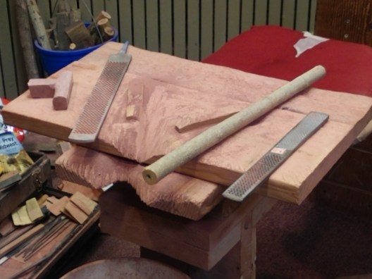
Jim talked with one of the native carvers for quite a while – discussing such things as chisels, and files and other tools of his trade. This carver was carrying on a tradition handed down to him from his ancestors. He is a fourth-generation carver and sculpts in the traditional way with hand tools only.
We got a little carried away with this beautiful, spiritual place and, 2 hours later, decided we better get going! Since we tarried too long at the monument, it meant we were not on target to reach my initial destination – a free camping spot along the St. Croix National Scenic Riverway. I had read that the County O Landing offered 5 dry camping spots on a first come basis. Pulling into a spot like this well after dark was not to my liking, so I consulted my camping apps once again and found a county fairground in Cambridge, MN. We could get there just after sunset if all went well.
Route 23 through Minnesota reminded Jim of the rolling hills of Chester County, PA where we both lived for many years. The difference was the expansive crop farms getting ready for harvest – corn, soy bean, and occasionally, what I thought must be sugar beet fields. I would characterize the farms we passed as the “tidiest” I’ve ever seen! We thoroughly enjoyed this scenic route. There was little to no traffic except when we came to a small town, and even then, traffic was minimal. It was a joy to fuel up in these small towns compared to the hectic pace of the interstate truck stops.
Travel Tip # 5: Get off the interstates when you can and discover the advantages of traveling at a slower pace! You will be surprised by what you find. I remember a trip long, long ago across I80. I was heading east for the summer from college in Boulder, CO and traveling with two friends. One of these friends had just purchased an old VW Bus that she was driving back to New Jersey. She was no mechanic and someone definitely took advantage of her. We made it as far as Russell, Kansas. The engine was shot, and we had to wait a couple of days until the Greyhound Bus came through town. A local family noticed our demise, found us a place to stay and invited us for dinner that night. Their hospitality was touching. The next day, that same family took us on a tour of the countryside around Russell (hometown of Bob Dole, by the way). I was so surprised to see rolling hills, and trees and a huge lake where locals picnicked and swam. They wanted us to see that there was more to Kansas than I80. Like I stated above – get off the interstates!
The county fairgrounds in Cambridge, MN were located on the eastern edge of town. I imagined a place surrounded by countryside but, obviously the town of Cambridge has seen some sprawl and the fairgrounds were actually surrounded by new shopping centers full of big box stores! Do not follow Google map directions when arriving at the fairgrounds. We did and ended up in the parking lot of the big box store next door. Turning off Route 23, take the road to the right in front of the fairgrounds and the entrance gate is on the left. It was just about dusk when we arrived, and there were no signs indicating the camping procedure. We saw a line of pull-through sites and stopped along them to check things out. The fairground website indicated camping rates for both dry-camping or hook-ups and we wanted the dry-camping sites.
I walked along some sites where there were multiple RV’s set up hoping to find a camp host. I did eventually see someone outside and asked about procedure. I learned there is an office as you enter the gate (we had not noticed this – it was dark, after all), and a caretaker who lives in the modular home right in front of the gate. The office was closed, and it did not appear anyone was home. The house was dark. As we left the house and headed back through the gate, we heard someone yelling. The elderly caretaker had seen us from inside his house, and appeared at the side door in a disheveled plaid bathrobe and stocking feet! He was a scruffy old character but not fussy, and told us to camp anywhere and he’d check with us in the morning.
We found a level, grassy spot that did not require unhitching and the night passed uneventful. We never did see the caretaker in the morning. My attempts at ringing his doorbell failed to produce him, so I deposited some money in an envelope and put it in the mail slot on the office door.


While this county fairground was not as quaint and “country” as the one we stayed at in Ohio, I’m still inclined to seek these places out as one-night stopovers when it is an option. As I stated in a previous blog posting, I’m happy to support local county fairs with my camping fees.
September 21, 2017
We got an early start from the fairgrounds for two reasons. We did not have to unhook the trailer – so in effect, we just needed to get in the truck and go. And, we needed to put some miles on the truck to get to the Upper Peninsula by dark. I decided to take Route 8 across Wisconsin since that would put us onto Route 2 across the southern part of the UP. We entered Wisconsin shortly after leaving the fairgrounds. The contrast in the countryside between Minnesota and Wisconsin was dramatic. Almost abruptly, the farms switched from crop farming to dairy and orchards. And, instead of being almost exclusively farmland, there is more diversity in land use in this part of Wisconsin.
Our ritual when we are traveling is simple. Jim must always first have his cup of black tea before he does anything else. I get up first, make the tea for him and then brew my coffee, which I put in my travel mug and save until we are on the road. While he is drinking his tea and waking up, I get the inside of the trailer ready for road travel. Once he finishes his tea, I make him a coffee for the road, and then finally, we are on our way. We stop to fix a quick breakfast after we’ve been on the road a couple of hours. We have settled into this routine and it seems to work for us!
On this particular day, I was getting a powerful urge for a “doughnut” to have with my coffee. About the time we would normally pull over for breakfast, I announce to Jim that I want to find a bakery. Over the past few years, this self-proclaimed baker has virtually given up sugar and sweets. But, every now and then, usually after we’ve been traveling for a couple of days, I get a hankerin’ for a pastry! And, I don’t mean the Little Debbie or Sara Lee variety or even Dunkin’ Donuts. God forbid! I want a real pastry from a real bakery. This is when I love google maps. We are traveling Route 8 and passing through many small towns. I’m convinced there must be a real bakery in these parts – or at least an orchard with apple cider donuts a la Northbrook Orchards in Chester County, PA.
Jim knows I mean business with my “doughnut declaration”. He’s been through this before. And even though he is not a doughnut aficionado, he knows better than to thwart my efforts to find the perfect doughnut shop. To my utter amazement, when I punch in “bakery near me” in google maps I find that the very next town of Barron, WI has a bakery. And, the Google Reviews are awesome! Yes!! This was going to be easier than I thought. Barron Bakery is indeed a real bakery.

Walking into this small store, I am overcome with the smells of freshly baked pastries, bread and doughnuts. What a heavenly treat. I decide on a cinnamon roll for myself, and I buy Jim three plain cider doughnuts as he requested. They have freshly brewed coffee, so I forgo making my own in the trailer, and indulge in theirs. I’m not quite to the $5 minimum I need to use my credit card so I’m forced to also buy a 3-pack of fresh blueberry bagels. My grand total is just over $6.00. Now that’s a bargain! I savored every single bite of that cinnamon roll while sipping on my hot coffee!
After the bakery, the day was fairly uneventful except for our bird sighting. We were driving along through farm country when Jim spotted these massive birds in a field to our right. I watched all summer long for Sandhill Cranes in the Tetons. We heard them near Oxbow Bend, and also on the forest road to Grassy Lake but never saw them. And, here they were, on the side of the road in rural Wisconsin – several Sandhill Cranes up close! Unfortunately, there was no shoulder to pull over so I could not get a photo but that’s okay. Just seeing them made my day!
As I’ve said before, we avoid RV parks and private campgrounds whenever we can while traveling. Our preference is the quiet and solitude of a national forest campground, or dispersed camping. I knew that the Hiawatha National Forest was just on the other side of Escanaba, MI and the distance from Cambridge, MN was about right for a long day’s drive. I used my Ultimate Campgrounds Public app to locate some NF campgrounds here in the Upper Peninsula. There were several choices and I opted for the Little Bay de Noc CG since it was positioned right on the Bay de Noc. I looked the campground up on Campendium to see if anyone had posted a review. Turns out, some folks who write a blog I follow, WatsonsWander (fellow Airstreamers) had stayed here several years ago, and gave a favorable review. That was good enough for me.
We found the campground easily, and chose site # 33. It was open, with few trees, and right on the water. At $9.50 a night with that trusty senior pass, this was a perfect spot and very well-maintained with spacious, private sites. We enjoyed a nice sunset and a good night’s sleep.


September 22, 2017
Today would be our longest travel day for this trip. We had 425 miles to go to reach Dearborn. The trek across the Upper Peninsula on Route 2 was uneventful. The population up here is sparse, and there is quite a bit of national forest land, so the drive was easy – long, straight roads with no traffic. There are spots along the route where the road hugs the coastline of Lake Michigan, and we chose one of these places with a nice scenic rest area to stop and take a break and eat breakfast.
When we were approaching the famed Mackinac Bridge, I started to see signs indicating the toll for the bridge. Uh-oh…..we had completely run out of cash and kept forgetting to find an ATM where I could use my credit union debit card. We were hoping that the toll booths accepted credit cards! We decided to just go for it and pull up to the booth. Lucky for us, they did – not sure how we would have gotten turned around on the bridge!
Travel Tip # 6: What’s in your wallet? Well, there better be some cash! I’m not sure how we managed to get so low on actual cash but we did. I generally don’t like to use debit cards so I’m not real savvy with them, and usually cannot remember my pin. We like the convenience of credit cards for tracking expenses, but when traveling I highly recommend a little bit of cash. We did find that all toll booths on our route accepted credit cards but I’m sure there’s bound to be exceptions.
Once we crossed over the bridge and picked up I75 towards Detroit, the trip got a little boring. I decided to pull out my laptop and get some writing done, and before I knew it, we were close to Dearborn. Our timing was perfect – arriving in the Detroit metropolitan area right at rush hour! Nothing to be done but grin and bear it! Thankfully, we were headed in the opposite direction from most of the traffic! I guided Jim on and off several major highways as we narrowed in on Luke’s place. Luke had assured us that we could park out on the street in front of his house, and we were hoping this was true.
Turns out, he was right! We had to raise up one side of the trailer with 2” boards under the tires to get leveled up (which is nothing really), and we had to disconnect the truck and park it up the street so we would not block anyone’s driveway. Easy! None of the neighbors seemed to notice an 8.5’ wide by 25’ Airstream parked on their street. We did not exactly blend in – but no one cared. 🙂


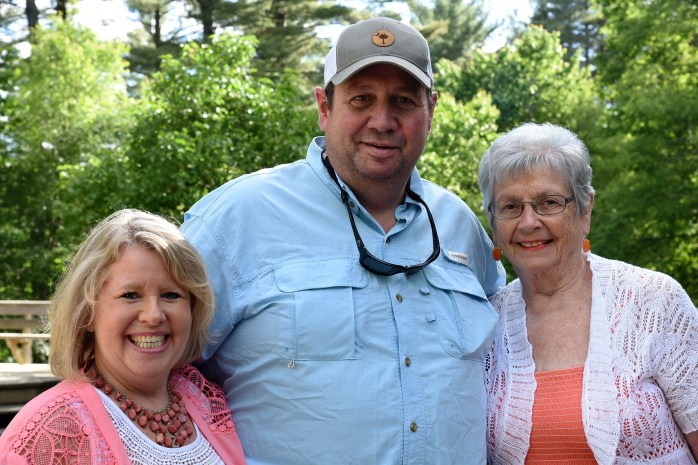
Luke’s girlfriend Sharon was still visiting while on vacation from her job in Shanghai, so it was a special treat to spend time with her as well. They cooked us up some dinner that night (complete with Sharon’s Asian cuisine and Luke’s homemade Strawberry-Rhubarb Pie) and it was all delicious.
A boyhood friend of Luke’s was also in town for the weekend. Anthony is a freelance artist who specializes in lighting design for theater and stage. He is currently touring with Counting Crows and had a show in Detroit Saturday night. He joined us for dinner, and it was great connecting with him. We shared stories, and talked for hours.
At one point, Sharon started describing some of the work she is doing with virtual reality and augmented reality games. This led to experimenting with some Virtual Reality programs. It was a blast! Anthony really got into tackling this one game, and we enjoyed watching him learn the maneuvers and master the game. I wanted to experience using the VR headset but the game Anthony was playing was more than a little advanced for me! Instead, Sharon hooked me up with a VR tutorial that shows the basics of how to use the hand triggers, move around, and engage in this world. I’ve never been a huge fan of computer games and am often very critical of those who spend too much time engaging in them. It’s always good to keep an open mind, though. I’m glad I gave VR a try. I have gained a new perspective on gaming.
September 23, 2017
The east coast is in the middle of a tremendous heat wave. Temperatures in Dearborn have been in the 90’s and humidity high. It’s been a while since Jim and I have endured this type of weather and I’m reminded why we have been traveling in the west the past year!
Luke planned the weekend for us and it all included indoor, air-conditioned activities. We were all for that! On Saturday, we drove to Detroit and visited the Detroit Institute of Art. It was so refreshing to spend time in an art museum again. I love seeing works by familiar artists, but also enjoy discovering unfamiliar painters.
I was especially happy to discover that this museum houses the room-size mural by Diego Rivera titled The Detroit Industry Murals. Luke was anxious for me to see it. I spent 8 years working among the murals of his Mexican contemporary, Jose Clemente Orozco, at the Baker-Berry Library at Dartmouth College. It was fantastic to see Rivera’s mural and compare his style to Orozco – so similar in many ways. These artists both gained fame during the Mexican Mural Movement that evolved after the Mexican Revolution. Rivera was crafting this mural in Detroit about the same time that Orozco was working on The Epic of American Civilization at Dartmouth – the early 1930’s. Both murals are now designated as National Historic Landmarks.


After leaving the museum, Luke wanted to show us some quintessential Detroit landmarks – including the famed Woodward Avenue. This is Detroit’s “main street” and is representative of Detroit’s historic automobile industry. The avenue was the place to “cruise” and be seen. The Federal Highway Administration has designated it as the Automotive Heritage Trail in the National Scenic Byways Program.


We left the city, and headed back to Dearborn to find a spot for some dinner. We settled on Brome Burger’s in Dearborn. I’m not a huge burger fan, but they had an organic beef option and I settled for the Mexican burger. I can eat anything if it has avocado on it! It was actually a very delicious meal.
I am always attracted to gardens, and the restaurant had an outdoor seating area with a lovely courtyard garden containing a sculpture designed by local high school students to promote multicultural awareness and a sense of community through art. Beautiful!


September 24, 2017
Sharon flew back to Shanghai early Sunday am, and after a leisurely morning, Jim, Luke and I headed off to yet another museum. The last time we visited Luke we toured Greenfield Village with plans to also visit the adjacent Henry Ford Museum. We did not have time for the later, so Luke wanted to make sure we got there on this trip.
The Henry Ford Museum of American Innovation and Greenfield Village is the largest museum complex in the United States – interesting fact! Henry Ford’s vision for the museum was to preserve items of historical interest and portray the culture of the Industrial Revolution through his collection of all types of memorabilia and everyday things such as furniture, cars, tools, machinery. The museum exhibits capture the very heart of American life creating a timeline through which we can view the evolution of our country. I was struck by some of the unusual items that Ford managed to procure for his museum.


We spent the entire afternoon in the Ford museum, and by 5pm we were tired and hungry. Dearborn, MI has a significant middle-eastern population and Luke has been enjoying their cuisine. We opted to try out a small restaurant he had yet to patronize that specializes in shawarma, a Levantine meat-based sandwich. Luke thought it would be fun for us to try this since we had never been exposed to it before. I chose the Chicken Shawarma wrap which consists of shredded chicken, a yummy garlic sauce, and pickles all wrapped in taboon bread. It was “out of the world” good. Along with a Greek salad, it was the perfect blend of tastes and spices. And, all for a whopping $10.00 tops.
Travel Tip# 7: Enjoy the local cuisine while traveling whenever your time and your wallet permits. You will be pleasantly surprised by the friendliness of the people and the quality of the food. And it does not have to be a high dollar, white tablecloth kind of place. We have stopped wasting our money at the more expensive establishments and seek out more modestly priced options – often finding them to be better food and a better bargain for our money.
After eating, we survived a hilarious episode in the supermarket. We needed to stop and get a few provisions for our pantry, and Luke also needed a couple of items. Once we had collected our food in the cart, we got in line at the checkout. I realized it was one of the self-checkout stations and decided to change lanes. I’ve always avoided the self-checkout lanes. Luke encouraged us to stay put and “experience” it, so we did. We let Luke check-out first so we could watch and learn. We managed the “watch” part of the lesson but did not “learn”. We just could not seem to get it right. I was scanning the groceries, and Jim was bagging. But, he just could not seem to get the sequence down and kept picking up the bags. The checkout station terminal did not like this. The darn computer kept locking up on us, requiring a person to come over and “unlock” the terminal so we could continue.
This happened multiple times despite Luke’s attempts to explain the bagging procedure to Jim. In all fairness, I kept hitting the wrong button whenever there was a bagging error so I was just as guilty of screwing up. We had a long line of people behind us waiting to checkout, and it was one of those moments when the situation is so absurd that I started laughing at our comic attempt to master this seemingly easy process. And, I cannot stop laughing. I literally had tears rolling down my face, which inspired Jim to start laughing. Meanwhile, Luke is trying to fade into the background and pretend he does not know us. 🙂
September 25, 2017
On Monday mornings, the garbage trucks pick up trash along Detroit Street and all vehicles must be off the street by 9am in the morning. In the early evening the night before, we watch as all the neighbors emerge from their houses, roll out their trashcans and start jockeying their cars into their driveways.
Our plan is to rise early, hook up the trailer and head for the Ambassador Bridge in Detroit. We would get an early start on the day’s drive across Canada and avoid the garbage trucks. A win, win situation for us and them. We left around 7:30 am and expected some traffic delays that never materialized. When we approached the bridge, the traffic pattern was a little confusing. We realized there was a toll for the bridge and the lanes all indicated either you needed a pass, or cash. We could not tell if there was an actual person at the booth or if you just needed to deposit money.
Remember that previous travel tip about making sure you have cash? I had meant to get some cash over the weekend but somehow, I just didn’t get it done. I motioned for Jim to pull over to the side, and I got out of the truck and ran up to the toll booth to scope out the situation. There was indeed a person in the booth and I sheepishly asked if she accepted credit cards. “Yes”, she said. Saved again! I gave Jim the “thumbs up” from the booth and we were on our way.
Going through customs at the border is always interesting for us. For some reason, it usually makes Jim nervous. Maybe he thinks he is going to say something wrong? I’m not quite sure why the anxiety crops up. But, too lessen the pain, we usually actually rehearse what we are going to say in advance to avoid any surprises. Seriously! I wonder if anyone goes to this extreme! You just never know what is going to come out of Jim’s mouth! Sometimes he starts rambling like he has to give his whole life history instead of just answering the question with minimal embellishment. In our confusion over the approach to the toll bridge, I forgot to initiate this pre-border conversation.
We get to the border station, and after the normal questions about citizenship and residence, the guy asks Jim how long he plans on being in Canada. Now, this is where it gets interesting. Withour hesitation, for some reason, Jim blurts out that we will be staying overnight in Canada. I look at him in disbelief. We’ve done this route several times and it is literally a 4-hour maximum drive from Detroit to Buffalo across that little piece of Canada.
I lean forward and inform the customs officer that we are only in Canada for a few hours, and proceed to answer most of the additional questions. When he asked Jim if he knew the license plate number on his truck, I thought we were in for it. He’s never memorized his plate number, and I know this. I quickly spout off the license plate number, and finally the questions cease and we are on our way. I remind myself to rehearse our answers before we reach Buffalo. 🙂
Our destination for the night changed part way through the day. I had planned on trying out a county fairground in New York just off I90. When I realized that it is actually a speedway, I reconsidered and opted for Cayuga Lake State Park. We have camped here before and even though it’s above my nightly fee parameter, we settle on it. We found a nice spot here, fixed some dinner and, since we had electric hookup, we could run our fan all night. It was still oppressively hot, and the fan helped cool down the trailer.
September 26, 2017
From Cayuga State Park, we could have made it to Leif’s house in southern NH this day but we decided to take it easy and do the trip in 2 leisurely days. The morning started out good. We cooked up some egg frittatas for breakfast and charted our route. We chose to avoid I90 once we started east from Buffalo and instead, we drove the scenic Route 20 byway all the way across upstate New York.
While looking over the map during breakfast, I noticed that there is a small town called Amber that sits on a small lake just to the east of the finger lakes. Jim was intrigued by this, and we decided to detour over to the town and check it out.
We were traveling along and missed the road that leads to Amber (Amber Rd). We saw the road sign too late to make the turn, so we continued on until we could find a place to turn around. Just a mile or so later, we came upon an orchard with a large parking lot and storefront. It reminded me of Northbrook Orchards back in Chester County, PA. We pulled in and did some shopping. I asked the cashier if she knew anything about the history of the town of Amber. She did not, but told us about a great general store there and a cemetery. We left with some apple cider doughnuts, a small blueberry pie, some gala apples and red potatoes. What a nice find!


We set our sights on finding the cemetery. We wondered if there were any Amber’s buried here. It’s a very unusual last name and we’ve never met anyone outside of Jim’s family with the surname. Perhaps the town was named for an early settler by the name of Amber! We parked along the side of road by the cemetery and wandered around among the old gravestones for about ½ hour. We found no Ambers. ☹ Oh well, it was still a nice detour!


Between our stop at the orchard and the stroll through Amber Cemetery, we had used up some time. We needed to get back on the road and make some miles. I was aiming for Woodford State Park just east of Bennington, Vermont for our next night’s accommodations. We were about 150 miles away and it was early afternoon. Plenty of time to arrive before dark.
Shortly after leaving the town of Amber, we were driving along Route 20 enjoying the scenery. This section of the road was very curvy and hilly – short but steep hills. It was another brutally hot day. Jim was traveling in tow mode most of the time to save on brakes and pamper the engine in the truck. We were starting up yet another long hill when Jim let out an almost imperceptible “Oh, no”. The engine light had come on and the truck started losing power. We limped up the hill, pulled over to the side of the road and shut the truck off. He was worried about starting down the next hill and having the truck shut down completely.
This same phenomenon happened to us a year ago in California. Going up a hill towing the trailer in extreme heat, we lost power. The problem then was the fuel filter. Jim had changed the fuel filter before we headed east on this trip, so it seemed unlikely that it was causing this issue. Last year in CA, he purchased an inexpensive code tester so he could pinpoint the engine light problem while traveling. We pulled that out and plugged it in. It spit out the following code – P0087. I have learned to look up these codes on the internet, and quickly found references to this code issue. It was indicating low fuel pressure, which could be a clogged fuel filter. Maybe we just got a bad batch of fuel somewhere?
Jim searched the back of the truck for his spare fuel filter while I located an auto parts store and called them. (just in case Jim did not find the filter) He found the filter luckily, but we were not in a good place to change it out.


About ½ hour had passed since we first pulled over, so he started up the truck to see if the engine light was still on. The engine light remained off – which had also happened in CA and we were able to drive another 100 miles to our destination. So, we used this opportunity to continue down the road and look for a more level spot to work on the truck. After several miles, we came upon a roadside rest area and pulled over. Jim got to work. He figured he would go ahead and swap out the fuel filter as a safety measure even though the engine light remained off.


We realized there could be some other issues causing the low fuel pressure from some conversations I read online regarding the P0087 code and Chevy trucks. It seems there was a service bulletin relating to Chevy Silverado Classic trucks between the years 2001 – 2007. We have a 2007. The rubber fuel lines had a tendency to collapse under hilly, hot conditions while pulling a load. Hmmmmm….sounding suspiciously like what happened to us. The age and mileage on the truck can also indicate potential “tired, worn” injectors. A costly proposition. We will need to investigate this problem more once we are home.
Travel Tip # 8: Never forget Murphy’s Law and the probability that something might go wrong. We were only a half day’s drive to our final destination of southern NH. We had traveled close to 2400 miles without a single mishap. Be prepared. Jim always travels with multiple replacement parts including filters. And the tools he needs to work on the truck. He’s a decent mechanic and it saves us lots of money when he can do routine maintenance and common fixes on the road.
By the time we were back on the road, we had lost another 2 hours. We would not be arriving at the state park in Vermont before dark. With no other good options, though, we forged ahead and hoped we would make it.
We ended up arriving at Woodford State Park well after dark. It has been a long time since we had to back into a campsite at night, and let me tell you, it was dark! The office was closed, of course, but I grabbed a map of the campground from the outside information rack and we turned into the first loop. At a sharp, left bend in the loop road, there was a campsite on the right that was roomy and the access was perfect for us. We got out of the truck to scope it out with our headlamps. Jim could pull up the road and back straight into the site. I guided him by flashlight and the process was flawless. The sight was level enough that it required just a couple of boards under the left wheels. It was a long day and we were tired!
September 27, 2017
The Woodford State Park is your typical, rustic Vermont state park campground. The sites have no hook-ups, are gravel/grass, and have enough vegetation between sites to afford a degree of privacy. We did not have access to the lake from our site but you could see it through the trees.
Since we were only about 85 miles from our son Leif’s house, we slept in and had another good, nourishing breakfast. I took the time to walk the short hiking trail over to the boat launch area and beach. Jim and I also walked around the other campground loops just to see the rest of the sites. The facilities were a little tired and Jim opted not to use the showers when he tested the water and found it was not getting hot! Maybe this time of year they turn off the hot water??


Our last day on the road unfolded without incident and we arrived at Leif and Jeannie’s about 2 pm.
Ah, nice to be settled for a spell!
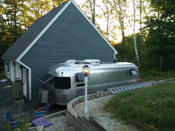
Travel Tip #9: Moochdocking is a form of boondocking where you take advantage of family and friends and stay on their property for free. It’s a great way to visit with folks and still retain your mutual privacy and personal space. Just remember to NOT overstay your welcome! 🙂
Somewhere Over the Rainbow

Somewhere over the rainbow way up high
There’s a land that I heard of once in a lullaby
Somewhere over the rainbow skies are blue
And the dreams that you dare to dream really do come true.
Our last evening in the Tetons, we were driving back from Jackson after running some last-minute errands. I had to return a book to the Teton County Library, and Jim needed to drop off some used engine oil to a well-drilling outfit in town who uses it for heating their shop.
The sky was turbulent – storm clouds interspersed with blue sky and it was magical. We drove through a rain cloud near Antelope Flats and to our right was the most amazing double rainbow – and me without any cameras in the truck! It almost seemed symbolic that this appeared on our last day.
I was reminded of one of our favorite songs – Somewhere Over the Rainbow – from Wizard of Oz – as sung by one of my favorite artists, Eva Cassidy. Her rendition of this classic tune is moving to say the least. We are still chasing our dreams, and even though there are good times, and not-so-good times – I still have no desire to trade my life right now for anything else. Occasionally, those darn flying monkeys appear to try and dampen my spirits and take me hostage (that part of the movie always scared the living daylights out of me) but, somehow, I fight them off and prevail just as Dorothy did!
Yes – I still have a long way to go to make this work financially, but I’m determined to figure out a way. This past summer has been an incredible experience on many levels – albeit, not profitable!
REFLECTIONS FROM THE SUMMER
We discovered that we still love the Tetons, even though it’s been 36 years since we were last here. And that we thoroughly enjoyed our summer here exploring this beautiful landscape.
We realized that we really do not love the town of Jackson, though. Too posh, and expensive for our taste. The western Idaho-side of the Tetons is much more to our liking – quieter and less pretentious. We did like some specific things in Jackson – the Snake River Brewery offered incredible food and good local brew, and the innovative Vertical Harvest greenhouse knocked our socks off.
We have a clearer idea of what workamping positions we PREFER – and that we differ on this to some extent! Which is okay. Last year, we worked for the same company, but our jobs were different. We did not work directly with each other all day long. This year we worked together, and while we do love each other, we discovered that working together all day, every day is a bit much at times! We simply need our days off to coincide. Lessons learned! Would we work together again – yes – but we’d prefer to find positions that are more agreeable to our interests if it still works to have our days off together.
Jim learned that he is certainly not enamored with the retail world! I do believe that he survived the summer by enjoying the comradery of the construction crews who were on site at Jenny Lake doing restoration work on the buildings and grounds. On mornings when we opened the store, after Jim had the coffee brewing, he would wander outside, and yell over the fence – “coffee’s on!” We gave the construction folks free, unlimited coffee – and they really appreciated this. He made some friends with these kindred souls, and may even have a possibility of working with them next summer.
While the retail aspect of the work could be repetitive at times, the thing we both enjoyed most was talking with the people who visited the store. I am, of course, all about information (being a former librarian) and I loved interacting with folks and helping them make the most of their stay in the Tetons. (Even though, technically, this was not my job – I took ownership of this!) Jim loved this part of the job as well – especially if his efforts helped someone out – i.e. the bike touring guy who rode in late one evening, and thought the campground was full – but Jim let him know that there was a special section just for hikers and bikers that always had room. Jim was also the recycling guru – constantly vigilant with regards to how visitors were disposing of their bottles and cans. And, he was relentless in his effort to educate the public on this subject!
We do believe that working at the Jenny Lake Store was indeed the best place to be within this company – with the best folks working there – thanks John and Sharon, Rick and Gloria, Mike and Tammy, Bill and Sandy, and Willie and Irene. Ask me in person why I feel this way 😊
We learned there are other opportunities for employment here in the Tetons, with better living accommodations – which we may explore in the future. Please note: We were not unhappy where we were – just gained the knowledge that it can be better.
We also realize a need to make some purposeful decisions regarding finances and physical property, and our experience this summer reinforced what we knew going into the job in the Tetons – it was not enough compensation given our present circumstances. We knew this, and accepted that we would not come out ahead this summer. But, it was our sacrifice for wanting to be here for the summer.
BEST OF TIMES
There are so many memories that stand out for me. A pictorial essay of my summer in the Tetons is the most appropriate way for me to convey my feelings about the momentous Summer of 2017. I will try to post photos that I have not already shared in previous blog postings – but there may be some overlap! And this is just the tip of the iceberg!!
The Wildlife
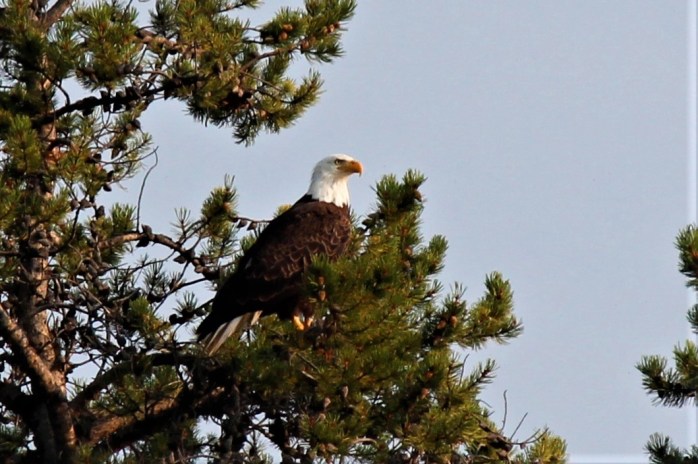

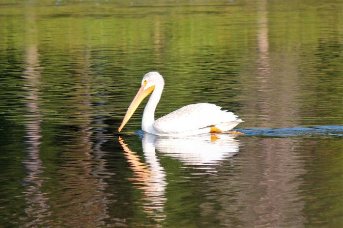

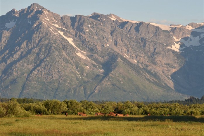
Our Hikes
Cascade Canyon


Garnet Canyon


Lake Solitude


Visits with Friends
Chelsea Crew at Jenny Lake

Driggs Family Visit


Kayaking
Jackson Lake


Oxbow Bend


Jenny Lake


Solar Eclipse


Oh – those Sunsets!


Far From the Madding Crowd

Thomas Hardy’s Victorian era novel with this title portrays the main character, Bathsheba, and her life on a Dorset farm far from the “hustle and bustle” of London. The term originated in the solemn 16th century poem by Thomas Gray, “Elegy written in a Country Churchyard”, and the line is meant to signify “being removed, either literally or figuratively, from the frenzied actions of any large crowd or from the bustle of civilization.” (quote from Dictionary.com)
Spending the summer working at the Jenny Lake Store, Jim and I have found it desirable to seek out locations within the park and the surrounding national forest that are “far from the madding crowd.” Jenny Lake is THE most popular spot to visit in the park, and while I enjoy chatting with the endless visitors who take the time to enter our store, I treasure solitude on our days off. We’ve explored by truck, bike, foot and kayak some lesser known places in the greater Teton area that have proved to be quieter, less traveled and incredibly beautiful.
Over the course of the summer, we have developed relationships with some of the National Park Service employees working at Jenny Lake – who have recommended some out-of-the ordinary spots to explore and we have taken the last couple of weeks to find some of these treasured destinations.
Will, who happens to spend his winters in Vermont, works in the park on the seasonal construction team that is renovating the original Jenny Lake Visitor Center. His girlfriend, oddly enough, lives in Barre, VT (near our location in Central Vermont). He frequents the store daily for his morning cup of coffee, and on one such morning, he recommended a hike for us that he loves and has done several times.
ON FOOT – SLEEPING INDIAN TRAIL

This trailhead is located on the border of the Bridger-Teton National Forest and the Gros Ventre Wilderness, and is accessed by driving through the Elk Refuge on the edge of town, near Jackson. Will drew us a map on paper with directions to the trailhead parking lot. It was somewhat vague, and not to scale, so we figured it would be an adventure just finding the trailhead. That proved to be true!
We entered the Elk Refuge on the edge of Jackson on the National Elk Refuge Road, and drove for more than a few miles along the road that meanders through the refuge, until we came to Flat Creek Road. This road continues on through the refuge for a few more miles, and eventually enters national forest land. You can tell you are on national forest land when you start to see dispersed camping spots! Will’s description said that once you pass the East Parking Lot you continue on for about another 1.5 miles on a much unimproved dirt road to the small trailhead parking lot.
We arrived at a parking lot, and assumed that it was the correct one. It had the right number of spaces per his description, and a trail leading off in what seemed to be the correct direction. We had walked about a ½ mile on this trail when we crested a hill and saw, in the distance, what appeared to be vehicles parked further down this dirt road. We determined that we had not reached the correct trailhead, so we retraced our steps, got back in the truck and headed on down the road – which was much worse than the section we had just traveled. Another mile, and we reached these vehicles. It appeared to better match the description Will had given us, and a description I had retrieved from the internet. (https://gearjunkie.com/best-hikes-in-jackson-hole)

We parked the truck, once again, next to the two vehicles in the lot, and proceeded to don our packs and poles. By this time, it had taken us much longer to reach the trailhead than anticipated so we were on the trail at about 9:30 instead of 8:00am. Oh well, it’s all about being flexible, right? Will had mentioned that the hike to the summit of Sleeping Indian (or Sheep Mountain) and back was about 10 miles. I had read conflicting reports on several blogs that indicated it was more like a 14-mile round-trip hike. We would soon find out!
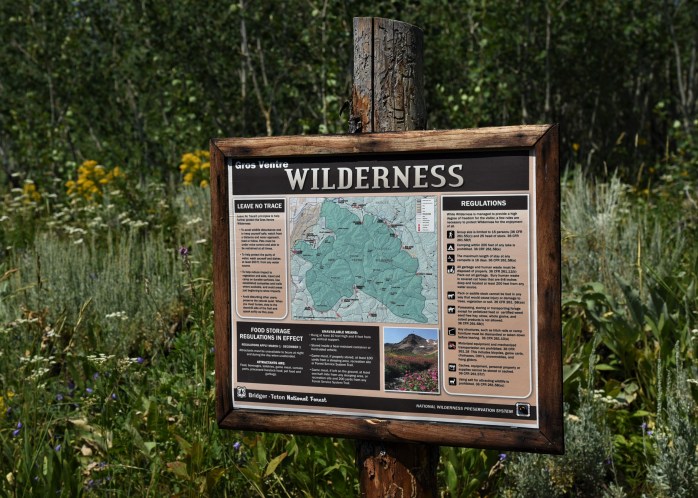
The Gros Ventre Wilderness boasts a very diverse mix of wildlife including Big Horn Sheep, wolves, deer, pronghorn, and bear. Along with the mix of fauna, there is an impressive array of wildflower meadows along the trail. While the trail is unmarked, it was easy to follow and meandered uphill through meadows and forests. Since we were totally unfamiliar with the trail, and it’s not marked with mileage markers, it’s hard to say how far we hiked.


By 12:30, we were sure we had traveled 5 miles, and had a clear view of the summit – which we estimated to be at least 2 more miles up the trail. Unsure how long it would take, and knowing the trail gets a tad more difficult to follow (from descriptions online), we opted to eat lunch and head back down.
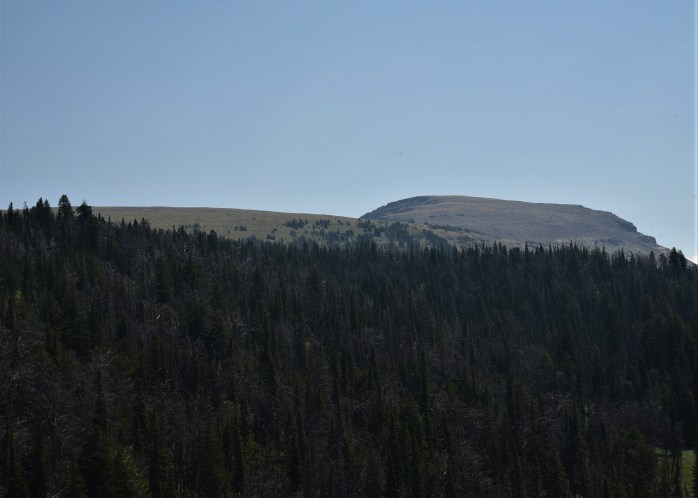


We did not see another human being the entire time we were hiking that day, until the end of the trail. We were back at the truck putting away our hiking gear when two young girls came off the trail. They had hiked to the top and confirmed to us that from where we were it was easily 2 or more miles to the summit.


I’m not sorry we did not reach the top of Sleeping Indian. The hike was absolutely breathtaking, and although the Teton views were somewhat obscured with the smoky haze we had been experiencing from northern forest fires, we were not disappointed. I saw some of the most incredible wildflower displays of my life. If you have a sense of adventure, and a sturdy, 4-wheel drive vehicle, then this trail is worth taking the time to find.

ON BIKES – THE DIRT ROADS IN THE PARK
Joe, the Naturalist for the Jenny Lake area, comes into the store daily (sometimes more than once a day!) and we always have questions for him. He’s very generous with his knowledge. For example, Jim saw an unusual looking fox near the store one morning, and we were unsure what kind of fox he was due to his strange markings. Our first thought – we’ll just ask Joe! He’s a great guy, and since his job is also seasonal, he returns to the Upper Midwest during the off-season to lead environmental science programs in schools.
Uhl Hill Loop
Joe was telling us one day about a region of the park called Uhl Hill, and I discovered that it was reached via a dirt road near the Elk Ranch area of the park. Jim and I decided to park the truck at a small pull-off at the entrance to the Elk Ranch Road – the dirt road that winds back into the Uhl Hill area – and do a loop that would bring us to Wolf Ranch Road and back out to Rt. 191.


The road is a fairly decent dirt road, but there are several small streams that need to be forded. At each stream, there was a small, rough wooden plank bridge just wide enough for a bike to use – so we did not have to ride through the streams.


Eventually, Elk Ranch road ends and we made a left onto Uhl Hill Road which dead ends at a reservoir, and a steep hiking trail that leads up to an overlook on Uhl Hill.
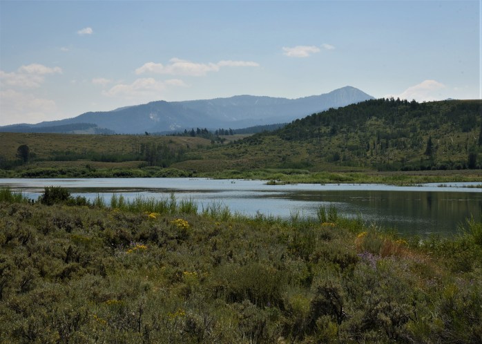

We parked the bikes there and walked the trail up to the overlook for spectacular views of the Tetons to the west, and the national forest to the east. This area is part of the grazing area for the park bison, but we did not see the herd back here while we were there. In fact, aside from a couple of folks on horseback, we were alone for the entire ride.

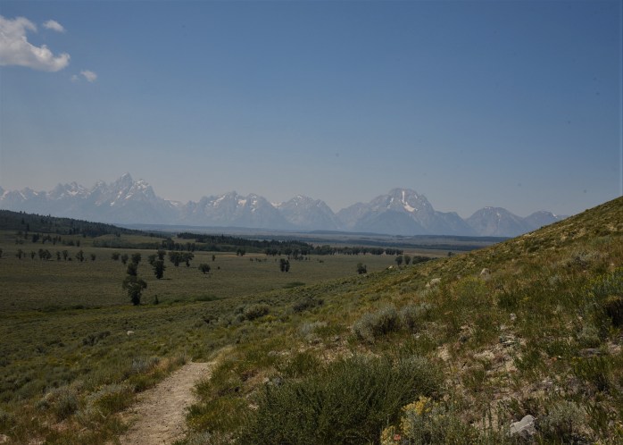


Shadow Mountain Road
We had tried unsuccessfully to do a popular bike loop that starts at Blacktail Butte parking lot, goes along Antelope Flats Road to Kelly, then down Gros Ventre Road to Rt. 191 – returning to Blacktail Butte via the multi-use paved trail along Rt. 191. The reason our first attempt was unsuccessful was that we started off, got just beyond Mormon Row and feared a thunderstorm was descending upon us. So, we turned around and decided to try again another day.
Since we had driven the above loop by truck, when we returned to bike the route, I made the decision to alter our plan and at the junction where we should have turned right to head to Kelly, we turned left and headed to Shadow Mountain.
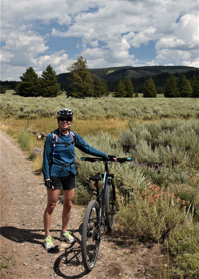
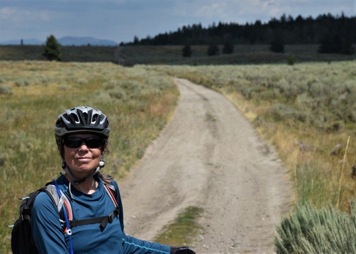
The road eventually turns into a dirt road, and enters national forest territory and traverses along the edge of the boundary between the park and the forest service land. We discovered that this is a popular dispersed camping area once you enter the national forest land. At the base of Shadow Mountain, there are a number of marked, undeveloped camp sites with to-die-for views of the Tetons. Boondocking at its best – and easy access with most rigs up to this point.
We continued biking past the camping area, following the road as it traverses the sagebrush meadow and ended up close to a junction that would take us back out to Rt. 191 if we had desired to do this. It was a great road for a mountain bike, not too rough and very little traffic. A couple of cars passed us, and some 4-wheelers – and that was it.
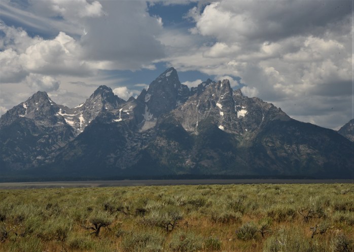
Since we are just days before the Great American Eclipse – and fire danger is high, the park and forest service have banned all campfires in the area until further notice. While biking, we passed several tents set up in areas that were not designated as camping spots. One spot had a campfire ring fashioned out of local stone, and Jim noticed a plume of smoke rising from the embers. No one was around, so we stopped and using some of our precious water, he doused the coals until it was “dead out”. We were really distressed to see that someone was being so careless. I snapped some pictures of the area, and when we returned to our truck, I called the forest service headquarters in Jackson and reported the incident. They assured me they would be paying a visit to this unsuspecting camper.
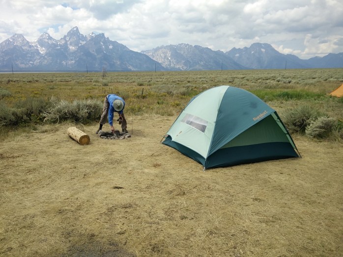
Before heading back to our truck, we took the road from the Shadow Mountain Base dispersed camping area that leads up the mountain. The map indicated there was more dispersed camping up there. It is a steep climb and we went about half way up before turning around. The road continues for miles, with many more camping sites tucked in off the road. For anyone interested in primitive camping, this is definitely a spot to investigate given its proximity to Jackson and Grand Teton National Park.

BY TRUCK – ROAD TRIPPING
A fellow workamper, and also fellow Vermonter, came in the store the other day, and he described their day off driving out to Slide Lake. We had not heard of this lake or this area, so we were intrigued. Jim examined a map with him detailing the directions, and after one of our early shift the next day, we decided to do a road trip and explore this area.
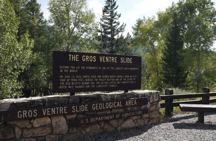
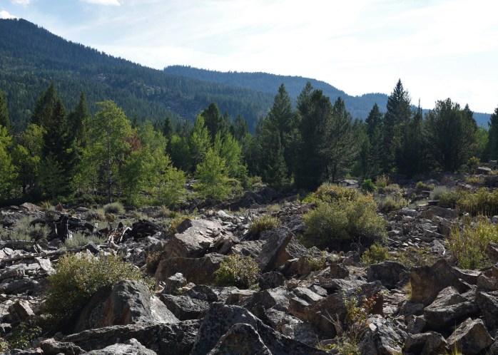
Slide Lake is located in the Bridger-Teton National Forest and was formed back in 1925 due to a monstrous mile-wide landslide that formed a natural dam along the Gros Ventre River. The lake is accessed via Gros Ventre Road off of Rt. 191. Our first stop was at an interpretive sign and small parking lot that marks the beginning of the short geology trail. The ½ mile trail winds through the landslide and ends at an overlook of the lake. Hard to imagine such a landslide!


We then continued on the road past Slide Lake, and a very nice forest service campground on the shore of the lake (Atherton Creek Campground). The black-top road ended at this point and a decent gravel road continued for miles. We drove along these massive red rock hills which were utterly amazing.
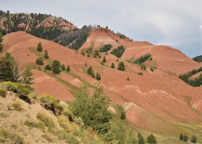
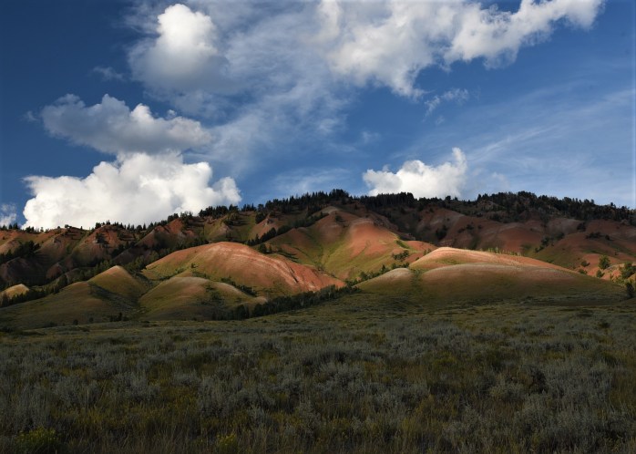
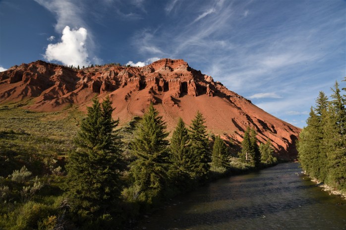
Even though this area is national forest and wilderness area, there are still some ranches interspersed within the boundaries of the federal land. I think they call these in-holdings for those properties withing the national park. I’m not sure if that’s the case in the other federal lands. I love the names of the ranches – Gros Ventre River Ranch, Red Hills Ranch, Red Rock Ranch, and my favorite – The Huntress. I wonder who lives there!
We drove until we crossed the Crystal Creek, and stopped for a snack. We found ourselves in a beautiful, hidden valley where there were actually a couple of ranches tucked in the hills here and there. What a setting for a ranch! This area is truly one of the most beautiful places I have ever encountered.
It turns out we were actually on the other side of Sheep Mountain (Sleeping Indian) and there were trails from this side leading up into the Gros Ventre Wilderness. Along this road, there were a couple of other more primitive forest service campgrounds – one was closed, but the Crystal Creek campground looked like a nice place to camp along the river.

We also noticed several dispersed camping pull-offs, and some short forest service roads leading to additional boondocking camping spots. One pull-off in particular sat high above the gorge carved by the river, and looked like an ideal spot for the airstream! We will definitely keep this spot on our radar screen. The road to this point is navigable with a trailer – although slow and narrow – still doable.

BY KAYAK
One of my favorite locations in the park is Cattleman’s Crossing. Just beyond Oxbow Bend, there is a small, unmarked dirt road that ends at this historic spot along the Snake River.
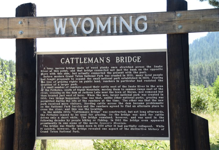
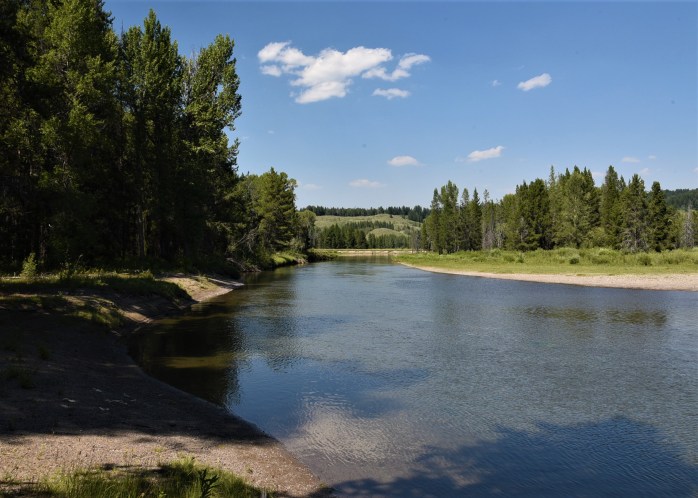
It is the perfect jumping off place to launch my kayak on the Snake River, and head downstream to explore (via boat) the famous Oxbow Bend area of the river. The water fowl and other birds here are amazing to discover and watch. This area is home to osprey, bald eagles, white pelicans, sandhill cranes, Canadian geese and many other species of birds.

I was thrilled to be able to kayak near the small island where the white pelicans have been hanging out. I love this unique bird. The white pelican is surprisingly graceful as it soars up the river, orchestrates an elegant water landing, and floats downstream in search of delectable delicacies underwater. I could watch them all day.


On two occasions, I was rewarded with watching bald eagles perched high in the pines, surveying the river and guarding their territory.

The elusive sandhill cranes have yet to make an appearance for me. After I kayaked back upstream one evening, and was walking along the shore, a bird-watcher informed me that I had just missed them heading for the cover of the shrubs near where I had just paddled.
While Cattleman’s Crossing seems to have been discovered by more people than some of the other places we’ve found, it is still a magical place and on a road a little less traveled than other areas within the park. Most of the visitors here are bird-watchers or nature lovers who are seeking a quiet, peaceful experience to just sit and reflect – and hopefully see some wildlife.

Exploring some of these hidden gems has been an experience of a lifetime. I am so grateful to be able to get to know this area and it’s many faces. I have more “hidden gems” – so stayed tuned!!
Photography Tales 2

We were 2 miles into our hike from the trailhead that marks the start of the trek into Death Canyon here in the Tetons. I had not yet taken any photos, concentrating instead on just hiking – as I often do during our ascent of a trail otherwise we will never get anywhere! Some ripening huckleberries caught my eye on the uphill side of the trail, though, and I decided to snap some pictures of these delectable fruits. I took a couple of shots, and then a short distance along the trail, we came to the Phelps Lake overlook – and I raised the camera to my eye once more. This time, however, I noticed something I had not noticed on the previous shots, that pesky little icon displaying in the viewfinder indicating I did not have an SD card in the slot! My heart sank!

Let me give you some history here. When I was researching cameras to upgrade to a better piece of equipment, I purposely chose a camera that had “two” SD card slots for a very good reason. I had once forgotten to replace my camera card in my old Canon, leaving it in my computer when I was transferring pictures. I left for a hike one day, and I did not have a replacement card handy, and found myself unable to use the camera when I needed it. I vowed this would never, ever happen again. (Yeah, right….)

My Nikon D750 has two card slots. The purpose for this is simple. Picture-taking capacity is much expanded, and (most important for me obviously) one also has a back-up card in the camera just in case. My plan was to always keep a card in the second slot as added insurance against failure. And for a while, I did just that.

Don’t ask me why I all of the sudden found myself with no cards in my camera on our Death Canyon hike. Oh – “the best laid plans of mice and men often go awry.” If I had to venture a guess, I’d say that I had relied on the back-up card at some point, and then had forgotten to replace it, or I had removed it to use in my Canon when realizing I was without a card in that camera! Who knows? Pure conjecture now – and it does not really matter anyway, right? I was card-less – no explanation would change that. To make matters worse, I also neglected to follow one of my golden rules to always check my camera before starting off to make sure I had a card IN the camera. So, I failed on two counts.

I did have some extra cards in my camera bag back in the truck. Positive points for that, but it was two miles to return to the trailhead and that was not happening. Luckily, we have these things called smart phones with built-in cameras that do not require an SD card! I was forced to store my Nikon in my pack and use my cellphone for this hike.
I was feeling pretty foolish that I had let this happen a second time but I was not going to let that ruin my hike. It was a beautiful day! My only regret was lugging my heavy Nikon up the steep trail for no good reason. (Actually, truth be told, Jim took pity on me and offered to carry the camera in his pack – and I relented! So, he ended up with the load with the promise that it never happen again!)

I happily started just snapping pictures with my cellphone, and all was good until I met a fellow photographer along the trail. This guy was carrying a serious camera with a monster telephoto lens up a pretty steep trail. (And I thought my camera was heavy for a long, steep hike!) I started chatting with him while I was waiting for Jim to catch up to me (remember he was carrying extra weight), and made a remark about being resigned to using my cellphone for this hike. I was looking for a little sympathy – and maybe, some comradery that perhaps I was not the only photographer who treks off on a hike minus an SD card in the camera.
So, I confessed to him that I was forced to put away my camera because I realized I had left my SD card in my computer at home. I was hoping that he would say – “oh yeah, that happens to all of us once in a while.” But, instead – he gave me this eye-brow raised look and said he’s never done that before – in a way that made me feel completely sheepish and inferior!
I was secretly hoping that he might offer me a spare card but I could see this conversation was going nowhere in that direction. He went on to tell me about all the great shots he was getting – and I decided it was time to hit the trail and put some distance between he and I – small talk had ended for me!

The first thing I did when I got off the trail was round up all my spare SD cards and immediately put two of them in my Nikon. One to be entirely for the purpose of back-up, and to never, ever leave the camera. (I’ve heard that one before!) Why is it I never learn my lessons the first time around??

I still managed to get some okay pictures from our Death Canyon hike but my smart phone is no match for the Nikon. Sorry, One Plus….


Food for Thought

We’ve always enjoyed eating out. When Jim and I first met, one of our favorite things to do on the weekend was to eat out for breakfast. Our first year together, we lived along the Brandywine Creek at the corner of Rt. 100 and Rt. 926 in Pocopson Township, Chester County. Hank’s Place diner in Chadd’s Ford was just a hop, skip and a jump down the road, and became our go-to breakfast joint. I have many fond memories sipping coffee in this small establishment amidst many famous local Chester County artists!
Invariably, wherever we live, we tend to settle on a few favorite local establishments. Once we find a good eatery, we’re loyal patrons! In West Chester, PA, we frequented Jamison’s (formerly Eachus Dairy), DeStarr’s Restaurant, the Square Bar, and New Haven Pizza! In Kennett Square, my hometown, we were often found in Giordano’s for pizza or a local coffee/bakery shop (no longer there) for their scrumptious cinnamon twists.
Upon our migration to Vermont, our tendency to hone in on a few good restaurants continued. We love Julio’s Mexican Restaurant in the capital city of Montpelier, and frequented Salt Hill Pub in Hanover, NH for occasional Happy Hour fare. One of my favorite places to meet for our Dartmouth book club was Stella’s in Lyme, NH.
Of course, now that we’re here in the Tetons for the summer, we’ve kept our tradition alive and have zeroed in a few favorite local establishments. When we were here during the winter 36 years ago, we loved to drive out to Moose Junction and enjoy a brew and some food at the restaurant/bar located there. The large picture window looking out over the Tetons, and the big stone fireplace created a rustic ambiance that was so warm and cozy. Now called Dornan’s, it remains our favorite place to go after work. Sorry for the double posting, as I’ve mentioned this before – but it deserves another spot in this write-up!

Dornan’s
The Pizza and Pasta Company at the Dornan’s complex operates out of the Spur Bar. As the name suggests, the menu consists of an array of pasta dishes and pizza creations named for the local mountains.  My favorite pizza is the Mount Owen – Sundried Tomato Pesto Sauce with Four Cheeses topped with Fresh Basil. Or, I also opt for the Teton – a simple marinara sauce and cheese to which I customize with my choice of toppings. We prefer to dine (weather-permitting) on the Upper Outside Deck which offers sweeping views of the Teton Range and the Snake River valley.
You can also find an outdoor chuckwagon at Dornan’s serving up breakfast and dinner. Jim used to frequent the breakfast back in the day when he hung out here in the late 1970’s.
On Monday nights during the summer, there is an informal jam session with local and traveling musicians sharing the stage and entertaining the crowd with an eclectic mix of music genres. (pictures in my previous post!)
Buffalo Valley Café
We were told about this little out-of-the-way café by our store managers. And, we were thrilled to find this place. It is located just east of Moran, away from the crowds, and along the Buffalo River.

This is a funky, little place located and operated by a guest ranch. The morning we were here, there was only one other couple in the small restaurant. I had heard they had wicked good Sausage Gravy and Biscuits – a favorite of mine – and I can verify this personally now! I’m not a big meat eater but I do enjoy this dish once in a while as a treat. Jim indulged in a hearty egg, hash browns, and sausage dish that he proclaimed was excellent. The best thing about this café (besides the food) was the drive to get there. Buffalo Valley is a beautiful area.


Oh, and while we were eating, a young gentleman came out to the counter, who we learned is the cook. We noticed he had on a T-shirt that advertised Avon Grove Ice Hockey along with a Philadelphia Flyers cap adorning his head. I love it when this happens. We started talking to him, and turns out he grew up in Landenberg (near where I lived in Kennett Square) and attended my rival high school – Avon Grove. Small world!
Snake River Brewery
We discovered this local brew for the first time at Dornan’s. I’m really not a beer drinker, but I have to admit that their Pako’s IPA is growing on me! Usually, the only time I enjoy a beer is with pizza on a hot day. Turns out, this climate is conducive to these conditions. Since we had been enjoying their beer in other establishments, we decided to give their own brewery pub a try. Located in Jackson, the brewery sits a few blocks from the center of town. It’s typical décor for a brew pub, with an open, multi-level lay-out complete with wide-screen TV’s showing – what else – extreme sports clips.


The place was jam-packed with people and obviously a popular spot. We opted to just get a couple of beers and an appetizer each. I was pleasantly surprised at the quality of the food. I ordered the Smoked Trout Cakes – and they were out-of-this-world delicious. The description is mouth-watering and accurately describes this tasty dish – Apple wood smoked trout cakes, spicy tomatillo & avocado salsa verde with sweet corn relish. Jim decided on the Sausage Sampler – Pale Ale pork, Lager apricot elk & Zonker bison sausage with Farmer Fred’s sauerkraut & whole grain mustard – and his was equally delectable. I have no doubt we will patronize this establishment a few more times this summer.


Well, I’m sure we will try out some other eateries over the summer and I’ll be sure to include an additional post if I find enough other places that warrant attention on my blog! I may even include the “duds” – those places that will not enjoy a second visit from us!!!
Path of Totality in the Tetons

Oh my! Time flies so fast! It’s already almost mid-July and there’s so much that we have done since the last time I posted. While riding bikes today along the Pilgrim Creek area of the park, I was thinking about the theme for my next posting. It seemed appropriate to devote at least one post to the event of the summer – the total solar eclipse. While my text will be focused on the eclipse, I’ll embellish the posting with some pictures of our adventures over the past two weeks. 🙂


By pure happenstance, Jim and I are positioned to be in one of the best places in the U.S. for viewing the total solar eclipse this summer on August 21st. A chance encounter with some fellow workampers along Interstate 10 in Arizona over the winter brought us to the Tetons this summer – when they encouraged us to apply for a job opening here, and we took them up on it.
I did not realize at the time that we were going to be in a prime spot to view the eclipse. My sister-in-law, who owns a house in Driggs, ID, clued me in to this while we were back in Vermont for a couple of months in early spring. She said she briefly considered renting out her house in Driggs to astronomy lovers who will be descending en masse to the area in August. Apparently, rental prices will be through the roof!


We were only on the job a couple of days when we were informed to expect to have record-breaking crowds in the park. I have no doubt this will be true. What an exciting place this will be come August! I am totally thrilled that we landed here this particular year. Just dumb luck!
We’ve just started to sell the special “solar glasses” (meant to be worn when witnessing the eclipse) in the Jenny Lake Store, and I did some research so I could be prepared to answer questions about the epic event. So far, I’ve fielded questions like: What is a total eclipse? And why are you selling these glasses here? 🙂
I’m surprised by the number of people who don’t realize the event is even happening. I learned that the Town of Jackson has an entire website devoted to this spectacular occasion – Teton Eclipse. Check it out!
So, just what is a total solar eclipse?? For a brief two minutes on August 21st, the moon will cross in front of the sun at mid-day in our location – causing total darkness for those in the path of totality. And, folks, that means us here in Jackson and the surrounding area!! The path of totality is a 60-mile wide shadow that defines the best viewing of the phenomenon – and it crosses the contiguous U.S. roughly from the coast of South Carolina to the coast of Northern Oregon. The National Aeronautics and Space Administration has a great map showing the path of totality across the country. Look to see if you are within it!! And if not, where you can go to view it best! I’m happy to see that my brother’s location in Charleston, SC is also within the path of totality.
Those lucky folks who live in Hopkinsville, Kentucky are the closest population center to the absolute prime spot for the eclipse – where the sun will be blocked for the longest period of time – which will be just 12 miles north of town and will traverse through Giant City State Park in Illinois and right by the Blue Sky Vineyard! Now, that would be a great place to spend the day! I wonder if they are Harvest Host members 😊 Ha! Ha!
NASA also has a link to NOAA’s information about weather conditions during the eclipse so people can be aware of up to date environmental viewing conditions. Check out NASA’s complete eclipse website for all kinds of activities and scientific information about this phenomenal happening.
I’m just glad to find myself in one of the best places to view the eclipse, and even though we are scheduled to work that day, we’ve received official word that our company is allowing us to close down the store just prior to the eclipse so we can go outside and enjoy the spectacle. And with our Jenny Lake location, we are just a mere 8 miles north of the center of the path of totality – which runs through the Gros Ventre Campground, along the Kelly Road and through Moose Junction. The absolute center of the path runs right through the Jackson Hole Airport.
According to Jackson astronomer Ryan Hennessy (quote taken from an article in JHStyle Magazine), this is what to expect. “You’re probably going to see the most spectacular sight in nature. You’re seeing the sky go from day to night.” He says that many of the brightest stars will appear, and in particular Mars and Venus will be visible, temperatures will drop slightly, animals will become confused, and the light will take on an eerie glow.
How lucky am I feeling? VERY LUCKY! I hope everyone is making plans to enjoy the eclipse at your locale!! Keeping my fingers crossed for clear skies that day!! While we wait for August, we will continue to explore this unique area. Below are more examples of the sights and sounds of Jackson Hole and the Grand Tetons…….


On July 3rd, we attended the weekly Monday Night Jackson Hole Hootenanny at Moose Junction – great opportunity for local artists (and those just wandering through the area) to perform!


Today, July 12th, we rode bikes from Colter Bay along Pilgrim Creek Road and then, stopped by Leek’s Marina to enjoy the lake views.


Returning to Colter Bay mid-afternoon, we rested up before embarking on an early evening kayak on Jackson Lake.


Flora and Fauna – Spring in the Tetons
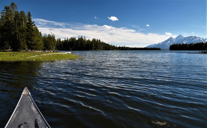
The Teton Valley is a remarkable natural environment created by forces of nature spanning millions of years. The Teton Fault accounts for the formation of the Teton range as movement along this fault caused the dramatic uplift of the mountain range. Even today, there are estimated to be many small, unnoticeable earthquakes per year. There is a great website that outlines recent earthquake activity in the greater area surrounding the Tetons. So, the fault is definitely still active and the potential for a major earthquake here does exist! I’ve heard some predict that this will be the year. I hope not while we’re here!
After the mountains were formed, glacial action sculpted the valley and mountains even further. The last glacial impact happened between 50,000 and 14,000 years ago – fairly recent by earth standards. In their wake, the glaciers left behind depressions and rocky moraines that contributed to the formation of the beautiful natural lakes such as Phelps, Taggart, Jenny, Jackson and others. The Snake River flows between some of these moraines which are visible from a number of overlooks throughout the park. One area of the park called The Potholes is indicative of how the glaciers impacted the terrain – leaving large “pothole” depressions in the sagebrush flats. The glaciers carved out U-shaped canyons in the Teton Range as well – such as Cascade and Paintbrush Canyon. There are still a number of small glaciers within the park. Mount Moran has two small glaciers that continue to sculpt the mountain – Skillet and Falling Ice. On the Grand Teton, the Teton Glacier is still flowing down the northern flank of the mountain. There is an interesting article on some scientific research that is being conducted on these glaciers and the impact of climate change on the park.
Over time, the Snake River flowing through this valley continues to form terraces and benches as it meanders down through the sagebrush flats. Between the river, the mountains and the high-desert flats, the area is rich with a diversity of ecosystems fostering an interesting mix of plant and animal life.
LOADS OF BLOOMS
When we first arrived in the Tetons, there was plenty of snow in the mountains (and there still is!). Most of the higher elevation trails were snow-covered but valley trails were open and passable. We started hiking some of these lower trails so we could get our hiking legs back, and I was surprised to see so many flowers and shrubs already starting to bloom.


One of the early flowers to bloom here in the park, and very prevalent, is the Arrowleaf Balsamroot. It forms very showy clumps throughout the park – often entire fields of zflowers are evident. This plant has useful medicinal properties and was traditiionally used by Native Americans for pain relief, as well as a remedy for treating colds, burns, wounds, and insect bites.


The Western Amelanchier is by far one of the prettiest examples of serviceberry that I have ever seen. Here in the park, the shrubs form small, dense clumps with startling white flowers in the spring. There are several eastern varieties of Amelanchier and it has always been one of my favorite native plants. I have to admit that I have never seen it bloom as impressively as I have here in the Tetons.

This Ballhead Waterleaf was a plant I found along the Taggart Lake Trail. The flowers were held underneath the leaves making it hard to even notice them. I’ve never seen this plant before so it was a thrill to find it and identify it! I was fascinated to learn that all parts of the plant are edible – especially tasty are the tender young leaves which apparently have a sweet carrot-like taste.


Rock Clematis grows along many of the trails in the park. I first noticed it on the Paintbrush Canyon trail and then again on the Cascade Canyon trail. It prefers the shade of the forest. Clematis has always been one of my favorite garden vines and to find a variety growing in the wild was pure delight!
")

I was lucky to even spot this lovely little orchid growing in the shaded forest on the Paintbrush Canyon trail. I searched for more than this one specimen but could not find any other plants. The other common name for this orchid is Fairyslipper – how fitting!

Ever since we’ve heard about the wild huckleberry plant that is native to this region, we’ve been trying to identify it in the wild. We have oodles of merchandise for sale in our store that has the native huckleberry as a major ingredient – including honey, syrup, all manner of candy to non-edibles such as hand cream, soap and huckleberry chapstick. The plant is closely related to blueberries and it’s not hard to see the resemblance in the flowers and plant structure. It’s no surprise that huckleberries are a favorite food of the bears in the park. I can imagine them feasting on the hillsides covered with this delectable berry.


The Silver Lupine is a less showy plant than other cultivated lupines that I’m used to on the east coast, but it has a very subtle beauty that makes it a striking plant whether by itself or combined with other blooming wildflowers such as the Indian Paintbrush. I’ve seen it growing almost everywhere in the park – from the sagebrush flats to more open areas in the Lodgepole Pine forests.

Sticky Geranium is growing with abundance in many areas of the park. I love geraniums and it was obvious to me this was a type of geranium but, since I’m not familiar with native plants in this region, I had consult some plant books to nail down the exact species. I understand that this plant is an important food source for both deer and elk in late spring and early summer.


I’ve encountered Indian Paintbrush species all over the United States, and the Teton Valley boasts a number of different varieties. I’m guessing that the ones I have photographed are Castilleja miniata – but I’m not going to swear by that! No matter what the species, these plants provide colorful splashes of red throughout the moist meadows of the park.

Not to be confused with Arrowleaf Balsamroot, several species of Arnica’s are blooming in the park about the same time but the habit and leaf of the plants are different. I hope I’ve got this right! I’ve been examining these plants for a couple of weeks now! Balsamroot, from my observation is a larger, more clump-forming plant with leaves that resemble an arrow. The Heartleaf Arnica is smaller, with a leaf roughly the shape of a heart and does not grow in large clumps but is more rhizomatous in nature. Arnica plants are well-known for their medicinal properties – used externally for swelling, cuts and bruises. In the park, they are a food source for mule deer and elk.
ABUNDANT WILDLIFE

Pronghorn are one of the most interesting animals! Everyday on our drive to work, we pass by the sagebrush flats where the pronghorn love to roam. Usually they are not near the road, and we view them from a distance. The one above happened to be close enough to the road that I could snag a photo with my telephoto. Pronghorns are related to goats and antelopes and are ungulates (hoofed animals). They can top speeds of 60 miles an hour making them the fastest land animal in North America.

Moose are a common sight in the park, especially in the wetter meadows and lakes. We have seen quite a few at a distance, and a young one quite close at Moose Pond near Jenny Lake. I was amazed to learn that moose will dive quite deep in search of food at the bottom of a lake or stream. One thing to be aware of – moose can be more dangerous than bears. I’ve heard stories about the dangers of getting too close to a cow with young ones or a bull moose with an attitude!

We have seen numerous marmots while hiking on the trails in the park – on the Bradley Lake trail, on the String Lake trail and today, on the Cascade Canyon trail. They are not too shy and love to pose for photos. Let’s face it – they are rodents. They earned the nickname “whistle pigs” due to their loud scream used to sound an alarm. These animals are not high on the food chain and are preyed upon by coyotes, grizzlies, and golden eagles.
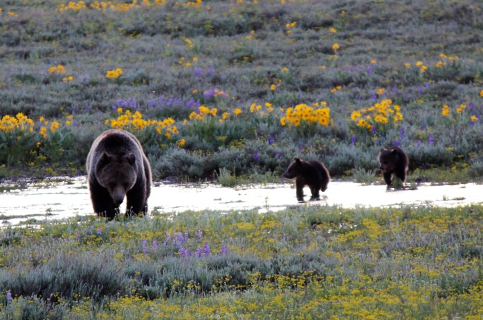

The biggest thrill of all came one evening on our way home from work. We happened upon an area near Pilgrim Creek that has been frequented this spring by a sow and her cubs at the precise moment when she was nearing the road, and wanting to cross. We had seen her and her cubs from a distance several times but this was really up close and personal. Park biologists believe that she may be staying close to the road in an effort to protect her cubs from aggressive boars (male bears) in the area.


We recently spent some time on the water canoeing around the small islands in Jackson Lake off the shore from Colter Bay. We watched the Common Mergansers above for quite a while in a protected cove south of Colter Bay. While we were sitting there, we also saw several Great Blue Herons and a Bald Eagle fly over! I’m hoping to improve my knowledge of birds this summer so look for more bird photos as I investigate their habitats. In particular, I’m on the hunt for the elusive Trumpeter Swan and Sandhill Cranes. I have seen some American Pelicans – but not close enough for a photo.
So, lots coming to life here in the Tetons this spring – which just officially became SUMMER!

