Lynn Amber - Travel & Photography
sharing my thoughts through words and images
Far From the Madding Crowd

Thomas Hardy’s Victorian era novel with this title portrays the main character, Bathsheba, and her life on a Dorset farm far from the “hustle and bustle” of London. The term originated in the solemn 16th century poem by Thomas Gray, “Elegy written in a Country Churchyard”, and the line is meant to signify “being removed, either literally or figuratively, from the frenzied actions of any large crowd or from the bustle of civilization.” (quote from Dictionary.com)
Spending the summer working at the Jenny Lake Store, Jim and I have found it desirable to seek out locations within the park and the surrounding national forest that are “far from the madding crowd.” Jenny Lake is THE most popular spot to visit in the park, and while I enjoy chatting with the endless visitors who take the time to enter our store, I treasure solitude on our days off. We’ve explored by truck, bike, foot and kayak some lesser known places in the greater Teton area that have proved to be quieter, less traveled and incredibly beautiful.
Over the course of the summer, we have developed relationships with some of the National Park Service employees working at Jenny Lake – who have recommended some out-of-the ordinary spots to explore and we have taken the last couple of weeks to find some of these treasured destinations.
Will, who happens to spend his winters in Vermont, works in the park on the seasonal construction team that is renovating the original Jenny Lake Visitor Center. His girlfriend, oddly enough, lives in Barre, VT (near our location in Central Vermont). He frequents the store daily for his morning cup of coffee, and on one such morning, he recommended a hike for us that he loves and has done several times.
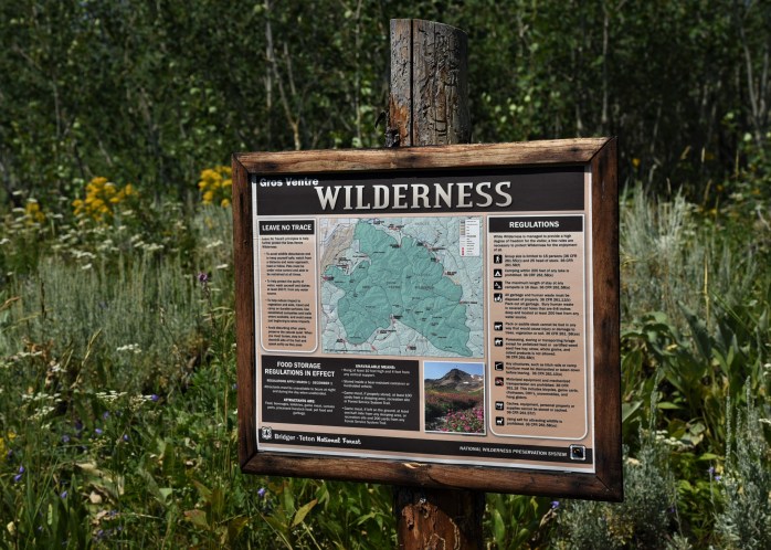
ON FOOT – SLEEPING INDIAN TRAIL

This trailhead is located on the border of the Bridger-Teton National Forest and the Gros Ventre Wilderness, and is accessed by driving through the Elk Refuge on the edge of town, near Jackson. Will drew us a map on paper with directions to the trailhead parking lot. It was somewhat vague, and not to scale, so we figured it would be an adventure just finding the trailhead. That proved to be true!
We entered the Elk Refuge on the edge of Jackson on the National Elk Refuge Road, and drove for more than a few miles along the road that meanders through the refuge, until we came to Flat Creek Road. This road continues on through the refuge for a few more miles, and eventually enters national forest land. You can tell you are on national forest land when you start to see dispersed camping spots! Will’s description said that once you pass the East Parking Lot you continue on for about another 1.5 miles on a much unimproved dirt road to the small trailhead parking lot.
We arrived at a parking lot, and assumed that it was the correct one. It had the right number of spaces per his description, and a trail leading off in what seemed to be the correct direction. We had walked about a ½ mile on this trail when we crested a hill and saw, in the distance, what appeared to be vehicles parked further down this dirt road. We determined that we had not reached the correct trailhead, so we retraced our steps, got back in the truck and headed on down the road – which was much worse than the section we had just traveled. Another mile, and we reached these vehicles. It appeared to better match the description Will had given us, and a description I had retrieved from the internet. (https://gearjunkie.com/best-hikes-in-jackson-hole)

We parked the truck, once again, next to the two vehicles in the lot, and proceeded to don our packs and poles. By this time, it had taken us much longer to reach the trailhead than anticipated so we were on the trail at about 9:30 instead of 8:00am. Oh well, it’s all about being flexible, right? Will had mentioned that the hike to the summit of Sleeping Indian (or Sheep Mountain) and back was about 10 miles. I had read conflicting reports on several blogs that indicated it was more like a 14-mile round-trip hike. We would soon find out!
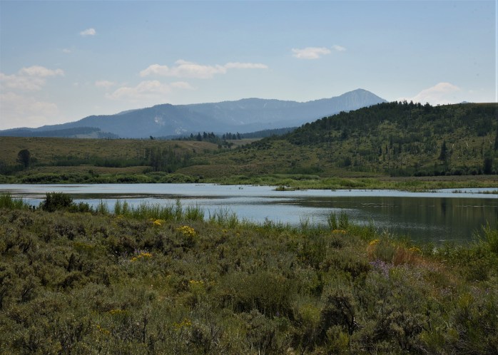
The Gros Ventre Wilderness boasts a very diverse mix of wildlife including Big Horn Sheep, wolves, deer, pronghorn, and bear. Along with the mix of fauna, there is an impressive array of wildflower meadows along the trail. While the trail is unmarked, it was easy to follow and meandered uphill through meadows and forests. Since we were totally unfamiliar with the trail, and it’s not marked with mileage markers, it’s hard to say how far we hiked.


By 12:30, we were sure we had traveled 5 miles, and had a clear view of the summit – which we estimated to be at least 2 more miles up the trail. Unsure how long it would take, and knowing the trail gets a tad more difficult to follow (from descriptions online), we opted to eat lunch and head back down.
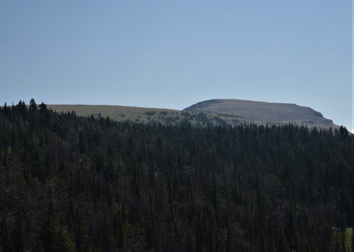


We did not see another human being the entire time we were hiking that day, until the end of the trail. We were back at the truck putting away our hiking gear when two young girls came off the trail. They had hiked to the top and confirmed to us that from where we were it was easily 2 or more miles to the summit.


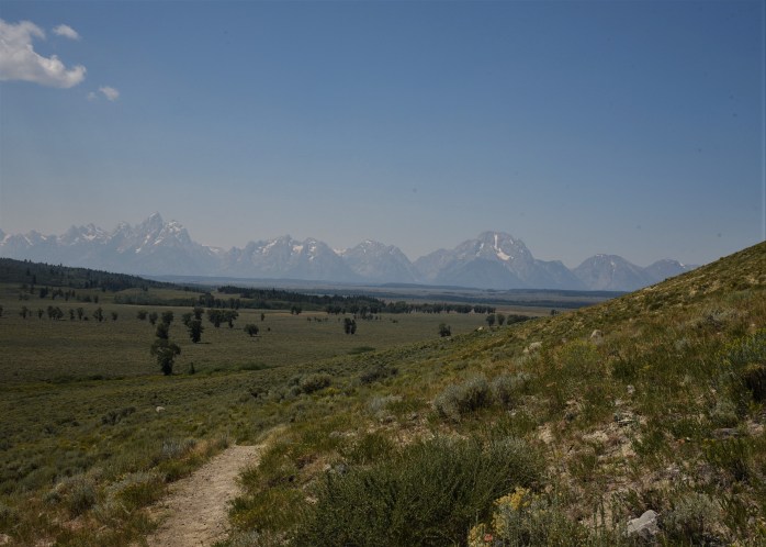
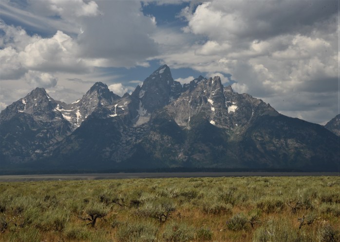
I’m not sorry we did not reach the top of Sleeping Indian. The hike was absolutely breathtaking, and although the Teton views were somewhat obscured with the smoky haze we had been experiencing from northern forest fires, we were not disappointed. I saw some of the most incredible wildflower displays of my life. If you have a sense of adventure, and a sturdy, 4-wheel drive vehicle, then this trail is worth taking the time to find.

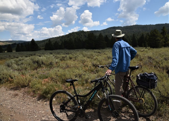
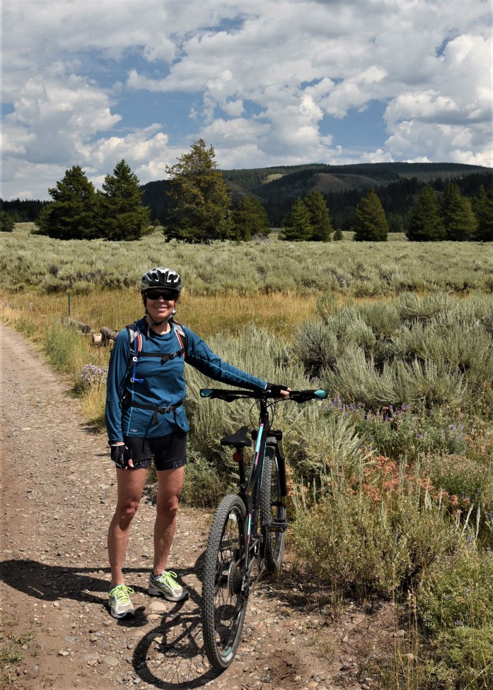
ON BIKES – THE DIRT ROADS IN THE PARK
Joe, the Naturalist for the Jenny Lake area, comes into the store daily (sometimes more than once a day!) and we always have questions for him. He’s very generous with his knowledge. For example, Jim saw an unusual looking fox near the store one morning, and we were unsure what kind of fox he was due to his strange markings. Our first thought – we’ll just ask Joe! He’s a great guy, and since his job is also seasonal, he returns to the Upper Midwest during the off-season to lead environmental science programs in schools.
Uhl Hill Loop
Joe was telling us one day about a region of the park called Uhl Hill, and I discovered that it was reached via a dirt road near the Elk Ranch area of the park. Jim and I decided to park the truck at a small pull-off at the entrance to the Elk Ranch Road – the dirt road that winds back into the Uhl Hill area – and do a loop that would bring us to Wolf Ranch Road and back out to Rt. 191.


The road is a fairly decent dirt road, but there are several small streams that need to be forded. At each stream, there was a small, rough wooden plank bridge just wide enough for a bike to use – so we did not have to ride through the streams.


Eventually, Elk Ranch road ends and we made a left onto Uhl Hill Road which dead ends at a reservoir, and a steep hiking trail that leads up to an overlook on Uhl Hill.

We parked the bikes there and walked the trail up to the overlook for spectacular views of the Tetons to the west, and the national forest to the east. This area is part of the grazing area for the park bison, but we did not see the herd back here while we were there. In fact, aside from a couple of folks on horseback, we were alone for the entire ride.


Shadow Mountain Road
We had tried unsuccessfully to do a popular bike loop that starts at Blacktail Butte parking lot, goes along Antelope Flats Road to Kelly, then down Gros Ventre Road to Rt. 191 – returning to Blacktail Butte via the multi-use paved trail along Rt. 191. The reason our first attempt was unsuccessful was that we started off, got just beyond Mormon Row and feared a thunderstorm was descending upon us. So, we turned around and decided to try again another day.
Since we had driven the above loop by truck, when we returned to bike the route, I made the decision to alter our plan and at the junction where we should have turned right to head to Kelly, we turned left and headed to Shadow Mountain.
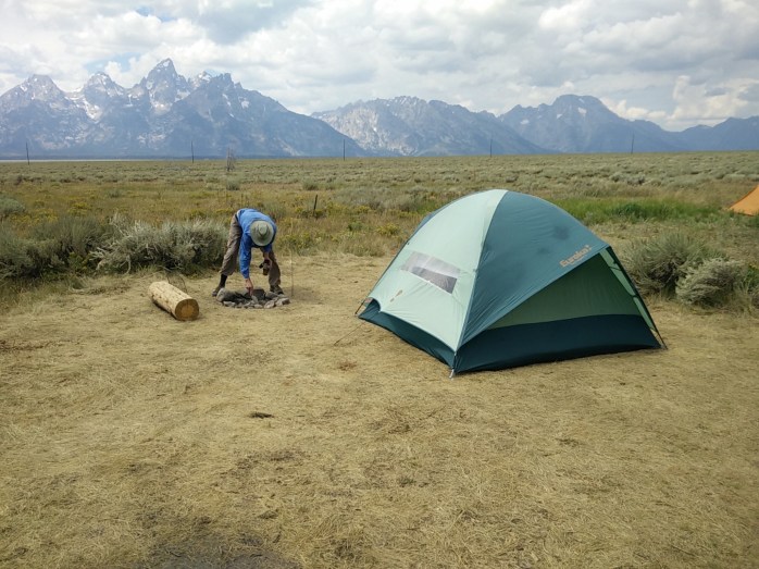
The road eventually turns into a dirt road, and enters national forest territory and traverses along the edge of the boundary between the park and the forest service land. We discovered that this is a popular dispersed camping area once you enter the national forest land. At the base of Shadow Mountain, there are a number of marked, undeveloped camp sites with to-die-for views of the Tetons. Boondocking at its best – and easy access with most rigs up to this point.
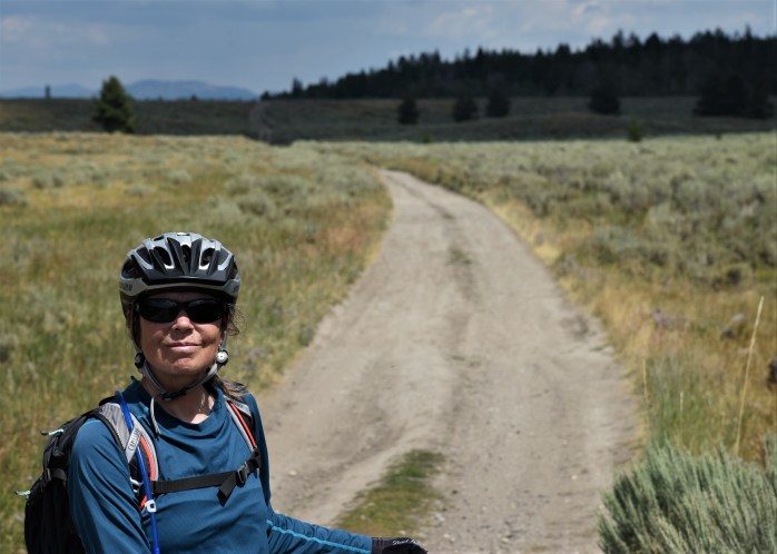
We continued biking past the camping area, following the road as it traverses the sagebrush meadow and ended up close to a junction that would take us back out to Rt. 191 if we had desired to do this. It was a great road for a mountain bike, not too rough and very little traffic. A couple of cars passed us, and some 4-wheelers – and that was it.
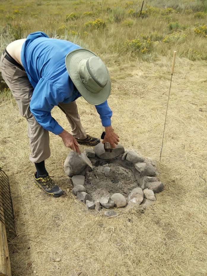
Since we are just days before the Great American Eclipse – and fire danger is high, the park and forest service have banned all campfires in the area until further notice. While biking, we passed several tents set up in areas that were not designated as camping spots. One spot had a campfire ring fashioned out of local stone, and Jim noticed a plume of smoke rising from the embers. No one was around, so we stopped and using some of our precious water, he doused the coals until it was “dead out”. We were really distressed to see that someone was being so careless. I snapped some pictures of the area, and when we returned to our truck, I called the forest service headquarters in Jackson and reported the incident. They assured me they would be paying a visit to this unsuspecting camper.
Before heading back to our truck, we took the road from the Shadow Mountain Base dispersed camping area that leads up the mountain. The map indicated there was more dispersed camping up there. It is a steep climb and we went about half way up before turning around. The road continues for miles, with many more camping sites tucked in off the road. For anyone interested in primitive camping, this is definitely a spot to investigate given its proximity to Jackson and Grand Teton National Park.

BY TRUCK – ROAD TRIPPING
A fellow workamper, and also fellow Vermonter, came in the store the other day, and he described their day off driving out to Slide Lake. We had not heard of this lake or this area, so we were intrigued. Jim examined a map with him detailing the directions, and after one of our early shift the next day, we decided to do a road trip and explore this area.
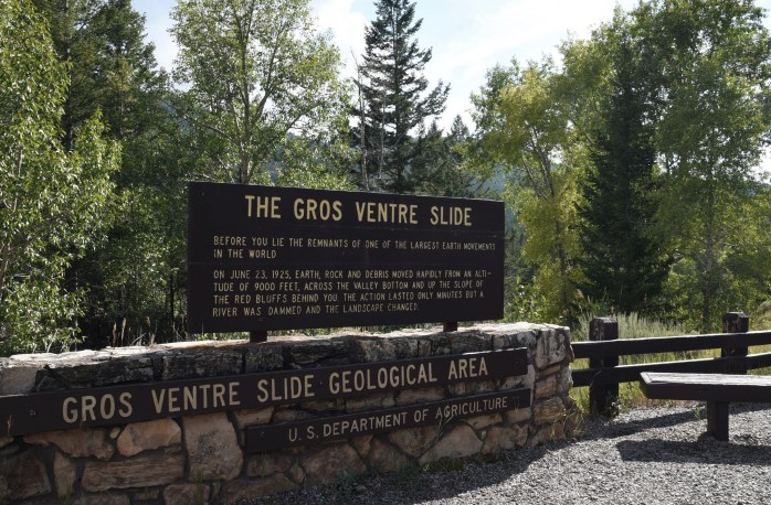
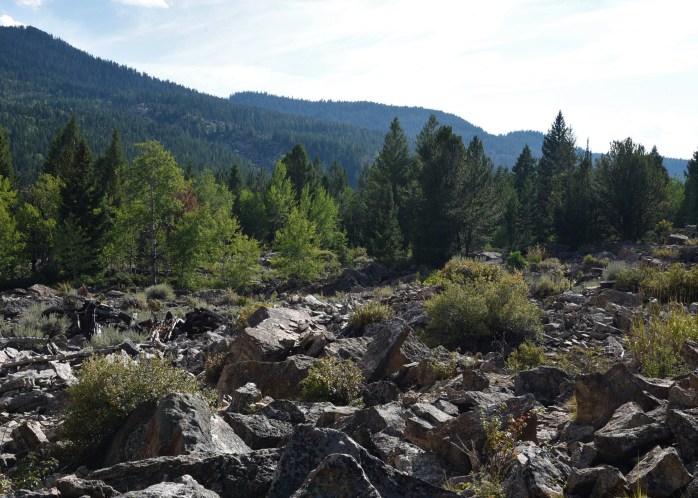
Slide Lake is located in the Bridger-Teton National Forest and was formed back in 1925 due to a monstrous mile-wide landslide that formed a natural dam along the Gros Ventre River. The lake is accessed via Gros Ventre Road off of Rt. 191. Our first stop was at an interpretive sign and small parking lot that marks the beginning of the short geology trail. The ½ mile trail winds through the landslide and ends at an overlook of the lake. Hard to imagine such a landslide!


We then continued on the road past Slide Lake, and a very nice forest service campground on the shore of the lake (Atherton Creek Campground). The black-top road ended at this point and a decent gravel road continued for miles. We drove along these massive red rock hills which were utterly amazing.
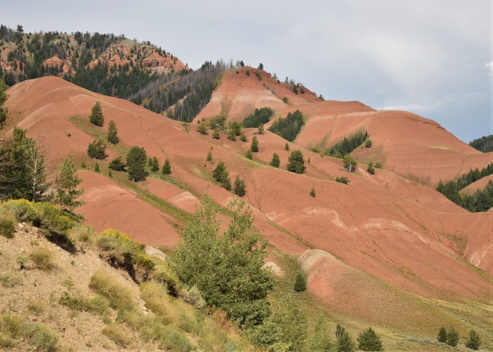
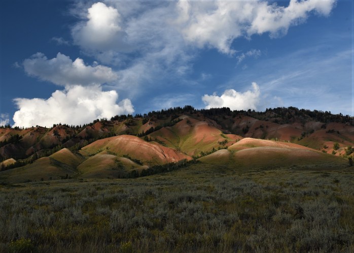
Even though this area is national forest and wilderness area, there are still some ranches interspersed within the boundaries of the federal land. I think they call these in-holdings for those properties withing the national park. I’m not sure if that’s the case in the other federal lands. I love the names of the ranches – Gros Ventre River Ranch, Red Hills Ranch, Red Rock Ranch, and my favorite – The Huntress. I wonder who lives there!
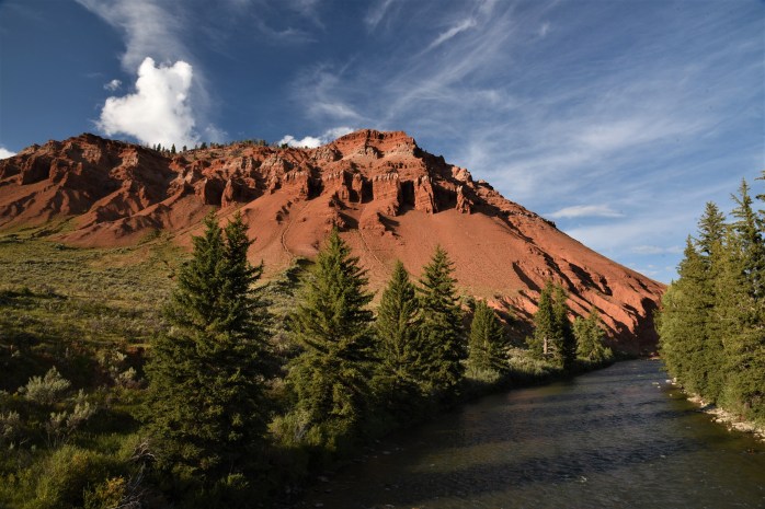
We drove until we crossed the Crystal Creek, and stopped for a snack. We found ourselves in a beautiful, hidden valley where there were actually a couple of ranches tucked in the hills here and there. What a setting for a ranch! This area is truly one of the most beautiful places I have ever encountered.
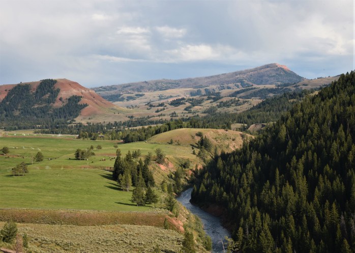
It turns out we were actually on the other side of Sheep Mountain (Sleeping Indian) and there were trails from this side leading up into the Gros Ventre Wilderness. Along this road, there were a couple of other more primitive forest service campgrounds – one was closed, but the Crystal Creek campground looked like a nice place to camp along the river.

We also noticed several dispersed camping pull-offs, and some short forest service roads leading to additional boondocking camping spots. One pull-off in particular sat high above the gorge carved by the river, and looked like an ideal spot for the airstream! We will definitely keep this spot on our radar screen. The road to this point is navigable with a trailer – although slow and narrow – still doable.

BY KAYAK
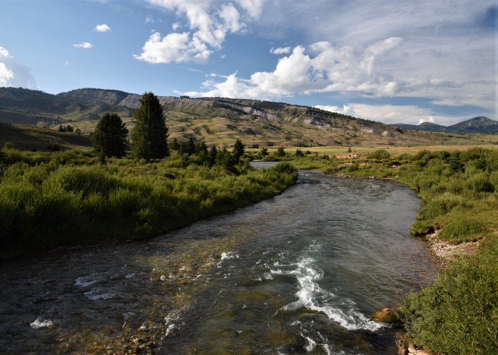
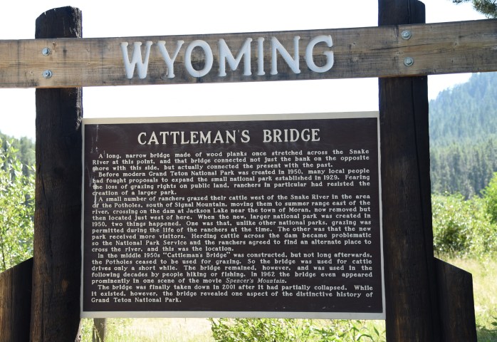
One of my favorite locations in the park is Cattleman’s Crossing. Just beyond Oxbow Bend, there is a small, unmarked dirt road that ends at this historic spot along the Snake River.
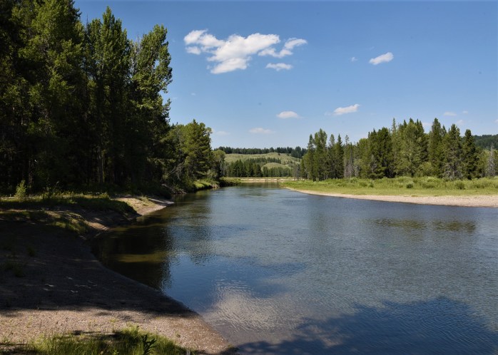
It is the perfect jumping off place to launch my kayak on the Snake River, and head downstream to explore (via boat) the famous Oxbow Bend area of the river. The water fowl and other birds here are amazing to discover and watch. This area is home to osprey, bald eagles, white pelicans, sandhill cranes, Canadian geese and many other species of birds.

I was thrilled to be able to kayak near the small island where the white pelicans have been hanging out. I love this unique bird. The white pelican is surprisingly graceful as it soars up the river, orchestrates an elegant water landing, and floats downstream in search of delectable delicacies underwater. I could watch them all day.


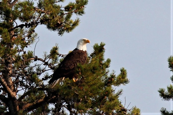
On two occasions, I was rewarded with watching bald eagles perched high in the pines, surveying the river and guarding their territory.

The elusive sandhill cranes have yet to make an appearance for me. After I kayaked back upstream one evening, and was walking along the shore, a bird-watcher informed me that I had just missed them heading for the cover of the shrubs near where I had just paddled.
While Cattleman’s Crossing seems to have been discovered by more people than some of the other places we’ve found, it is still a magical place and on a road a little less traveled than other areas within the park. Most of the visitors here are bird-watchers or nature lovers who are seeking a quiet, peaceful experience to just sit and reflect – and hopefully see some wildlife.

Exploring some of these hidden gems has been an experience of a lifetime. I am so grateful to be able to get to know this area and it’s many faces. I have more “hidden gems” – so stayed tuned!!

I loved the wildflower photos (in August no less) and traveled your routes vicariously on Google Maps. Nice country–looking forward to a fall 2018 visit to the area and have bookmarked this blog post for future reference.
Did you see the 1967 movie with Julie Christie? Heart throb when i was 21 🙂
LikeLike
Too funny about Julie Christie – I have not seen the movie, but I’ve put it on my list since reading more about the novel. And, I’ve put the novel on my list too!!
LikeLike