Lynn Amber - Travel & Photography
sharing my thoughts through words and images
October Photo a Day 10.1.21

Fall colors are starting to pop out all over Mount Desert Island. Yesterday’s dramatic cloud-filled sky complimented the emerging colors. 🙂
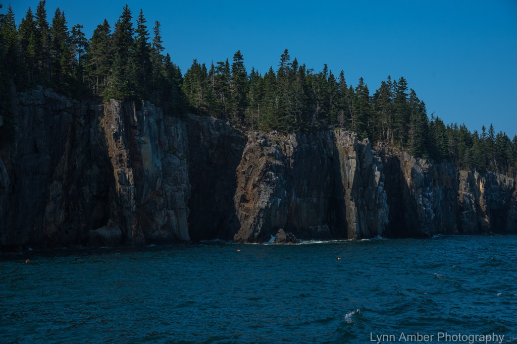
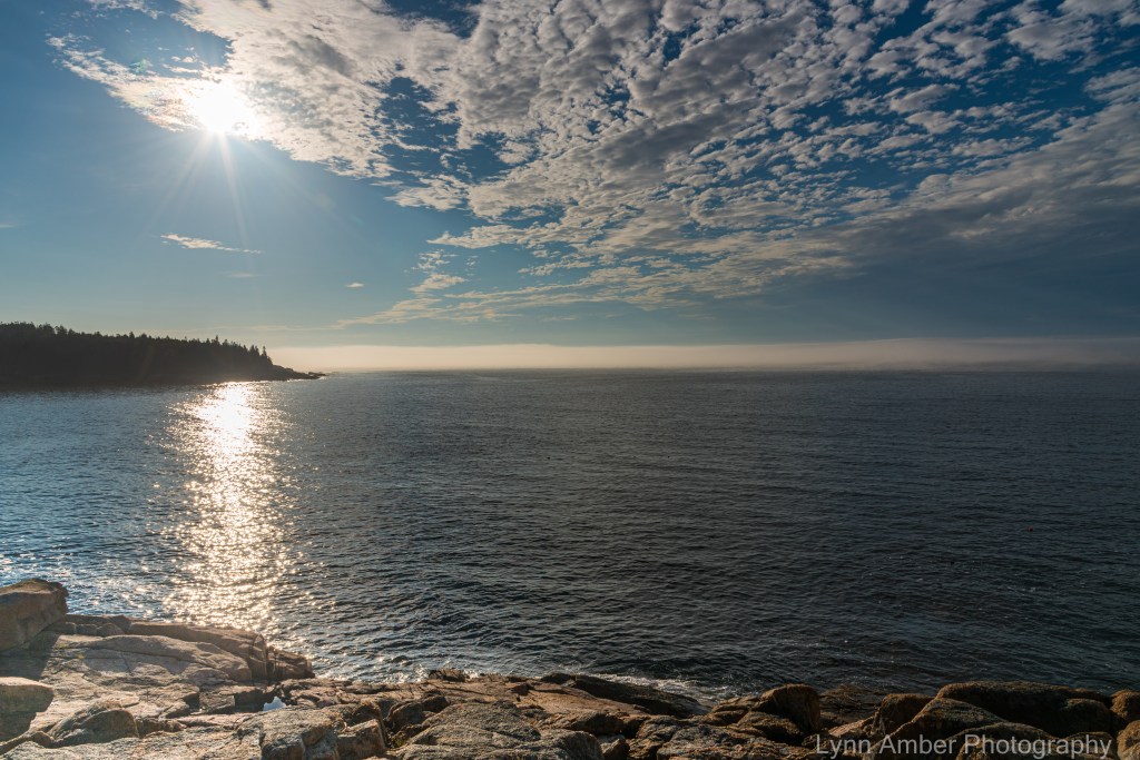
High Surf Along the Acadia Coast

A couple of weeks ago, Hurricane Larry was way off the coast of Maine causing high surf advisories for us. I decided to head over to the Ocean Path along Thunder Hole and Otter Point to check out the seas. The bottom observation deck at Thunder Hole was closed but I made my way down to the next level above that to capture some shots of the incoming surf.
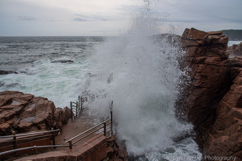
In the above photograph, you can see why the park closes the bottom section of the observation deck! 🙂
I was stationed on the next level up from there snapping pictures.
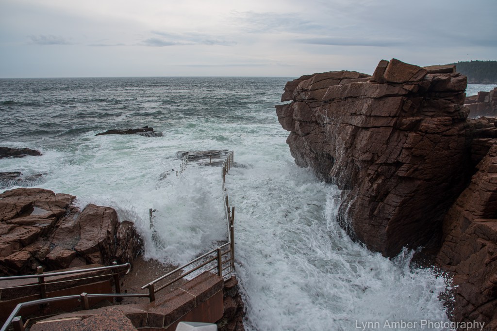
It was when I was snapping the next photograph that I realized I might get exceedingly wet! After getting the photo, I immediately turned my back to the spray and avoided getting my camera completely drenched with salt water.

After hanging out at Thunder Hole, I drove down past Otter Point and got some more great photos of the wave action.
I noticed this guy up on the rock and snapped a couple of pictures. This is what the park means when it issues warnings to tourists about getting too close to the edge of the rocks during high surf advisories!


No better time to get out and photograph the park than during inclement weather! Makes for some superb photographs!

Carriage Road Tour

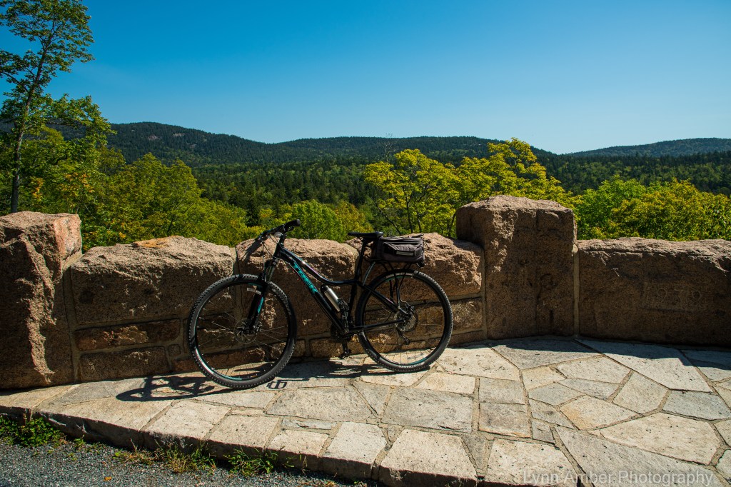
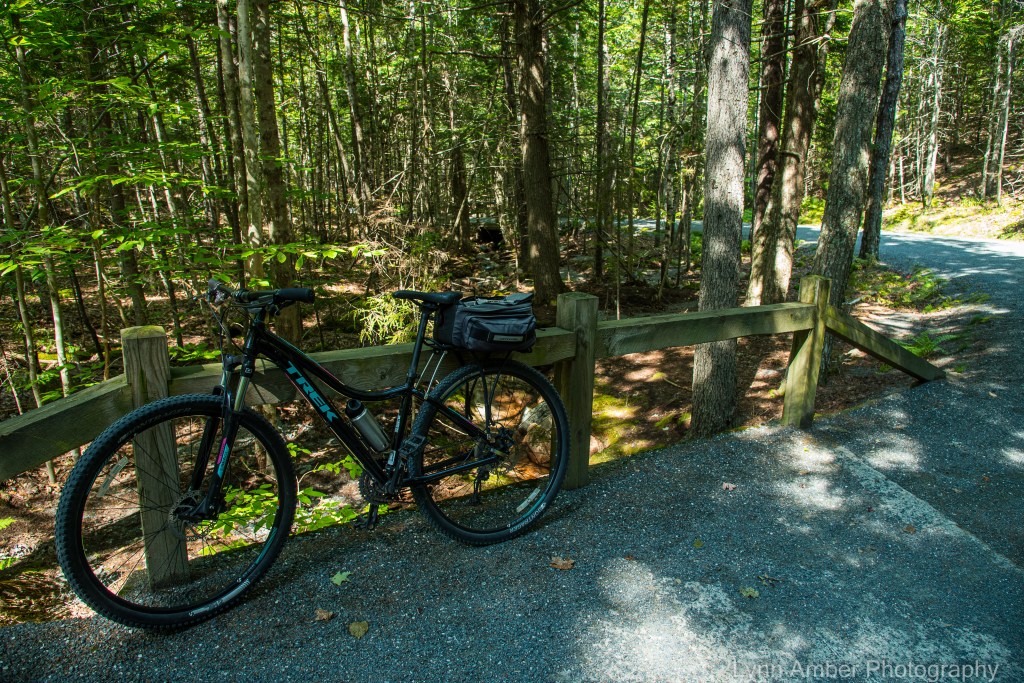
On Wednesday, the weather forecast was ideal for a long bike ride. I planned a route that would take me several hours to complete and capture a circuitous journey through the heart of the park. It was an ambitious 14-plus mile tour.
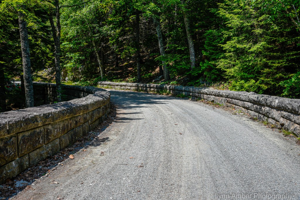
The 45-mile carriage road system in Acadia National Park has its origins back in the early 1990’s when John D. Rockefeller Jr. envisioned creating a motor-free byway through the young, developing national park. His inspiration for these paths came from the carriage road system his father had constructed on this estate – Forest Hill – in Ohio. Between the years 1913 and 1940, with the help of landscape architect Beatrix Farrand and countless other engineers and laborers, the existing gravel-packed roadway came to fruition. Today, the byway is maintained through a partnership between Acadia National Park and the non-profit Friends of Acadia organization. Funding through the federal Recreation Fee Demonstration Program allows a portion of the park entrance fees to be funneled directly into carriage road maintenance projects. In 1995, the Friends of Acadia established an endowment fund that contributes money towards the upkeep of the roads. In addition, volunteers with the Friends of Acadia alongside park employees spend countless hours on maintenance and restoration projects.
This year, the entire 6-mile section of the carriage roads around Eagle Lake was closed to undergo a major restoration effort. To date, the east side of this route is still closed for construction but the western and southern sections opened a couple of weeks ago. I decided to start my bike ride at Eagle Lake and see firsthand the newly constructed roadway.
Parking anywhere in the park has been a challenge this year due to the record-breaking visitors who have descended us. When I arrived at the Eagle Lake carriage road access parking lot, it was full. Instead of parking along the side of the road leading up to the parking lot (as many people do), I opted for turning around and headed for the Eagle Lake boat launch area. Few people realize there are a limited amount of parking spaces here and I lucked out! There was only one other vehicle parked here! It meant I had to travel the short distance back to the other parking area – c’est la vie!
I started my ride at Sign Post # 6 on the northwest side of Eagle Lake and started the 1.9 mile climb to Sign Post # 8. It is a moderate uphill that gets your heart pumping right away!

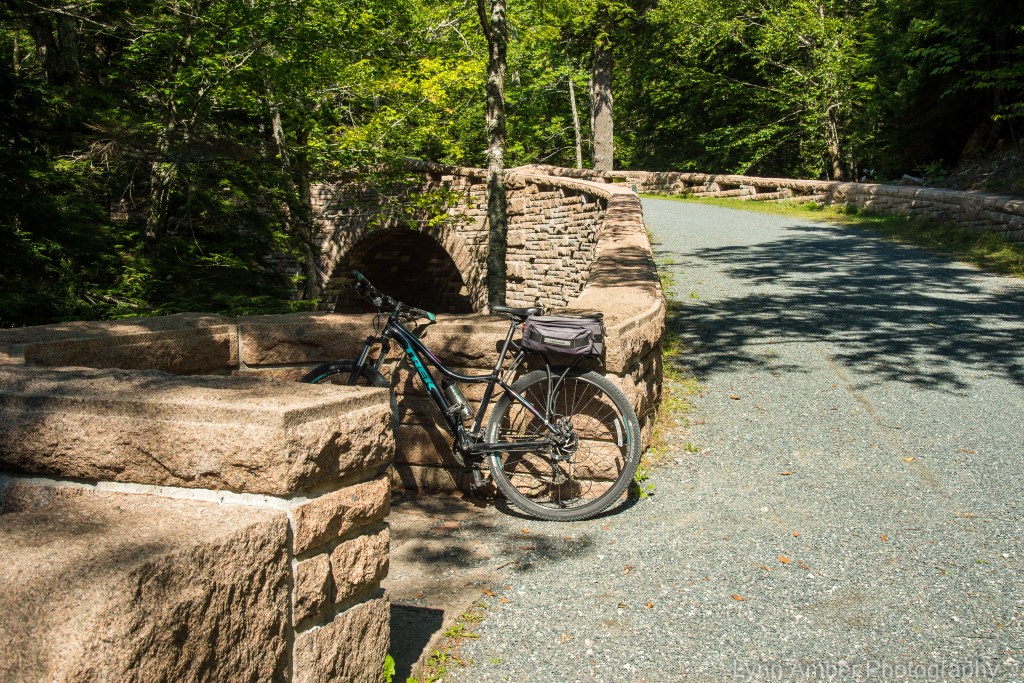
At Sign Post #8, I took a right hand turn and traversed the .1 mile section to Sign Post # 10S. A left turn at this juncture leads towards Jordan Pond. This 2-mile stretch of road has some short, gradual uphill climbs followed by a long downhill ride to Jordan Pond. One of the fun aspects of biking the carriage roads is challenging yourself to “bag” as many of the Rockefeller bridges as possible along the way. The first bridge I came to is the beautiful Deer Brook Bridge. Aptly named for the small creek it spans, this bridge was built in 1925.

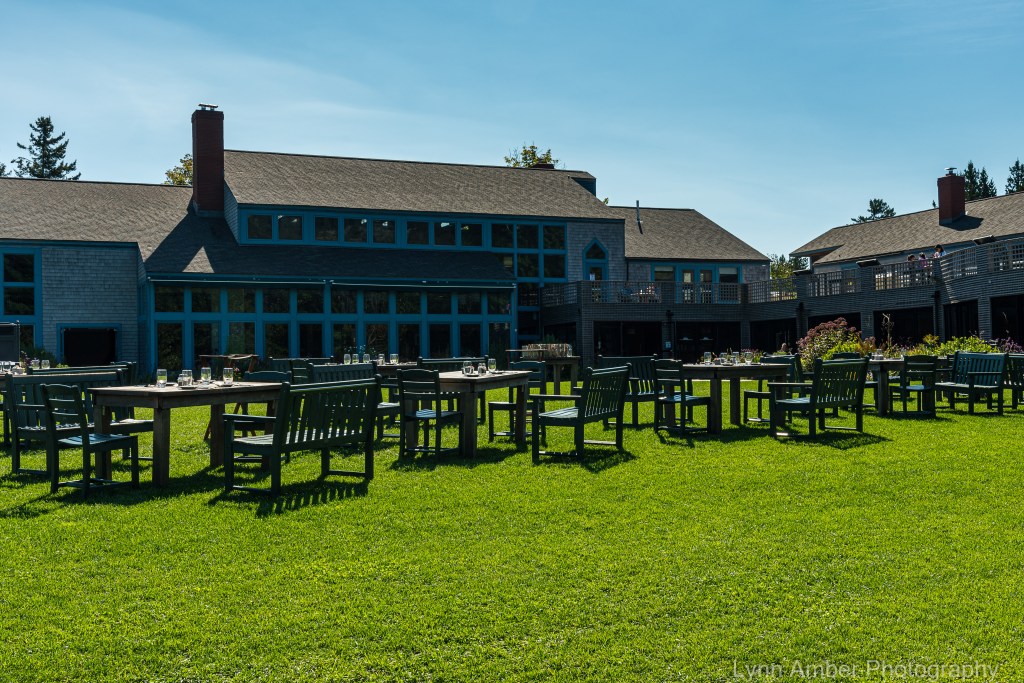
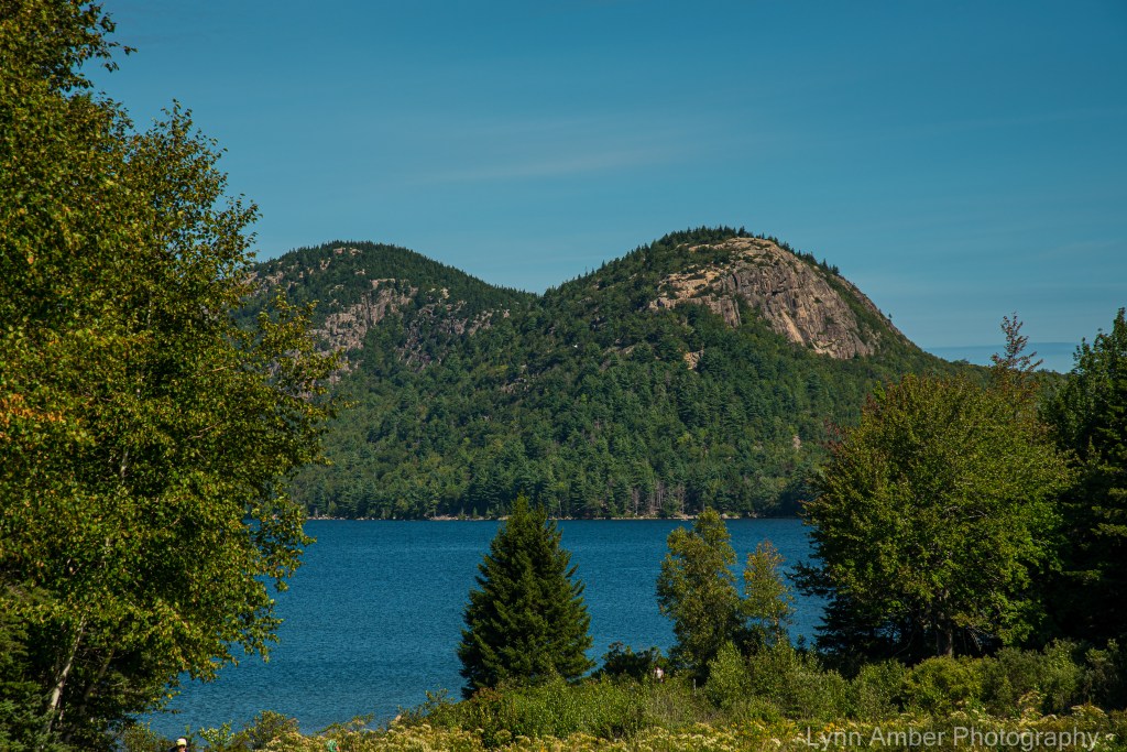
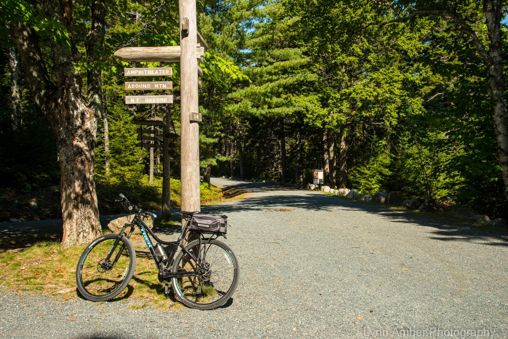
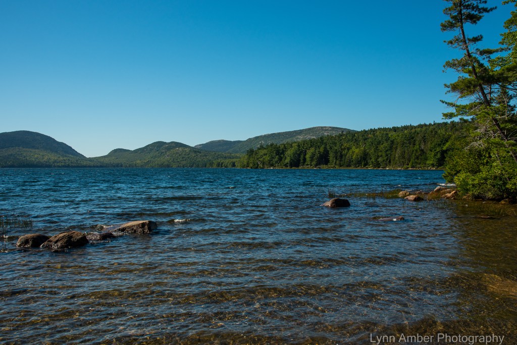
Past the Deer Brook Bridge, an opening in the tree-lined carriage road reveals a great view of Jordan Pond. My next goal was Sign Post # 14. However, I took a short detour on down the hill to the Jordan Pond House so I could fill up my water supply for the remainder of the ride.
Named for the family who used to farm this land back in the mid-1800’s, the Jordan Pond House started life as a restaurant and tourist destination in the late 1800’s. The original building was lost to a fire in 1979, and it was rebuilt and re-opened in 1982. Famous for its “tea and popovers”, it is a full-service restaurant and a very popular destination. Adjacent to the restaurant is a large gift shop, and it is also a great jumping off point for access to the carriage road system.
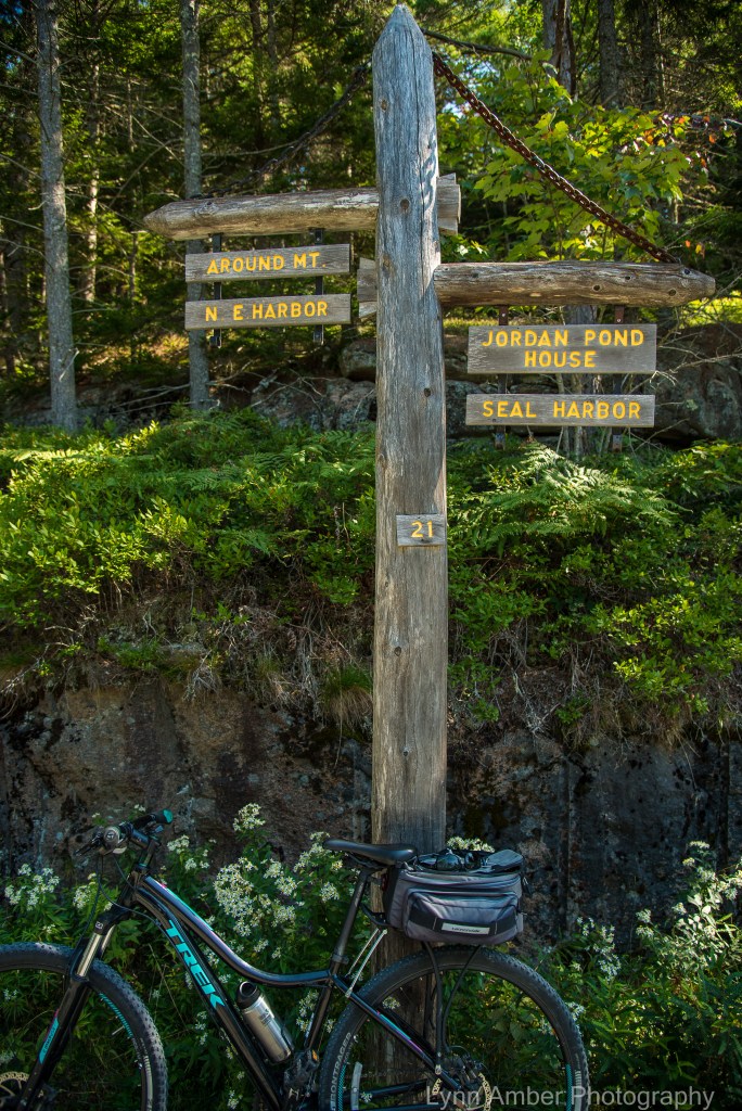
After filling up with water, I made the short uphill climb back up to Sign Post #14 and took a left hand turn to ride the 1.0 mile section to Sign Post # 21. There are two bridges along this part of the byway – the West Branch Jordan Stream Bridge and the Cliffside Bridge. Of course, I stopped at both to grab a photo!

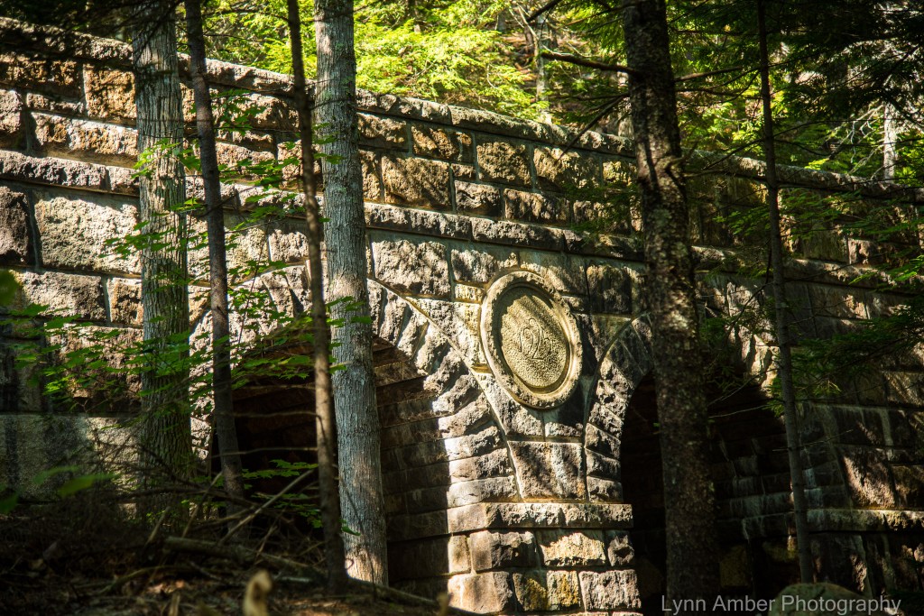
According to an historical document I came across (from the Historic American Engineering Record published by the National Park Service), this bridge was built in 1931 and designed by architect William Welles Bosworth. Engineered by Paul Simpson who worked closely with Rockefeller, it was copied from a similar bridge in New York’s Central Park.
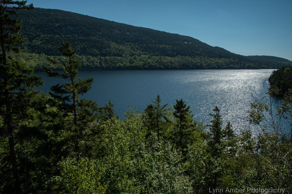
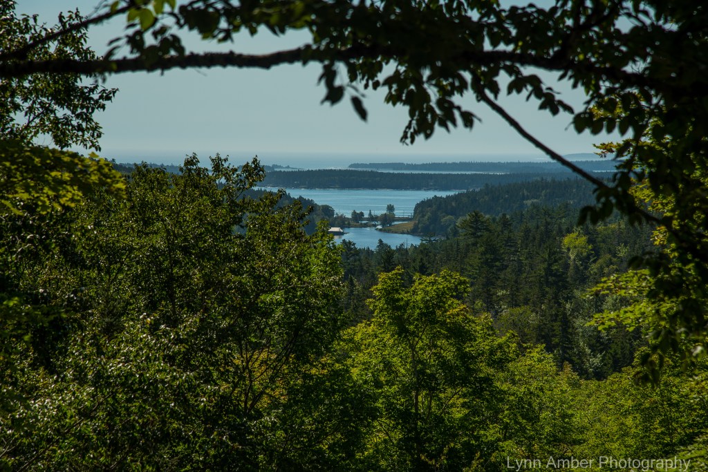
Heading towards the Cliffside Bridge, the view opened up to expose the distant Little Long Pond and its historic boathouse – a former Rockefeller property that is now part of the non-profit Land and Garden Preserve.
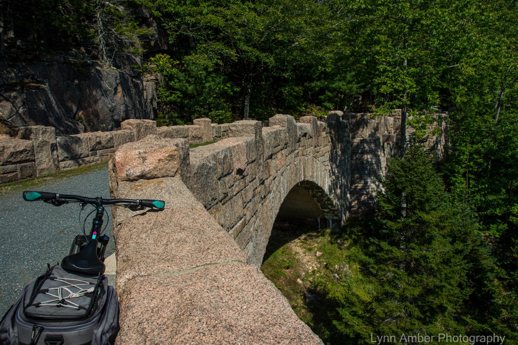
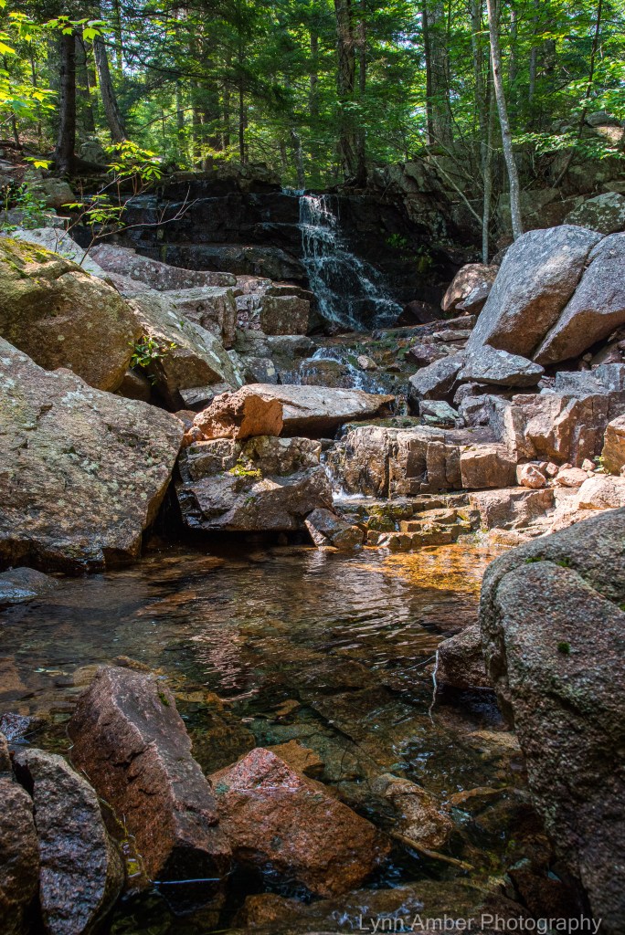
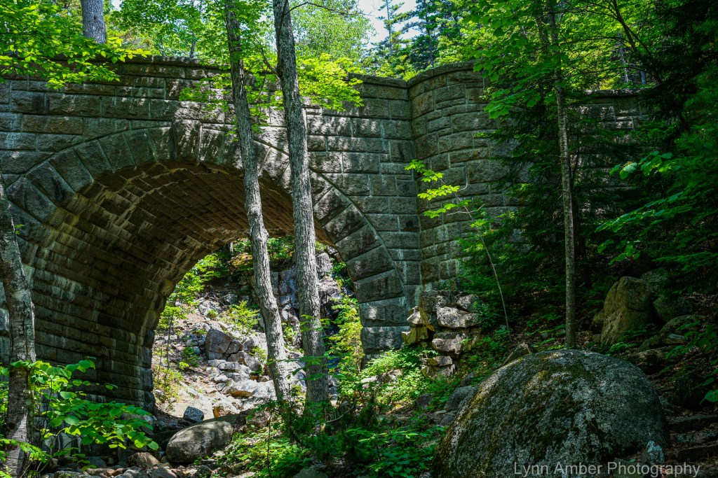
The Cliffside Bridge was constructed in 1932. The single arch spans 50 feet and the granite stone bridge is almost 250′ long from end to end! Leaving the Cliffside Bridge, I quickly approached Sign Post # 21 where I hang a right-hand turn towards Sign Post # 20. This stretch of the road is a moderate ride with a nice mix of gradual uphill climbs followed by some restful downhills. Also along this part of the byway is the impressive Amphitheater Bridge built in 1931. Considered the largest of the Rockefeller bridges, this one sits high up on a hillside and spans the Little Harbor Brook. The arch was designed to showcase the Little Harbor Brook waterfall that cascades down towards the bridge on the uphill side.
Continuing on this 1.2 mile distance, I reach the Sign Post # 20 where another right-hand turn will take me the .9 miles to Sign Post # 19. Again, this part of the route consists of moderate grades with an equal amount of uphill climbs and downhill glides!

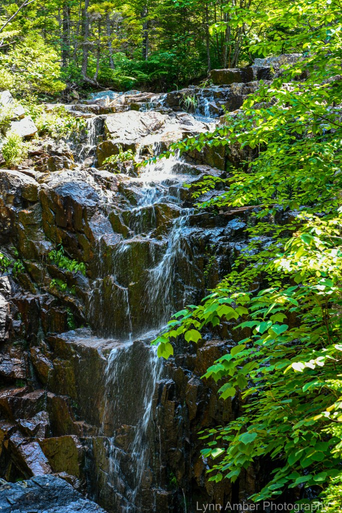
The section of the carriage road between Sign Post # 19 and Sign Post # 12 begins with a long, gradual ascent that leads me towards two more Rockefeller bridges. Built in 1925, the Waterfall Bridge extends across the Upper Hadlock Brook and showcases one of the largest waterfalls in the park. It is especially dramatic to visit this bridge after a significant rain! The bridge is faced with stone and reinforced with concrete and steel. Since there was limited stone in the immediate vicinity of the construction, granite was hauled to the site from the Brown’s quarry 3 miles away at a considerable cost. From the Historic American Engineering Record description: “The bridge walls are constructed of cut granite and feature semicircular plan turrets to either side of the arch. The stone parapet walls are capped by projecting stone coping and
terminate in scrolled stone end posts or curtails.”
Located in close proximity to the Waterfall Bridge, the Hemlock Bridge spans the Maple Spring Brook and is an understated yet elegantly styled structure. Completed in 1924 just prior to the Waterfall Bridge work, the Hemlock Bridge is named for the towering hemlock trees that create a backdrop for the stone bridge. The description in the Historic American Engineering Record is telling: “One of only two Gothic-arched bridges on the Rockefeller carriage road system, Hemlock Bridge is one of eight major stone bridges on the “Around-the-Mountain” carriage road loop. The pointed arch design was chosen for its harmony with the pointed hemlock trees which surround the site.”

After leaving the Hemlock Bridge behind me, I reach Sign Post # 12 and the steep descent to Sign Post # 13. Between Sign Posts 10 and 12 is part of the “Around the Mountain” route that suffered severe storm damage and erosion in the torrential rain we had in June. The repairs have yet to be completed and this area has been closed most of the summer.
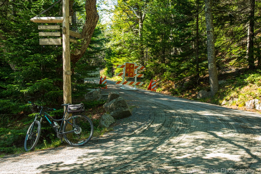
Looking towards the Around the Mountain section of the road system that has been closed since June due to storm damage
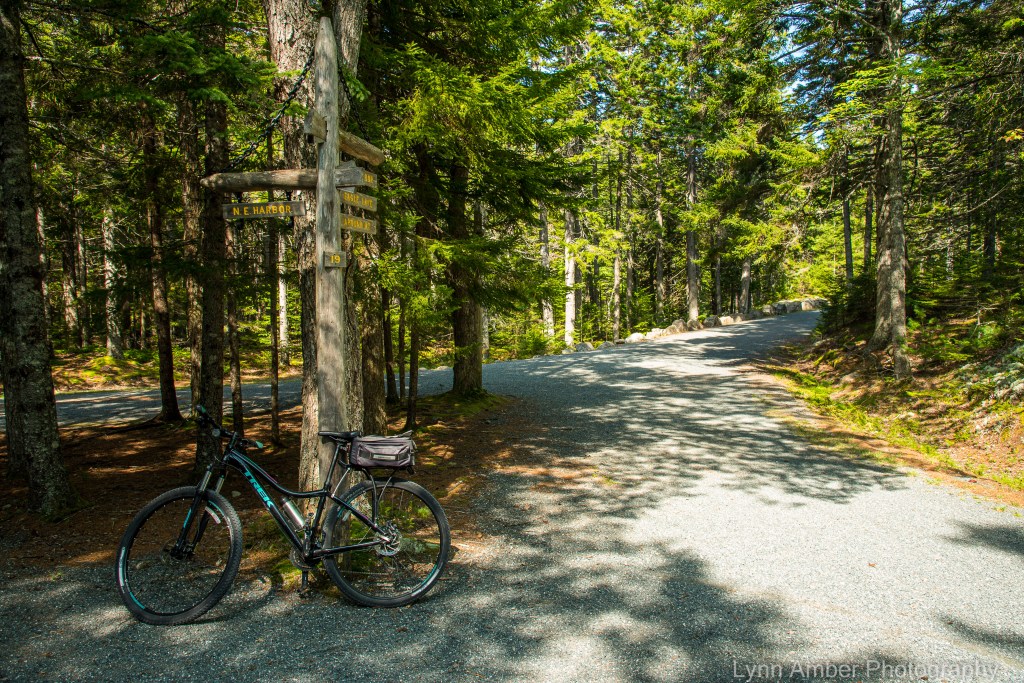
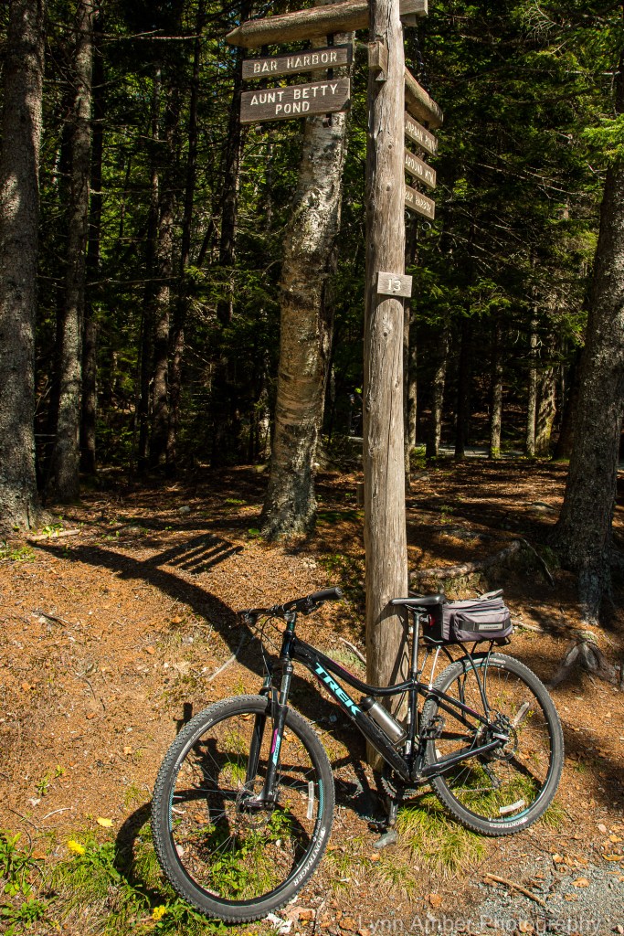
At Sign Post # 13, I take a right and head towards Aunt Betty Pond, passing by the Parkman Mountain parking area on my left. This 3.3 mile section of the carriage road is primarily wooded and has very moderate grades – although at this point in the journey my legs are feeling workout and any slight uphill climb is a challenge! 🙂
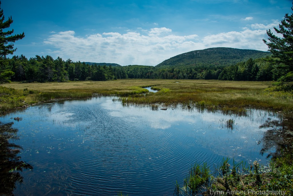
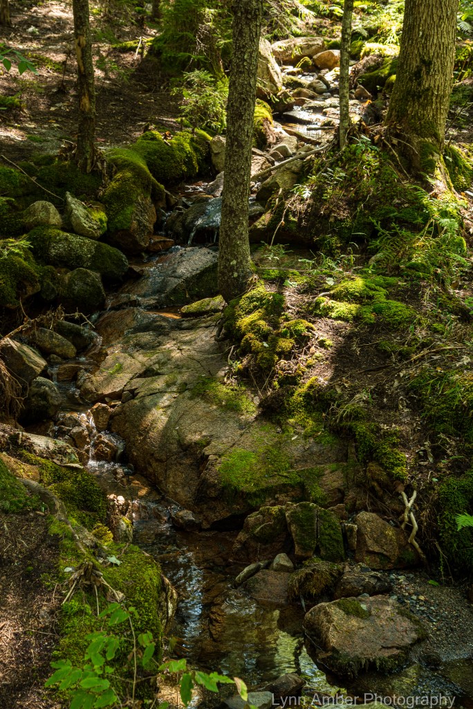
Before embarking on the last big 1.1 mile uphill climb, I stopped for a break and some snacks at this beautifully peaceful spot along the road.
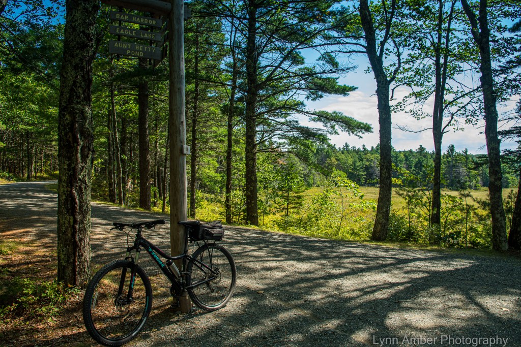
After my lunch break, I have a decision to make. I could take a left at Sign Post # 11 and take the road past Aunt Betty’s Pond which would take me back to Eagle Lake near my starting point. Or, I could go right at # 11 and bike the route through the Seven Bridges area. Since I’ve biked to Aunt Betty’s Pond already this year, I opted for going through the Seven Bridges and ending up at Sign Post # 10N.
The Seven Bridges connector road zigzags over the small brook that eventually dumps into Aunt Betty’s Pond watershed. The small wooden bridges span the creek as the 1.1-mile ascent climbs towards Sign Post # 10N. It’s a shady, steep climb and since this is the 12th mile of my 14-mile journey you can imagine how my legs were feeling! 🙂 It was a good excuse to take a break for photographs!!
At Sign Post # 10N, we come once again to the Around the Mountain byway that is closed due to storm damage. Along that section of the trail is another Rockefeller bridge called the Chasm Bridge. In previous years, I’ve walked to that bridge via this section of the carriage roads. It will not be a bridge I visit this year.

At this point, I retrace my route back to Sign Post # 8 and take the refreshing downhill glide to the Eagle Lake parking area – my trip complete!! A perfect day in every way!! 🙂
Winter Harbor Ferry
A couple of weeks ago on one of my day’s off, the forecast was predicting record high temperatures and a heat index over 90 degrees. I decided the best place to be in that kind of heat was on the water! During my 3 seasons here in Acadia, I had never embarked on the Bar Harbor-Winter Harbor Ferry that crosses Frenchman’s Bay and takes travelers to Winter Harbor and the Schoodic Peninsula, where the mainland part of the park is located.
I decided to take the 11:00 am ferry over to Winter Harbor and return on the 2:30 pm ferry boat. This would allow me enough time to take a short hike on the Schoodic Peninsula and return home in time for an early dinner.

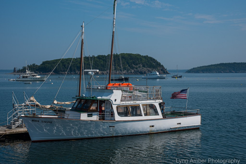
The ferry “Miss Lizzie” started boarding about 15 minutes ahead of departure time and it was full! I decided I wanted to have a strategic spot on the upper deck and made my way up the ladder as soon as I stepped onto the deck.
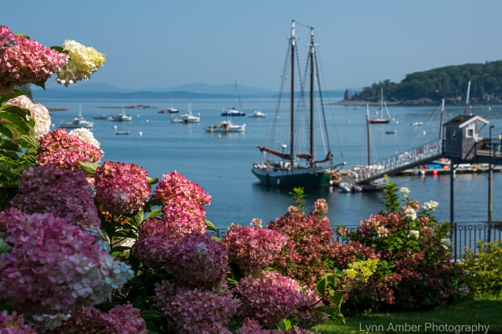
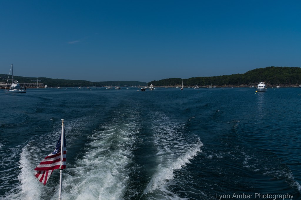
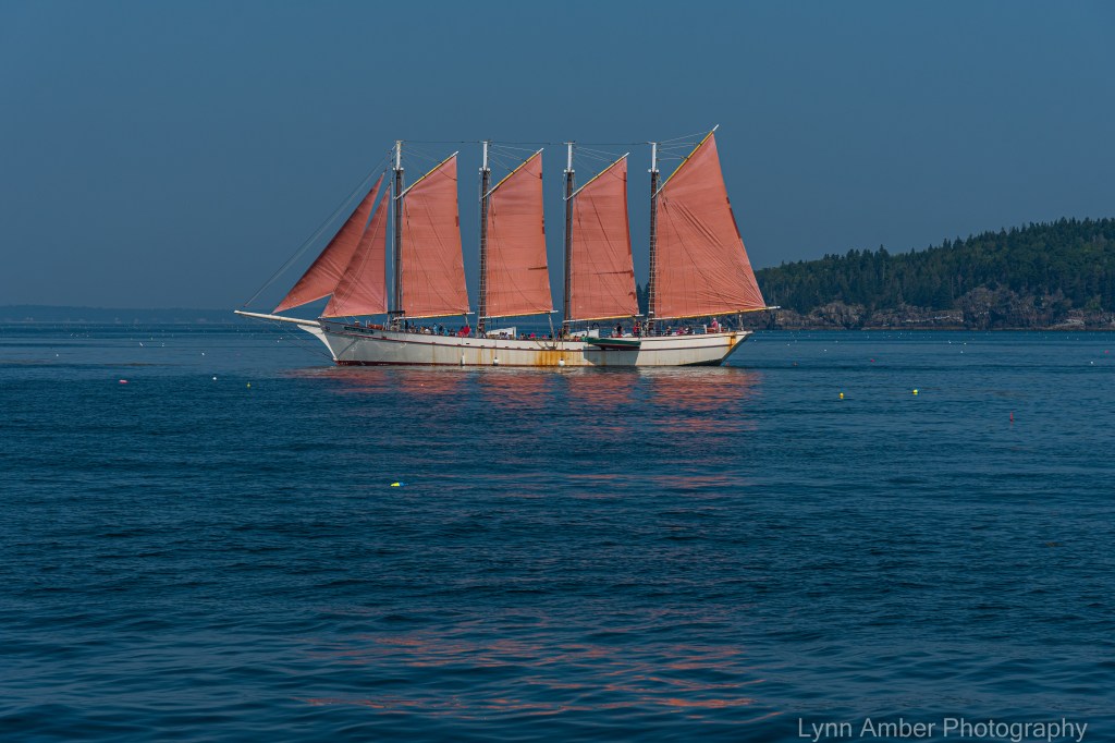
As we left the harbor, we immediately saw some porpoises swimming along in the wake of the boat. It was so much fun to watch them! They were too quick for a photo! Up ahead of us, the Margaret Todd schooner was sailing back into the harbor. My last season here in Acadia I took a ride on the Margaret Todd. It was well worth it – although the cruise I enjoyed was lacking enough wind and we only had the sails up for a short while. Looks like there was plenty of wind on this trip today!
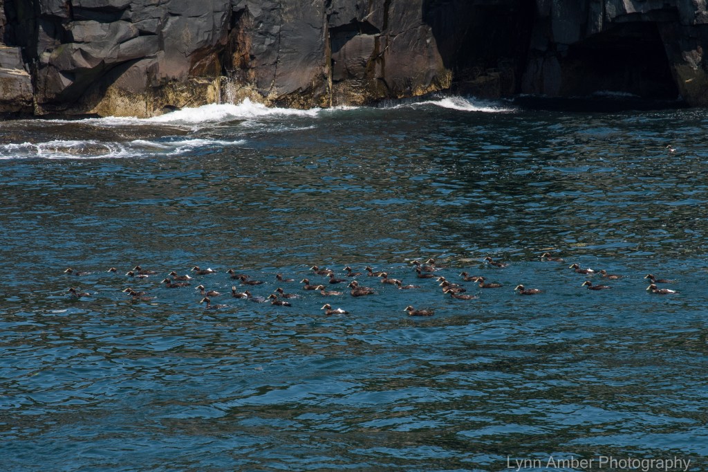
As we were skirting the Porcupine Islands, there was a flock of juvenile Common Eiders floating near the shoreline of the island. My original post listed these as American Coot. I was going by the white bill mostly and a Vermont friend who is a bird expert pointed out that he thought perhaps they were actually Common Eiders – in the juvenile stage. I am very inexperienced with bird identification and will most confidently go with his assessment! 🙂
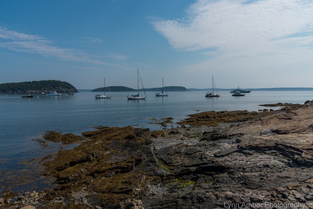
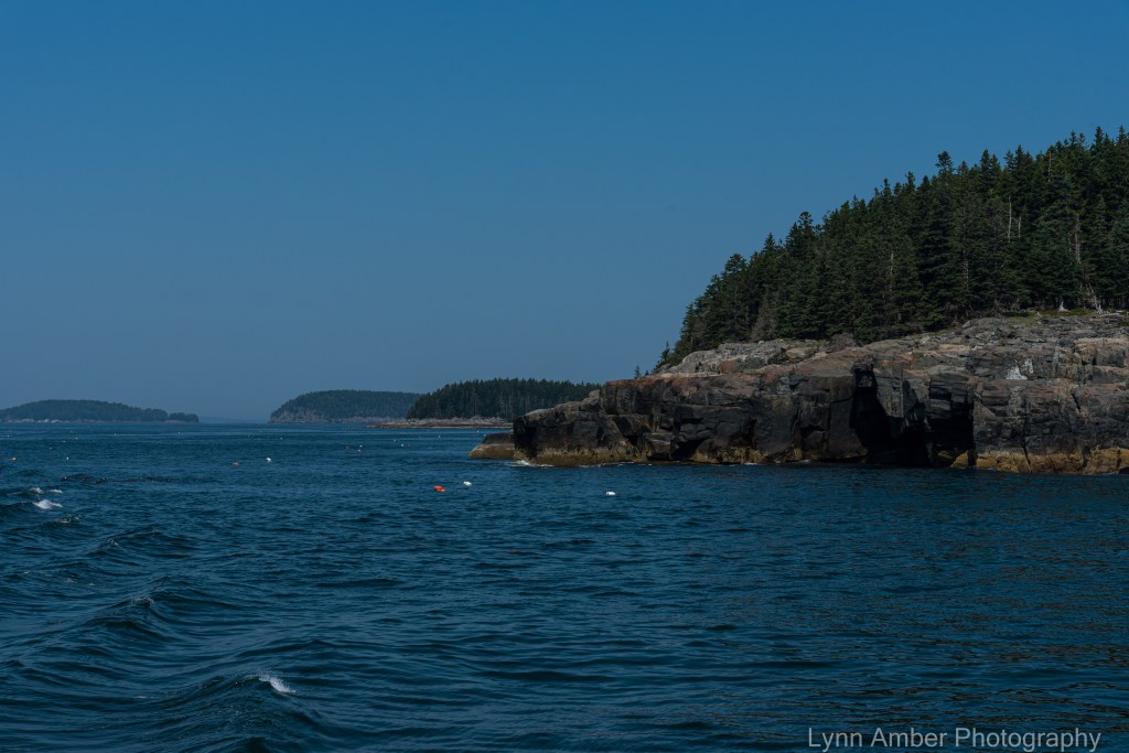
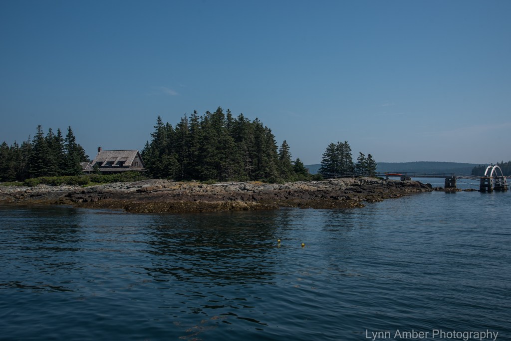
Scenes in Frenchman’s Bay on the way to Winter Harbor:
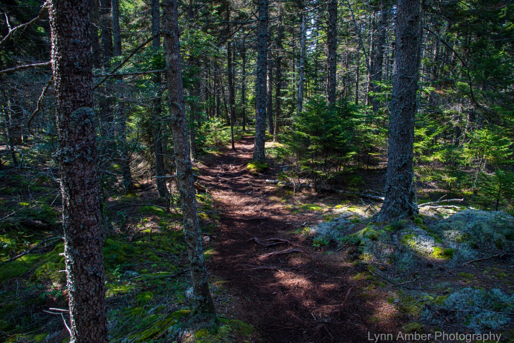
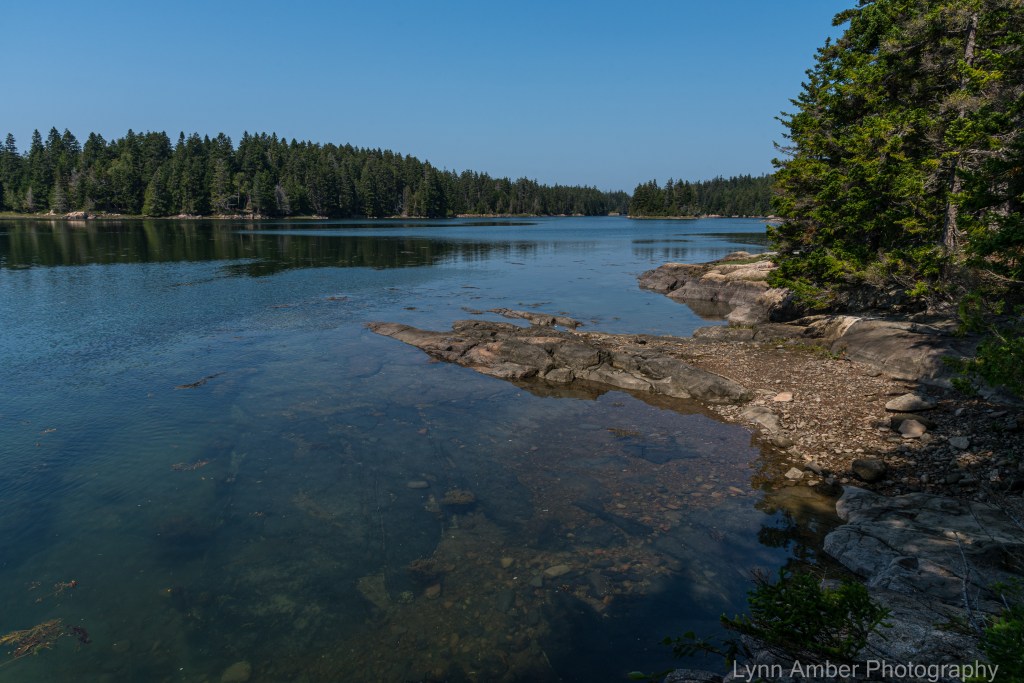
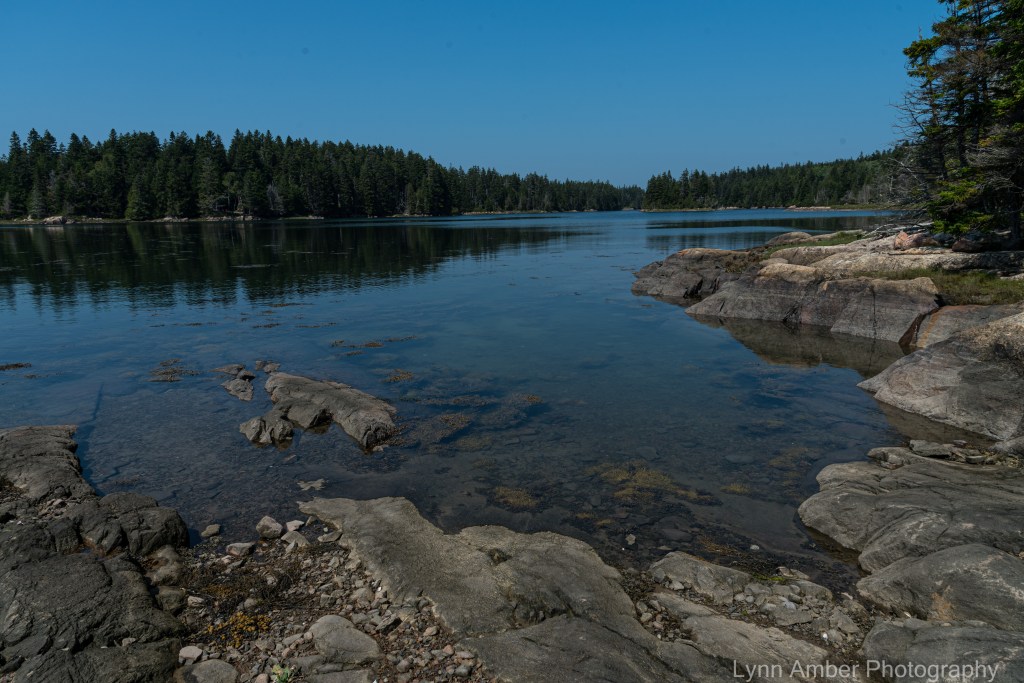
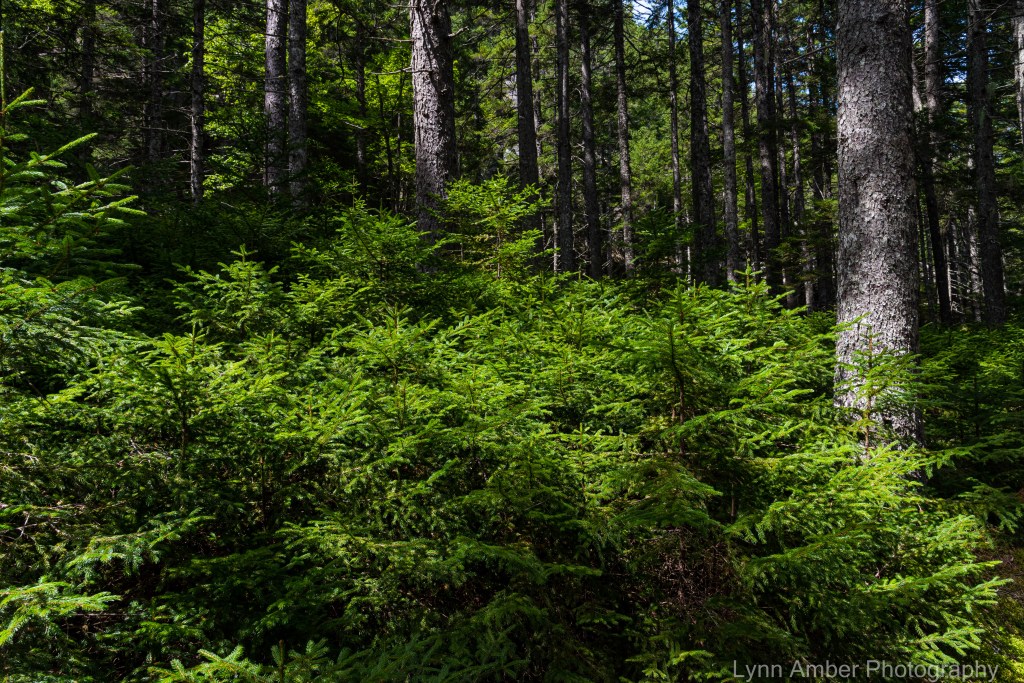
Once we docked at Winter Harbor, I hopped on the Island Explorer shuttle bus that would take me to the Visitor Center at the Schoodic Woods Campground. From there, I intended to take a short hike along the Lower Harbor Trail – making a 2.8-mile or so loop back to the starting point in time to take the shuttle back to the ferry. The trail took me through some nice, moss-covered, shady forest and along the coast of a protected harbor. A great choice for such a hot, humid day! 🙂
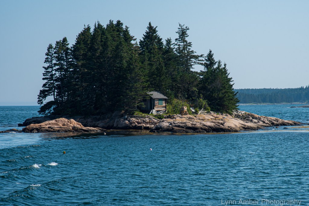
On the ride back to Bar Harbor on “Miss Lizzie” I got a few more shots of some of the sights along the way. It was a perfect day for a outing on the water!!
Camera Maintenance

My camera is now 5 years old and I’ve been very happy with the purchase of this amazing full-frame digital wonder. While not a true professional-grade camera, it has served me well. I had one issue with the mode dial a couple of years ago and had to send it off to the Nikon center for repairs. It came back to me in great shape and I’ve had no problems since then with the functioning of the camera.
I clean the exterior body and lenses regularly, and use the “mirror lock-up” function to gently blow out any dust particles that make their way onto the sensor in the interior of the camera. However, after 5 years, it was obvious that I needed to do more to clean the sensor of dust. My attempts to remove dust using the blower did not get rid of some stubborn, nasty, clinging particles.
Over the past several months, I have been spending an inordinate amount of time in Lightroom removing “dust spots” with the spot removal tool. During this last month, my patience with this process finally reached its boiling point! All indications in my Nikon manual warned against attempting a self-cleaning of the sensor. In my manual, it states “dirt that cannot be removed with a blower can only be removed by Nikon-authorized service personnel.” The last time I sent my camera off for repair weeks went by before it was returned to me. I just did not want to go this route.
Researching online, I found several really good videos by professional photographers that detailed the process of removing these difficult dust particles. While I was nervous about trying this, it seemed simple enough and I ordered one of the recommended full-frame sensor cleaning kits complete with a number of pre-packaged cleaning swabs and a sensor cleaning solution. The kit came with detailed instructions. I resigned myself to the fact that I might damage the sensor and would accept the consequences. But, all indications pointed towards this being a very easy process.
After the first pass with the moistened swab, I took a test photo and loaded it into Lightroom to see if I had been successful in removing all the dust particles. The image was so much better than before but I still noticed several dust spots remaining along the edges of the photo. According to the instructions, a second cleaning was often necessary and I performed an additional pass over the sensor with a new swab.
It was close to sunset by the time I completed the second cleaning so I walked down along the coastline and took a shot of the sunset – with an emphasis on getting as much sky as possible. I loaded the photograph into Lightroom and scanned for dust. For the first time in many months, I had ZERO dust spots that needed manipulation!! 🙂
I am a happy, happy photographer!!
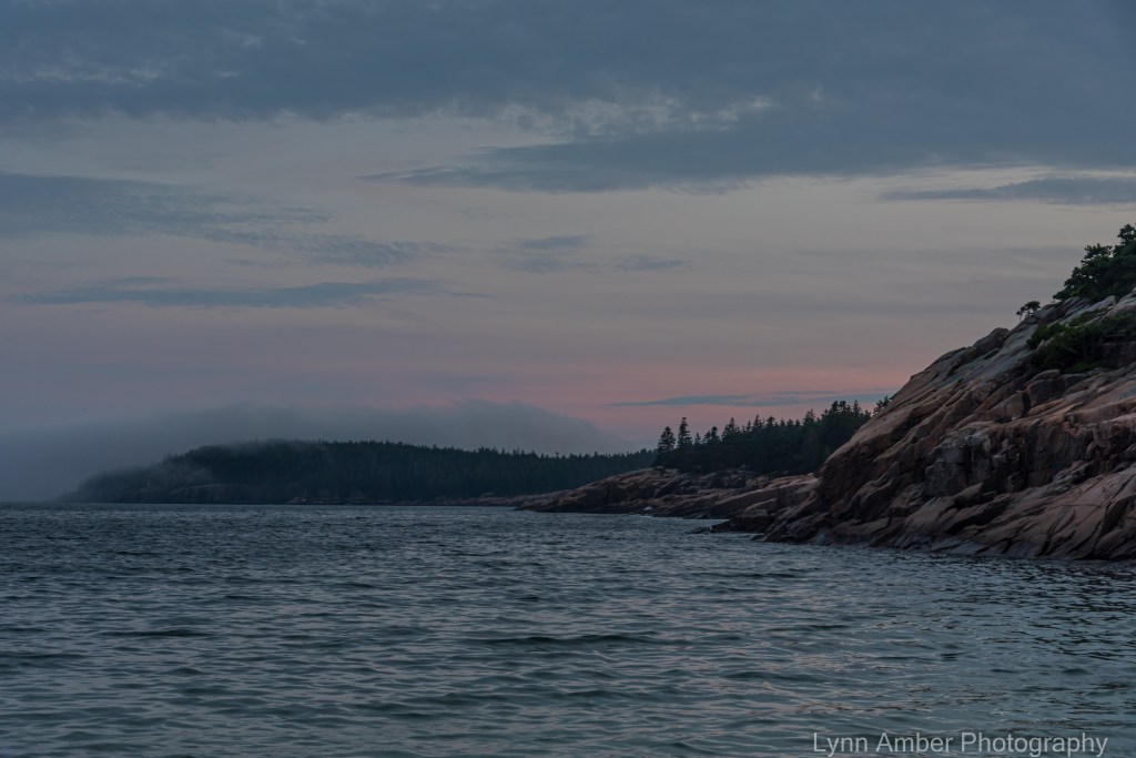
Sunrise Over Otter Point
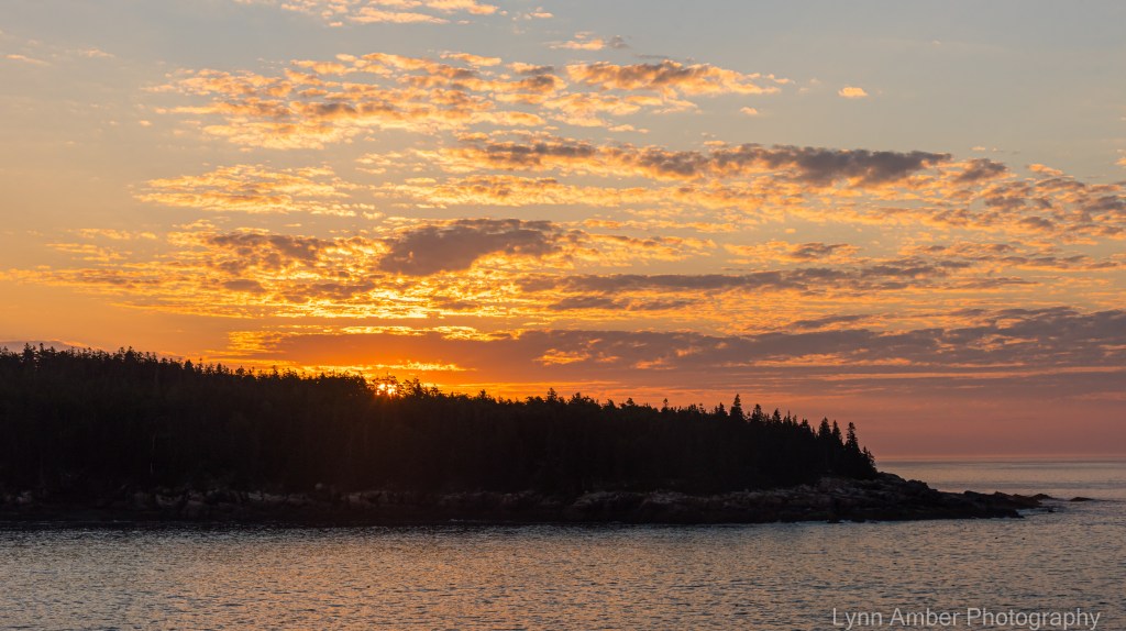
Rose early the other morning and watched the sunrise over Otter Point. Turned out to be a good move. Since I was up so early I was able to beat the heat and get a 7-mile hike in before noon! 🙂
I hiked a loop that takes me up and over Pemetic Mountain. Love this trail. I started at the north parking lot for Jordan Pond and traversed over to the Bubble Pond carriage road extension via the Bubble and Jordan Ponds Path. From there, I walk the carriage road to its junction with the North Ridge Pemetic Mt trail. This is a steep, rocky and root-covered 1.1 mile trek to the summit. I head back to the parking lot via the South Ridge Pemetic Mt trail and re-do part of the Bubble and Jordan Ponds Path. The entire loop is close to 7 miles and takes the hiker through conifer forests, along two ponds and across the ridgeline of a granite-covered mountain. Who could ask for anything more!! 🙂

I choose to do this loop so that I’m walking down the south ridge because the views are just phenomenal!

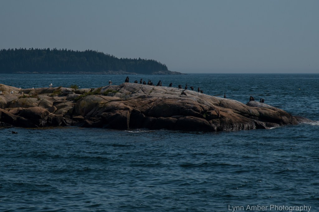
Cormorant Pair

During my morning walk along the rocky coast the other morning, I stopped and watched this pair of cormorants resting on a rock outcropping. Cormorants spread their wings so they can dry them after diving for food. Their feathers are designed to inhibit buoyancy so they can dive deeper. This causes their wings to get waterlogged and they need to dry them occasionally! Some other bird species use this wing-spread technique for thermoregulation but it has been shown that cormorants strictly do this to dry their wings. Interesting and fun science fact!! 🙂
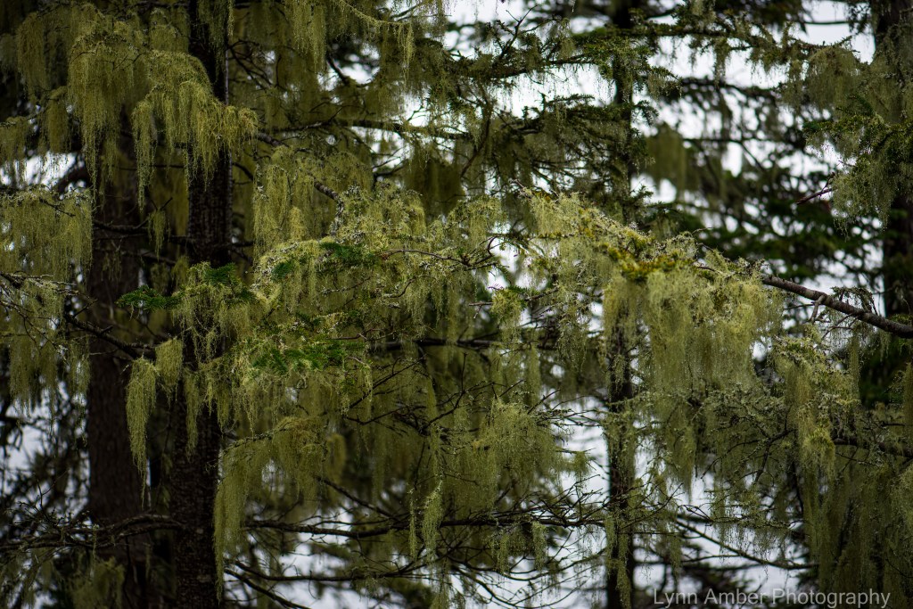
Along the coast hanging from the trees is a type of fruiticose lichen from the genus Usnea – often referred to as Old Man’s Beard. The park website cites that Acadia is rich in its lichen population and claims to be one of the most lichen-diverse national parks in the country. As indicators of air quality, lichen diversity and abundance can tell us a lot about the environmental health of the region. Apparently, some birds will use these long strands when nest building – including the northern parula warbler. Cool! 🙂
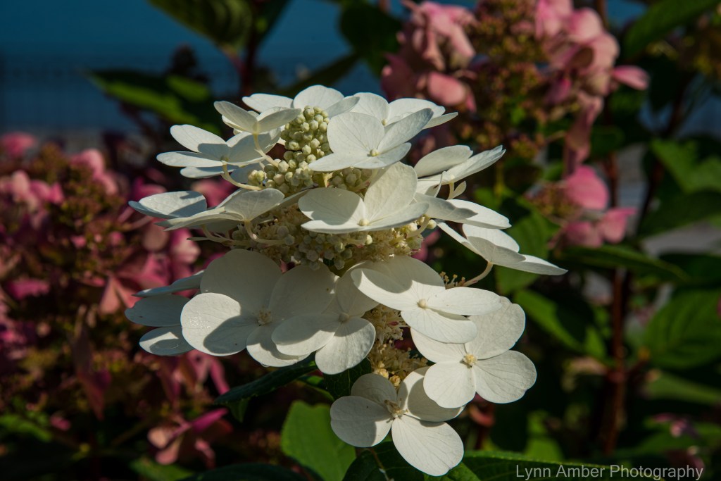
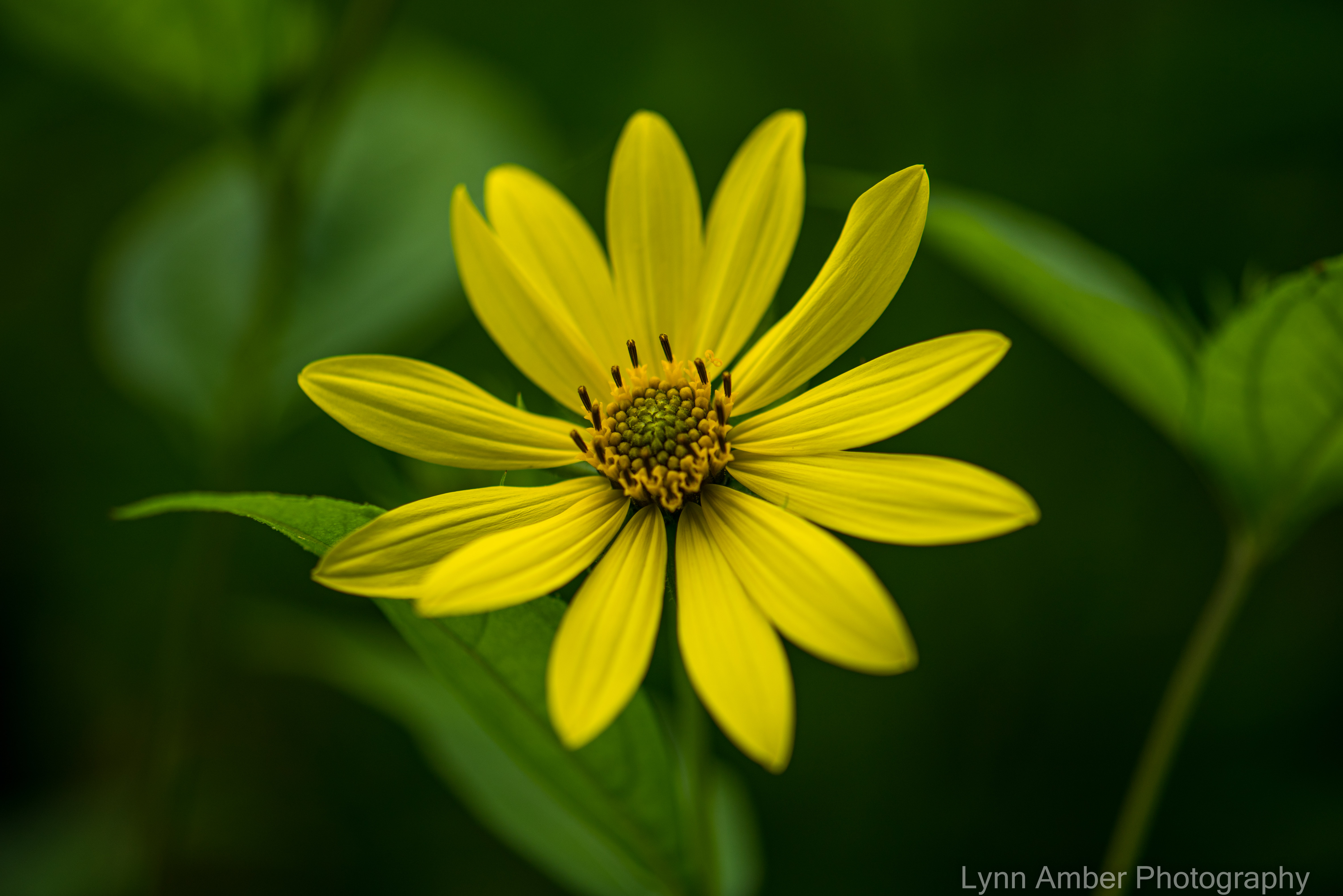
Thuya Garden Flower Fix
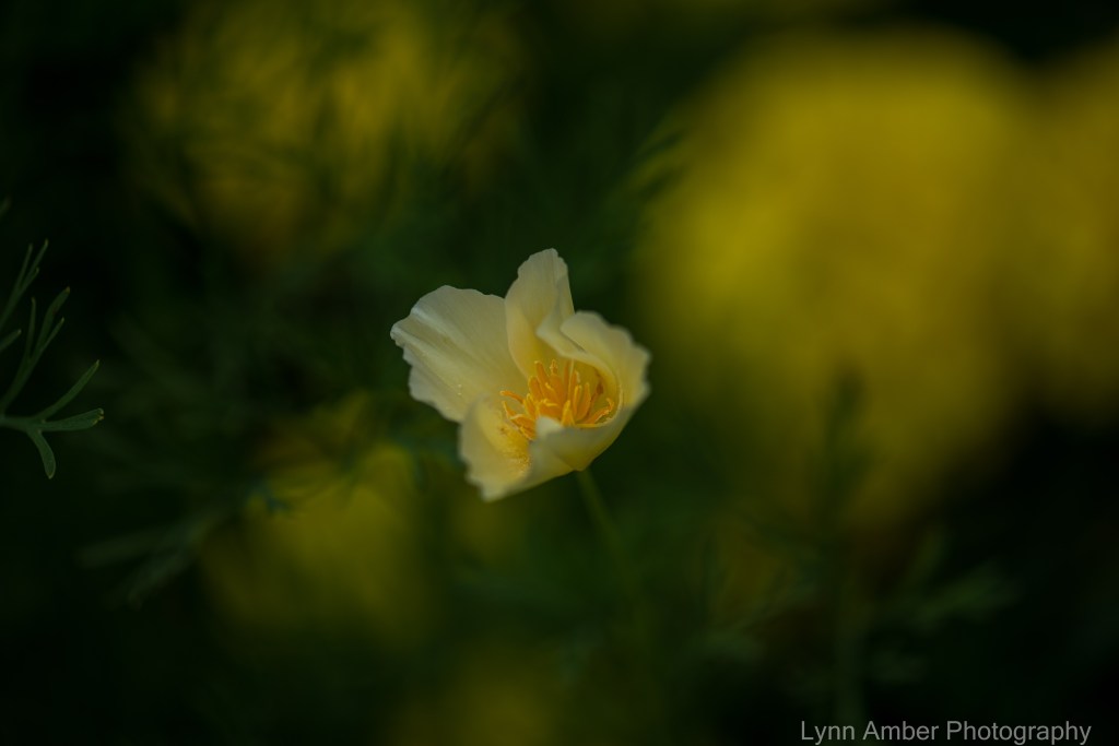
I needed a serious flower fix yesterday. So, dodging raindrops, I visited my favorite garden on the island to see what was in bloom since the last time I dropped in. Using a very shallow depth of field, I was able to create some very nice effects!


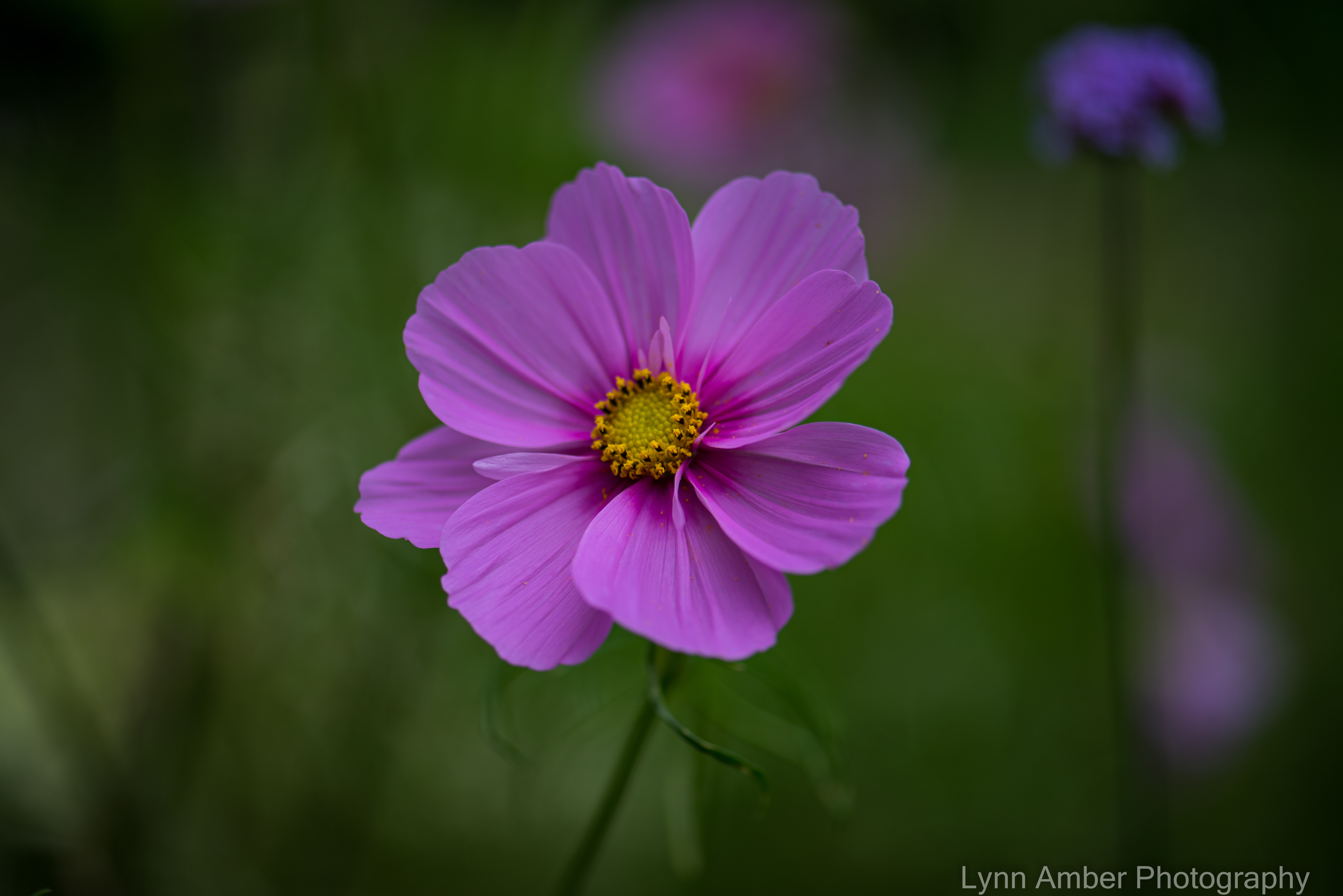

Spending time strolling around the garden and concentrating on photo composition totally captures my attention and I am liberated from all the negativity in the news and everyday worries that seem to invade and capture my thoughts. Great therapy – gardens and photography! 🙂


Relaxing Day Off Hike
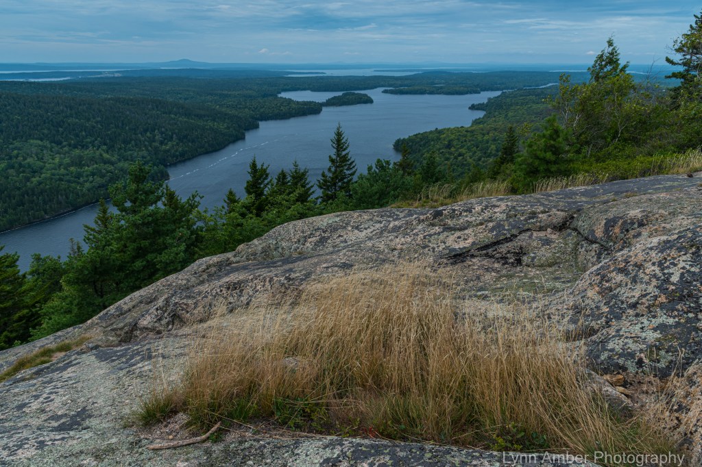
I have found that my third season here at Acadia has changed my perspective with regard to my day off excursions. I no longer feel the need cram as much hiking and biking in as before – always seeking out that one trail I have yet to conquer. It feels more like home now than a tourist destination. I sleep in more often and enjoy the simple pleasures of having a leisurely coffee down on the rocky coastline, and, then, I choose my free time hikes/bikes more discriminately.
One of my favorite short hiking loops is around Beech Mountain. The Valley Trail leaves from the parking lot at Beech Mountain and runs along the base of the Beech Mountain cliffs. It is a stunning hike through a moss-covered, rock-strewn spruce forest.
At the South Ridge Beech Mountain Trail junction, I hang a right and ascend the semi-steep path with multiple stone staircases to the summit of Beech Mountain. Once at the summit, I take in the view on the fire tower platform before starting my descent down the other side of the mountain.

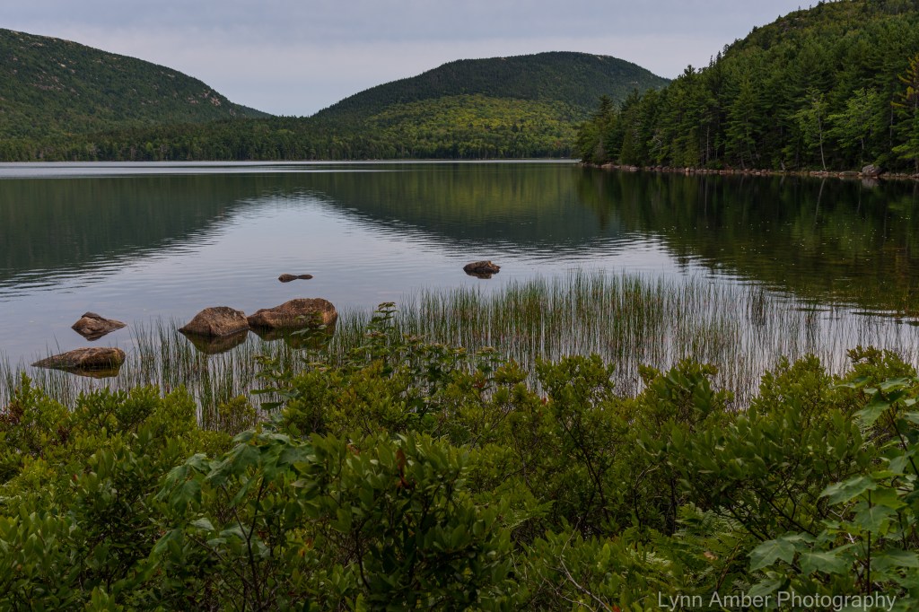
As I head back down the trail to the parking lot, I like to take the route that runs along the ridge above Long Pond. I have a favorite spot where I take a snack break and enjoy the solitude and quiet looking down on the large lake. From my vantage point, I watched a few kayakers making their way along the far coastline of the lake.
This morning for my second day off, I rose earlier (still not early enough for the sunrise!), walked down to the water’s edge and enjoyed watching the fog build off-shore. There was a lone lobster boat crew out checking their traps way off shore – the sun glistening off the boat. Cormorants and gulls were drifting by – gliding along the surface of the water. A peaceful start to the day!
Not sure what the rest of my day will bring – it’s been nice not “planning” my day’s off. As I do my morning chores, I’ll let my musings guide me towards the next adventure!
Sand Beach Sunset

I shot a number of photographs from the the shoreline at Sand Beach last night over a period of about a half an hour – close to sunset. Most of the shots did not include any people although there were a few lingering tourists enjoying a late day on the beach . I don’t know who these young boys are but this ended up being my favorite shot. I only took a couple of photos with them on the edge of the scene but I think the photograph speaks volumes about the mood of the evening. I was watching them splashing around in the waves totally immersed in their play and it took me back to memories of my own boys at that age – in a world all their own.
The fog was rolling in across the ocean and Otter Point, in the distance on the right, was engulfed with a blanket of mist. A zoomed-in look at the Otter Point mist below:

I moved a little further down the beach for a different angle just as the sky was turning pink towards the southwest.