Lynn Amber - Travel & Photography
sharing my thoughts through words and images
Carriage Road Tour

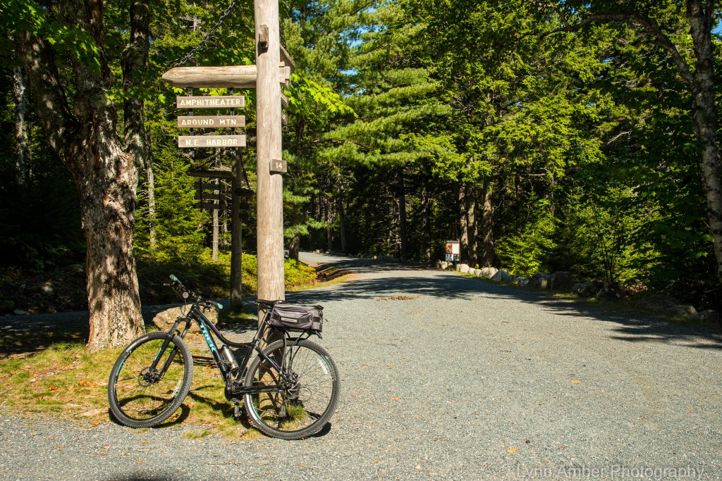
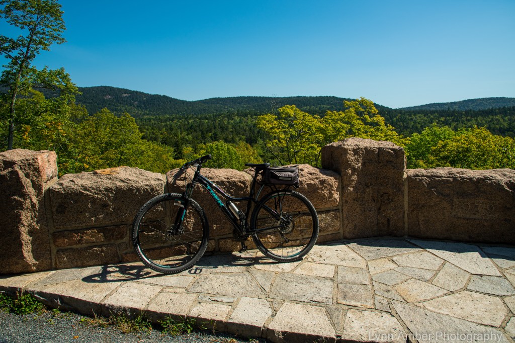
On Wednesday, the weather forecast was ideal for a long bike ride. I planned a route that would take me several hours to complete and capture a circuitous journey through the heart of the park. It was an ambitious 14-plus mile tour.
The 45-mile carriage road system in Acadia National Park has its origins back in the early 1990’s when John D. Rockefeller Jr. envisioned creating a motor-free byway through the young, developing national park. His inspiration for these paths came from the carriage road system his father had constructed on this estate – Forest Hill – in Ohio. Between the years 1913 and 1940, with the help of landscape architect Beatrix Farrand and countless other engineers and laborers, the existing gravel-packed roadway came to fruition. Today, the byway is maintained through a partnership between Acadia National Park and the non-profit Friends of Acadia organization. Funding through the federal Recreation Fee Demonstration Program allows a portion of the park entrance fees to be funneled directly into carriage road maintenance projects. In 1995, the Friends of Acadia established an endowment fund that contributes money towards the upkeep of the roads. In addition, volunteers with the Friends of Acadia alongside park employees spend countless hours on maintenance and restoration projects.
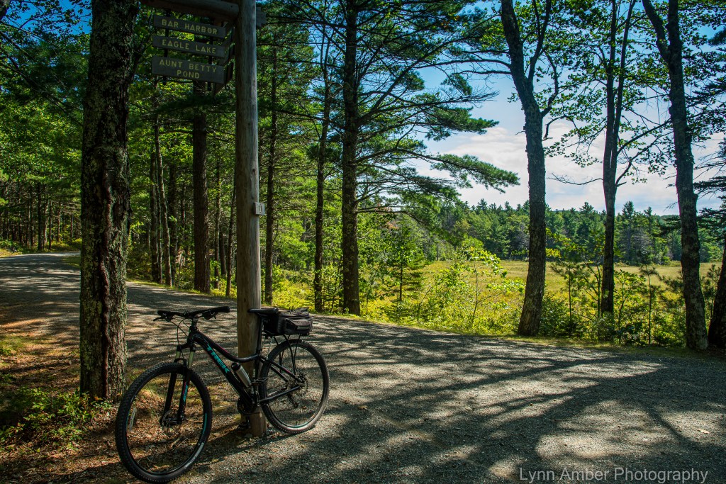
This year, the entire 6-mile section of the carriage roads around Eagle Lake was closed to undergo a major restoration effort. To date, the east side of this route is still closed for construction but the western and southern sections opened a couple of weeks ago. I decided to start my bike ride at Eagle Lake and see firsthand the newly constructed roadway.
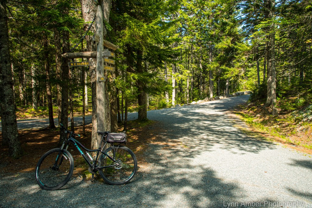
Parking anywhere in the park has been a challenge this year due to the record-breaking visitors who have descended us. When I arrived at the Eagle Lake carriage road access parking lot, it was full. Instead of parking along the side of the road leading up to the parking lot (as many people do), I opted for turning around and headed for the Eagle Lake boat launch area. Few people realize there are a limited amount of parking spaces here and I lucked out! There was only one other vehicle parked here! It meant I had to travel the short distance back to the other parking area – c’est la vie!
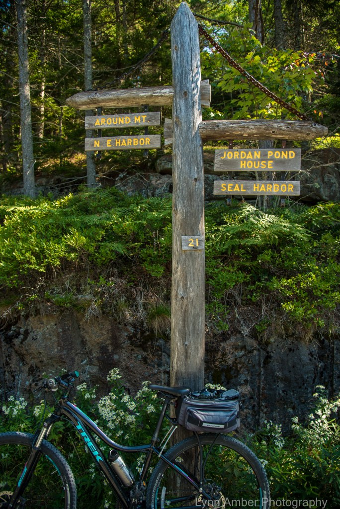
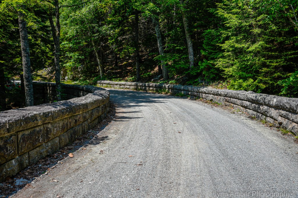
I started my ride at Sign Post # 6 on the northwest side of Eagle Lake and started the 1.9 mile climb to Sign Post # 8. It is a moderate uphill that gets your heart pumping right away!

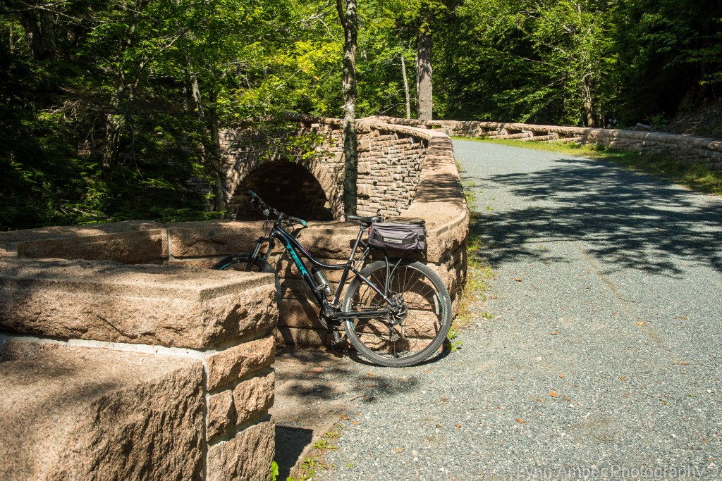
At Sign Post #8, I took a right hand turn and traversed the .1 mile section to Sign Post # 10S. A left turn at this juncture leads towards Jordan Pond. This 2-mile stretch of road has some short, gradual uphill climbs followed by a long downhill ride to Jordan Pond. One of the fun aspects of biking the carriage roads is challenging yourself to “bag” as many of the Rockefeller bridges as possible along the way. The first bridge I came to is the beautiful Deer Brook Bridge. Aptly named for the small creek it spans, this bridge was built in 1925.

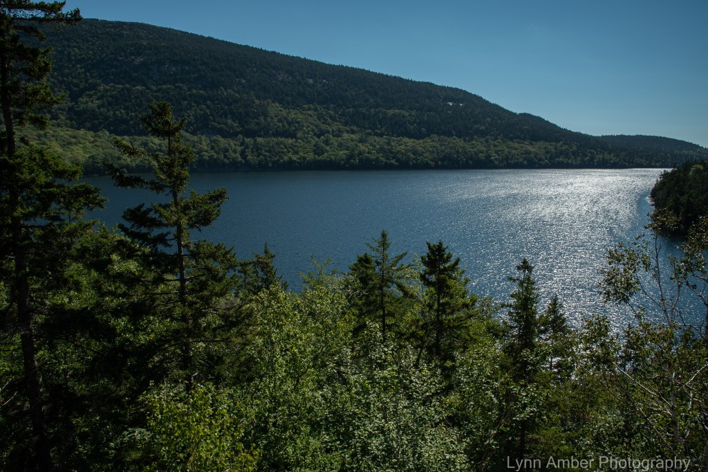
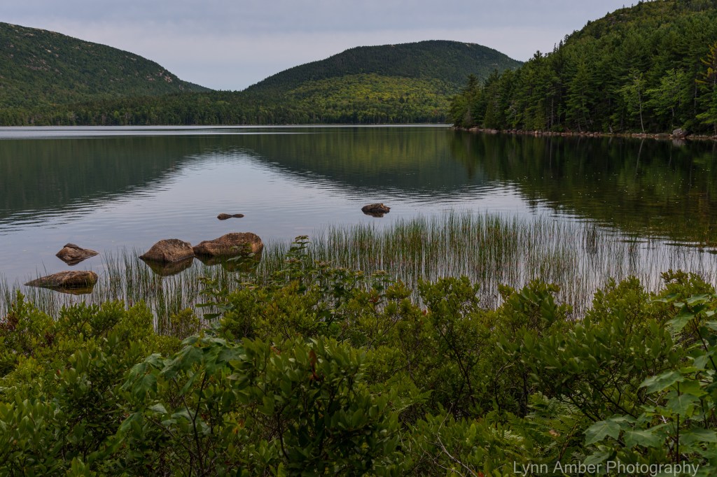
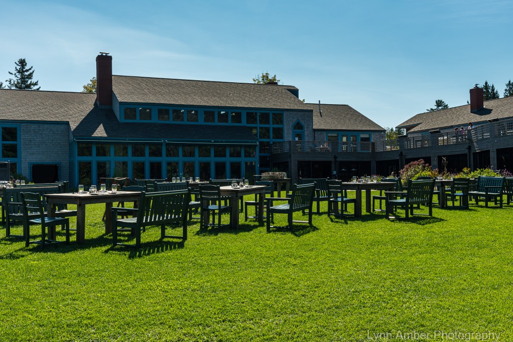
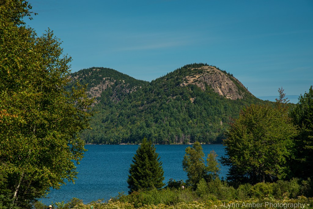
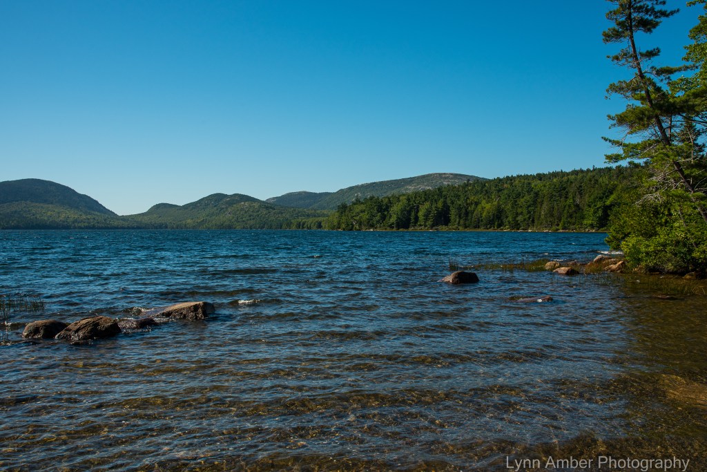
Past the Deer Brook Bridge, an opening in the tree-lined carriage road reveals a great view of Jordan Pond. My next goal was Sign Post # 14. However, I took a short detour on down the hill to the Jordan Pond House so I could fill up my water supply for the remainder of the ride.
Named for the family who used to farm this land back in the mid-1800’s, the Jordan Pond House started life as a restaurant and tourist destination in the late 1800’s. The original building was lost to a fire in 1979, and it was rebuilt and re-opened in 1982. Famous for its “tea and popovers”, it is a full-service restaurant and a very popular destination. Adjacent to the restaurant is a large gift shop, and it is also a great jumping off point for access to the carriage road system.
After filling up with water, I made the short uphill climb back up to Sign Post #14 and took a left hand turn to ride the 1.0 mile section to Sign Post # 21. There are two bridges along this part of the byway – the West Branch Jordan Stream Bridge and the Cliffside Bridge. Of course, I stopped at both to grab a photo!

According to an historical document I came across (from the Historic American Engineering Record published by the National Park Service), this bridge was built in 1931 and designed by architect William Welles Bosworth. Engineered by Paul Simpson who worked closely with Rockefeller, it was copied from a similar bridge in New York’s Central Park.
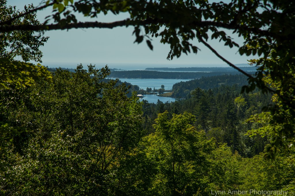
Heading towards the Cliffside Bridge, the view opened up to expose the distant Little Long Pond and its historic boathouse – a former Rockefeller property that is now part of the non-profit Land and Garden Preserve.
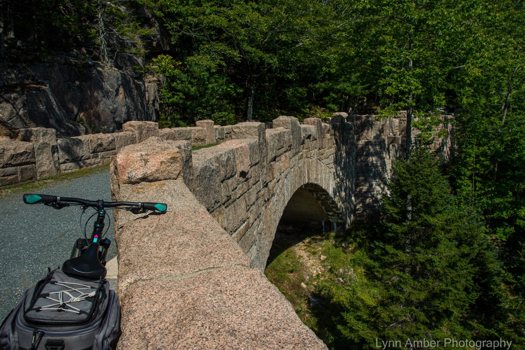
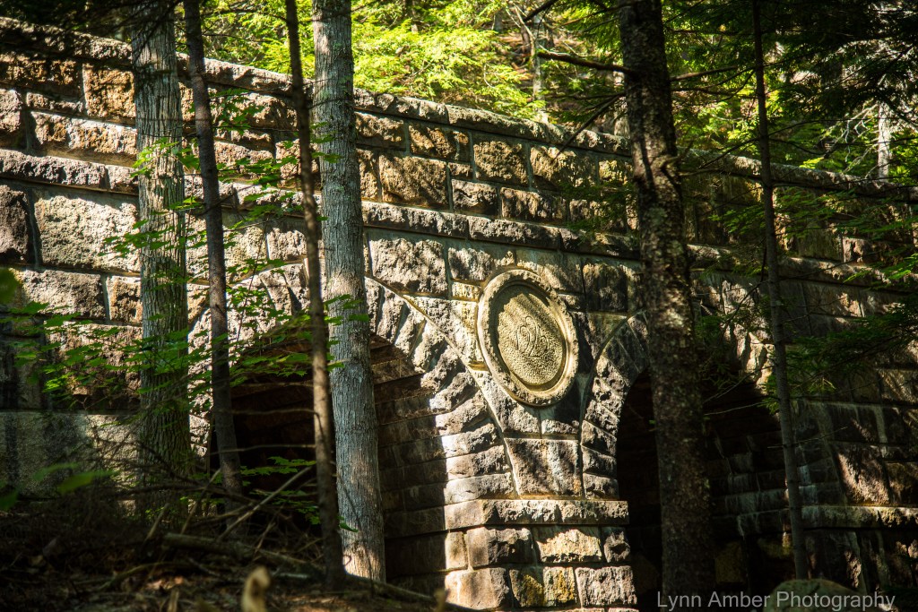
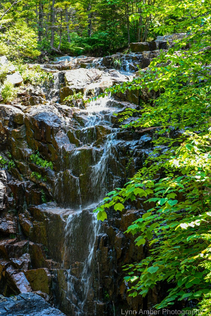
The Cliffside Bridge was constructed in 1932. The single arch spans 50 feet and the granite stone bridge is almost 250′ long from end to end! Leaving the Cliffside Bridge, I quickly approached Sign Post # 21 where I hang a right-hand turn towards Sign Post # 20. This stretch of the road is a moderate ride with a nice mix of gradual uphill climbs followed by some restful downhills. Also along this part of the byway is the impressive Amphitheater Bridge built in 1931. Considered the largest of the Rockefeller bridges, this one sits high up on a hillside and spans the Little Harbor Brook. The arch was designed to showcase the Little Harbor Brook waterfall that cascades down towards the bridge on the uphill side.
Continuing on this 1.2 mile distance, I reach the Sign Post # 20 where another right-hand turn will take me the .9 miles to Sign Post # 19. Again, this part of the route consists of moderate grades with an equal amount of uphill climbs and downhill glides!

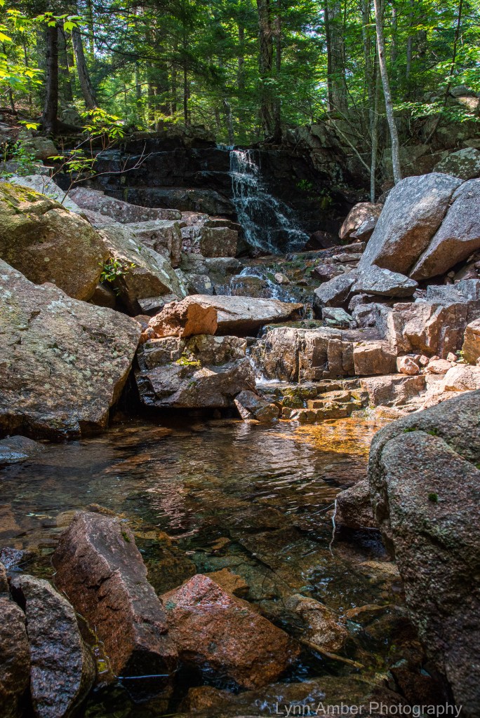
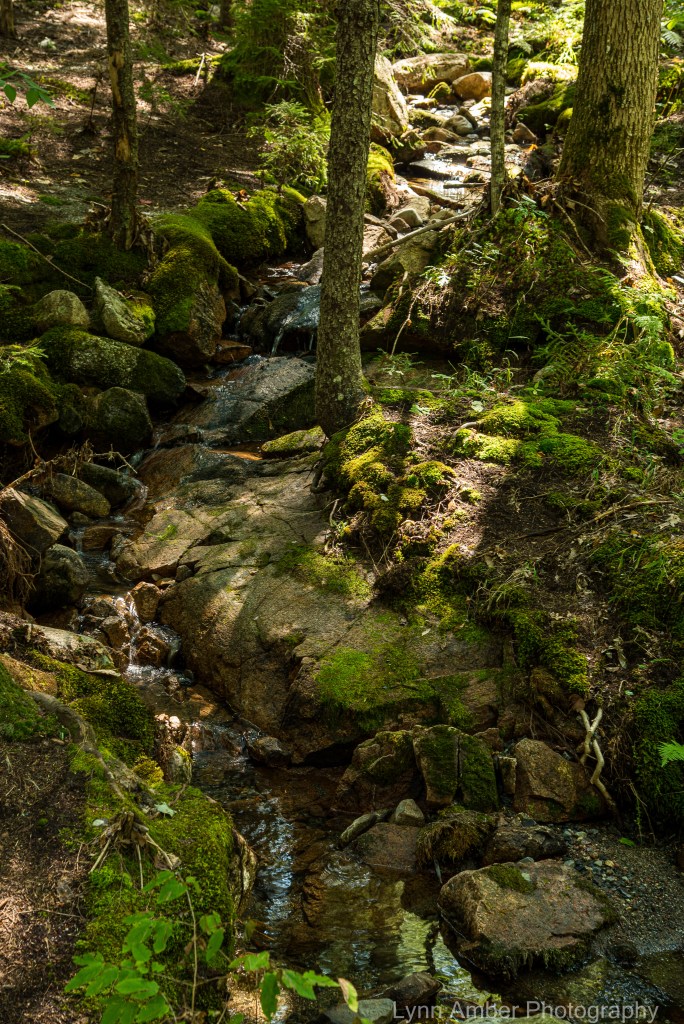
The section of the carriage road between Sign Post # 19 and Sign Post # 12 begins with a long, gradual ascent that leads me towards two more Rockefeller bridges. Built in 1925, the Waterfall Bridge extends across the Upper Hadlock Brook and showcases one of the largest waterfalls in the park. It is especially dramatic to visit this bridge after a significant rain! The bridge is faced with stone and reinforced with concrete and steel. Since there was limited stone in the immediate vicinity of the construction, granite was hauled to the site from the Brown’s quarry 3 miles away at a considerable cost. From the Historic American Engineering Record description: “The bridge walls are constructed of cut granite and feature semicircular plan turrets to either side of the arch. The stone parapet walls are capped by projecting stone coping and
terminate in scrolled stone end posts or curtails.”
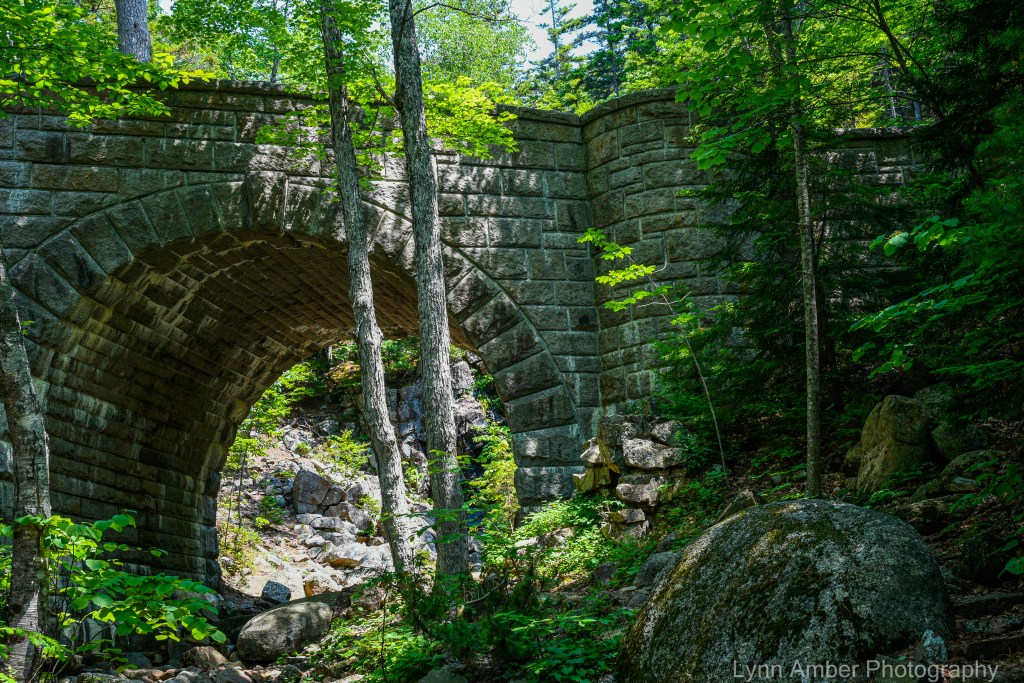
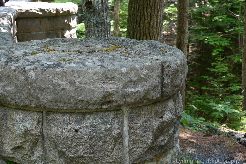
Located in close proximity to the Waterfall Bridge, the Hemlock Bridge spans the Maple Spring Brook and is an understated yet elegantly styled structure. Completed in 1924 just prior to the Waterfall Bridge work, the Hemlock Bridge is named for the towering hemlock trees that create a backdrop for the stone bridge. The description in the Historic American Engineering Record is telling: “One of only two Gothic-arched bridges on the Rockefeller carriage road system, Hemlock Bridge is one of eight major stone bridges on the “Around-the-Mountain” carriage road loop. The pointed arch design was chosen for its harmony with the pointed hemlock trees which surround the site.”

After leaving the Hemlock Bridge behind me, I reach Sign Post # 12 and the steep descent to Sign Post # 13. Between Sign Posts 10 and 12 is part of the “Around the Mountain” route that suffered severe storm damage and erosion in the torrential rain we had in June. The repairs have yet to be completed and this area has been closed most of the summer.
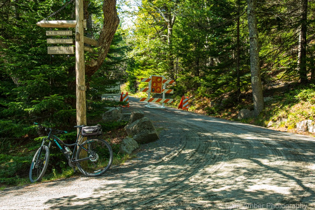
Looking towards the Around the Mountain section of the road system that has been closed since June due to storm damage
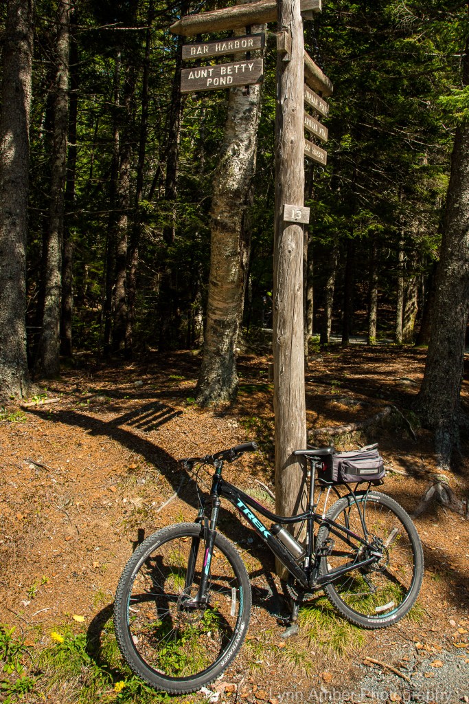
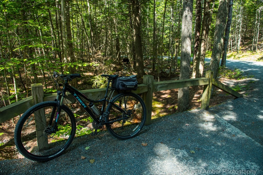
At Sign Post # 13, I take a right and head towards Aunt Betty Pond, passing by the Parkman Mountain parking area on my left. This 3.3 mile section of the carriage road is primarily wooded and has very moderate grades – although at this point in the journey my legs are feeling workout and any slight uphill climb is a challenge! 🙂
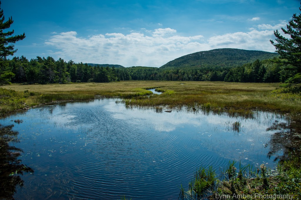
Before embarking on the last big 1.1 mile uphill climb, I stopped for a break and some snacks at this beautifully peaceful spot along the road.
After my lunch break, I have a decision to make. I could take a left at Sign Post # 11 and take the road past Aunt Betty’s Pond which would take me back to Eagle Lake near my starting point. Or, I could go right at # 11 and bike the route through the Seven Bridges area. Since I’ve biked to Aunt Betty’s Pond already this year, I opted for going through the Seven Bridges and ending up at Sign Post # 10N.
The Seven Bridges connector road zigzags over the small brook that eventually dumps into Aunt Betty’s Pond watershed. The small wooden bridges span the creek as the 1.1-mile ascent climbs towards Sign Post # 10N. It’s a shady, steep climb and since this is the 12th mile of my 14-mile journey you can imagine how my legs were feeling! 🙂 It was a good excuse to take a break for photographs!!
At Sign Post # 10N, we come once again to the Around the Mountain byway that is closed due to storm damage. Along that section of the trail is another Rockefeller bridge called the Chasm Bridge. In previous years, I’ve walked to that bridge via this section of the carriage roads. It will not be a bridge I visit this year.

At this point, I retrace my route back to Sign Post # 8 and take the refreshing downhill glide to the Eagle Lake parking area – my trip complete!! A perfect day in every way!! 🙂

Lynn, you have done a masterful job of portraying the carriage roads and it’s dramatic bridges, including some of their unique features. I realize you had a sunny day with clear skies, yet the colors in your images are more brilliant than the scenery itself. Kudos for this grand tour of Acadia’s most beloved asset. Stewart
PS: I hope you will soon feature Duck Brook Bridge, my second most favorite after the Cobblestone Bridge you previously wrote about.
LikeLiked by 1 person
Oh – I bike the Witch Hole Pond loop all the time and park by the Duck Brook Bridge – it is a spectacular example as well!
LikeLike