Lynn Amber - Travel & Photography
sharing my thoughts through words and images
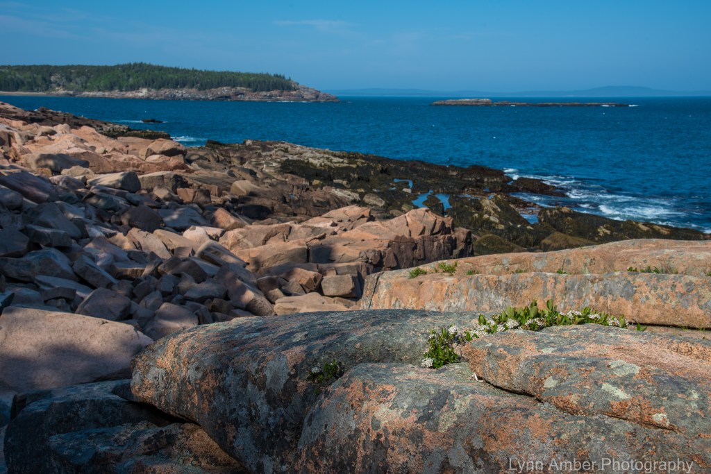
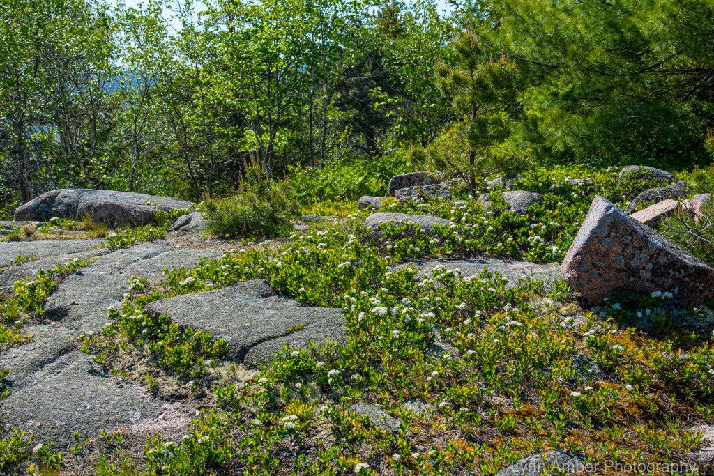
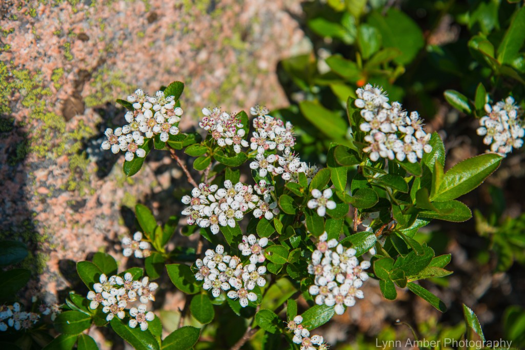
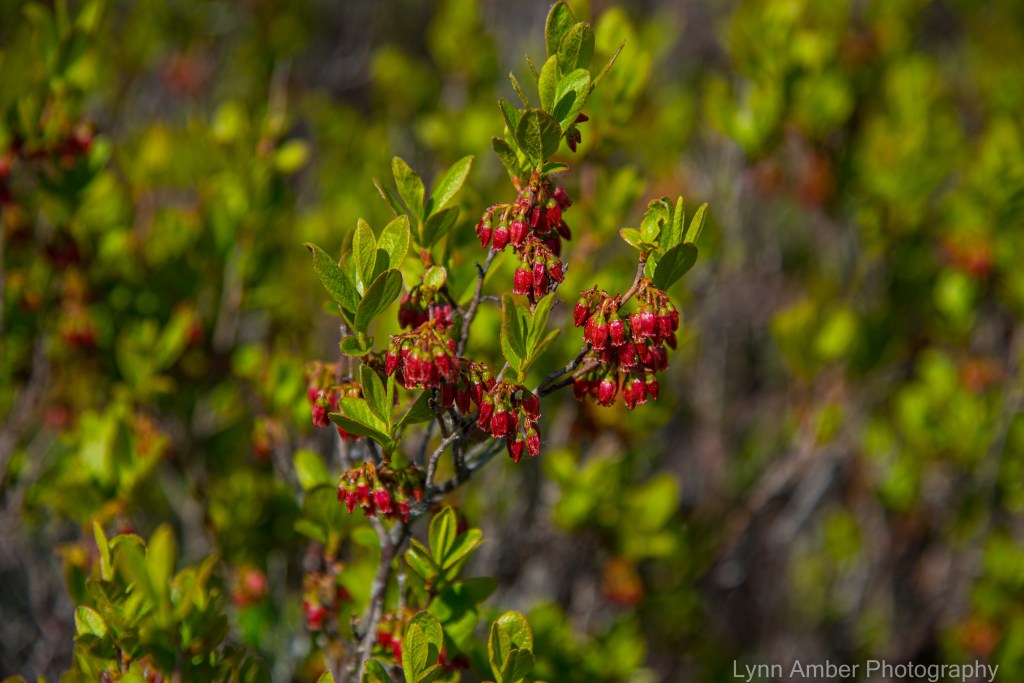
Photo a Day 7.1.21

It’s time to initiate a new challenge for myself to post a photo a day for the month of July! Should be interesting as my cell signal has been challenging the past couple of weeks. I guess the closest tower is getting overwhelmed by all the visitors to the island.
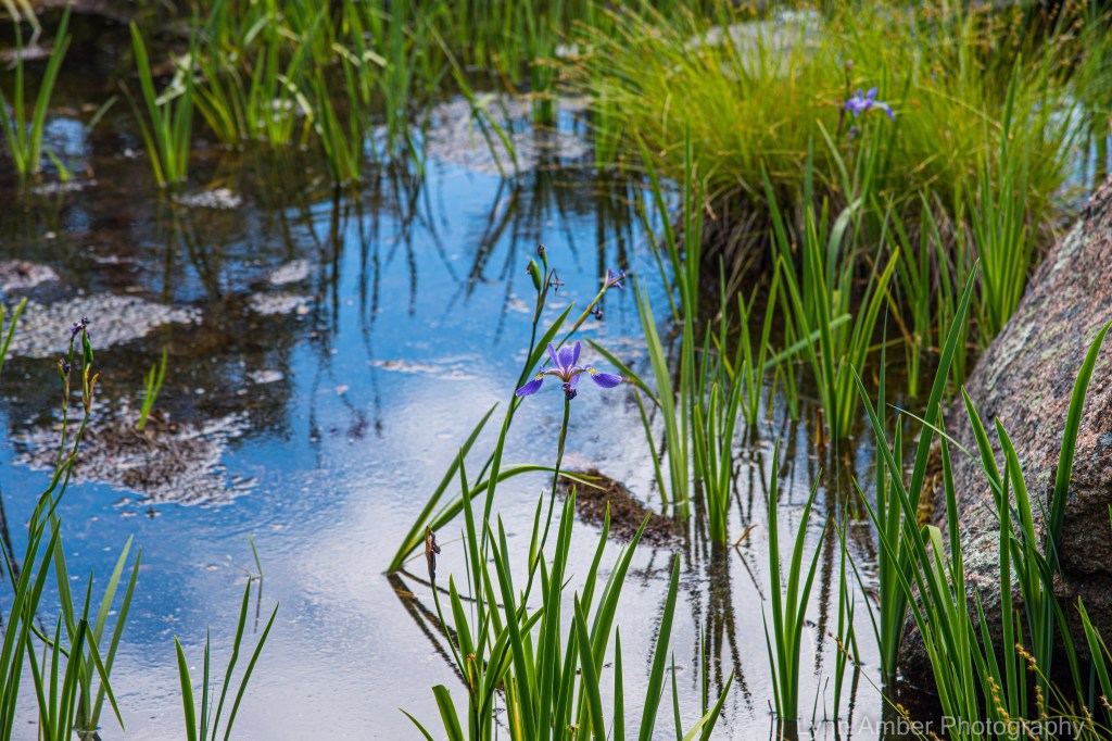
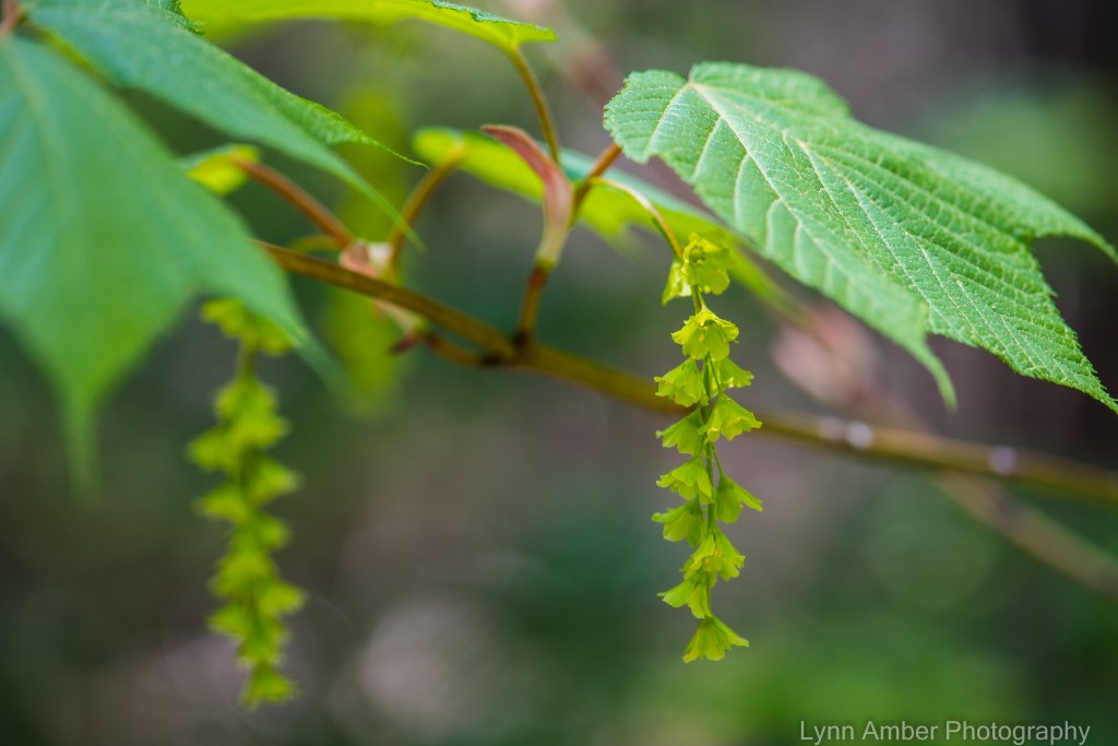
The photo above was taken at the Wild Gardens of Acadia – a native plant garden maintained by the Friends of Acadia.
Foggy Day and Rilke

As I was preparing my breakfast this past Sunday morning, I decided to pull up Vermont Public Radio on my iPhone and listen to whatever programming happened to be broadcasting – really just for some background noise. I was listening to a segment called On Being with Krista Tippett and came into the online discussion late trying to ascertain what the focus was – clearly something rather philosophical. When I heard mention of Rainer Maria Rilke, I immediately perked up. Two women were the subjects of the interview – Joanna Macy (environmental activist, author, Buddhist scholar) and Anita Barrows (psychologist, poet and translator) – and the discussion centered on their recent new translation and commentary on a book of poetry by Rainer Maria Rilke called Letters to a Young Poet.
I was somewhat familiar with Rilke having used one of his short poems for a book art project I engaged in at my previous place of employment – Dartmouth College. We had a vintage hand-operated printing press and I learned how to use it during a 2-part workshop. The one-page sheet I created was simple and involved setting the type, rolling the ink on the typeset and moving the plate under the press for “setting” the print. The poem I chose was:
“I Live My Life in Widening Circles”
I live my life in widening circles
that reach out across the world.
I may not complete this last one
but I will give myself to it.
I circle around God, around the primordial tower.
I’ve been circling for thousands of years
and I still don’t know: am I a falcon,
a storm, or a great song? –Rainer Maria Rilke

The conversation on today’s podcast captured my attention completely once I realized the women were discussing Rilke. I was so totally enthralled by the words of wisdom imparted by Joanna Macy in particular. The connection she feels and pure love she evokes for this earth we live on struck a deep chord within me.
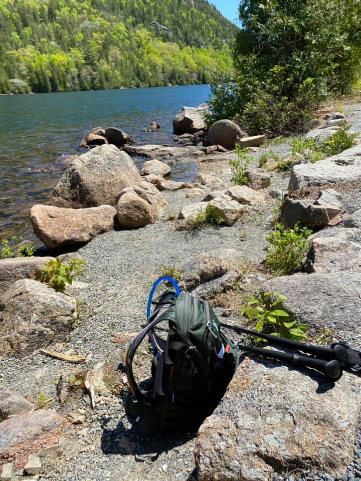
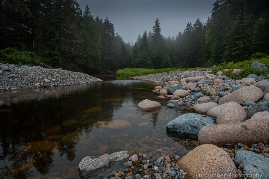
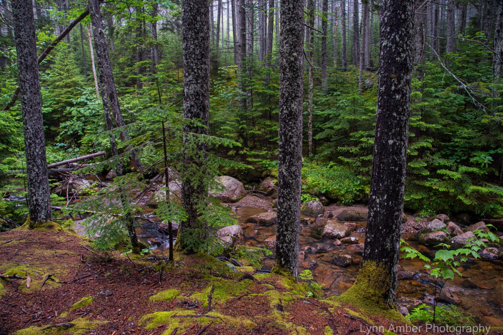
The radio show was timely in that I had – just the day before – taken a short hike on a favorite trail – to Hunter’s Beach. It was a foggy morning and I wanted to get some exercise before starting my late day shift at work. As I walked along the forested path that winds along Hunter’s Brook and ends at the cobblestone beach in Hunter’s Cove, I felt such a feeling of peace and love for this place we call earth. The cloudy, foggy morning cast a different light on the forest – the colors were more vivid and the forest just seemed more alive. It was enchanting. All my senses were more alert – the smell of the pine needles, the songs of numerous birds calling to each other, the gentle murmur of Hunter’s Brook, the feel of the soggy path on my feet.
Sunday morning, as I thought about what photographs I would post here from my hike to Hunter’s Beach, I was struck by the discussion on NPR and Joanna Macy’s observations of the natural world. I knew then what my dialogue would include for this post. I could relate to Macy’s philosophy and musings on our beloved Earth. It made me realize how much my photography is linked to what I experience in nature and the love I have of the natural world. Rilke shared that same reverence for the natural world and the environment that is entrusted to “us” humans. I shared above a link to the transcript of that radio program. It was inspiring. In particular, Joanna Macy read a section of a poem (Ninth Elegy) by Rilke that was new to me – and her reading of the poem brought tears to my eyes. I realize now why I so enjoy photographing nature – it is what I truly relate to and I believe with all my heart that we need to cherish our natural world and protect it for future generations. I share the poem she read here. Enjoy!
Earth, Isn’t This What You Want: a poem by Rainer Maria Rilke
Earth, isn’t this what you want? To arise in us, invisible?
Is it not your dream, to enter us so wholly
there’s nothing left outside us to see?
What, if not transformation
is your deepest purpose? Earth, my love,
I want it too.. Believe me,
no more of your springtimes are needed
to win me over—even one flower
is more than enough. Before I was named
I belonged to you. I see no other law
but yours, and know I can trust
the death you will bring.
See, I live. On what?
Childhood and future are equally present.
Sheer abundance of being
floods my heart.


Historic Acadia Trails
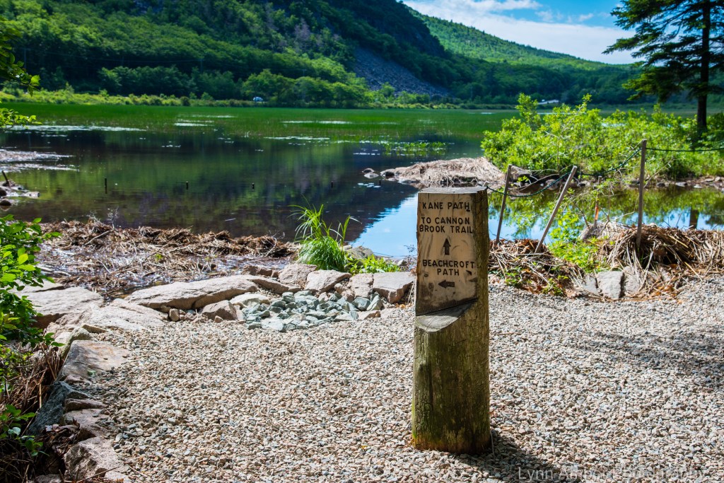
The history of the evolution of the trail system here in Acadia National Park is fascinating and I highly recommend reading a brief introduction to it here. One of my all-time favorite memorial pathways is the Beachcroft Trail. Designed by Andrew Liscomb and organized by George Dorr, the Beachcroft Trail contains all of the trail construction techniques used on the early pathways in Acadia. It’s a steep climb to the summit of Champlain Mountain but well worth the effort.
Once the Island Explorer starts operating on the island, I enjoy using the free shuttle bus to drop me off at a trailhead so that I can hike a longer distance – using different trail connections – one-way back to my summer residence. My first day-off this week hit on the first day the shuttle started up for the season! With that milestone reached, I planned my first excursion on the Island Explorer in conjunction with one of my favorite one-way hikes – Sieur du Monts to Beachcroft Trail to South Ridge Champlain Trail to the Gorham North Ridge Trail to the Gorham South Ridge Trail to the Otter Cove Trail back to Blackwoods Campground. It’s a 6-mile hike that summits two mountains and offers insanely beautiful views across the iconic Acadia coastline. Enjoy the photographs I took along the way!!

The trail starts with a short connection along the Jesup Path out of the Sieur du Monts area of Acadia. At The Tarn, follow the signs that point towards the Beachcroft Path.

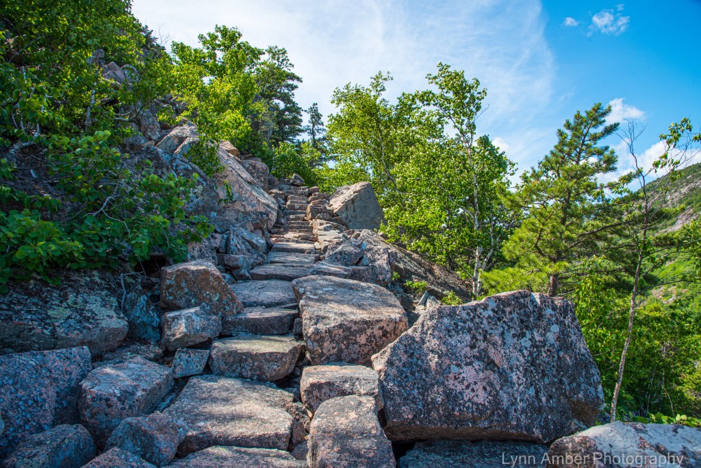
The trail crosses Route 3 and the Beachcroft Path officially begins with a set of stone steps. The stonework on this trail is amazing.
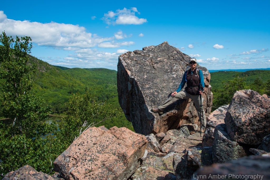
When I first hiked this trail a few years ago, I set up my camera on a timer and shot a photo of me at the “Dorr” rock. There is a famous photograph depicting the “father of Acadia” posed in front of this rock. I just had to replicate this photo with me in place of Dorr. So, of course, on this recent hike, I paused at the “Dorr” rock for another photo op. 🙂 (The name of the rock is my own – just a disclaimer!)

Continuing on the trail, I was reminded just how steep the top part of this trail is! Luckily, it is a short section!

Once at the summit, the view is unparalleled!!

I’m always amazed that this depression at the summit of Champlain Mountain is always filled with water – creating a cool little ecosystem for plants to thrive.
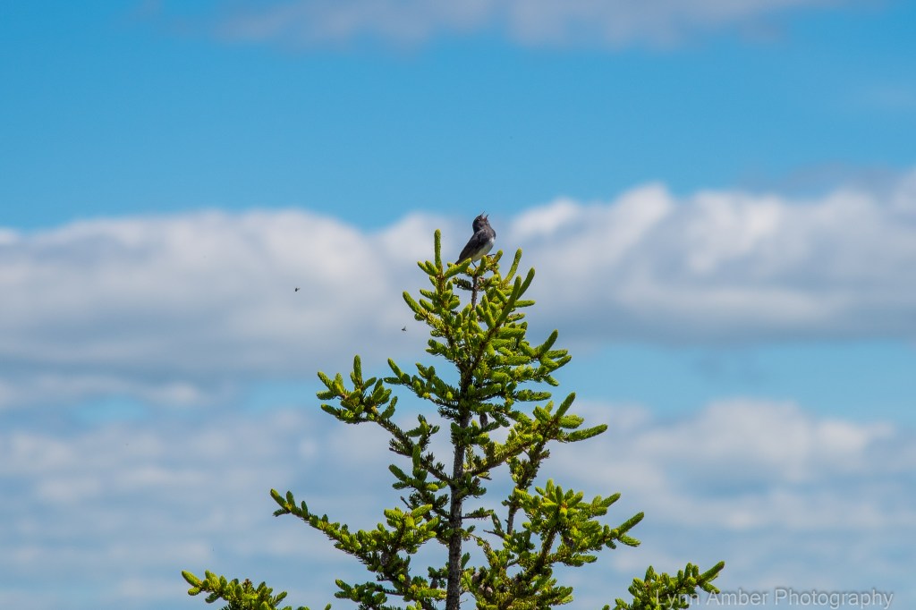
As I crossed the official summit and started down the South Ridge Champlain Trail, I heard this little Junco calling out to me!

The long-range view descending the South Ridge Trail of Champlain Mountain is an impressive panorama of the Acadian coastline – from left to right – Sand Beach cove can be seen, then The Bowl – a small pond that sits beneath The Beehive and finally, on the far right side of the photograph is Otter Point jutting out from the island. Baker Island can be seen off in the distance off the coast.
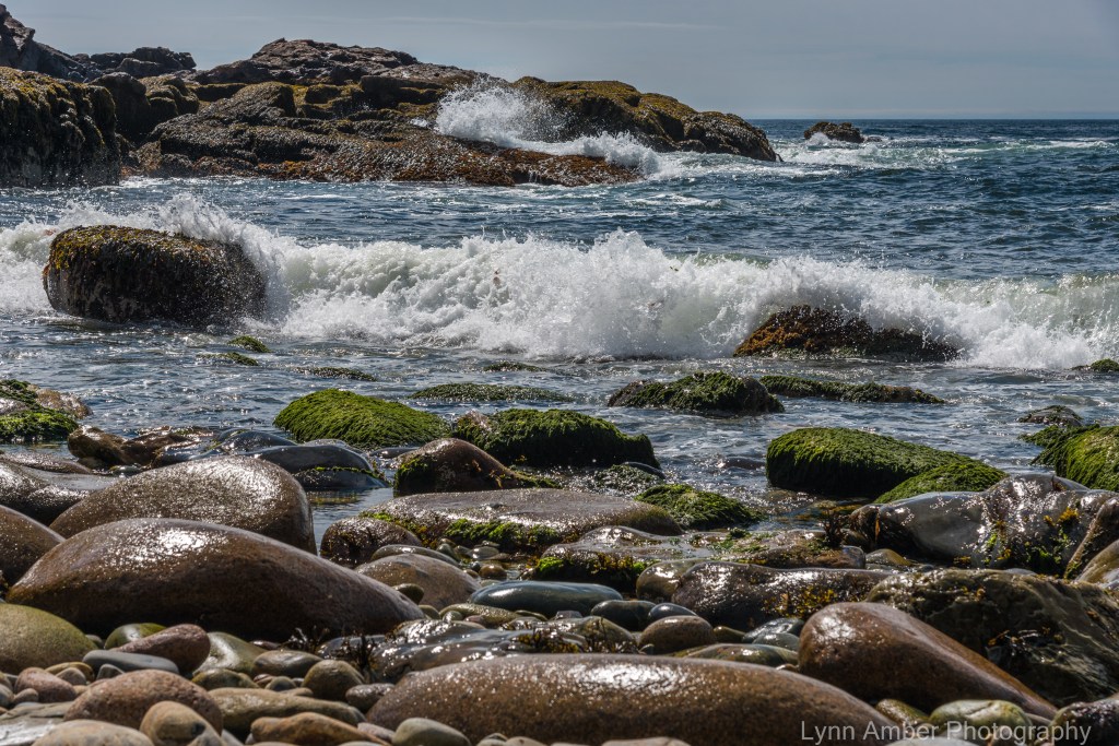
Wave Action at Little Hunter’s Beach
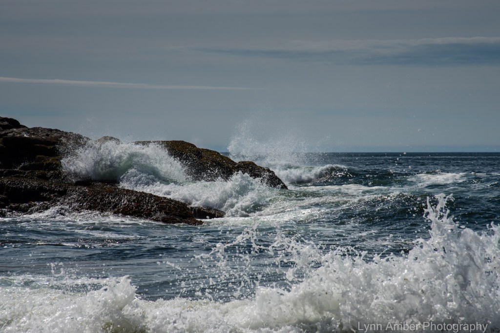
It was a beautiful, cool, crisp morning – perfect weather for a walk to Little Hunter’s Beach. I was armed with a fresh thermos of piping hot coffee to enjoy on the way. The tide was out but the waves were still impressive as the swells gathered momentum and developed into curling, frothy waves! 🙂
I sat on a rock by the water’s edge relishing the sunshine and solitude – trying to guess which swell would materialize into the biggest wave!


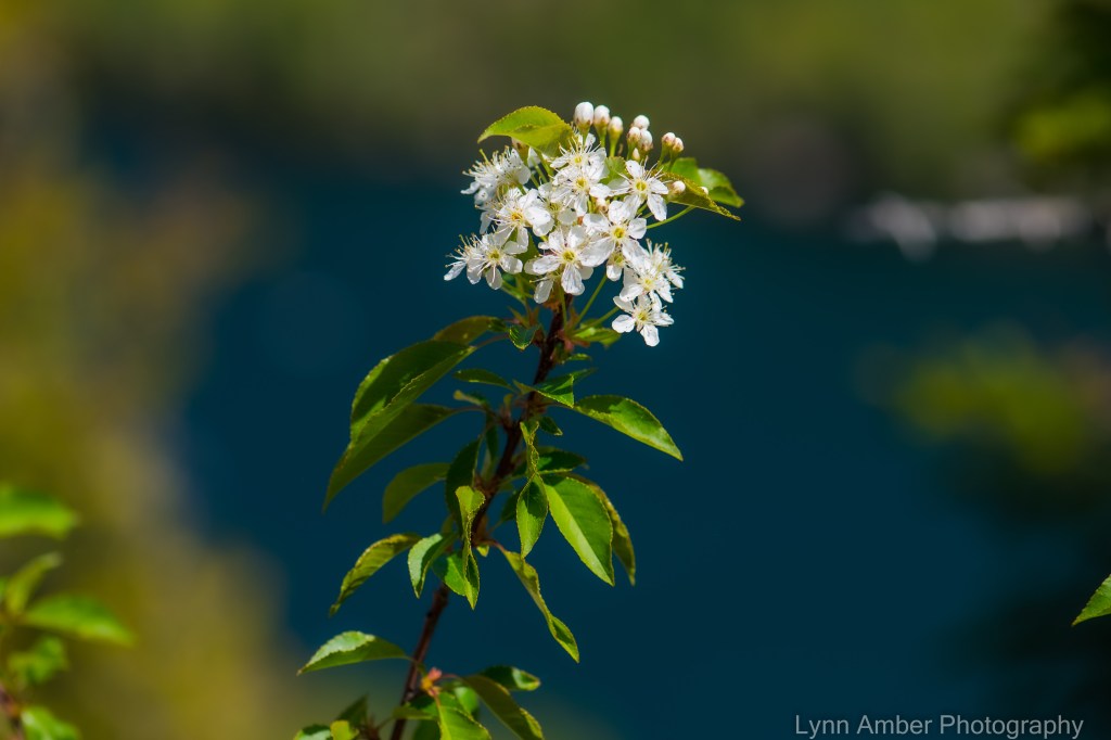
Otter Cove Blossoms
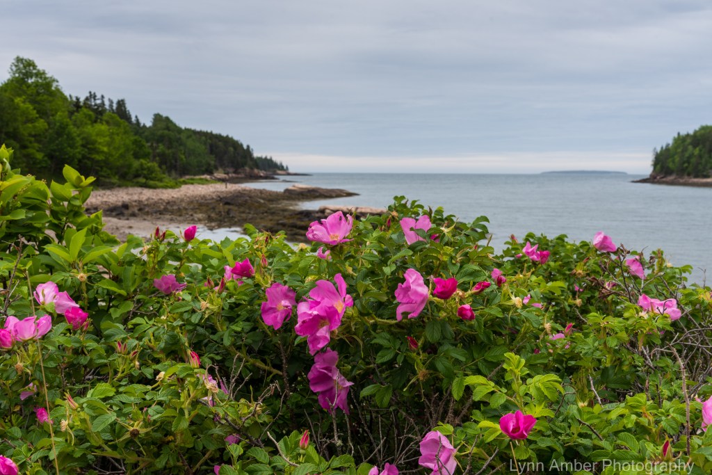
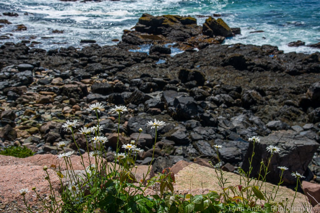
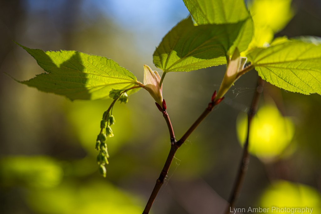
My leisurely stroll along the Otter Cove coastline the other day revealed lots of showy plants in bloom and a few inconspicuous ones that are only visible to those taking the time to look more closely. It was an eclectic group of plants – ranging from native to non-native origins.
Rugosa Rose is in full bloom now along coastal Maine – so colorful and boldly withstanding the rigors of life on the edge.


Only those taking the time to get out of their cars or off their bikes would notice the more subtle blossoms of the following seaside plants:

The tiny blue and yellow flowers of this plant are very delicate and pretty. This plant is actually a member of the potato family – Solanaceae.
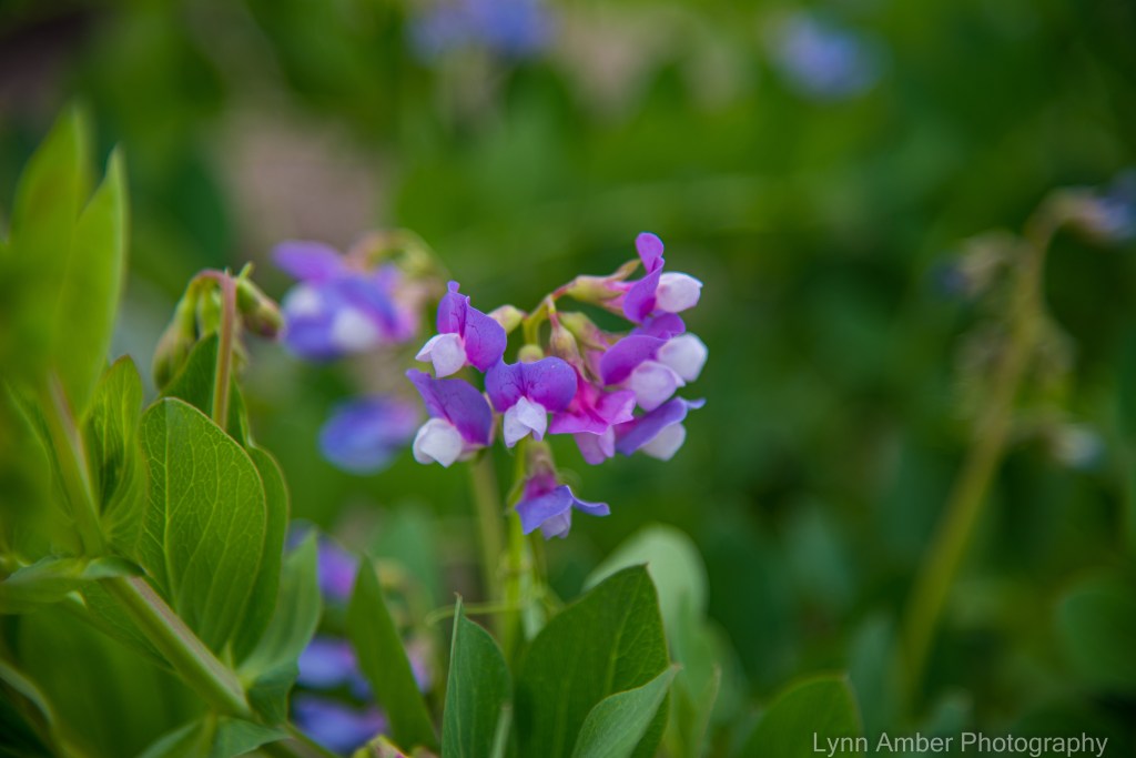
Lathyrus japonicus grows along the coast and, as you can tell by its flowers and habit, is a member of the legume family – Fabaceae. The young shoots and leaves can apparently be eaten raw in salads. I read that the Dena-ina (a Northwest Native American tribe) ate the seeds of this plant raw or boiled.

While an interesting flower, the Birdsfoot Trefoil is considered an invasive plant in some areas of the country. It was introduced into this country as forage for livestock and has escaped along coastal Maine and can be found along roadside and in meadows.

This plant closely resembles morning glory vine and is considered a noxious weed in some parts of the United States. It is another non-native plant that has adapted to the growing conditions of Acadia and is seen in the harsh coastal environment. I have to admit the flower sure is pretty!
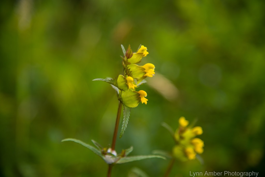
I’m not sure I’ve ever seen this plant before and finally identified it as Rhinanthus minor. The unusual nature of the flower really caught my eye. Apparently, the plant is semi-parasitic – meaning it has the ability to obtain both water and nutrients from the roots of neighboring plants.
Schoodic Bog Along the Down East Sunrise Trail
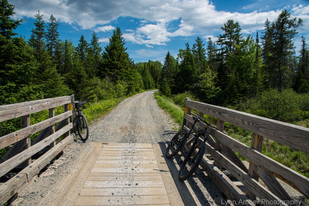
On one of my day’s off last week, with Jim visiting from Vermont, we decided to take our bikes to the mainland and explore part of the Down East Sunrise Trail. The Down East Sunrise Trail is an 87-mile rail trail that is part of the larger East Coast Greenway. Since I’ve been interested in the rail-trail movement for awhile, I wanted to try and ride as much of this pathway as possible this summer.
I choose the section of trail that runs from Franklin, ME to the Tunk Lake Road access point in Sullivan, ME. The reason I picked this section is that it runs through the Schoodic Preserve and Bog. I thought it might be an interesting area to visit!
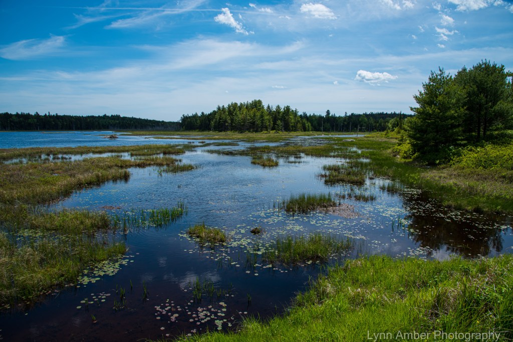
The Schoodic Bog is home to a wide variety of both plants and animals – from water lilies and carnivorous pitcher plants to beavers and water-loving birds of prey. The bog itself encompasses about 150 acres of the 500-acre preserve and sits at the base of Schoodic Mountain.


The trail head parking in Franklin is on Winter Street which runs alongside the town library and dead ends at the lot. The gravel parking area is fairly large and will accommodate many vehicles. When we arrived, the first thing I noticed was two riders on dirt bikes crossing the road on the trail, and then, shortly after they left, there was a four-wheeler traveling on the trail. I was a tad dismayed. When doing my research about the rail trail, I failed to notice that this trail is shared by those on motorcycles and ATV’s. I generally do not consider these compatible with the quieter modes of transportation such as bicycles, horses and hikers.
We had driven over an hour to get here, so the decision was made to go ahead and ride – and hope that we do not run into too many dirt bikes or ATV’s. I’m glad we did because it really ended up not being an issue.
After cycling for a short while, we came to a bridge across a very tea-colored stream called Card Mill Stream. It’s not surprising that there would be a build up of tannins in this vegetative-rich environment full of decomposing plant material!
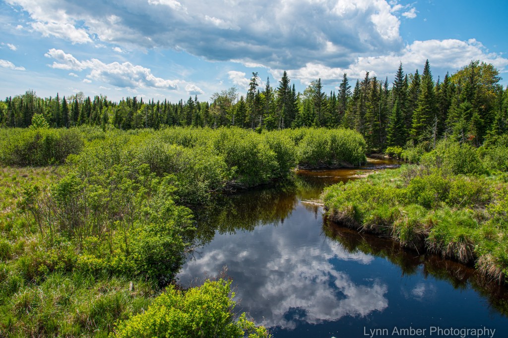
After leaving the Card Mill stream area, we traveled through mostly forested land until reaching the Schoodic Bog. We decided to stop here for lunch since there was a very inviting picnic table overlooking the water. Of course, with all that water, one would expect it to be buggy and we were not disappointed. In the end, we did not sit at all – but ate our sandwiches while walking (very briskly!) along the bog – trying to discourage (unsuccessfully!) the pesky mosquitoes from bothering us!
We had a wonderful view of Schoodic Mountain from the bog. In the distance, beaver dams were evident and I saw many pitcher plants out in the marshy soil – too far away for a close-up photograph however!


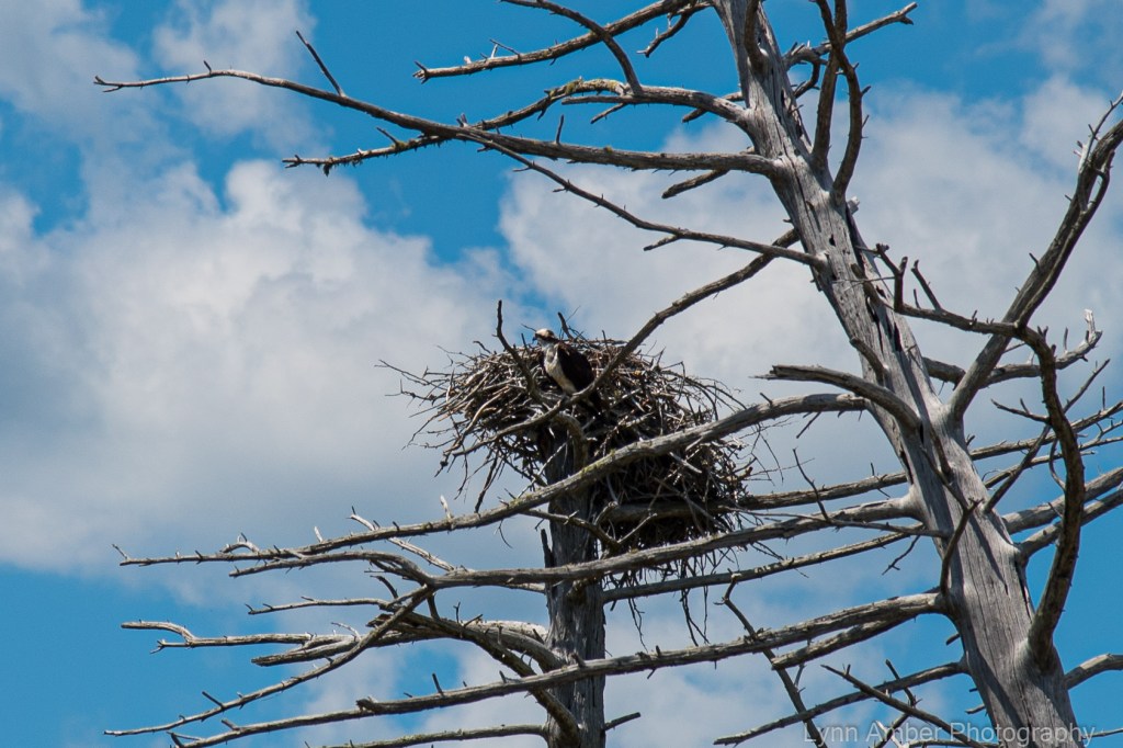
As we continued on our bikes after lunch, we noticed an osprey nest with one of the parents perched on a nearby dead tree – keeping a close eye on its babies in the nest. We stopped and watched the bird for quite awhile and every now and then we could see a baby osprey sticking it’s head up above the twigs in the nest.

After watching the osprey, we traveled for a bit more until we had almost reached the Tunk Lake Road access point. We turned around just after the 6-mile mark and headed back to Franklin. It was a nice 12-mile ride on a beautiful blue sky, cloud-filled day. The only complaint I have about this rail trail is that, at times, the surface was exceedingly uneven and gravelly – making it hard to travel with any speed – and also creating a very bumpy ride. I wonder if the motorized vehicles using the trail contributes to the rough and rutted surface?

After loading the bikes on the car, we continued on Route 182 (also called the Blackwoods Scenic Highway) until it once again intersected with Route 1. It was a very pretty drive past some beautiful fresh water lakes.


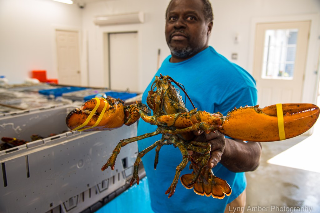
Once we got back on Route 1, we detoured onto some scenic back roads for the drive back to Mount Desert Island – stopping in at a wharf on the Narraguagus Bay – hoping to get a bite to eat. Turns out this wharf is just a retail/wholesale seafood establishment and not a restaurant. We surveyed their options and decided to come back another day to buy some fresh seafood – when we are prepared with a cooler! It all looked good though!

Beautiful Hiking Weather
I’ve been busy hiking the past couple of days on two of my favorite trails in Acadia National Park. The weather has been unseasonably warm for this time of year and I took advantage of it!
Hiking the same trails might seem redundant to some – but I find there’s always something new to discover! This week I’ve witnessed some additional native plants coming into bloom since my last hike along this trail.

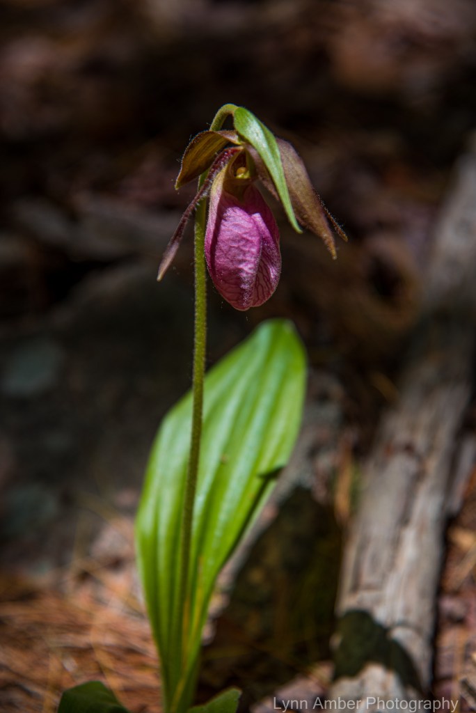
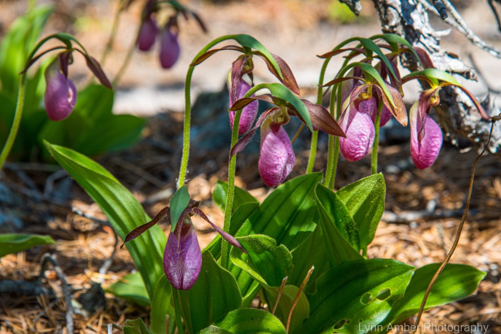
Ascending the South Ridge of Cadillac Mountain today, I was so surprised to see the Pink Lady’s Slipper in bloom! The last season I was here, they did not bloom until the first week in June. So glad I chose to hike this trail today!
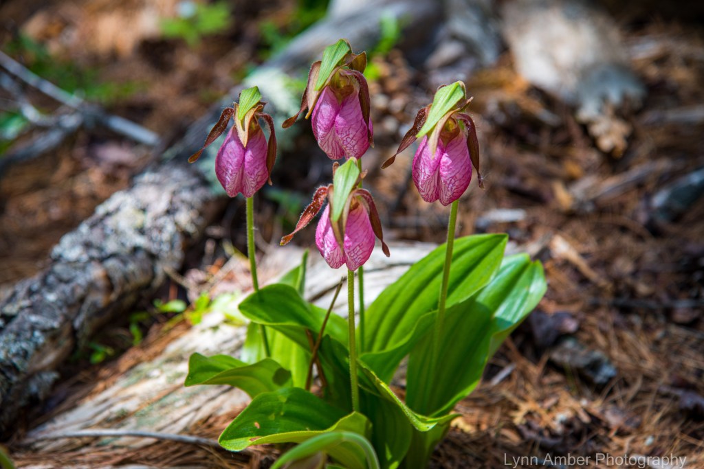
I know where there are several patches of these orchids growing along the South Ridge Cadillac trail, so I was tuned in to looking for them. Just so unbelievably gorgeous! I try not to draw attention to them and wait to photograph until no one is near me on the trail. 🙂
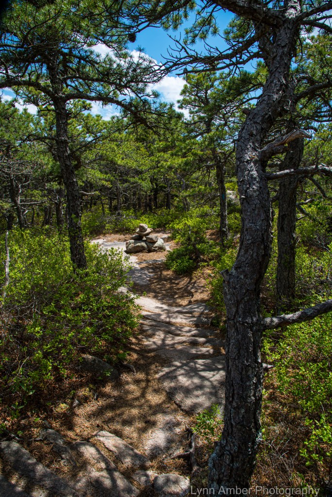
I love the hike up the South Ridge of Cadillac – one travels through so many ecosystems as you climb towards the summit – the pitch pine forest above Eagle’s Crag is such a cool environment!


On my descent from the Featherbed area beneath the Cadillac summit, I found a “new-to-me” patch of orchids nestled under a Pitch Pine! What a great discovery!

There’s always something new to discover along the same well-worn pathways – if you just keep looking! 🙂
Last night’s Full-ish Moon
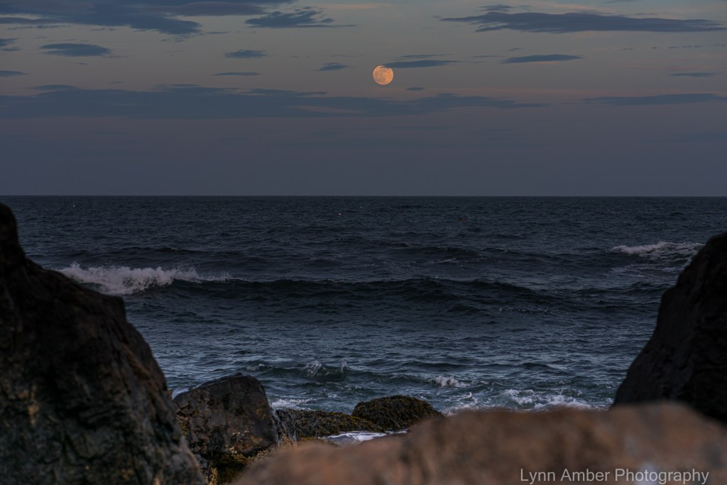
Funny photographer story about my effort to capture the “Flower Moon:”
I’m enjoying revisiting my old haunts this season but missing my husband’s companionship more this time around. You’d think that after being isolated with each other for a year that the distance would be welcome! Not so! 🙂 We talk on the phone frequently at least. Last night, with my cell phone propped up on a rock, we conversed while I photographed the full moon and the sunset down along the rocky coast (in one of my favorite secret places!)
As I was packing up my camera gear (while still chatting with him), I lost my balance due to trying to manipulate the tripod, camera bag with extra lens and camera around my neck and shoulders so that the weight was equally distributed. I tumbled backwards very ungraciously over a large rock and landed on my bum. Thankfully, unhurt, except for my pride. It was quite a feat pulling myself up as I had all that gear wrapped around my neck!! As I lay there awkwardly positioned and weighted down with camera gear shaking my head at my demise, I could hear Jim’s voice from the phone calling “are you still there?”
Ah – the oft perilous life of a photographer! 🙂

Aunt Betty’s Pond
The second day of my time off work last week, I decided to ride my bike on some of the carriage roads in Acadia National Park. One of my favorite areas is the loop that surrounds Witch Hole Pond. Since that circular loop is only 3 miles, I extended the ride by taking the carriage road connector to the Eagle Lake parking area. Crossing under Route 233, I hopped on the carriage road towards Aunt Betty’s Pond. The ride totaled around 8 miles – with an impressive ascent coming back up from Aunt Betty’s Pond.
It was a leisurely ride on a picture perfect day. I’m dismayed about the decision to close the entire Eagle Lake loop for reconstructive work this summer. While it is possible that part of the loop may eventually open, it is a major route used to connect with many other carriage road loops. Seems to me that the park could have opted to shut down sections of the trail allowing for better traffic flow to adjoining carriage roads. I’m sure there will be many disappointed visitors.
I did not stop for many photos along the way, opting instead to just enjoy the ride. Here are a few….

I’m always curious about the origin of place names. I tried to find some information detailing why this pond is named after an “Aunt Betty.” On the Mount Desert Island Historical Society facebook page, someone else posed the same question. There was no clear answer but local historians posited that perhaps Aunt Betty was a member of the Richardson clan – a local family. The Richardson Brook has its origin at this body of water.

I found a little more history regarding Witch Hole Pond. Early maps show that today’s name is derived from the “Pond of Witch Hollow.” Old land maps showing ownership indicate that the pond and surrounding area was divided and owned by two separate families – the Bowlers and the Haights. Over a period of 20 years, the park eventually purchased the tracts of land and the area was incorporated into the growing acreage we now know as Acadia National Park.
The origin of the name is lost to history. At one time, the pond was surrounded by dense forest that may have created a “spooky aura” about the place. Local sentiment believes this is perhaps why “witch” came to be associated with the pond. There is documentation that suggests the presence of a sawmill and quarry adjacent to the pond in the early years of settlement around Bar Harbor. An interesting article I found indicates that Witch Hole Pond was once the location of a “pest house.” Dating to the late 1800’s, these houses were small, town-operated buildings used to isolate community members who were afflicted with infectious diseases such as typhoid and small pox.
With this new knowledge, my walk around Witch Hole Pond will be much more interesting as I conjure up what it must have been like back in the day!

Since I usually do not cycle on the connecting carriage road between Eagle Lake and Witch Hole Pond, I’m not very familiar with the Breakneck Ponds that border the carriage road along this stretch. I propped the bike up on a tree and walked over to the shoreline of these two ponds and made a mental note to come back. A group of birders were scanning the landscape here for feathered friends so I’m guessing this might be a good spot for birdwatching. I asked what they were looking for (keeping my “pandemic” distance) – but I got a very “chilly” response. I usually find birders to be more friendly – but perhaps Covid has us all wary. In any case, I will need to return with binoculars and find out for myself!
Pleasant Pemetic
The Rhodora
In May, when sea-winds pierced our solitudes,
I found the fresh Rhodora in the woods,
Spreading its leafless blooms in a damp nook,
To please the desert and the sluggish brook.
The purple petals fallen in the pool
Made the black water with their beauty gay;
Here might the red-bird come his plumes to cool,
And court the flower that cheapens his array.
Rhodora! if the sages ask thee why
This charm is wasted on the earth and sky,
Tell them, dear, that, if eyes were made for seeing,
Then beauty is its own excuse for Being;
Why thou wert there, O rival of the rose!
I never thought to ask; I never knew;
But in my simple ignorance suppose
The self-same power that brought me there, brought you. ~Ralph Waldo Emerson
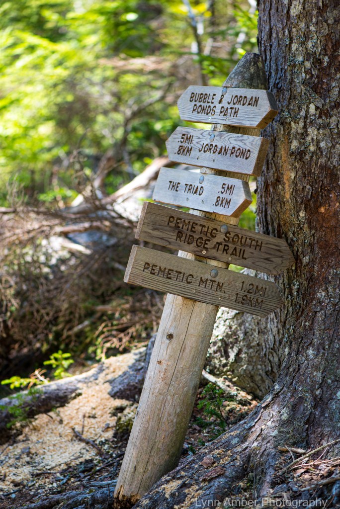
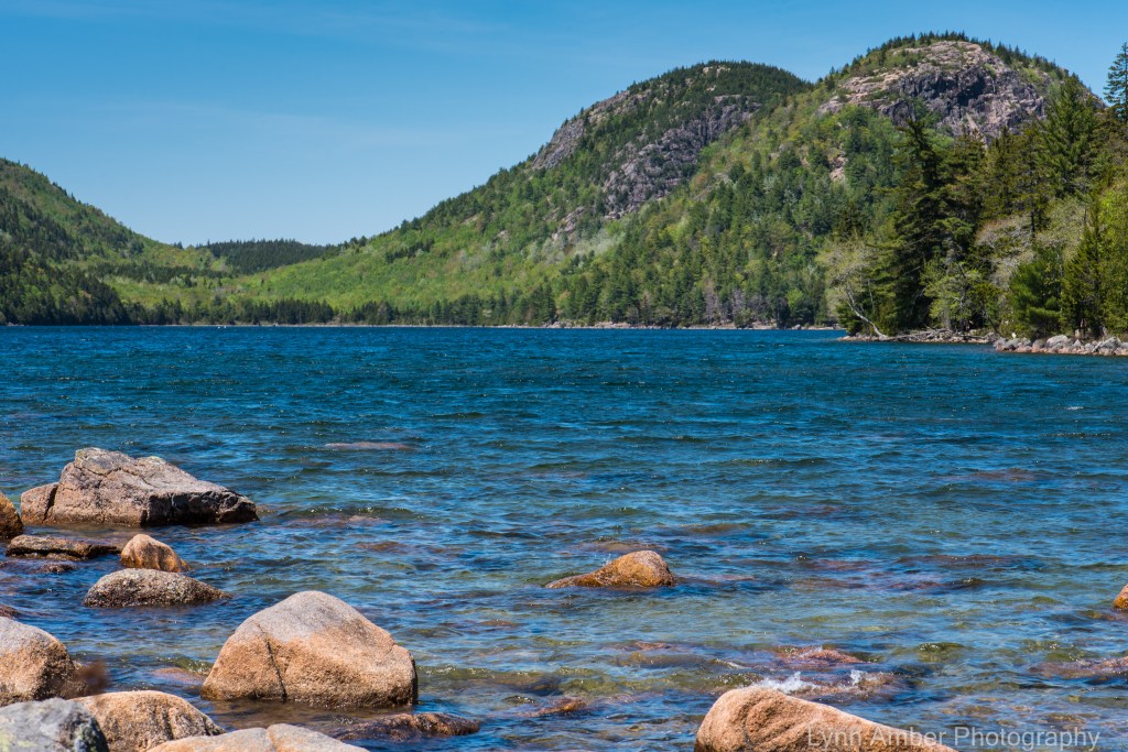
Today, I hiked one of my favorite loops here in Acadia National Park. Leaving from the Jordan Pond parking lot, I used the Bubble and Jordan Ponds Path to reach its junction with the South Ridge Pemetic Trail. After spending some quiet time at the summit gazing out at the coastal islands, I descended via the North Ridge Trail to the carriage road that skirts Bubble Pond. Taking this to where it once again intersects with the Bubble and Jordan Ponds Path, I completed the loop back to the parking lot. It’s a 5.5 to 6 mile hike through several unique environments – from the shady, majestic spruce/fir forest to the rocky, exposed summit of Pemetic and, then, along the Bubble Pond shoreline.


I took a break at Bubble Pond and enjoyed some trail mix for lunch – reveling in the sunshine! There were some people canoeing on the pond. I made a promise to myself to get up early one morning and bring my kayak here before they close the parking lot for the season!