Lynn Amber - Travel & Photography
sharing my thoughts through words and images
Schoodic Bog Along the Down East Sunrise Trail
On one of my day’s off last week, with Jim visiting from Vermont, we decided to take our bikes to the mainland and explore part of the Down East Sunrise Trail. The Down East Sunrise Trail is an 87-mile rail trail that is part of the larger East Coast Greenway. Since I’ve been interested in the rail-trail movement for awhile, I wanted to try and ride as much of this pathway as possible this summer.
I choose the section of trail that runs from Franklin, ME to the Tunk Lake Road access point in Sullivan, ME. The reason I picked this section is that it runs through the Schoodic Preserve and Bog. I thought it might be an interesting area to visit!
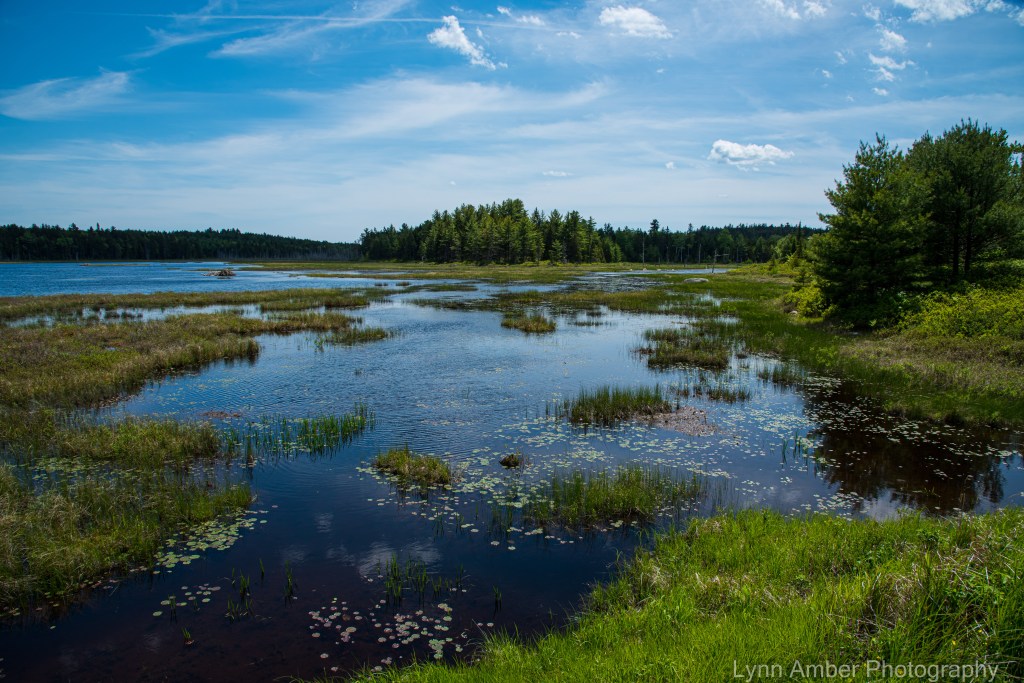
The Schoodic Bog is home to a wide variety of both plants and animals – from water lilies and carnivorous pitcher plants to beavers and water-loving birds of prey. The bog itself encompasses about 150 acres of the 500-acre preserve and sits at the base of Schoodic Mountain.


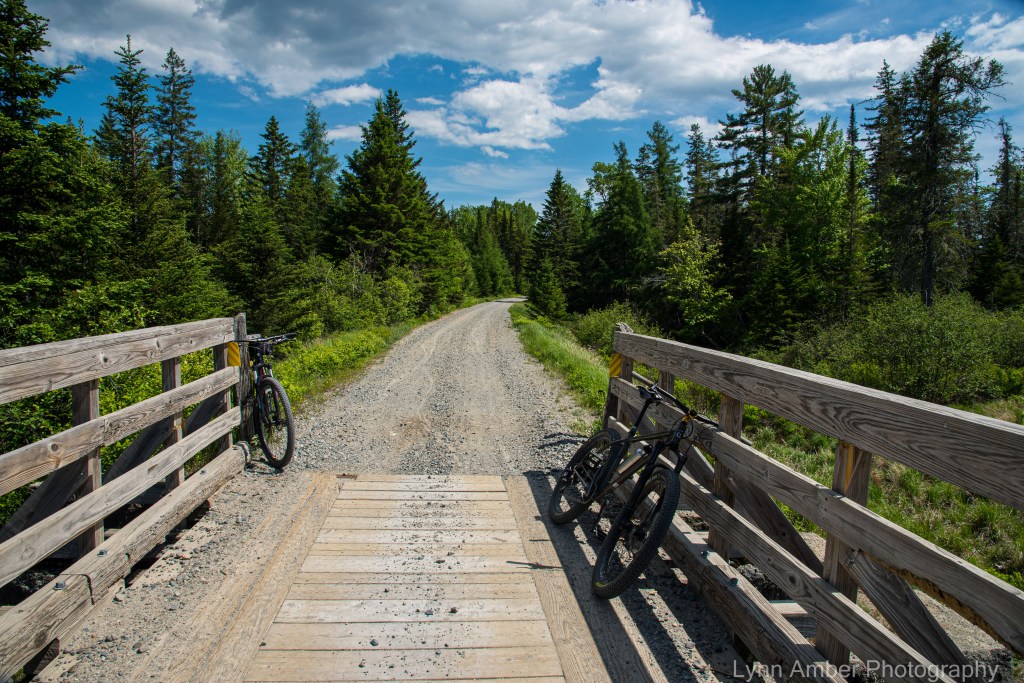
The trail head parking in Franklin is on Winter Street which runs alongside the town library and dead ends at the lot. The gravel parking area is fairly large and will accommodate many vehicles. When we arrived, the first thing I noticed was two riders on dirt bikes crossing the road on the trail, and then, shortly after they left, there was a four-wheeler traveling on the trail. I was a tad dismayed. When doing my research about the rail trail, I failed to notice that this trail is shared by those on motorcycles and ATV’s. I generally do not consider these compatible with the quieter modes of transportation such as bicycles, horses and hikers.
We had driven over an hour to get here, so the decision was made to go ahead and ride – and hope that we do not run into too many dirt bikes or ATV’s. I’m glad we did because it really ended up not being an issue.
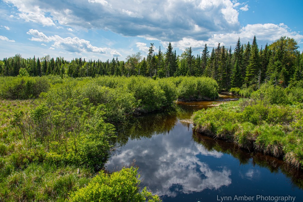
After cycling for a short while, we came to a bridge across a very tea-colored stream called Card Mill Stream. It’s not surprising that there would be a build up of tannins in this vegetative-rich environment full of decomposing plant material!
After leaving the Card Mill stream area, we traveled through mostly forested land until reaching the Schoodic Bog. We decided to stop here for lunch since there was a very inviting picnic table overlooking the water. Of course, with all that water, one would expect it to be buggy and we were not disappointed. In the end, we did not sit at all – but ate our sandwiches while walking (very briskly!) along the bog – trying to discourage (unsuccessfully!) the pesky mosquitoes from bothering us!
We had a wonderful view of Schoodic Mountain from the bog. In the distance, beaver dams were evident and I saw many pitcher plants out in the marshy soil – too far away for a close-up photograph however!


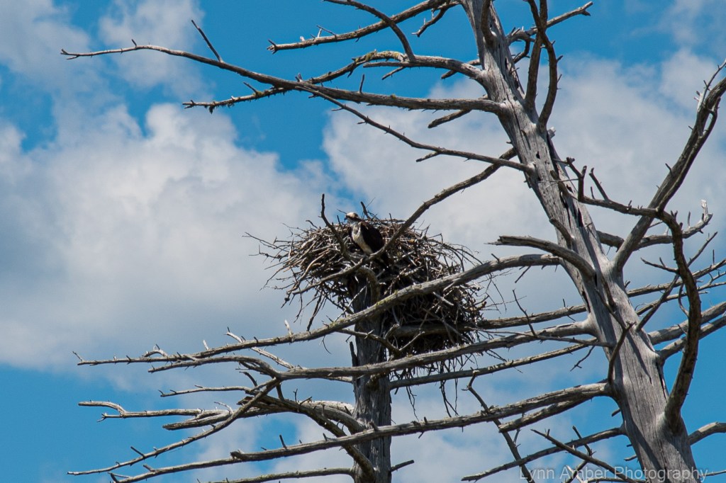
As we continued on our bikes after lunch, we noticed an osprey nest with one of the parents perched on a nearby dead tree – keeping a close eye on its babies in the nest. We stopped and watched the bird for quite awhile and every now and then we could see a baby osprey sticking it’s head up above the twigs in the nest.

After watching the osprey, we traveled for a bit more until we had almost reached the Tunk Lake Road access point. We turned around just after the 6-mile mark and headed back to Franklin. It was a nice 12-mile ride on a beautiful blue sky, cloud-filled day. The only complaint I have about this rail trail is that, at times, the surface was exceedingly uneven and gravelly – making it hard to travel with any speed – and also creating a very bumpy ride. I wonder if the motorized vehicles using the trail contributes to the rough and rutted surface?

After loading the bikes on the car, we continued on Route 182 (also called the Blackwoods Scenic Highway) until it once again intersected with Route 1. It was a very pretty drive past some beautiful fresh water lakes.


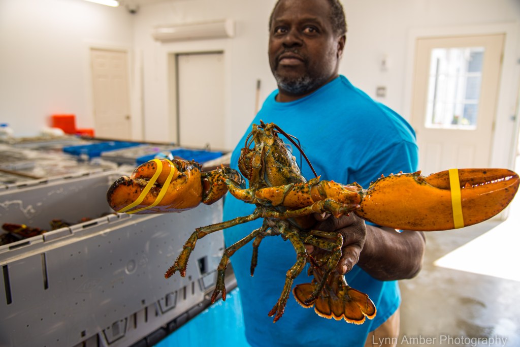
Once we got back on Route 1, we detoured onto some scenic back roads for the drive back to Mount Desert Island – stopping in at a wharf on the Narraguagus Bay – hoping to get a bite to eat. Turns out this wharf is just a retail/wholesale seafood establishment and not a restaurant. We surveyed their options and decided to come back another day to buy some fresh seafood – when we are prepared with a cooler! It all looked good though!