Lynn Amber - Travel & Photography
sharing my thoughts through words and images
Volcanic Legacy Scenic Byway Part III Vol. 1

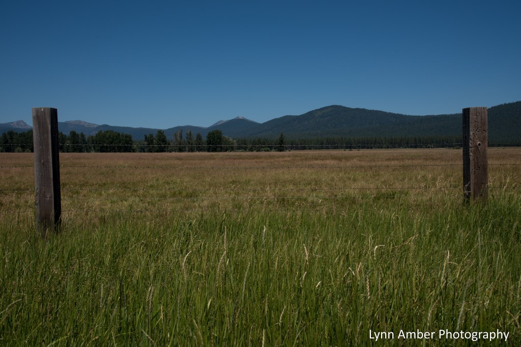
The next leg of our journey exploring the entire Volcanic Legacy Scenic Byway took us to the amazing Crater Lake National Park. We picked up the byway in Fort Klamath and traveled Route 62 to the turn off for Crater Lake. The byway circumnavigates Crater Lake via the West Rim and East Rim Drive.
Our return to Crater Lake was bittersweet. The first time we visited the park was in 2014 on our road trip from Vermont to pick up our “new to us” Airstream travel trailer. We purchased the trailer from a private seller in Eugene, Oregon and our first day on the road with the trailer had us cruising the West Rim Drive around Crater Lake. We did not linger in the park on this visit – only pulling into overlooks along the way that would accommodate the truck and trailer (at a length of 45′ overall). I was excited to return and explore the park more closely. We have visited Crater Lake twice in two weeks since it is only a 2 hour drive from our current location.
On Route 62 heading towards Crater Lake, there’s a scenic vista turn-out with an interpretive display. Looking at the photograph below, imagine an enormous, snow-capped mountain rising up into the sky from the far vista that would take up almost the entire skyline. That would have been Mount Mazama – the volcanic peak that erupted 7,700 years ago and ultimately collapsed – forming what is now Crater Lake.
Crater Lake is the deepest lake in the United States at 1,943 feet. There are no streams flowing into or out of the lake. The water level is totally maintained by rain, winter snow melt (averaging 528 inches per year) and evaporation. Arguably one of the most outstanding features of the lake is its deep, blue color. Three factors contribute to this remarkable hue – the depth of the lake, its purity and the effects of solar radiation.

My goal on our first day trip to Crater Lake was to hike Garfield Peak. One of the taller peaks in the park at 8,061 feet , it rises up right along the rim of the crater and offers some outstanding views of the lake during the moderately challenging hike to the summit. It’s a 3.6-mile out-and-back with an elevation climb of just over 1,000 feet – short but steep! 🙂 The trailhead starts just past the Crater Lake Lodge at the Rim Village area of the park. The biggest challenge on the hike was dealing with the wind! We kept having to hold onto our sun hats along the trail so they did not get blown down to the lake! They would not have been retrievable!

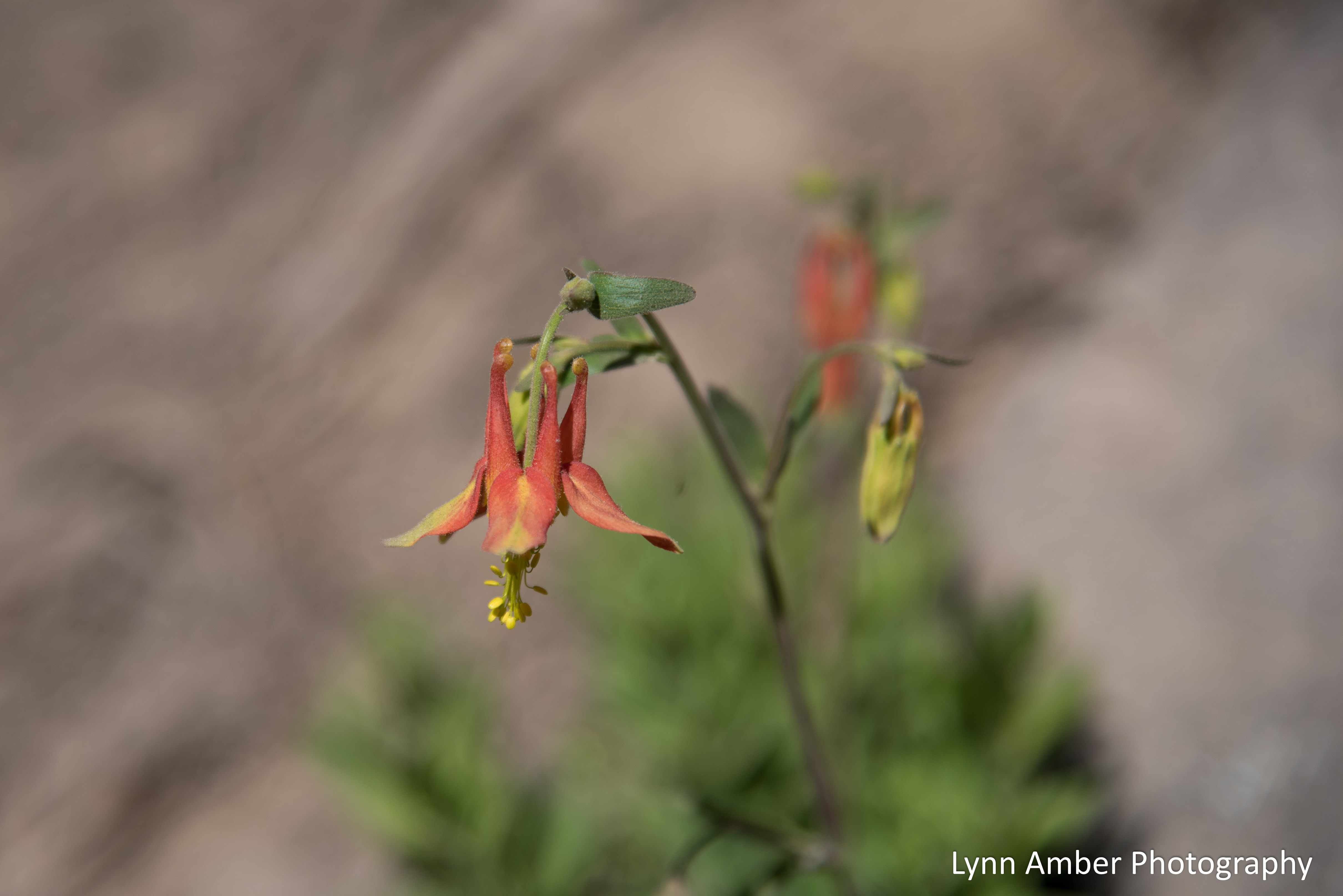
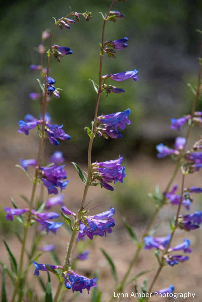
There were so many wildflowers blooming along the trail including my favorites – Indian Paintbrush and Penstemon. Also, some phlox, stonecrop, columbine and balsamroot…a very good flower day!!


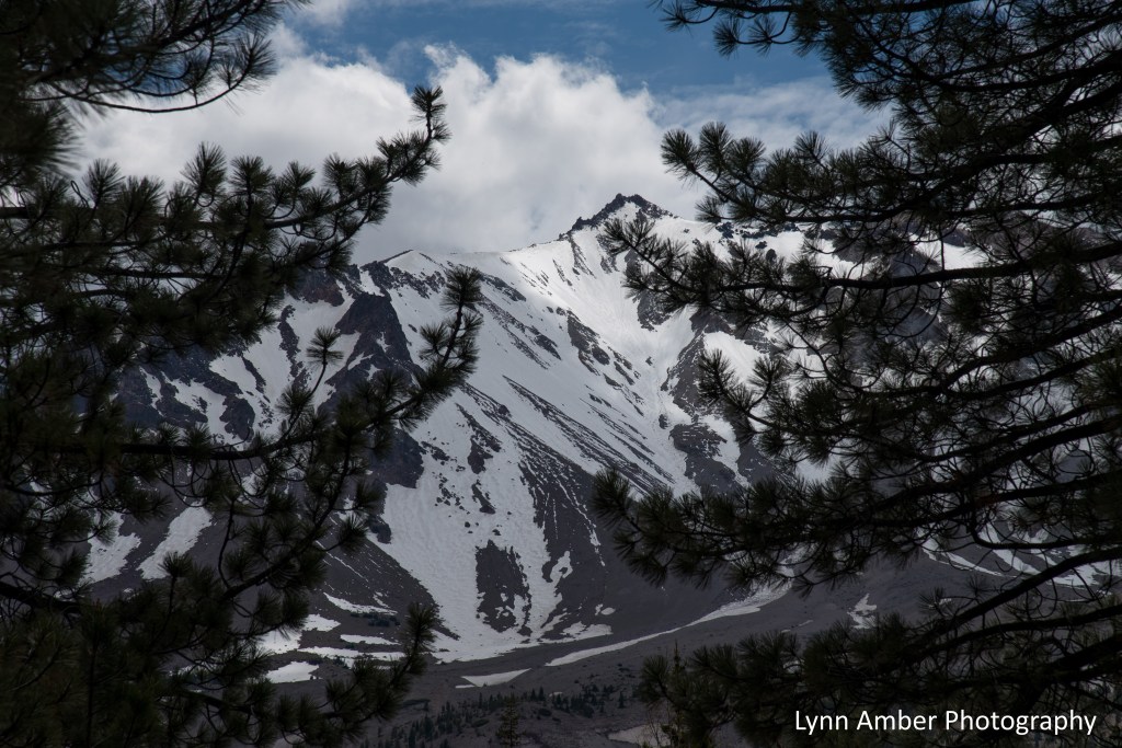
Near the top there are still some areas of snow – it was a record snowfall this year and Crater Lake experienced some very late spring snows as well. Parts of the Rim Drive and many trails never opened up until mid-June.

The views of the lake from the summit were spectacular! We hung out a bit and had a snack before starting our descent.

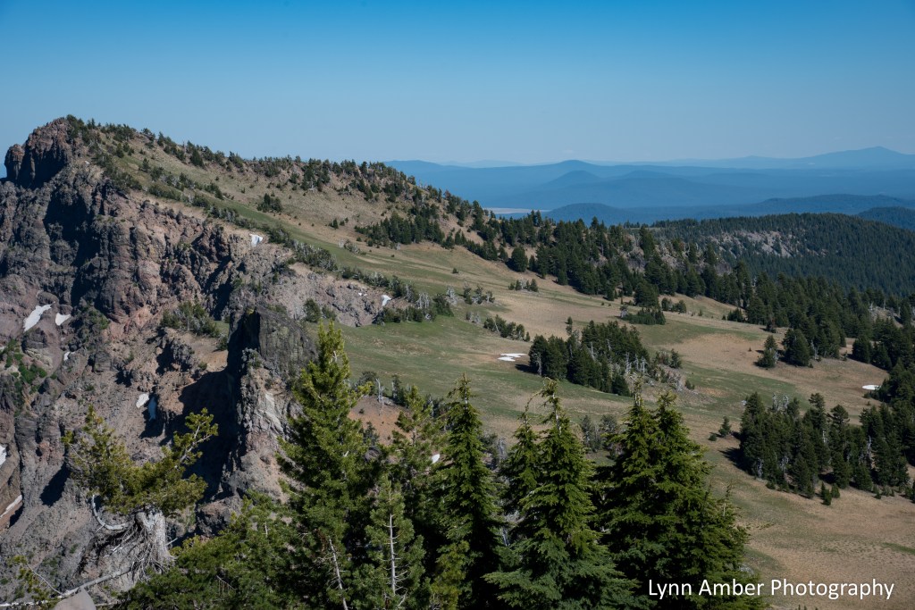


We had some nice views of the surrounding forests on our descent from the summit.


After a day’s adventure on the trail, we were looking at a 2-hour drive back to our “home for the summer” so we popped in to the Mazama Village cafe for a couple of coffees to go. As I waited in line to make my order, I noticed some very nice-looking food being delivered to patrons who were seated. Might be a good spot to have a meal next time. 🙂
Tomorrow I’ll share our second day trip to Crater Lake! 🙂
Capricious Captures 7.28.22

Mystical fog rainbow appeared along the coast of Point Reyes National Seashore as the fog was lifting. I just know there must be a pot of gold out there! 🙂
Capricious Captures 7.27.22

In between more lengthy posts, I’ve decided on a new strategy that will allow me to share more photographs regularly without a lot of time devoted to prose! I’ll be posting random, whimsical photographs both old and new.
The Smoothstem Blazing Star is providing much need color in Lava Beds National Monument right now – blooming along roadsides and along hiking trails. I liked this photo because of the “bug” who appears to be hanging on for dear life! 🙂
Volcanic Legacy Scenic Byway Part II
Several weeks ago we decided to embark on another section of the Volcanic Legacy Scenic Byway. Our goal was to explore Lassen Volcanic National Park. While I recommend spending more than one day here, that’s all we had so we made the most of it! We picked up the byway via Route 299 west of Burney and headed south on Route 89 towards Lassen. After entering the park, our first stop was the visitor center by Manzanita Lake. Located in the Loomis Museum building, the visitor center contained a small gift shop, a ranger-staffed information counter and a small museum that seemed to be devoid of many of the exhibits. I suppose maybe they were re-modelling??

I did talk with an interpretive ranger there to get some ideas on what to see since we would only have one day. He gave me some good advice and we decided to start with the 2-mile loop trail that runs along the perimeter of the lake. After our 3-hour drive to get here, we were ready to stretch our legs! The Manzanita Lake Trail is an easy trail with virtually no elevation gain or loss – making it a very popular, short hike.

We had some awesome views of Lassen Peak and the Chaos Crags area during our hike around the lake!
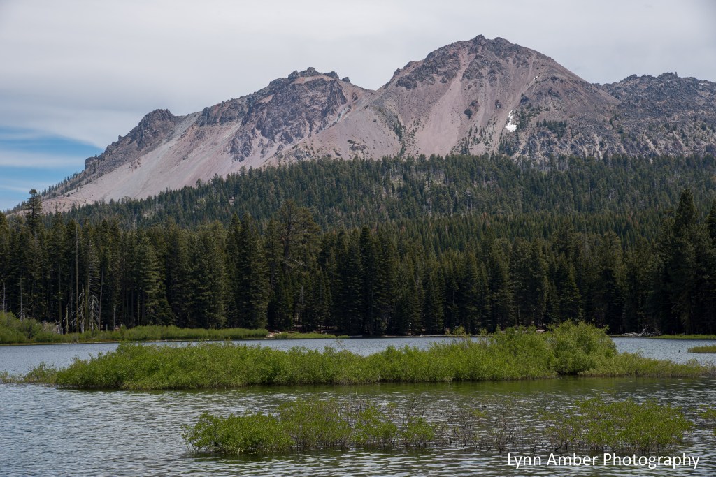
More pictures from Lake Manzanita….there is also a large campground here which would be a great place to hang out for a few days to allow for exploring more areas of the park.


We continued on the 30-mile long scenic road through Lassen until we reached the Devastated Area pull-out. There is a short interpretive trail here that explains the eruption of Lassen Peak that occurred in the park in 1915-1916. If you need a lunch spot, there’s a nice picnic area here as well – perfect timing as we were definitely ready for a snack! There are some great views of Lassen Peak from the picnic area.

After enjoying a small lunch and walking the short trail at Devastated Area, we continued on south through the park until we reached the parking area for the Kings Creek Falls Trail. It was at this point that the effects of the Dixie Fire became evident to the east of the park road. The fire entered the park in early August 2021 and burned over 73,000 acres of park land before being contained. In all, the Dixie Fire burned over 950,000 acres resulting in the largest fire in California history. Our hike along the Upper Cascades section of the trail took us through some of the burned out area. So sad!


As we started to approach the junction of the Upper Cascades Trail with the one-way Cascades Foot Trail, we crossed a small stream and started to see some plant life again! These tiny wildflowers were blooming along the trail.


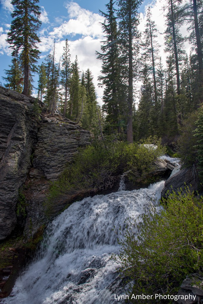
Since the Kings Creek Falls overlook was still closed due to the fire, we did not hike down there but veered to the right at the junction with the Cascade Foot Trail and ascended up the steep, one-way trail that hugs the Cascades – a series of small waterfalls that descend through the canyon. The cascades were amazing and totally worth the moderate 3-mile roundtrip hike from the parking lot. I took so many photographs of the cascades it is hard to choose which ones to share – but I’ll try to limit my choices to three photos!!


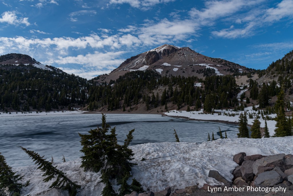
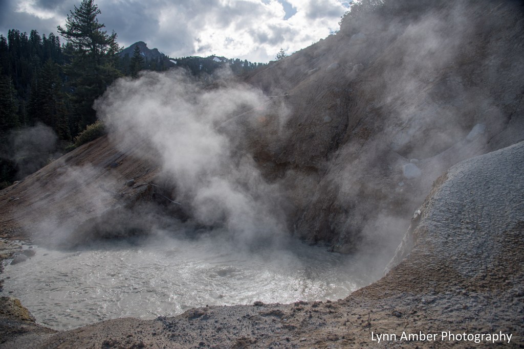
Since the day was getting shorter and we had a long drive back to our summer home, we opted for just one more stop in the park before making a long loop back. A trip to Lassen NP would not be complete without a stop to see one of the hydrothermal areas of the park. The most accessible spot is the Sulphur Works – the site of a long-gone sulfur mining company and roadside attraction. Along the way, we made quick stops at Lake Helen and Bumpass Hell parking area.

At Sulphur Works…..


There are so many more hiking trails I’d like to explore in Lassen Volcanic National Park! I hope that we can get down to the park for an overnight stay before the summer ends!
Organ Pipe Cactus National Monument Part 4
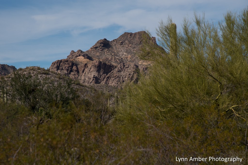
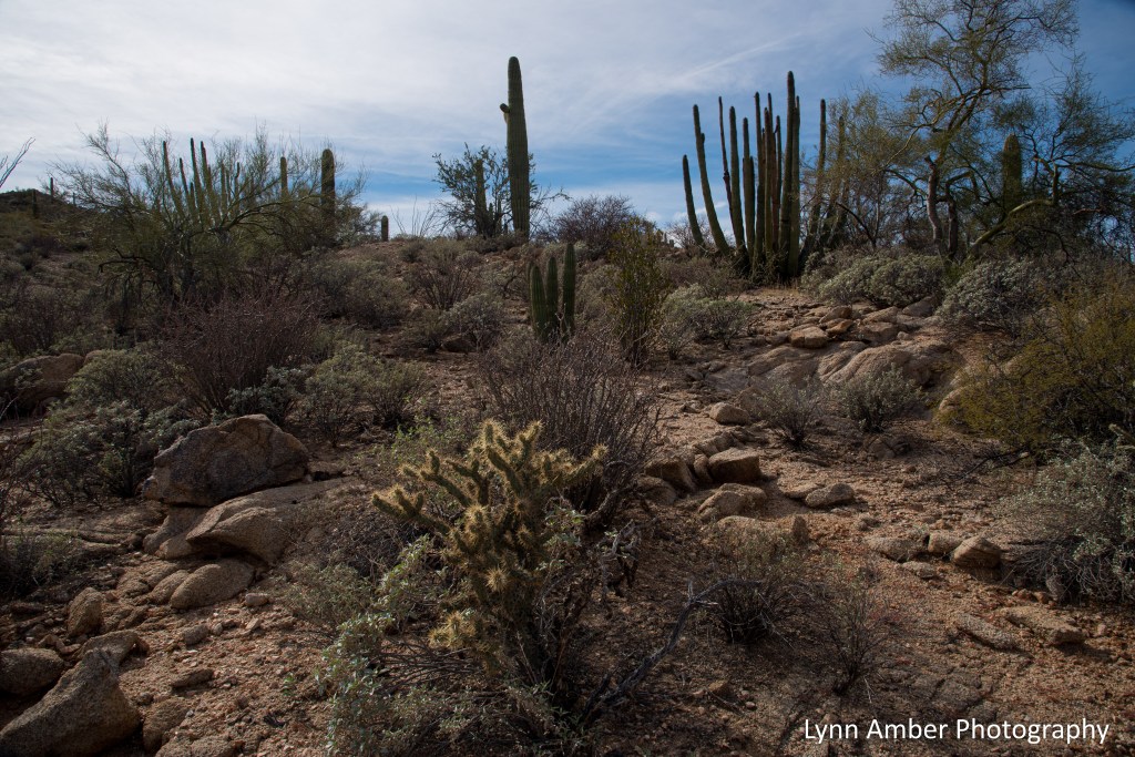
On one of our remaining days in the park, we decided to explore the area off the North Puerto Blanco Drive. We drove to the trailhead for the Red Tanks and Senita Basin hikes and decided on a 7-mile route that would take us along the Red Tanks Trail bringing us to the Senita Basin Loop – which would ultimately lead us back to Red Tanks. While the 7-mile length might seem daunting to some, it was a relatively easy, mostly level walk that followed a section of an old mining road.
The interpretive sign at the start of the trail gave us some indication as to what to expect on our walk. There are numerous side trails and alternatives to take that can decrease or extend your hike, including a spur that passes by some old mining sites (the Baker Mine trail spur).
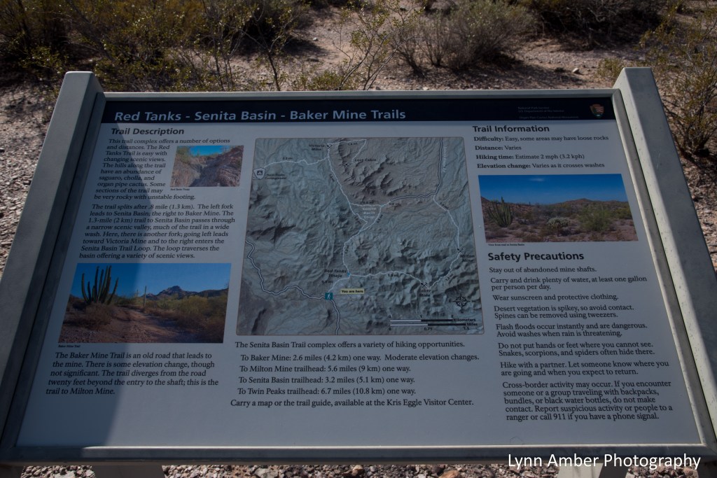
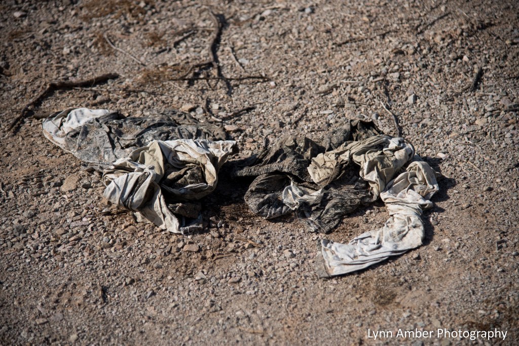
I like that the trail description also shared some safety precautions including the possibility of encountering cross-border activity and how to deal with this. We did come across some old, discarded clothing at several locations along the trail and found one of the black water bottles mentioned in the safety tips. All of these items looked ancient and not the result of recent activity. In our time spent wandering around the national monument, we never felt unsafe or uncomfortable in the back country.
Much of the first part of the hike followed a dry river wash.
More scenes along the way….


This area is known for some depressions called “tinajas” that form in the bedrock from spring rains or wind erosion. These carved-out depressions hold water and are an important lifeline to plants and animals in the desert.


I mentioned previously that we came across discarded clothing and water jugs along parts of the trail. It was a very sobering experience. I could not help but feel compassion for those who give up everything to travel to a foreign land in hopes of a better life.

In several locations throughout the park, we noticed these tall blue flags and, near this trail, we finally discovered just what they are marking! They identify the location of water stations. A group call Humane Borders, operating out of Tucson, distribute these 55-gallon water containers near routes along the border used by migrants. Their mission is simple: “to save desperate people from a horrible death by dehydration and exposure.” It is so very heartwarming to know there are such kind, dedicated people out there who volunteer their time to help save lives.

This concludes my photographic and written journey recounting our trip to Organ Pipe Cactus National Monument! It was a special place equipped with one of the best national park system campgrounds I’ve ever experienced. Take the time to travel there if you can! Outstanding hikes, beautiful sunsets, lots of plants and wildlife – all in a place less-travelled and wonderfully quiet.

Big Sur Coastline San Simeon Region

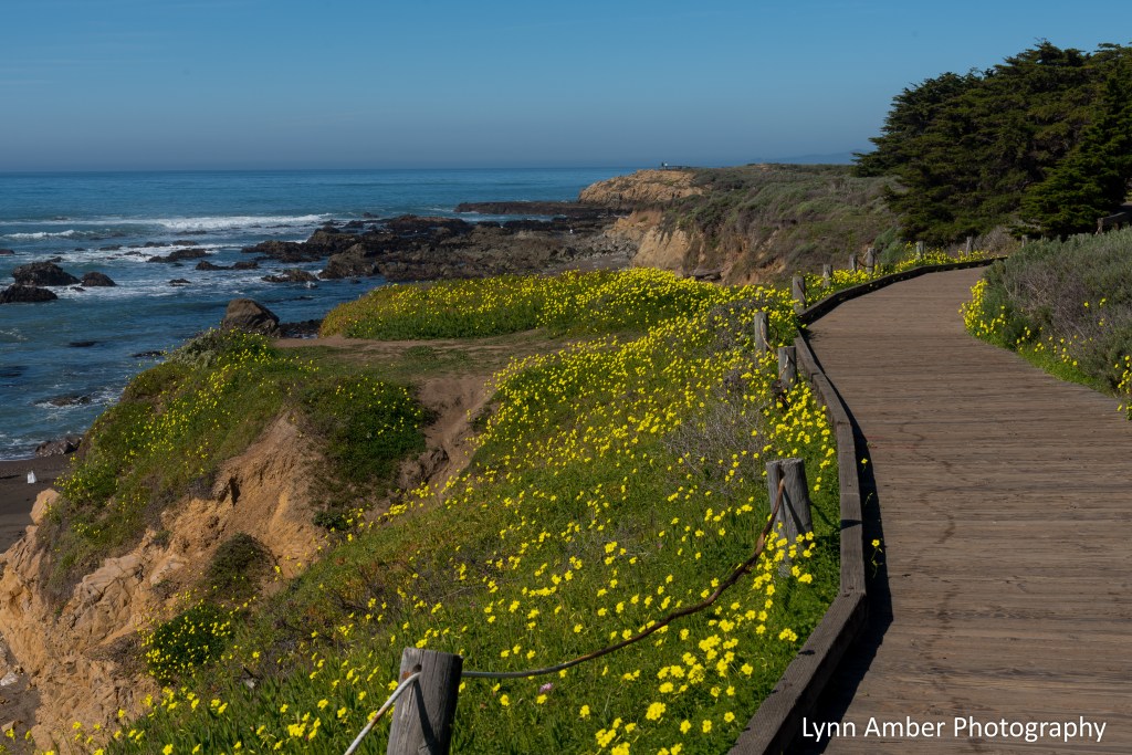
Traveling the coastal Route 1 through the Big Sur region of California has been on my bucket list for years. On our multi-month road trip this past winter, I made it a priority to detour through Big Sur. Often times, when visiting new places, expectations are high and can exceed actual experiences – leading to disappointment. This was not the case with the Big Sur highway! We visited in February and the weather was absolutely perfect – cool nights and warm, sunny days. Our road tour started in the San Simeon region of Southern California. We spent a couple of nights at the Hearst San Simeon State Park and explored the area surrounding San Simeon and to the south on day trips from the campground.
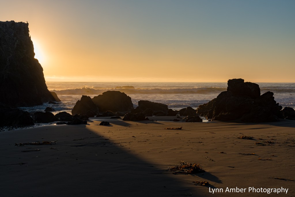
On our first day, we arrived at the campground in the afternoon hours and set up camp. Once that was complete, we took a walk on the trail leading to the beach and explored the coastline. There was a little bit of fog rolling in here and there giving the whole place a mystical ambiance. It was heavenly!

Lots of seagulls were basking in the late afternoon sun!

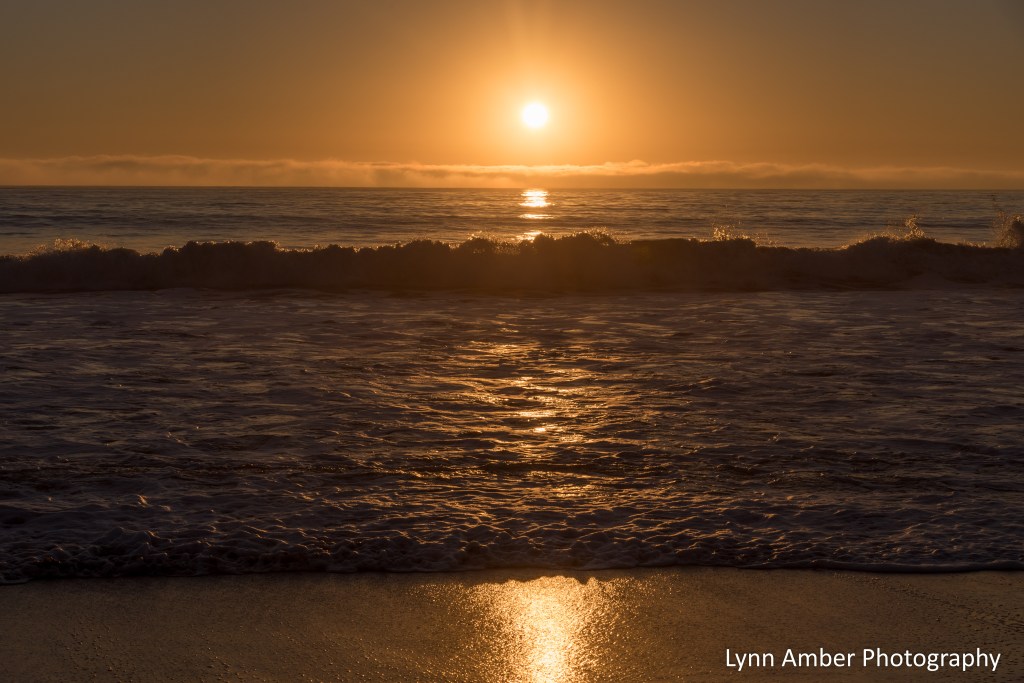
We stayed on the beach as the sun was starting to set and were rewarded with the nice, subtle colors of a spectacular sunset!

The following morning we set off on a day trip south to explore an area called Moonstone Beach. I noticed this location on the map and fell in love with the name! It is a small beach community with an oceanside boardwalk path traversing the length of the town. We noticed lots of small, bohemian-style hotels lining the main drag. It looked like a very nice, laid-back atmosphere in which to enjoy a pampered vacation.

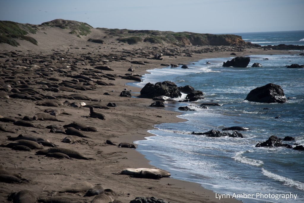
After strolling the boardwalk at Moonstone Beach, we drove north through the village of San Simeon in search of the Elephant Seal Vista Point! The best time to visit and view the elephant seals begins in mid-November and extends to mid-May. They frequently gather on beaches along the coast and are fascinating to watch! More information about their life cycle and behavior can be found on the Friends of the Elephant Seal website.

We could have spent the entire day with the elephant seals but we had a reservation for a wine-tasting at the Hearst Ranch Winery and had to tear ourselves away! The main ranch for the winery is located in the Paso Robles area inland from the coast but they have a tasting center in San Simeon that is situated right on the water. It was a beautiful location and we had a fantastic host who greeted us and explained the wines. He was a good storyteller and shared some history of the area and the Hearst Castle. Unfortunately, the Hearst Castle – which sits atop the mountain across the road from the winery – was closed due to road erosion from a recent rainstorm. I was disappointed that we could not take the tour of the castle and grounds but now we have a good reason to come back for another visit! We left the winetasting with 4 bottles of wine – which meant the wine tasting fee was waived – but even with that deduction I’m not even going to mention how much that set us back financially! 🙂

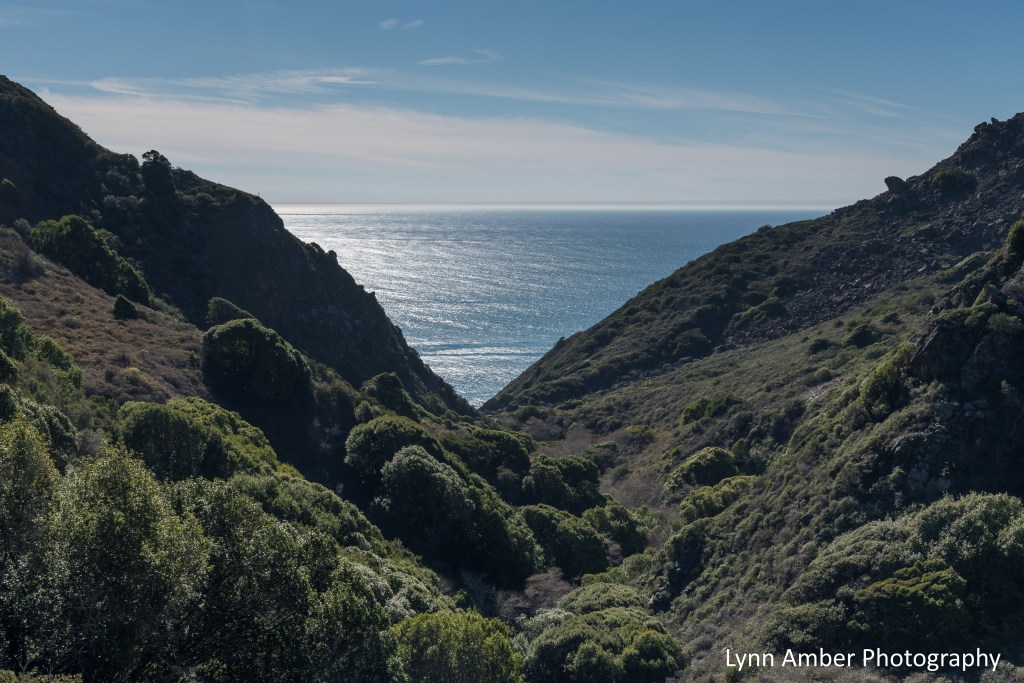
After leaving the winery, we headed back to the campground and enjoyed some spectacular scenery along the way. 🙂 This valley leading down to the water captured my eye and I had to stop and take a photo!
We were back at the campsite when the sun was setting and, all of a sudden, the sky was ablaze with color. I grabbed my camera and ran to a spot where I had a clear shot of the ocean and sky. Amazing!

Stayed tuned for the next leg of our journey along the Big Sur highway!
Clouds over Grassland

I’ve been trying to complete another post from our winter trip to Organ Pipe Cactus NM but my hotspot is sooooo incredibly slow today – so I gave up! Here’s a shot from Lava Beds NM a week ago when some storms were moving through the area. The clouds here are extremely dramatic!
OC&E Woods Line State Trail

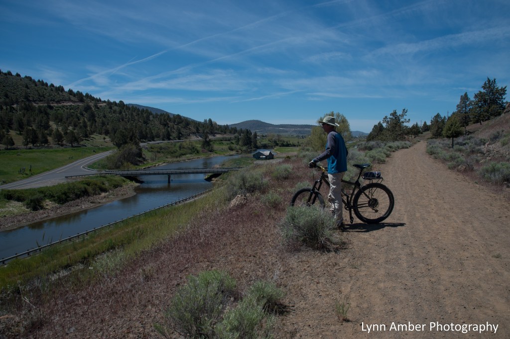
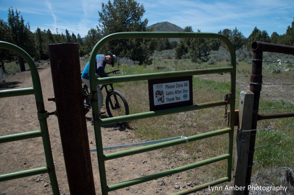
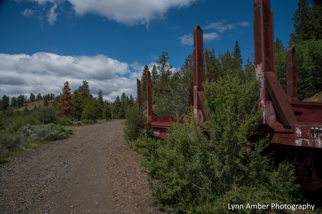
The Oregon, California and Eastern Railroad bed was converted to the OC&E Woods Line State Trail starting in the early 1990’s and is a 109-mile rail trail that runs from Klamath Falls to Bly, Oregon with an extension to Sycan Marsh. Along the way, it passes through small rural communities, ranch and farmland country and national forest land. There are numerous access points along the trail to choose from depending on where you want to bike. On our first trip to the rail trail we parked at the Pine Grove Trailhead just east of Klamath Falls and biked to a point just before the Dairy Y Trailhead for a round-trip total of over 12 miles. The section from Klamath Falls to the town of Olene is paved. The rest of the trail is packed gravel and in relatively good condition.
Pine Grove Trailhead
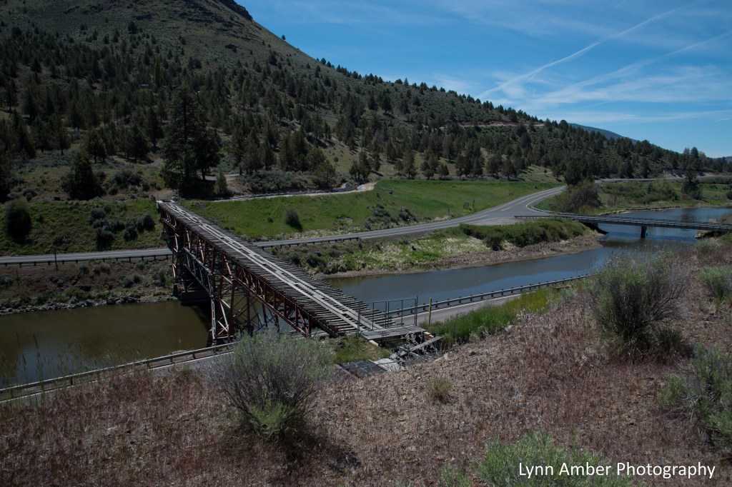


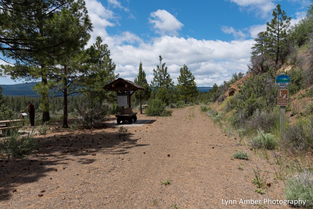
Switchbacks Trailhead
On another day, we decided to visit a section of the trail accessed via the Switchbacks Trailhead near the town of Sprague River. Our intent was to bike but, since I was not feeling quite up to par that day, we just hiked some of the switchback section. It was so beautiful and green here! I cannot wait to come back and bike this area so we can cover more ground!
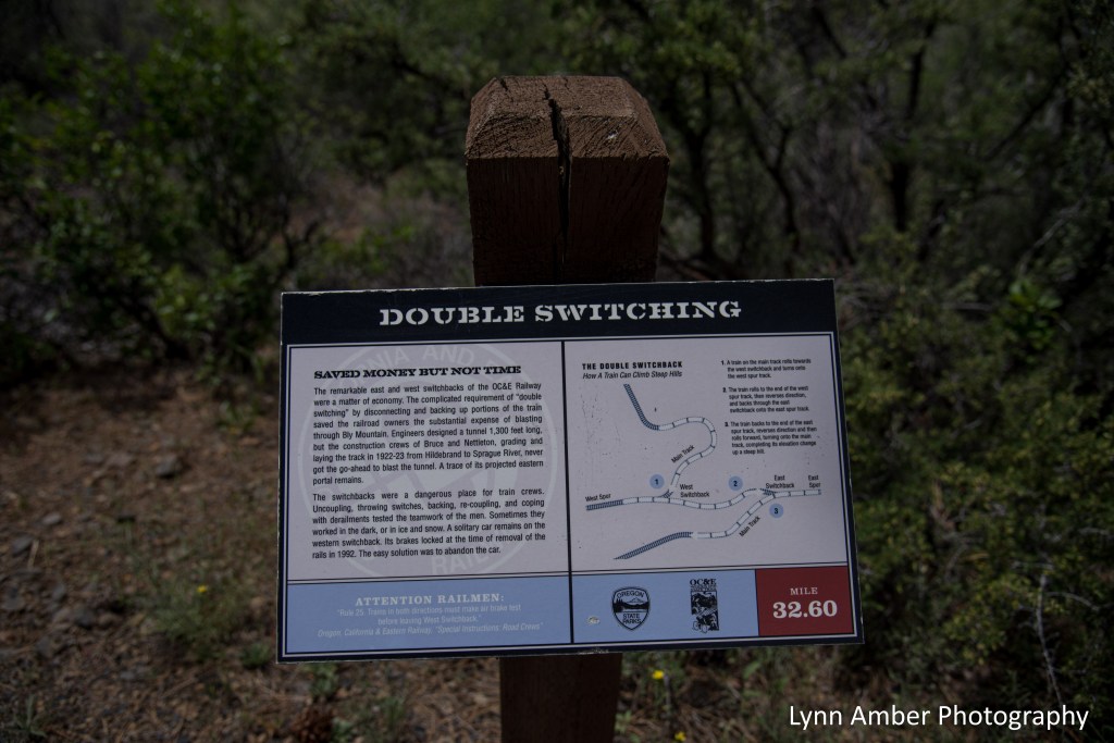
There was an interpretive display in the picnic area that described the use of switchbacks by the railroad industry. A switchback was used as a means to climb steep grades without having to endure the expense of building tunnels or employ heavy earth-moving equipment. We hiked the switchback area and some of the former railway bed to the south.
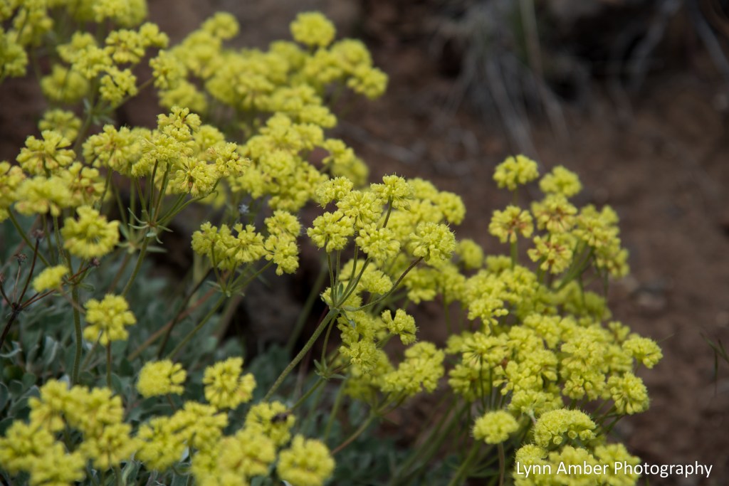
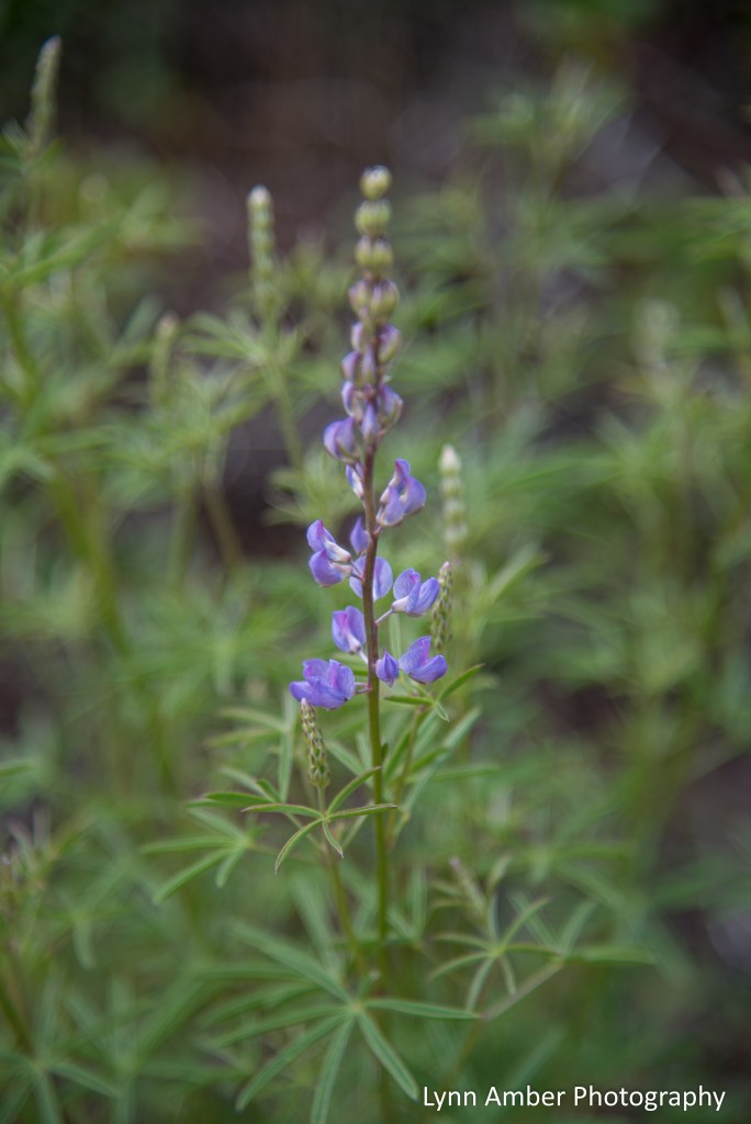
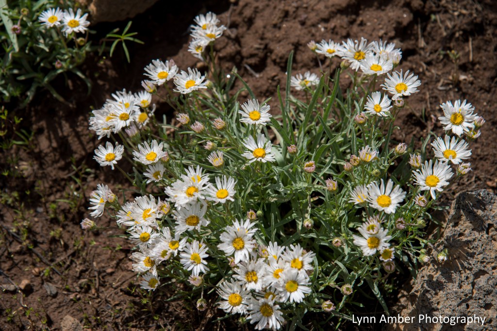
There were lots of wildflowers blooming along the trail including penstemon, lupine, daisies and buckwheat.

When the OC&E Railway was being shut down as a railroad corridor and the rails were being dismantled, there was one railroad car that could not be removed easily because the brakes had locked up. I was determined to see this car as we had not passed it on the trail. We found it on a section near the parking lot that we had not hiked.


Thoroughly recommend exploring all or parts of this amazing rail trail! Each section has unique qualities and landscapes. Camping is allowed only in designated places so plan ahead or simply enjoy day trips. We do not have a second vehicle to do a one-way shuttle but that would be a great way to explore the trail without backtracking.
Before leaving the area, we drove some of the national forest gravel road back into the Fremont-Winema NF and noticed a few spots where it is possible to do some dispersed camping that seemed trailer-friendly. Something to keep in mind for the future!
Lava Beds Desert Bloom

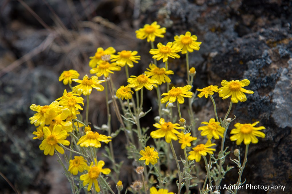
From a distance, the Lava Beds NM landscape looks fairly barren and harsh. But, up close and personal, there are many wildflowers blooming right now along the trails and roadways. On my travels in and around Gillems Bluff the other day, the sagebrush and juniper landscape was ablaze in color. (from a high-desert perspective that is!)


Volcanic Legacy Scenic Byway – Part I
The Volcanic Legacy Scenic Byway is one of 42 “All American Roads” established in the United States. The entire route is nearly 500 miles in length and is easily divided up into leisurely day trips. We are fortunate to be working right smack in the middle of this byway that extends from its southern terminus near Lassen Volcanic National Park in North-Central California to its northern boundary at Crater Lake National Park in South-Central Oregon. The route passes through the fiery, dramatic landscape of four National Park Service properties and numerous state parks, wildlife refuges and national forests with an eclectic assortment of small town communities to explore along the way.
Last week on one of our days off, we decided to embark on a road trip and complete part of this scenic byway. Leaving the Tulelake area, we made a brief stop in Merrill, OR to fuel up (diesel is more than $1 cheaper in Oregon than California) and then headed west on Route 161.
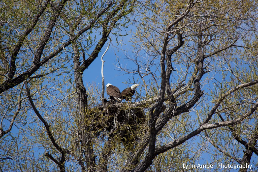
We travel Route 161 often since it’s our major path to Klamath Falls for all amenities and it passes by the Lower Klamath National Wildlife Refuge. We discovered an eagle’s nest in the refuge a while ago and visit it often to see how the babies are progressing!
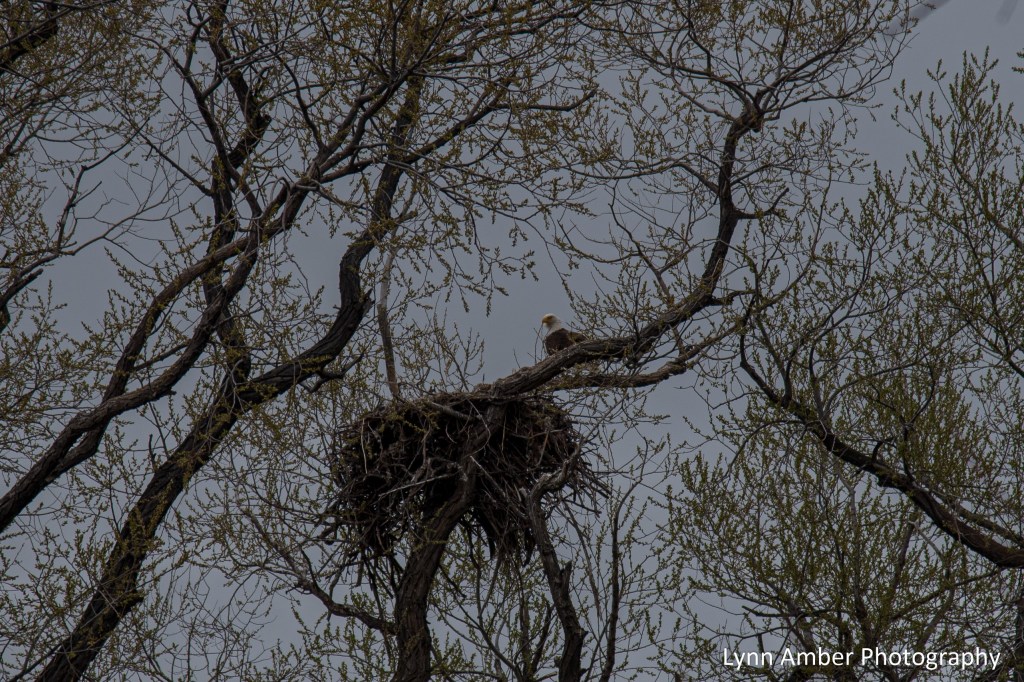
The above photo was taken back in May before the leaves came out making the nest and the eagle very visible! Later in the month, we took my Canon camera with the 200mm lens back out and captured some of the photos below. Jim snapped the photos while I did the editing – just need to give credit where credit is due!! Good job Jim!

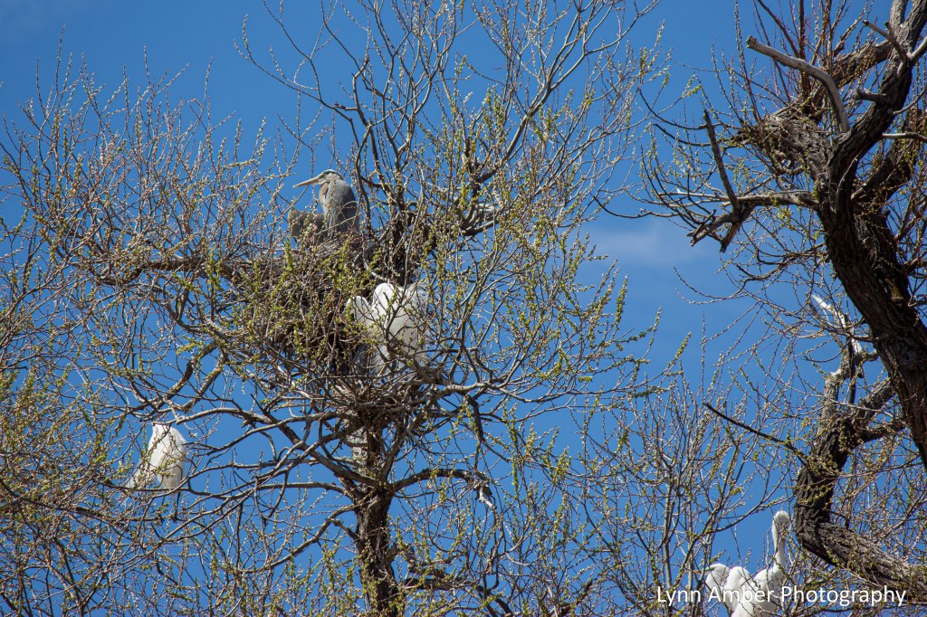
In the same area, we grabbed some shots of a Great Blue Heron and some egrets hanging out in the trees!
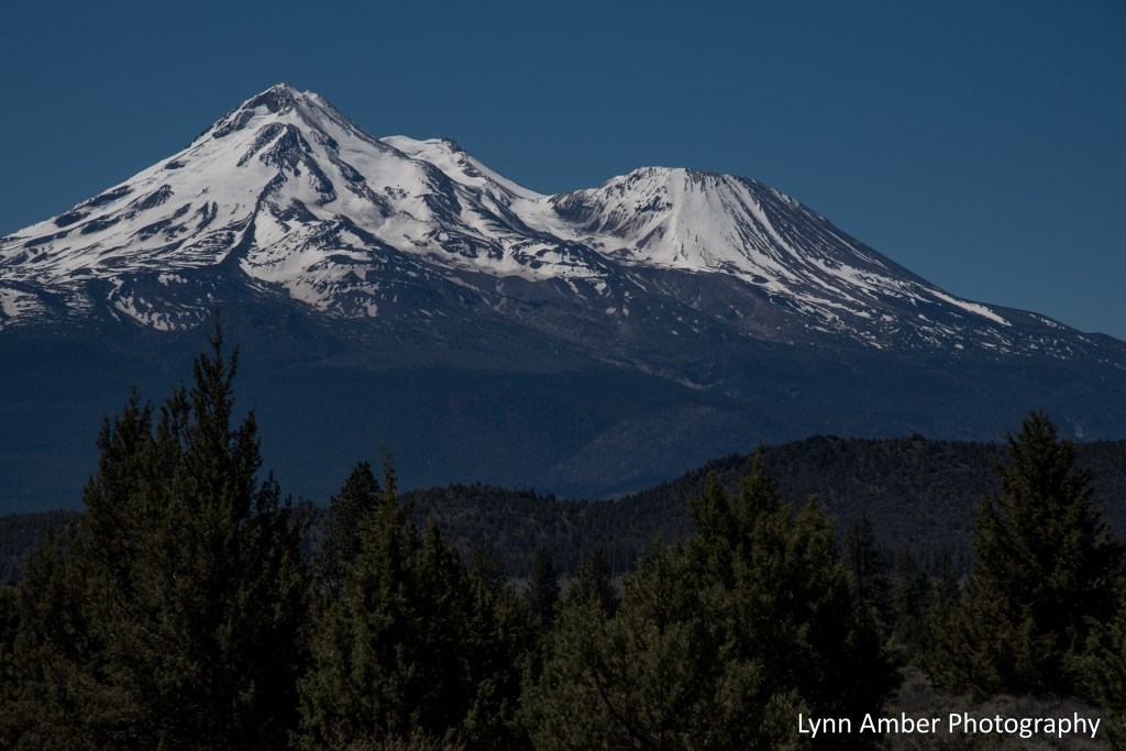
At the junction of Rt. 161 and Rt. 97, we headed south towards Mt. Shasta, the town. This scenic road offers up some of the most stunning views of Mt. Shasta, the mountain, and it was a picture-perfect day for viewing this 14,000+ volcanic peak. At some point this summer, we will venture back here to hike some of the trails on the mountain.
At Mt. Shasta (the town), we picked up Rt. 89 and began our drive through the Shasta-Trinity National Forest. I recently read an article touting the attributes of McCloud, CA – a small, mountain town that sits in the shadow of Mt. Shasta. An old lumber and railroad town (designated a National Registered Historic District), the historic buildings are well-preserved and there are numerous hotels, restaurants and activities to attract visitors year-round. Visit the McCloud Chamber of Commerce website for more information! We hit McCloud at just the right time to take a break from driving and grab a snack. Since it was Tuesday, unfortunately we found many eating establishments closed but the coffee shop in the historic McCloud Mercantile Hotel was open and we enjoyed a great cup of fresh brewed coffee and a blueberry scone!
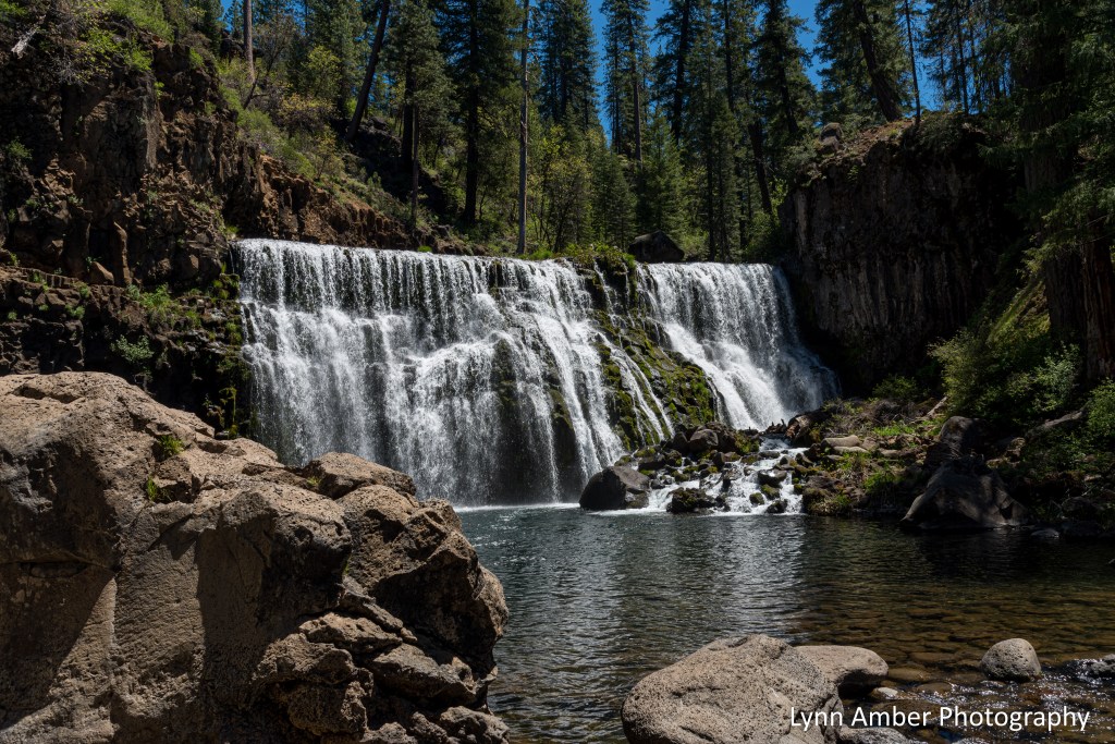
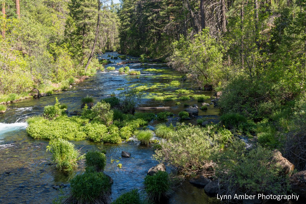
Continuing south on Rt. 89, we detoured off the road to visit the McCloud River Falls area. What a treat!! The McCloud River is a state Wild and Scenic River that runs for over 75 miles – fed from the snowy peaks and springs of the Cascade Mountain area surrounding Mt. Shasta. Starting at the parking area for the Middle Falls, we hiked the switch-back trail down to the base of the falls and just hung out here for awhile taking in the breathtaking beauty of this waterfall. Jim couldn’t resist dipping his feet into the painfully cold water at the base of the falls! The waterfall certainly commands most of the attention in this area but the diversity of the forest plants is not to be missed. Douglas-fir, white fir, ponderosa pine and incense-cedar dominate this area and there are some magnificent specimens along the trail.
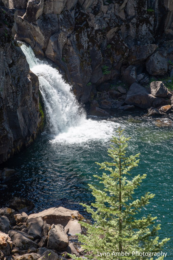
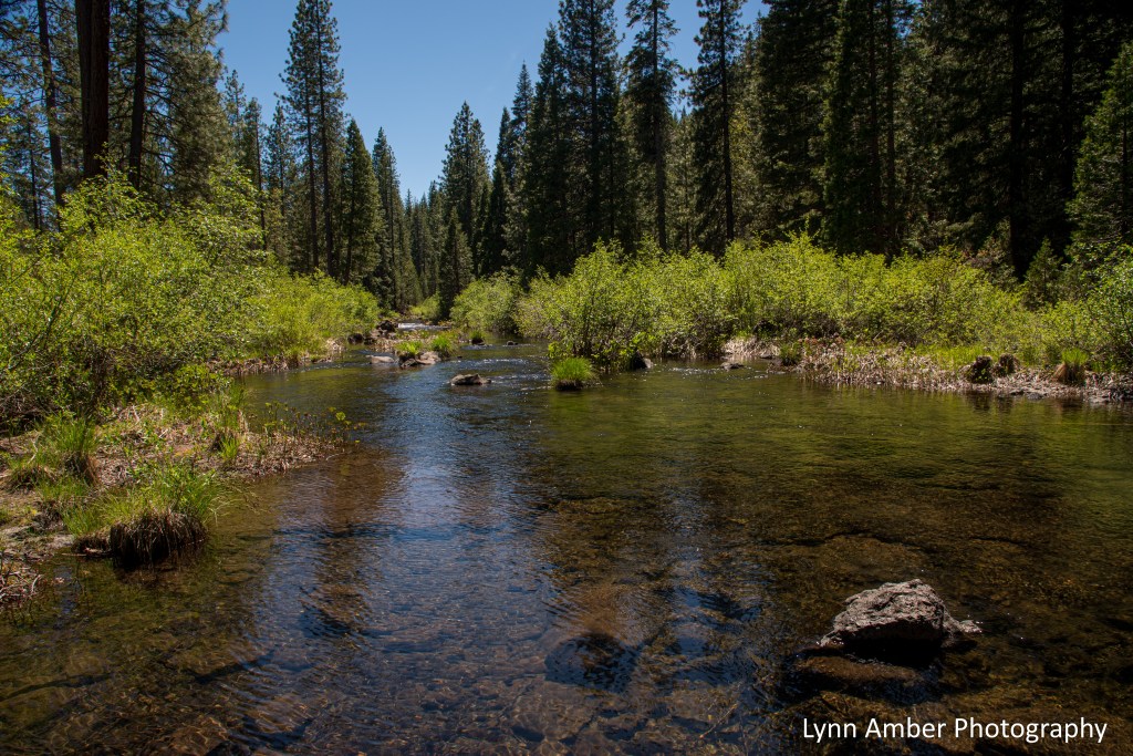
We traveled to the Upper Falls for a brief period before getting back on the road towards Burney Falls area. The Upper Falls, while not as dramatic, had its own special charm. And the river above the falls here was so tranquil and peaceful!
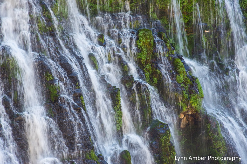
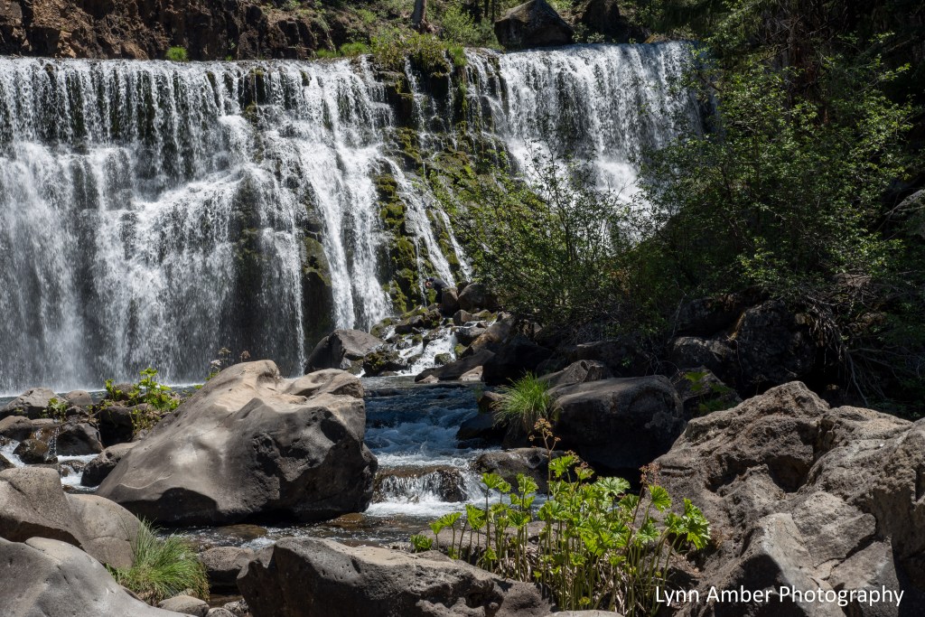
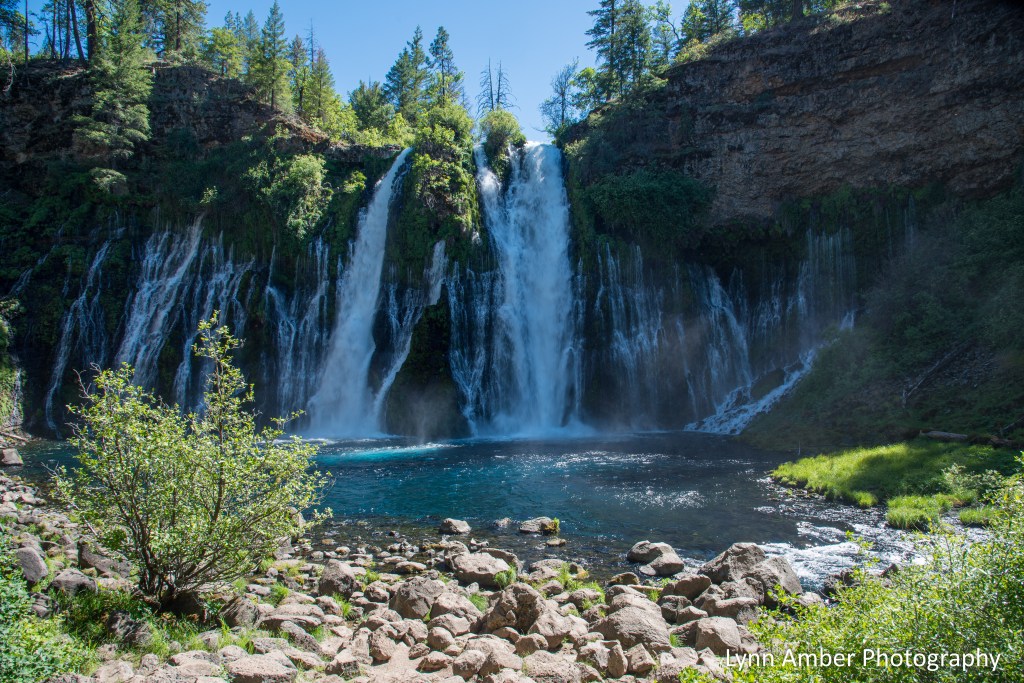
Our next destination was the McArthur-Burney Falls Memorial State Park. It seems “waterfalls” was the theme for the day! We hiked the Falls Loop Trail which starts at the top of the falls and descends to the base of the waterfall. The trail continues downstream and passes over the creek via a small bridge, reversing course along the forested hillside upslope past the falls and back over the stream above the falls. Air temperatures had climbed during the day and the hike in the forest was nice and cool!!

Burney Falls is over 120’ high and 250’ wide and more than 100 million gallons of water flow over the cliff in a day! The falls are unique in that the water emerges not just from the top where the creek overflows but through numerous cracks and springs in the face of the cliff. Hanging gardens of ferns and other plants provide a backdrop to the tumbling water creating a stunning display. Designated a National Natural Landmark in 1954, it is truly one of the most spectacular places in Northern California.
Notice the propensity of plants growing out of the face of the cliff!

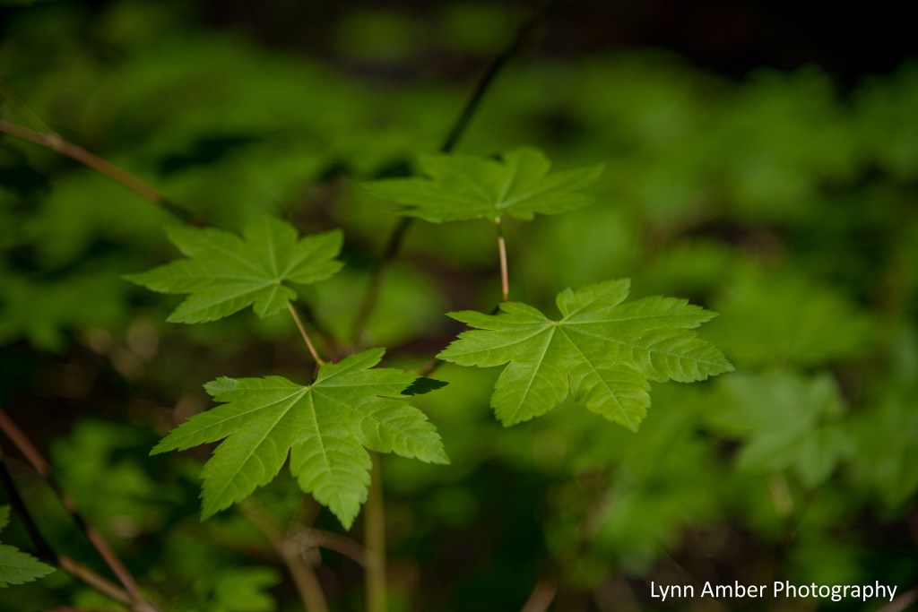
Along the trail, I noticed an unusual maple leaf that I was unfamiliar with – turns out it’s called a Vine Maple – Acer circinatum. Lovely leaf and texture!
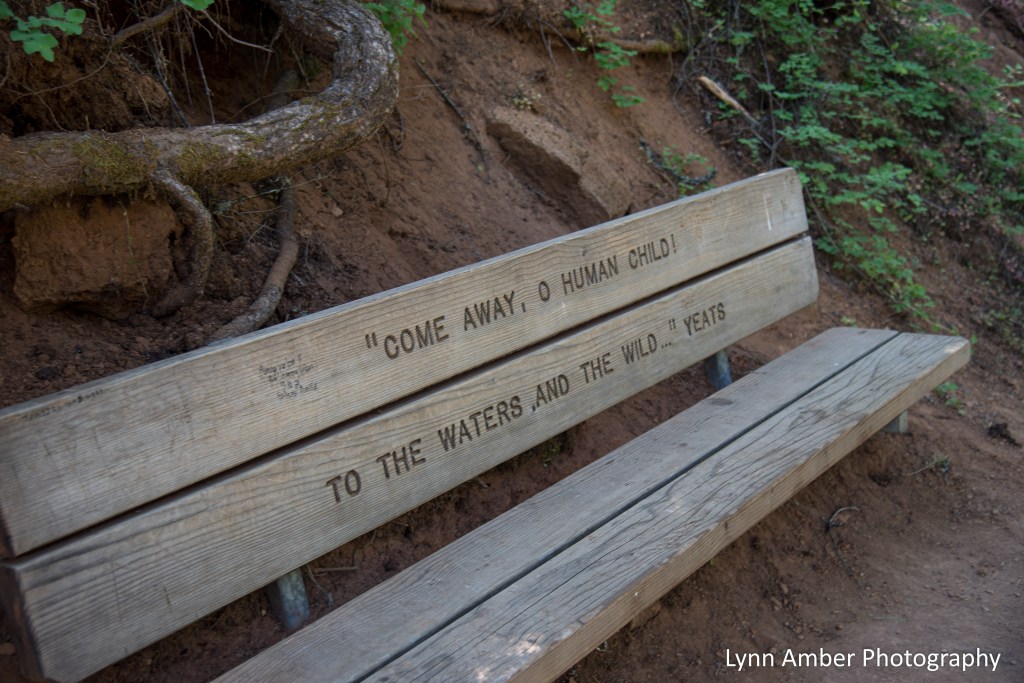
I also was impressed with the benches that were dispersed along the Falls Loop Trail.
At the end of the trail, there was a cut-out of a log that showed where different historical events fit in with the rings of the tree. I love these displays!

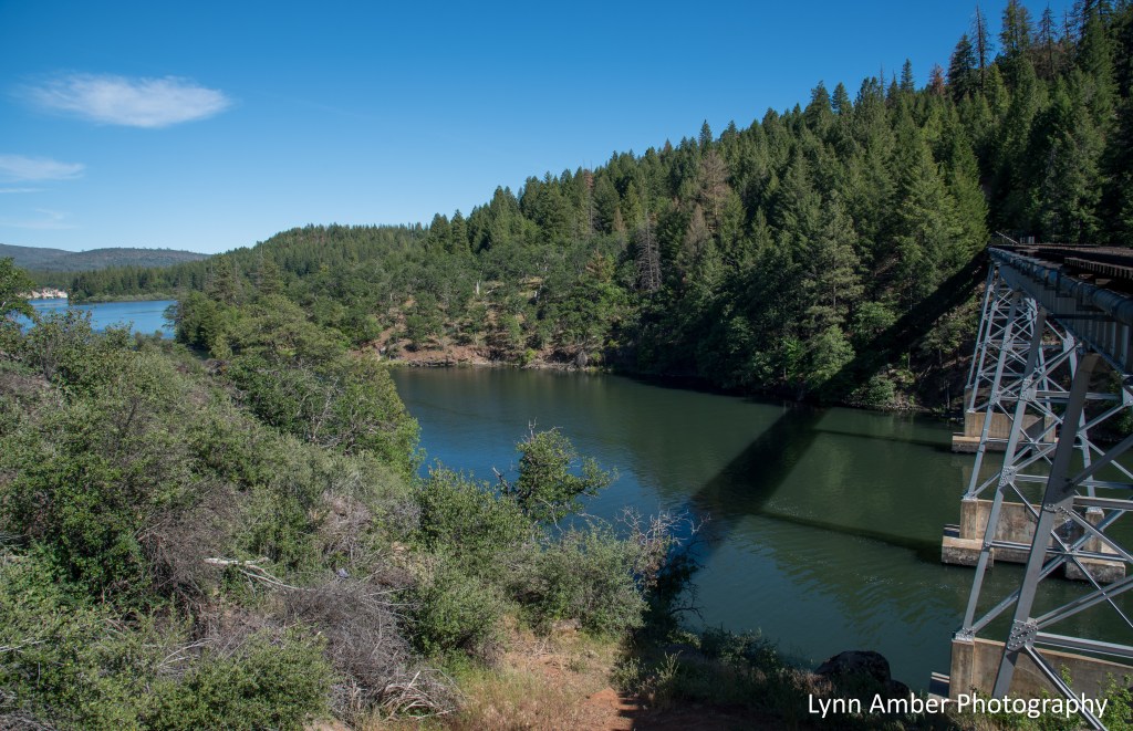
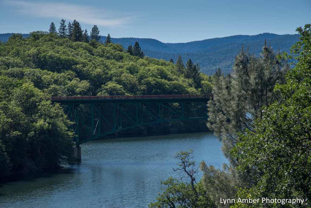
A short distance from Burney Falls is another interesting attraction that I did not want to miss. One location for some scenes from the iconic, 1986 coming-of-age movie Stand By Me was filmed in this area. We made the detour to see the infamous railroad bridge on the Great Shasta Rail line where, in the movie, the boys had a close encounter with a train. Cool!! Of course, Jim always stretches the boundaries of acceptable behavior and ventured past the barriers to stand on the bridge! 😊

A great road trip. Over the course of the summer, we’ll travel all stretches of this byway and I’m looking forward to two highlights in particular – exploring Lassen Volcanic National Park and Crater Lake National Park!!
