Lynn Amber - Travel & Photography
sharing my thoughts through words and images
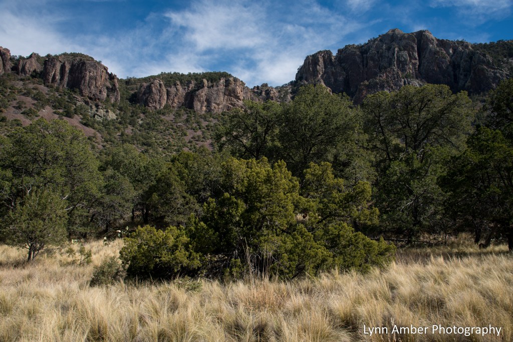
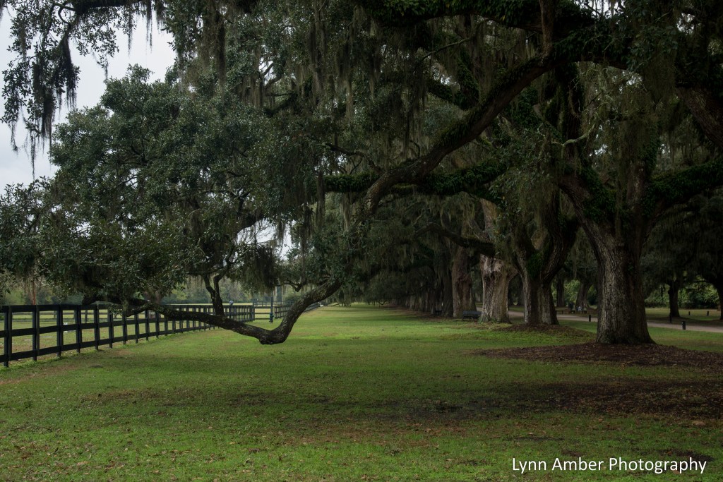
Big Bend Hikes: Long Chisos Basin Loop
My last hike before ending my season at Big Bend had to be one more walk in the Chisos Basin. Since I’m in training for a long walk in France, I chose to do the long loop around the top of the basin – going up the Laguna Meadow Trail and connecting to the Pinnacles Trail via the Colima and Boot Canyon Trails. The weather was ideal with temperatures just right for the 11-mile hike! Love these mountains so much!
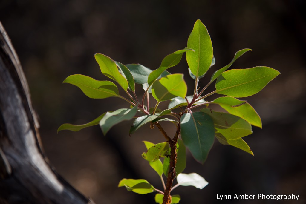
We decided to do the long loop in a counter-clockwise direction. The Laguna Meadows Trail is a more gradual ascent and we followed this trail to its junction with the South Rim and Colima Trails. Along the way, I grabbed some pictures of some of the plants I love that inhabit this mountain environment.

After about 4.5 miles, we came to the junction of the Blue Creek Trail which descends steeply towards the Homer Wilson Ranch and is part of the Outer Mountain Loop. The Outer Mountain Loop is a popular 3-day backpacking route that skirts the base of the Chisos Mountains and climbs into the mountains. At some point, it would be fun to try completing this difficult hike. When Jim and I reached the Blue Creek Trail, we came across a couple eating lunch who were just starting their Outer Mountain Loop backpack trip and getting ready to head down the Blue Creek Trail. We spent some time chatting with them and talking about their other backpacking experiences. The woman shared that she has hiked the Appalachian Trail a section at a time and still has to complete the Vermont leg of the trail near us.
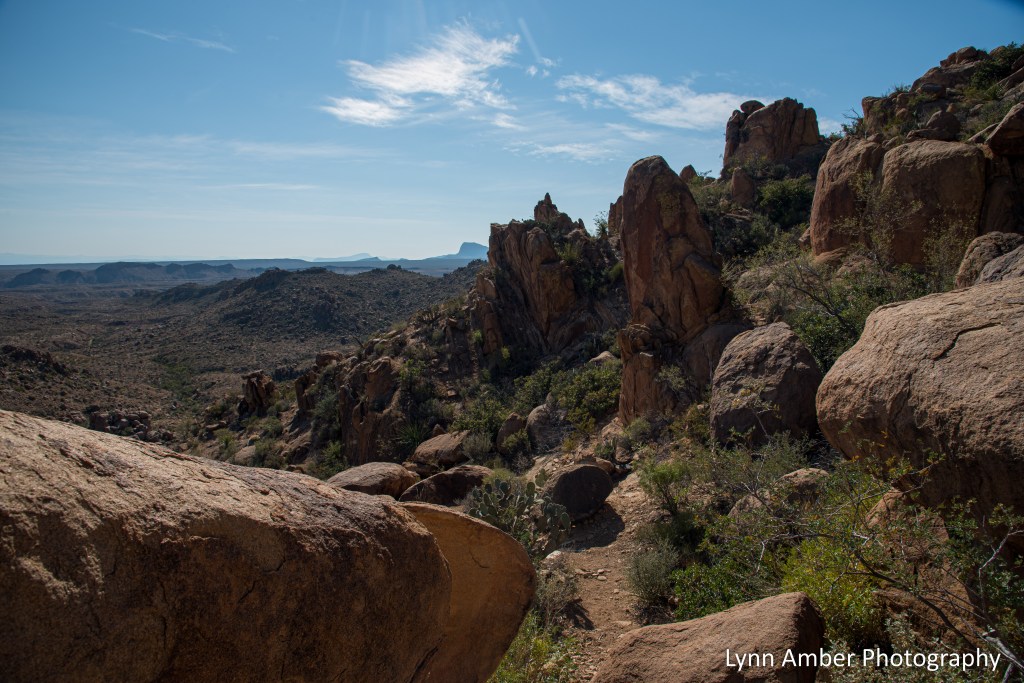
After leaving those folks, we forged on to the end of the Laguna Meadows Trail where it meets two trails – the South Rim Trail and the Colima Trail. Although I would have liked to hike out to the South Rim, it would have added 4 miles to the distance and meant getting done near dark. I was content with just viewing the South Rim from the Laguna Meadow Trail! 🙂

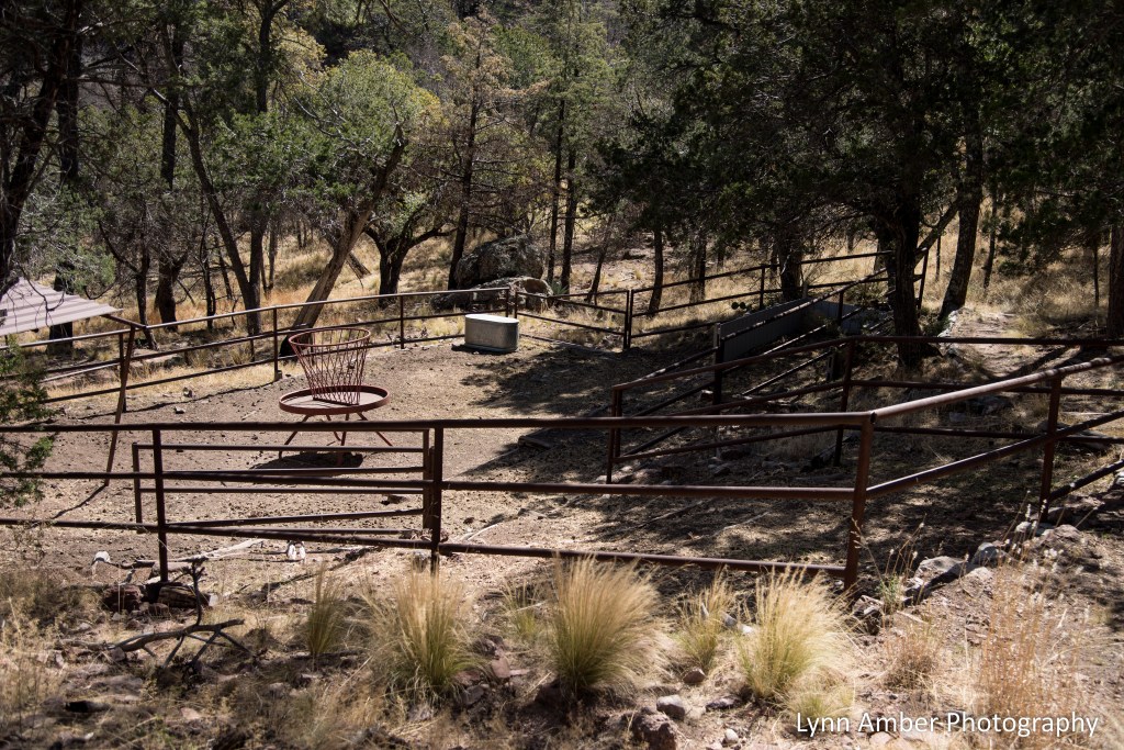
The Colima Trail is a connector trail that leads to the Boot Canyon Trail and the East Rim Trail system. In this area, there is a corral and cabin used by the park trail crew. We noticed the corral just off the trail and could not resist checking it out.
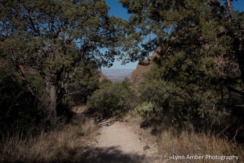
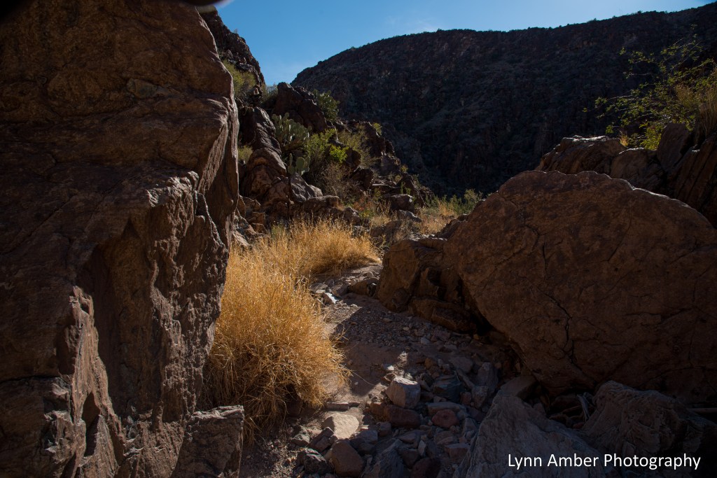
The short mile-long Colima Trail brought us to the Boot Canyon Trail. We hiked this same loop a number of years ago and I was reminded how much I loved this part of the hike through the magnificent canyon terrain with sweeping views of the desert and Sierra del Carmen range in the distance.
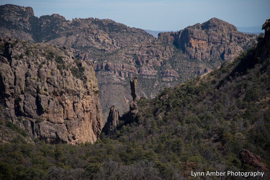
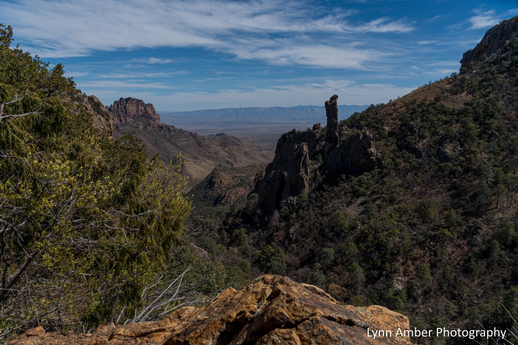

The Boot Canyon Trail is dramatic and breathtaking – a highlight of the hike for me! It winds around Emory Peak and through the canyon with some short, steep climbs and drop-offs punctuated with amazing views.
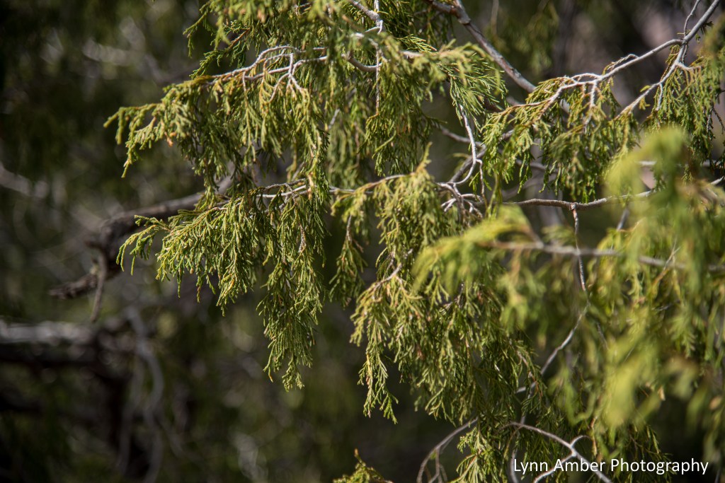
Along with Texas Madrone, the Chisos high country is peppered with several varieties of Oaks, Pinon Pines and Juniper trees. There is an incredible diversity of plant material here. It has taken me a few years to really learn and appreciate this unique plant life.

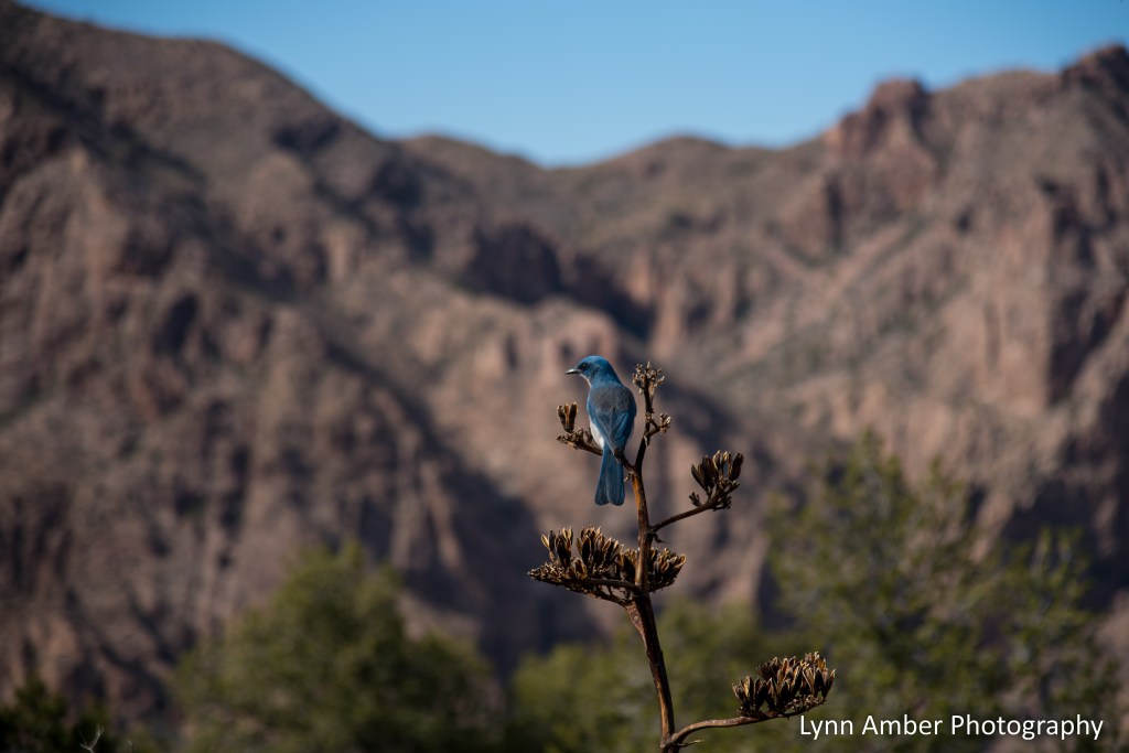
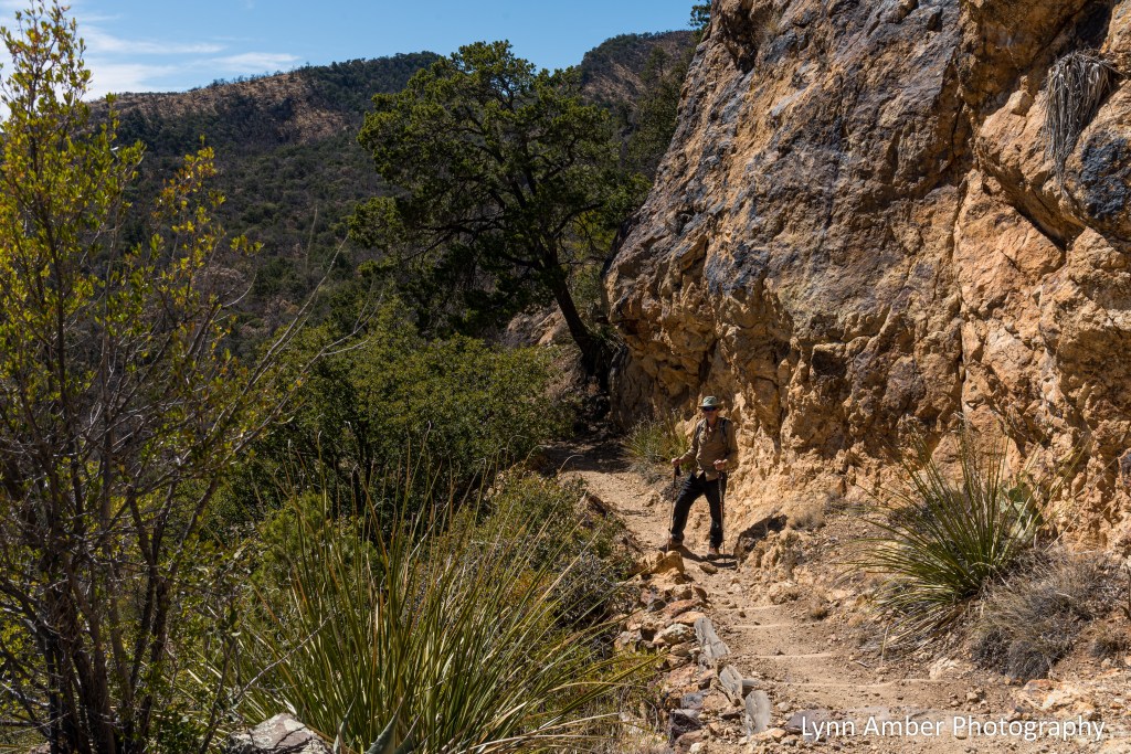
Once we reached the junction with the Pinnacles Trail, we were well past the half-way mark of the hike and had just the 3.5-mile descent to go. I always feel like descending is easier but, honestly, the Pinnacles Trail loses elevation steeply and really does wear on the legs!! Thank goodness for hiking poles! We stopped for a few breaks along the way and I got side-tracked with trying to capture a photo of the Mexican Blue Jay that was taunting us on our descent!


The Juniper Flats area along the Pinnacles Trail is really pretty and there are several back-country campsites here. Next trip to Big Bend, we decided that we would spend a couple nights up here. It is a short hike from the parking area with a backpack and I can imagine the night sky must be spectacular!


This Mexican Blue Jay was following us down the trail – looking for a hand-out I assume! Every time I would get close to snapping a good photo, he would take off before I could get focused! Finally, towards the end of the hike, he perched on this agave flower stem and stayed put – allowing me to capture him up close and personal. Such a tease!

I have much more to post regarding our 5-month stay in Big Bend and will continue as I find the time. I am somewhat pre-occupied with planning for an upcoming spring trip to France and the start of an adventurous trek along the Way of St. James – Le Puy. I purchased a lighter weight travel camera for this 460-mile walk and hope to be able to document my journey! Au revoir, à bientôt….
Big Bend Hikes – Blue Creek Trail
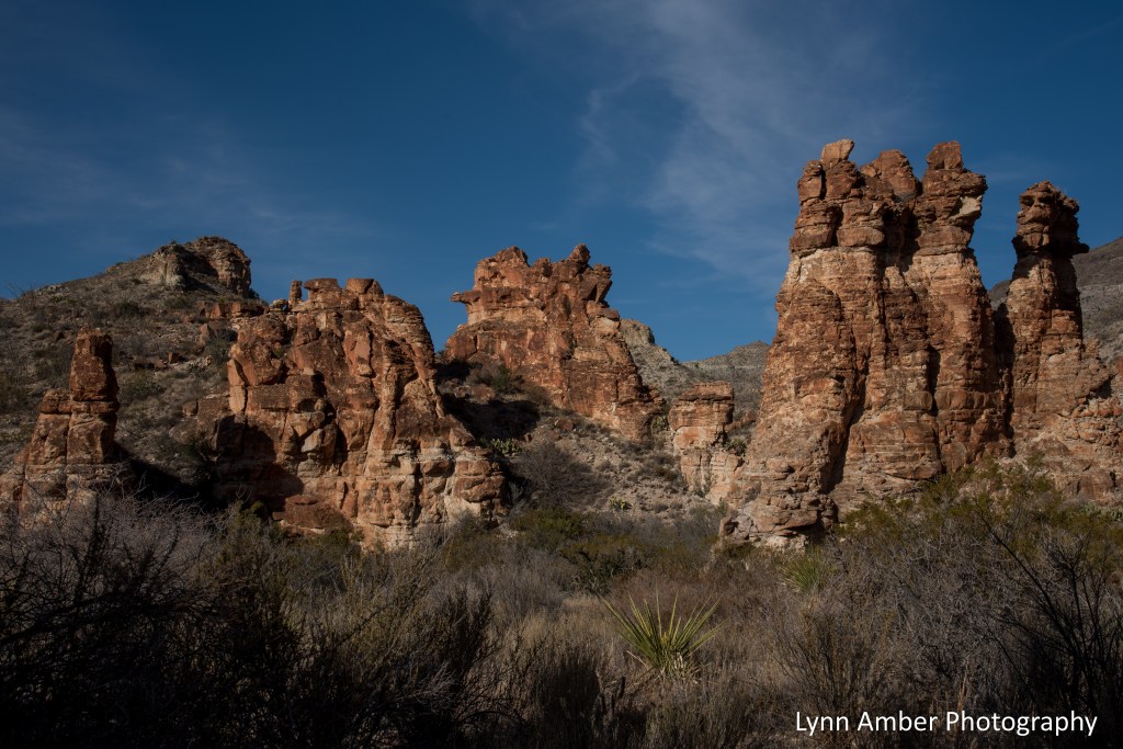
If you’re looking for something a little different and less travelled, the Blue Creek Trail has a lot to offer. The trail starts in the Blue Creek wash near the Homer Wilson Ranch ruins and climbs up into the Chisos Mountains – from desert floor to mountain vistas all in one hike! The round-trip hike is about 11 miles.
We got a late start on the day we hiked the trail, and chose to do a 6-mile hike which would take us past the red rock hoodoos and into the foothills leading to the mountains. If you want to just get a look at the red rock formations, then you can shorten the roundtrip walk to 3 miles.
Heading into the arroyo near the ranch, the trail follows the wash winding past impressive, stories high red rock formations.
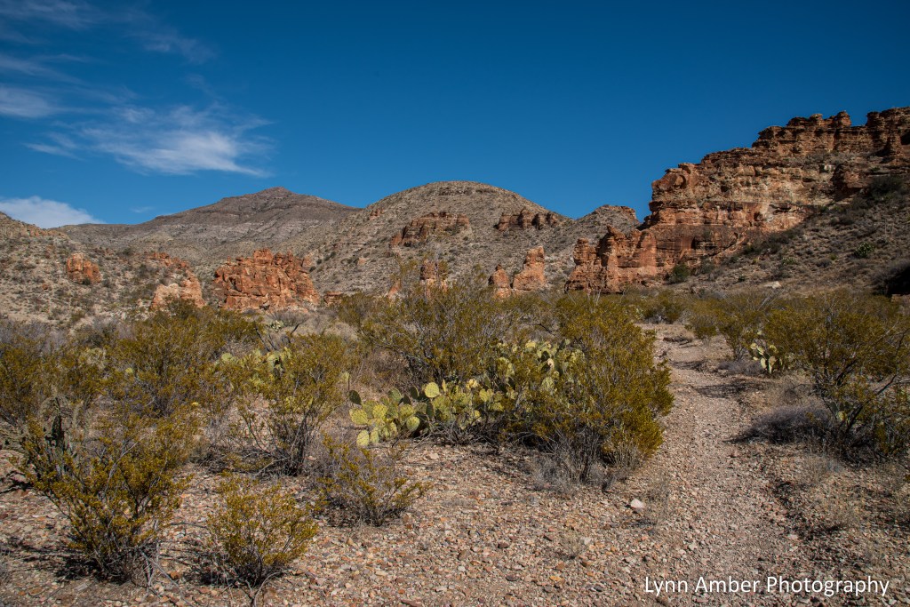
After leaving the red rocks behind, the trail climbs up out of the wash and starts its ascent to the intersection with the Laguna Meadows Trail high in the Chisos. If you take the trail all the way to its terminus, it would be about a 2600+ elevation change. We hiked well into the foothills before turning around.

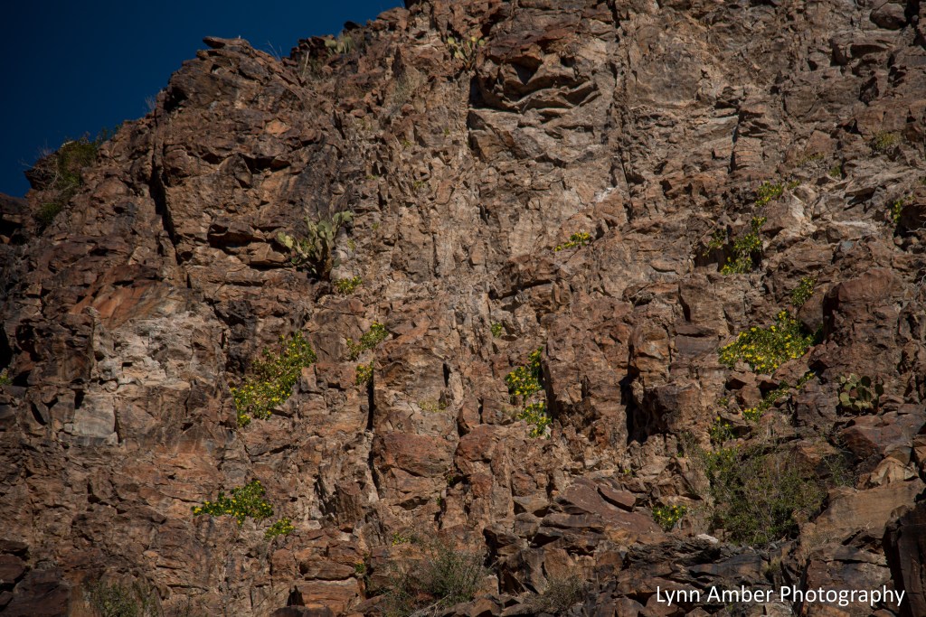
Our return trip towards late afternoon offered some beautiful vistas looking out towards the Rio Grande River valley and the cliffs that line the river.

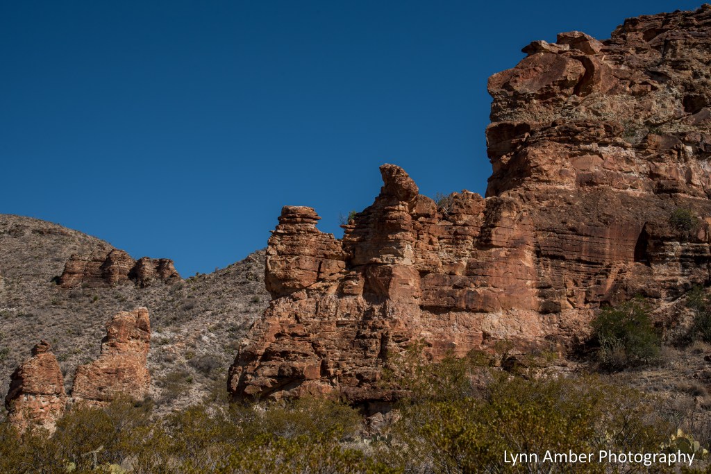
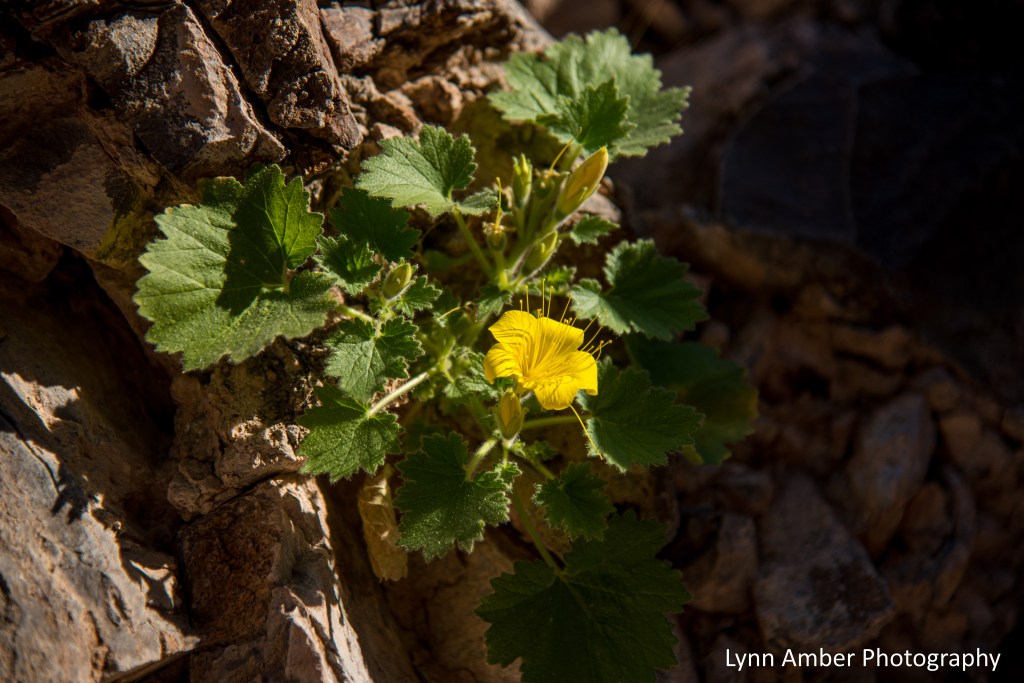
The late afternoon light was really illuminating the red rocks on our descent and casting interesting shadows. I was amazed at the plant life that survives on the steep cliff walls!

Back at the start of the trailhead, we wandered around the historic ranch ruins admiring the architecture of the buildings – including the artistically laid flagstone floor in the house. The house and buildings in this location were used by a foreman named Lott Felts. The main house for the ranch was located a few miles away in Oak Canyon. I had the pleasure of talking with a descendant of Homer Wilson a couple of weeks ago. He mentioned that Homer Wilson was his grandfather and he was headed to Oak Canyon to visit the site of his ranch. I love it when people with real connections to the park come back and tell me stories about their ancestors. Pretty cool!! 🙂

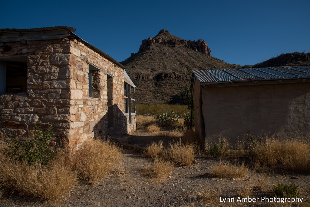
What a wonderfully peaceful and picturesque spot! Can you imagine living here?
Big Bend Flowers

Towards the end of January, we drove to a small parking area along the Ross Maxwell Scenic Drive to hike down the wash that leads to Horseshoe Canyon. I was so surprised to find some plants in bloom!! The above rock nettle was cascading down the canyon walls in drifts!
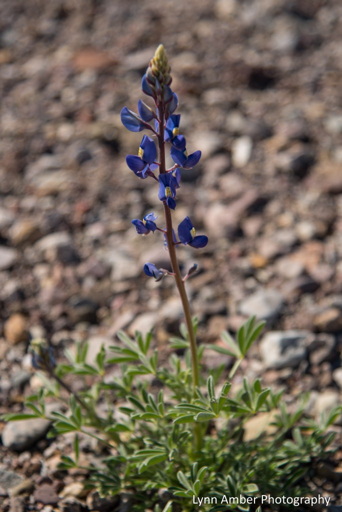
Of course, perhaps the most famous flowering perennial in Big Bend National Park is the Big Bend Bluebonnet – a common name for the plant Lupinus harvardii. Towards the end of January after some rain, this perennial started blooming in some warmer microclimates throughout the park.

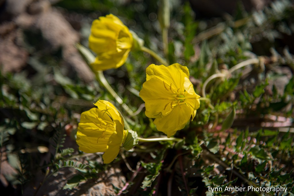
Along the wash mixed in with the blue bonnets were numerous Desert Evening Primroses – Oenothera primiveris.
It was a sweet little walk along an unmarked trail. The canyon was unique with its unusually rough rock surface. We will need to go back and explore deeper into the canyon on another day! 🙂

Big Bend Critters – Tarantulas
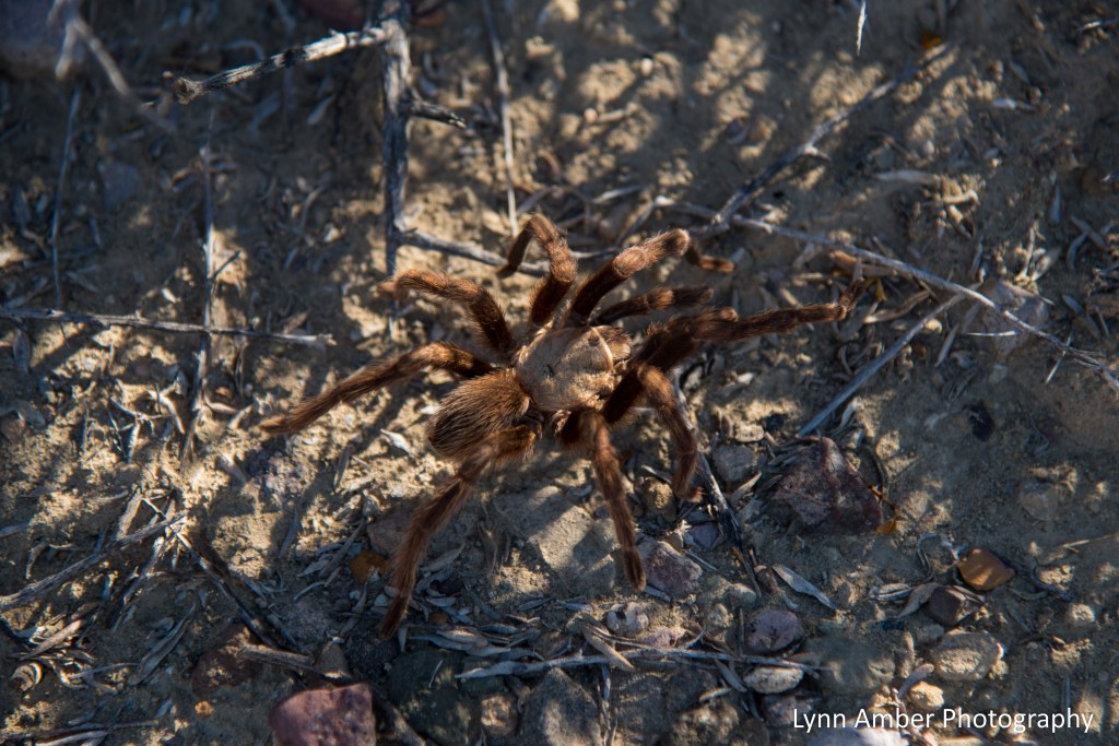
On our previous trips through Big Bend National Park, we never saw a single tarantula. This winter they are everywhere!!
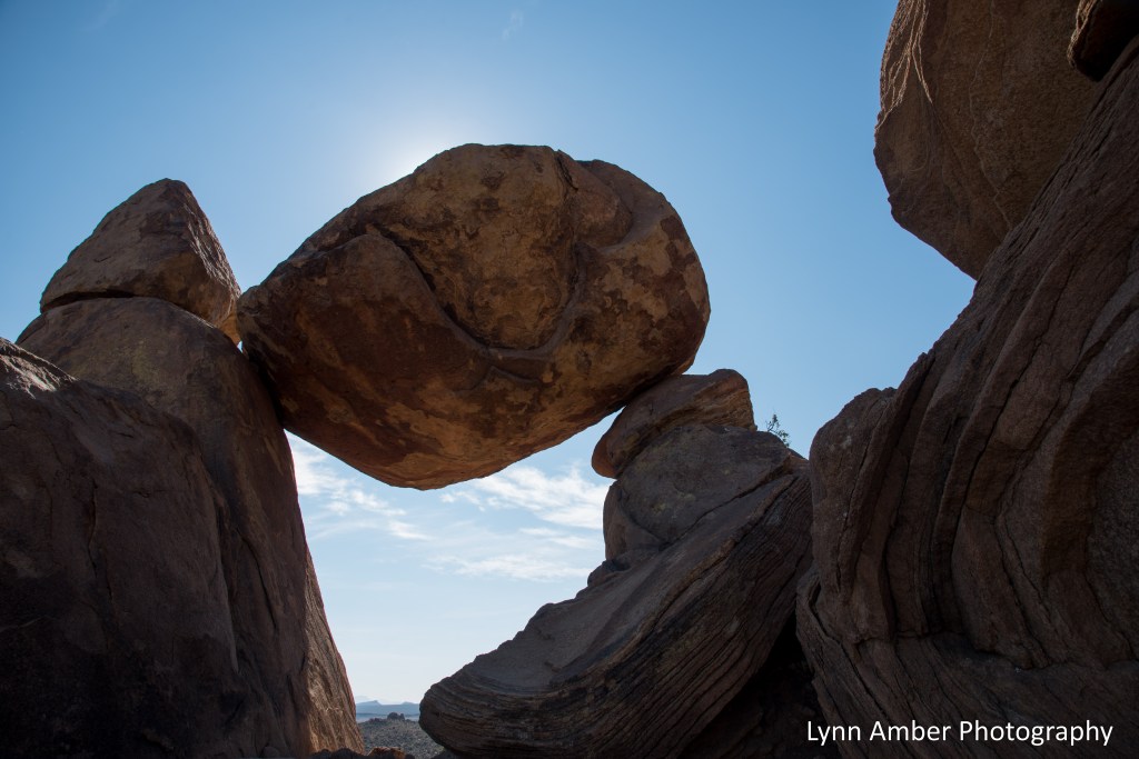
Big Bend Hikes: Balanced Rock

It’s been a long time since I posted. My cell data speed took a beating last month when I was trying to watch some FIFA soccer matches! So, had to wait until it reset with the monthly turnover! 🙂
One of my favorite short hikes in Big Bend is the trek to the “balanced rock.” Officially called the Grapevine Hills Trail, the trailhead is accessed via 6 miles of dirt/gravel road leading to a small parking area.
I hiked it again this year after reading the book Death in Big Bend: Real Stories of Death and Rescue in Big Bend National Park, by Laurence Parent. (This is a great read, by the way) There’s a story in the book about a young man who ventured out on this easy, 2-mile trail and got lost, eventually suffering from heat stroke and perishing in the hot, desert sun. Part of the trail follows a wash and hikers must pay attention to the markers indicating when the trail leaves the wash and takes a turn leading back to the parking area. This particular hiker was on the trail on a blistering hot day in early summer and was probably already suffering from heat stroke and disoriented as he was returning to the parking area from the end of the trail at the balanced rock. He missed the marker where the trail exits the wash and, instead, continued down the wash. That was his fatal mistake.
One cannot see the parking area from the wash as it sits lower in elevation where it passes the lot and, is therefore, hidden from view. The hiker overshot the parking area by a few hundred feet and, in his disoriented mental state, kept walking in the wash. A mile or so beyond his car, he perished.
I was curious about how this could have happened and, once we returned to the parking lot, I walked down the road which descended steeply to the wash and saw where he must have crossed the road. There would have been no indication at the time that the trailhead parking area was nearby at this juncture. The park service has now placed a directional sign in the middle of the wash at this crossing with an arrow pointing to the parking area. It was very sobering to realize just how quickly one can be overcome with heat and lose their way – even on the easiest of hikes. What’s the lesson here? During the hottest times of the year, carry plenty of water, hike during the coolest parts of the day and tell someone where you are going and when you expect to return.

Big Bend Hikes: Pine Canyon Trail

Thanksgiving Day in Big Bend National Park started off crisp and clear, eventually warming up in time for a nice mid-day hike into Pine Canyon.
The Pine Canyon Trail starts at the end of Pine Canyon Road and is reached via 6 miles of rough, rocky dirt road travel. While high-clearance 4×4 vehicles are recommended, it is possible for higher-clearance all-wheel drive SUV’s to make the cut – just drive slow!! Those wishing to take the extra effort to reach the trailhead are rewarded with a nice 4-mile roundtrip hike through diverse vegetation on a lesser trafficked trail.
The route starts at the end of the small parking lot that defines the terminus of the road. For the first 1.5 miles, hikers are traversing through a lush desert environment characterized by sotol, beargrass, juniper and pinyon pine. As the trail enters the canyon, the vegetation changes drastically and the trail begins a steep ascent to the Pine Canyon pour-off where it ends at a seasonal waterfall. Plants found in the canyon include several varieties of oak, big tooth maple, pinyon pine, madrone and Arizona pine. The deciduous trees were exhibiting some nice fall color! I found evidence of longspur columbine plants along the trail deep in the canyon. I can only imagine how beautiful they are in bloom!!


Amazing how much cooler it was in the canyon compared to the exposed desert portion of the trail!! One of the benefits of an out-and-back trail is the alternative views you experience on the way out. Walking back to the parking area, we were rewarded with some stunning views of the limestone cliffs of the Sierra del Carmen Mountain Range in the distance.

It was a great hike! Hard to believe that I would come down with Covid the very next day!! I had no symptoms on Thanksgiving Day at all. Covid hit me hard and fast Friday night and put me in bed for several days!! After 3 years of avoiding the dreaded virus, I guess it was inevitable that I would eventually contract it. I’m on the mend now and furiously washing and disinfecting everything in sight! 🙂
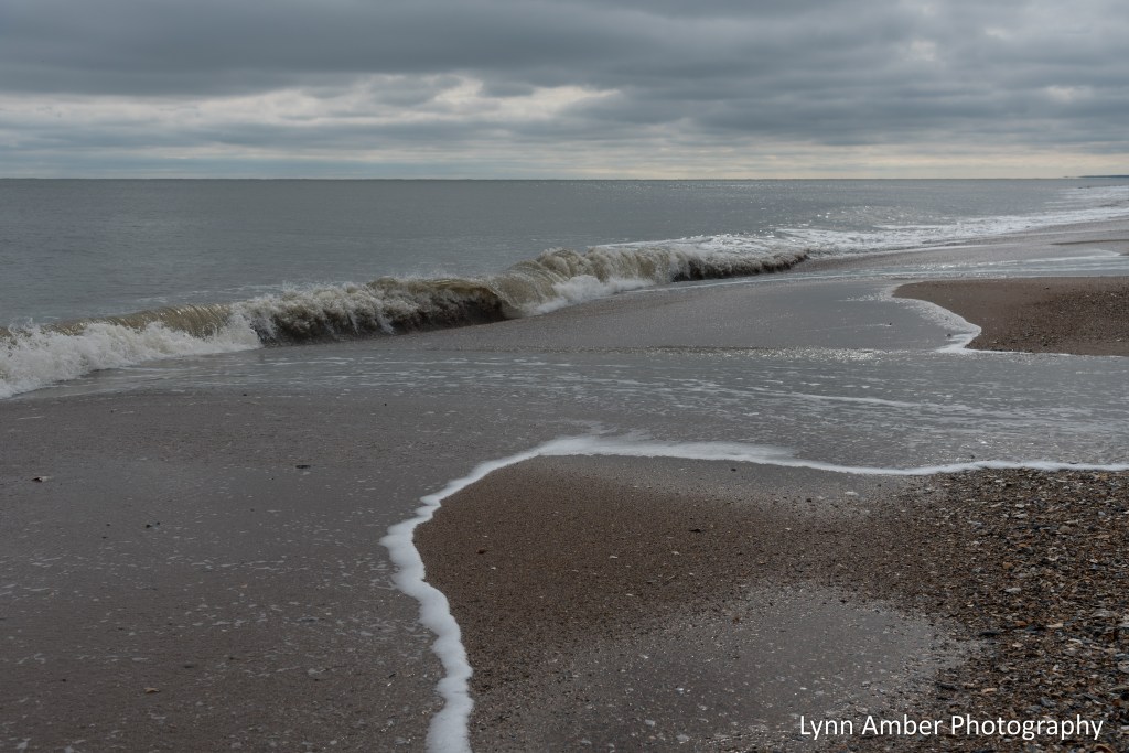
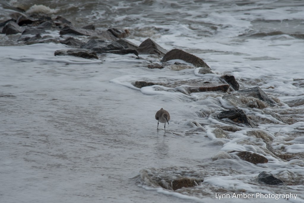
Edisto Beach Moments
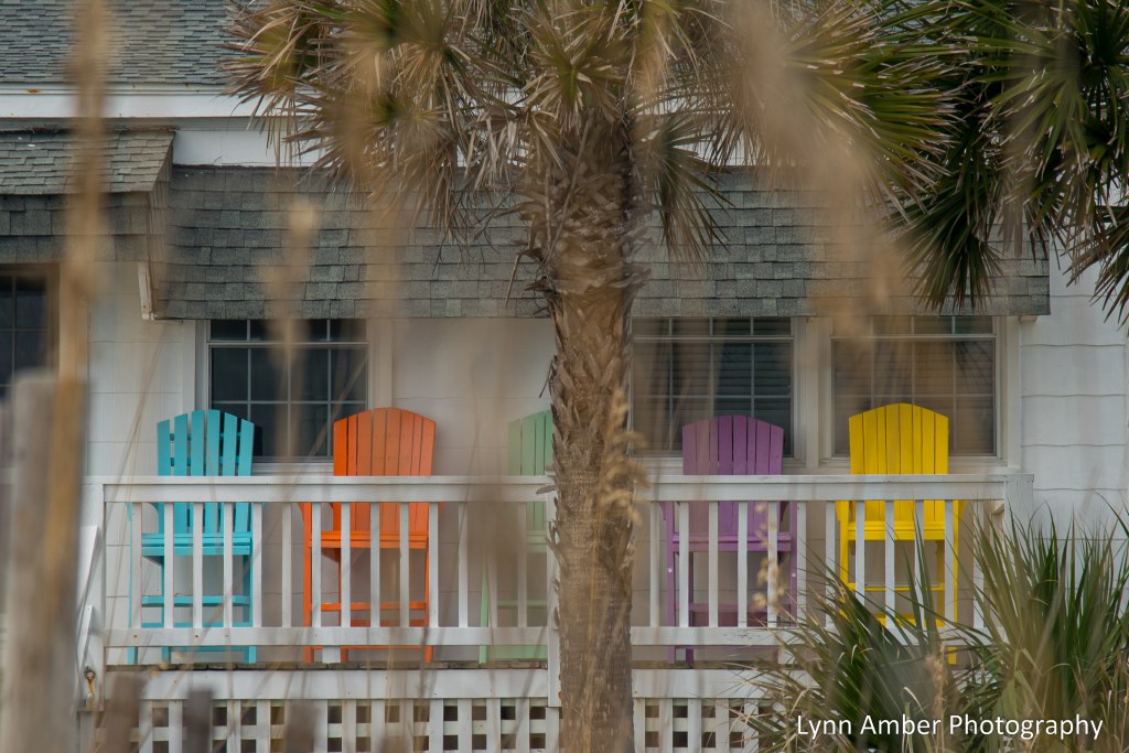
Our annual family trip to Edisto Beach occurred one week later in November than normal. It meant that we missed the late-season hurricane that came up the coast but had to endure less than ideal weather from the backlash of the storm. It was cloudier and cooler than usual even by local standards. We still managed to get a couple of beach walks in and some side trips to local attractions. Our trip in photos!
Beach Time

Boone Hall Plantation
Boone Hall Plantation was established in 1681 by Englishman Major John Boone. It has realized several transfers of ownership over the years but has continued to produce agricultural crops throughout its long history. The current owners, the MacRae family, purchased the plantation in 1955 and opened it to the public a year later.


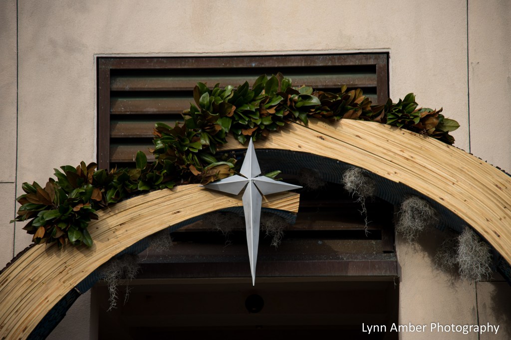
Mepkin Abbey Creche Festival
Mepkin Abbey was established in 1949 on the grounds of the former Mepkin Plantation. It is inhabited by Trappist monks who follow the Rule of St. Benedict by devoting their lives to “prayer, spiritual study, work and hospitality.” For 18 years, the abbey has hosted a Creche Festival – displaying close to 100 nativity scenes from artists around the world. Friends of mine who live near the abbey invited us to join them for a tour of the festival. It was absolutely a wonderful experience. While most of the nativity scenes were located indoor, there were a few outside displays where I could take pictures. They were all so very unique in their interpretation of the nativity!


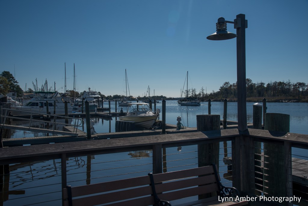
Georgetown, SC
We try to choose a new town somewhere within a couple of hours from Edisto Beach to explore during our visit. This year, the choice was Georgetown, SC. Founded in 1729, the city quickly became a registered port of entry allowing trading to occur directly from the city rather than all trade going through Charleston. Early on, indigo was the main crop traded in the port. Later, rice and lumber were major exports. Today, the outskirts of town are dominated by International Paper. The town itself was a surprise. A walkable downtown center along the historic Front Street with restaurants and shops is surrounded by old, well-kept neighborhoods of Victorian-style homes. The marina no longer supports large ships so the shipping industry has died here, but there appears to be a healthy population of tourists and leisure boaters enjoying the harbor.


From the Porch on Edisto Beach


Memorial to a Friend

While visiting Edisto Beach, South Carolina a couple of weeks ago, my extended family and I visited Boone Hall Plantation in Mount Pleasant. The day before this visit, I learned of the passing of a friend and former colleague. Joe Wright was a man of many talents – one of which was his love of roses. I spent some time in the rose garden at Boone Hall that day contemplating my friend and this photograph says it all.
Joe – I’m thankful to have known you.
Big Bend Flora 11.9.22

Another beautiful red-flowered perennial blooming in the Chisos Mountains is the Ipomopsis aggregata. I found this little gem along the Lost Mine Trail – a popular 5-mile out and back trail near the Chisos Basin. It’s one of my favorite hikes in the park due to the spectacular views and the diversity of plant material encountered along the way. At the terminus of the trail high above Juniper Canyon, you can see for miles across the desert floor below.


Big Bend Flora 11.2.2022
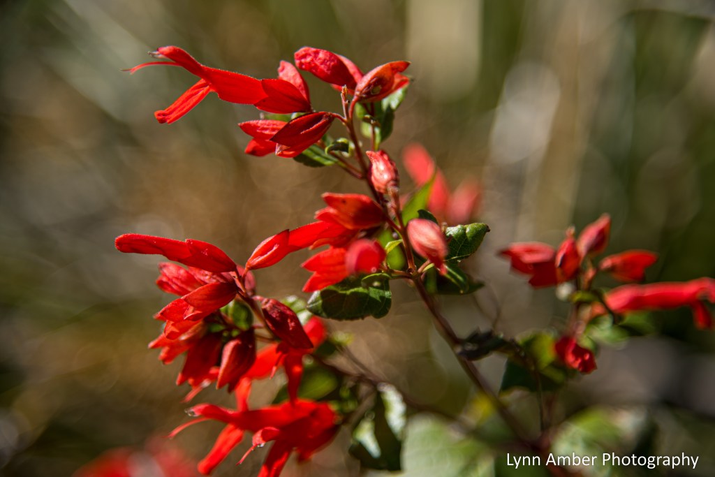
Hiking the upper part of the Lost Mine Trail in the Chisos Mountains last week, I came upon the showy, bright red, tubular flowers of Salvia regla or Mountain Sage. Often blooming in the spring and, again in the fall, the flowers are attractive to migrating hummingbirds! The plant is native to the rocky, higher elevation slopes of the Chisos Mountains and a corresponding area across the border in several of the states of Mexico.
