Lynn Amber - Travel & Photography
sharing my thoughts through words and images
Cinque Terre Hiking Trip – Day 3

October 14, 2025 – Day 3 – Monterosso to Vernazza
The third day along the Cinque Terre coastline we completed our first hike within the national park. The agenda for the day included a ferry ride from Porto Venere to Monterosso – the northern most village in the Cinque Terre – where we would begin our hike to Vernazza. This would be a more challenging hiking day with some significant elevation gain and we would get an introduction to the many “steps” that criss-cross these hills and were used by villagers back before modern transportation came to the area.
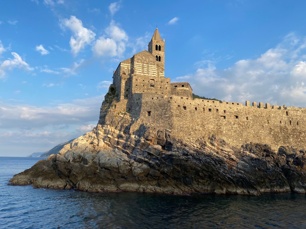
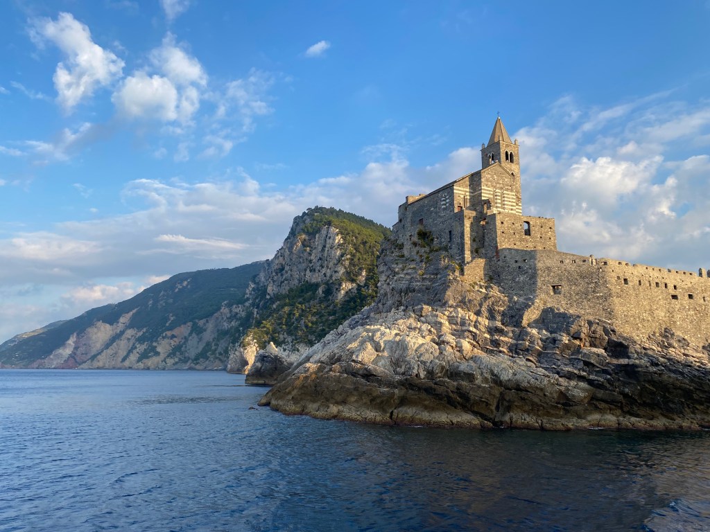
Our day started with a mini-van ride to Porto Venere where we caught the ferry to Monterosso. The boat ride would take us along the entire Cinque Terre coastline and past all five of the small villages nestled along the shore at the base of the steep terrain. As we left the harbor in Porto Venere and headed out to the Ligurian Sea, we passed by the Church of San Pietro all aglow in the morning light.
It was a beautiful day for a ferry ride. The sea was calm and the sun was bright and warmed of us even though there was a chill in the air on the water.


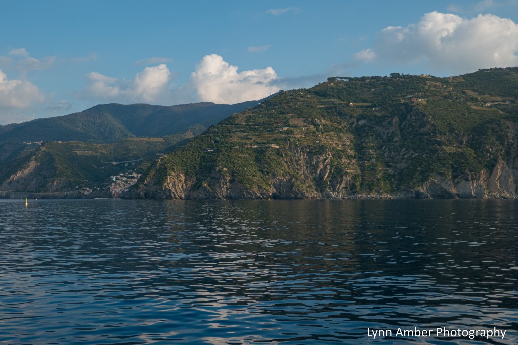
From the water, we got a really good view of the landscape of the Cinque Terre and an understanding of the steep terrain and what lies ahead for us as we traverse this landscape on foot!
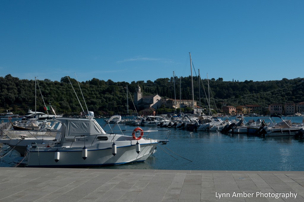
The ferry ride to Monterosso is about an hour long and we would be making one stop along the way to drop off and pick up passengers in Riomaggiore – the first village we come to on the coast. We will be back here on foot at the end of the day to catch the ferry back to Porto Venere.

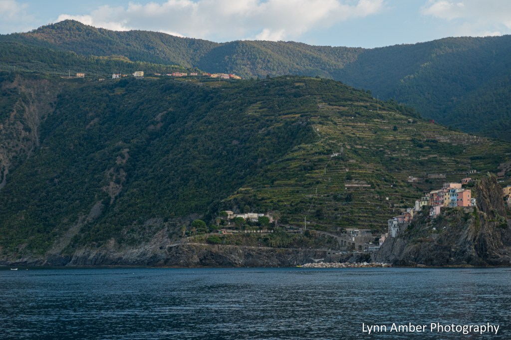
Riomaggiore is one of the easiest villages to dock the ferry since they built a barrier to create a calm breakwater area between the shore and the sea. In some of the other villages, when the sea is rough the ferry cannot dock. Leaving Riomaggiore, we continued up the coast and passed by the village of Manarola.
In the photograph below, you can see Manarola in the bottom right hand corner. On the ridge up and to the left is Manarola’s sister village, Volastra. Each village along the Cinque Terre has a sister village up on higher ground. These villages had a reciprocal relationship – helping each other out with goods and services during a time when the villages were more isolated without roads or public transportation. In a couple of days, we would be hiking from Manarola to Corniglia via Volastra.

The next village we passed on our boat ride north is the tiny hamlet of Corniglia. Corniglia is the smallest and least visited village along the Cinque Terre and is the only village that is not directly on the water. One of the things that contributes to it being less travelled is the accessibility of the train station. It sits below the village and demands a descent or ascent of 385 steps depending on whether you are leaving or arriving by train.
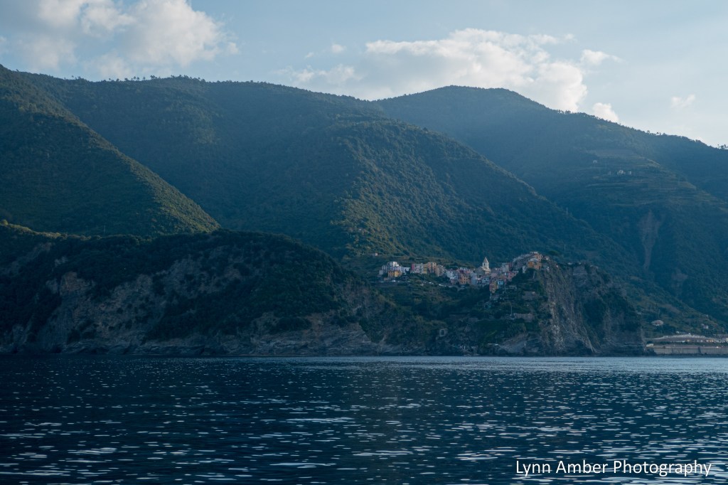
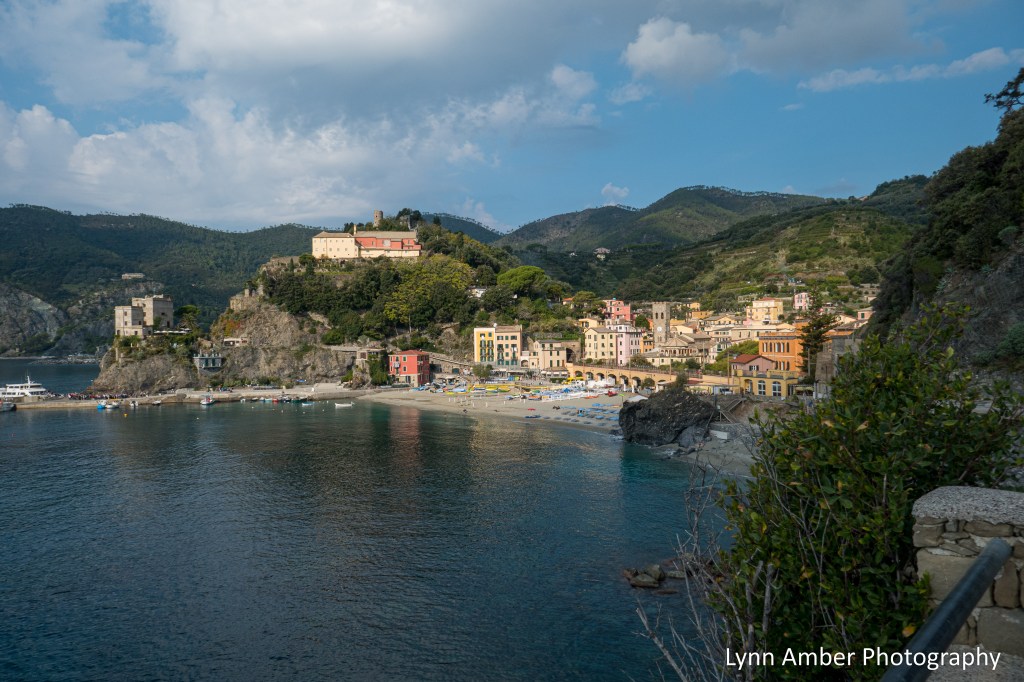
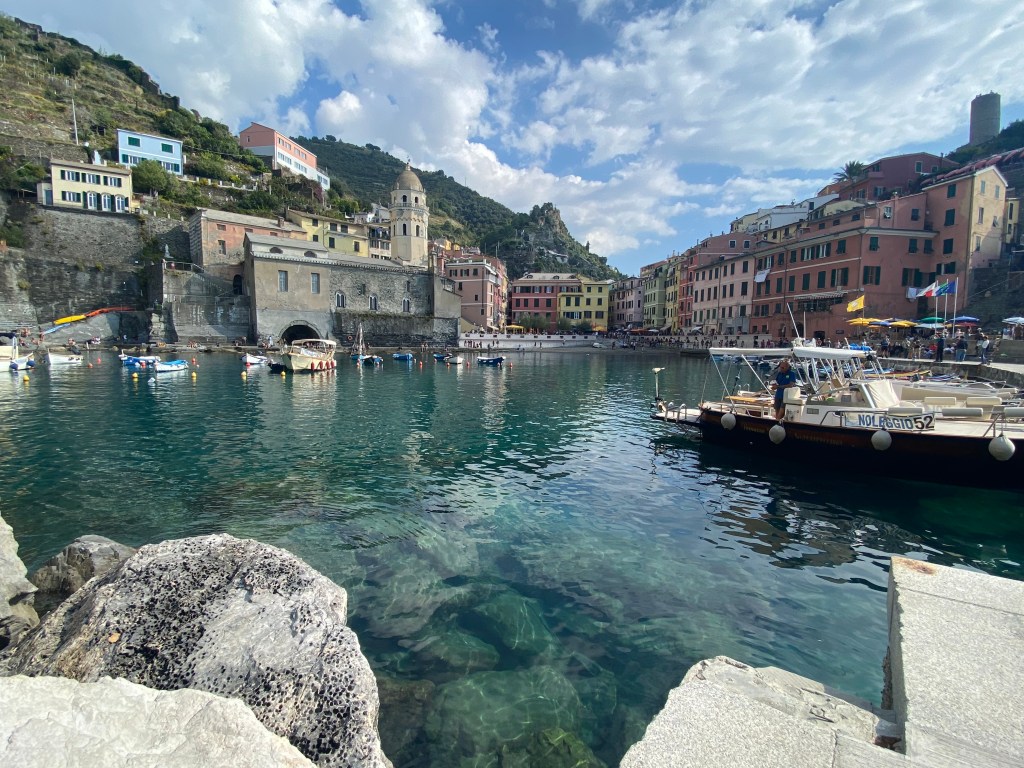
Moving north we can barely see the buildings that comprise the town of Vernazza. This would be our hiking destination today via the trail from Monterosso. The harbor is very protected and secluded from the sea. It is one the prettiest villages and we will get a better view of the busy harbor area from our walk.
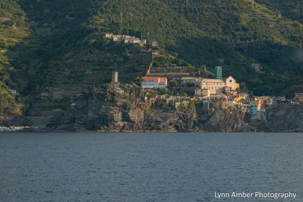
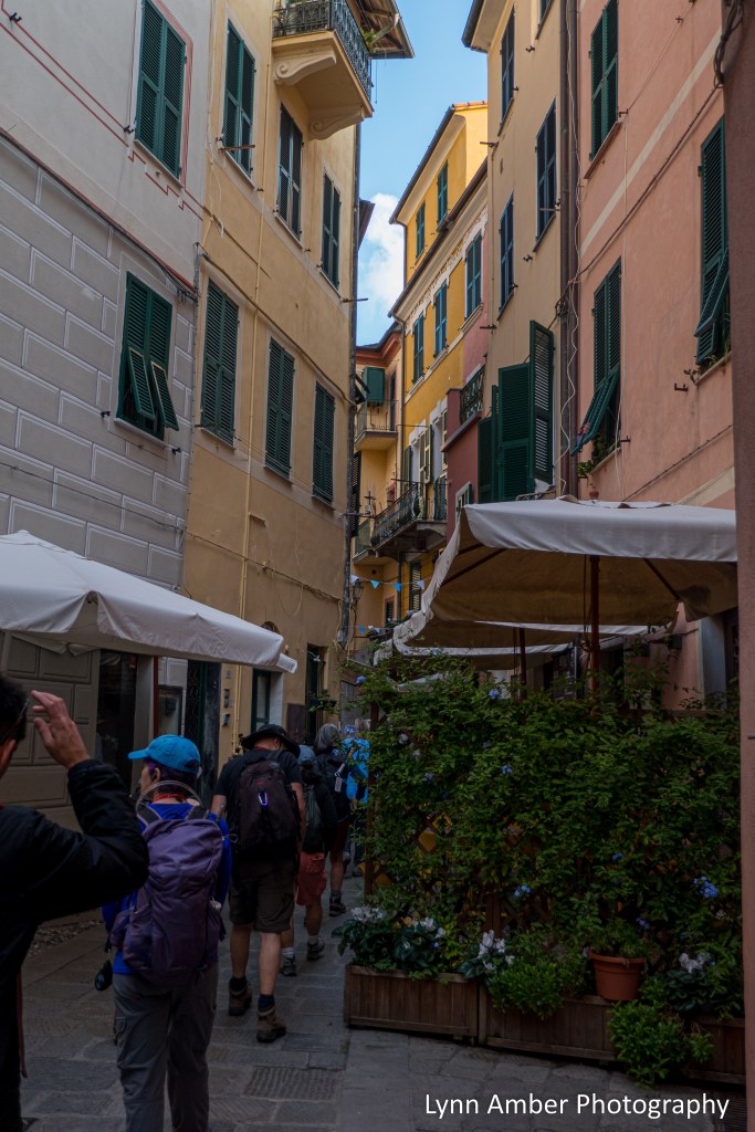
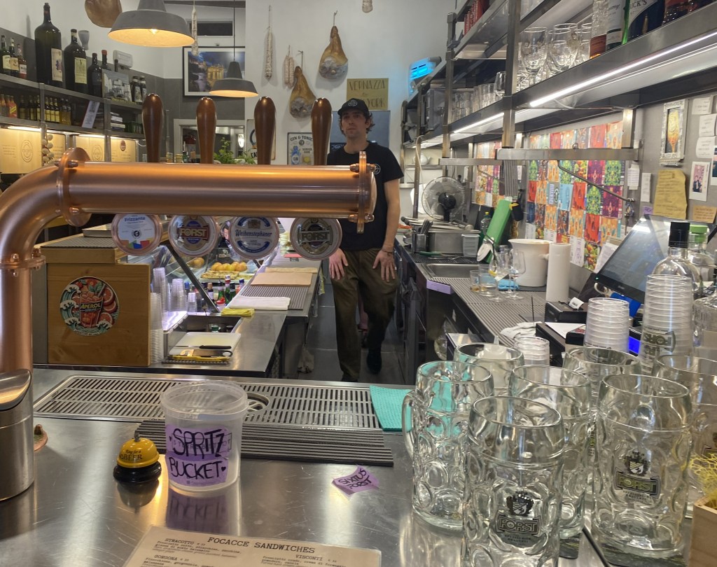
And, finally, a short distance from Vernazza is the busy town of Monterosso. Possibly the liveliest of the five towns, Monterosso al Mare has two sections – a new town and an old town. It also does have some flat seaside beaches. The ferry docked and we disembarked. We had some time before our hiking guide Boris would arrive to start our walk. He lives in Genova and travels each day to meet us. His train was delayed this morning. So, we wandered around the old town area for a spell and made sure to hit the public restrooms before we departed on the hike. Public restrooms are more abundant in Europe, often have an attendant present and cost around one euro to use. Always be sure to have some coins with you when you travel! The alternative is to enjoy a meal or snack at a local cafe or restaurant which then entitles you to use their restroom. This also contributes to the local economy!


The town was crowded with people but we managed to walk some of the narrow side streets and visit one of the churches.

The Church of Saint John the Baptist was of the same architectural type as we’ve seen in Porto Venere – with the black and white façade.


Love the potted flowers and, of course, I’ve been smitten with shutters and ancient doorways ever since my Camino in Southern France!


There was a cute artsy wall near the public bathrooms and I just had to take a photo! Octopus are common in the waters off the coast of the Cinque Terre.

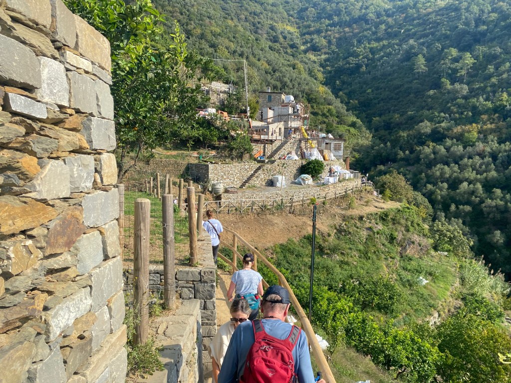
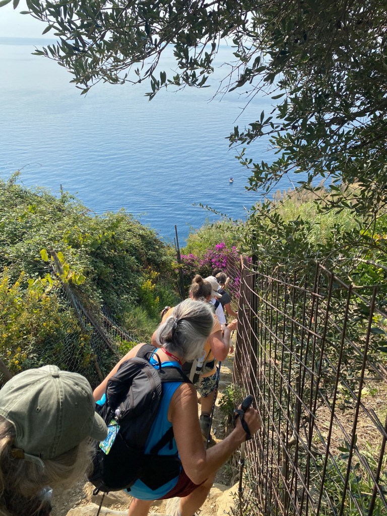
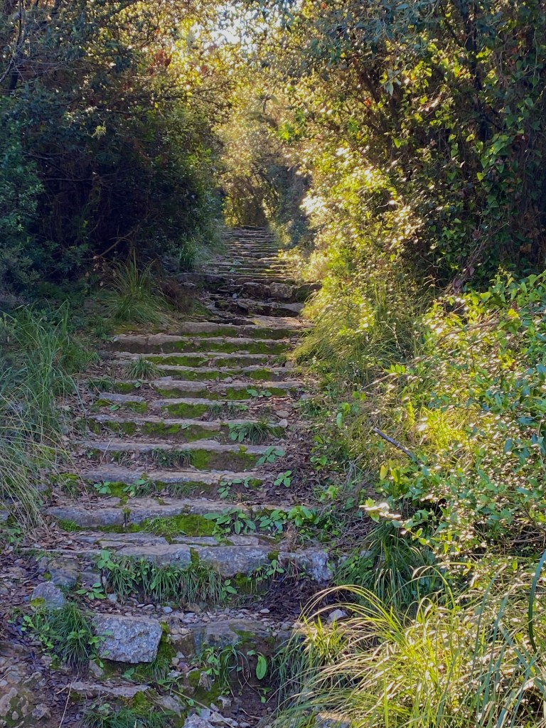
Well, Boris finally arrived and it was time to start our hike. Today’s hike would be more challenging than yesterday’s jaunt around Palmaria Island. Boris and Leonardo rated our hike today as moderately challenging. We would be hiking about 2.5 miles – which does not seem like much – but the initial ascent involved a steep climb with 700+ stone steps. Our total elevation gain/loss today would be 1200′. We would encounter terrain that alternated between steps, cobblestones, dirt and rocks and, at times, it would be a narrow trail. Toward the conclusion of our hike, the descent into Vernazza would be steep with many more rocky steps!
Our guides were very organized. Boris always led the way and provided commentary on the history and culture of the area via those handy wireless transmitter/receiver communication devices. Leonardo always brought up the rear helping those in the group who had a slower pace. The hike started off fairly tame with a promenade high on the cliff above the sea. After climbing the 700+ rock steps, we had a stretch of tame ups and downs before our ultimate steep downhill into Vernazza. It was a breathtaking hike along the coast with dramatic views of the Ligurian Sea.


I only managed to grab one photo that represents the steep stairs that we climbed. Multiply this by about 35 and it gives you an idea of the initial ascent.

The pace that Boris set for the group was just right and most of the group adapted well to this pace. We stopped at strategic spots along the way for breaks – usually places with enough room for us to get off the trail and not block other hikers or places of interest.
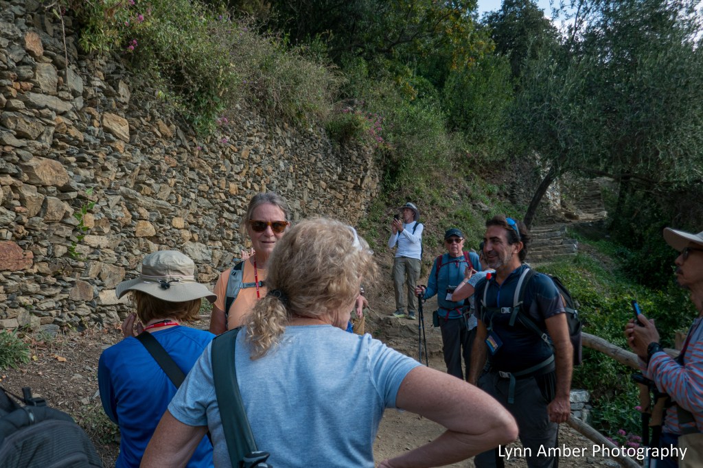
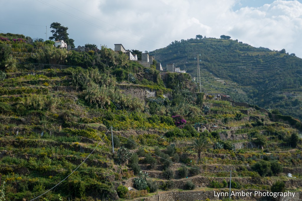
Above, Boris is explaining the history of the stone walls that were built to terrace the hillside. These walls were tall and built to created level areas for vineyards, gardens and olive trees.
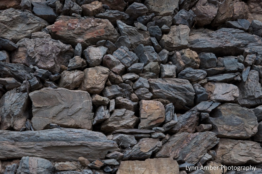
Many of the trails we were walking on were the ancient paths used by the farmers to move about this difficult landscape. In the photograph below, the stone “steps” worked into the wall were used by locals to move from one level to the next. All the labor of transporting the grapes and harvest was done by hand.

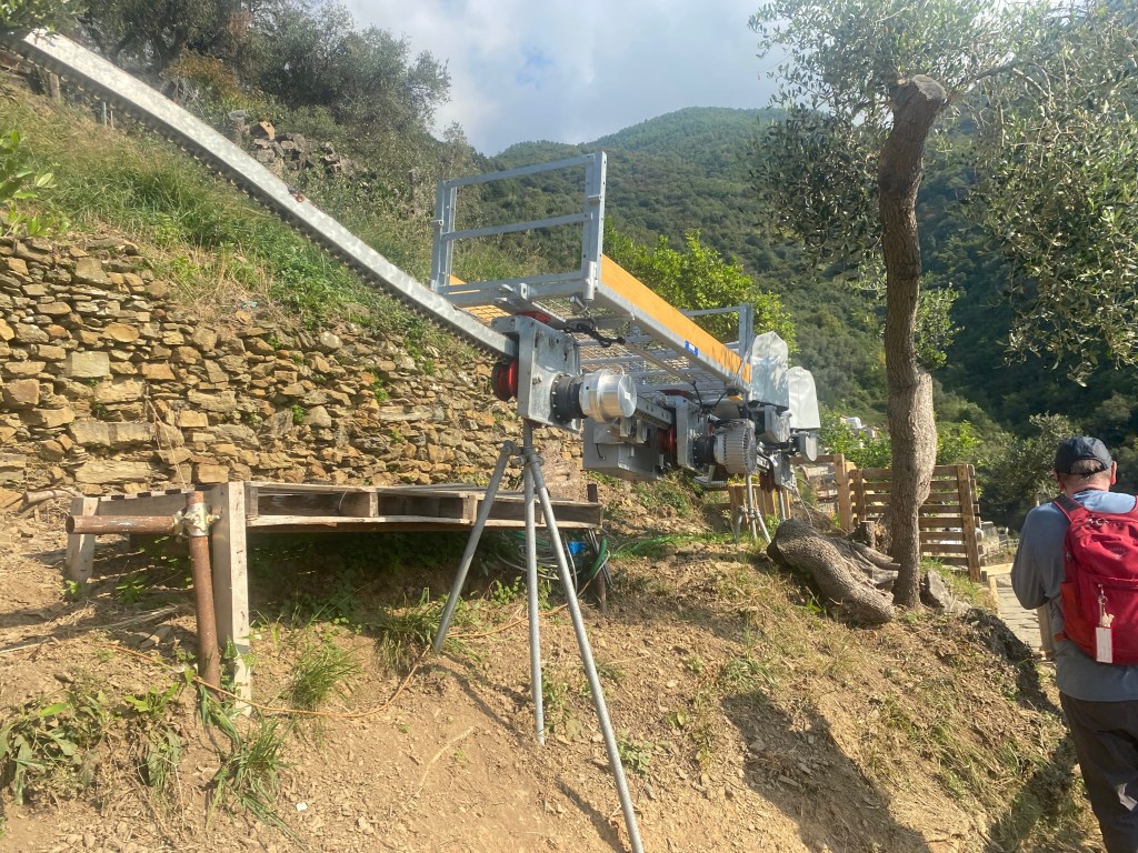
In much of the area we walked through, the terraces were overgrown and the walls were in a state of disrepair. When public transportation came to the area in the way of rail and road, the local population had more access to the larger towns like La Spezia and their way of life shifted. The tough life of subsistence agriculture was abandoned and many of the farms became overgrown. When the area was designated a national park in 1999 as a means to protect the cultural and historical aspects of the area, the work began to restore many of the walls and abandoned buildings. Below, one such restoration project is underway by the national park. The stone used for the construction project arrives on scene in large plastic “bags” suspended from helicopters!
Some more hiking photographs:

We kept coming across this interesting “rail” system that criss-crossed the trail. In an effort to modernize the harvest of the grapes, this system was developed to transport grapes. Much easier than moving the harvest by foot!
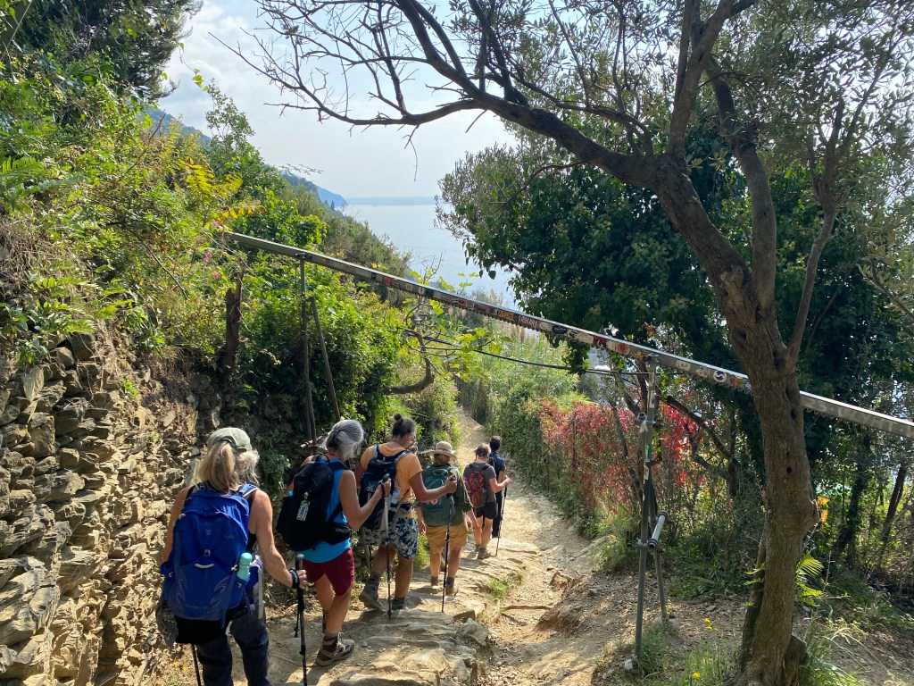
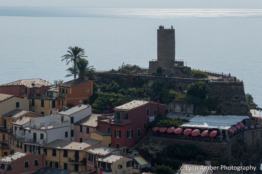
Boris has been leading groups on this trail for 13 years and has designed “hiking breaks” that also serve as scenic overlooks. As we rounded a corner where we finally got a peek of Vernazza, the view was incredibly picturesque. The picture illustrates perfectly the reason why the view of Vernazza and its harbor from the ferry is obscured.

Heading down into Vernazza:

As we dropped down into Vernazza, there were some great opportunities for photographs!

The boats above represent the traditional boats used for fishing and transporting of goods. Gozzos were small wooden boats mostly used for fishing. Leudos were somewhat larger boats used for transporting goods such as barrels of wine. The boats were small because there were no harbors back in the day. Boats had to be lowered down into the water via a “crane-like” device. Today, many of these reproductions of the traditional boats are used for tours.

Once we got to Vernazza, we were on our own for exploring and eating lunch. I joined a couple of fun ladies from Washington State for lunch and a walk-about. We grabbed some foccacia to-go, a nice cold beer and headed to the harbor to eat alongside the water. It was a glorious, sunny day with good company. I am thankful for these two best friends from the west coast for “adopting” me and letting me hang out with them today!
The province of Liguria is famous for its unique version of foccacia. The word comes from the Latin focacias translating to “hearth bread” and – let me tell you – it’s nothing like the foccacia here in the states. Here in Liguria, it is mouth-watering good with many scrumptious embellishments. I became obsessed with sampling it in various places throughout the week!

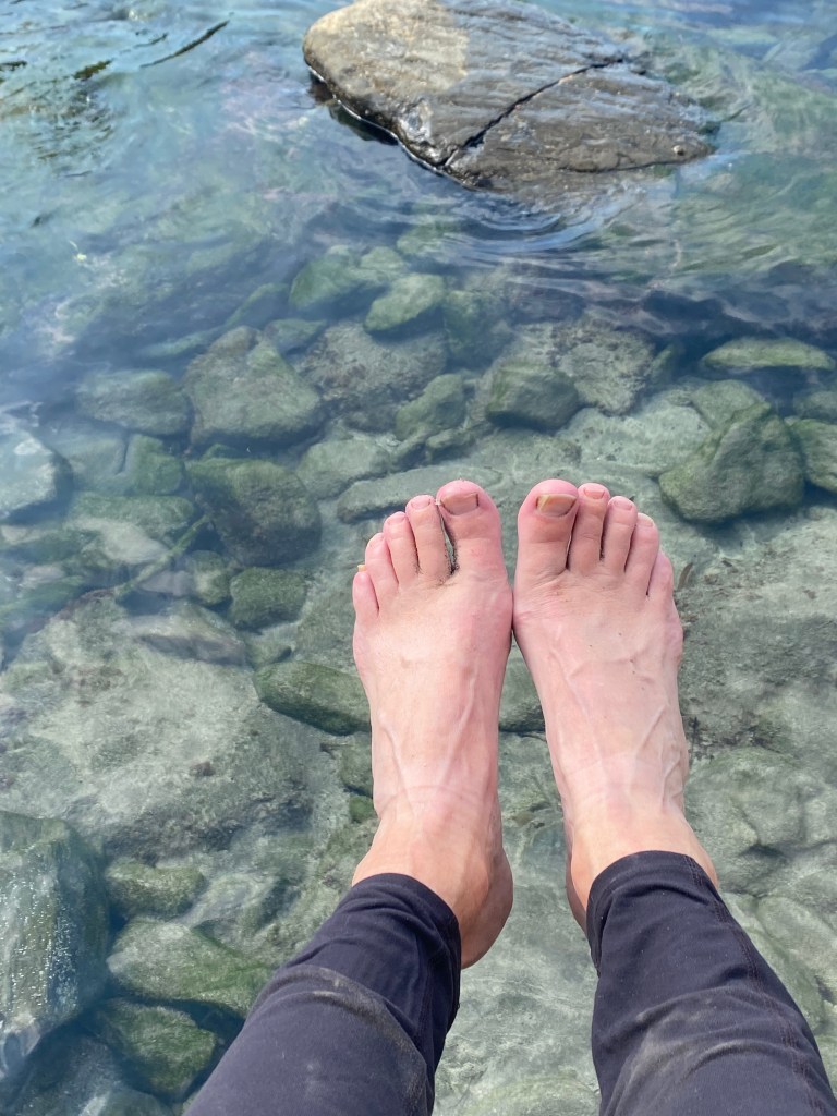
We sat on a wall above the water and ate our lunch in total bliss! I could not resist taking my boots off and dipping my hot, sweaty feet in the water.

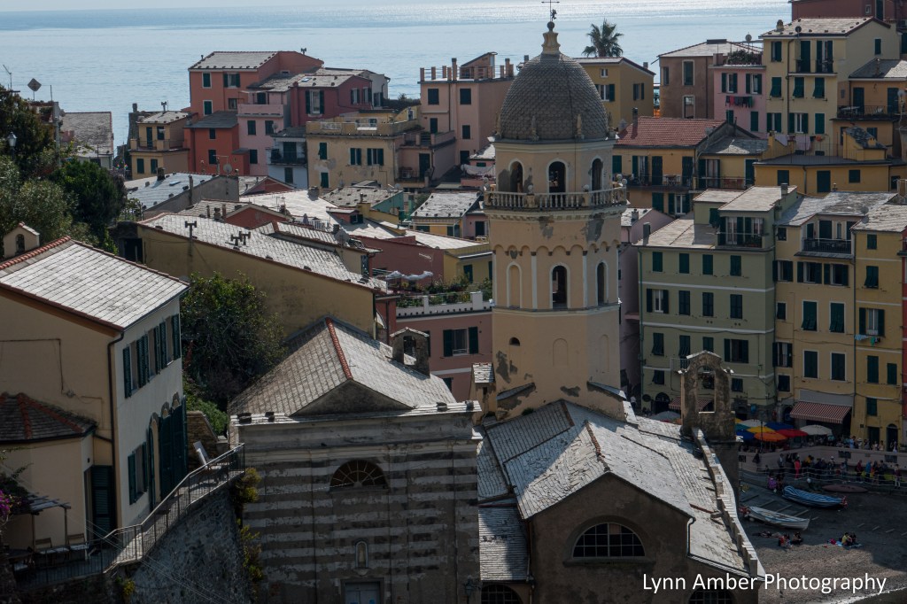
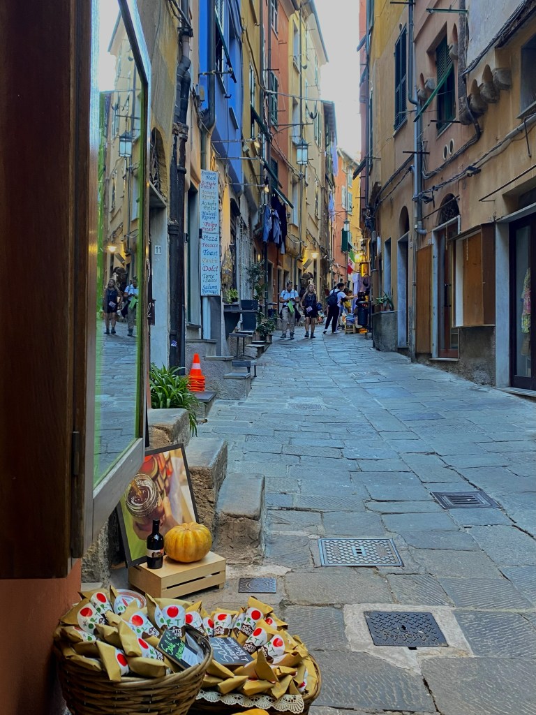
We strolled around the harbor after lunch and it was the most photogenic area! Most online pictures of Vernazza look exactly like the ones I snapped! Colorful and lively!
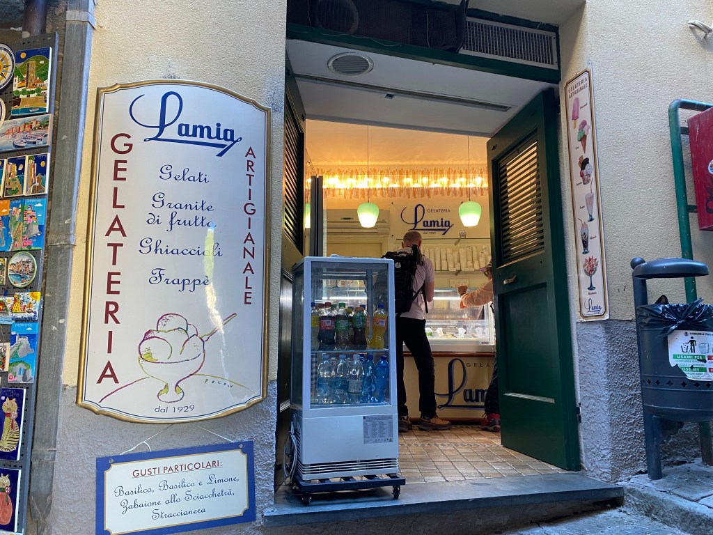
We had some time before our rendezvous with the rest of the group so we stopped by – what else! – a gelato shop!!

It was time to connect with the group and head to the train station that would transport us down the line to Riomaggiore. Boris lined us up along the tracks and gave us a pretty good lecture about guarding our belongings against pickpockets while on the train and when loading and unloading.
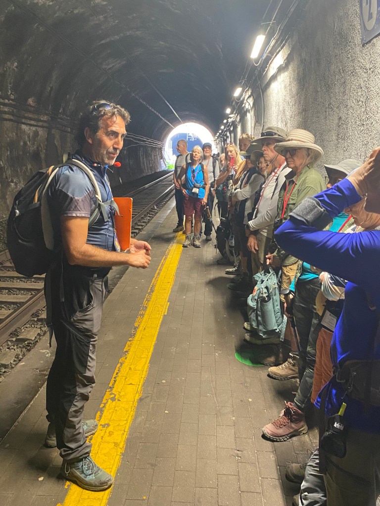
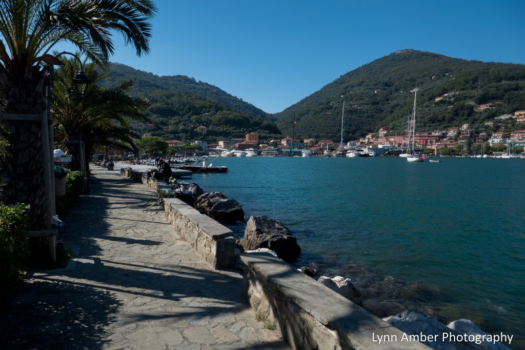
The train ride to Riomaggiore was short and the train was very crowded. It was a bit nerve-wracking with the crowded aisles to make sure we exited the train without being left behind!! Once in Riomaggiore we had to make our way from the train terminal to the ferry docks across town.
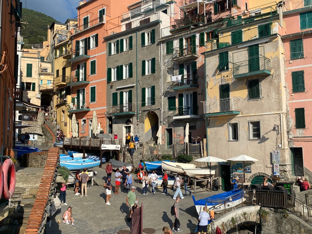

The main street in Riomaggiore is actually a “covered canal” that has a stream underneath that flows out to the sea (in the foreground of the photograph above). This is true of the main street in Vernazza as well. The town got its name from this stream called “Rio Maggiore” or “Major River.”

It was a perfect day. We arrived back at our hotel in time to freshen up and return to Porto Venere for dinner at the Ristorante La Marina. Once settled back in the hotel for the evening, I did not have any trouble falling asleep!
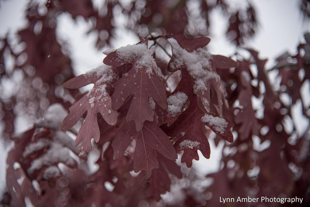
Oak Leaves and Snow

Winter’s icy grip
Grasps the marcescent oak leaves
Clinging for dear life.
~Lynn Amber
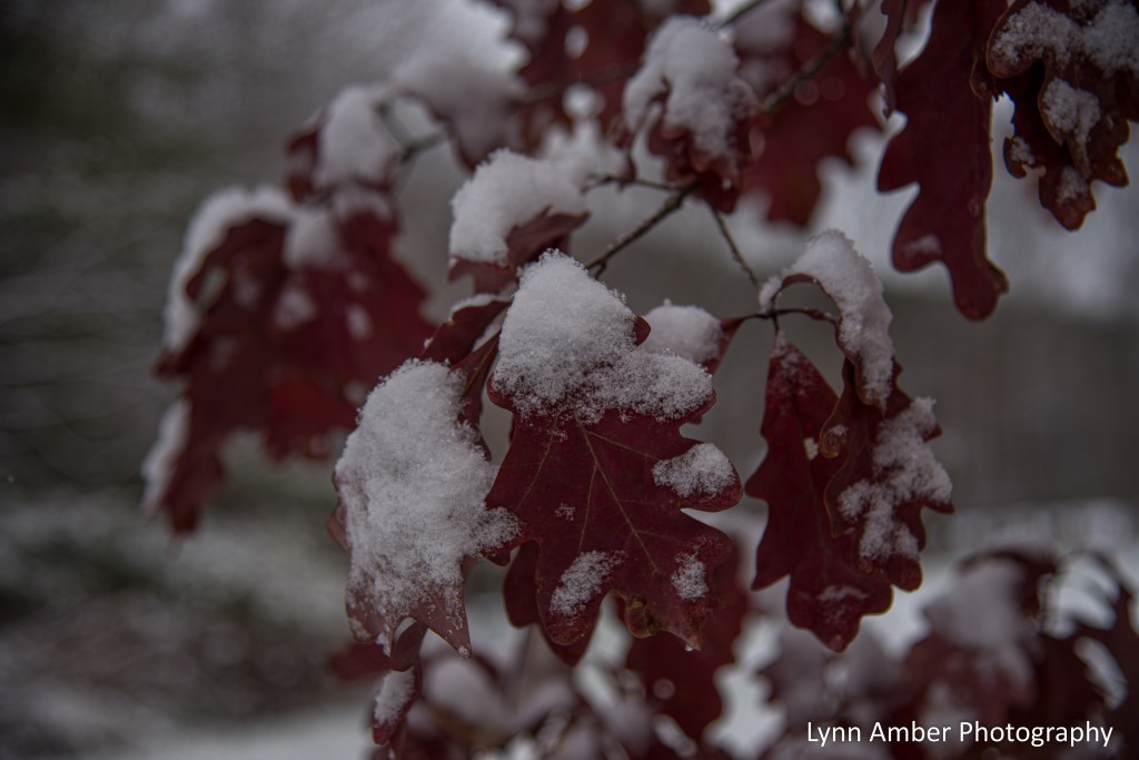
The oak trees on our property are not native to this precise location. They were born from acrons scooped up at a Pennsylvania rest stop many years ago – by my son Luke and I. We were enjoying a short road trip to my home state of PA and had stopped to take a break along the interstate. There were a variety of different species of oaks at the rest area and we indiscrimately gathered acorns from all over the ground.
I was home-schooling my son at the time and the acorn experiment became an impromtu science lesson. We planted the acorns back home in Vermont and watched them grow over the years. There is a mix of Red Oak, White Oak, and Chestnut Oak. My husband eventually dug them up from the temporary “nursery” where they were planted along the edge of the forest and dispersed them around the property. This is their story – a piece of Pennsylvania that we brought back to Vermont.
Cinque Terre Hiking Trip – Day 2

October 13, 2025 – Day 2 – Palmaria Island and Porto Venere
The second day of our group tour started with a boat trip to Palmaria Island from the small village of Porto Venere. Our first hike would be on the island of Palmaria in the Parco Naturale Regionale di Port Venere. The program did a fantastic job of organizing the hikes so that we would be going from “easier” to “harder” throughout the week. Today’s hike would be the easiest hike of the week – with a 700′ elevation gain along a 2.5 mile trail. Our guide, Boris, was very specific at the start of each hike concerning the level of difficulty and the conditions along the trail – steepness of ascents and descents, whether the trail was asphalt, dirt, rocky, etc.
We used communication devices as we hiked so that we could listen to Boris as we walked. Even if you were in the back of the line or – like me- wandering off to take photographs, one could still hear his narrative. He commented on the history and culture of the areas we visited in detail. Growing up in nearby Genova, he has dedicated his life as a tour guide since graduating from college. In Italy, to be a tour guide requires training and passing a very rigorous examination. He explained that there are 3 types of guides – hiking guides, tour guides and group leaders. Both he and Leonardo, our group leader, are certified in all three.
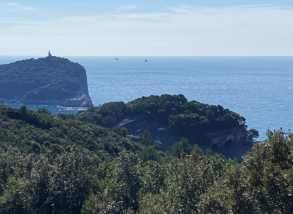
Palmaria Island is the largest island in a 3-island archipelago. The two smaller islands are Tino and Tinetto. and are virtually uninhabited. Tino Island was the site of a medeival monastery and archeaological ruins remain there. It is also controlled by the Italian Navy which supports a lighthouse and its surrounding structures. Tinetto is barely more than a rock outcropping and also was home to an ancient monastery.
We arrived in Porto Venere in the morning to board the ferry that would transport us to Palmaria Island. Porto Venere was slowly waking up and the morning light on the colorful building facades was stunning!

It was a very short ferry ride across the channel.

in the background
Once we exited the ferry and visited the nearby restaurant (where we would be eating lunch later) to use the restrooms, we started our hike. The initial part of the hike was a short, steep ascent that would take us near the top of the island where we would pass by an old fort.
Once we left the pavement, we started up the steepest part of the hike today through overgrown mediterranean scrub.
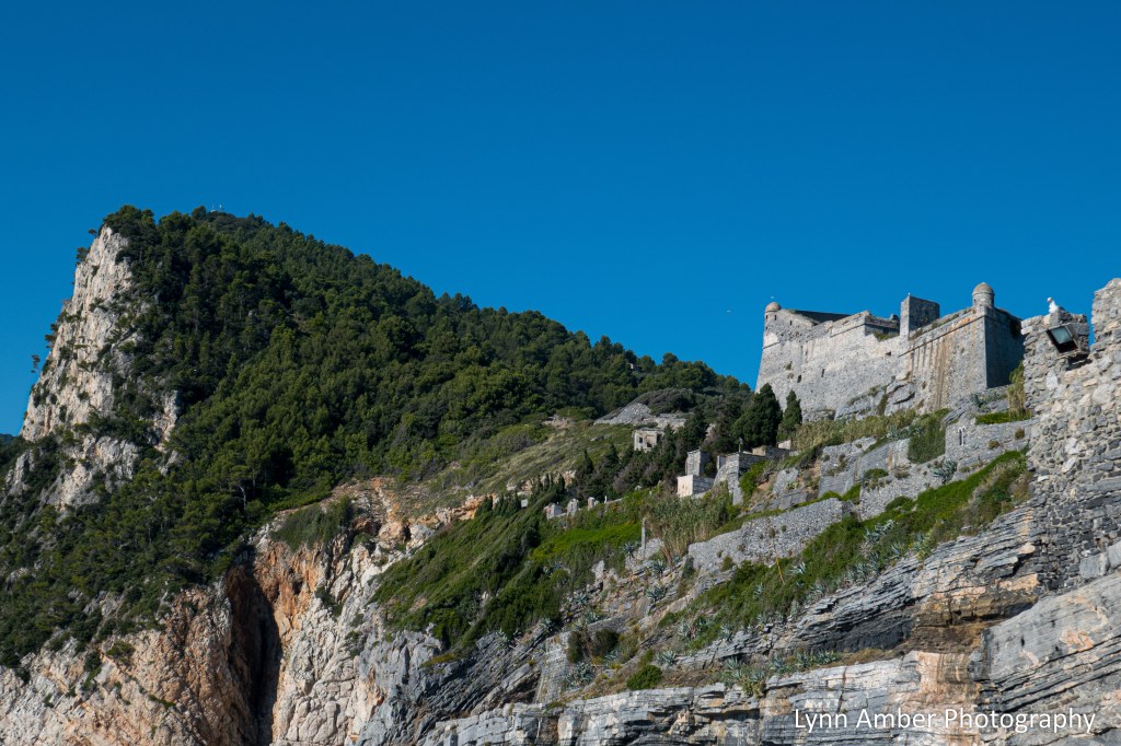
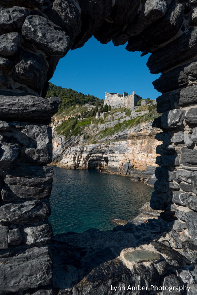
Towards the high point of our hike, we passed by the ruins of Fort Cavour. The fort was a Napoleonic era military fortress designed in 1808 and constructed later in the 1800’s to defend the Gulf of Le Spezia.


As we walked, Boris was telling us about the resident “wild” goat population on the island and, as if right on cue, we were visited by some of this population! They were not shy!

We took a break under some shade at the summit before heading back down the eastern side of the mountain. While resting, our guide explained some of the geology of the area.
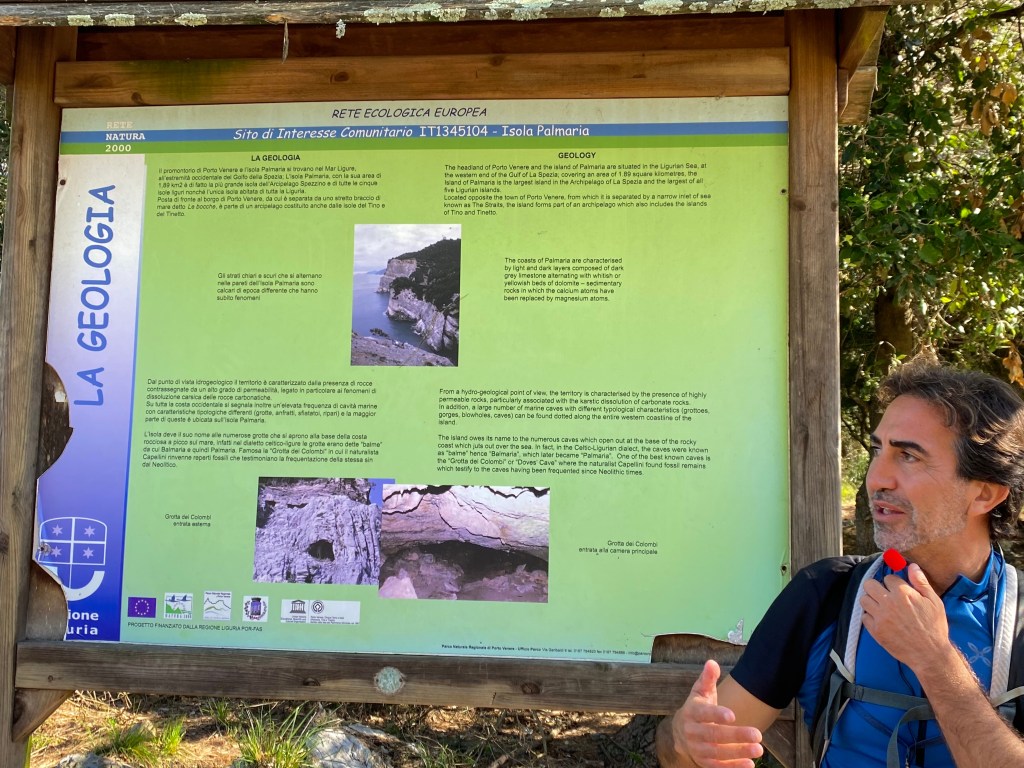
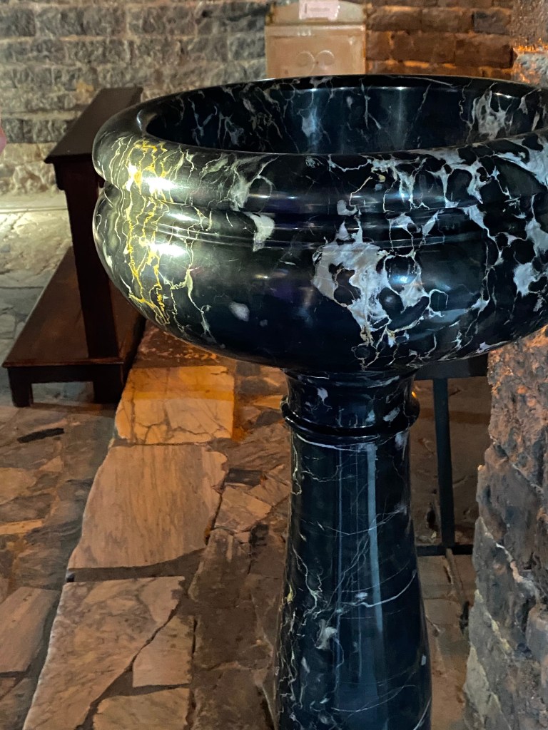
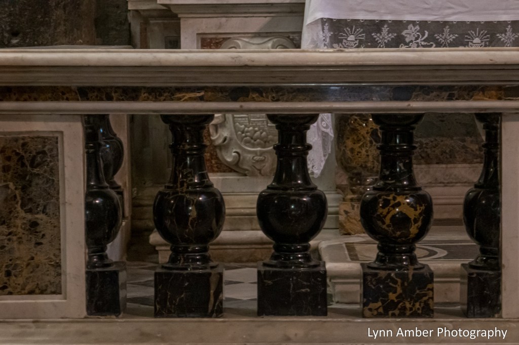
Palmaria Island gets its name from the Latin – Balma – which means “cave”. The island is reknowned for its sea level caves on the steep, western coast. The most famous cave is the Grotta dei Colombi. Archeaological artifacts found in this cave suggest it was inhabited during the Ice Age. These artifacts are on display at a museum in Le Spezia. Another important activity on the island was the mining of Portoro Marble. It was extracted on the island and is a high-end marble – black with striking gold-colored veins. We will see examples of this type of marble throughout our trip.
We had some magnificent views of Tino Island and the water on our descent through the Mediterranean scrub landscape on the eastern side of the island – typical plants include holly oak, downy oak, strawberry tree, rock rose and spanish broom.

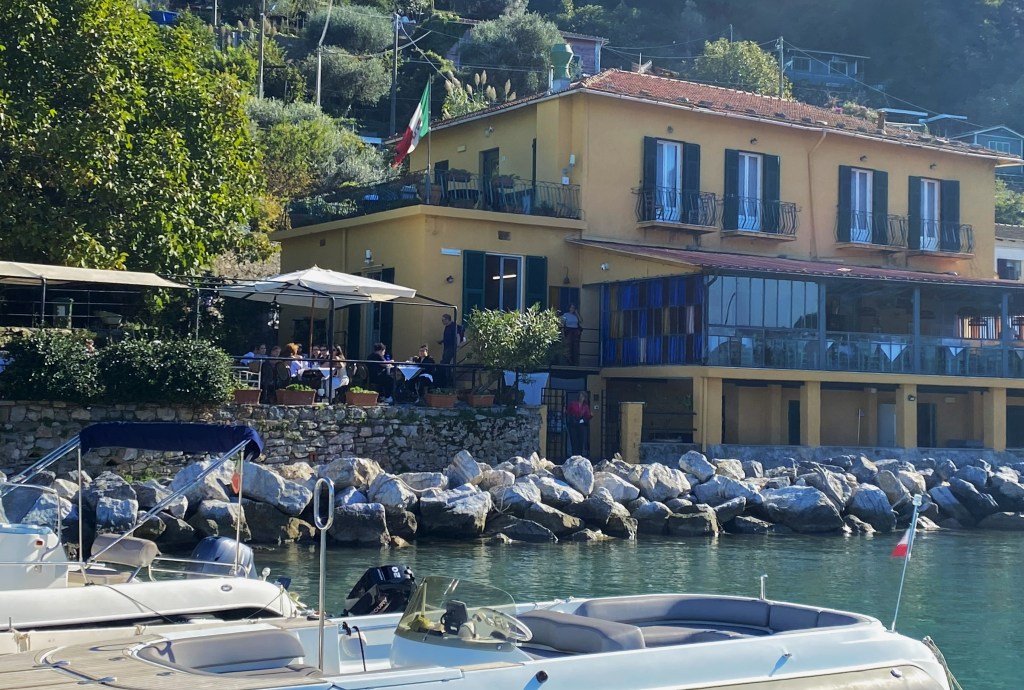
Once we reached our starting point near the dock, we were treated to a spectacular lunch at the island restaurant Locanda Lorena. It is rumored that Steven Spielberg is regular visitor to this restaurant. We had a multi-course meal with local fare such as mussels and clams and, of course, pasta.


We rode back to Porto Venere after lunch on a smaller boat – I think we somehow missed the ferry? – but it was quite cozy!

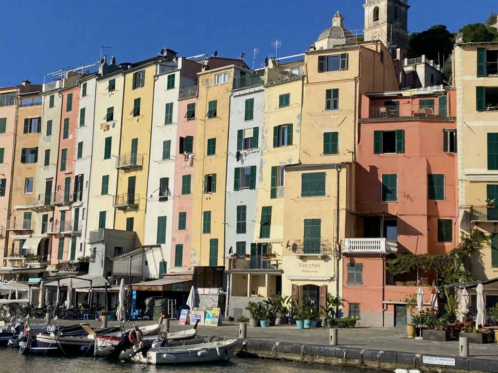
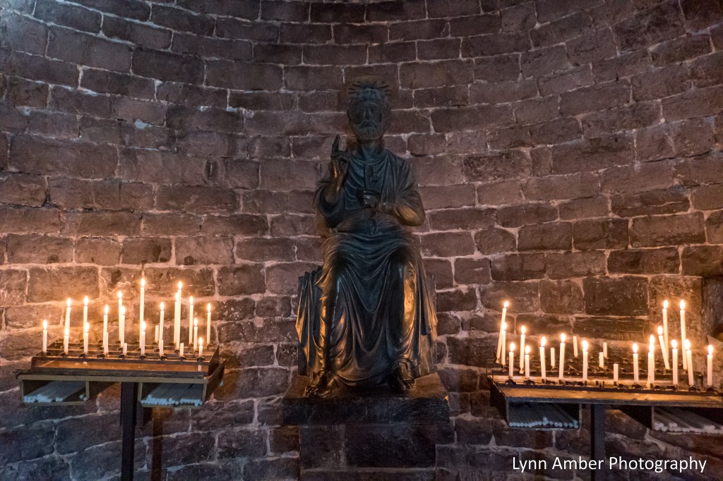
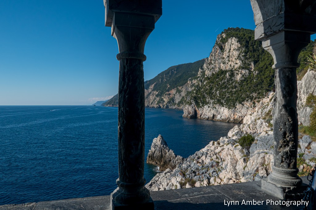
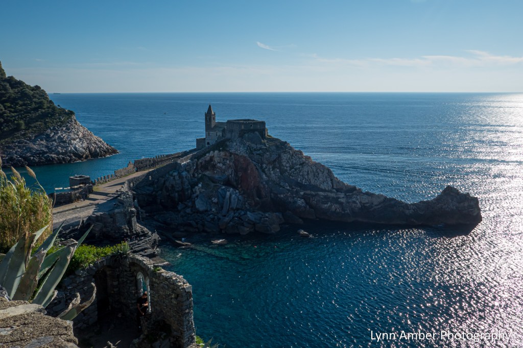
After returning to Porto Venere, we did a walking tour of the town visiting some of the local landmarks. Our first stop was the Chiesa di San Pietro – San Pietro Church – built in 1198 on a rock outcropping at the entrance to the gulf. It was built on the ruins of a Roman temple dedicated to the goddess Venus – and this is where Porto Venere’s name is thought to have derived. The architecture is of the Genoese Gothic style with it’s characteristic black and white bands of stone on the façade.


After leaving the church, we walked along a stone path that offered up spectacular views of the Cinque Terre coastline.


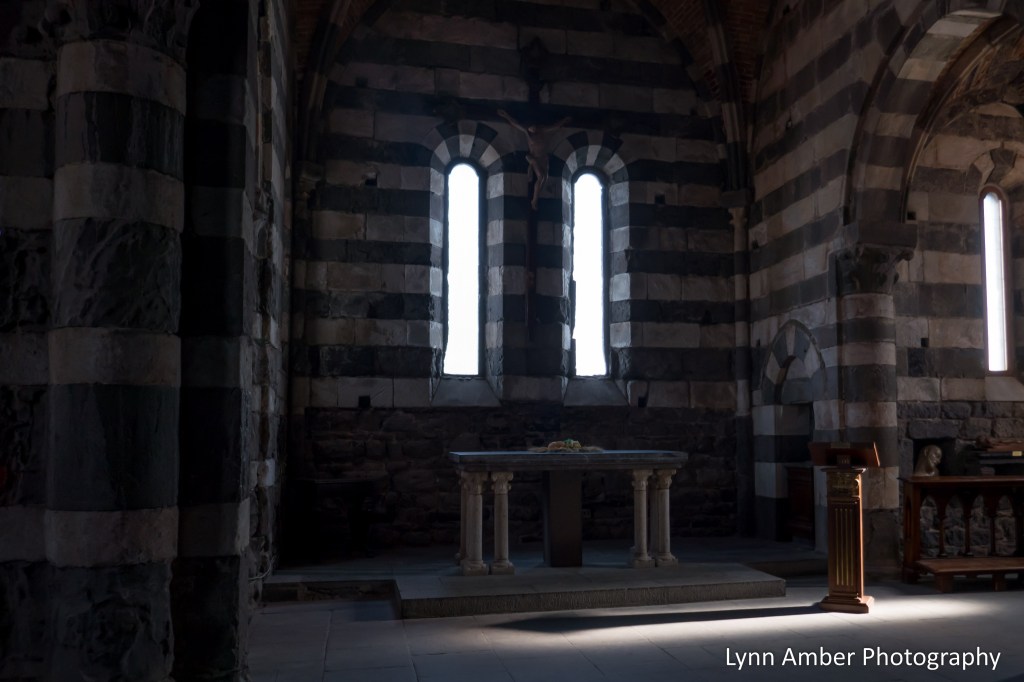
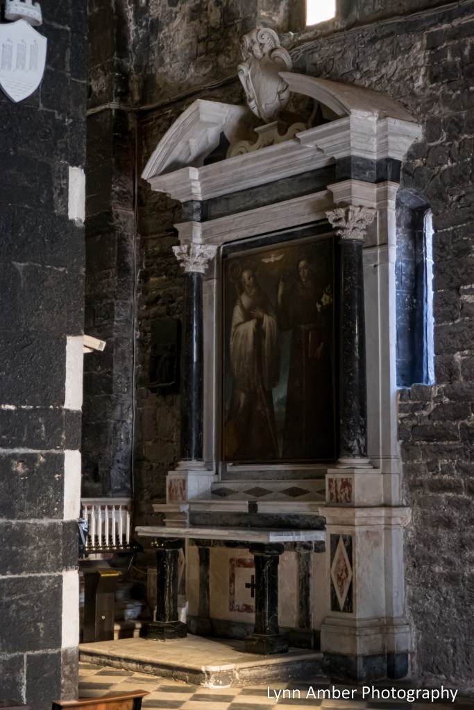
After walking through narrow streets, our next stop was at the Church of San Lorenzo. Built in 1130, this church displays the same Genoese Gothic style architecture of many ancient churches in the area. Inside the church is a parchment framed in white marble of the Madonna and Child dating to the 1200’s that is called the Madonna Bianca. The town of Porto Venere celebrates her with an annual festival on August 17th each year.


Some of the architectural features in the church:


Leaving the church, we climbed a little higher in the village for some awesome views of the landmarks and the Gulf of Le Spezia.

We had some time before catching our ride back to our hotel and headed back down into the center of town in search of – what else – Gelato!!

After arriving back at the hotel, we had time for a quick shower and clean up before attending the first of several lectures throughout the week. The first topic was a brief history of Liguria and the rise and fall of Genova.
The first day of hiking allayed my fears in regard to spending the week hiking with strangers and following the pace of others and a strict schedule. Our group was comprised of all hiking abilities – with most falling within the moderate to above moderate range of ability. The pace was moderate and I never felt it was too slow or too fast – and allowed for picture-taking along the way. The mix of attendees on the tour was refreshing and I felt very lucky to have landed with folks who were friendly, unassuming, interesting and accepting of everyone. It would be fun getting to know this eclectic group of travelers!
Cinque Terre Hiking Trip – Day 1

About a year ago, on a whim, I signed up for a Road Scholar group tour entitled “Hiking the Cinque Terre.” I had been researching the possibility of hiking the trails of the “Parco Nazionale delle Cinque Terre” for a few years. It was one of those places that immediately attracted me when I first heard of the trail that connects the five villages along this rugged coast. At the time I signed up for the group tour, my husband was not interested in flying overseas. Group tours do not usually excite me. I prefer the spontaneity of traveling without a set schedule or according to someone else’s schedule. But, since I would be flying solo on this one, I decided to take a chance on a tour group.
I was apprehensive about hiking with a group of people and, particularly, strangers. I generally like to hike on my own or with just a couple of people and prefer to set my own pace – allowing for breaks for photography or plant hunting – as I desire. So, it would be a challenge to alter my hiking style and I wasn’t sure I would enjoy it.
On October 11, 2025, I boarded a plane at Boston’s Logan Airport and headed to Pisa, Italy via a lay-over in Frankfurt, Germany. I arrived a day earlier than the program start date due to requesting a better flight and therefore I had to book an Air BandB at my own expense for the first night. Since I had booked the flights through Road Scholar, they provided the transport from Pisa to our program location in Le Grazie and I just needed to meet the group the next morning back at the airport. My bed and breakfast was walking distance to the airport and this all went well without a hitch!
We arrived in Le Grazie on October 12, 2025 late morning and checked into our rooms at the Hotel della Baia. We would use this hotel as our home base for our daily hiking excursions through the Cinque Terre region. The hotel was absolutely wonderful. My room was on the ground floor and included a small patio facing the harbor. As a solo traveler, I did pay for a double room as part of my overall fee for the trip even though I was a single occupant. But, it was worth it to me to have my own space at the end of a long day of hiking. As an self-described introvert, I need that alone time to decompress! Since the program did not officially start until 6pm (with a lecture and group dinner,) we were free to explore the small village of Le Grazie on our own for the afternoon.
After unloading my baggage in the room, I was anxious to walk around the village! It was such a vibrant, blue sky kind of day and warm and I’d never seen anything like the architecture visible from the bus as we entered the town. I needed to see it up close and personal! Across the side street from the hotel, there is a wide pedestrian walkway and it extends all the way around the harbor.

It was a beautiful, warm, sunny Sunday afternoon and the waterfront was alive with people enjoying the weather and sun-bathing along the water. It was almost shocking to see people in such skimpy beach attire soaking up the sun! Clearly, Europeans are not as body conscious as us Americans! And, with all the hype about skin cancer in the U.S., I’m not used to seeing people sun-bathing with such abandon! I walked from the hotel along the waterfront past small parks and all the way to the opposite side of the harbor.
I noticed a small alley way that led to an ancient Roman archaeological site – Villa romana del Varignano Vecchio – and followed it uphill to see what it was. It was closed when I arrived and I would not get another opportunity to explore it. It was the site of the oldest olive oil mill in the province of Liguria.

I walked along the narrow path that skirted the perimeter of the ruins until I reached a dead end. It was good to just stretch my legs after the long flight and bus ride to Le Grazie!
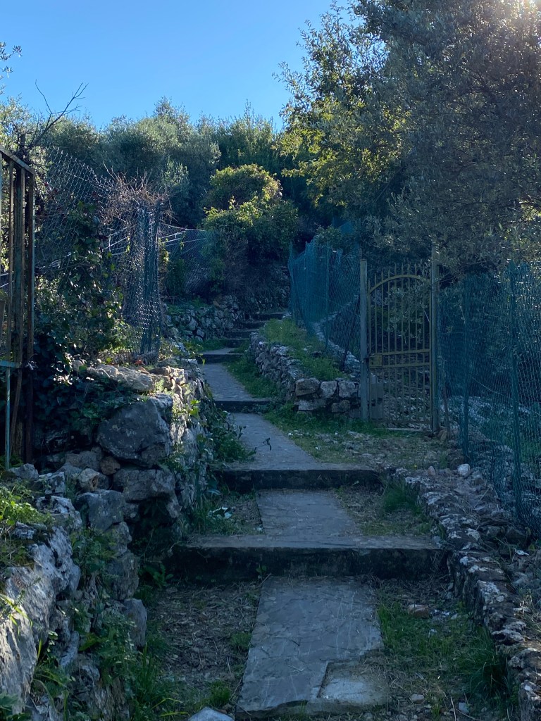

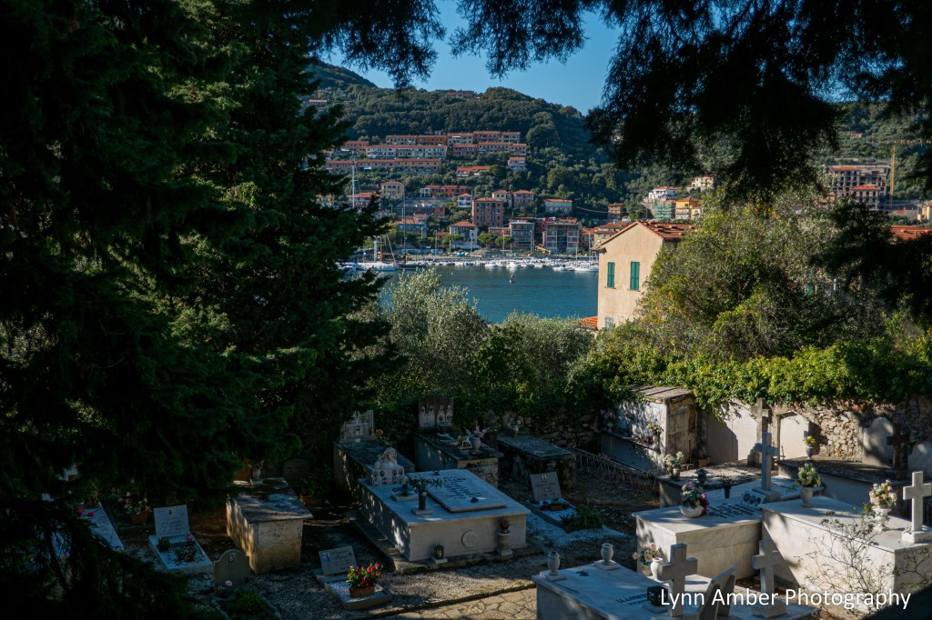
At the dead end, I turned around and made my way back to the narrow alley way and started back down to the harbor. Part way down, I noticed an open gate on my right and decided to see what lay beyond! To my surprise, it was a cemetery! If you’ve seen previous posts of mine, you know I am fascinated with cemeteries and love to explore them. I wandered around through multiple terraces of stone memorials thinking that it would lead to the church I had seen from the harbor. I never saw a connection to the church but it was a lovely spot and the view of the harbor was spectacular.
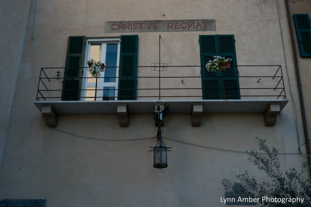
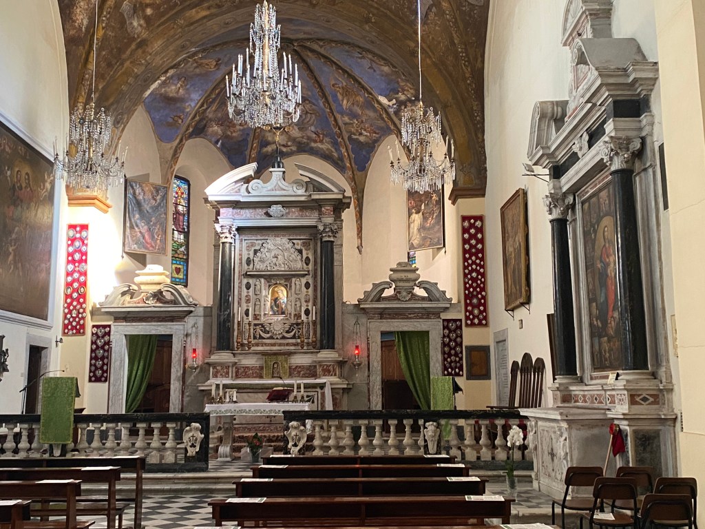
Back down by the harbor, I found the entrance path that lead to the church – Santuario di Nostra Signora delle Grazie – Sanctuary of our Lady of Grace. Parts of the church and cloister date to the 1500’s – oh my! What was once part of a convent is now perhaps private housing?? I could not really tell the present day purpose of the attached building.. but it was simplistic in design and appealing to the eye. More about the history of the church can be found here.

After walking around the church, it was time to head back to the hotel and get ready for our opening lecture and first group dinner at the hotel. Throughout the week, we enjoyed a complimentary buffet breakfast at the hotel prior to our daily excursions. It was by far the best buffet breakfast I’ve ever had in any hotel I’ve stayed in – daily offerings of mouth-watering scrambled eggs, an assortment of fresh fruit, traditional pastries, yogurt, granola, local jams – and all you can eat. We did consume several evening meals at the hotel as well that were equally tasty!
Cinque Terre Hiking Trip – Preview
October 2025
My blog posts have been intermittent for some time now. Sorry!! I have had very limited cell service since last Spring and no convenient internet service. But, I’m back home in Vermont for the foreseeable future and enjoying consistent connectivity! So, I have a lot to catch up on!
The list of posts that need to be written and shared include: the continuation of my Le Puy Camino from Spring of 2023; the trip my husband and I embarked on Spring of 2025 consisting of a cool Danube River boat trip and our Camino Portuguese adventure; and my most recent hiking trip to the Cinque Terre coastline of Italy. I hope to devote a little bit of time every day to editing photographs and drafting commentary – and hopefully get caught up documenting my travels over the coming winter months.
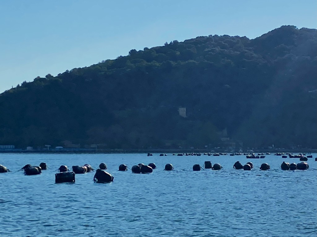
I’ll start off today with a single photograph from my recent trip to the Cinque Terre – just a little snapshot of what’s to come! The photograph above was taken along the pedestrian walkway lining the harbor in Le Grazie, Italy. Le Grazie is one of several towns that line the coast of the Gulf of Poets – also referred to as the Gulf of La Spezia. It is my home base for the next week as I explore the wonders of the Cinque Terre!
The boats in the foreground are commercial boats used in the mussel farming industry that dots the gulf waters. The black barrels float on top of the water and farmers suspend ropes from these barrels. The mussels attach themselves to these ropes and are left there to grow before harvesting. This is an industry that has been active since around 1800 and makes a significant contribution to the local economy.
Le Grazie was my home base for 8 days while exploring the Cinque Terre National Park or the Parco Nazionale delle Cinque Terre in Italian.
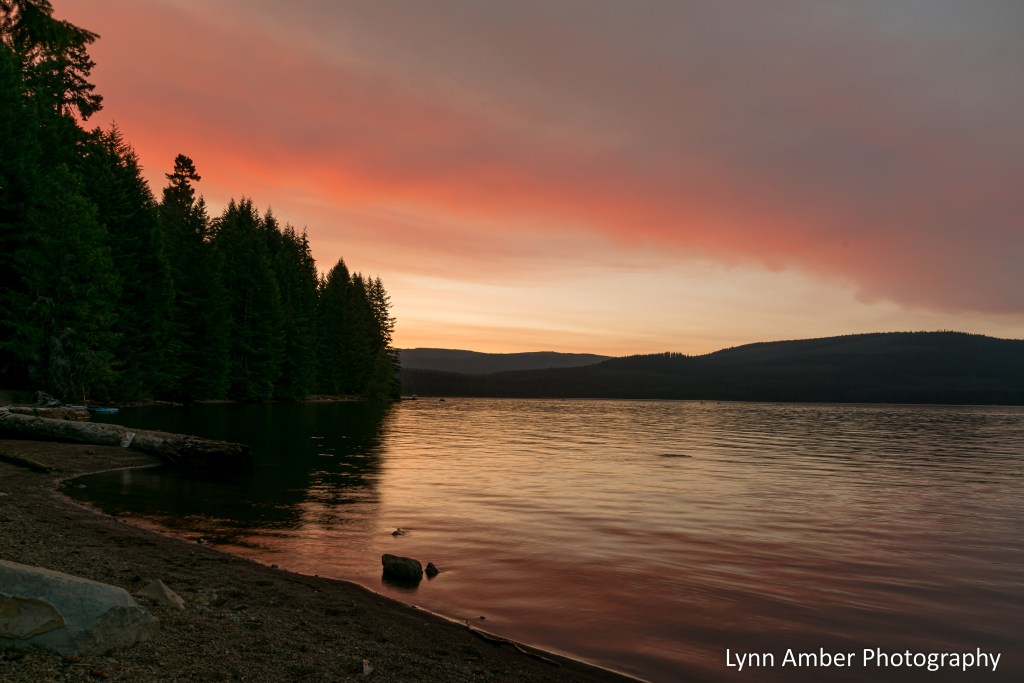
August Sunset on Timothy Lake
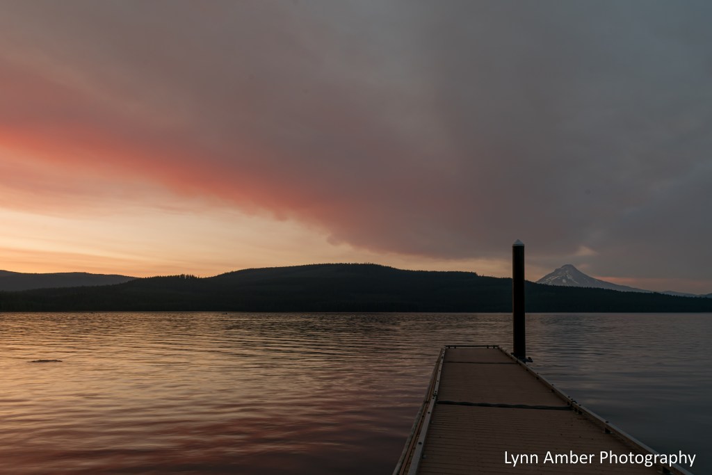
We’ve had a smokey haze all day due to wildfires to the south of us and it makes for some very pink sunsets.
More Timothy Lake Ducks
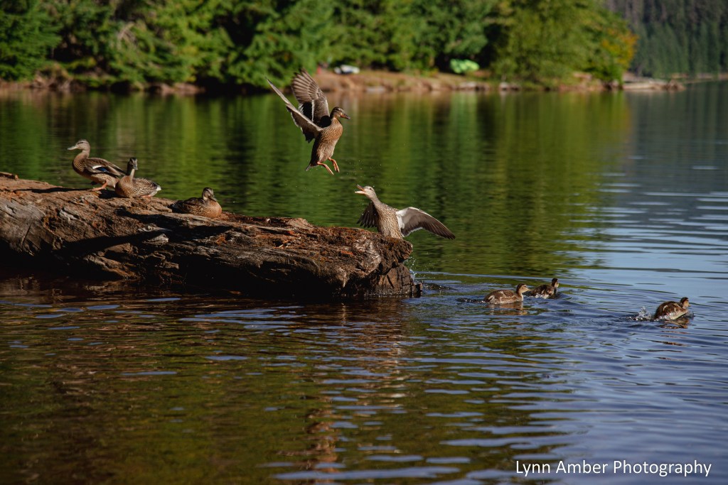
I’m not sure what provoked the one duck into scolding his fellow log-sitter – but the squabble was amusing!
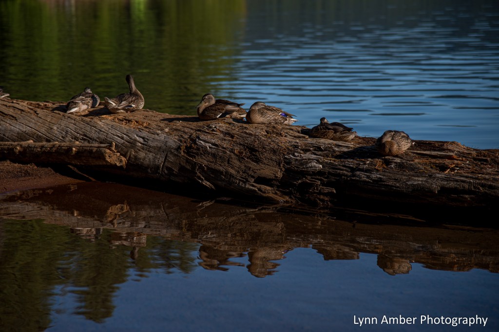
Lazy Timothy Lake Morning
July 29, 2025
I like to bring my chair and coffee down to the lakeshore early in the morning on my days off. I’m usually greeted by one of the several flocks of ducks that call our campground day use area home. 🙂 They are so chill!!
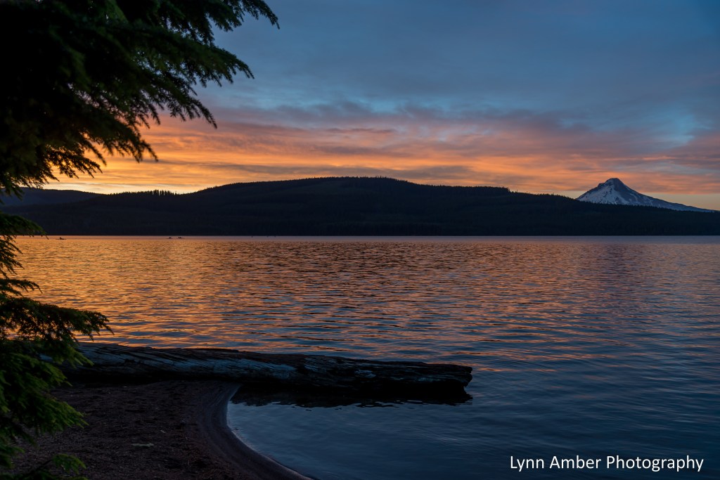
Timothy Lake 2025 – Sunset

We have not had many colorful sunsets at Timothy Lake this summer but this one a few days ago was absolutely spectacular!
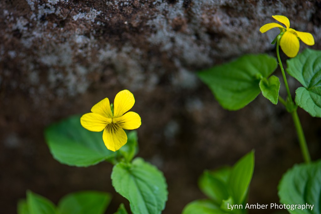
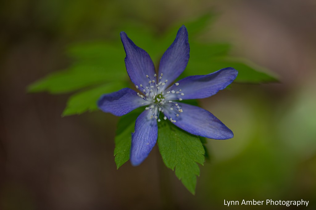
Timothy Lake 2025 – Early Wildflowers
Connectivity issues have prevented me from posting for awhile but hoping now that I have a good system to get back to regular posts!
We arrived back at Timothy Lake in the Mt. Hood National Forest for a second year of camp hosting and the early wildflowers blooming in the forest did not disappoint!