Lynn Amber - Travel & Photography
sharing my thoughts through words and images
Volcanic Legacy Scenic Byway Part II
Several weeks ago we decided to embark on another section of the Volcanic Legacy Scenic Byway. Our goal was to explore Lassen Volcanic National Park. While I recommend spending more than one day here, that’s all we had so we made the most of it! We picked up the byway via Route 299 west of Burney and headed south on Route 89 towards Lassen. After entering the park, our first stop was the visitor center by Manzanita Lake. Located in the Loomis Museum building, the visitor center contained a small gift shop, a ranger-staffed information counter and a small museum that seemed to be devoid of many of the exhibits. I suppose maybe they were re-modelling??

I did talk with an interpretive ranger there to get some ideas on what to see since we would only have one day. He gave me some good advice and we decided to start with the 2-mile loop trail that runs along the perimeter of the lake. After our 3-hour drive to get here, we were ready to stretch our legs! The Manzanita Lake Trail is an easy trail with virtually no elevation gain or loss – making it a very popular, short hike.

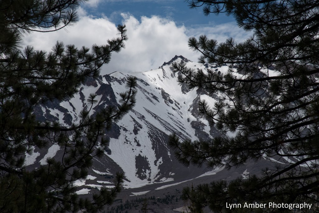
We had some awesome views of Lassen Peak and the Chaos Crags area during our hike around the lake!
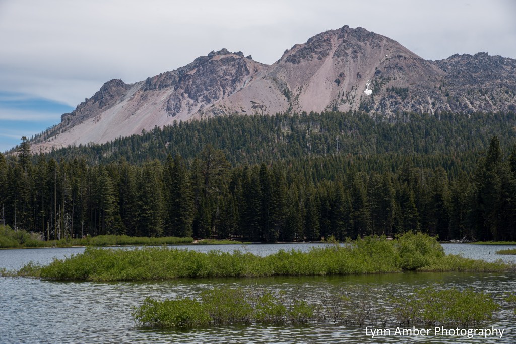
More pictures from Lake Manzanita….there is also a large campground here which would be a great place to hang out for a few days to allow for exploring more areas of the park.


We continued on the 30-mile long scenic road through Lassen until we reached the Devastated Area pull-out. There is a short interpretive trail here that explains the eruption of Lassen Peak that occurred in the park in 1915-1916. If you need a lunch spot, there’s a nice picnic area here as well – perfect timing as we were definitely ready for a snack! There are some great views of Lassen Peak from the picnic area.

After enjoying a small lunch and walking the short trail at Devastated Area, we continued on south through the park until we reached the parking area for the Kings Creek Falls Trail. It was at this point that the effects of the Dixie Fire became evident to the east of the park road. The fire entered the park in early August 2021 and burned over 73,000 acres of park land before being contained. In all, the Dixie Fire burned over 950,000 acres resulting in the largest fire in California history. Our hike along the Upper Cascades section of the trail took us through some of the burned out area. So sad!


As we started to approach the junction of the Upper Cascades Trail with the one-way Cascades Foot Trail, we crossed a small stream and started to see some plant life again! These tiny wildflowers were blooming along the trail.


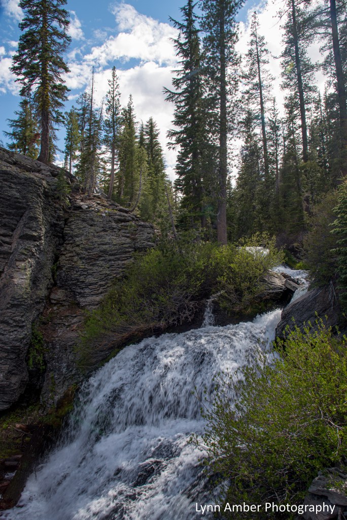
Since the Kings Creek Falls overlook was still closed due to the fire, we did not hike down there but veered to the right at the junction with the Cascade Foot Trail and ascended up the steep, one-way trail that hugs the Cascades – a series of small waterfalls that descend through the canyon. The cascades were amazing and totally worth the moderate 3-mile roundtrip hike from the parking lot. I took so many photographs of the cascades it is hard to choose which ones to share – but I’ll try to limit my choices to three photos!!


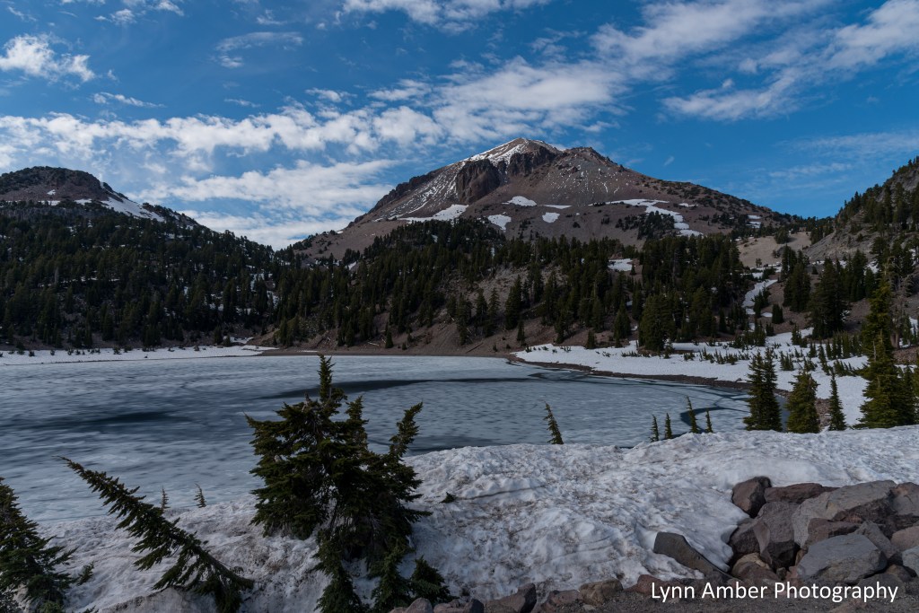
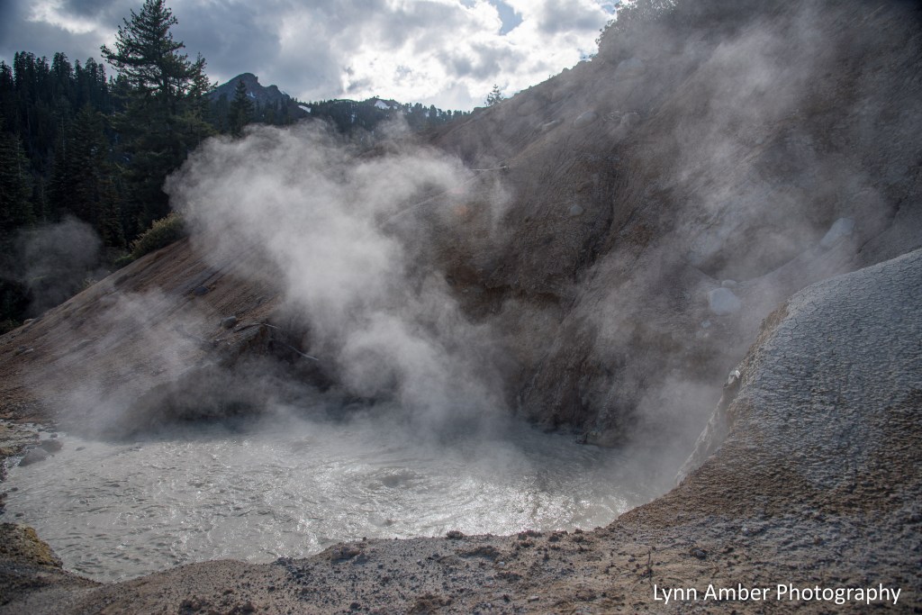
Since the day was getting shorter and we had a long drive back to our summer home, we opted for just one more stop in the park before making a long loop back. A trip to Lassen NP would not be complete without a stop to see one of the hydrothermal areas of the park. The most accessible spot is the Sulphur Works – the site of a long-gone sulfur mining company and roadside attraction. Along the way, we made quick stops at Lake Helen and Bumpass Hell parking area.

At Sulphur Works…..


There are so many more hiking trails I’d like to explore in Lassen Volcanic National Park! I hope that we can get down to the park for an overnight stay before the summer ends!
