Lynn Amber - Travel & Photography
sharing my thoughts through words and images
November Edisto Beach Trip III

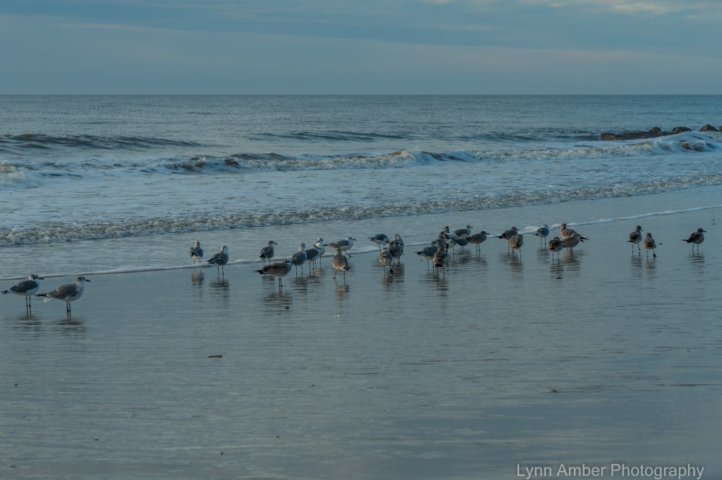
My last full day on Edisto Beach was a busy one indeed. I embarked on my now regular sunrise walk noticing the very subdued colors this morning. There was a thick cloud cover as I started out but eventually the sun broke through the clouds and created some awesome reflections on the water.

After my morning stroll along the shoreline, my sister, cousin, nephew and I rode over to a local eatery called the Sea Cow for breakfast. It’s a funky, little establishment that is extremely popular with locals and tourists alike serving up an excellent breakfast. I enjoyed a perfectly cooked two-egg cheese and spinach omelet embellished with fresh, homemade biscuits and the best southern-style grits I’ve ever tasted! Yum, yum!! 🙂
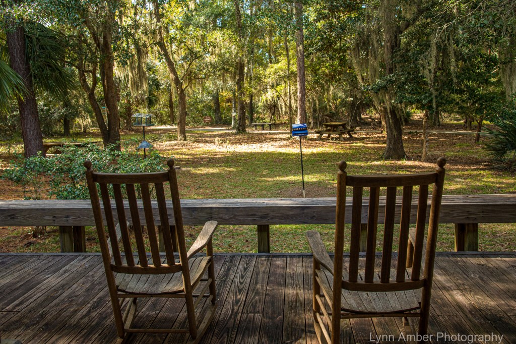
We returned to the beach house after breakfast to visit with my niece and her two young boys before she returned home for their afternoon naps. My plan for the afternoon was to explore the Edisto Beach State Park. No one else was interested in hiking through the park, so I got dropped off at the entrance to the park by my sister and cousin – who decided to do a little shopping and also taxi my nephew to a disc golf park.

I stopped in at the park ranger station before wandering off so I could get a map of the trails and some information. The two women in the office were so nice! One woman highlighted several places of interest and explained that all trails were open with the exception of a portion of the Scott Trail. In all, there are probably only 5-6 miles of trails and they are all level, hard-packed and easy on the feet. Good thing because I had arrived in sandals – not exactly good hiking shoes! After chatting with these park employees, I decided on a route and phoned my sister to let her know when and where they could pick me up later.
My hike started at the beginning of the Spanish Mount Trail. This trail is a one-way 1.7-mile hike out to the marsh and ends at an interesting archeological site. The trail winds through the maritime forest of South Carolina coast.
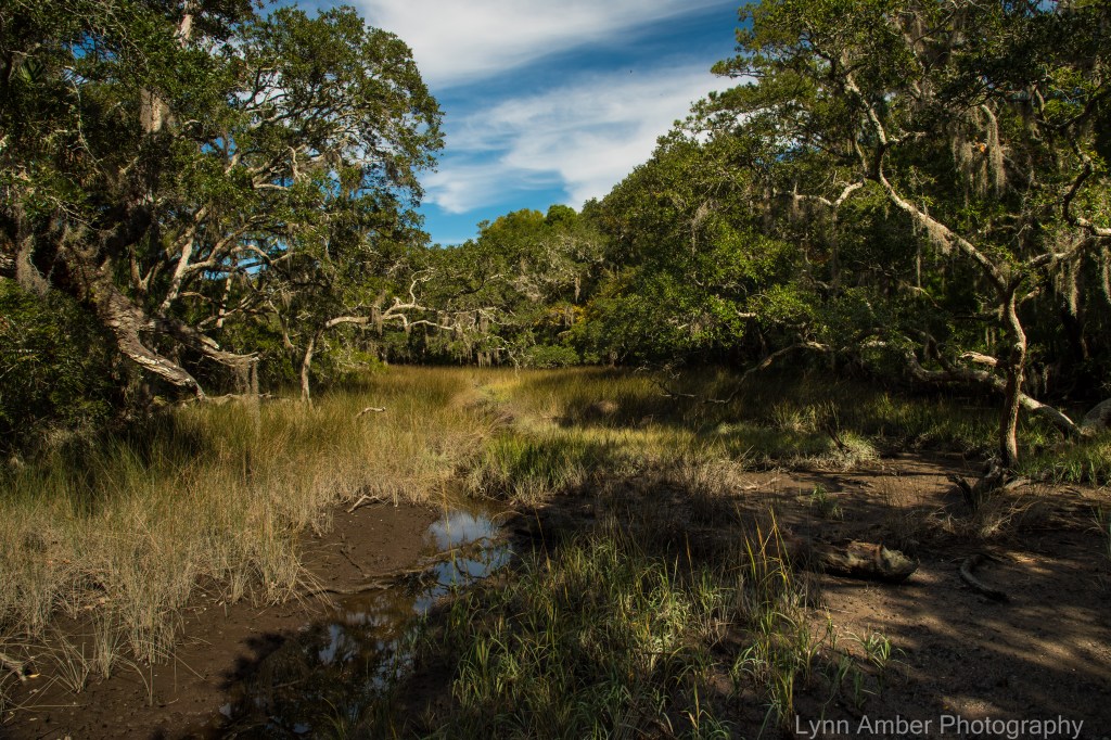
The maritime forest is a unique ecosystem that is extremely important to preserve and protect. This natural environment serves as a protective shield for the coastline and salt marches – helping to stabilize the shoreline, provide storm protection and conserve groundwater while supporting a diverse plant and animal population. The plants growing in the maritime forest are adapted to this harsh environment – tolerating the dry, sandy soils and salt spray. I love exploring ecosystems that are foreign to me having grown up in the northeast. There is so much beauty in nature! Plants common to this area include the majestic live oak, laurel oak, palmetto, loblolly and slash pine and red cedar.

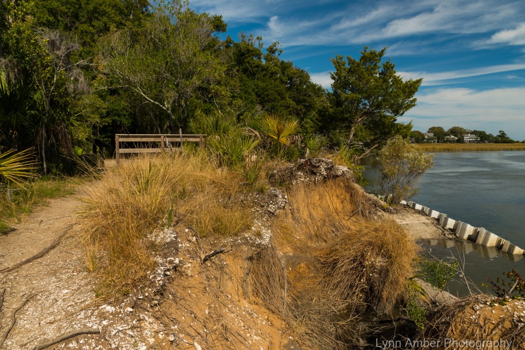
The Spanish Mount Trail ends at an open water section of the salt marsh along a bank that holds a important Native American archeological site . At this location is an ancient shell midden (aka trash heap) created by the Edisto native Americans somewhere around 2,000 BC.


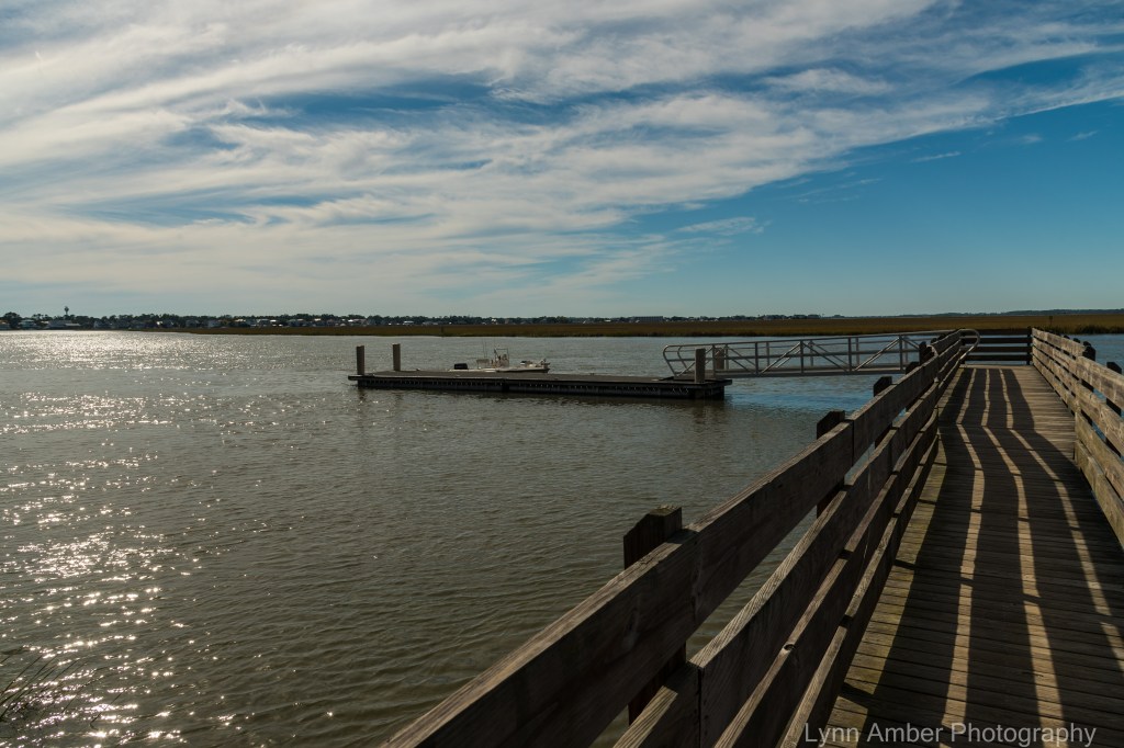
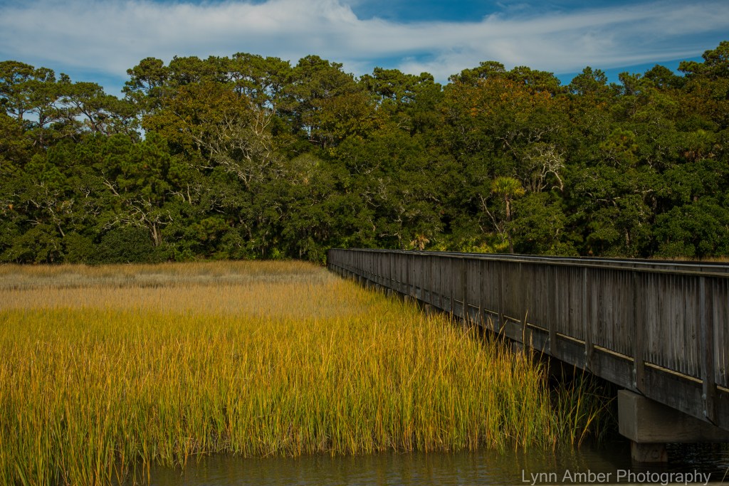
After wandering around the shell midden and conversing with a couple of fishermen who were in a small boat just off-shore there, I followed the .4-mile Big Bay Trail that leads from the terminus of the Spanish Mount Trail to the Environmental Learning Center. Before reaching the environmental center, the trail passes through the public boat launch area that provides access to the waters of the salt marsh. From the dock, there’s a great view over to Edisto Beach.
The Environmental Learning Center is located in a “green” building and serves as the educational and outreach center for the park. The center offers programs for all age groups with a focus on the unique aspects of the ACE Basin and the responsible management of coastal resources. An interpretive exhibit in the main building emphasizes the importance of the natural history of the area and the ACE Basin – which is the largest estuarine reserve on the East Coast. I learned that ACE stands for the Ashepoo, Combahee, and Edisto Rivers whose waters form the estuary that comprises over 350,000 acres. I found the exhibit on the loggerhead turtles that nest on the island particularly interesting!
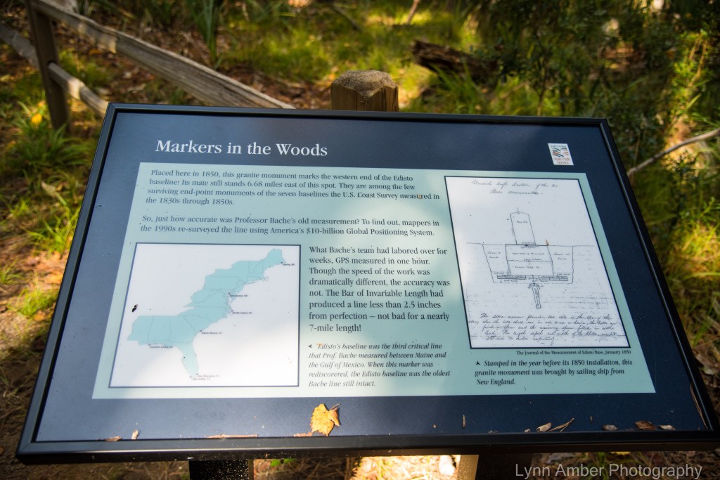
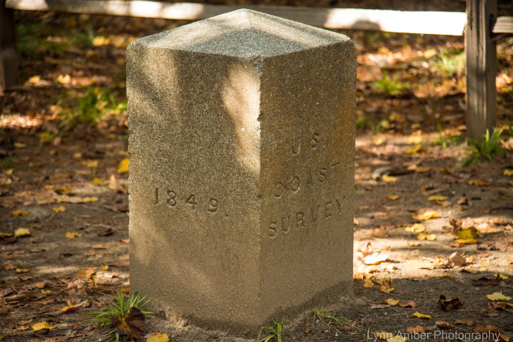
The Bache Monument Trail is a short, easy .2-mile walk that leads from the learning center to the Bache Monument. Alexander Bache was a scientist and surveyor in the mid-1850’s who was instrumental in completing a mapping of the entire coastline during his tenure as superintendent of the US Coast Survey. He was the great-grandson of Benjamin Franklin and obviously inherited the “inventive” gene. Bache developed a tool known as the “Bar of Invariable Length” that was used for this survey that culminated in measuring the entire eastern US coastline. Two of the baseline markers for this survey are on Edisto Island.

While waiting for my ride, I walked down to the fishing pier near the learning center to take another peek at the waterway winding through the salt marsh.

Exploring the maritime forest and coastal waters was so much fun! Overall, I hiked about 6 miles in the park and learned a lot about this diverse, ecologically important area. I highly recommend spending time hiking or biking these trails and enjoying the serenity and charm of the South Carolina low-country. Later that day, we drove over to my brother’s house for a low-country boil which is a regional delight! The dish consists of shrimp, pork sausage, corn on the cob, and potatoes all boiled in a large stockpot outdoors – with a special seasoning. It’s a great meal to feed a crowd!
A nice finale to a wonderful week at Edisto Beach! 🙂

The “Low country boil” sounds like something I could tolerate really well!
LikeLike