Lynn Amber - Travel & Photography
sharing my thoughts through words and images
2 Days, 2 Parks
When Jim and I explored the southwest during the winter of 2017, we bypassed Carlsbad Caverns and Guadalupe National Parks twice! On both occasions, the weather forecast called for cold temperatures (sub-freezing) and high winds. As we headed west this winter, I kept tracking the weather and noticed a “sweet spot” in the weather around Carlsbad and Guadalupe. So, we took a chance and altered our route from I-40 by dropping down towards Carlsbad – taking Rt. 60 near Amarillo, Texas.
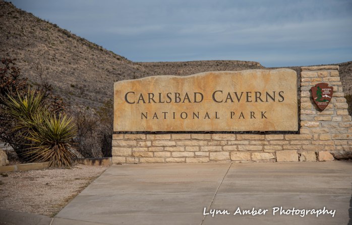
I was so excited to finally tour both of these unique parks! Our first day in the area, we chose to visit Carlsbad Caverns NP.
Day 1 -Carlsbad Caverns NP
The geologic history of the cave formation here is fascinating! The short and sweet version is as follows: About 286 million years ago there was an inland sea called the Delaware Basin covered much of the region around Carlsbad and Guadalupe. A limestone-rich reef formed on the perimeter of the basin and is known today as the Capitan Reef. Over time the inland sea started to recede leaving behind salt deposits in the basin that acted as a preservative for the reef area. About 65 million years ago, tectonic activity in the region started to create an uplifting of the terrain and eventually resulted in the reef being raised – forming the mountain ranges that exist here today including the Guadalupe Mts.

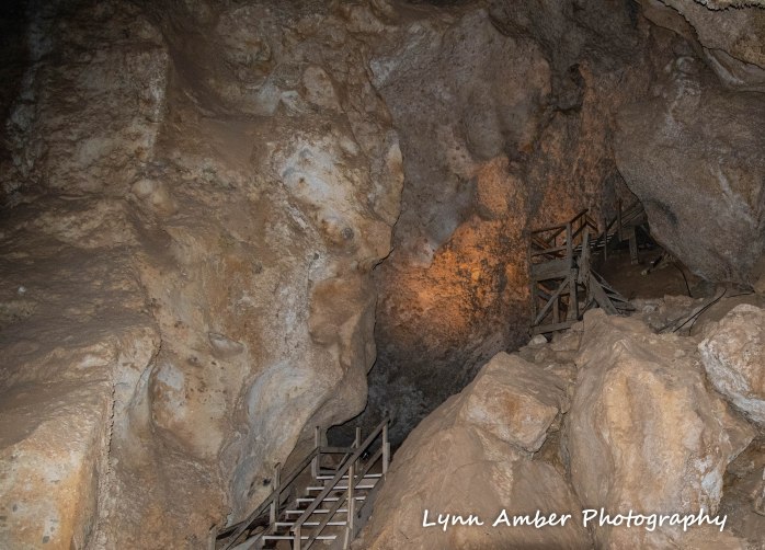
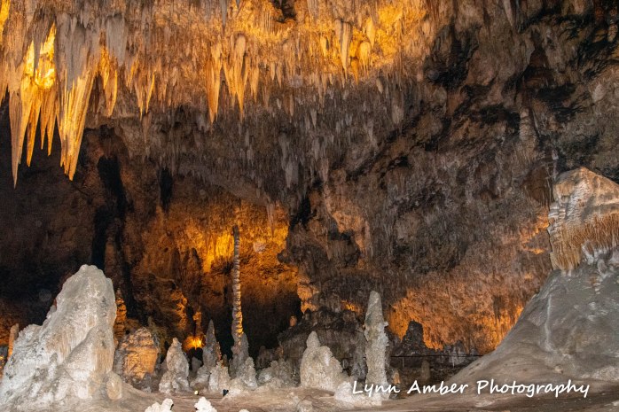
The formation of the Carlsbad Caverns is unique due to a major ingredient in their formation – sulfuric acid. The large amount of oil deposits in the region provided hydrogen sulfide which in turn reacted with oxygen and produced sulfuric acid – that contributed to the dissolution of the limestone rock. With the active tectonic faults came changes in the topography that allowed for the underground water table to drop leaving huge, underground passageways that are relatively dry. Gypsum is a by-product of the sulfuric acid reacting with the limestone and there are large deposits of this in the caves. In more recent times, erosion has allowed water to penetrate the caves. As a result, the speleothems we enjoy today started to form and continue to evolve and decorate the caverns today!
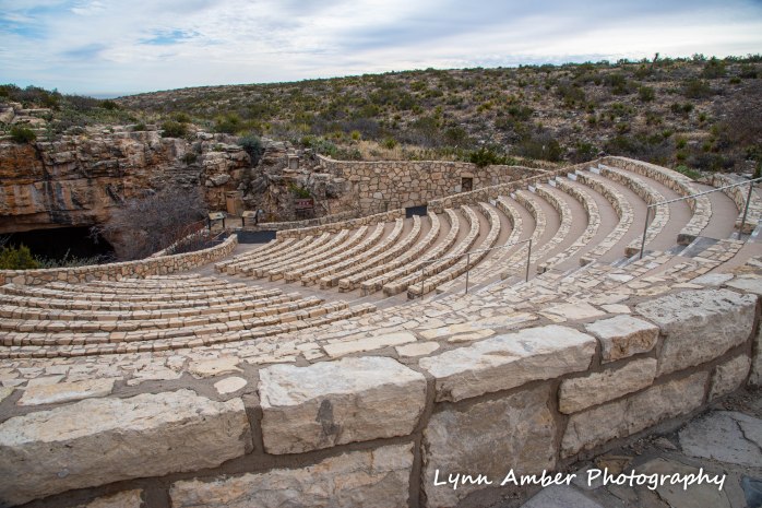
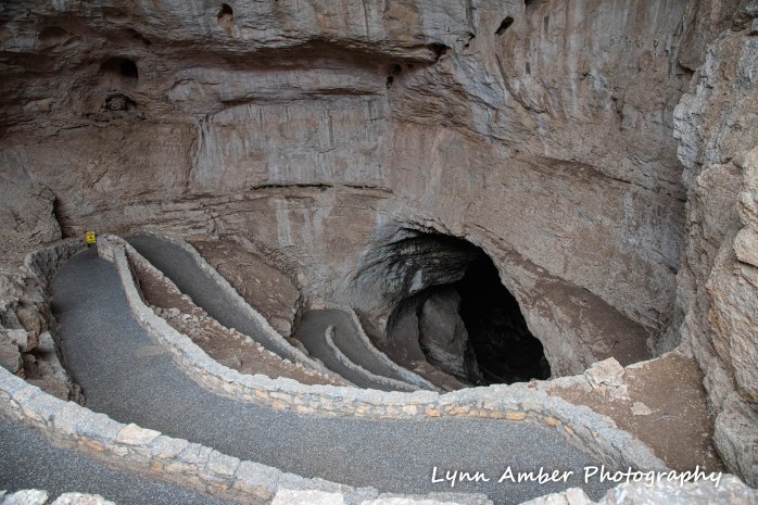
There are two ways to get down to the caverns which are over 700 feet underground. Visitors can choose to walk down through the “natural” entrance – the 1.25-mile steep trail – to the Big Room or take the elevator from the visitor center. The walk down goes from the Natural Entrance through the Main Corridor and connects with the loop around the Big Room – which is an additional 1.5 mile and a fairly level hike. The return to the top of the cavern is via elevator from the Rest Area and Lunchroom. We walked down from the Natural Entrance and came back via elevator.

Throughout the walk, we marveled at the endless formations of stalactites, stalagmites, draperies, soda straws, flowstones and “popcorn” aragonite. Photography is permitted and flash is allowed.


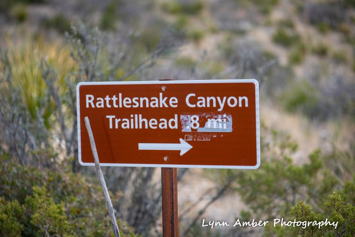
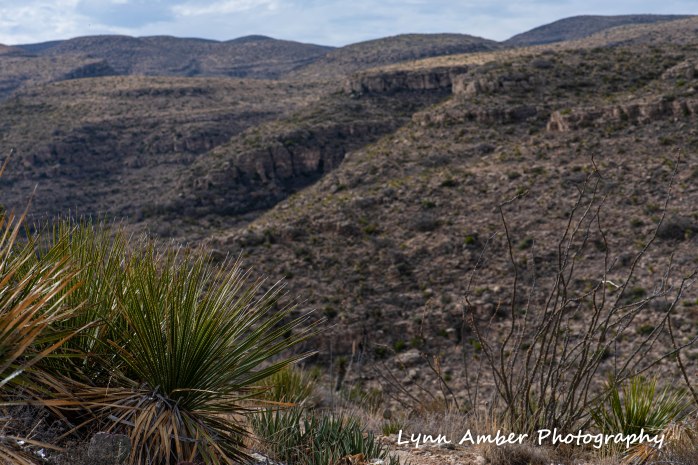
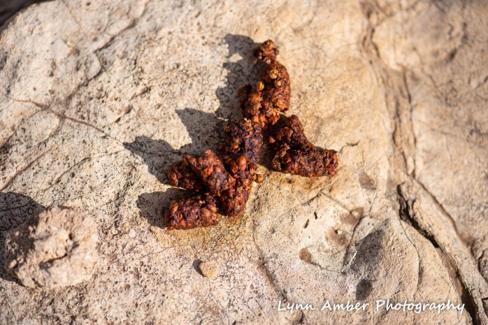
After touring the caverns, we drove the 9.5-mile Desert Loop Road through the park itself and stopped for a quick hike on the Rattlesnake Canyon Trail. It was nice to get out on a trail after so many days of driving from the northeast!! We saw an abundance of scat on the trail that we later learned was from the Ringtail (Bassariscus astutus), an omnivore closely related to coati and raccoons. But, alas – no rattlesnakes!!!


Loved your excellent description of the geologic formation of the caverns as well as the excellent photos. They compliment each other very nicely.
Stewart
LikeLike
It was a very abbreviated description!! Honestly did not think the photos would turn out given the need to use a flash!! I was pleasantly surprised 🙂
LikeLike