Lynn Amber - Travel & Photography
sharing my thoughts through words and images
Le Puy Camino: Cahors
April 21, 2023
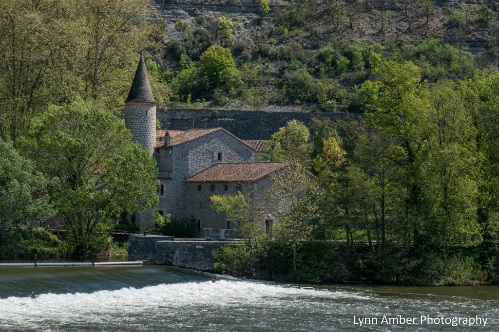
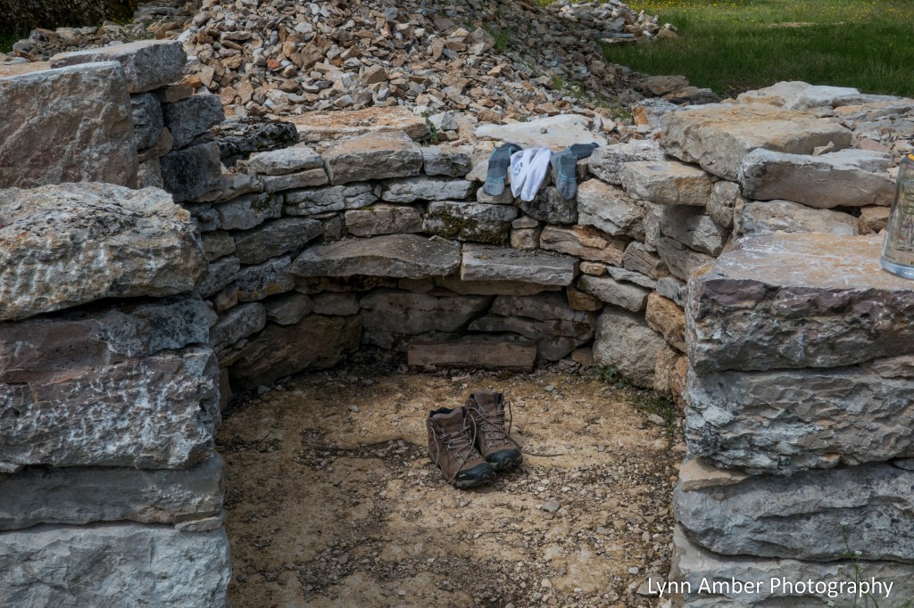
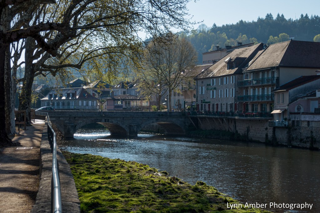
We arrived in Cahors via taxi from Bach and luckily for us the hotel allowed us to check-in early. We had reservations at the Hôtel-Restaurant La Chartreuse. The hotel sits on the banks of the Lot River across the waterway from the center of town.

I continued to feel sick for much of the day and spent a good bit of time in the hotel room trying to secure lodging for our next few days. As the main season for walking the Way was upon us, it was becoming increasingly harder to find lodging that would keep us within a certain manageable kilometer range each day. After working out the next several days, I ventured out into the city to explore.
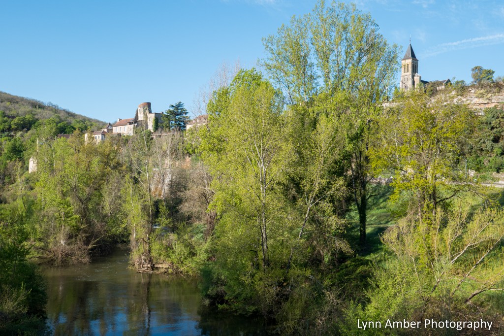
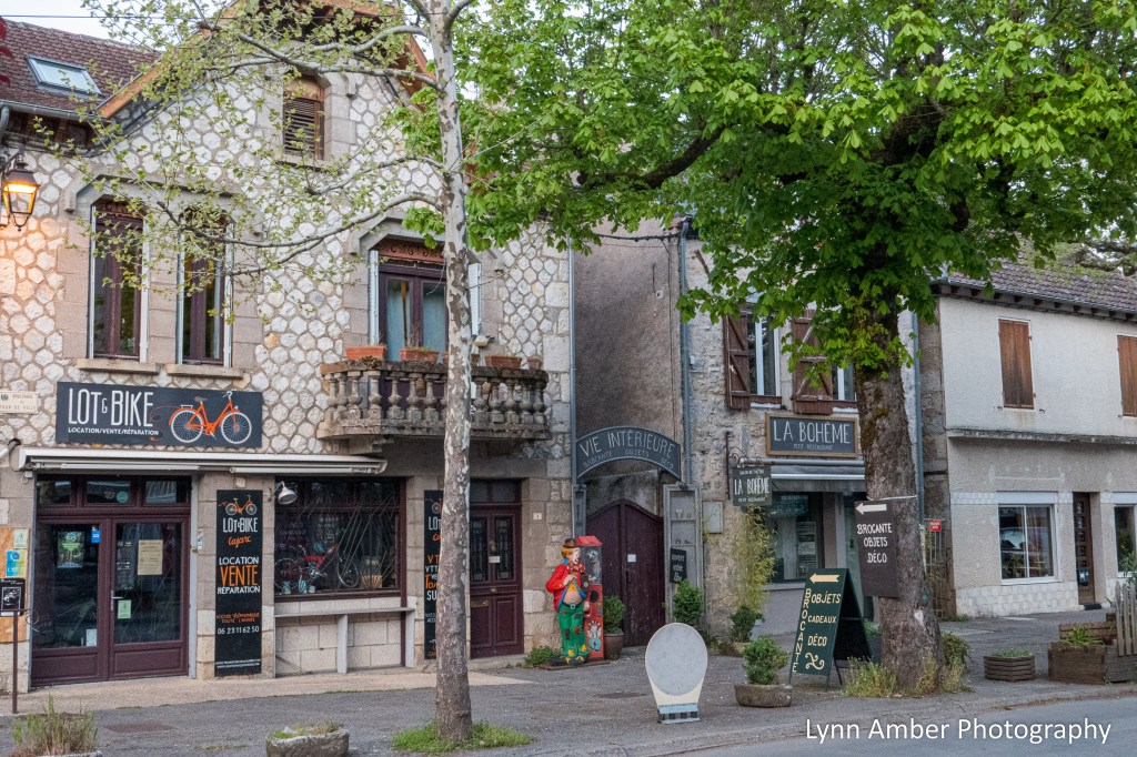
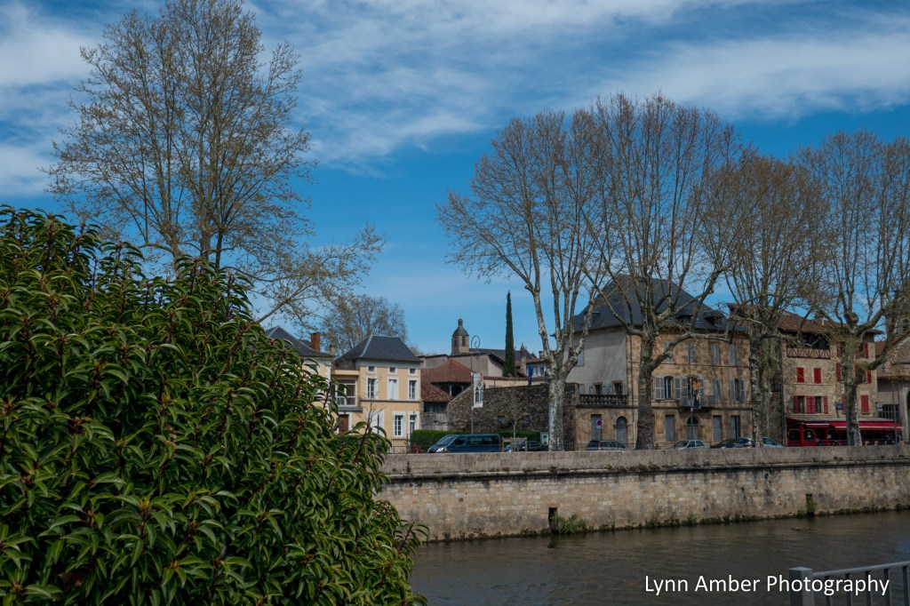
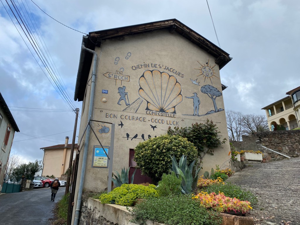
A short walk from the hotel is the bridge (with a pedestrian sidewalk) that crosses over the Lot and deposits visitors into the main downtown area of the city. It was quite a shock to be in a “city” after walking through quaint, medieval villages for days on end! Since Cahors is considered the half-way point of the walk between Le Puy and Saint-Jean-Pied-de-Port, we needed to get another Miam Miam Dodo guidebook. The Miam Miam Dodo is divided into 2 sections. It was somewhat of a milestone to be done with Section 1!!
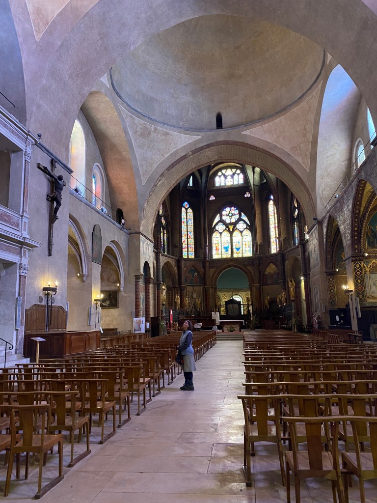
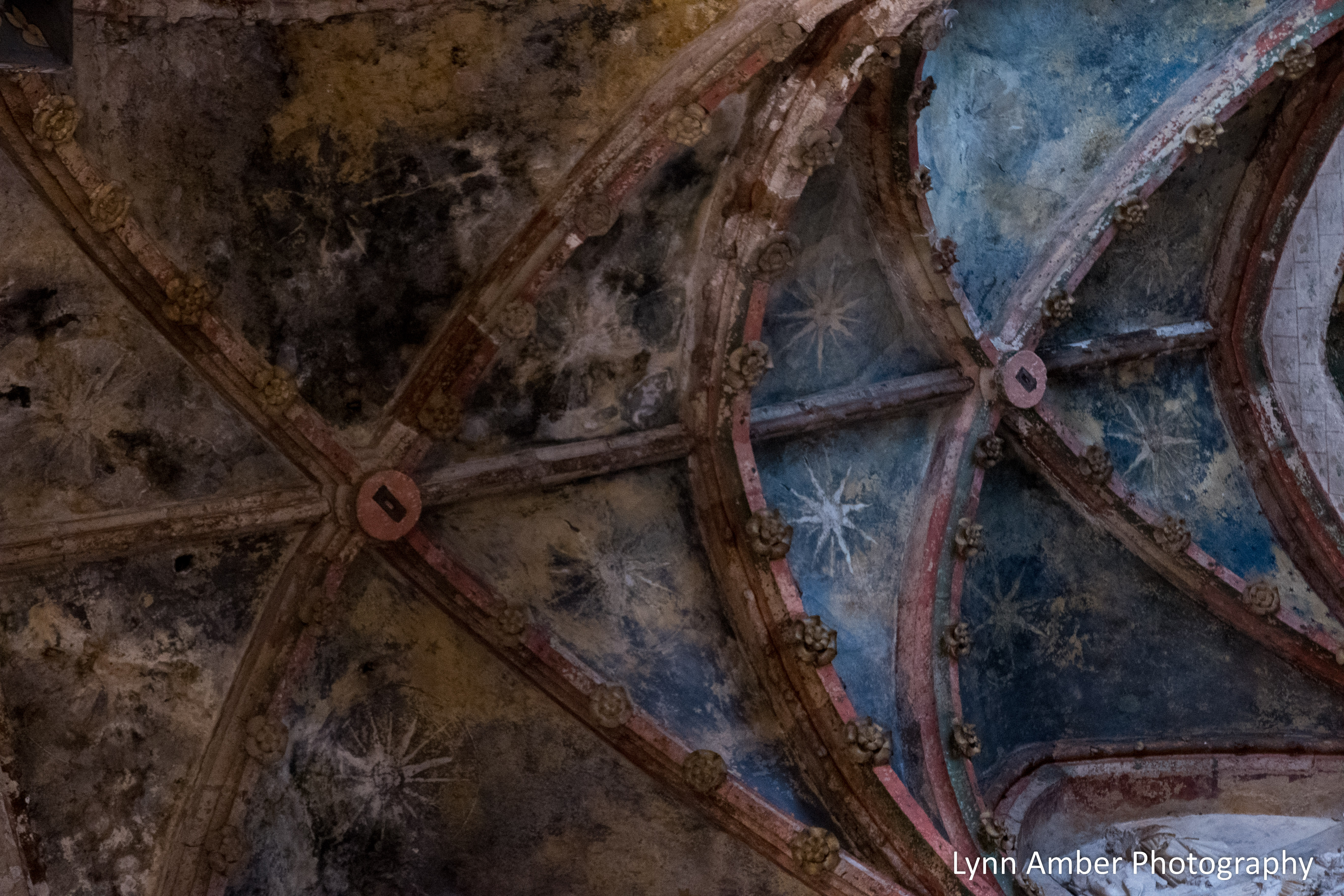
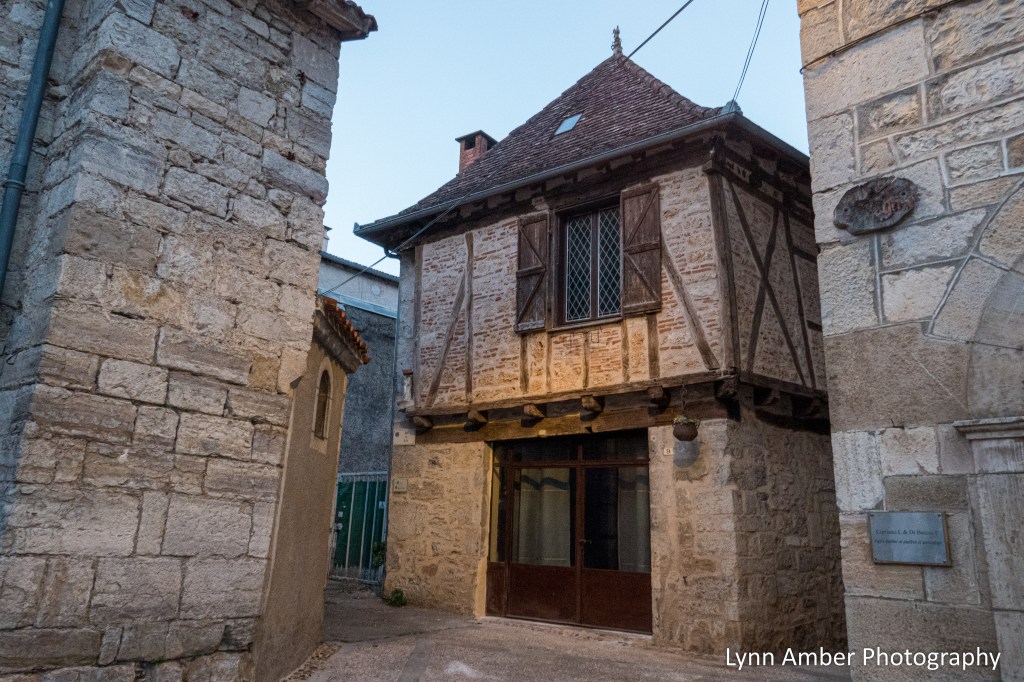
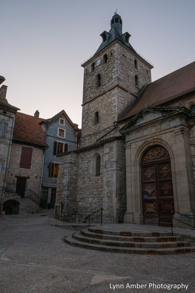
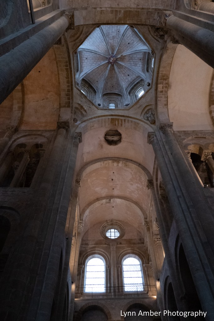
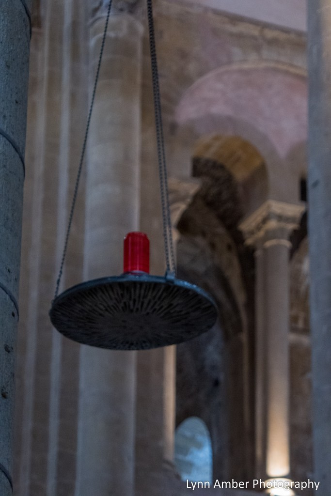
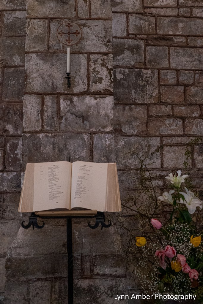
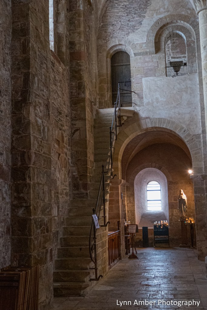
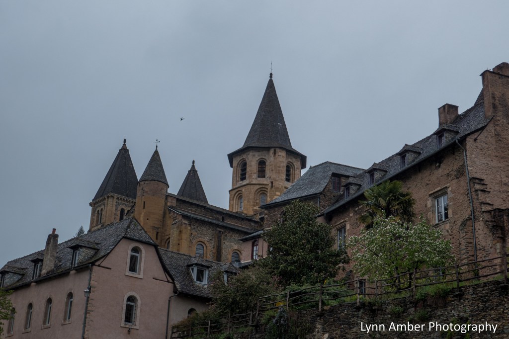
We located the Office de Tourisme de Cahors and purchased our Section 2 Miam Miam Dodo and wandered around town exploring the architecture and visiting the main church – Cathédrale Saint-Etienne.


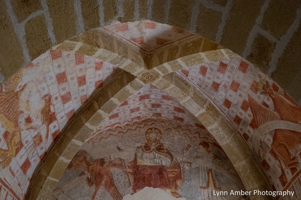
There was a courtyard behind the main part of the church with a formal garden surrounded by long columned hallways. The garden is adorned with lavender and white lilies certain times of the year to honor the Virgin Mary.
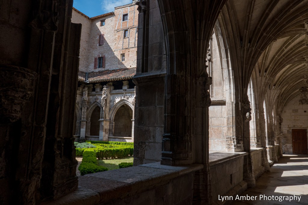

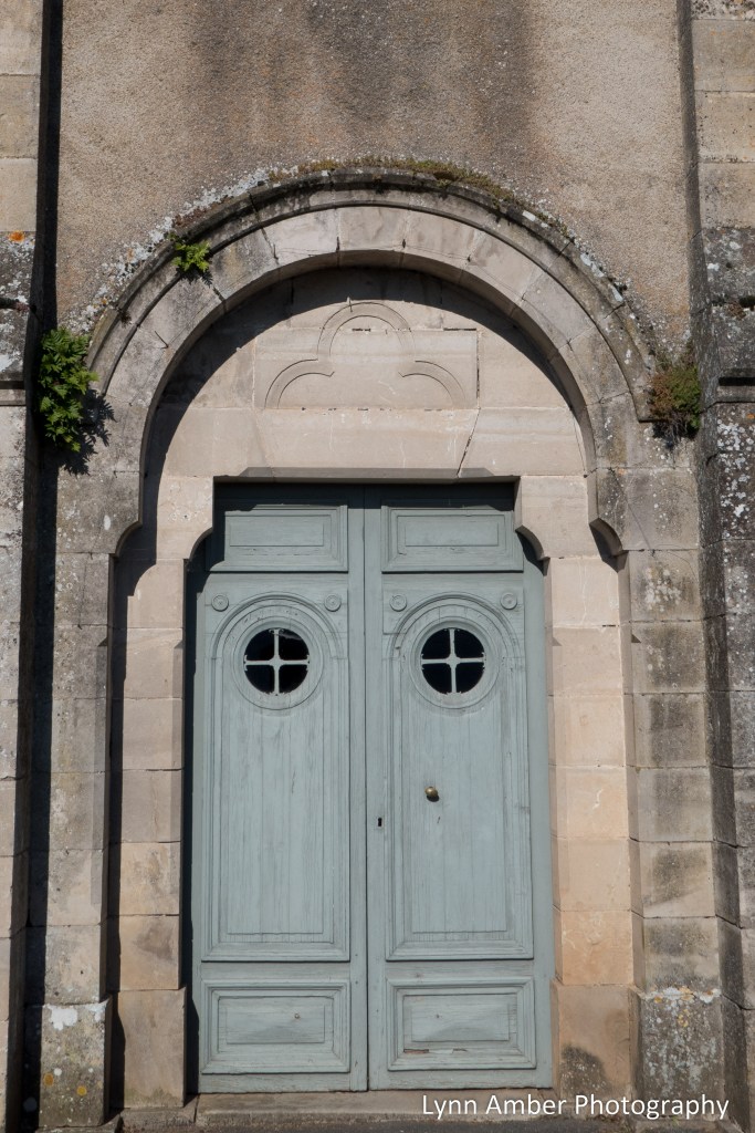
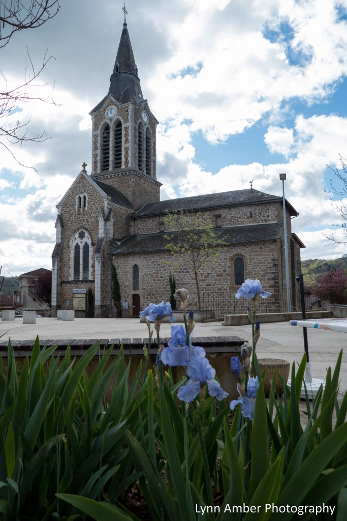
Cathédrale Saint-Etienne was built in the 12th century and has had many facelifts since that time. It is a UNESCO world heritage site due to its importance along the pilgrimage route to Santiago de Compostela.
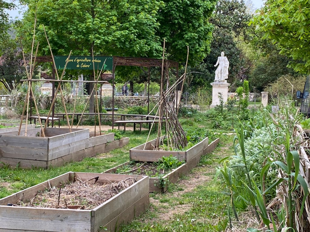
Another interesting spot in the city was the Agora d’agriculture urbaine – a community garden located near at the end of a wide, open paved plaza.
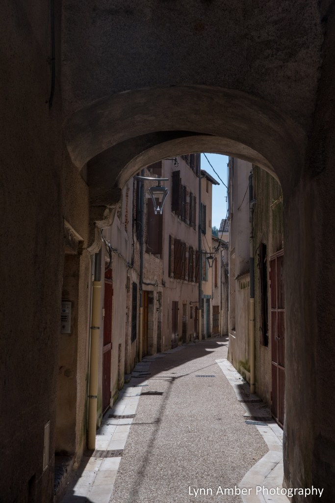
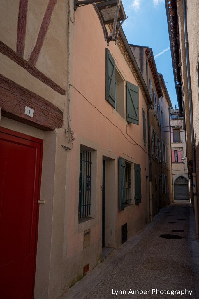
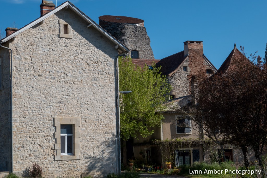
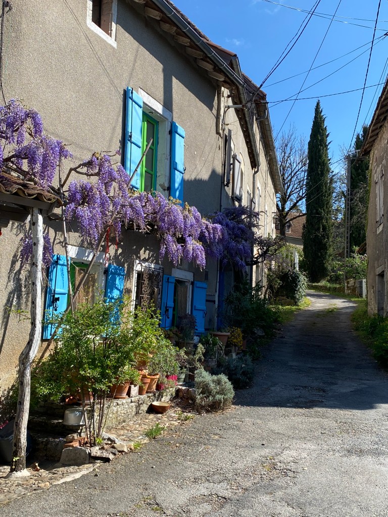
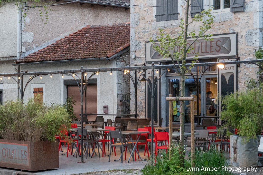
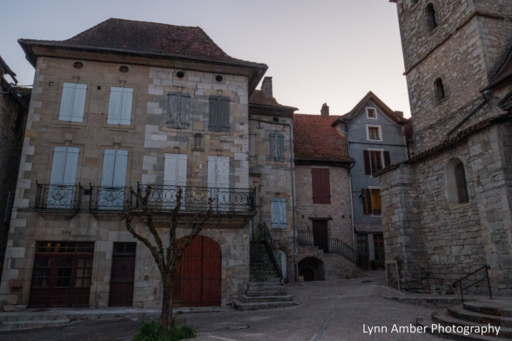
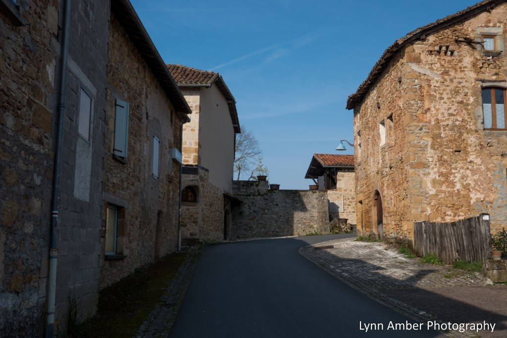
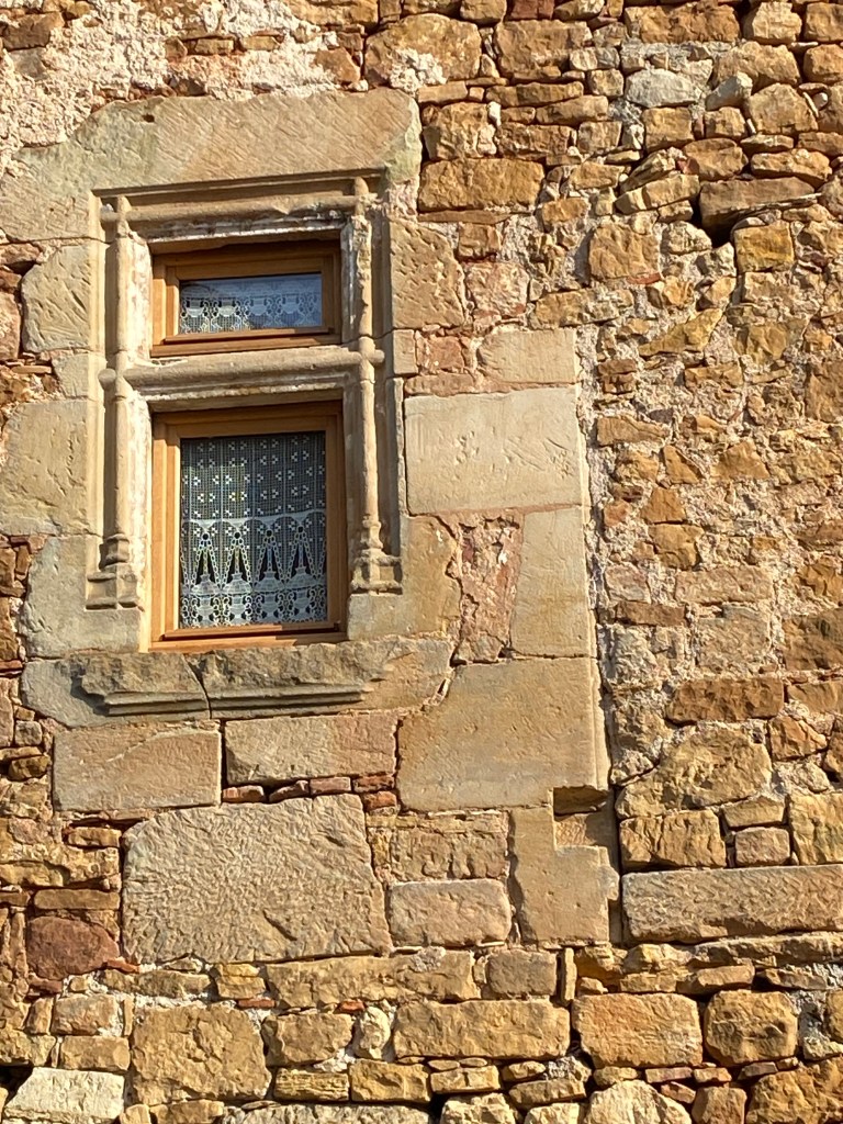
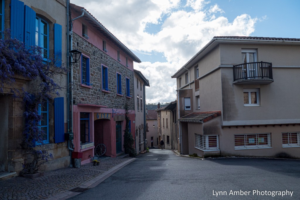
While much of the city looks fairly modern, walking along some of the side streets gave a sense of how the ancient town appeared in the past.
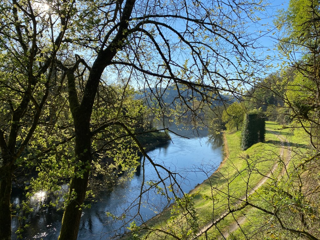
There is a visitors booth on the city side of the bridge and I stopped in there to get my pilgrim credential stamped. I noticed a walking path along the river from this spot. I spent some time on my own exploring and took a walk along this urban path that follows the Lot River. It was peaceful and I found some fig trees!! I love the foliage and fruit of this marvelous plant that grows in moderate climates.


We ate dinner in the hotel restaurant that night and prepared for our next day’s journey to Labastide. I wish I could say I enjoyed my time in Cahors – but feeling ill and being frustrated with finding lodging put a damper on my mood! Perhaps I will visit the city again and view it differently. But the bustling atmosphere with increased traffic and people were not really a welcome sight for me at this time. Onward!
California Coast 11.23.24
November 23, 2024
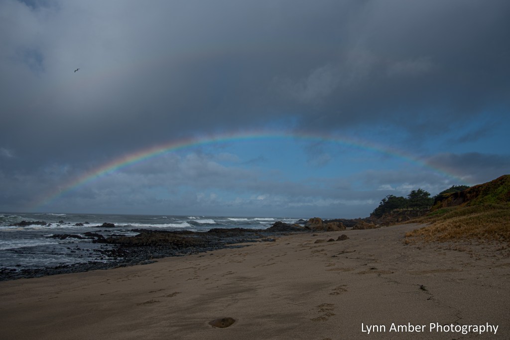
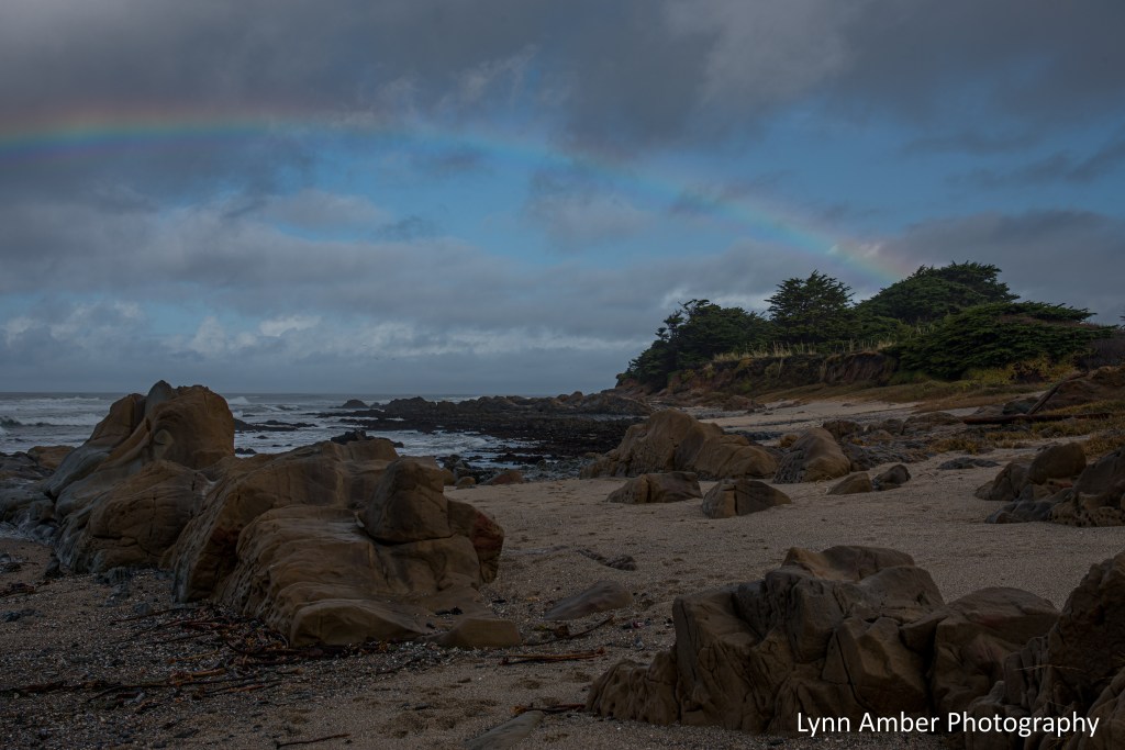
We’ve been visiting our son in the Santa Cruz Mountains on the peninsula near Woodside, CA. Unfortunately, upon our arrival, we were inundated with an “atmospheric river” coming off the Pacific Ocean. This past Saturday, there was a break in the weather and we drove over the hill to the coast to soak up some sun and give their Belgian Malinois “Wylie” a good run on the beach.
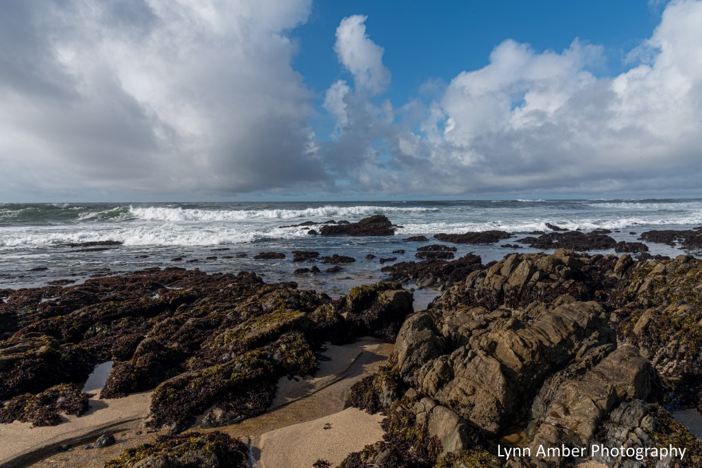
Pescadero Point Beach is one of many small beach areas located off the coastal Route 1. It was so nice to see the sun even though we were greeted with some intermittent misty rain. It produced an incredible rainbow as we walked down to the beach!
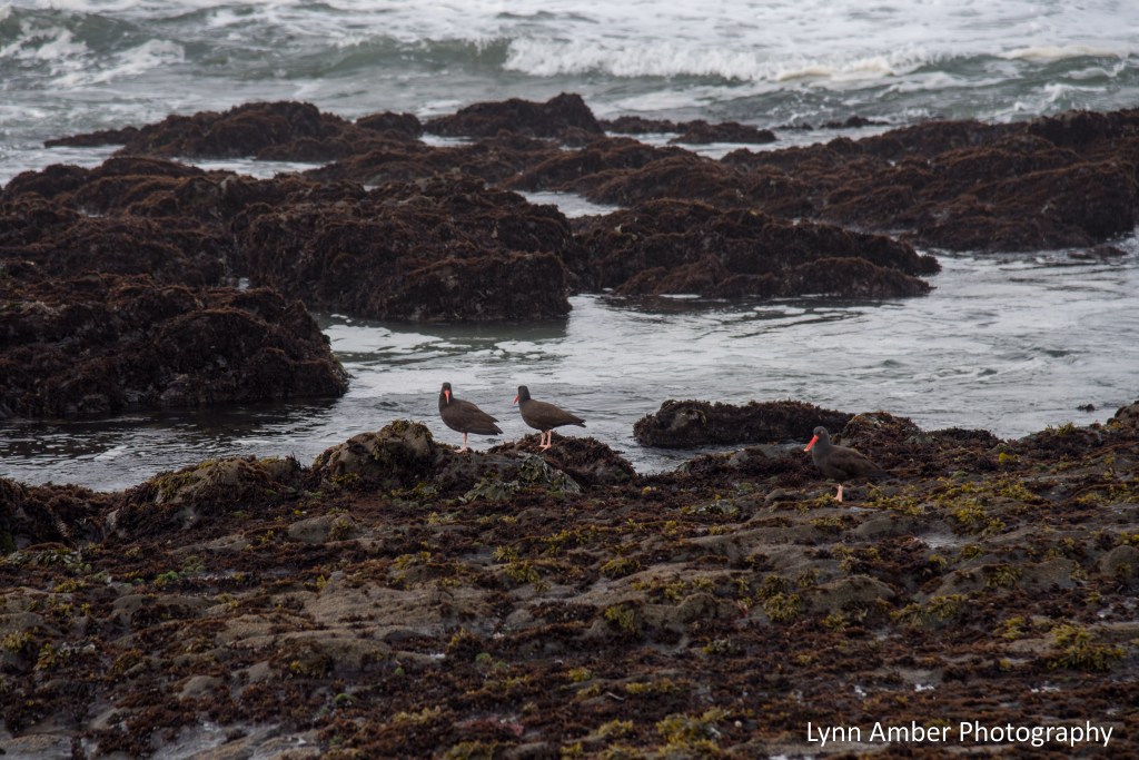
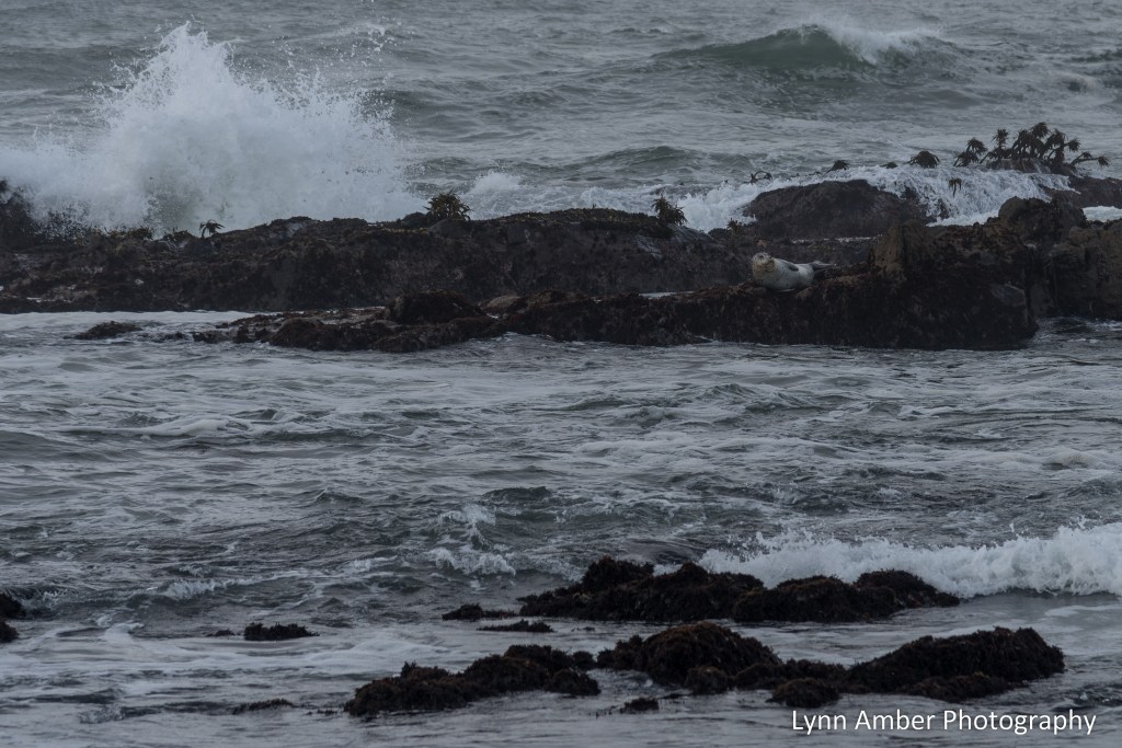
The rocky coast was teeming with aquatic wildlife. We watched some oystercatchers wading along the shoreline and on the rocks busy looking for food. We also caught a glimpse of some seals – one of which was enjoying a perch on a rocky shelf just off the coast.


Le Puy Camino – via Podiensis: Limogne-en-Quercy to Bach

April 20, 2024
Before departing Limogne-en-Quercy, we stopped by a local grocery to pick up some snacks. This was the first “supermarket” we had encountered on our journey since leaving Le Puy-en-Velay. I had gotten used to – and loved! – the quaint “épiceries” that inhabited the many small villages we passed through. It felt rather bewildering to be wandering around a store that was so reminiscent of our way of shopping in the United States. I found that I really did enjoy the comfort and ease of shopping in small local groceries where my only concern was the food needs for that day.
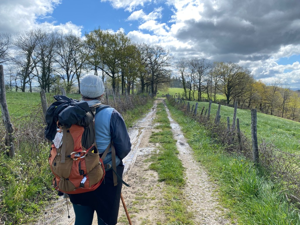
It would be a 14.7 kilometers to the hamlet of Bach where we would be spending the night. Susan and I walked together today which was a nice change of pace. And, the weather was gorgeous!!
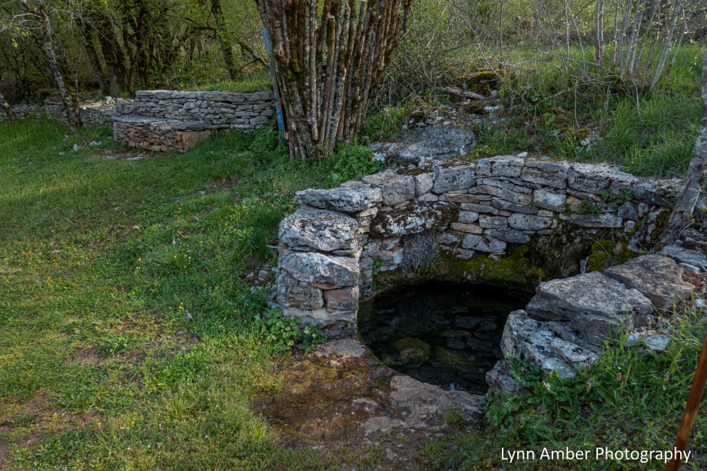
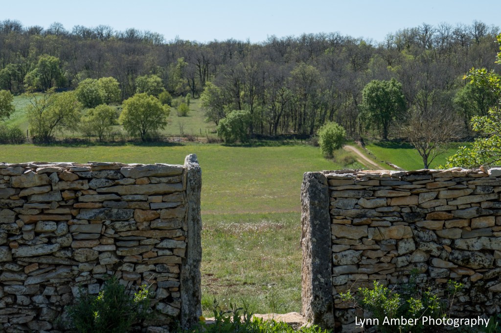
The walk today was characterized again by stone walls lining the path and some interesting sites along the “way.” Four kilometers into our hike, we passed by a spot with a “watering hole” called Lac et puits de Ju.

An interpretive sign at the site indicates that it has been a resting place for pilgrims and watering hole for animals for many years. The sign asks that all passing by “respect this place and its environment.” It also records many of the bird species that have been observed here.

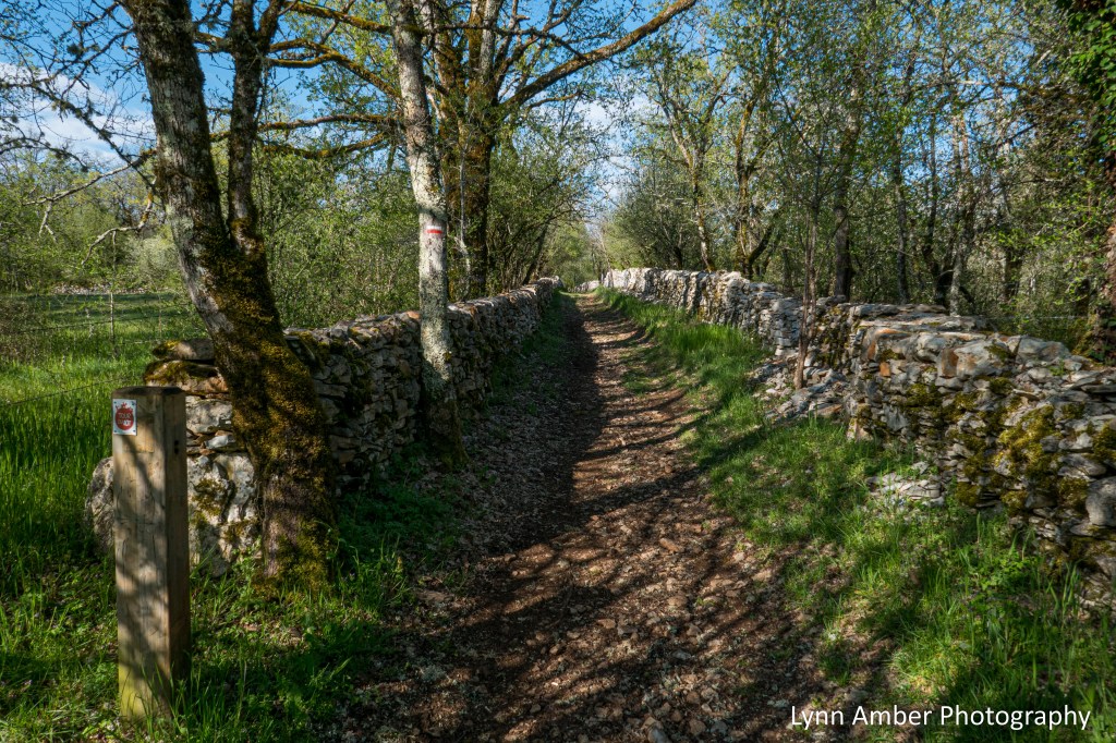
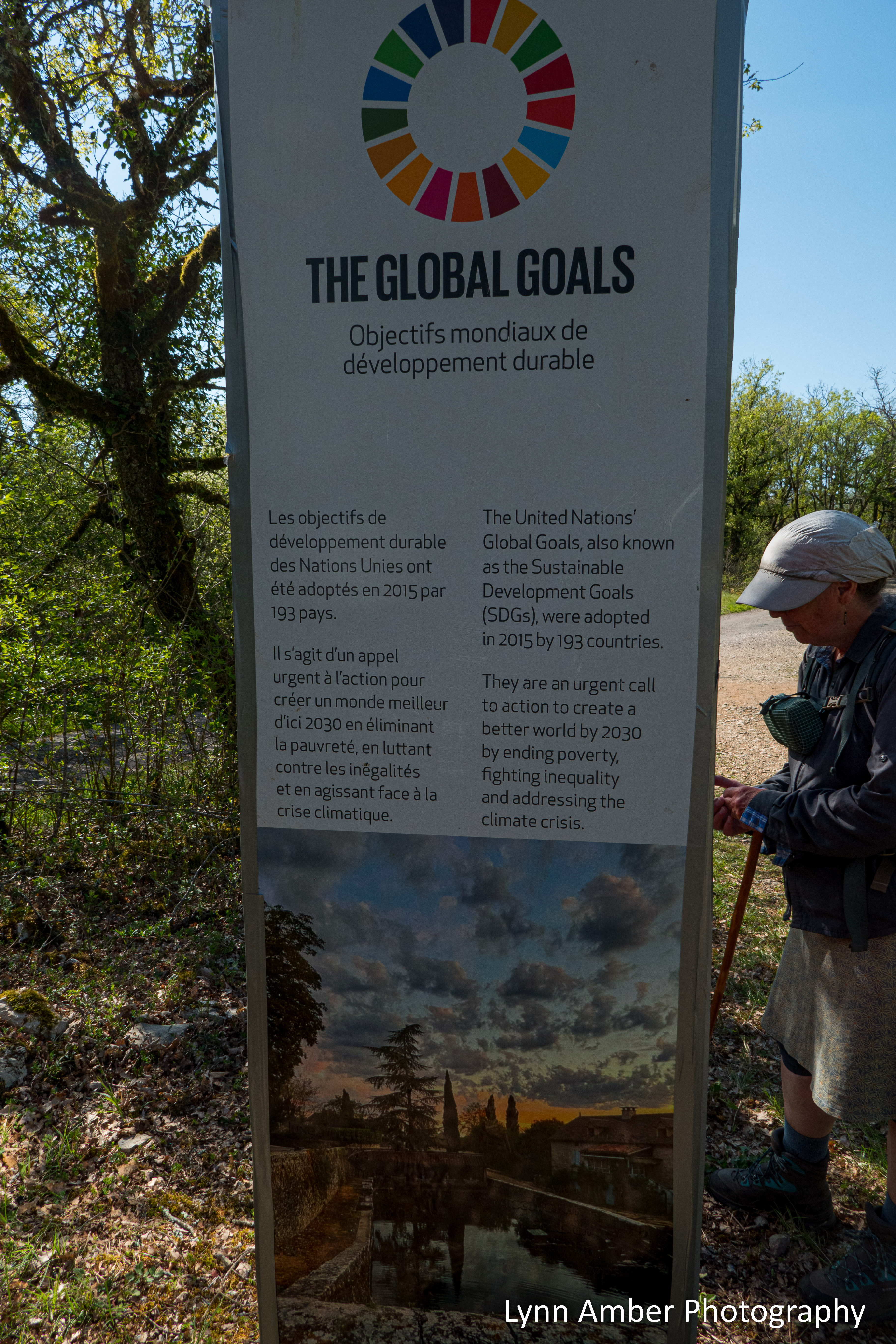
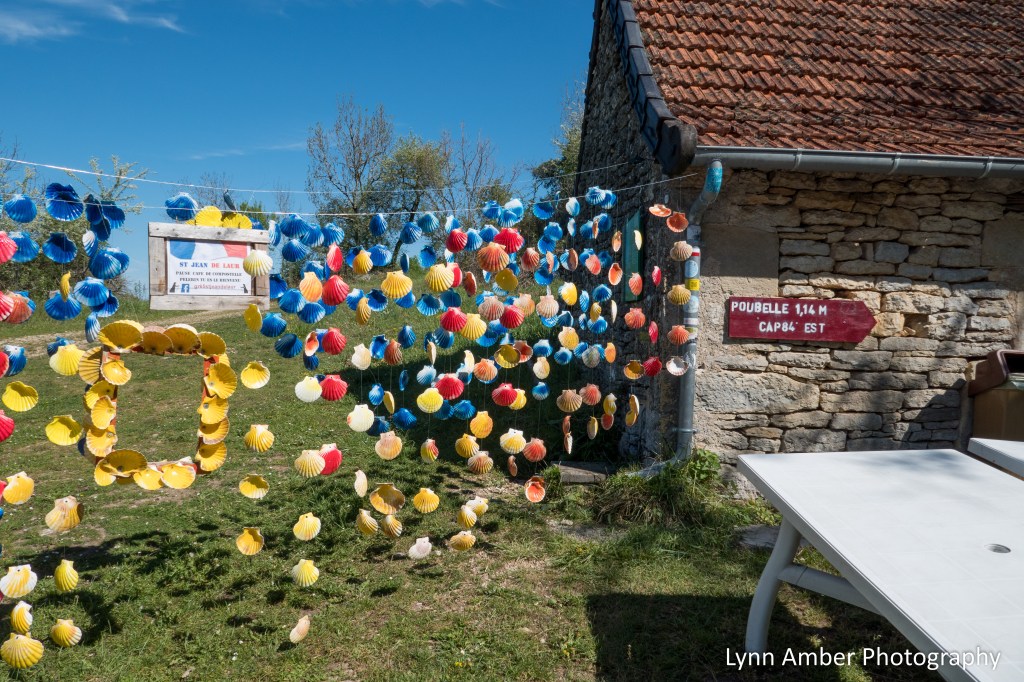
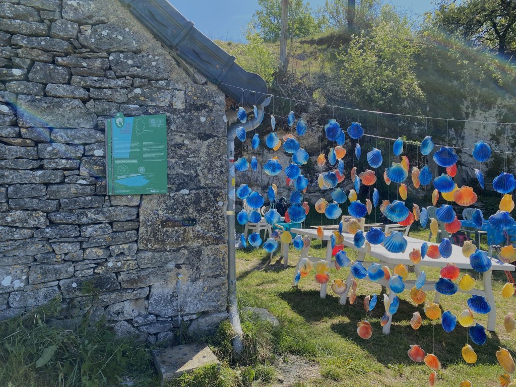
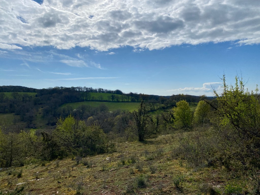
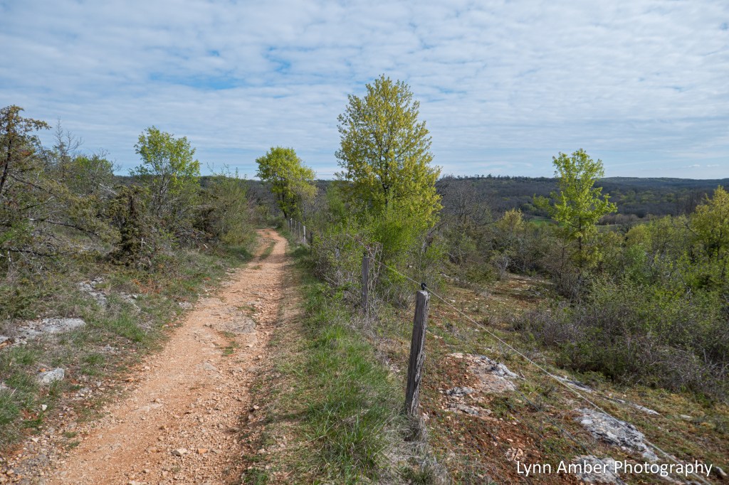
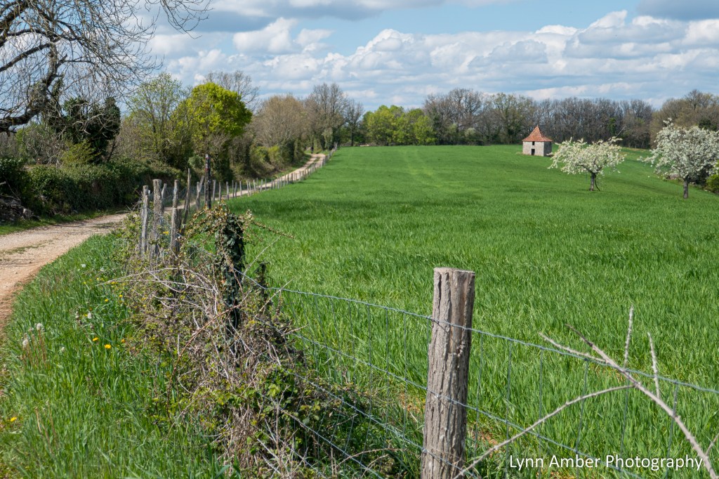
Much of the walk consisted of terrain like the photograph below. It was along this path and, before reaching the village of Varaire, that we encountered an noble global awareness campaign.
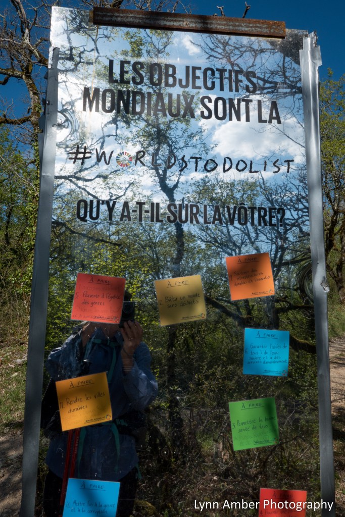
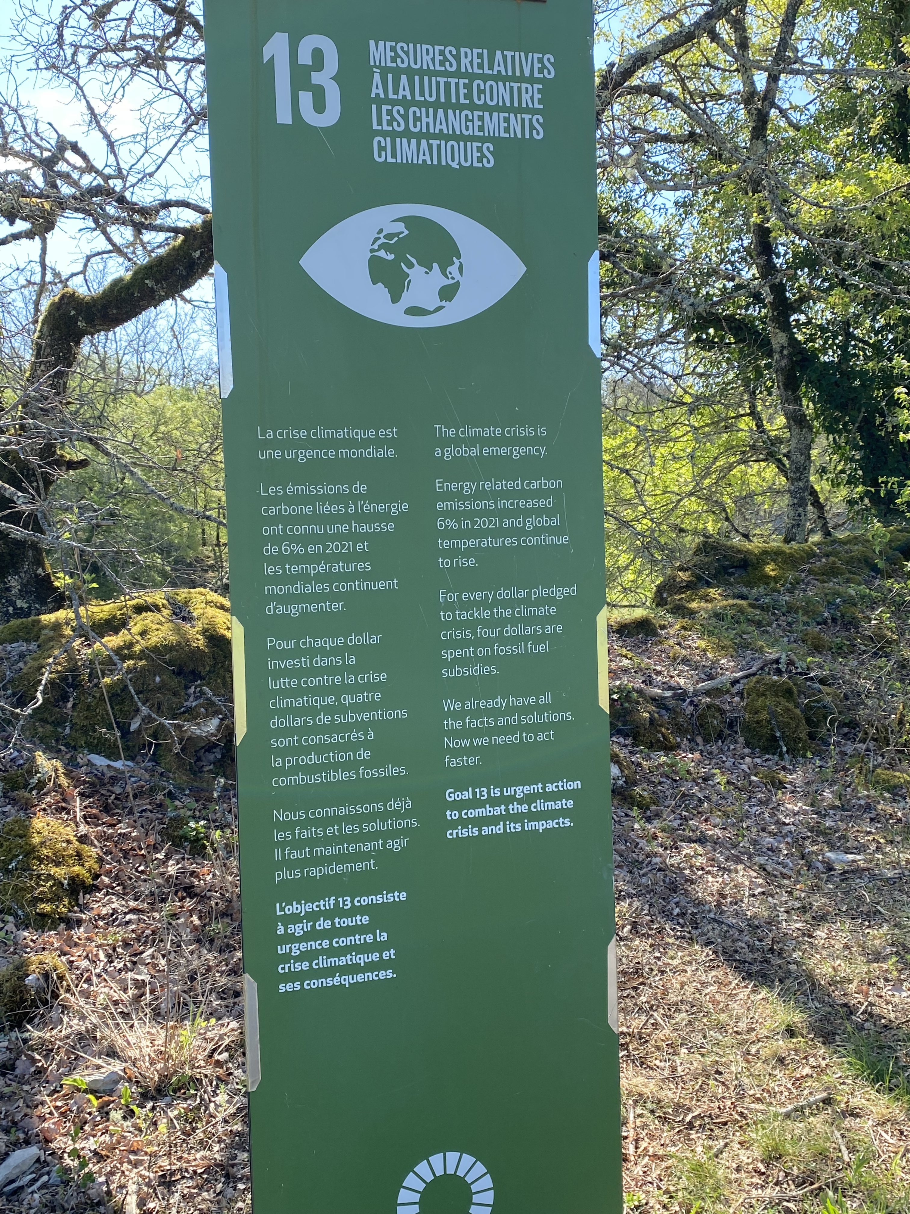
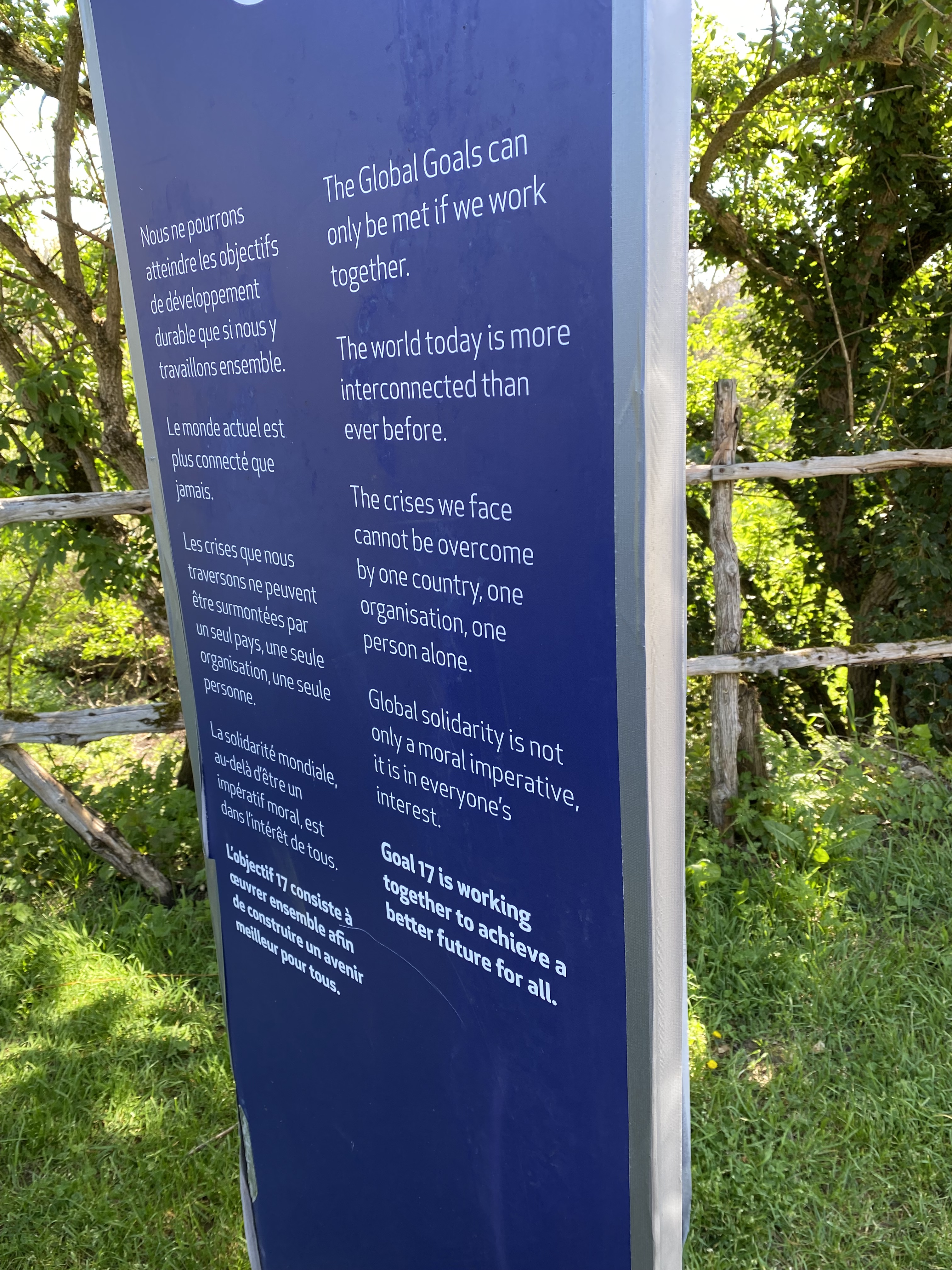
The interpretive displays we happened upon are part of the United Nations Global Goals initiative. The small town of Varaire was selected as a host for this exhibition in October 2022. The 17 “totems” that represented the 17 sustainable development goals were in place by mid-December. The totems are located on the GR65 coming into town and throughout the village. There’s an informative website that describes how the citizens of Varaire have strived to live these principles in their everyday life. To learn more about the UN Sustainable Development Goals please visit this website. The 17 goals are a call to action for all countries to work together to achieve a sustainable future for the inhabitants of the planet we call Earth.
I cannot stress enough my belief that we are a global community where isolationism and nationalism have no place. We cannot live in isolation. What we do impacts everyone globally and vice versa. Seeing this exhibition was one of the highlights of my “camino” adventure.
The first panel below introduces the concept of global goals and invites people to share what would be their to-do list. It was rewarding to read the responses and also challenging to convert to English!!

Each numbered panel represents one of the 17 goals. I was grateful that these were presented in both French and English!


When I was reviewing all the photographs I took of these signs, I realized that I had taken a pretty cool self-portrait!

We started coming upon some scattered buildings as we approached Varaire. The countryside was just beautiful!


We entered the center of the village and found a sweet cafe to enjoy a hot drink and our lunch.


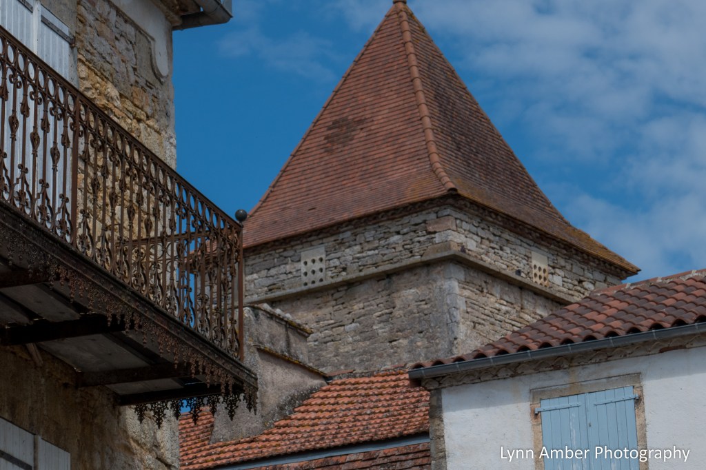
A few scenes around town…

We popped into the local church – Église Saint Barthélemy – before leaving town and getting back on the GR65.

The rest of the day was uneventful – we walked and we rested – and simply enjoyed the peace of the day.

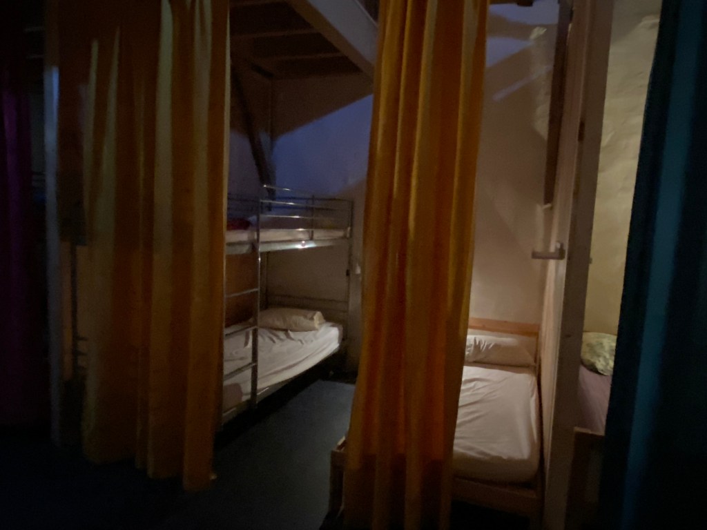
Our biggest surprise of the day happened upon our arrival in the village of Bach – our destination for the day. We found the lodging where we had made a reservation only to be informed by the hostess that someone in the household had come down with Covid and so we could not stay there! Thankfully, she had prepared for this and arranged for us to stay in another gîte in town.
We were grateful that she had set this up for us. But, the gîte was just okay – mediocre food and uncomfortable beds. I will say that the hosts were very welcoming and entertaining at dinner. And, the fee was by donation only so it did not cost us very much. I will not divulge the name of the accommodation out of respect for our hosts. But, the next day I woke with a tremendous stomach ache which persisted for the entire day.
The good news is that we were not walking that day. We could not secure any accommodations between here and the city of Cahors so we opted to take a break from the “way” and get a taxi ride to Cahors. The bad news is that the taxi ride was a very rough one on winding, narrow roads and I had to endure this with an extremely sensitive stomach!
Cahors is considered the half-way point between Le Puy-en-Velay and Saint-Jean-Pied-de-Port – a real milestone! More to come on our stay in this more urban environment.

Le Puy Camino – via Podiensis: Cajarc to Limogne-en-Quercy

April 19, 2023
Today was a picture perfect blue-sky day!! I started off the day walking for a short while along the Lot River. The walk from Cajarc to Limogne en Quercy alternates between lightly traveled paved backroads and dirt paths. It passes through woodlands and fields and covers close to 19 kilometers. That’s a hefty distance!
Shortly after leaving Cajarc, I noticed a town sitting way up high above the Lot. Then, I eventually realized that the GR65 ultimately meandered right through the center of this walled village of Gaillac.

The architecture in Gaillac is like other towns along this section of the Way. Buildings are made of stone or stucco, topped with red clay tiles.


I left the village of Gaillac. It would be 6 kilometers of countryside before I would reach another small town – Saint-Jean-de-Laur. I would walk through young forests and open country with extensive views.


Just on the outskirts of Saint-Jean-de-Laur, there was the most amazing pilgrim rest stop!! During the high season, it also has a snack bar. There were a few local folks at the rest area cleaning up and getting ready for its official seasonal opening. I was invited to take off my pack and rest a spell. The volunteers who were cleaning up were so very friendly!
I sat and ate a snack. The locals asked me where I was from. When they heard I was from the United States, one of the gentlemen went into the shelter. He brought out an old-timey speaker and set it on the table. I was curious what he was up to! He went back in the shelter and fiddled with something. All of a sudden, The Star-spangled Banner began blasting from the speaker. I was so touched!! Made my day!!
I noticed a plaque on the side of the building. It was a “pilgrim” adaption of a Pablo Neruda poem. I made an effort to translate the passage relying heavily on Google Translate. Noble words to live by…

“He dies slowly, he who becomes a slave to
habit, retracing the same path every day,
he who never changes his landmarks, nor the color of his clothes or who
never speaks to a stranger. He dies
slowly who does not change course,
who does not take risks to realize his dreams…….
Live now, risk today
Act now.
Don’t let yourself die now.
Don’t deprive yourself of being happy.
So Pilgrims, go ahead, set out on the Path and do not
deprive yourselves of being happy because your steps
will be your words, the path your song,
fatigue your prayer.
And then the silence will speak to you.”
Pablo Neruda

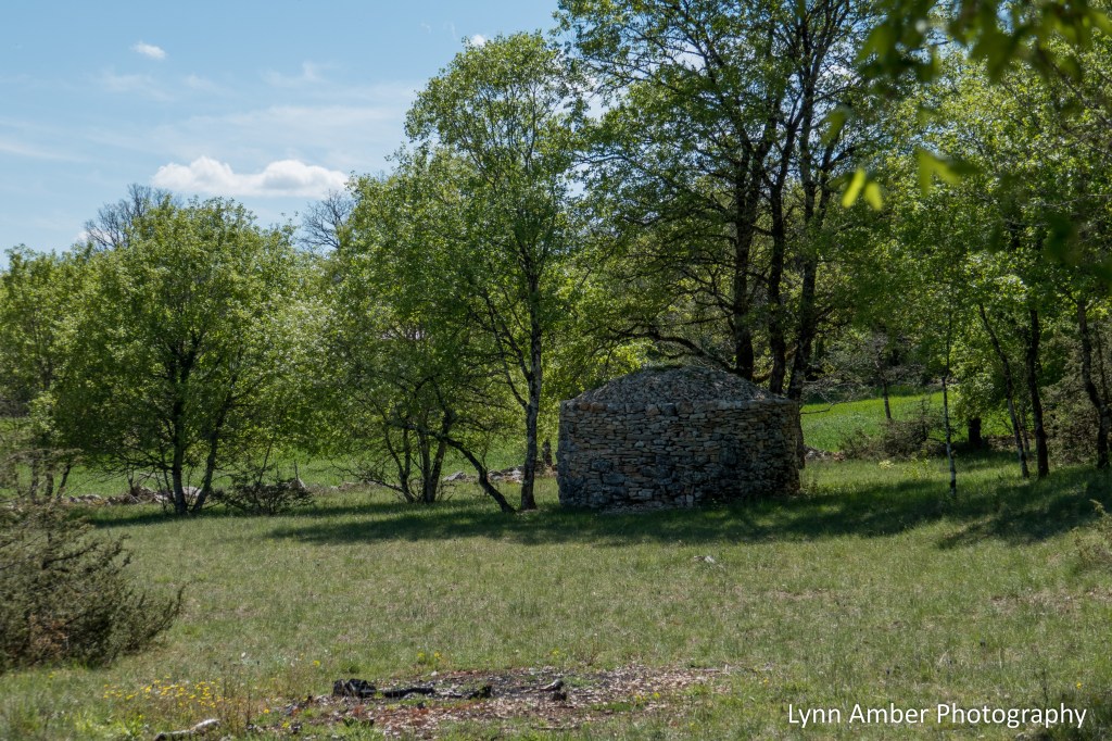
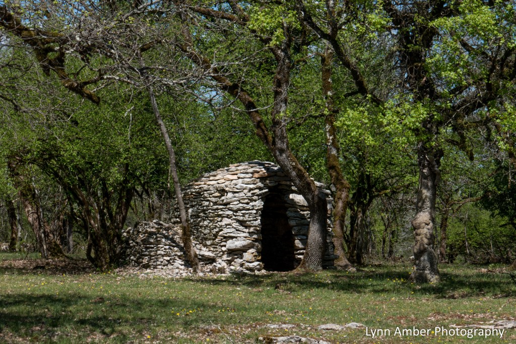
The walk today featured old stone walls. There was evidence of the past lifestyle of the region, seen in the form of cabanes.


The park was clearly behind the rebuilding of some of the stone walls along the trail. I was intrigued by the pattern used here where the stones are placed vertically on the top of the wall.

As I grew closer to Limogne-en-Quercy, I stopped. I needed to plug in the address for the gîte – Les Gîtes de Lescurou. It was a bit off the GR65. I had to pass through the village. Then I took a right on a side street. After that, I walked through a neighborhood on the outskirts of town. The gîte was located on a gated property. It was a small structure. The structure was converted into 2 apartments. These apartments were separate from the main house. At 44 euros inclusive of dinner and breakfast, it was a steal. We even had the luxury of a washing machine!! Our host – Charlotte – had a unique way of serving the meals. She prepared the meals ahead of time. Then, she placed them in cartons for us to heat up in the little kitchen in the apartment.

It is always nice to arrive at my new destination and find such beautiful accommodations!! It was a relaxing and peaceful evening here.
Le Puy Camino – via Podiensis: Béduer to Cajarc
April 18, 2023
Before departing Béduer today, our host kindly showed us an alternate path that would be a short-cut back to the GR65 heading towards Cajarc. This meant we would not have to back-track and would save us a few “steps.” Our walk today will approach 19 kilometers – so a bit further than the last two days. After leaving Béduer, we quickly entered open territory with the trail meandering along mildly rolling hills and occasional homesteads.
It was along this stretch of the “way” that we encountered our first “cabanes.” Most of these stone huts date to the 17th century and I read that some of the oldest preserved huts were built during the reign of Louis XIV. The cabanes were used as temporary shelters where they were built away from homesteads and out in agricultural grazing areas. Depending on the region and need, these shelters had many functions – serving as animal shelters, tool storage, human habitation and at times places to store food.
Typical cabanes used native stone from fields that had been cleared for agricultural uaw – both for the side walls and the roof.


We passed by some very cool homesteads that all had a similar architecture of the region – stone and clay tiles.

I was thrilled to discover some early spring blooming flowers as we walked and identified a native orchid called Early Purple Orchid – Orchis mascula. My plant finder app clearly shows this orchid to have a native range in this region of France but it is also common throughout Europe.

Much of the landscape today was open with little shade so I much appreciated it when I got to a spot where there was some tree cover!

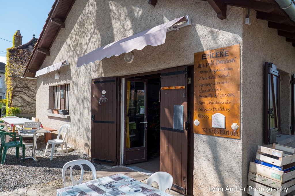
There is one small village along the route between Béduer and Cajarc and it boasted the presence of a great little market called the Epicerie Au Petit Bonheur. The town of Gréalou is where I planned to take my lunch break. The architecture of the village buildings conveyed a feeling of a different era – long passed. When I arrived in the village I was happy to see that there were picnic tables outside the market – perfect!! I took a long break here and even removed my boots and socks so my feet could get a little air and sunshine!
Directly across from the market was the Église Notre Dame de l’Assomption. I read that this church dates to the 12th century with a few older sections remaining from that time period. The church is framed by some large sycamore trees – one of my favorite trees!

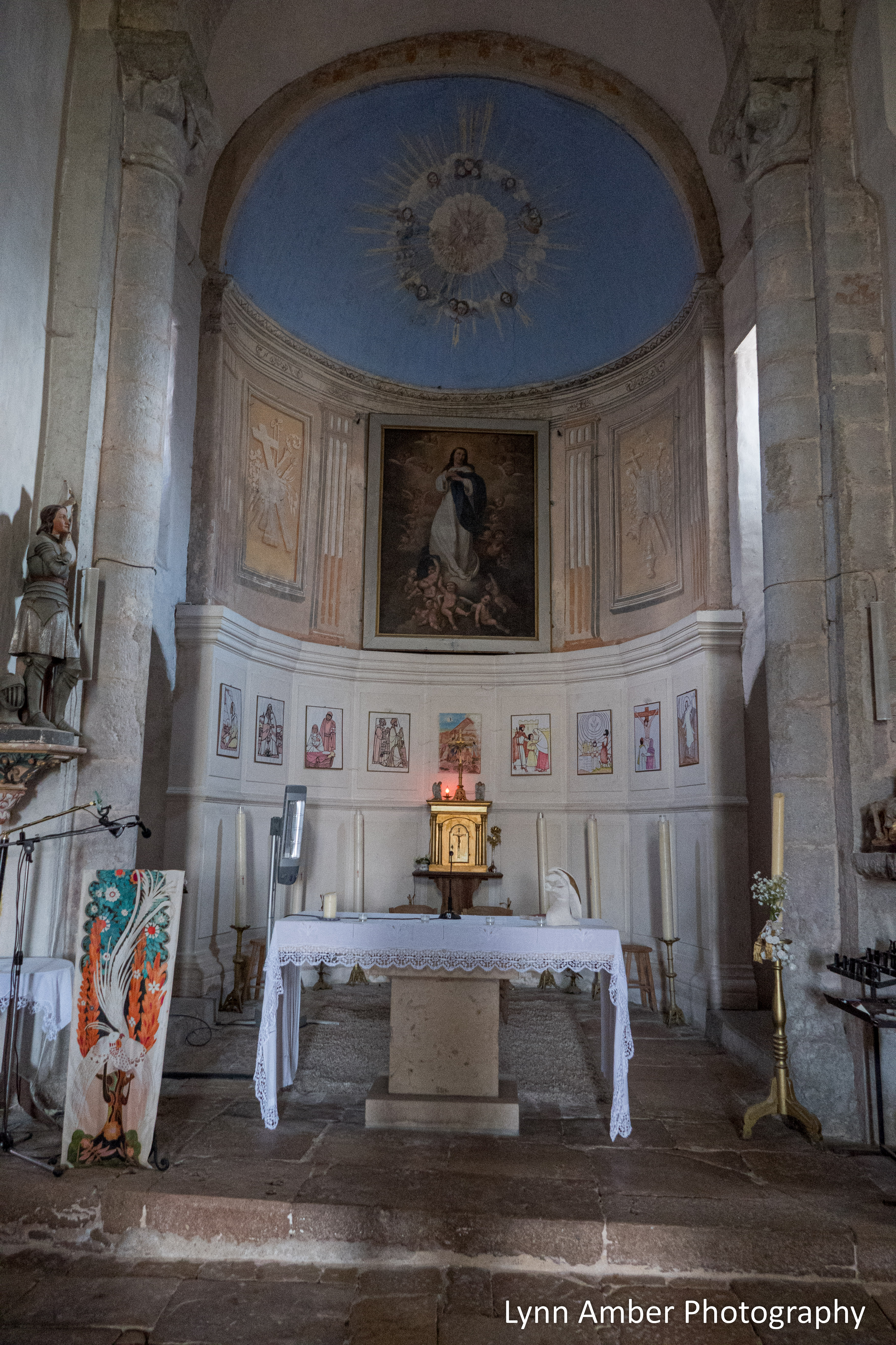


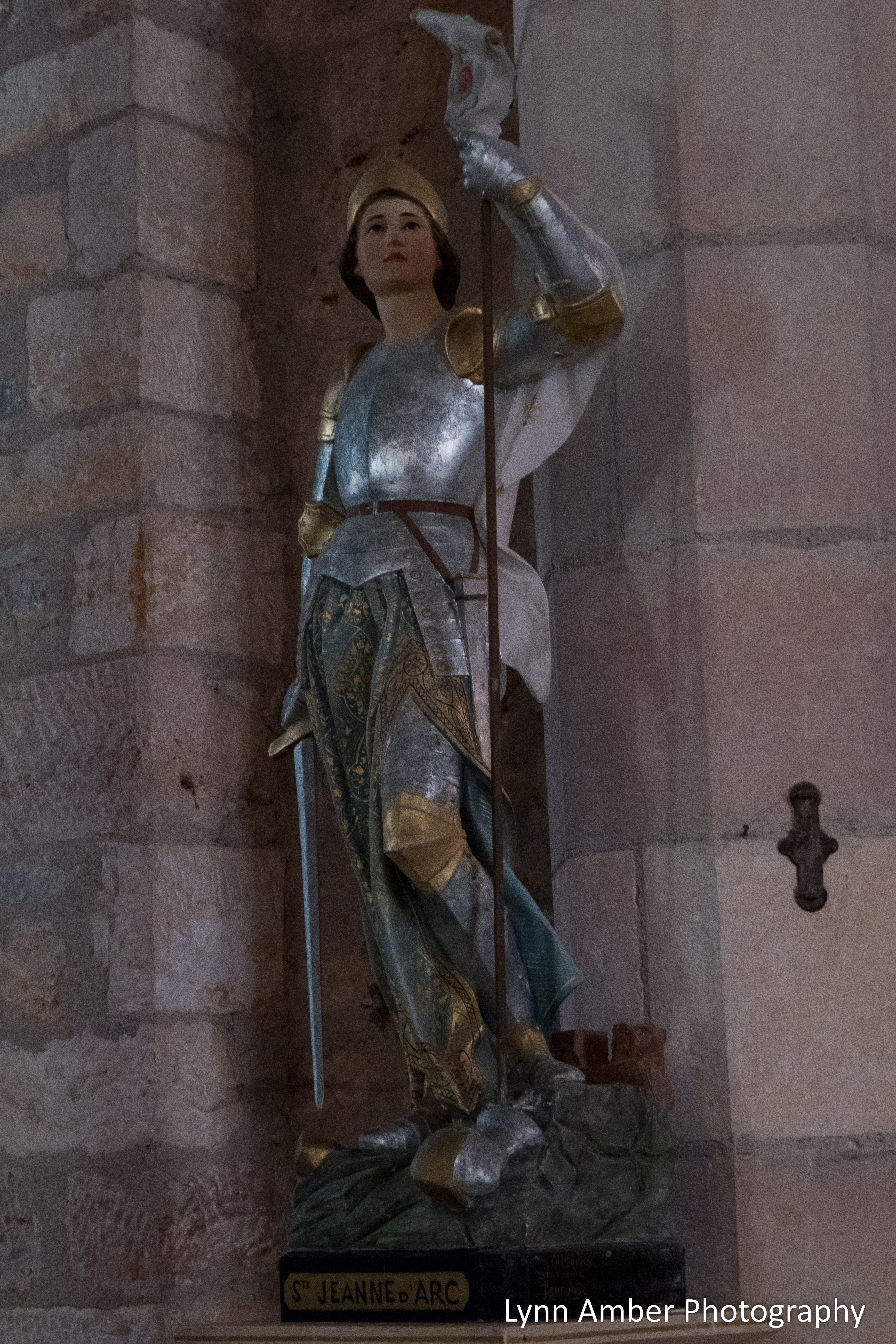
Some interior photographs – I believe the statue of the lady to be Joan of Arc.
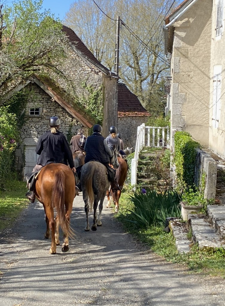
On my way out of town, I was overtaken by some folks on horseback – hey, can I have a ride?!!
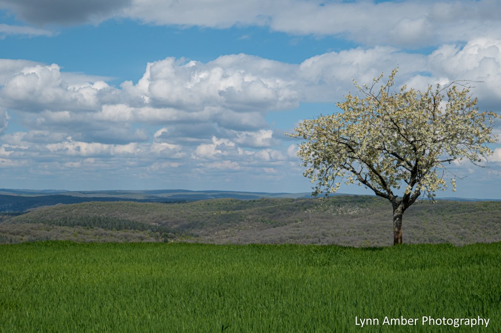
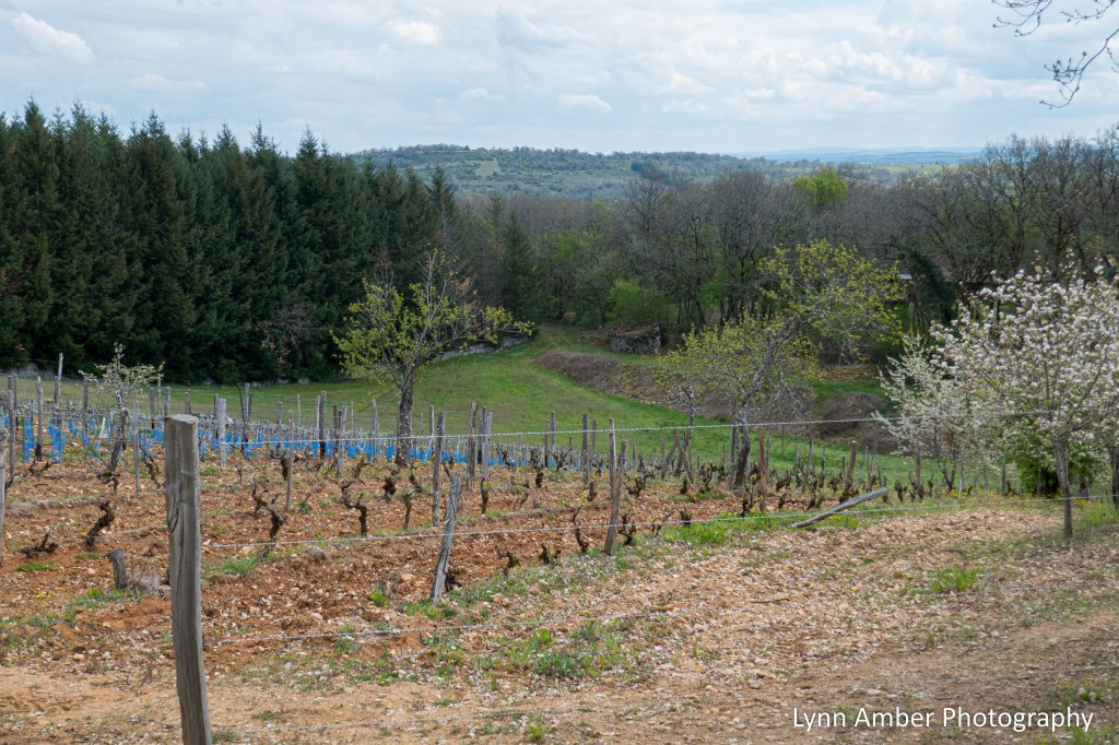
After leaving town, the landscape opened up with vast fields of green and more interesting archeological structures.
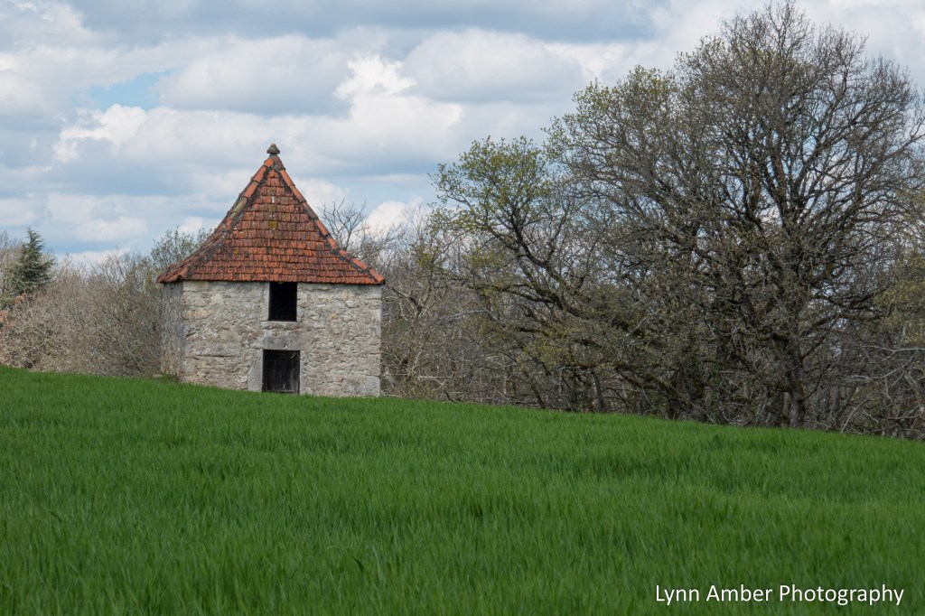
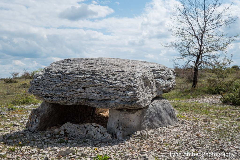
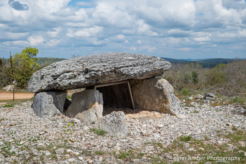
Between Figeac and Cahors, there is a unique parc régional that was established in 1999 and recognized in 2017 as a UNESCO Global Geopark – the Parc naturel Régional des Causses du Quercy. Shortly after passing the structure above, I came upon the sign describing this preserved land.

The sign explains one of the unique features of this park – the dolmens – stone burial tombs that are dated to 3500 years ago and represent some of the earliest preserved structures built by humans in the area. The sign indicates that – to date -over 600 dolmen have been inventoried in the Lot department. The writing says “the Lot department is one of the richest in France in megalithic tombs.” Wow!!
I came across one of the ancient tombs that sits right along the Camino. I believe this is the Dolmen du Pech Laglaire 2 – and a UNESCO site. Visit the following website for more details about this special place and the communities in the region that support it.
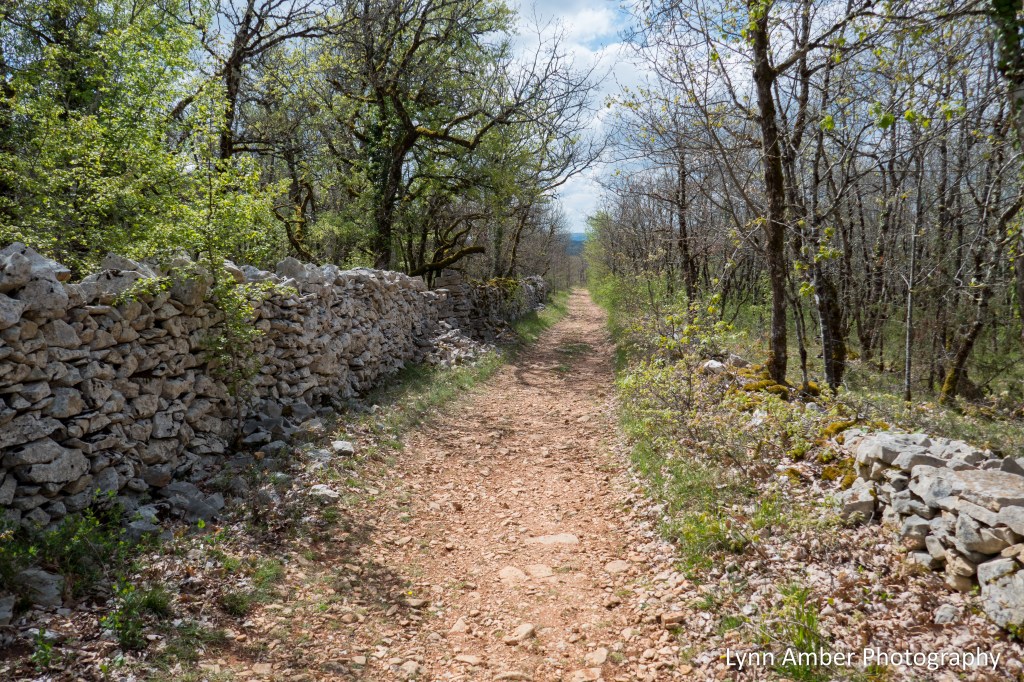
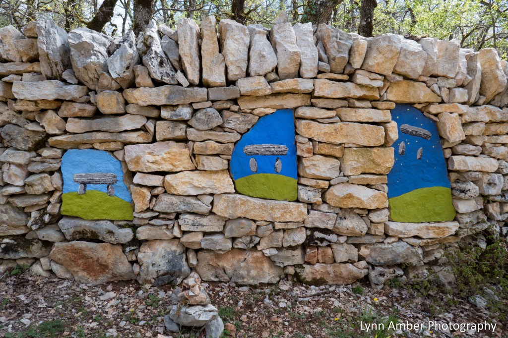
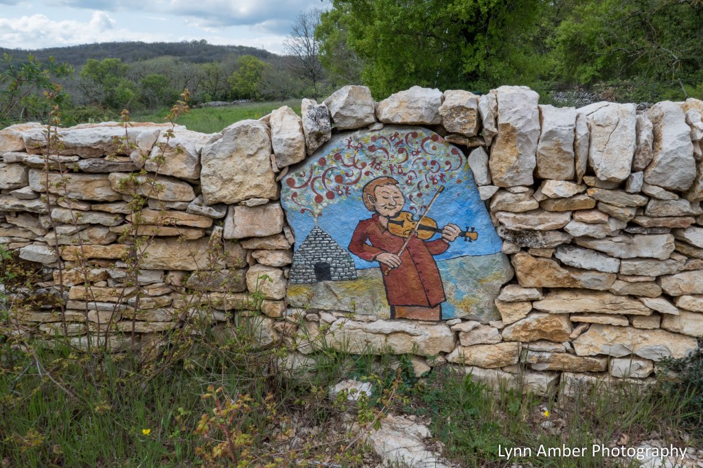
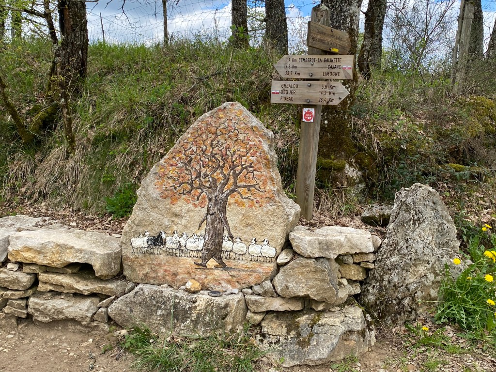
After passing by the ancient tomb above, the path follows a long stone wall. At various places along the wall, there is some colorful artwork! I loved walking this section of the Way.
Because the walk today was about 19 kilometers, I stopped occasionally to remove my boots and socks and dry out them as well as my feet. Plus, it was nice to just get the pack off my back for a spell!

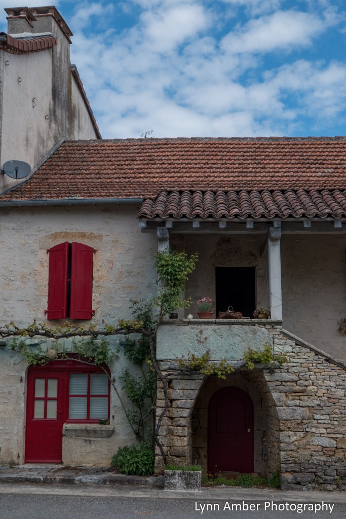
As I walk, my eye is always drawn to unique features such as fences, shutters, cool buildings, etc. I thought this was a quirky but effective privacy fence!


The descent into Cajarc was steep and before heading down the hill I was able to get a glimpse of the town from above.


Our lodging for the night in Cajarc was at a “hotel” – Hôtel-Restaurant La Peyrade. It sat on the edge of town at the base of a steep hillside and I would compare this accommodation to a “motel” in the United States. We paid 70 euros for our room and meals. It was certainly adequate and the room was clean and spacious. Each room had its own “balcony” where we had access to a clothes rack for drying our hand washed items after a day of hiking. I arrived at the hotel and checked in and had plenty of free time to wander around town.
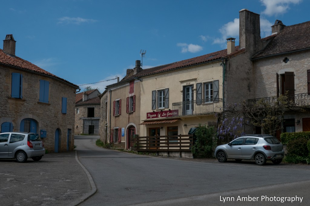
I have to admit I was quite smitten with Cajarc. The downtown area was lively with lots of shops and cafes. It felt like a vibrant community. The buildings and narrow streets reminded me just how old these villages are that we pass through!


As dusk started to fall, the streets had minimal lighting and it gave off an interesting effect.

It was a pleasant evening, a good meal and a good night’s sleep. My walking partner decided to take a rest the next day, sightsee around Cajarc and take a taxi to the next destination. I would meet her there later in the day. I started off early in the morning for it was another lengthy walk – 18.5 kilometers to Limogne en Quercy.
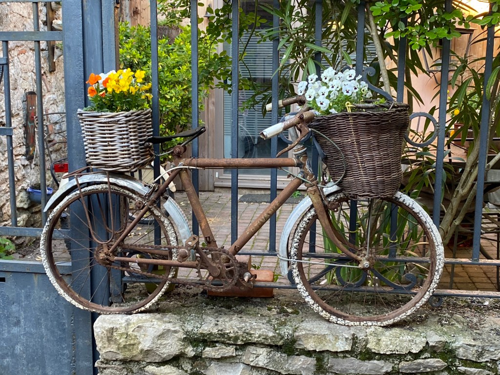
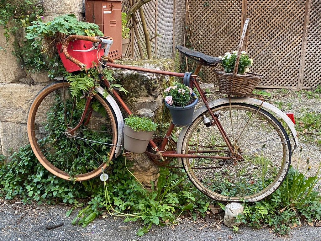
As I was weaving my way through town on the GR65, I passed down a narrow street with all of these old bikes decorated as garden ornaments. What a great way to start my day!!

Heading out of town along the river…
Le Puy Camino – via Podiensis: Figeac to Béduer

April 17, 2023
Today, our walk between Figeac and Béduer would be a short walk – only 12 kilometers or close to 7.5 miles. The weather is clear and sunny. It’s interesting to note there is a popular alternate route that leaves Figeac called the Rocamadour variant. It detours through the Célé Valley and rejoins the GR65 in Cahors. The village of Rocamadour is situated on a cliff and was a very significant stop for the ancient pilgrims. It is apparently a beautiful route and perhaps one day I will walk this section.
We stayed on our original course and followed the GR65 out of town. The path climbs steeply out of Figeac before leveling off and traversing the countryside. From Figeac to Béduer, there is but one small town that we pass through and we were warned that there probably would be no place to find food along this section. So, we both packed a picnic lunch!
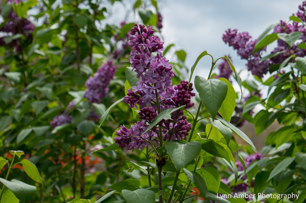
Spring is definitely settling in and the signs are everywhere – spring bulbs and spring flowering shrubs and trees are a welcome site.


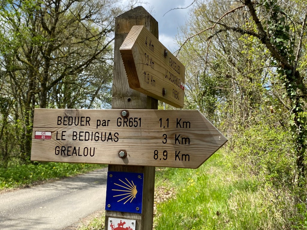
About 7.5 kilometers into the walk today, I reached the small village of Faycelles. What a totally sweet place!! It was here that the GR65 made a right hand turn onto the Rue de la Forge. What a pleasant surprise! It is a cobblestone “alley” that climbs up to the main part of the village.


I found a great spot to enjoy my picnic lunch on this narrow pedestrian street. My view took in the countryside below and the town buildings above. And – I was thrilled to be resting nearby one of my all-time favorite trees – a redbud in bloom!! The gardens and ancient buildings along this stretch of the path just took my breath away. I have a vivid memory of sitting on this bench in the warm sunshine basking in the beauty that surrounds me. I can still imagine the fragrance of the blossoming plants, the feel of the cobblestones under my feet and the taste of the refreshing orange I ate while resting on the bench.

After lunch, I continued up the path into the village proper.

Since it was a short walk today I popped into the Eglise Notre-Dame de Nativité in Faycelles. Interesting interior…


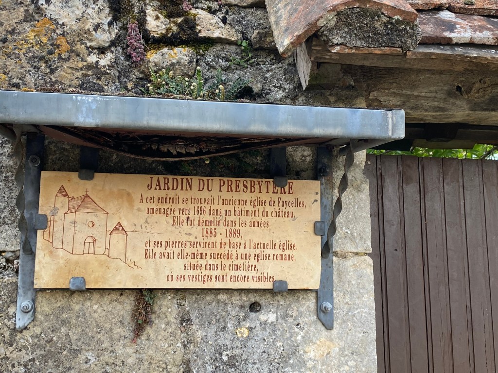
I left the church and headed out of town. On the edge of town, I came across an ancient tower. The sign on the tower suggests that it was a watchtower and it was restored in 2001.

As I was admiring the tower, I noticed a walled garden to my left. The sign on the wall said that it was the site of the original ancient church in Faycelles built in 1696 and later demolished in the late 1800’s. The stones of the old church were used in the foundation of the existing village church. The gate into the garden was locked. Too bad I could not see what was on the other side!
Once I passed by the edge of town, the landscape quickly turned back into rolling, green hills with the occasional homestead or, in the case below, an abandoned set of buildings.

After leaving Faycelles, I had about 5 kilometers to go before reaching my destination – the Chambre d’hôtes La Coquille in Béduer.
Planning Tip: I may have already mentioned this but I thought it worth noting again. I secured our accommodations about 3 or 4 days in advance. My preferred method of making a reservation was via email. Email addresses were included in the Miam Miam Dodo guide book. I could use Google Translate to compose my email in French and it also gave me a written acknowledgment in case there were any issues once we arrived. It worked really well most of the time and, even though my email was in French, the hosts could always tell that we were American by the phone number and the quirky way the French language sometimes came across in Google Translate! Many times the hosts would respond to me in English – if they could. I actually preferred they respond in French so that my language skills would improve!
There were a couple of critical turns that I had to make in order to reach Béduer since the town does not sit directly on the GR65. As I drew near to Béduer I kept a watchful eye out for signage. The first sign directed me to turn right to stay on the GR65.
The second sign indicated my detour onto the road D21 and towards the GR651 – a variant that travels through the Célé Valley and connects to the Rocamadour variant.
A short walk after making this turn and I came to a crossroads with a little picnic area that looked to be new construction. I noticed that right across the street from the picnic area was the Chambre d’hôtes La Coquille – our lodging for the night.
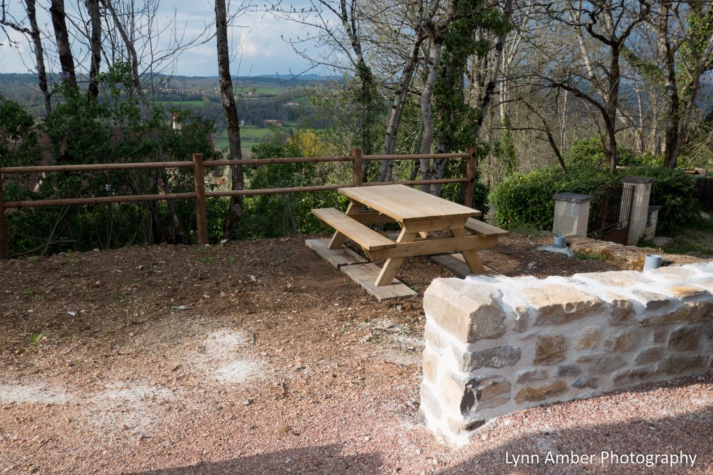
Since I had arrived well before check-in time, I hung out in the picnic area for awhile and also emailed our hosts to ask when I might be able to check-in. While I waited, a man pulled up in a car and checked out the picnic area. I got the impression he had something to do with the work being done. At one point, he went to his car and brought back a bag. He was excited to show me what he had collected – mushrooms!! I’m not sure what kind they were but apparently he had just foraged for them and was proud of his accomplishment.
Eventually, I heard back from our host and she let me know that our lodging door was unlocked and I could go ahead and settle in. We were to use the ground floor apartment in the cute cottage behind the main house.

One of the things I most loved about this journey was our lodging and, often times, being surprised by the quality and attention to detail that our hosts exhibited. We paid 55 euros each for this beautiful apartment complete with a kitchen and dining area. This price included dinner and breakfast. What a deal!

I settled into our spot and proceeded to hand wash some clothes and take a shower. We had some time before the evening meal and took a walk to explore the “Château de Béduer” next door. According to the website, this ancient compound has been around since the time of the Crusades. Most of the buildings that stand today date from the 13th century. Le Château and La Grange are both available for vacation rentals and special events today. Since it is privately owned and walled, we could not access the grounds or explore the Château. Bummer!! I encourage you to visit the link to the website above to get a sense of its glory today.


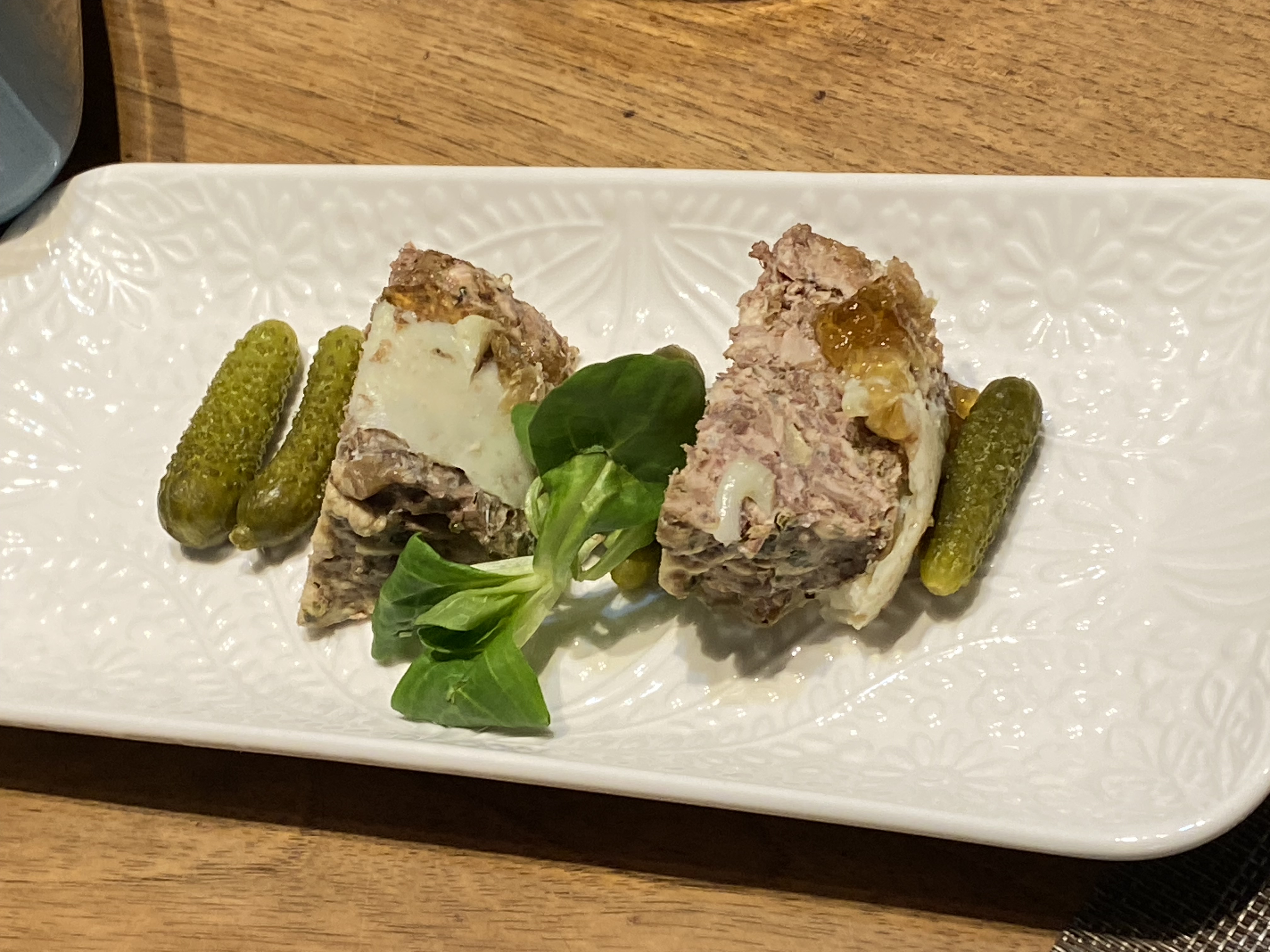
After wandering around, we headed back to our lodging in anticipation of a good meal! Our host brought our dinner over to us. She had prepared it in her home and it was delicious! It was a chicken dish, a pâté
of some sort?? and a nice big salad. Of course, a bottle of wine was also included! Excellent!


I can honestly say that walking every day for much of the day gives one an appetite and also makes one very thankful for a good, comfortable bed! I slept good most nights! 🙂
Tomorrow we would pay the price for a short walk today – it would be a 19 kilometer trek to the town of Cajarc. Until next time!
Le Puy Camino – via Podiensis: Le Terly to Figeac
April 16, 2023
Leaving Le Terly, it would be a shortish walk to our destination of Figeac – about 11 kilometers. Piece of cake!! The weather gods delivered us a nice day for our hike – sunny, blue skies!


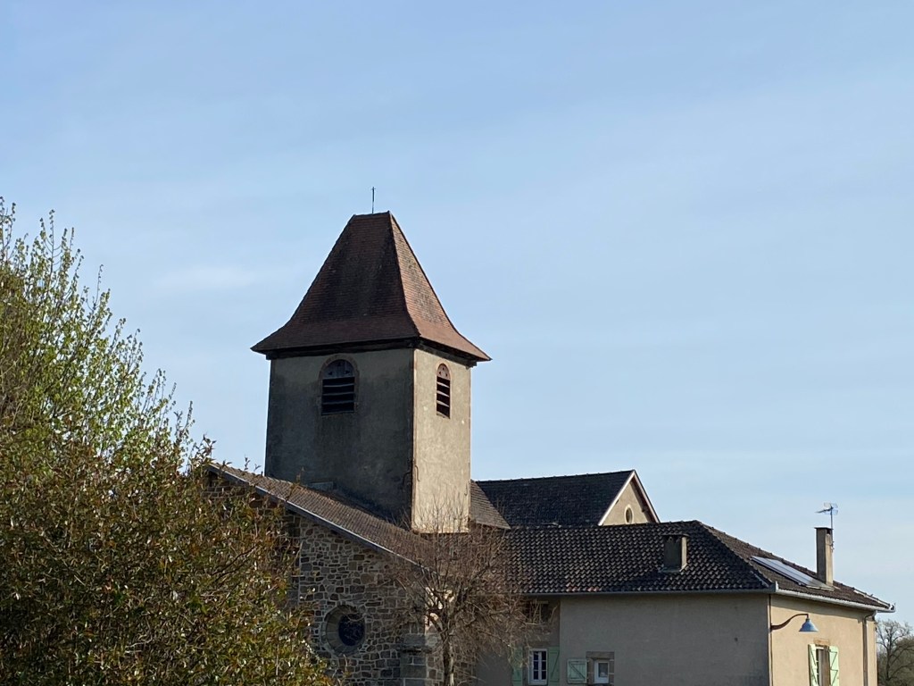
The first small hamlet we came to was about a 3km walk from Le Terly. In Saint-Félix, the main attraction is the Église Sainte Radegonde which dominated the landscape. Parts of the church date to the 11th century.


I include the above photograph because, throughout the Way, our feet were our focus. Adjusting the laces, removing our boots on occasion to air out our feet and dry our socks…never ending attention to the condition of our feet!
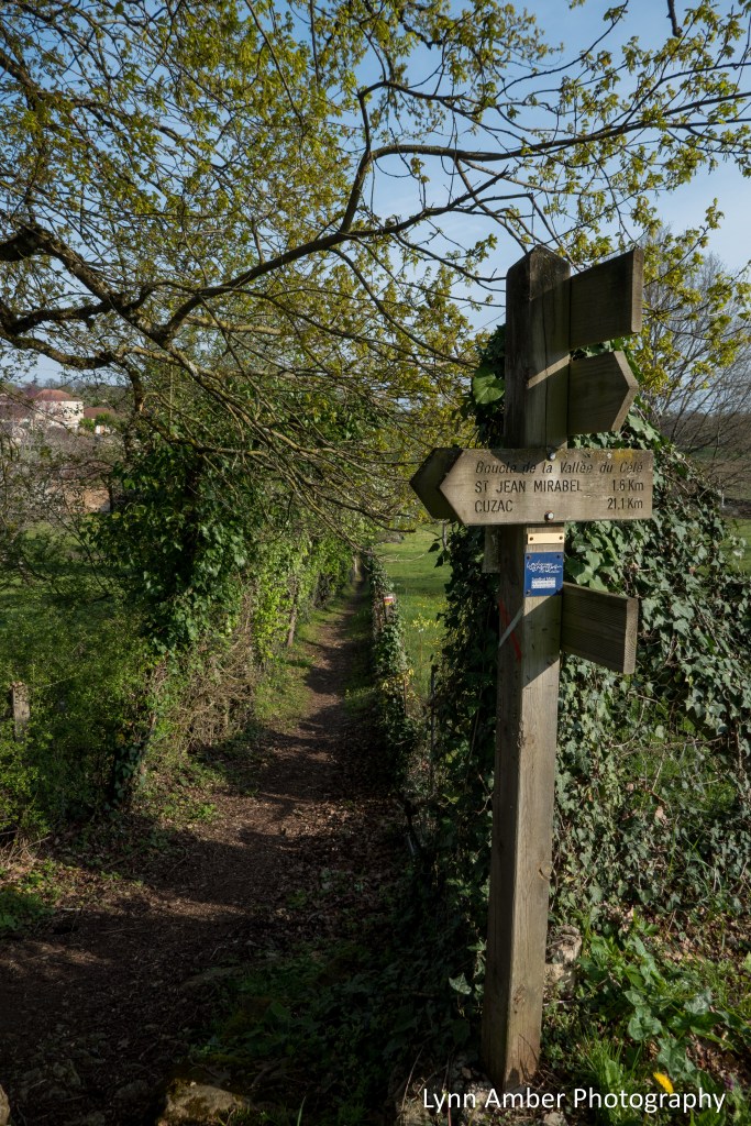
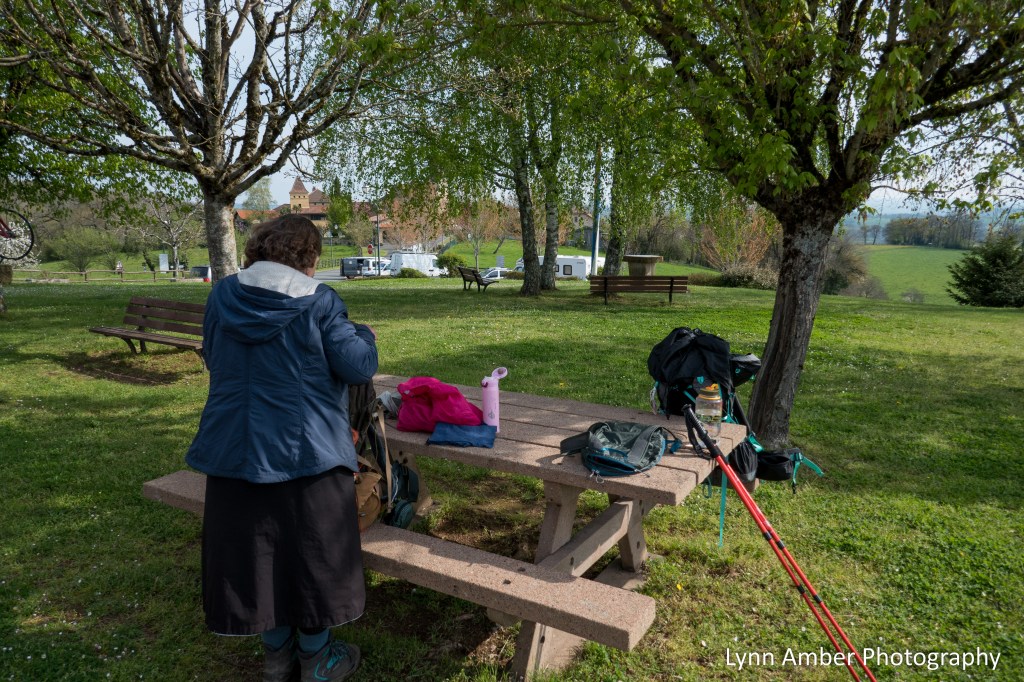
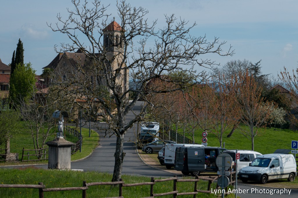
Saint-Jean-Mirabel was a short 1.8km from Saint-Félix and a walk through a landscape of rolling hills. The GR65 brought us into one section of the town near the Salle Communale and the office of the Mairie. It looked like there was an event going on in the Community Hall but we stopped there and used the restrooms and had our picnic lunch on the grounds.
There was another section of the town a little further from us up on the hill. It is where the Eglise Saint-Jean-Baptiste is located. We did not detour over there – although upon reflection, I wish we had.

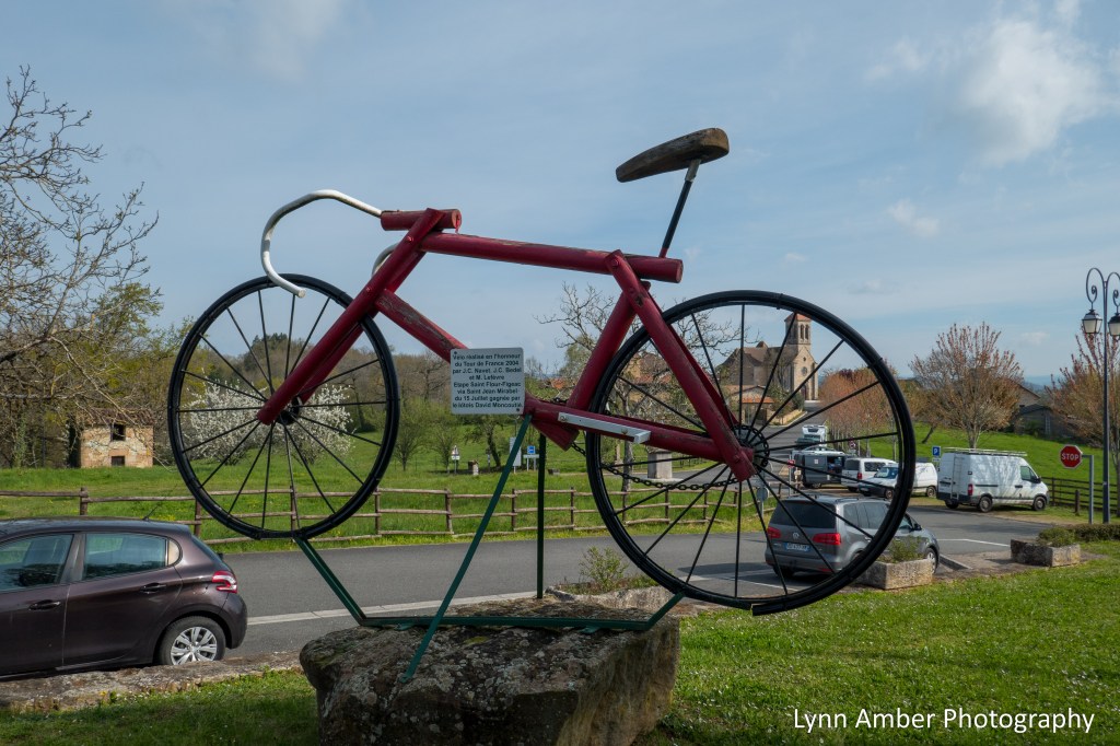
A couple of things are memorable about this day in this town. I noticed as we entered the village that there was an area for “free” RV parking. Cool!
The other highlight in the village was the sculpture outside the Community Hall commemorating the year the Tour de France passed through this village. The plaque roughly translates to “This bike was made in honor of the 2004 Tour de France by J.C. Navet, J.C. Bedel and M. Lefèvre – Saint Flour-Figeac stage via Saint Jean Mirabel on July 15 – won by David Moncoutié from Lot.”
On one of the buildings, there was an interesting poem written on a piece of stone. It was clearly intended for those hiking the Camino. It starts by saying: “Pilgrim, where are you going? Hiker, where are you going? Maybe you do not know who is guiding you on the path…” and goes on to recount the many regions and places you will encounter and the many landscape features that will be crossed. The last sentence – Tu n’oublieras plus le chemin – “You will never forget the way”. Reading this now after more than a year and a half since walking – I’m definitely getting a tad teary-eyed.

After our snack, we continued on our journey through more bucolic countryside! With less than 8 kilometers to go until reaching Figeac, we enjoyed the more leisurely walk.

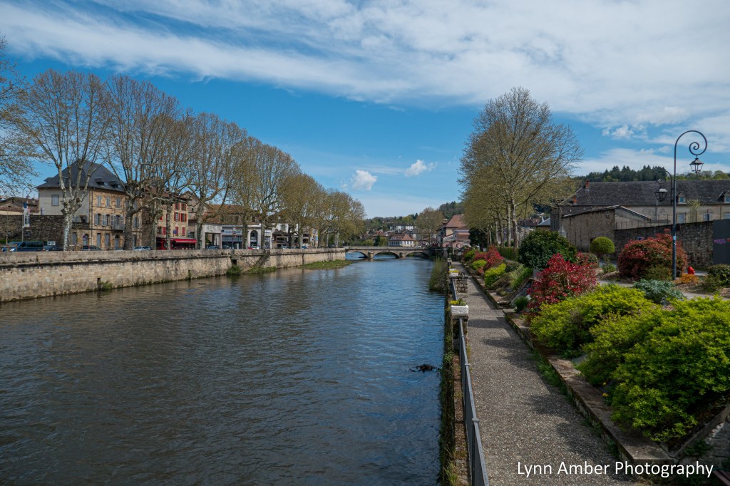
Figeac sits in the valley of the River Cèlè. It is a medieval town much like many of the towns we have traveled through on this journey. The river winds its way through the center of town.
Our destination was the Chambre d’hôtes Chemin des Anges. We shared a room this night with a father and daughter who were walking the Chemin. At 54.50 euros for the demi-pension, it was a good deal and our host was very friendly.

After dropping our bags at the accommodation, we headed into Figeac to explore. It was Sunday so stores were starting to close as is the custom in France. The architecture was amazing!


We were looking for a cafe for a snack and came across these two “best friends” – who we have seen along the way and shared accommodations. They invited us to join them at the Cafe & Hôtel Champollion. They spoke very little English but we still enjoyed their company. Sometimes words are not needed.

After our snack, we wandered around the village and peeked inside the Église Abbatiale Saint Sauveur à Figeac. In 843, an abbey was founded on the site of the current church by Benedictine monks. The church itself dates to the 12th century. It served as a major pilgrimage sanctuary during the Middle Ages until the Wars of Religion caused the town to be taken over by the Protestants. This is when parts of the church and abbey were destroyed. In later years, the church was rebuilt to its current structure.

We had a very special mission while in Figeac. The last time Susan, my walking partner, was here hiking the Camino she had wanted to find the Carmel monastery and church. She was not able to due to time constraints so we made it a priority on our visit to the city. Susan is a Secular Carmelite who, as a lay person in the Catholic Church, commits to following the teachings of the order. So, for her, it was a deeply spiritual endeavor to see this church. Select this link for an overview of the Federation of Carmelites in France. As it happens, the church was a very short walk from our lodging and we went to take a look.

The Carmel is an unassuming set of buildings surrounded by a tall stone wall. We entered through the wrought-iron gate and were greeted by a gentleman who explained that the Gîte du Carmel was not yet open for the season. He figured we were pilgrims looking for accommodations and the Carmel caters to pilgrims by offering inexpensive lodging from May to September. Susan explained why we were there and that she was hoping to go into the chapel. She did get to access the chapel and, in addition, she was surprised when one of the Carmelite nuns came to one of the doors and greeted her. They live a very secluded lifestyle so this was extremely special for Susan to receive her blessing. I was very touched. This was by far the highlight of our short stay in Figeac. You never know what will transpire on “the way.”
Back at our lodging, we had dinner and retired for the night. Tomorrow – destination is the town of Béduer.

Le Puy Camino – via Podiensis: Vivioles to Le Terly

April 15, 2023
After some cold, damp days, the weather took a more positive turn! It was sunny for most of our 18 kilometer walk today, albeit a tad windy and cool. But – oh, the sun!! 🙂
We left Vivioles bright and early and skirted the small city of Decazeville ultimately reaching the Chapelle Saint-Roch.


The chapel of St. Roch was built in the 1500’s and is situated above Decazeville and the valley below. It’s a beautiful chapel with a stone exterior and simple, yet elegant interior.


After leaving the chapel, we walked along a paved road for a short distance before diverting onto a footpath that eventually descended rather steeply to the Lot River valley below and the town of Livinhac-le-Haut.


We crossed the river and walked into town – looking for a place to rest and grab a cup of coffee.
We found a “bar” in the square – Place du Quatorze Juin – opposite the Église Saint-Adrien de Livinhac-le-Haut.

Saint Adrien was a Roman soldier who converted to Christianity in the 4th century and was beheaded for this choice. He is considered to be the patron saint of soldiers.
From Livinhac-le-Haut, the way follows a mostly dirt path through agricultural lands and rolling hills.


Before reaching the town of Montredon, we came upon a large stone cross with an interpretive sign and picnic area. Translating the sign, it explains that the cross traditionally marked the junction of three historical regions – Quercy, Rouergue, Auvergne. The present day cross is a modern day reproduction of the original and provides a beautiful rest area for pilgrims.

Once we arrived at the village of Montredon, we got down to the business of getting warm and finding sustenance to keep us going. We were rewarded with a fantastic meal at a small restaurant/gîte called Bien et Toit. Even though the sun was shining, it was cool and windy. Our host went out of his way to make us feel welcome and even fired up the small woodstove in the restaurant so that we could warm up!

We enjoyed a hot, grilled sandwich and cup of hot tea – all for a whooping 13 euros total.
Before leaving town, we toured the Chapelle Notre-Dame de Pitié.

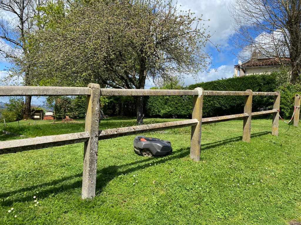
We continued on towards our destination for the night. It’s always interesting what one will see along the way. We passed through a residential area at one point and I was surprised to see a “robotic” lawn mower! Too funny! The old and the new alongside each other on the Way.
Along this section of the GR65, we met a gentleman who has embarked on an epic pilgrimage. Gustav started his journey in Finisterre on the coast of Spain and was following the Jerusalem Way all the way to Israel. Remarkable! We encountered him in mid-April and he said he hoped to reach Jerusalem by December. I took a snapshot of the blog that he was writing to chronicle his journey. He took a selfie with us and said he would be posting it to his blog along with all the other people he has encountered along the way. I forgot all about looking up his blog until I started writing this post. It appears he made it to Adana, Turkey. I actually found a place marker for our picture on his blog – there was a caption “Susan and Lin from USA” but no photograph. Oh well, it was gratifying to know that he had made it so far.

In the tiny hamlet of Guirande, we came across an ancient chapel – Chapelle Sainte-Madeleine de Guirande. This chapel dates back to the 13th century and is adorned with beautiful murals in the very simplistic interior of the church.


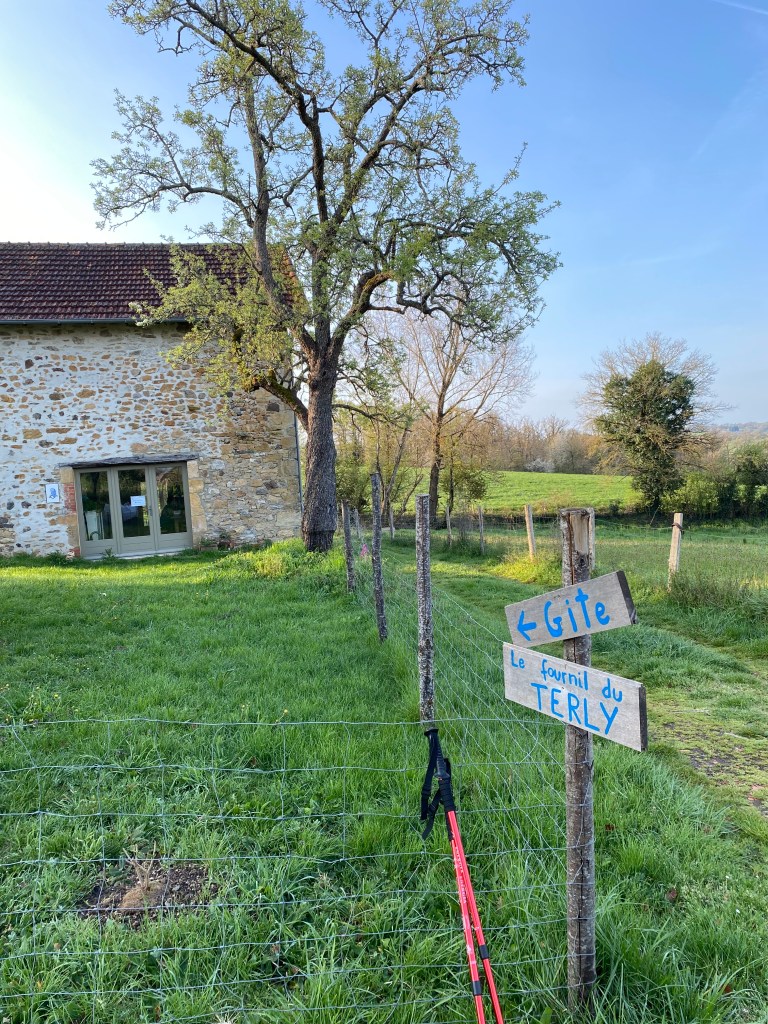
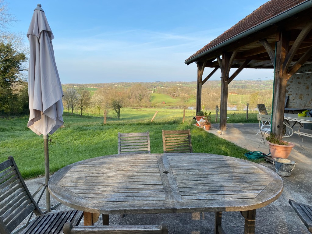
After we explored the tiny chapel, we continued on to Le Terly – our stop for the night. We had reservations at Gîte du Fournil du Terly. The accommodation is run by a young woman who is a new owner and was located outside of town in the French countryside. It was a great spot and we had a full house of all women pilgrims who shared with us the dormitory-style second floor. The communal meal was hearty and well-prepared. The only issue for a second night in a row – no heat!! There was a huge pile of blankets for us to add to our beds and that did help to keep us warm during the night.

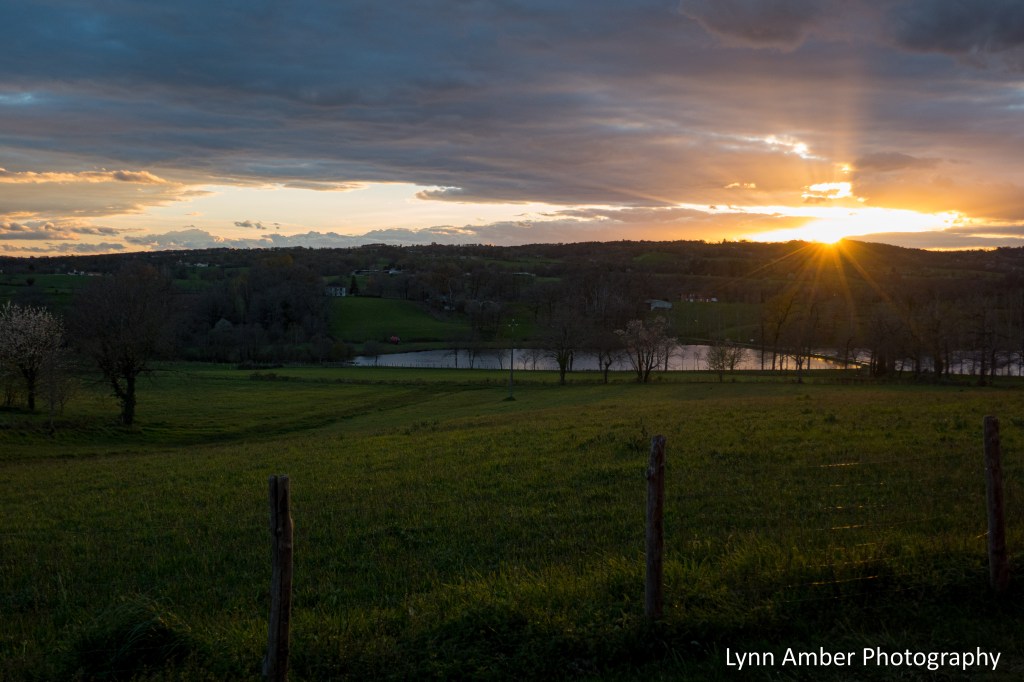


It was a good day! Tomorrow we would have a short day to arrive in the medieval town of Figeac.
Le Puy Camino – via Podiensis: Conques to Vivioles

April 13 and 14, 2023
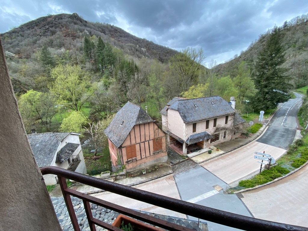
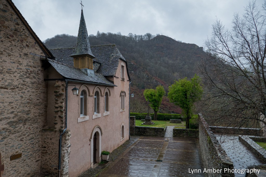
Conques is a medieval town renowned for its preserved Romanesque architecture and art. The town is built on a steep hill and most of the streets are paved in cobblestones. The wet weather made walking in town more treacherous than the trail, in my humble opinion, as the cobblestones were very slippery when wet! Once I entered the town, I made my way to our accommodations for the night VERY gingerly! I was amazed at how others were walking along normally as if the streets were dry. Was there a trick to walking on this pavement that I was unaware of??
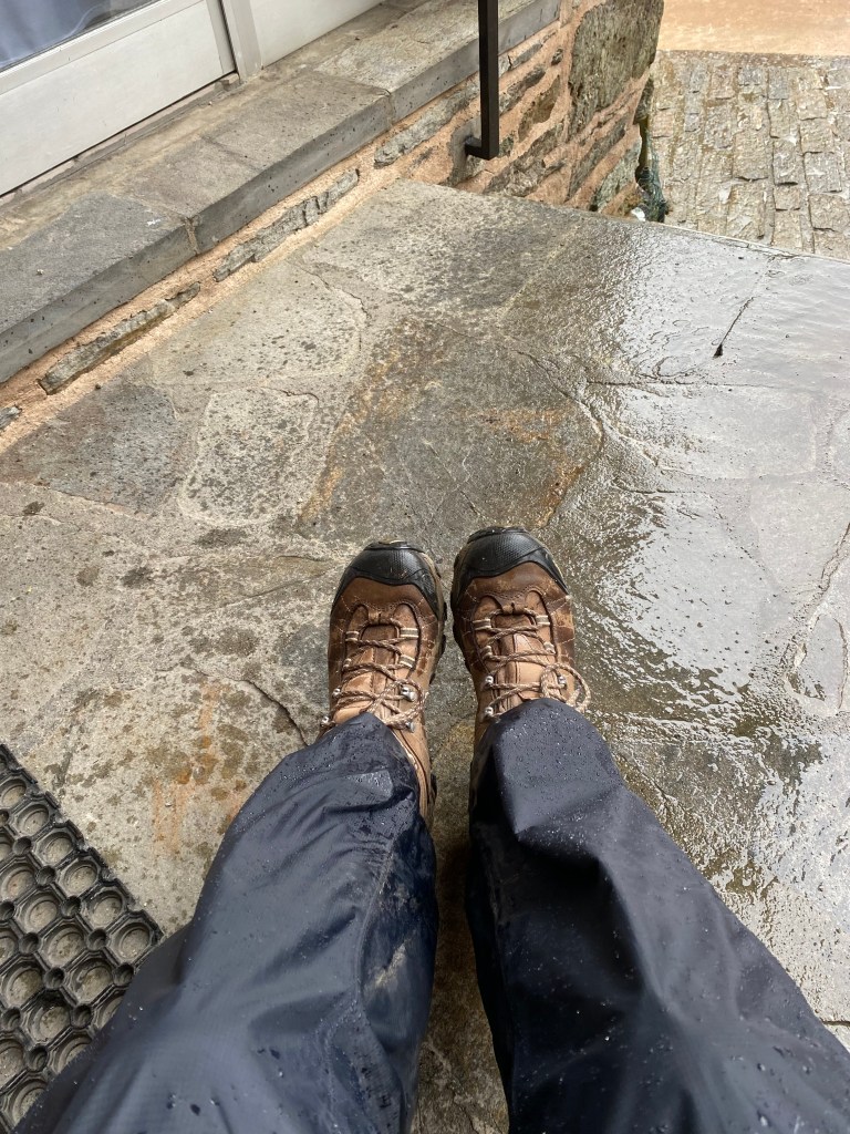
Our lodging – the Chambre d’hôtes Au Castellou – was located at the base of the hilly town on a paved road. I arrived at the door to find a note indicating that the check-in time was not for another couple of hours. There was a little overhang above the door and a chair – so I sat down out of the rain to ponder what I would do for a couple of hours. My raingear was dripping with water and my boots were drenched although my body and feet were dry!

As I was sitting there resting, the door to the lodging opened. My hosts had noticed me sitting outside looking rather damp and invited me in early! The Chambre d’hôtes Au Castellou has 5 chambers and provides an intimate, charming atmosphere. It was truly one of my favorite accommodations!

The town is nestled among the hills within the valley formed by the Dourdou de Conques – a river that eventually flows to the Lot.
Once settled in my room, the owners invited me downstairs and warmed me up with a nice hot cup of tea! Manu and Florence are new owners of the establishment and could not have been nicer.

We paid a tad more for this accommodation but it was so totally worth every euro! It was 83.50 euros each for the room, dinner and breakfast. Plus, they made us a beautiful picnic lunch the next morning. It was a miserably rainy evening so we did not make it to the pilgrim mass at the Abbatiale Sainte-Foy de Conques but chose to stay warm and cozy indoors for the evening. Our dinner was fresh-caught trout from the river and Manu kindly showed us the proper way to de-bone the fish as it is served as a whole fish on the plate! This instruction served us well for future meals. We had a nice surprise when one other guest showed up for the night and it was our friend Thomas who we have encountered numerous times on the trail.
Since it had rained much of the night, we opted to avoid the slippery climb up the mountain the next day and hired a taxi to drop us off at the top of the hill. That meant we only had to walk 8.5 km that day. Nice break! While we waited for the taxi, we had time to wander around town and spent time in the Abbatiale Sainte-Foy de Conques.
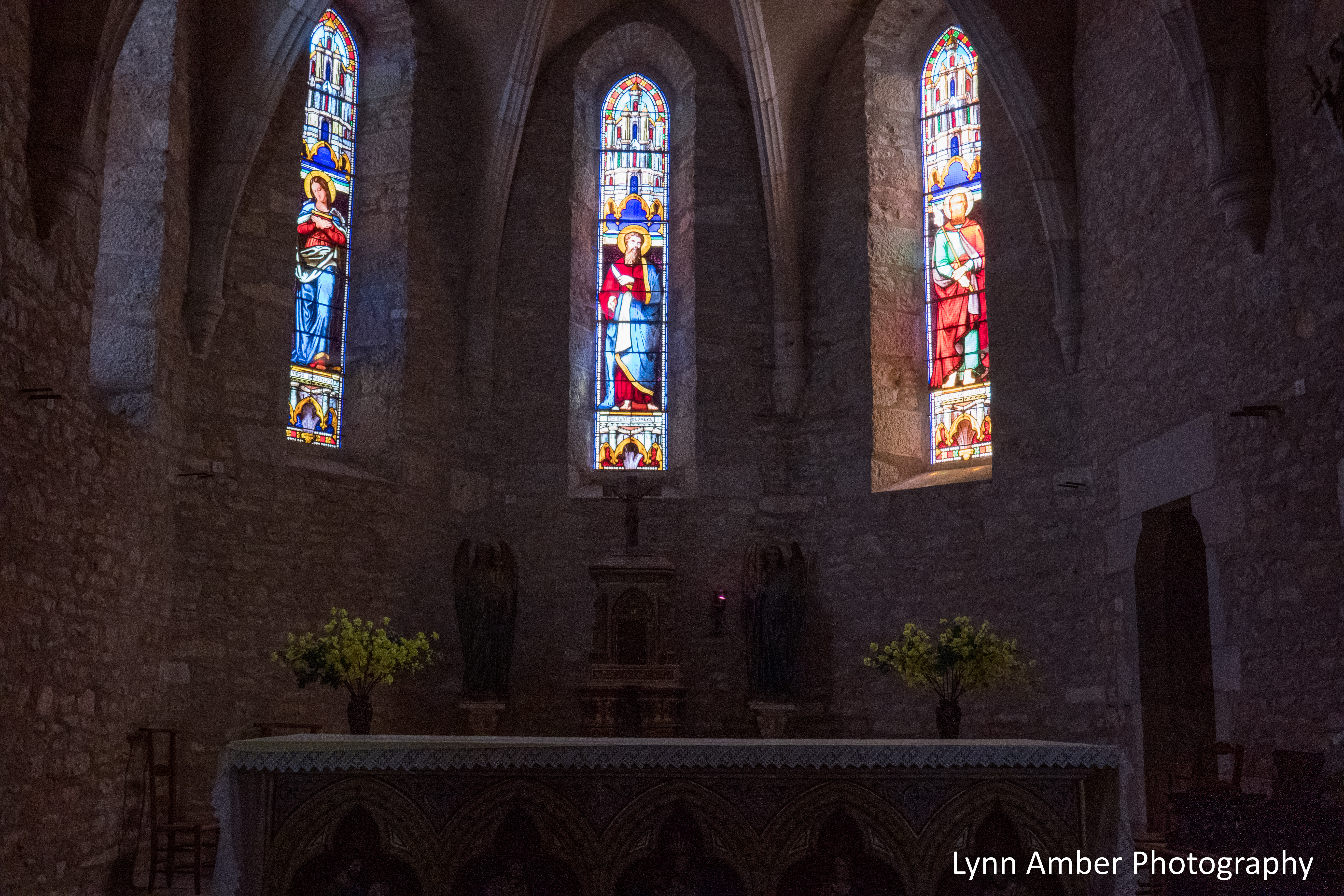
The church is named for the martyr, Sainte Foy, who as a young girl, adopted the Christian faith at a time when the Roman empire occupied France in the 2nd century. She refused to worship pagan gods and was condemned to die. In 866, the Abbey Church of Sainte-Foy obtained the remains of the martyr Sainte Foy and, as a result, Conques gained notoriety as a stop along the pilgrim route The Way of St. James. The interior of the church was magnificent and I focused on photographing some details that I found beautiful.

After wandering around the inside of the church, there was a break in the rain and we strolled through the back courtyard of the abbey and the cemetery.


We continued on into the town and eventually found a nice little cafe for a cup of coffee and a pastry.


After touring the town in the morning, it was time to catch our taxi and we headed out of town. It was a very drippy, soaking rain most of the day. We got dropped off and parted ways for the day. I did not take many photographs as it was just too wet to pull out the camera! But, here are a few to give you an idea of the conditions:


Our accommodation for the night was the Ecogîte Le Mineur Payson. It is housed in an old building and is equipped with a kitchen and small grocery store where we could buy provisions to cook our own meal. No demi-pension here!! We were the only guests scheduled to stay overnight and had the whole place to ourselves. Our double room was nice and the common area had great over-sized chairs and furniture for lounging and resting. There was a terrace off the second floor common room but it was too wet and chilly to enjoy.


We chose not to buy a full meal. We had our picnic lunch from the morning to eat. It cost us 32 euros for the night and breakfast. While the accommodation was adequate, I had one major issue with the stay. After a cool, damp, rainy day, I was ready for a nice, hot shower. Much to my surprise, there was no hot water for a shower. Grrrrr….the host was not readily available and we never did really find out what the situation was with the water.
The skies started to clear in the early evening and it promised to be a much better day for walking tomorrow.
I know it’s been awhile since I have posted about my Camino journey. I got side-tracked with other things happening in my immediate life. But, I am focusing on continuing to recount my Camino walk in France in the spring of 2023 and intend to finish the memorable journey this Fall. I am starting to plan the second leg of my Camino walk – using the Camino Portugués route. My hope is that by finishing the written account of my first walk I will gather the inspiration and excitement to plan my next adventure along the Way! Here we go!
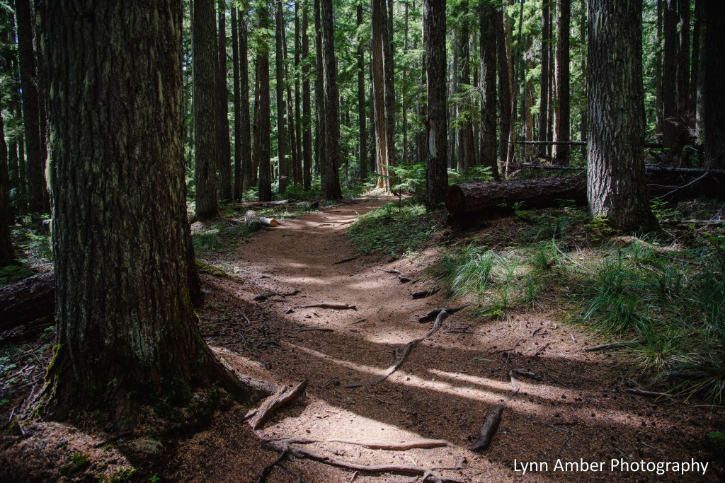
Timothy Lake Journal: Fall is in the Air

As the power company draws off water to meet energy demands downstream, the lake levels are dropping and the shoreline has changed. Tree stumps that are typically submerged have gained new life and provide interesting artistic impressions across the landscape.

Before the Oak Fork Creek was dammed for hydroelectric purposes, this area was used for sheep grazing. Timothy Lake is named for the timothy grass that spanned the meadows and provided grazing food for the sheep.
As we say good-bye to summer and approach the fall season, there are signs that we are transitioning to a new season – cooler temperatures, an increase in precipitation and some leaves beginning to turn.