Lynn Amber - Travel & Photography
sharing my thoughts through words and images
Le Puy Camino – via Podiensis: Vivioles to Le Terly

April 15, 2023
After some cold, damp days, the weather took a more positive turn! It was sunny for most of our 18 kilometer walk today, albeit a tad windy and cool. But – oh, the sun!! 🙂
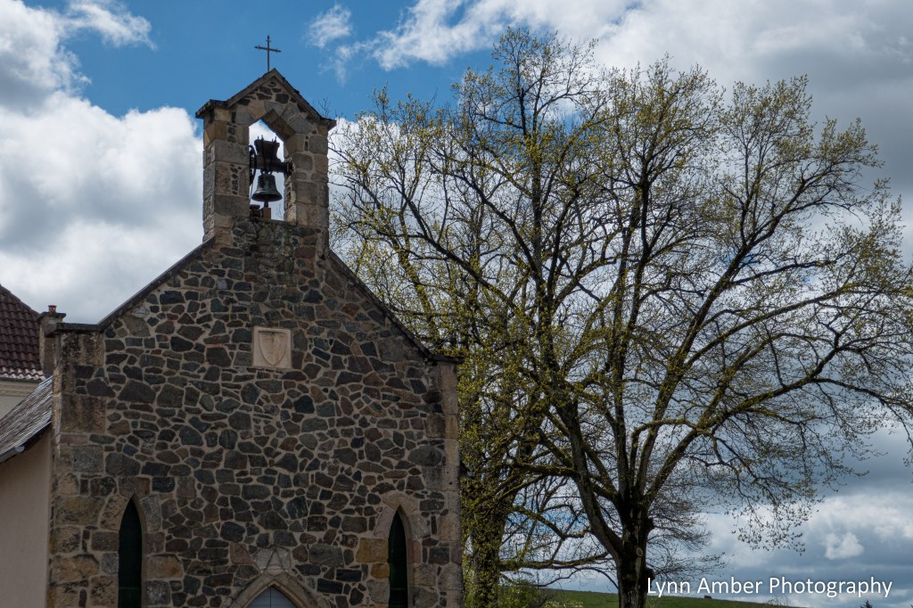
We left Vivioles bright and early and skirted the small city of Decazeville ultimately reaching the Chapelle Saint-Roch.


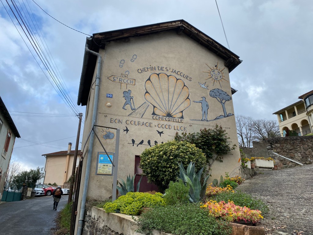
The chapel of St. Roch was built in the 1500’s and is situated above Decazeville and the valley below. It’s a beautiful chapel with a stone exterior and simple, yet elegant interior.


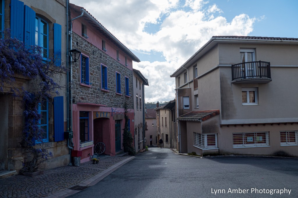
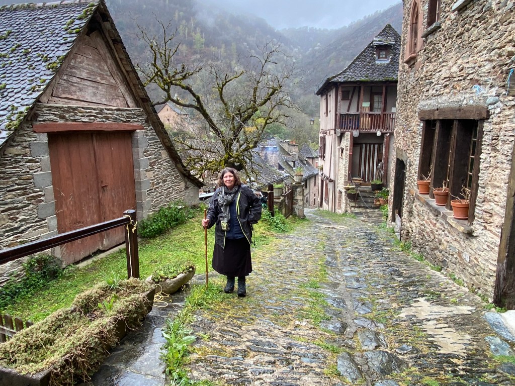
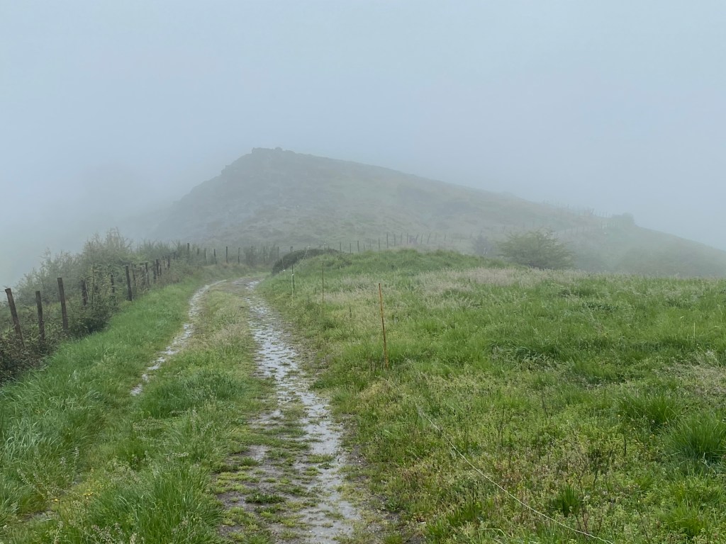
After leaving the chapel, we walked along a paved road for a short distance before diverting onto a footpath that eventually descended rather steeply to the Lot River valley below and the town of Livinhac-le-Haut.


We crossed the river and walked into town – looking for a place to rest and grab a cup of coffee.
We found a “bar” in the square – Place du Quatorze Juin – opposite the Église Saint-Adrien de Livinhac-le-Haut.
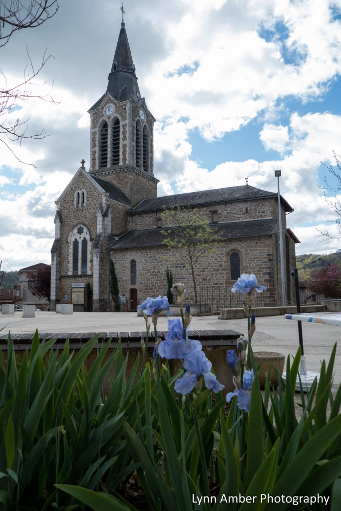

Saint Adrien was a Roman soldier who converted to Christianity in the 4th century and was beheaded for this choice. He is considered to be the patron saint of soldiers.
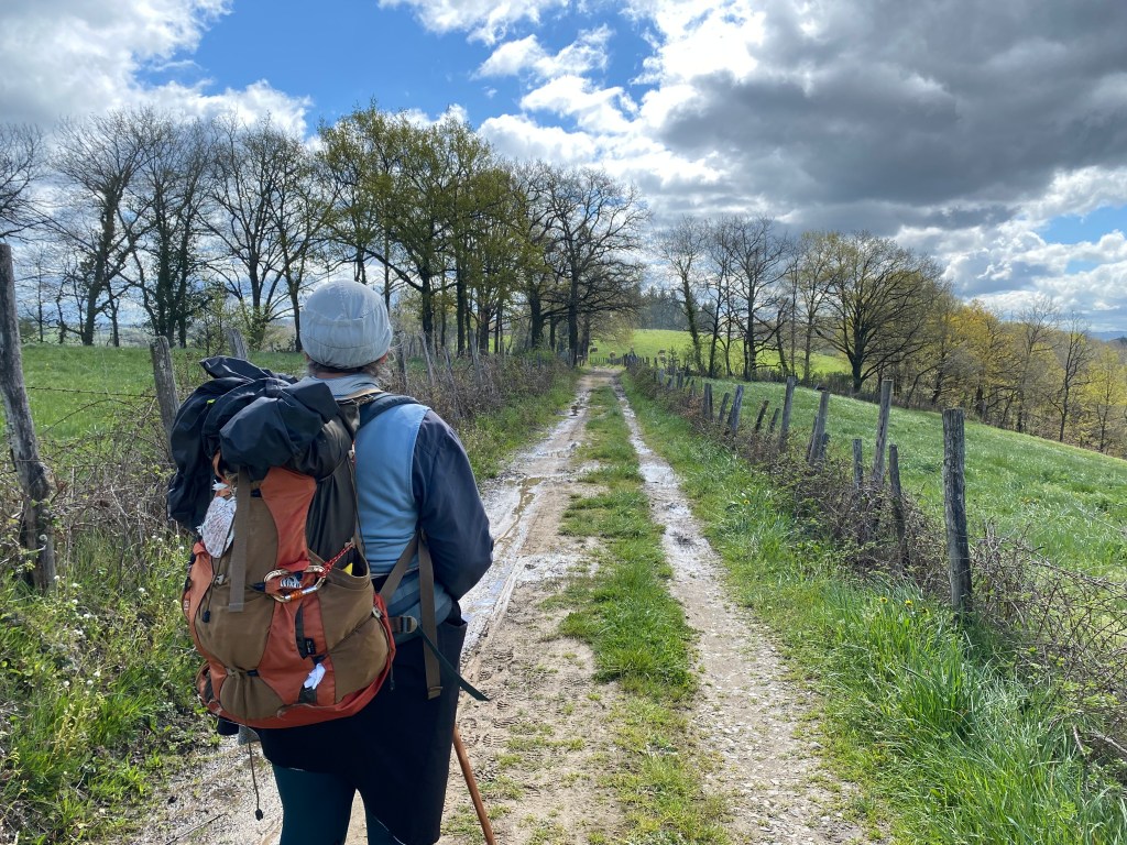
From Livinhac-le-Haut, the way follows a mostly dirt path through agricultural lands and rolling hills.


Before reaching the town of Montredon, we came upon a large stone cross with an interpretive sign and picnic area. Translating the sign, it explains that the cross traditionally marked the junction of three historical regions – Quercy, Rouergue, Auvergne. The present day cross is a modern day reproduction of the original and provides a beautiful rest area for pilgrims.

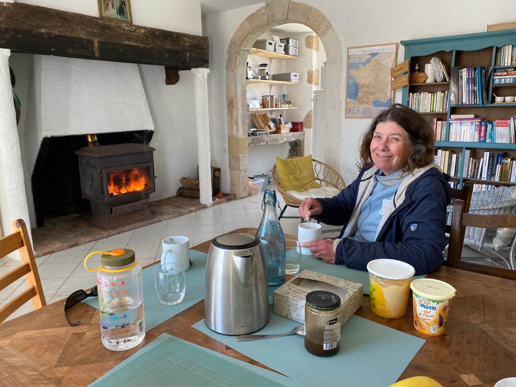
Once we arrived at the village of Montredon, we got down to the business of getting warm and finding sustenance to keep us going. We were rewarded with a fantastic meal at a small restaurant/gîte called Bien et Toit. Even though the sun was shining, it was cool and windy. Our host went out of his way to make us feel welcome and even fired up the small woodstove in the restaurant so that we could warm up!

We enjoyed a hot, grilled sandwich and cup of hot tea – all for a whooping 13 euros total.
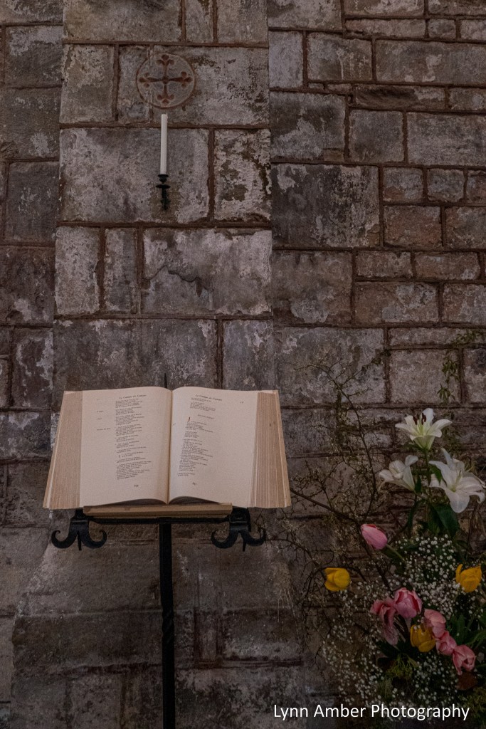
Before leaving town, we toured the Chapelle Notre-Dame de Pitié.

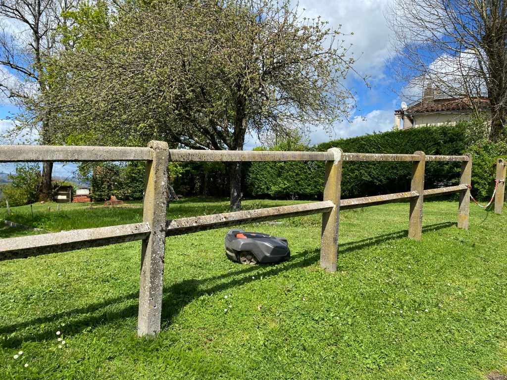
We continued on towards our destination for the night. It’s always interesting what one will see along the way. We passed through a residential area at one point and I was surprised to see a “robotic” lawn mower! Too funny! The old and the new alongside each other on the Way.
Along this section of the GR65, we met a gentleman who has embarked on an epic pilgrimage. Gustav started his journey in Finisterre on the coast of Spain and was following the Jerusalem Way all the way to Israel. Remarkable! We encountered him in mid-April and he said he hoped to reach Jerusalem by December. I took a snapshot of the blog that he was writing to chronicle his journey. He took a selfie with us and said he would be posting it to his blog along with all the other people he has encountered along the way. I forgot all about looking up his blog until I started writing this post. It appears he made it to Adana, Turkey. I actually found a place marker for our picture on his blog – there was a caption “Susan and Lin from USA” but no photograph. Oh well, it was gratifying to know that he had made it so far.

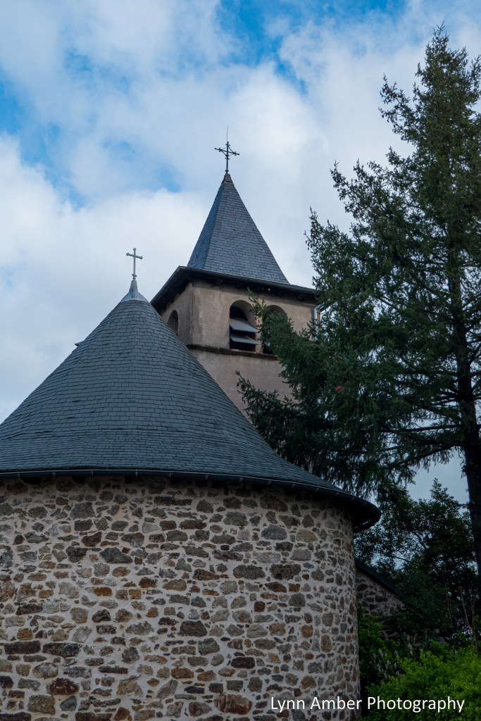
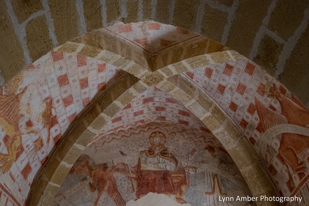
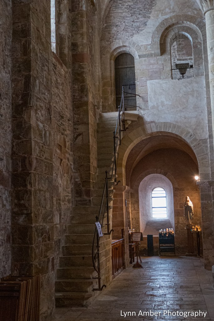
In the tiny hamlet of Guirande, we came across an ancient chapel – Chapelle Sainte-Madeleine de Guirande. This chapel dates back to the 13th century and is adorned with beautiful murals in the very simplistic interior of the church.


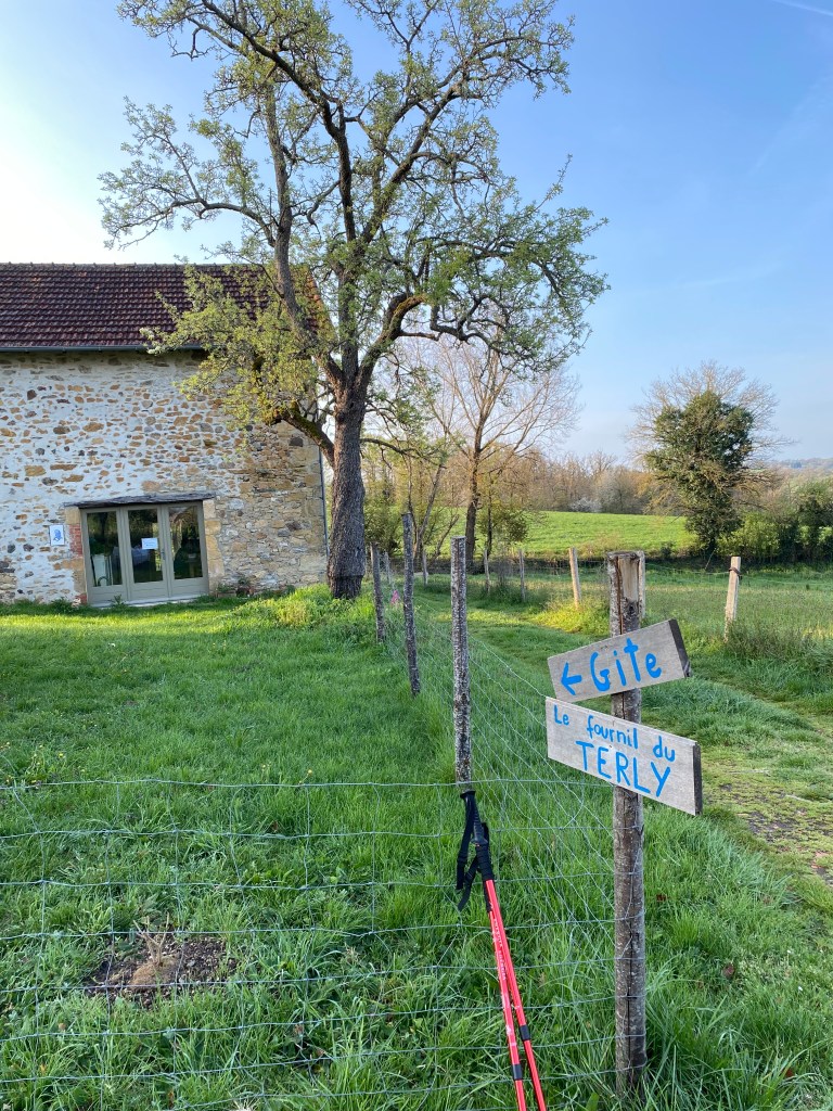
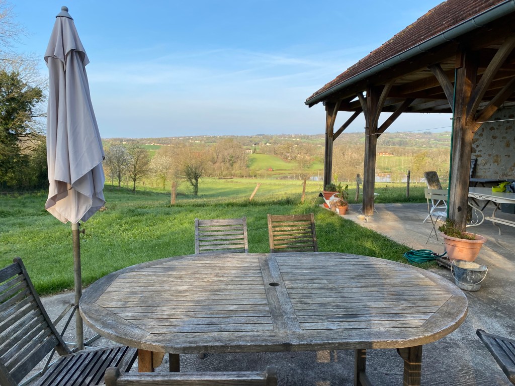
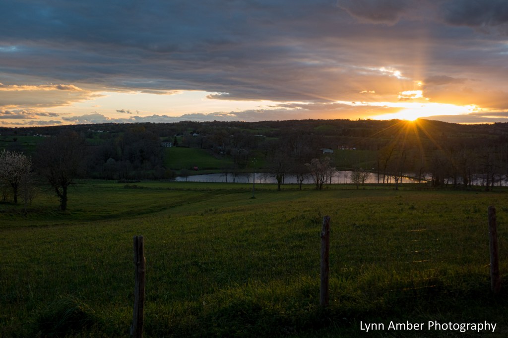
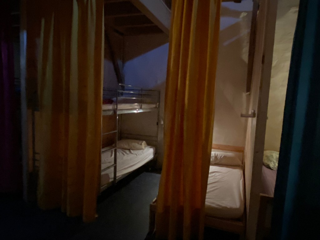
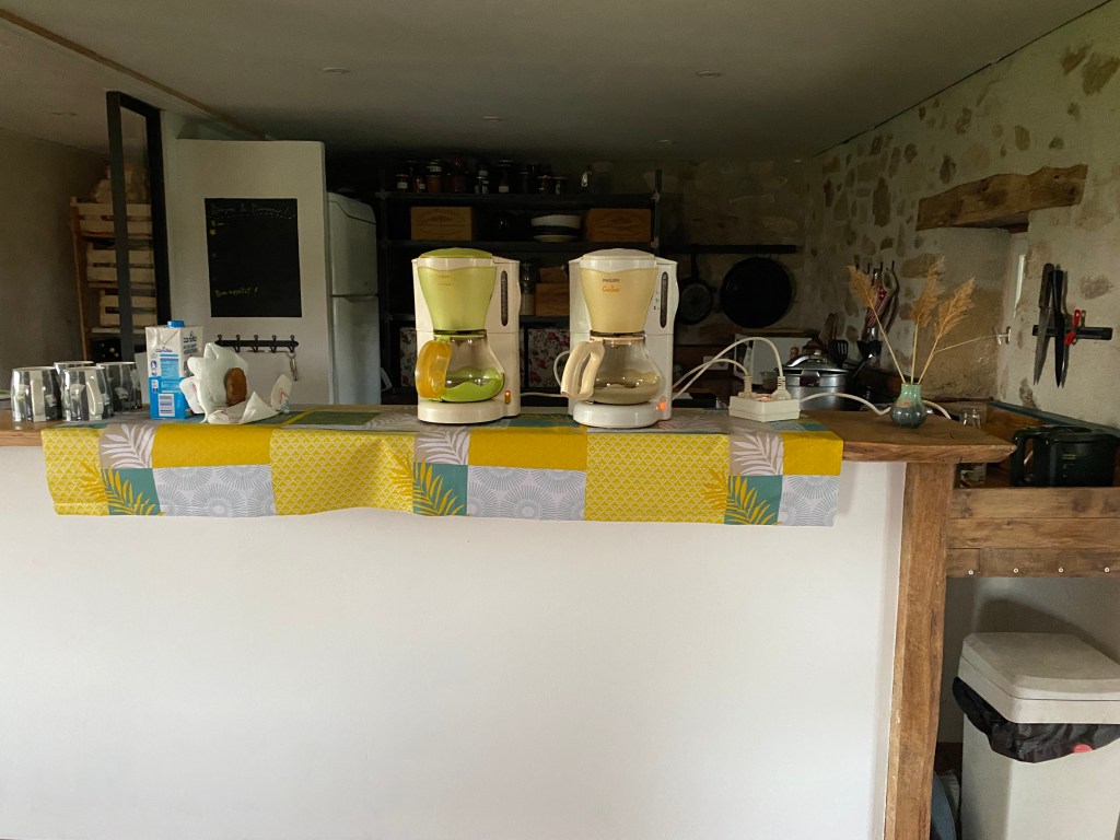
After we explored the tiny chapel, we continued on to Le Terly – our stop for the night. We had reservations at Gîte du Fournil du Terly. The accommodation is run by a young woman who is a new owner and was located outside of town in the French countryside. It was a great spot and we had a full house of all women pilgrims who shared with us the dormitory-style second floor. The communal meal was hearty and well-prepared. The only issue for a second night in a row – no heat!! There was a huge pile of blankets for us to add to our beds and that did help to keep us warm during the night.


It was a good day! Tomorrow we would have a short day to arrive in the medieval town of Figeac.
Le Puy Camino – via Podiensis: Conques to Vivioles

April 13 and 14, 2023
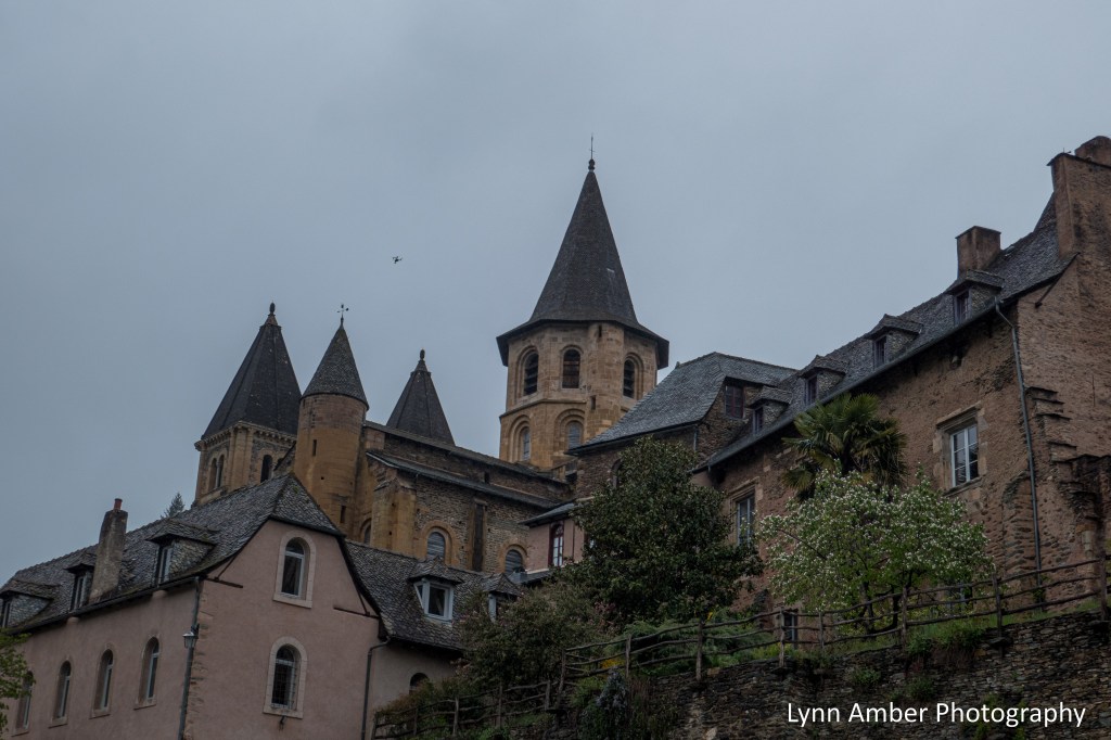
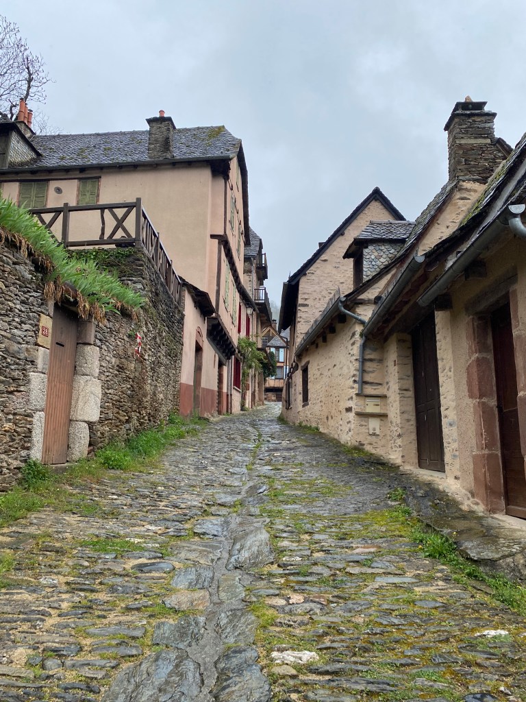
Conques is a medieval town renowned for its preserved Romanesque architecture and art. The town is built on a steep hill and most of the streets are paved in cobblestones. The wet weather made walking in town more treacherous than the trail, in my humble opinion, as the cobblestones were very slippery when wet! Once I entered the town, I made my way to our accommodations for the night VERY gingerly! I was amazed at how others were walking along normally as if the streets were dry. Was there a trick to walking on this pavement that I was unaware of??
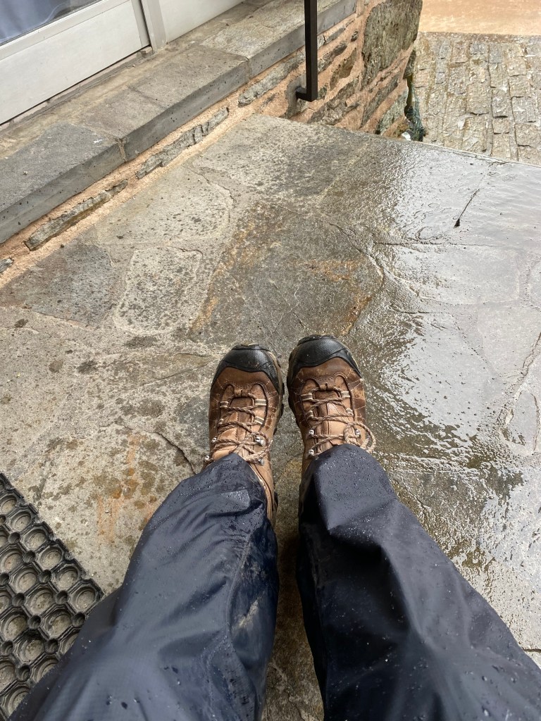
Our lodging – the Chambre d’hôtes Au Castellou – was located at the base of the hilly town on a paved road. I arrived at the door to find a note indicating that the check-in time was not for another couple of hours. There was a little overhang above the door and a chair – so I sat down out of the rain to ponder what I would do for a couple of hours. My raingear was dripping with water and my boots were drenched although my body and feet were dry!

As I was sitting there resting, the door to the lodging opened. My hosts had noticed me sitting outside looking rather damp and invited me in early! The Chambre d’hôtes Au Castellou has 5 chambers and provides an intimate, charming atmosphere. It was truly one of my favorite accommodations!

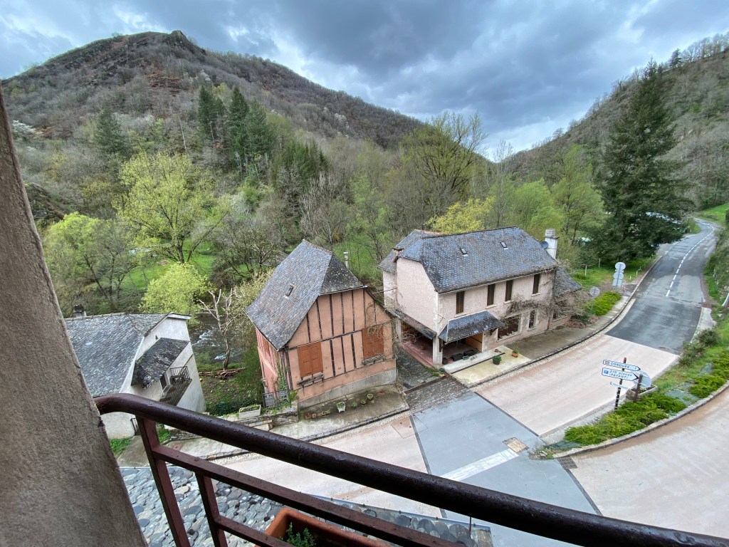
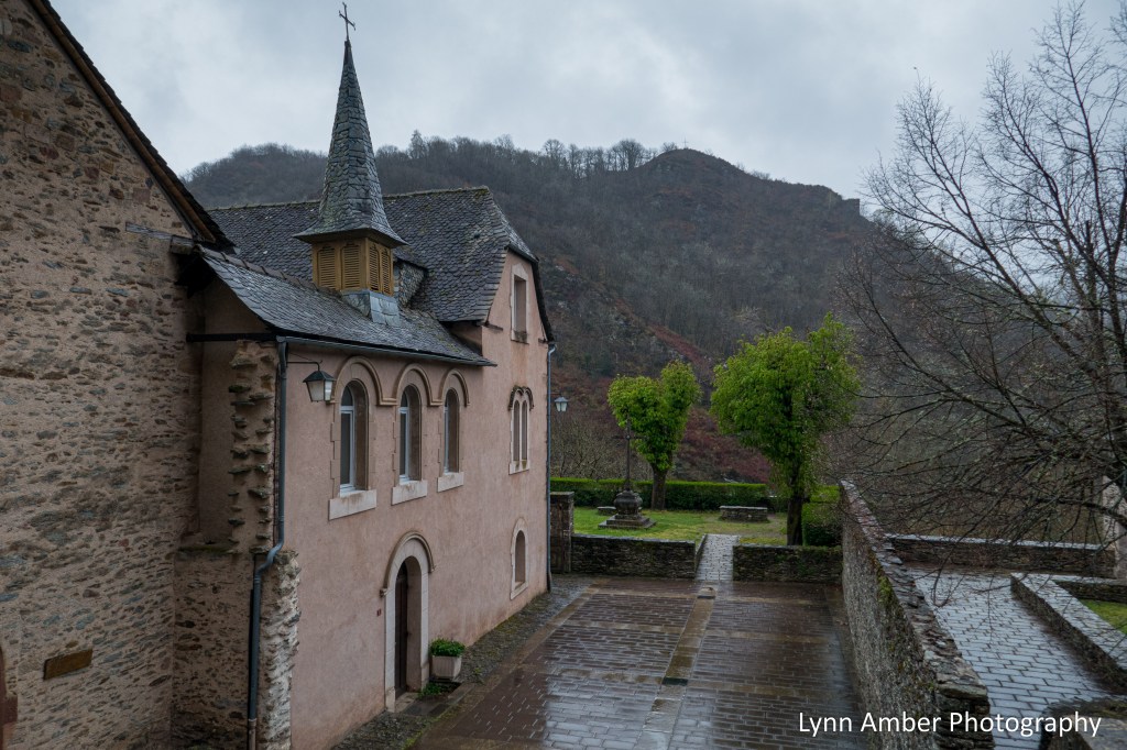
The town is nestled among the hills within the valley formed by the Dourdou de Conques – a river that eventually flows to the Lot.
Once settled in my room, the owners invited me downstairs and warmed me up with a nice hot cup of tea! Manu and Florence are new owners of the establishment and could not have been nicer.

We paid a tad more for this accommodation but it was so totally worth every euro! It was 83.50 euros each for the room, dinner and breakfast. Plus, they made us a beautiful picnic lunch the next morning. It was a miserably rainy evening so we did not make it to the pilgrim mass at the Abbatiale Sainte-Foy de Conques but chose to stay warm and cozy indoors for the evening. Our dinner was fresh-caught trout from the river and Manu kindly showed us the proper way to de-bone the fish as it is served as a whole fish on the plate! This instruction served us well for future meals. We had a nice surprise when one other guest showed up for the night and it was our friend Thomas who we have encountered numerous times on the trail.
Since it had rained much of the night, we opted to avoid the slippery climb up the mountain the next day and hired a taxi to drop us off at the top of the hill. That meant we only had to walk 8.5 km that day. Nice break! While we waited for the taxi, we had time to wander around town and spent time in the Abbatiale Sainte-Foy de Conques.
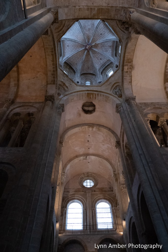
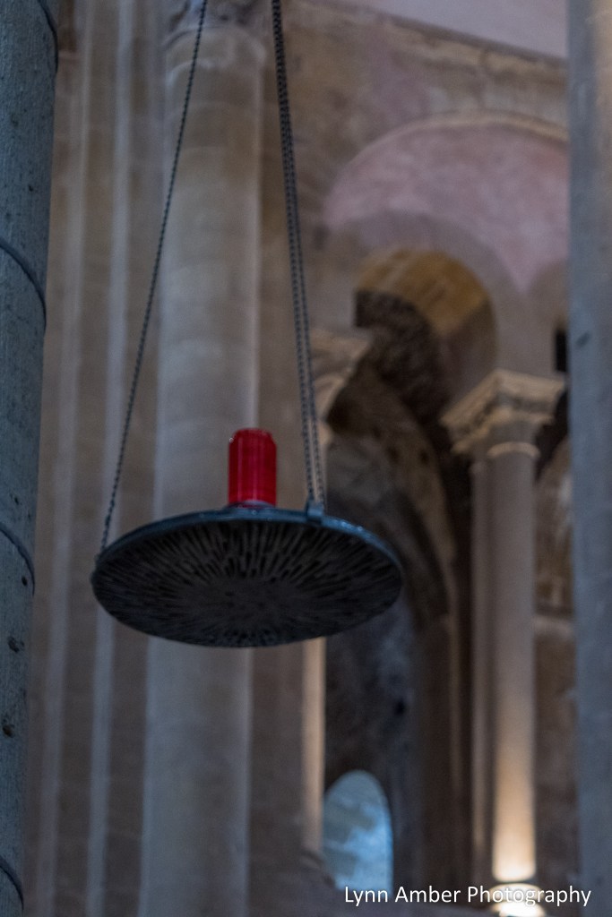
The church is named for the martyr, Sainte Foy, who as a young girl, adopted the Christian faith at a time when the Roman empire occupied France in the 2nd century. She refused to worship pagan gods and was condemned to die. In 866, the Abbey Church of Sainte-Foy obtained the remains of the martyr Sainte Foy and, as a result, Conques gained notoriety as a stop along the pilgrim route The Way of St. James. The interior of the church was magnificent and I focused on photographing some details that I found beautiful.

After wandering around the inside of the church, there was a break in the rain and we strolled through the back courtyard of the abbey and the cemetery.


We continued on into the town and eventually found a nice little cafe for a cup of coffee and a pastry.


After touring the town in the morning, it was time to catch our taxi and we headed out of town. It was a very drippy, soaking rain most of the day. We got dropped off and parted ways for the day. I did not take many photographs as it was just too wet to pull out the camera! But, here are a few to give you an idea of the conditions:


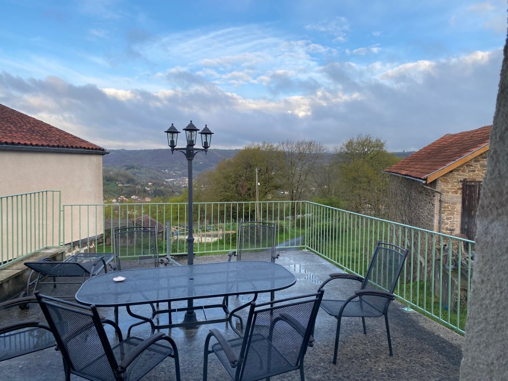
Our accommodation for the night was the Ecogîte Le Mineur Payson. It is housed in an old building and is equipped with a kitchen and small grocery store where we could buy provisions to cook our own meal. No demi-pension here!! We were the only guests scheduled to stay overnight and had the whole place to ourselves. Our double room was nice and the common area had great over-sized chairs and furniture for lounging and resting. There was a terrace off the second floor common room but it was too wet and chilly to enjoy.


We chose not to buy a full meal. We had our picnic lunch from the morning to eat. It cost us 32 euros for the night and breakfast. While the accommodation was adequate, I had one major issue with the stay. After a cool, damp, rainy day, I was ready for a nice, hot shower. Much to my surprise, there was no hot water for a shower. Grrrrr….the host was not readily available and we never did really find out what the situation was with the water.
The skies started to clear in the early evening and it promised to be a much better day for walking tomorrow.
I know it’s been awhile since I have posted about my Camino journey. I got side-tracked with other things happening in my immediate life. But, I am focusing on continuing to recount my Camino walk in France in the spring of 2023 and intend to finish the memorable journey this Fall. I am starting to plan the second leg of my Camino walk – using the Camino Portugués route. My hope is that by finishing the written account of my first walk I will gather the inspiration and excitement to plan my next adventure along the Way! Here we go!
Timothy Lake Journal: Fall is in the Air

As the power company draws off water to meet energy demands downstream, the lake levels are dropping and the shoreline has changed. Tree stumps that are typically submerged have gained new life and provide interesting artistic impressions across the landscape.

Before the Oak Fork Creek was dammed for hydroelectric purposes, this area was used for sheep grazing. Timothy Lake is named for the timothy grass that spanned the meadows and provided grazing food for the sheep.
As we say good-bye to summer and approach the fall season, there are signs that we are transitioning to a new season – cooler temperatures, an increase in precipitation and some leaves beginning to turn.


Timothy Lake Journal: Firefighting Planes

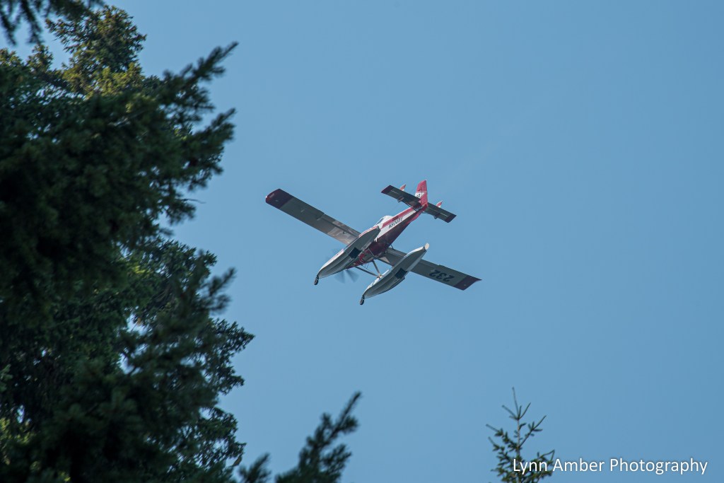
On two occasions this summer, we have had to clear the lake of boaters in order to allow access for a couple of firefighting pontoon planes. The Sandstone Fire (ignited due to a lightening strike) is positioned to the southwest of our location and close enough to Timothy Lake to warrant its use as a water source to help contain the blaze.
We posted signs on sandwich boards at our boat launches in the campgrounds and day use areas warning potential boaters to remain within 50 feet of the shoreline. In addition, the U.S. Forest Service deployed two law enforcements officers to patrol the lake and insure compliance by those on paddleboards, kayaks, canoes and motorboats.

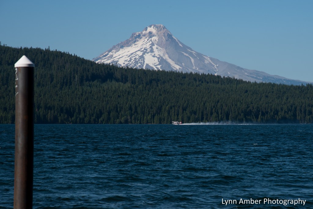
In the background above, you can see one of the pontoon planes starting to lift off after filling with water. The planes have hatches that open and allow the pontoons to scoop up water. It’s amazing to watch these pilots skim the surface of the water, load up their pontoons and, then, proceed to lift up and get above the tree line. Their piloting skill is remarkable!!

The first day they were on the lake scooping water there were no visible signs of a fire. Our skies were bright blue and clear. The second day was remarkably different. In the photographs below, you can see the smoke-filled air. Due to the wind direction, the pilots also approached the lake from a different angle.


It’s been a tough year in Oregon for wildfires. We have been fortunate that none have impacted us here at Timothy Lake – with the exception of a couple of smokey days.
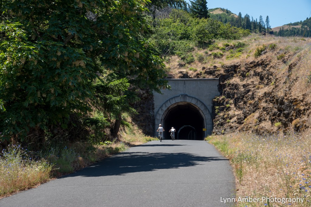
Timothy Lake Journal: Columbia River Gorge Biking
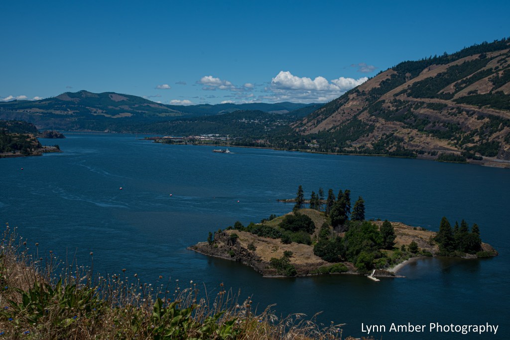
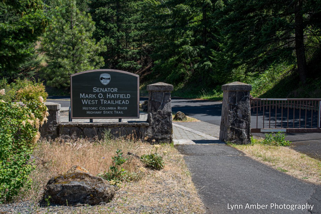
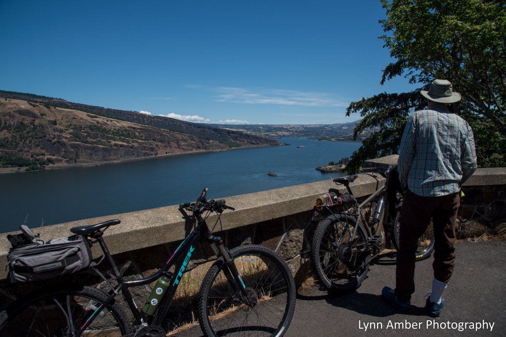
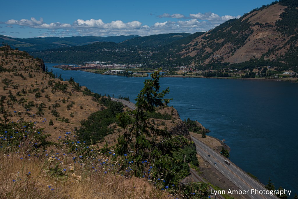
Back in June, we enjoyed a glorious day-off biking the Historic Columbia River Highway State Trail!! The section we biked is referred to as the Senator Mark O. Hatfield West Trailhead.
It is a 9-mile paved out and back ride from its starting point just outside of Hood River to the edge of the town of Mosier. Gorgeous views of the Columbia River! There is a large parking area near the beginning of the trail and a visitor center that was unfortunately closed the day we were there.
The trail follow the historic state highway – one of the first scenic highways in the US. There is an outdoor interpretive sign that aptly describes some of the history of the road.
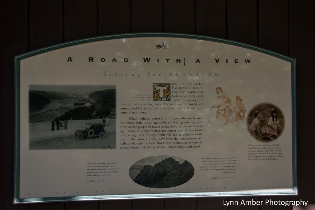
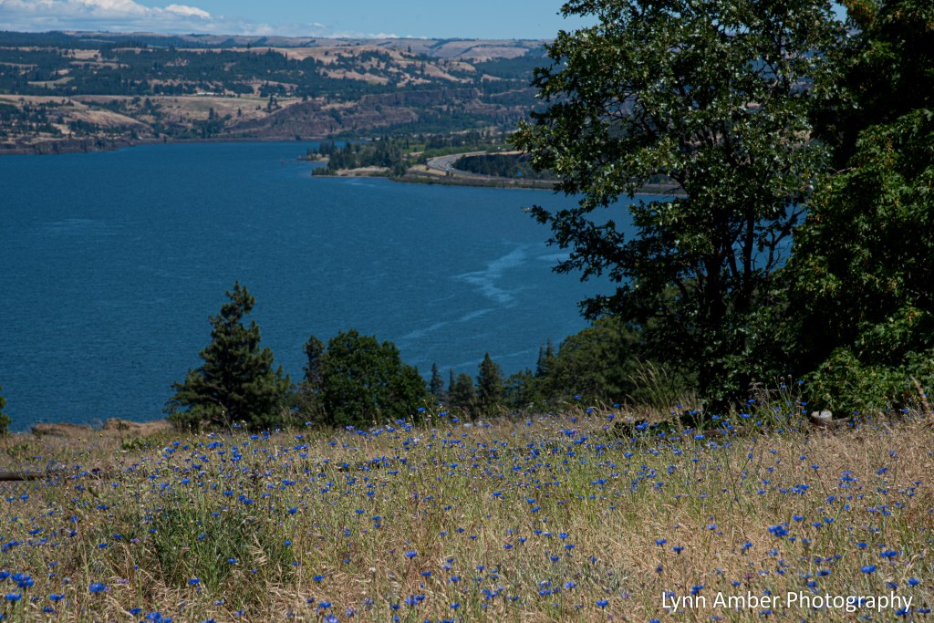
As the signage above says – it is indeed a “road with a view!” The old road sits high above the Columbia River and Interstate 84 and offers up some spectacular views of the river along the winding, hilly trail. There are a few overlooks along the way that allow for resting and admiring the remarkable landscape – with its transition from a Douglas Fir forest to a high desert environment.
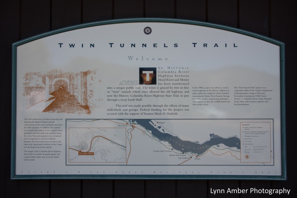
The Senator Mark O. Hatfield West Trailhead between Hood River and Mosier is just one small section of the extensive bike trail along the gorge. We rode this trail back in June and, as of my writing today, this section is closed due to a wildfire in the region. Hopefully, it will re-open soon.
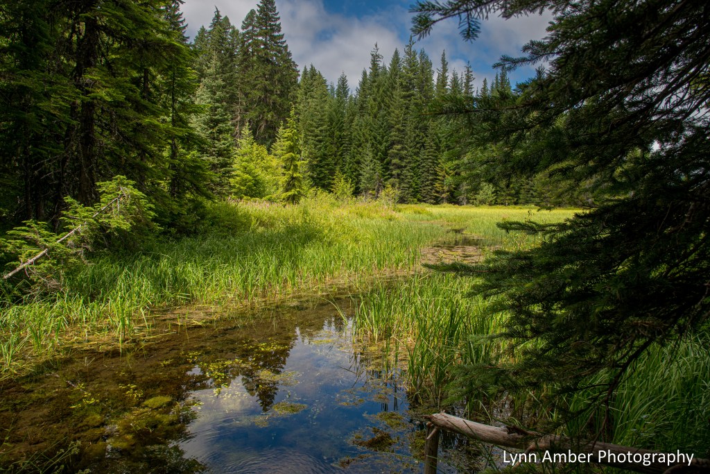
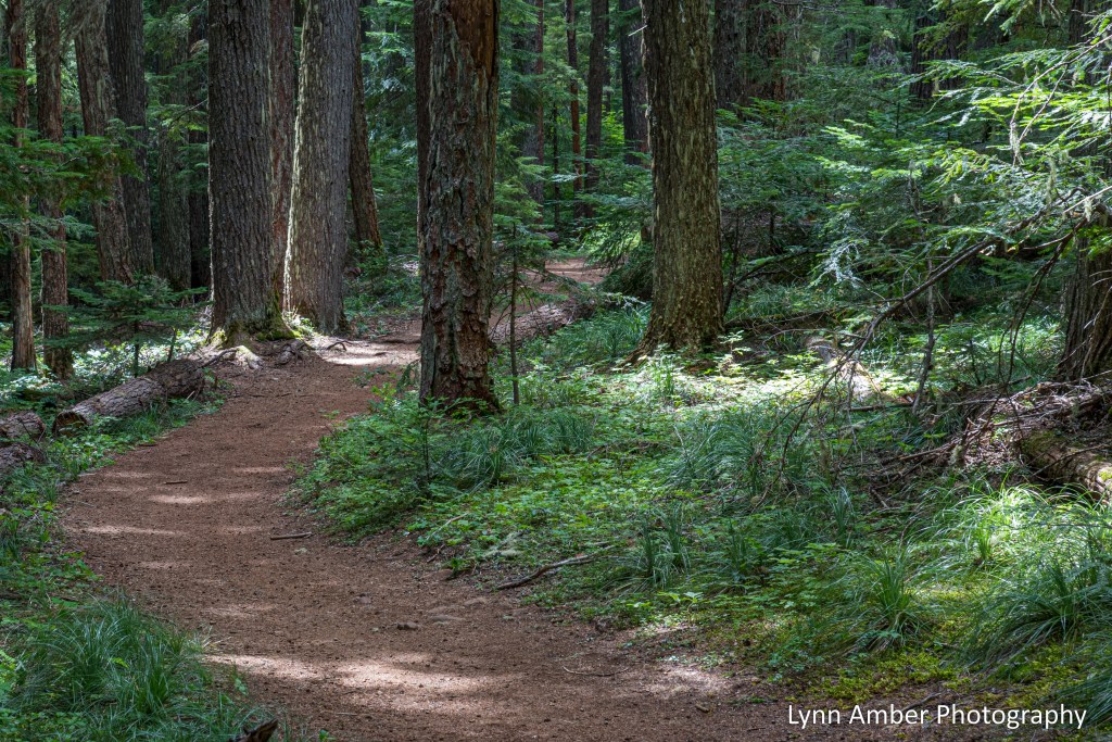
Timothy Lake Journal – Perimeter trail

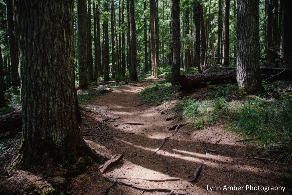
The trail that circumnavigates Timothy Lake follows several different pathways including a section of the Pacific Crest Trail, and two different National Forest trails – the Timothy Lake 528 and 529. It’s a beautiful 13-mile hike with minimal elevation gain and spectacular scenery through the Douglas Fir forest and along the shore of Timothy Lake.
The Prince’s Pine or Pipsissewa pictured above is flowering on the forest floor right now and is a delightful little wildflower! It’s an evergreen plant found in coniferous forests – especially dry woodlands. Prince’s Pine is a medicinal plant that was used by North American native populations and considered to be an astringent and all-purpose tonic. I read that it was also an ingredient in root beer!
Moderate temperatures and lots of shade made for a very relaxing walk through the forest! Some scenes along the way:


Timothy Lake Journal – More Wildflowers!

As soon as this beautiful groundcover dogwood started to emerge I felt a kinship to this plant. It is so very similar to Cornus canadensis – which I love – or is it Cornus canadensis? Here in the Pacific Northwest I’ve come across massive displays in the forest and along the lake.
Apparently, Cornus x unalaschkensis is thought to be a cross between Cornus canadensis and Cornus suecica. The species can be hard to distinguish and since I’m no botanist I’m not going to guess which one this is! I did look up the range for Cornus x unalaschkensis and it does appear to be present in the Timothy Lake region of the Mt. Hood National Forest.
Whichever species it is – it is lovely as a carpet on the forest floor!
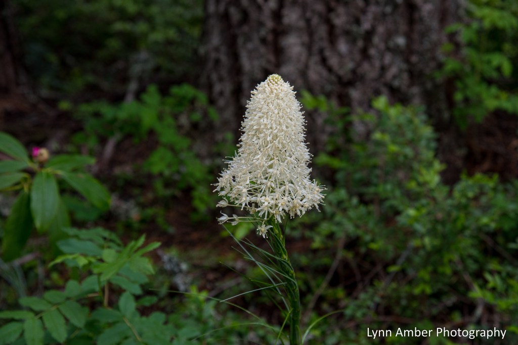
Bear grass is a plant that I am not at all familiar with and discovered growing en mass on the forest floor in the Mt. Hood National Forest. It gets its name due to the fact that bears like to munch on the tender, young flower stems. It has also been observed that grizzly bears will use the grassy parts in their dens!
The plant is fire-resistant and drought-tolerant – needing occasional burns for renewed growth. Another common name for this plant is Indian Basket Grass. Native Americans used this plant in basket-making and also roasted the roots as a source of food.

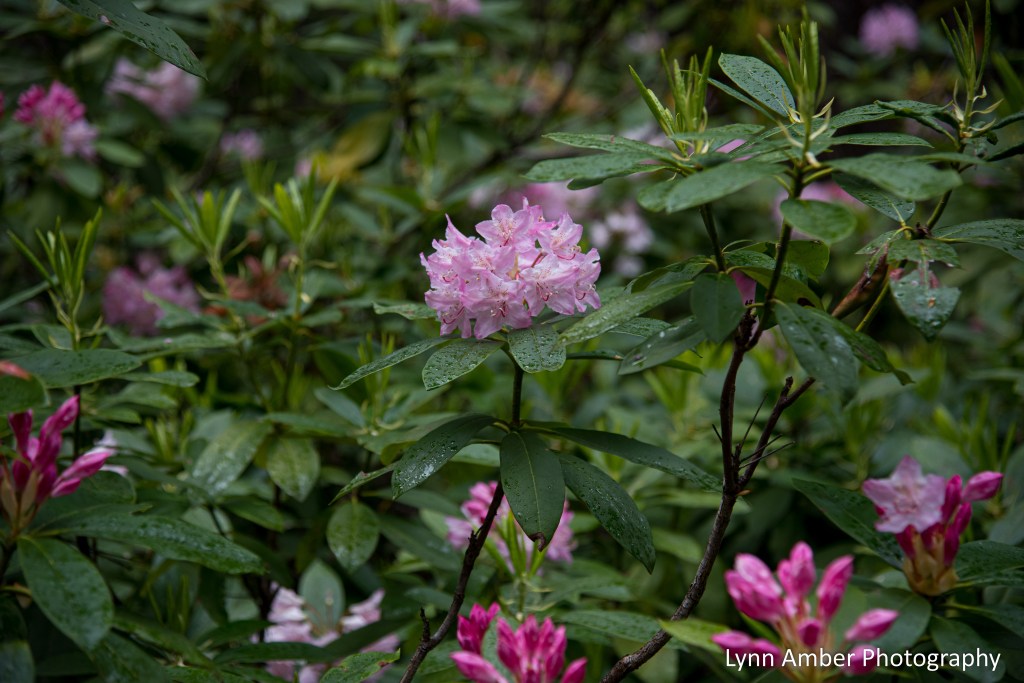
And, of course, the Pacific Rhododendron is at its peak right now!!
Timothy Lake changes its appearance on a daily basis and sometimes multiple times throughout the day. On a recent walk along the shoreline, the peacefulness of this scene caught my eye!

Timothy Lake Journal – Tamanawas Falls

On one our recent day’s off, we planned a day trip to the small town of Hood River to get supplies. After enjoying a DELICIOUS breakfast at the Huckleberry Inn in Government Camp, our first stop was the trailhead for the Tamanawas Falls.
This was our second attempt to hike back to the Falls!! 😉 Last week, on our way back to camp after a trip to Hood River, we thought we had enough daylight to make it to the Falls and back. In the guidebook, it said the hike was a 2-mile out and back. WRONG! We decided to turn back when we realized the mileage was not accurate and that it would be pushing it to avoid walking back at dusk.
It turns out that the correct mileage is more like 4.5 miles round-trip – still an easy distance – but had we known that the first time we would not have tried to attempt it late in the day. Sometimes, trail descriptions are deceiving! Lesson learned: read more than one review!
The trail starts at a sizable parking lot along the southbound side of Route 35 about 32 miles from Timothy Lake area. We were told that this is a very popular hike and, in the summer, it can be difficult to get a parking space. This time of year, though, it was only about half full when we arrived. I wanted to hike this trail now before the water levels drop in summer so as to get the best effect of the falls with maximum water flow. Be aware that this is a fee-based area and you do need to either self-pay a 5.00 day fee at the pay station or display a federally accepted annual pass.
Just after leaving the parking lot, there is a wooden bridge that crosses the East Fork of the Hood River. I could tell by the construction that the bridge was sturdy but it had a decided lean to the left! The river was rushing underfoot and it felt a tad unsettling crossing the bridge!

I did take the time to stop in the middle of the bridge for a photo shot of the river downstream. But, I did not linger!!
Shortly after crossing the bridge, there is a trail junction where hikers will make a right to head towards the Falls. The first part of the trail is fairly well-packed and easy with a few minor ups and downs. Along this stretch, the trail ascends above Route 35 and the road is visible to the left at times. Eventually, you come to another trail junction and, this time, the Falls trail leads off to the left. Ultimately, you are following trail number 650A towards the Falls.

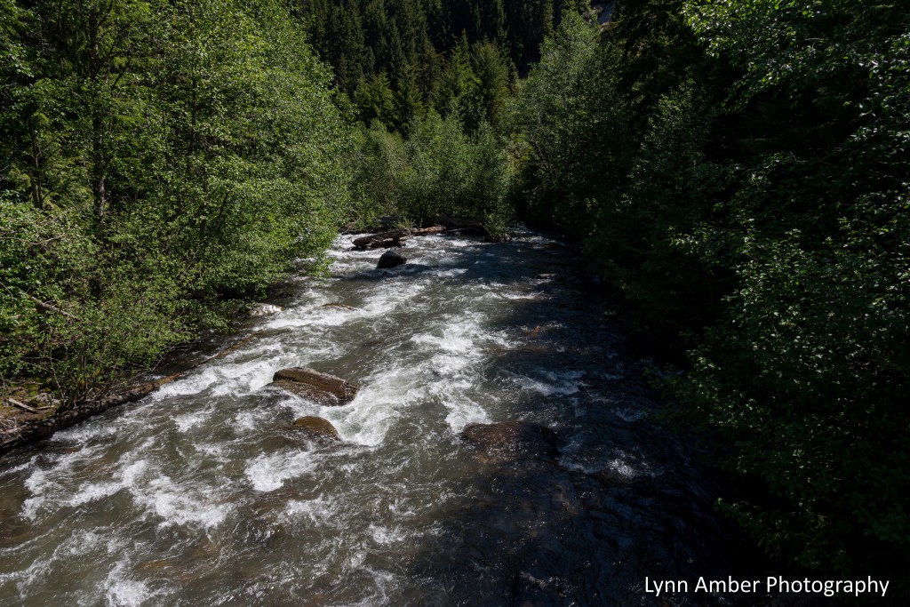
From here, the path descends to the Cold Spring Creek corridor. Once you reach the creek, another bridge crosses the creek and the trail follows the river for the rest of the hike up to the Falls.


There was a ton of water in the creek this time of year and along the way we saw many “mini” waterfalls as the creek descends towards the East Fork of the Hood River.


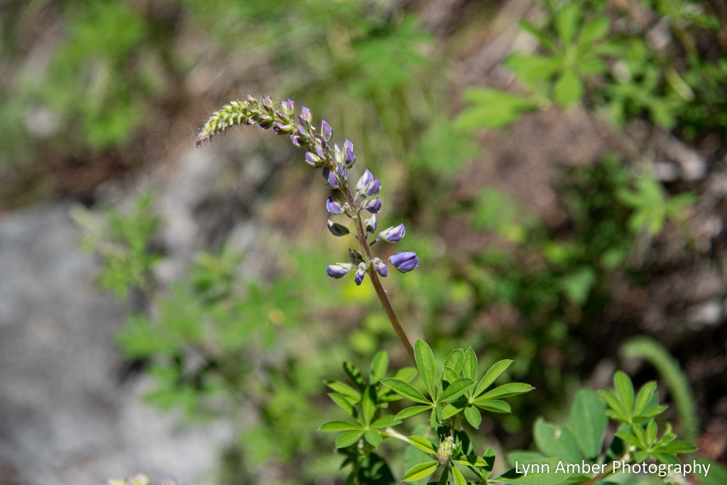
Much to my delight, I was able to capture a few wildflowers blooming along the trail and in the forest!


The above plant, Vanilla Leaf, gets its name from the scent of the leaves when they are crushed. It is thought that the leaves can be an effective insect repellent when dried.


About a 1/4 mile before the Falls, there is another trail junction. The route to the Falls veers off to the left and enters the most difficult part of the hike. There is a short but steep rock scramble just after this junction. It’s hard to pick out the actual path of the trail but there is a preferred route if you can find it!
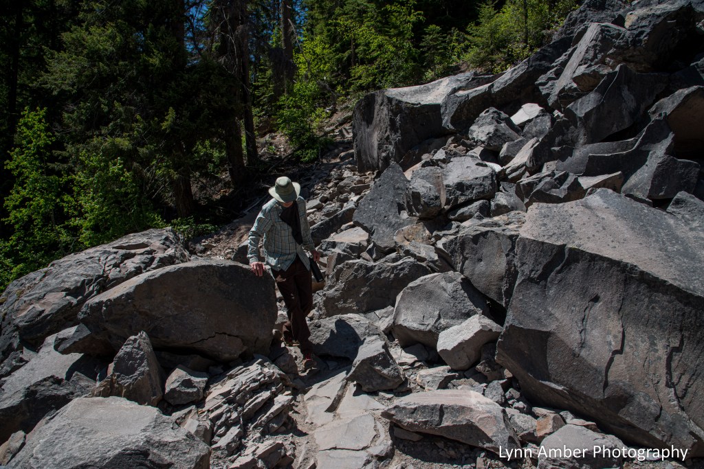
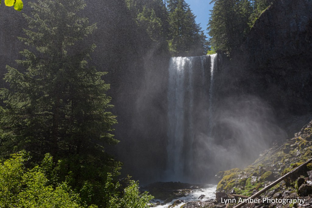
It’s a short jog to the Falls once you negotiate the talus slope. Often, when I hear about an awesome waterfall that is a “must see”, I’m disappointed once I reach the destination – usually the wrong time of the year and there’s just a trickle of water in the falls! Well, let’s just say that this time I was super impressed and the waterfall far exceeded my expectations! I’m so glad we made the second attempt to view this amazing place!
The Tamanawas Falls flows over a 110′ cliff that is about 40 feet wide! Very cool!! There was a significant mist rising off the waterfall while we were there and it created a mystical experience.

It was a beautiful – mostly shaded – walk through the predominantly Douglas Fir forest. I give it a 5 “star” rating as a family friendly relatively moderate hike.
Timothy Lake Journal – Spring Flowering Plants

It’s springtime in the Mt. Hood National Forest and I’m discovering lots of plants coming in and out of bloom. Right now, the Pacific Rhododendron is on full display in the forest at our elevation and is stunning!
Some wildflowers that I observed in mid-May are past their prime but I caught them while they were at their best.

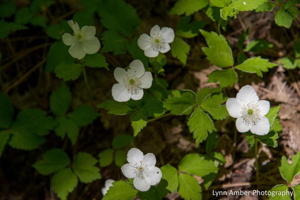
The Oregon Anemone is an uncommon plant found in conifer forests of the Pacific NW up to around 5,000 feet. It’s an unassuming little plant that blooms here in mid-May. This plant is similar to the Western Wood Anemone ( Anemone lyallii) – the main difference being the number of stamens. I’m calling this plant an Oregon Anemone due to the fact that it appears to have more than 35 stamens where as the Western Wood Anemone has fewer than 35 stamens. But who’s counting?! 🙂
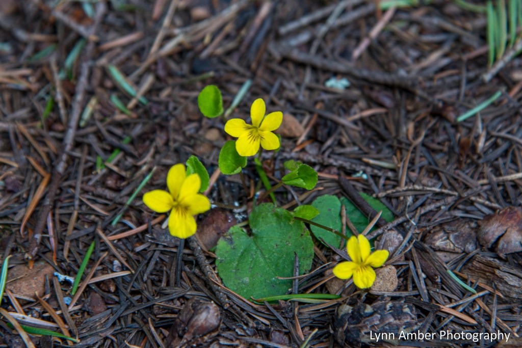
The Redwood Violet is a tiny little plant and I only found a few small patches of it in and around the South Shore Trail on Timothy Lake. Such a cutey!! It’s name comes from the fact that it is found in redwood forests but it also inhabits other conifer forests, including the predominant Douglas Fir forest here.

The Pacific Trillium thrives in a Douglas Fir forest so I guess that’s why it is so prolific here. There are some incredible specimens of this plant throughout the Mt. Hood National Forest. I just love this plant!!
Stay tuned for more interesting Pacific NW plants!!
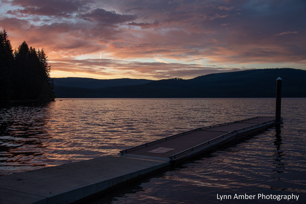
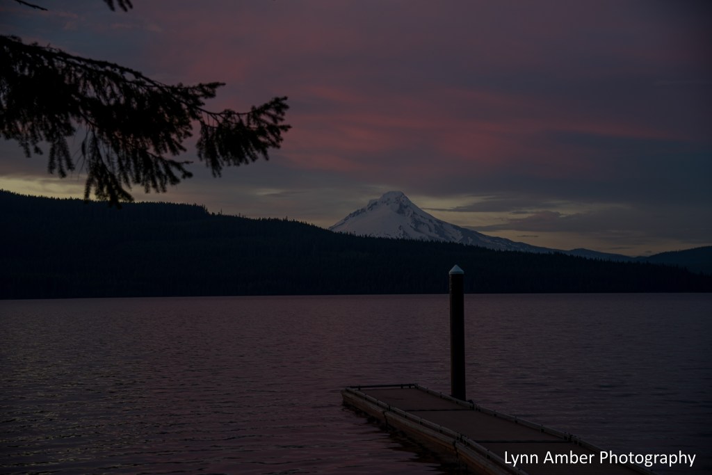
Timothy Lake Journal – Mt. Hood
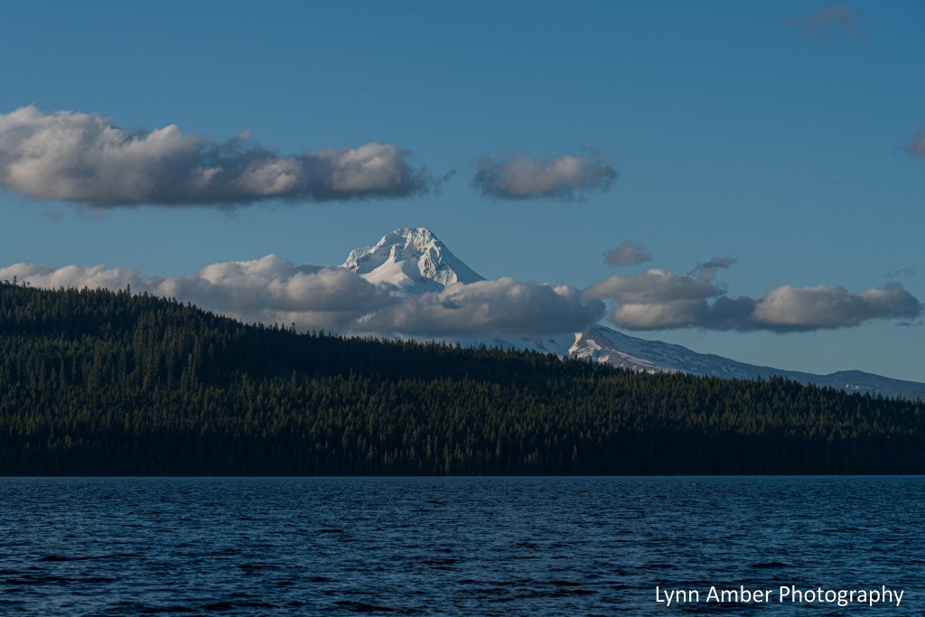
It has been 4 weeks since our arrival at Timothy Lake to begin our newest workamping adventure. We have settled in nicely and feel lucky to have this view every day!
It’s amazing how different the mountain appears from day to day depending on the weather and cloud cover. The other day we had a particularly nice sunset and the way the color played off the snow-covered peak was remarkable.