Lynn Amber - Travel & Photography
sharing my thoughts through words and images
151st Tunbridge World’s Fair

The Tunbridge World’s Fair has been an annual Vermont tradition since 1867 with the exception of only a few years during that time when the fair was cancelled due to both World War’s and the 2020 pandemic.
When my two sons were in elementary school, we entered exhibits in the fair that were judged – vegetables from our garden, baked goods, arts and crafts, and school projects. We all scored our fair share of 1st, 2nd and 3rd place ribbons and I even garnered a blue ribbon for some photography way back then!
It has been many years since I visited the fair – due to traveling, work schedule, change of lifestyle, etc. But this year, since I find myself home for the season, it became a priority to get there at least once during the 4-day event.
The Tundbridge Fair has all the hallmarks of a typical agricultural fair – farm animal judging, horse and oxen pulling contests, pig races, amusement rides, old time craft demonstrations, music venues, horse competitions and food – lots of fair food! It was fun to spend a few hours on a Saturday afternoon strolling around the fair grounds taking in all the sights. It must have been a banner year for the organizers of the fair – all 4 days were filled with sunshine and comfortable temperatures. Given the rainy season we’ve had, this was a true blessing.
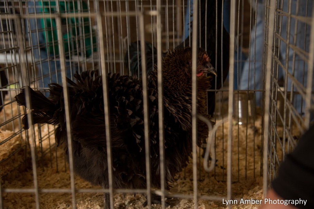
Our first stop was the animal barns where we spent a lot of time admiring the various chicken breeds. We love chickens and even though it’s been years since we raised them for eggs – they are still a favorite!


After the chicken barn, we walked through the cow barn. I had to be careful not to get too close to the back end of the cows – oops! My camera almost got a “bath!”


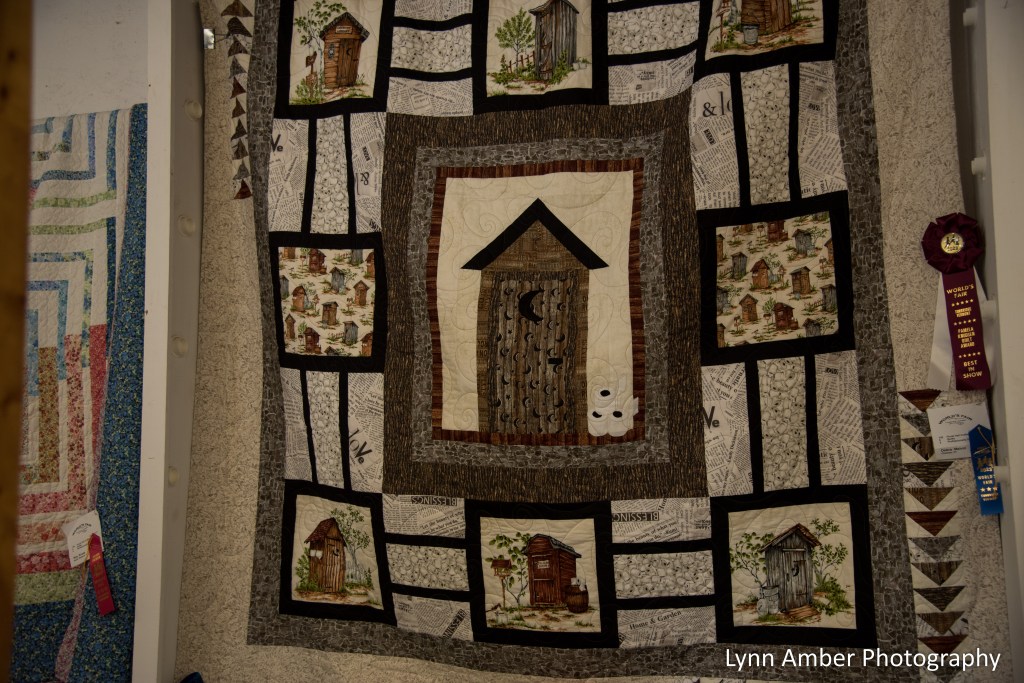
My favorite pastime at the fair is viewing all the exhibits related to arts and crafts – both the adult and youth divisions – in Floral Hall. I had fun reminicsing about the days we used to arrive here to turn in our items for exhibit!

And, as a quilter, I was in awe of the craftsmanship represented here!!

Love the “outhouse” theme on this one! It was made by a woman I used to carpool with to Dartmouth College everyday!
The youth art work is always a treat to see! The creativity of our young people is so inspiring!


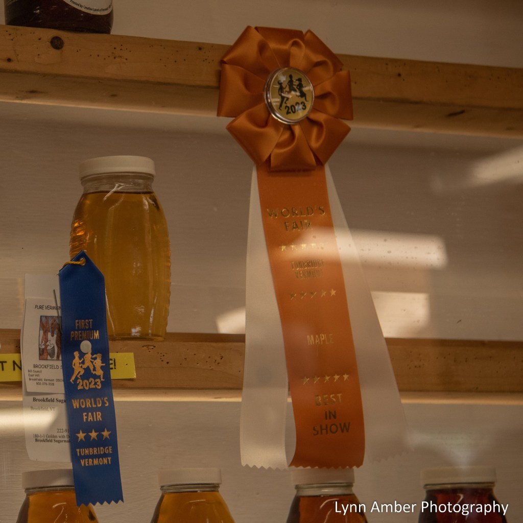
After wandering around the vegetable exhibits, we headed outside to find the one class of exhibits that I really came to the fair to see – the maple syrup entries!! Our friend, Bill, won Best of Show this year for his maple syrup – Brookfield Sugarmakers – and I’m so proud of him! These are displayed in the Sugar Shack located up near Antique Hill.
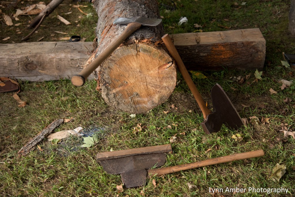
Once we got a glimpse of his maple syrup on display, we wandered around Antique Hill. I had a hard time pulling Jim away from watching these guys shape a wood beam!


There was a Civil War encampment across from the old agricultural engine displays.


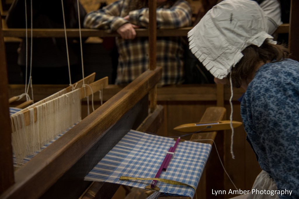
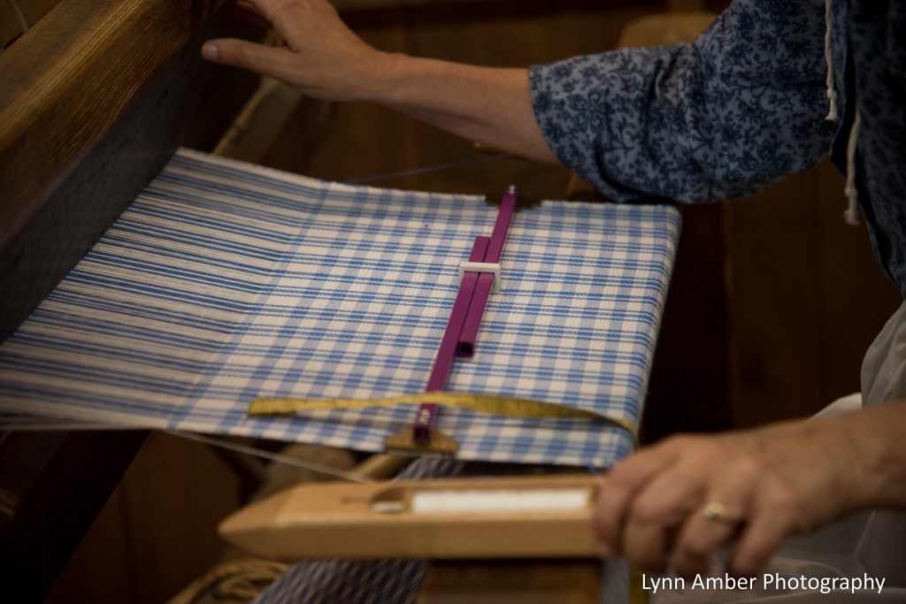
I wandered into the antique barn where there are tons of museum quality displays and watched the woman weaving on a loom – something I’ve always thought would be fun to try.
I took a walk through the building that houses all the old carriages and means of transportation.

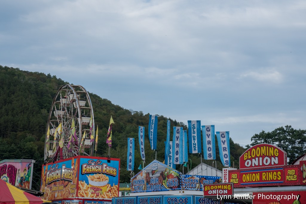
Before leaving the fair, we walked around outside taking in the sights – lots of amusement rides and food to keep a person busy for quite a while!

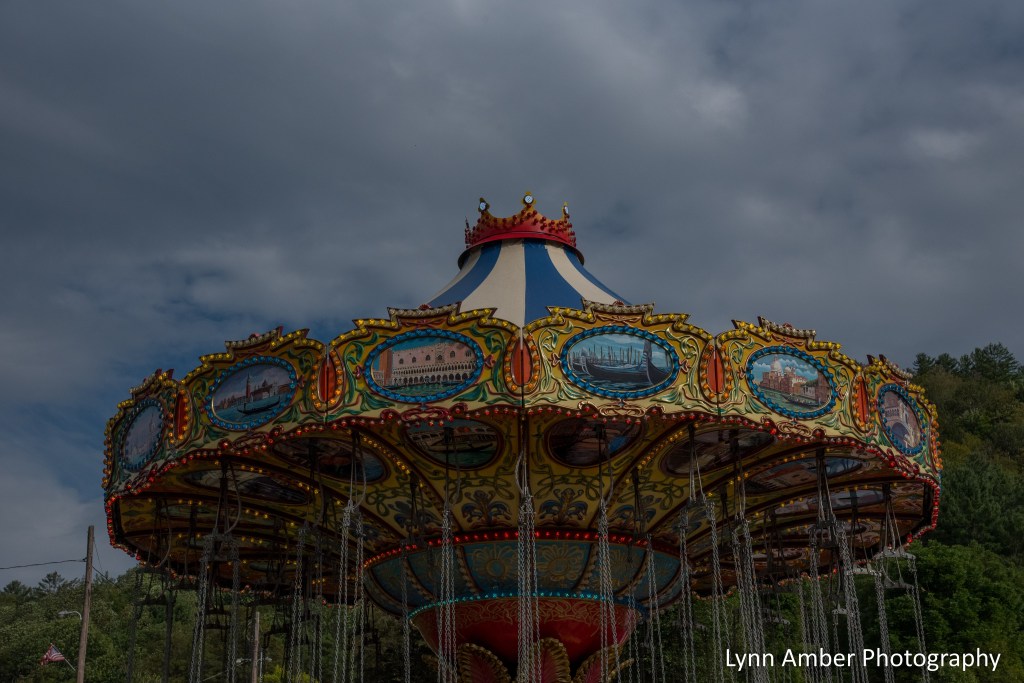


And, my all-time favorite amusement ride – the carousel!

We opted not to stay for dinner as the crowds were getting oppressive and the food truck lines were long. But, that’s okay. Our new favorite lunch spot – the Tunbridge General Store – was open and not crowded as everyone was down at the fairgounds! We had a peaceful, quiet sandwich there listening to the hum of the fair in the background!

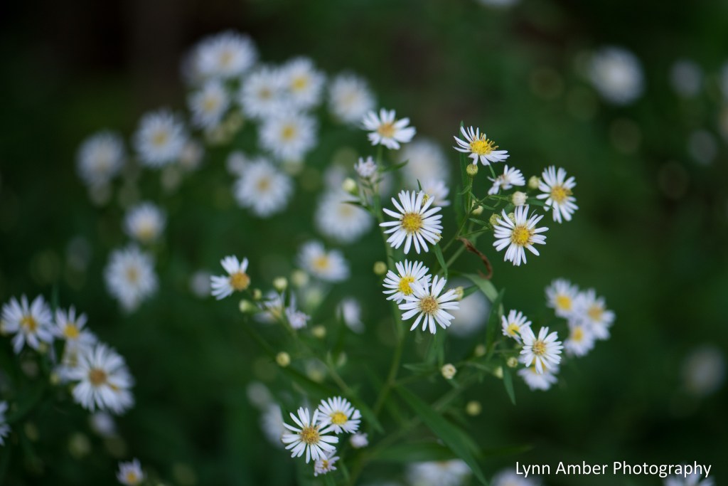
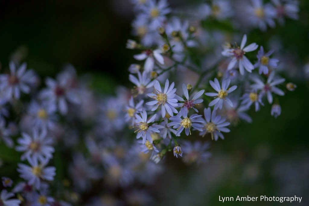
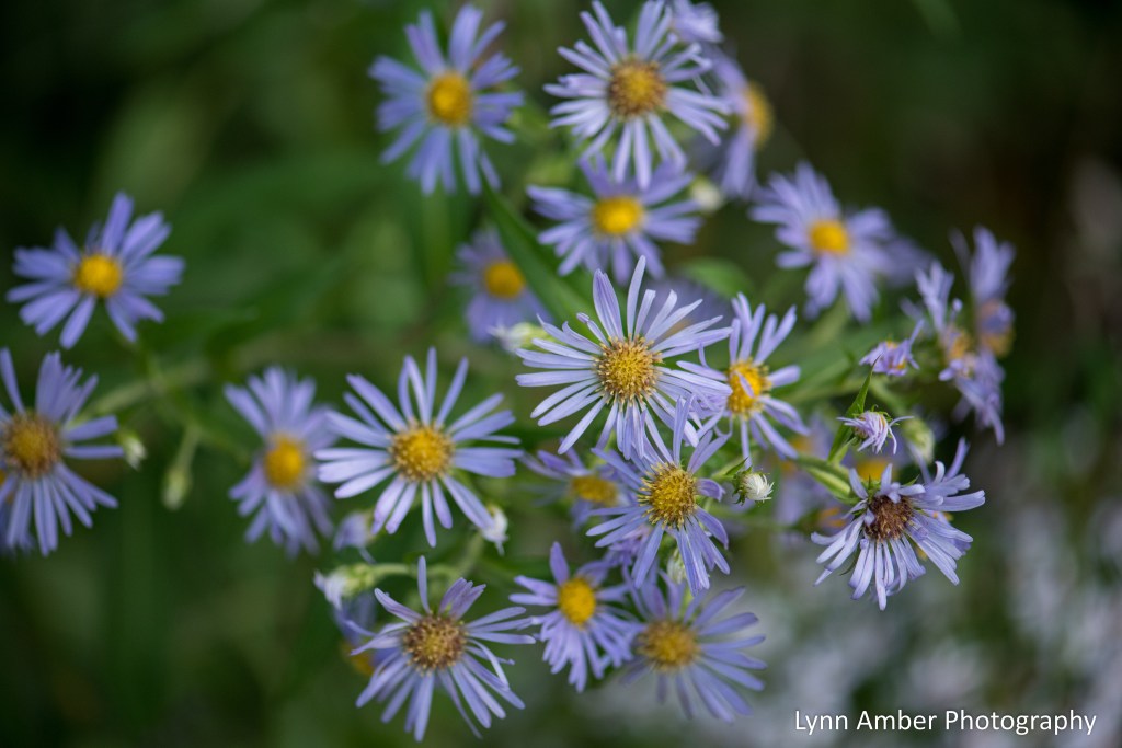
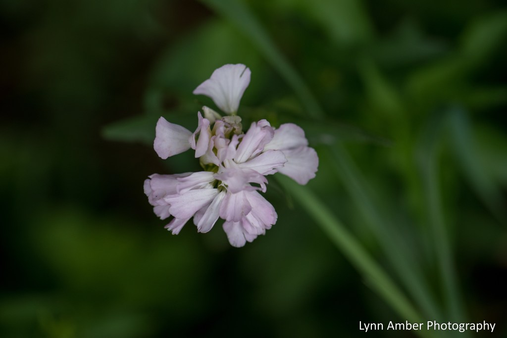
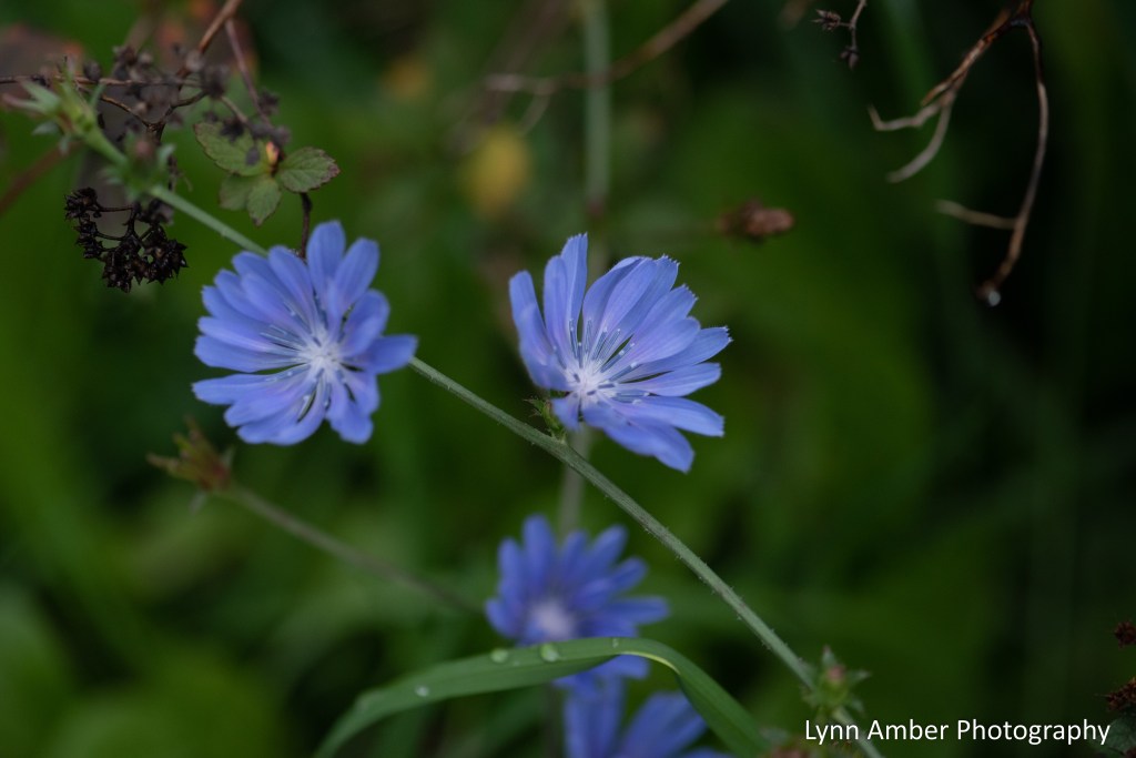
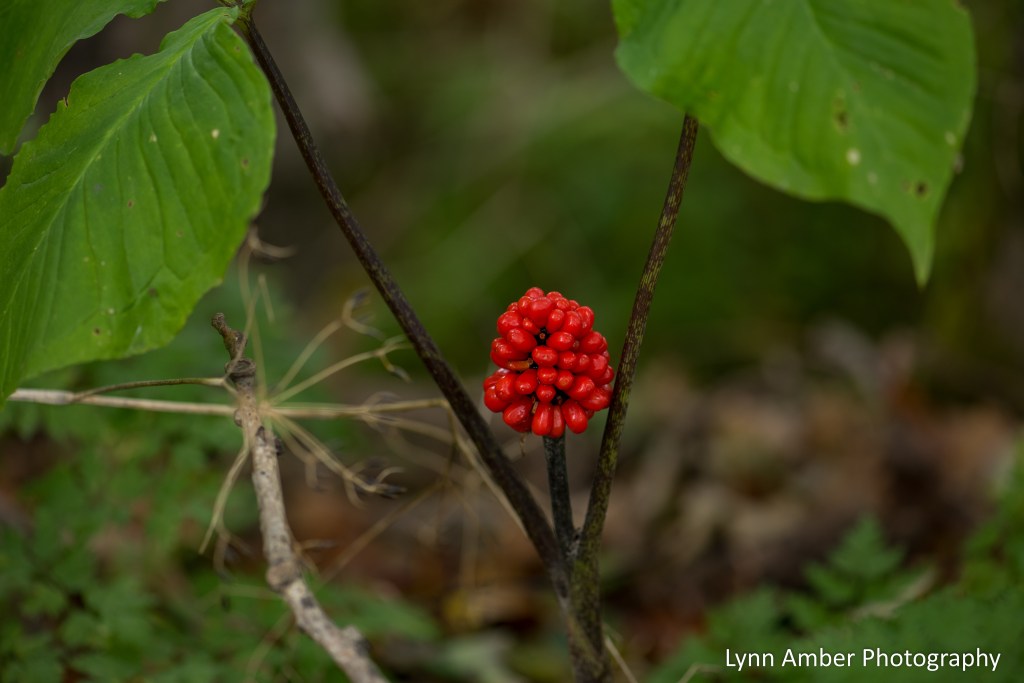
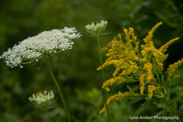
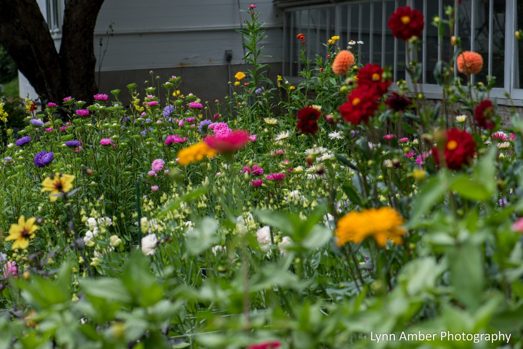
Arrival of Fall Wildflowers in Vermont
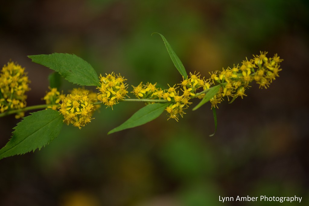
On my walks over the weekend, it is very apparent that the seasons are changing. We have entered the season for fall wildflowers and they are providing color along the roadsides and in the fields around my neighborhood.
There a few different asters blooming – and it can be challenging to identify them. I’ll give it a go – but I’m not promising accurancy! I also found soapwort, evening primrose, chicory, brown-eyed susan and jack-in-the-pulpit berries! And, of course, queen anne’s lace and goldenrod are still putting on a show.


Le Puy Camino – via Podiensis: Saint-Alban-sur-Limagnole to Aumont-Aubrac

April 5 and 6, 2023
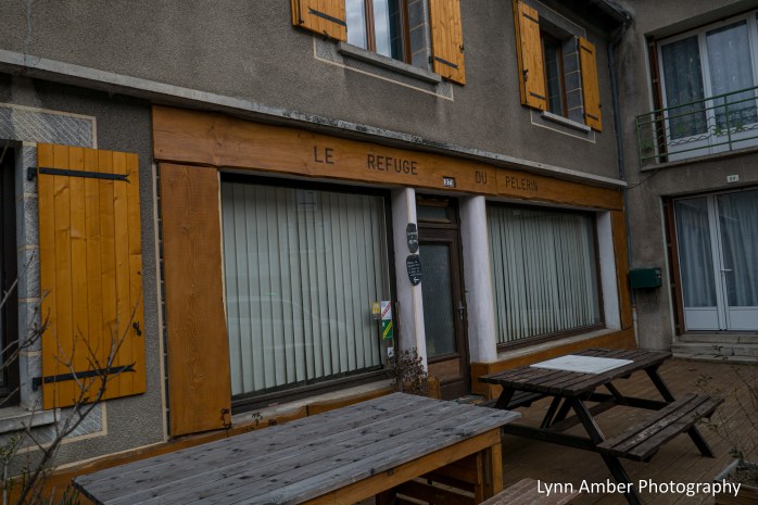
After arriving at Le Gîte d’étape Le Refuge du Pèlerin, my host explained her system for checking in guests. She had a “mud room” entrance where we were to leave our backpacks, shoes and hiking poles. It was all very organized and neat! She also had a small backyard where she had a clothesline so that we could handwash our socks, underwear, etc and hang them out to dry.
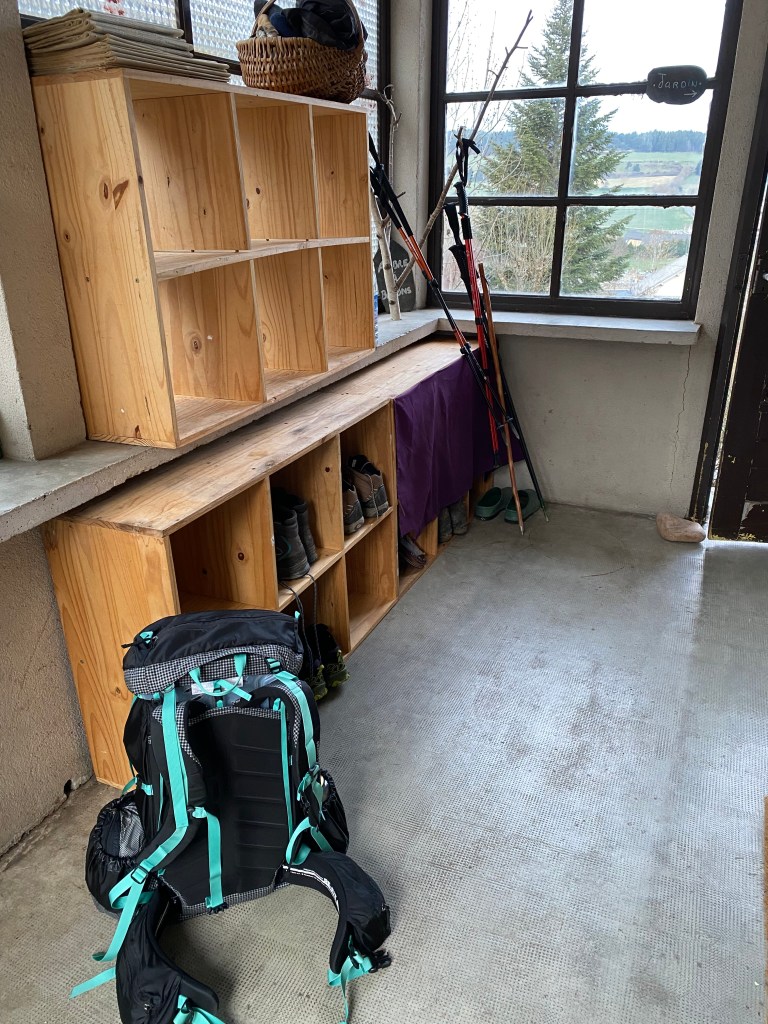
I followed my usual routine once I settled into the room that Susan and I would share. Since it was 3:00pm, I decided to do my wash first and get it out on the line drying. Next, I showered and changed clothes while I charged up my phone and camera. With time to spare before dinner, I headed out to explore the town!
A little history...
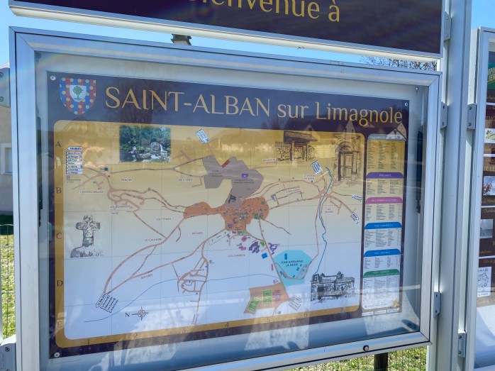
There is a town located in the northwest corner of my home state of Vermont named St. Albans. I was curious if there was a connection between the two towns. I learned that Saint Alban was the first British Christian martyr to be recognized by the Roman Catholic Church. He would have been on of the few Christians living in what is now England during the 1st century. Originally, he was a pagan who served in the Roman Army. He lived outside of London and legend has it that he protected a priest by harboring him in his home. He became enamored with the priest’s religious leanings while taking care of him and converted to Christianity. When officers of the Roman Army came to arrest the priest, St. Alban pretended to be the priest in order to save the priest from execution. His executioners realized he was impersonating the priest and, because he refused to renounce his new faith, they killed him anyway. Along with Saint-Alban-sur-Limagnole and St. Albans in Vermont, there are numerous other towns worldwide that share the name – including St. Albans in England.
The Francois Tosquelles Hospital Center is also located in Saint-Alban-sur-Limagnole. It has been in existence since the 1800’s as a psychiatric facility. During the second World War, Dr. Francois Tosquelles arrived and introduced the idea of institutional psychotherapy. Also, during the war, the hospital served as a refuge for those fleeing the persecution of Hitler and the German army who occupied the town. It was a key link in the underground resistance movement.
The Eglise de Saint-Alban, named after the saint, is a prominent architectural feature in the center of the town. It is built from local red sandstone and has a unique 3-bell tower.


After visiting the church and wandering around the cemetery, I popped into a local tavern for a relaxing glass of wine and scoped out the neighborhood pâtisserie. I would make that my morning stop for purchasing tomorrow’s lunch!

Back at our lodging, we were treated to a delectable dinner consisting of a 4-course meal. Starting off the food adventure, we enjoyed a squash soup. That was followed by Chicken Curry with rice and zucchini. Often in France, after the main course, a cheese plate is offered – which was the case here as well. It took me awhile to get used to eating so much after the main meal. Dessert was a light custard tart. All of this, plus breakfast and sleeping quarters for a mere 38 euros each! What a deal!
The next morning, we filled up on the typical French breakfast – bread and jam, cheese, coffee and croissants. A hearty meal for walking energy! Before departing, we captured a group shot of Susan and I with our lodging companions – Thomas (from Florida) and Peter (from Switzerland). As you can see, the weather is still a tad chilly in the mornings!

While the day started off cool, it eventually warmed up and I shed layers rather quickly. Today’s walk to Aumont-Aubrac would be 15 kilometers with a bit of elevation change in the middle part of the walk – quite a lot of ups and downs!
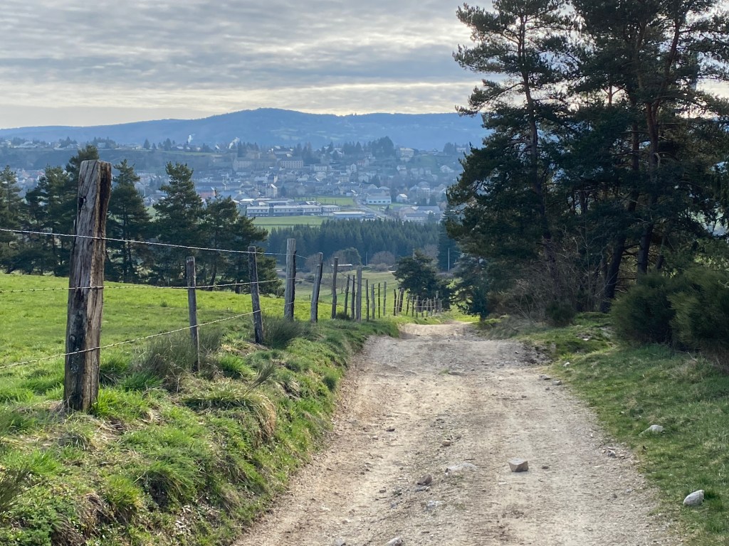
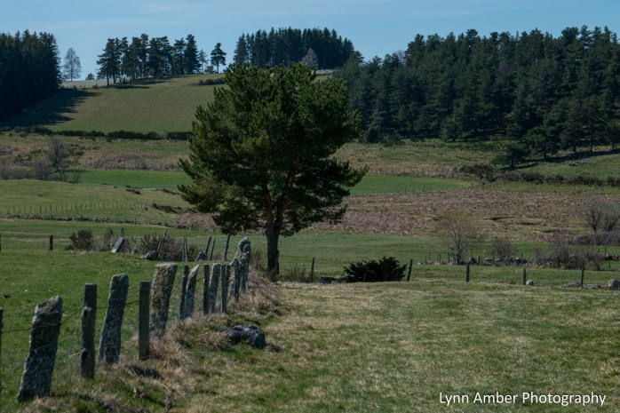
Between Saint-Alban-sur-Limagnole and the tiny village of Chabanes-Planes, the landscape opened up and the countryside was beautiful.


After about 5 kilometers, I entered the small hamlet of Chabannes. There was not much here except a few houses and farm buildings – a quiet little town.


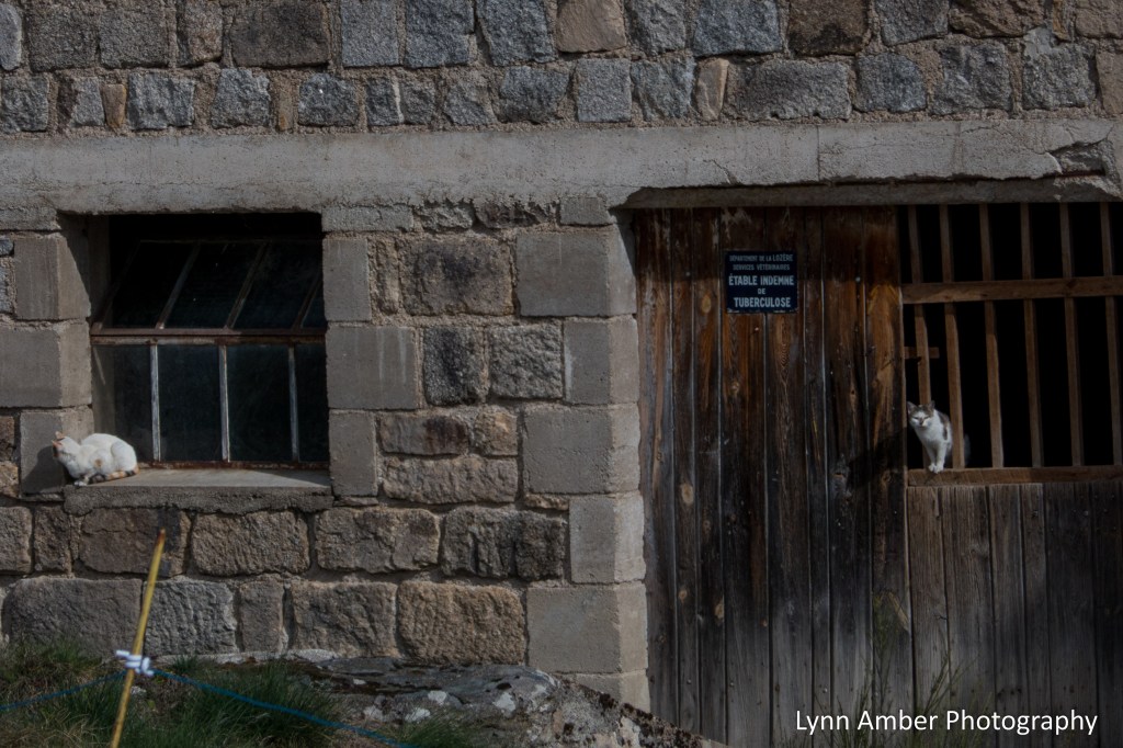
The town of Chabannes sits up high on a hill and from the road I could see some white-capped mountains in the distance – not sure what these mountains are called. I think we are still too far away to see the Pyrenees. We are in an area called where the Massif Central range travels – so perhaps some peaks in that region??

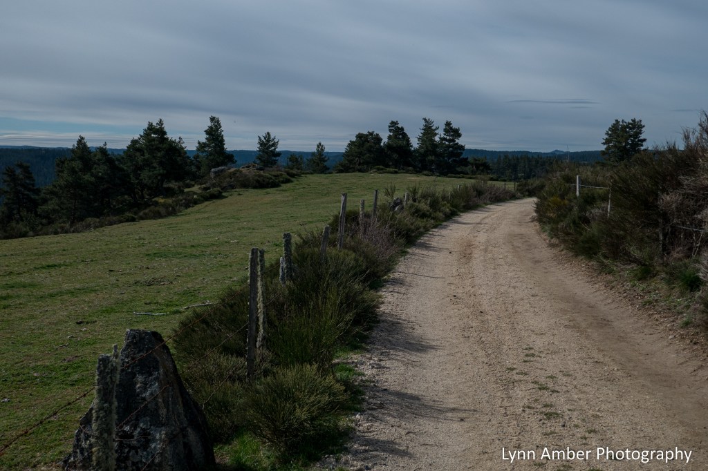
After passing through Chabannes, the land opened up with some expansive views.

Most of the “wildlife” I’ve seen along the Way to date has been of the agricultural farm animal variety. But, today, I did see a beautiful, sleek red fox cross the trail up ahead of me. He was too fast to even attempt a photo but the picture below is the field he crossed.
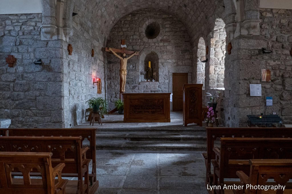
Another 3 kilometers of walking brought me to the village of Les Estrets. Our guidebooks describe Les Estrets as a former Templar command post – specifically the Order of St. John. The Eglise Saint-Jean-Baptiste de Fontans is situated on the route into town.


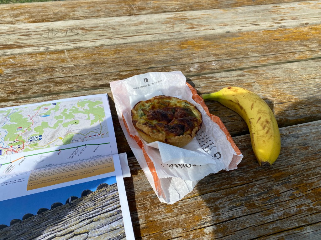
I ate my lunch in Les Estrets at a picnic spot in town. It was a yummy personal size quiche from the pâtisserie in Saint-Alban!!
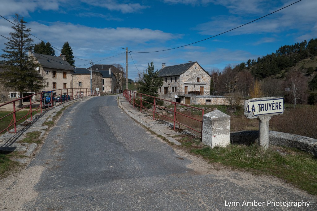
Upon leaving Les Estrets, the path crosses over the La Truyère – a river that that has its origin in the Margueride area of South-Central France. Along the way, it apparently carves out some pretty amazing gorges.
Between Les Estrets and my destination of Aumon-Aubrac, there is mostly open country with a very tiny settlement called Bigose along the way. The main attraction here is a very fancy looking gîte called the Auberge Les Granges de Bigose. It was not open for the season yet but it appeared to be a nice quiet location for an overnight stay. It was here that I made a very brief wrong turn. I was admiring the architecture of the buildings and missed that GR65 that veered off to the right! 🙂 I realized my mistake immediately!
Because I was also trying to stay tuned to how my feet were holding up, I noticed some minor rubbing on the back of my leg where the top of my boot hits my leg. Something to keep any eye on but right now it is not causing a problem.


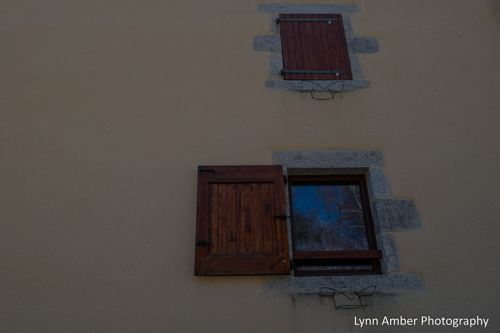
On the side wall of the auberge, I noticed these windows. Love the detail!
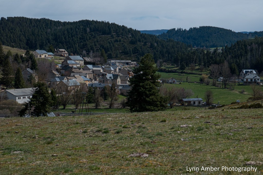
After leaving Bigose, it was a 6+ kilometer walk to my destination of Aumont-Aubrac along mostly country dirt roads.


It was a glorious day – sun-kissed warmth permeated my being along the Way – and I arrived in Aumont-Aubrac around 2:30pm. Lots to tell in my next post about our stay in this gateway town that will lead us into the elusive, isolated Aubrac region of France. Stay tuned!!
August 2023 Stay-cation Day 1

Last weekend, Jim and I decided to try a “stay-cation” and took 3 days to visit three different places – near and not so near – to our home in Vermont. One of my favorite places to take a leisurely stroll is the Marsh-Billings-Rockefeller National Park in Woodstock, VT. There are miles of carriage road trails and footpaths to explore as well as a very cool mansion to tour. Behind the mansion, the park maintains a perennial garden that has been the subject of some of my other posts in previous years.
On this visit, I was surprised to learn that the site was established as a national park as recently as 1998. Just a year before we moved to Vermont. We had not toured the mansion before – either it was not open or it was closed for Covid on previous visits. So, we did the free tour this time around that consisted of just walking around the first floor of the interior of the house. It was quite impressive with elaborate woodwork and parquet flooring. I did not take any pictures inside but take my word for it – it is worth the short wait to get a glimpse of the interior.

After touring the house, we ambled through the perennial garden and, on our way to the trails, passed by the cutting garden that is adjacent to the greenhouse.

The cutting garden was impressive!


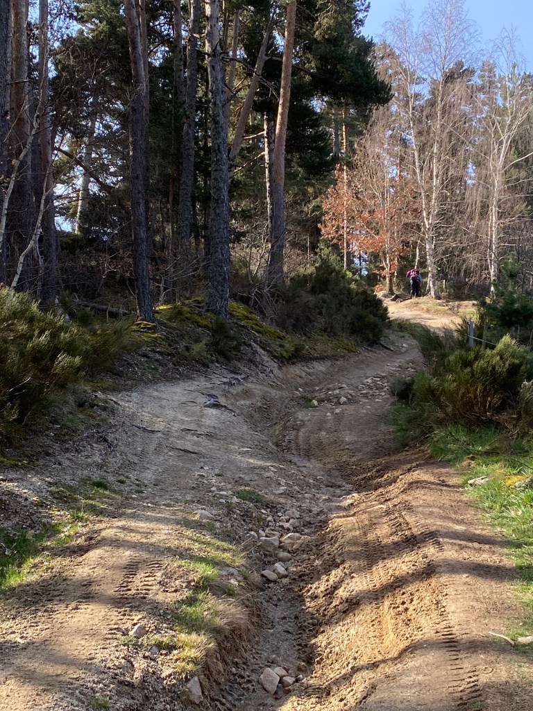
After admiring the fantastic cutting garden, we continued onto the carriage road trails and walked to the Mt. Tom summit. It was a beautiful day – not too sunny – and cool.


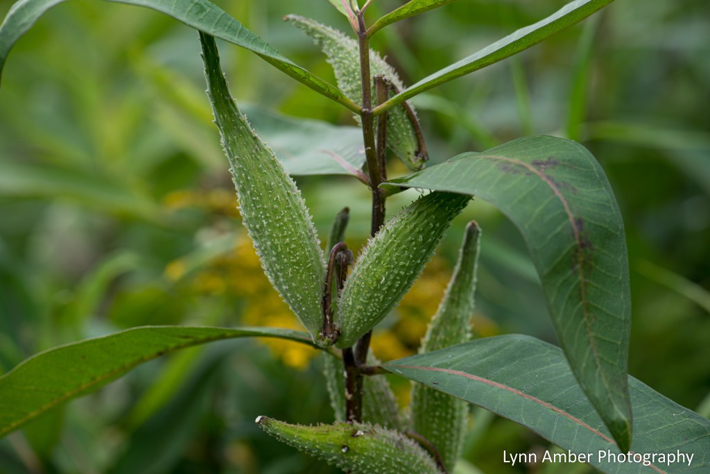
Seedheads – Nature Photo Challenge
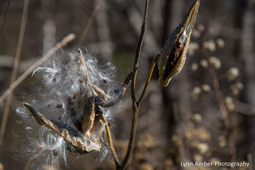
This week’s Denzil Nature Photo Challenge is to post interesting seedheads. I love photographing milkweed after it has gone to seed. I’m cheating a bit as this is a photograph I took in November 2021. I am enamored with the artistic design of the seedhead!
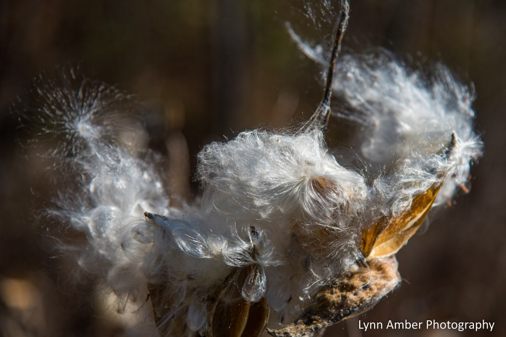
Here’s what they look like today when I photographed the clump back by my pond.
Captivating Crocosmia

The Crocosmia that I purchased from an avid gardener in town and planted in early summer is now blooming profusely. As expected, the hummingbirds love it and visit the blossoms every morning!
Le Puy Camino – via Podiensis: Chanaleilles to Saint-Alban-sur-Limagnole

April 4, 2023
Once my new acquaintance Thomas and I had connected with our host, Evelyn, we dropped our bags in the common room at the Gîte du Pont . Evelyn invited us to make ourselves at home and prepare a cup of tea if we desired – so I took her up on that offer and also made a cup for Thomas. We chatted together over tea and I found out that Thomas is a retired paramedic and fire-fighter from Florida. He started the walk in Le Puy and has plans to walk all the way to Santiago de Compostela. Being from Florida, he said he is finding it challenging to walk this section of the Camino due to the changes in elevation. Something he is not used to! We will see him many times over the next couple of weeks.
Plastic bins were provided for us to put all the items that we needed in the room (as was the routine in many places in order to prevent the spread of bed bugs) and, after we drank our tea, we stashed our backpacks under the stairwell and were escorted to our room. At this accommodation, we shared a room with 4 other pilgrims – one of those being Thomas. This would be the first of many “coed” arrangements. I’m often the first person to arrive at an accommodation and take advantage of that by scoping out the best bed locations! 🙂 I chose the corner of the room where there were two beds separate from the others that afforded a little privacy and claimed them for Susan and myself.
I was able to get showered, changed and handwash some clothes items before other guests arrived. Evelyn had a clothesline outside to hang the clothes and with the sunny, breezy weather I was pretty sure they would dry!
Susan arrived at the gîte a bit later and I was anxious to hear if my “trail note” had successfully guided her to the accommodation. Alas, somehow, she missed recognizing that the “note” was intended for her and she continued on the GR65 to Chazeaux. 😦 When she arrived in the next village (which was actually very close to where we were staying), she encountered a woman and asked her for directions to the gîte. As it turned out, the woman knew our host Evelyn and offered to give Susan a ride back to the lodging. (Susan – annotate if you wish as I’m going on memory here!) I recount this story to make a point.
Along the Camino, there are many times when assistance is needed – getting lost the trail, fixing damaged equipment, tending to irritating blisters, negotiating muddy trails and detours – and the “magic” of the Camino is that someone always seems to appear to help. It’s a camaraderie that exists among pilgrims and villagers that is hard to replicate elsewhere. It restores my faith in humankind. Another example of kindness is the first aid that Thomas administered to one of our other roommates that night who had the biggest blister on his foot that I have ever seen. Thomas used his skills as a trained paramedic to help this hiker continue on his journey.
Planning Tip: It is good practice to review your route each morning before heading out on the trail. Pay special attention to the “extra” directions given in the gîte descriptions. In the Miam Miam Dodo, these are in green, italicized text located within parentheses. Since the text is in French, it’s important to either learn basic directional words in French or at least have Google Translate handy as an app on your cell phone. We had to divert off of the GR65 several times over the course of 6 weeks and the specific directions given by the gîte owners were invaluable for finding the accommodation.
The fun part of the “trail note” happened about a week later. We were in a new gîte introducing ourselves to our housemates. When Susan mentioned her name, one of the other pilgrims perked right up and asked, “Are you the Susan who someone scratched a note for on the trail a ways back?” We had a good laugh over that comment and the fact that the note had survived for multiple days!
Evelyn had a full house for her first night of the season and, despite her anxiety over not having enough food, she presented us with a meal that was exceptional – a 4-course meal that included creamed squash soup and sausage and pasta salad followed by a cheese plate and a yummy dessert with salted caramel sauce and yogurt. We shared our dinner table with a Swiss mom and her son, three French pilgrims, a Belgium man and Thomas.

April 5, 2023
We woke up to a sunny but very frosty morning. Evelyn gave us walking directions that proved to be a short-cut back to the trail and we headed on our way. The day’s walk was a mixture of paved road, dirt road and trail through a varied landscape. Today’s walk would be around 20 kilometers – our longest so far – but except for a moderate elevation gain in the morning the route was fairly tame.

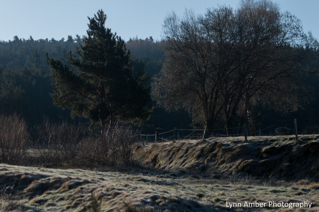
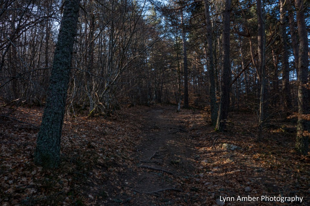
Between Chanaleilles and Le Sauvage, the land was a mixture of open views and managed forest. The cool, crisp air felt great.


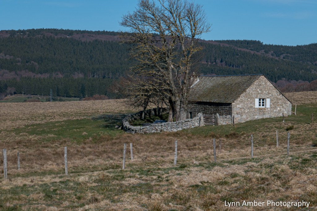
For about 4.5 kilometers there is little sign of any buildings. About 1.3km from Le Sauvage, the land opened up and this single stone structure came into view. I remember this spot vividly. I feel in love with the starkness of the landscape and the wild, untamed beauty of this region. Hence, the naming of the area called Le Sauvage – “the wild”. I took my first break here and soaked up the peacefulness of the moment.

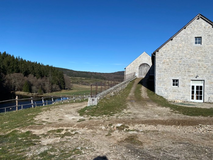
Shortly after continuing on my way, I started to walk through a series of gates at a farm and came to the remote complex known as the Domaine du Sauvage – an isolated compound that houses a cafe, restaurant, farm and gîte.

Once I got through the maze of stone walls and gates, I came to a sign announcing the arrival at Domaine du Sauvage with a map of the building complex.

This area has an interesting and tumultuous history. As the name Le Sauvage indicates, this was a wild and isolated land that was not populated until around 1100. At that time, settlements started to spring up operated by lords who cleared some of the forest, constructed buildings and developed agricultural interests including food crops and livestock grazing.
Also passing through this region was the Chemin de Saint Jacques pilgrim route. The topography through this mountainous area (known as the Mageride district) can be very hostile. Near Le Sauvage is a pass that provides for an easier land route for travel. Because of the proximity to the Chemin, somewhere around the 12th century, a bishop established a domain in this area (referred to as L’Hospitalet) that provided lodging, a hospital and a place of worship. The Hotel-Dieu in Le Puy served as manager of that property for many years. Eventually, the existing lord donated the entire site to the Hotel-Dieu. There were periods when the site was abandoned or unused when disruptions such as the Wars of Religion were happening. Ultimately, the site was bought by private entities who refurbished buildings and, today, the site where the Domaine du Sauvage sits, is operated by the General Council of Haute-Loire. Rumor has it that the site is often associated with the Knights of Templar. It is said that the site was the location of Templar headquarters at one time. That’s a fun fact! The ruins of the original L’Hospitalet are a little further past the Domaine du Sauvage.

There was a small cafe around the corner of the building but I chose not to stop as I had a long way to go and had already taken a short break. What a beautiful setting! It’s a very popular place to stop for the night and it was clear that advance reservations were not only recommended but necessary.
Just past the Domaine du Sauvage, the GR65 takes a right hand turn along a dirt trail leading into some thick forest. The next landmark I was looking for is 3.6km away and is the Fontaine St-Roch and Chapelle St-Roch. Remember the story of Saint Roch? The one with a dog always by this side.
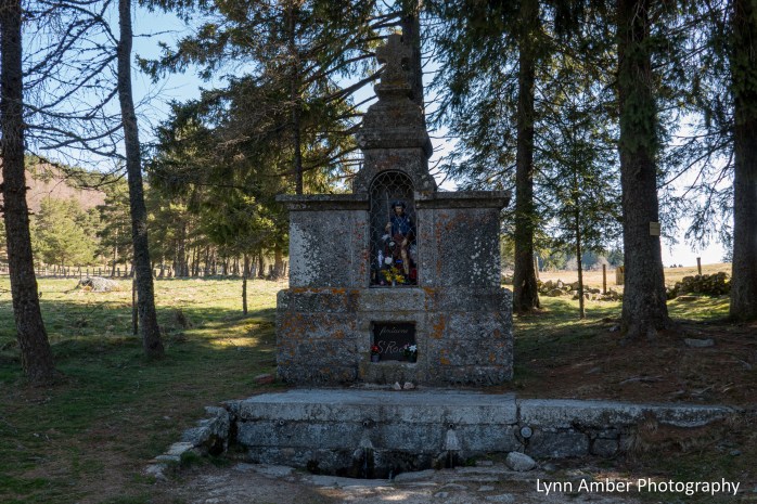
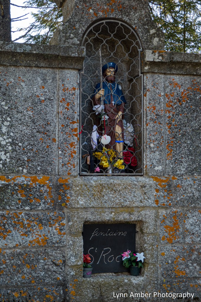

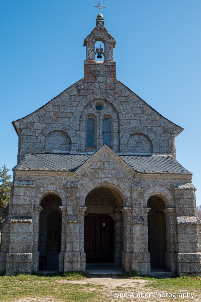
A short walk past the Fontaine St-Roch sits the Chapelle St-Roch. I met up with Thomas here and we sat and shared a lunch together outside the church.

Unfortunately, the chapel was not open but I was able to peek through the windows at the interior.


Near the chapel by the side of the road was another small stone structure that serves as a pilgrim shelter. I popped in there to check it out. I can see where it would be a welcome sight in inclement weather!
The rest of the walk to my destination of Saint-Alban-sur-Limagnole was through open countryside wandering past old buildings and fields of grazing animals. It was along this section that I took a wrong turn in the trail!
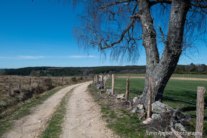
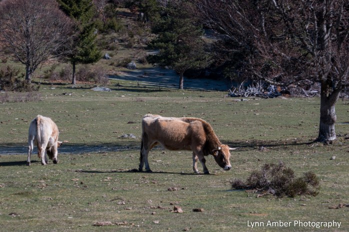
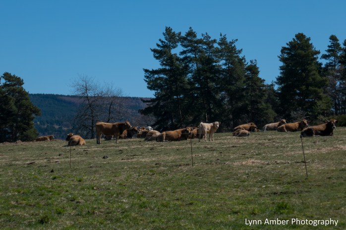
The reason I took a wrong turn was because I was walking along and saw a herd of cattle up on a hill to my left. I wanted to get a photograph of them! As it happened, there was a fork in the trail up ahead and I stayed left because I was eyeing those cattle! After I got my picture, the dirt road started to descend slightly and I realized I was not seeing any white/red markers that indicate the GR65. They are usually pretty obvious and, remembering the fork in the road, I turned around. Luckily, I had not travelled more than a kilometer. When I reached the fork, it was clear that the trail marker was not at the fork. I would have needed to look down the road to the right to see it and those darn cows distracted me! 🙂 Ultimately, a harmless detour!
Walking through the small village of Le Rouget, I saw this backyard garden where they used old iron bedposts as a fence! I love it!


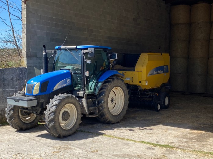
I was so surprised to see New Holland farm equipment walking through Southern France. I grew up a short distance from New Holland in Pennsylvania. Too funny!
Eventually, I saw the familiar signs that I was approaching a town and found myself entering on the outskirts of Saint-Alban-sur-Limagnole.

Our accommodation for the night was Le Gîte d’étape Le Refuge du Pèlerin. It was literally located just down this street and I walked right to it without realizing it. I arrived at 3pm and was soon joined by, who else? – Thomas! We would be housemates yet again.
Whew – I packed a lot into this post – next time I’ll share my wanderings around town and our evening at the gîte followed by Day 7 on the trail…
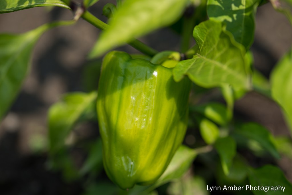
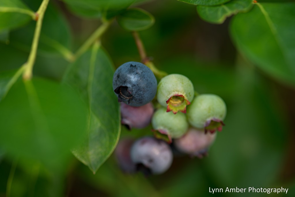
Edibles from the Garden
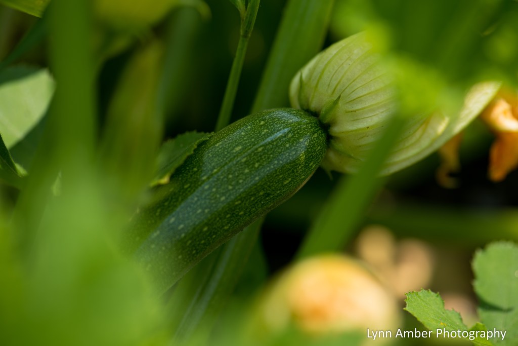
I follow a blog called Denzil Nature and, every Wednesday, he invites other bloggers to participate in a Nature Photo Challenge. I thought it would be fun to start joining his challenge as a way to get involved and motivate myself to broaden my photographic subjects. This week he requested participants take to their vegetable gardens, local botanical gardens and fields and forests in search of edible plants, vegetables and fruits. My photos are all from my personal garden. With all the rain we’ve had this summer, my small garden has been extremely productive. I cannot complain!


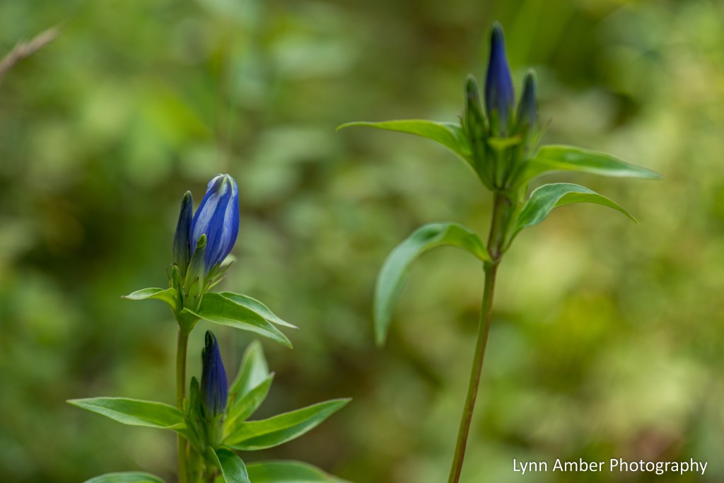
A Blue Gentian

My friend Bill called me over to his place today so we could take a walk to a wet, boggy area near his property that has some impressive bottle gentians in bloom. Such a cool wildflower! A unique characteristic of the flowers of the bottle gentian is that they never completely open. This wildflower prefers very moist, fen-type environments and is found throughout the entire northeastern portion of the United States and extending into the upper mid-west.
Queen of the Meadow

We’ve not mowed our back meadow much this summer and, as a result, the wildflowers are putting on a nice show! Queen Anne’s Lace is gracing our back country roadsides and meadows giving credence to the fact that summer will soon be winding down.

