Lynn Amber - Travel & Photography
sharing my thoughts through words and images
Hiking Acadia – PART 1

“The only neighborhood of mountain and sea on all our Atlantic Coast. The cliffs look down, not on bay or lake, but upon broad ocean. It is to find in one, the Isle of Shoals and Wachusett; –Nahant and Monadnock; — Newport and the Catskills.” – Clara Barnes Martin, November 1866.
I came upon this quote recently and was struck by the observation of this long-ago visitor to Mount Desert Island. When I am “interviewed” by potential Junior Rangers here at the park, one of the questions in the booklet that the kids must ask me is “What is it you like most about Acadia?” My answer is always the same: I tell them that what I like most about Acadia is that the mountains and the sea converge here on this small island – and I like that this is very unique to the Atlantic coast. Imagine my surprise when I discovered the quote above by author Clara Barnes Martin that so mirrored my own reflections of this unique environment! I immediately felt a kinship to her.
It’s just past mid-July and so far, I’ve hiked almost 60 miles of trails and biked about 20 miles of carriage roads. I have read that there are about 150 total miles of hiking trails in the park, and close to 57 miles of carriage roads. I would say that I have a pretty good start towards completing at least 100 miles this summer!!! Given that, I thought it was about time to document some of my favorite hikes.
Quite by accident, I stumbled upon a two-volume publication that details the history and significance of trail building in Acadia and charts a path towards the perpetual maintenance and improvement of the trail and carriage road system here. Published in 2005, Pathmakers: Cultural Landscape Report for the Historic Hiking Trail System of Mount Desert Island addresses the historical perspective of trail building in Acadia. It’s sister volume, Acadia Trails Treatment Program proposes a plan for the long-term maintenance of the trail system in the park. The report was created through the collaboration of three main entities: Acadia National Park, Friends of Acadia and the Olmstead Center for Landscape Preservation.
I’m intrigued by this publication, was thrilled to find an online copy and look forward to learning a bit of history about the trails I’ve been hiking. Some of the trails in the park date back to a time when Native Americans lived and worked on the island. Early trails were also established during the turn of the century by local village associations and continued after the establishment of the park in 1916. On some trails, I have discovered memorial plaques commemorating people who contributed to the formation and upkeep of the trails in the late 1800’s and early 1900’s. The Pathmakers report is lengthy, so I will absorb it very slowly and – offer in “small tidbits” – what I discover about these historically significant and culturally unique trails.
Some of my thoughts on the condition of the trails in Acadia:
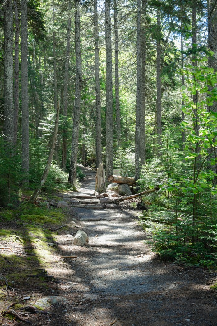
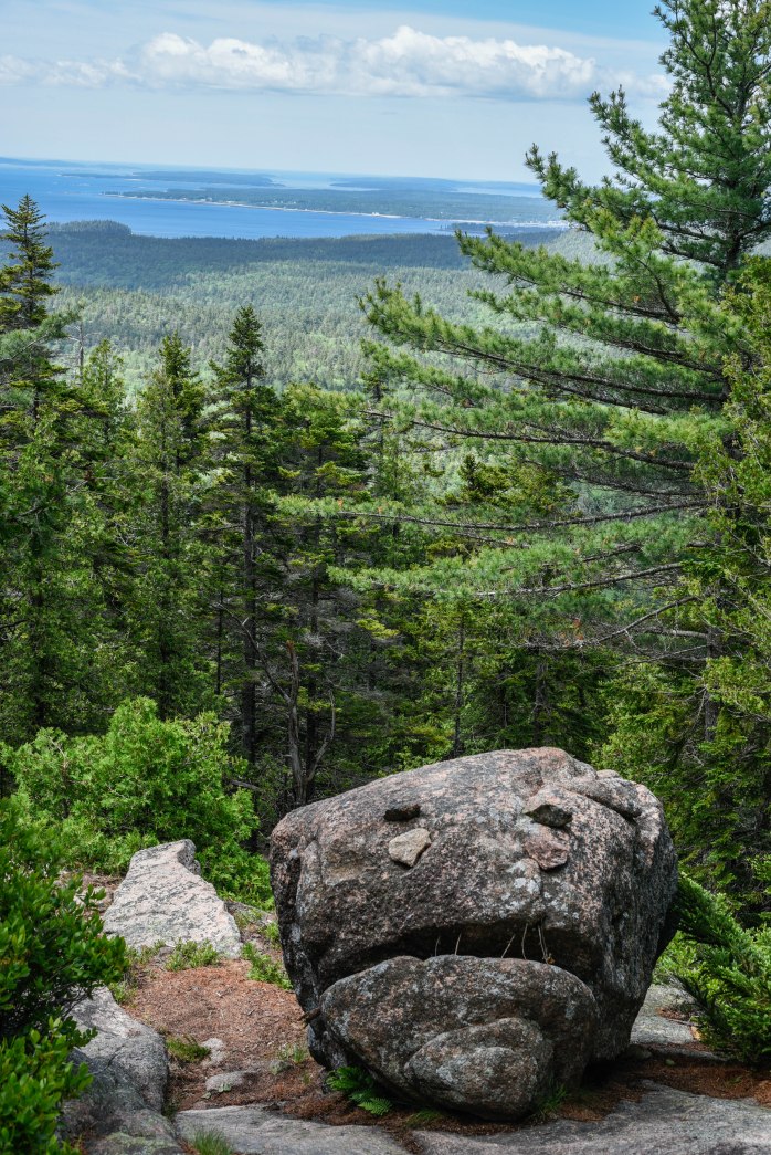
- At the lower elevations, expect to hike on rocky/dirt trails mixed with lots of tree roots! While the hiking in Acadia is not particularly strenuous when compared to the high-altitude hiking of the Tetons or Sierras from our past two summers, I have noticed that the footing can be somewhat more treacherous on many of these trails. This is a rocky island and the trails are well-used – producing many, many exposed tree roots in the forested sections of the trails. I find it exceedingly difficult to hike on trails dominated by tree roots. You have to be “aware” at all times. Tripping hazards abound!! Due to the glacial action that happened here as well, higher elevation trails are predominately granite rock ledge and pose their own challenges with regard to footing.
- Although the elevation is not outrageous at the summit of the mountains (we are on the east coast after all), some trails running east and west are steep (due to the glacial action here many years ago) and the elevation gain on these trails is substantial for short distances. So, it is possible to find strenuous hikes in these parts!
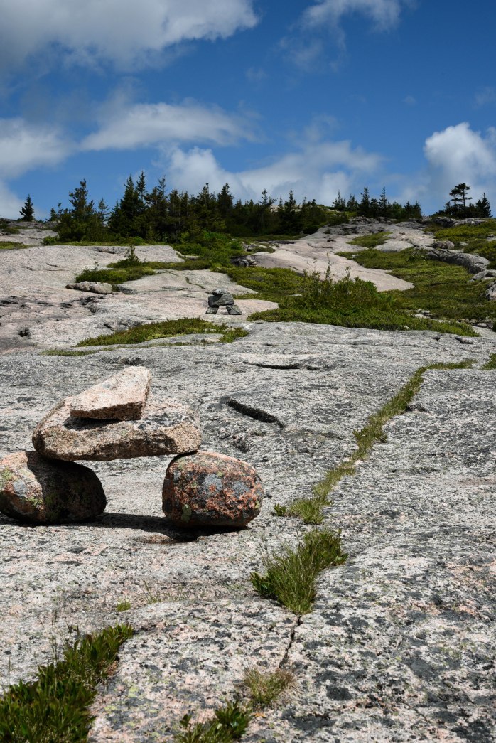
- Above the tree line, the trails tend to be on solid rock with trail markings designated by rock cairns. You need to pay attention when hiking above tree line so that you remain on the trail. This is critical to protecting the fragile natural environment and plant life.
- The trail markings seem to be more than adequate. I have “wandered” off trail by accident only a couple of times and immediately realized my mistake 😉 That said, I highly recommend purchasing a detailed hiking/biking trail map with distances and elevations marked. It is worth it’s weight in gold. My only regret is that I purchased a “paper” map when I first arrived, instead of the costlier ($10.50) waterproof map. I now have a paper map that is literally in shreds! That is how much I have referenced it, and it has not even gotten wet! I will be buying a sturdier, waterproof map shortly.
- Hiking alone brings a whole new perspective to the sport. I am realizing the importance of quality vs. quantity. It is important to be more aware of your surroundings and pay attention to every aspect of the trail. I walk more purposefully and try to always wear sturdy high-top hiking boots. I also recognize the value of trekking poles – which I would never have been caught hiking with just a few short years ago. I examine trail characteristics and descriptions, degree of difficulty and distances. I shy away from trails that are more difficult with regard to rock scrambling and exposure when I’m hiking on my own. “Safety first” is my new motto. Trail research is exceedingly easy in this technology-rich era.
I will be sharing some of my hikes with very brief descriptions, total mileage and a few of my favorite photos. They are in no particular order – and for this post, I will start with my hike up Pemetic Mountain. I mentioned this hike in a recent post but did not go into detail about the hike itself. I call it my “forever hike.” Since it took me much less time than I thought to complete the out and back hike up Pemetic, I extended the outing to include the South Bubble Summit! As I was coming down the home stretch along Jordan Pond, I was definitely ready to get back to the Airstream and put my feet up!

Pemetic Mountain
Mount Desert Island was originally inhabited by members of the Wabanaki Confederation – including the Passamaquoddy and Penobscot Tribes. The island was named Pemetic by these native peoples. I’ve heard different interpretations of the anglicized meaning of this word – including “range of mountains” and “sloping land.” Pemetic Mountain is referenced a number of times in the “Pathmakers” report I mention above, and hiking to its summit is recorded in a passage from an interesting guidebook that was published in 1867 from articles written by Clara Barnes Martin. Apparently, she traveled to the island in 1866 and, from her journal excerpts, the trip was published as a series of weekly columns for the Portland Transcript. Later, the works were compiled into a guidebook available for tourists to the island.
Between 1910 and 1911, residents from Seal Harbor got together and purchased over 3,600 acres of land that included Pemetic Mountain, Cadillac Mountain and The Triad. This land was later donated to the Hancock County Trustees of Public Reservations – an organization established by prominent island citizens to preserve lands for public use. Acadia National Park was eventually created – by piecemeal – due to this individual effort to purchase and donate large tracts of land for “perpetual use of the public.”
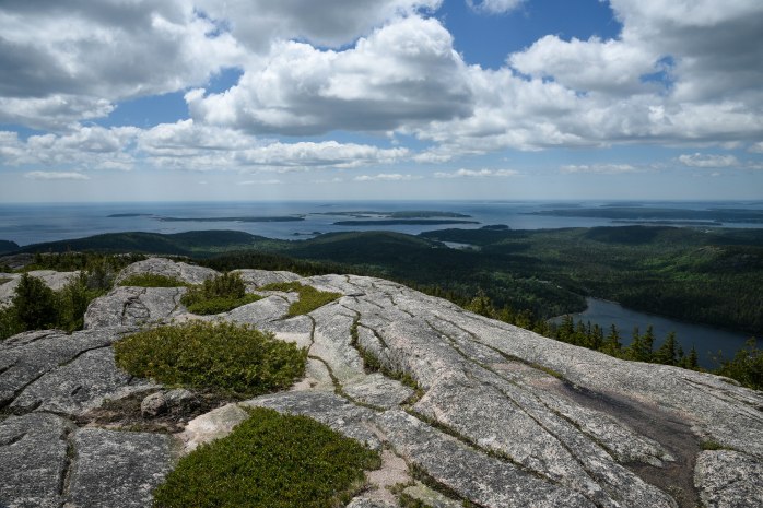
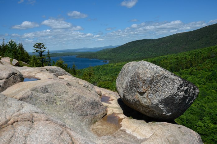
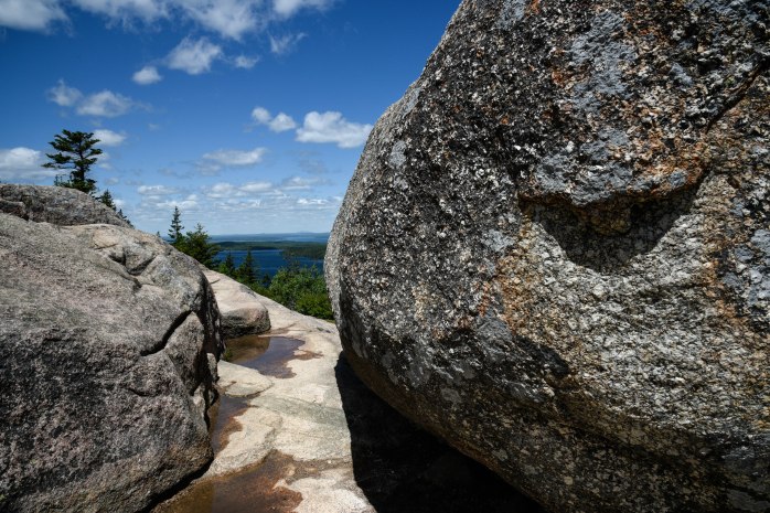
The Pemetic Mountain South Ridge hike was a spectacular surprise. I often seek hikes that are less popular (which translates to less people!) and had read that this was a gem. I can substantiate that claim unequivocally. It remains one of my favorite hikes so far this summer. I started the hike at the Jordon Pond boat launch parking lot. (Tip: In the height of the summer season, get there before 10 am to be assured a parking spot – or better yet, take the free shuttle bus!) From the parking lot, I accessed the Jordon Pond Trail heading east along the south end of the lake until it intersected with the Bubble Brook Trail. The Bubble Brook Trail then crossed the Park Loop Road and brought me to the junction with the Pemetic South Ridge Trail. The Pemetic South Ridge Trail rose steadily through the fir/spruce/pine forest eventually breaking out onto granite rock ledges and I traversed this rocky ridge to the summit. The vistas from this trail are amazing! The day I hiked the trail was quite possibly the windiest day of the summer thus far, and I felt like I would be blown off the mountain! This is a moderate “up and back” hike, and I extended it by hiking around the east side of Jordan Pond and up the Bubbles Trail to the South Bubble summit and the famous Bubble Rock. It made for a 9-mile hike overall. One of my longest and most memorable hikes this summer.

Stayed tuned for short posts on other hiking adventures – with a little history interspersed for interest!

What a fantastic panoramic view of the Cranberry Islands. I’ve never hiked Pemetic Mt. in all the years of visiting Acadia. It truly is one of those places where there is always one more place to explore although my tendency is to revisit my favorites each year.
Stewart
LikeLike